[page 1]
INDIA DIRECTORY,
OR
Directions for Sailing
TO AND FROM THE
EAST INDIES,
China,
NEW HOLLAND, CAPE OF GOOD HOPE, BRAZIL,
AND THE
INTERJACENT PORTS:
COMPILED CHIEFLY FROM
ORIGINAL JOURNALS AT THE EAST INDIA HOUSE,
AND FROM
Observations and Remarks,
MADE DURING TWENTY-ONE YEARS EXPERIENCE NAVIGATING IN THOSE SEAS.
BY
JAMES HORSBURGH, F.R.S. A.S
CORRESPONDING MEMBER OF THE IMPERIAL ACADEMY OF SCIENCES ST. PETERSBURGH, HYDROGRAPHER TO THE HONORABLE EAST INDIA COMPANY.
They that go down to the sea in ships, that do business in great waters; these see the works of the Lord, and his wonders in the deep. PSALM CVII. v. 23, 24.
VOLUME FIRST.
THIRD EDITION.
LONDON:
PRINTED FOR THE AUTHOR,
AND SOLD BY
KINGSBURY, PARBURY, AND ALLEN, BOOKSELLERS TO THE HONORABLE EAST INDIA COMPANY, No. 7, LEADENHALL STREET.
1826.
Entered at Stationers Hall.
[page 2]
Pluminer and Brewis, Printers. Love Lane. Little Easte .
[page 3]
PREFACE.
IN submitting a third edition of this Sailing Directory to the Public, and to those Navigators who frequent the oriental seas and adjacent parts, the author returns his sincere thanks for their candid reception of the former editions of his work, and he trusts that the present will be found still more worthy of public confidence.
To correcting, re-writing, and enlarging the second edition of volume first, with useful information obtained, and from discoveries made, since the original publication of the India Directory, he devoted a great portion of his time; the result of which will easily be perceived, by reference to the following places, the descriptions of which have either been re-written with many important additions, or they comprehend original materials entirely new: viz.
Geographical situations of the principal harbours and headlands on the coasts of Spain and Portugal, with directions.—Canary Islands.—Coast of Guinea, and West Coast of Africa.—Chief Harbours on the Coast of Brazil, and Rio de la Plata.—Bouvet's Island.—Gough's Island.—Tristan de Acunha.—Bird Islands, and Doddington Rock, and Knysna in South Africa.—South Coast of Terra Australis, and Bass' Strait.—Africa East and N. E. Coasts, to the Red Sea, and Arabian Coast.—Island Mazeira, with soundings, not before known.—Gulf of Persia nearly all rewritten, and greatly enlarged and corrected from late surveys.—Aldabra Islands, true situation by late observations.—Several late discovered shoals, and geographical limits of Saya de Malha Bank.—Maldiva Islands, their principal Channels elucidated, and lost knowledge restored, from original journals, and other documents.—
[page 4]
Directions to sail into Marmagoa Road.—Gulf of Manar.—Great and Little Basses, Ceylon.—Hooringottah River, Bengal.—Directions for sailing between Malacca Strait, Bengal, and Madras; with many other useful observations and directions, comprised in the second edition, too numerous to be mentioned in a preface.
In the third edition, now submitted to the public, much additional important information will be found, and many valuable discoveries elucidated, since the preceding edition came from the press, among which the following seem deserving of notice.
Geographical position of Funchal,—Cape de Verd Islands, and several parts on the West Coast of Africa, from late surveys.—Table Bay, Cape Good Hope,—Algoa Bay, and several places on the East Coast of Africa, particularly Zanzibar. N. W. and Northern Coasts of New Holland, entirely new. Geographical position and description of the islands and dangers in the Seychelle and Madagascar Seas, mostly all re written from late explorations and surveys.—Shoals in the Red Sea.—Geographical positions of Headlands on the South Coast of Arabia.—In the Persian Gulf, the Eastern Coast of Arabia described, with the correct situations of the Headlands, Towns, Islands, and Dangers adjacent, stated from the late laborious surveys performed by the officers of the Company's Bombay Marine; the whole of which coast, having been hitherto unknown to European navigators.
With these additions, and the diligence bestowed in correcting errors of the press, the author hopes that the utility of the India Sailing Directory to his brother seamen, may prove as great as his wishes for their safety, and the nautical prosperity of Great Britain.
[page 5]
CONTENTS.
| PAGE | |
| DIRECTIONS for sailing from England towards India.—First towards Madeira; places of shelter near this Route | 1 |
| Directions for sailing from Madeira to the Southward:—Salvages, Canary, and Cape Verd Islands | 9 |
| A Table denoting the Equatorial Limits of the Trade Winds between Africa and America, as experienced in every month of the year | 18 |
| Directions for sailing from the Cape Verd Islands across the Equator:—Islands in the South Atlantic, or Ethiopic Ocean | 29 |
| Abstracts and Remarks, on Passages to, and from St. Helena.—1st, Eastern Passage | 40 |
| 2d. Western Passage | 45 |
| 3d. Comparative View of Passages to, and from St. Helena | 46 |
| Winds and Currents in the Gulf of Guinea:—Coasts, and adjacent Islands, and from thence to the Southward | 48 |
| Winds and Currents, near the Equator, and the Brazil Coast.—Ships which have been carried near the latter | 54 |
| Brazil Coast.—Headlands, and principal Harbours, with Sailing Directions | 56 |
| Instructions and Observations for Navigating the Rio de la Plata, or River Plate.—By Captain Heywood of the Royal Navy | 63 |
| Directions to sail from the Coast of Brazil, toward the Cape of Good Hope;—Islands near this Route | 72 |
| Cape of Good Hope.—Description of the Bays, and the Coasts in its vicinity, with Sailing Directions | 76 |
| Cape and Bank of Aguilhas.—Description of the Land, the Bank, and Currents | 86 |
| Winds and Weather near the Bank of Aguilhas.—Doubtful Dangers, to the South, and Eastward | 90 |
| Islands in the Southern Ocean.—Directions to Sail from the Cape of Good Hope, toward Bass' Strait, and Cape Van Diemen.—Winds and Currents | 95 |
| Dangers near the West Coast of New Holland, near Sandalwood Island, and Timor | 104 |
| Sailing Directions from St. Paul, toward the North-west Cape of New Holland, and the Straits East of Java.—North-west Coast of New Holland and Islands | 112 |
| Islands to the South and S. Eastward of Java; adjacent Straits, and South Coast.—Directions to sail from St. Paul, to the Strait of Sunda | 117 |
| Directions for the Outer Passage, to places on either side the Bay of Bengal;—Prevailing Winds in the Indian Seas | 125 |
| Directions to sail from the Cape of Good Hope, to Bombay, the Malabar Coast, or Ceylon; also from Mauritius to Ceylon, by the Middle Passage, &c | 128 |
| Directions for the Passage to the Eastward of Madagascar | 131 |
| Directions for sailing to the Islands Roderigue, Mauritius, and Bourbon:—Description of them, and the Passage from thence towards India | 132 |
[page 6]
| Eastern Coast of Madagascar.—With Sailing Directions | 139 |
| Archipelago of Islands, and Dangers, North, and North-east, of Madagascar | 145 |
| Chagos Archipelago, with Sailing Directions | 162 |
| Channel of Mozambique, and St. Augustine's Bay.—South and West Coasts of Madagascar; Islands, Shoals, Winds, and Currents | 169 |
| Comoro Islands, and adjacent Dangers;—Directions for sailing to the anchorage of Comoro, Mohilla, Mayotta, and Johanna | 185 |
| Passage from the Comoro Islands towards India.—Adjacent Islands and Shoals | 191 |
| South Coast of Africa, from Cape Aguilhas to Algoa Bay;—Bays, Headlands, and Sailing Directions | 194 |
| Coast of Africa, from Algoa Bay, to Cape Corrientes | 200 |
| Coast of Africa, from Cape Corrientes to Mozambique | 206 |
| Coast of Africa, from Mozambique to the Equator | 212 |
| Coast of Africa, from the Equator to Cape Guardafui, Island Socotra | 221 |
| Coast of Africa, from Cape Guardafui to the Straits of Bab-el-mandeb, with Sailing Directions | 226 |
| Coast of Arabia, from Cape Aden to Mocha, and the Straits of Bab-el-mandeb | 230 |
| Navigation of the Red Sea.—Coasts of Abyssinia and Arabia, with Sailing Directions | 235 |
| Coast of Arabia | 239 |
| Directions for sailing from Mocha to Juddah;—Description of Dangers near the Passage | 240 |
| Directions for sailing from Juddah to Koseir:—Islands and Dangers in the Passage | 245 |
| Instructions to sail from Koseir, up the Sea of Suez, Islands, Dangers, and Harbours in the Passage | 248 |
| Winds and Currents;—Directions for sailing to, and from the Red Sea | 254 |
| Coast of Arabia from Aden to Ras-el-had, Muscat, and Cape Mussendom.—Winds, Currents, Bays, Headlands, and Sailing Directions | 258 |
| Directions for sailing from India to Muscat, and to the Entrance of the Persian Gulf | 271 |
| Coasts of Scindy and Persia, with Sailing Directions.—1st. Coast of Scindy from the Gulf of Cutch to Cape Monze | 273 |
| 2d. Coast of Persia from Cape Monze to Cape Jask | 274 |
| Gulf of Persia:—Winds and Currents:—Directions for sailing to Basra:—Coasts, Islands, Harbours, &c. | 279 |
| Arabian side of the Gulf | 298 |
| Directions to sail from the Gulf of Persia to the Malabar Coast, and other parts of India | 319 |
| Coast of Guzarat, from Goapnat Point, to Diu Head, and the Gulf of Cutch | 321 |
| Coast of India from Bombay to Surat River, with Sailing Directions | 325 |
| Gulf of Cambay; Banks near the Entrance, and Directions from Surat Bar to the Northward | 330 |
| Directions from Surat Bar to Gogo, and from the Gulf of Cambay, to the Southward, in the S. W. Monsoon | 332 |
| Monsoons, Land and Sea Breezes, and Currents, on the Western Side of Hindoostan;—Directions for sailing along the Coast. | 334 |
| Bombay Harbour, and the circumjacent Land; with Sailing Directions—1st. Description of the Hills, Lighthouse, Islands, &c | 339 |
| 2d. Description of Dangers, with marks to avoid them | 341 |
| 3d. Of Tides and Soundings | 344 |
| 4th. Brief Remarks for Entering the Harbour | 345 |
| 5th. To work into the Harbour during the Night in clear weather | 347 |
| 6th. To approach the Harbour in the S. W. Monsoon | 348 |
| Directions to work out of Bombay Harbour, in the S. W. Monsoon, and to sail Southward to the South Coast of Ceylon | 349 |
[page 7]
| Description of the Western Coast of India, from Bombay to Cape Comorin.—1st. Coast of Concan, with Sailing Directions | 351 |
| 2d. Coast of Canara, with Sailing Directions | 358 |
| 3d. Coast of Malabar, with Sailing Directions | 362 |
| Laccadiva, or Laccadive Islands.—Channels and Dangers, with Sailing Directions | 371 |
| Maldiva Islands, their extent, and separating Channels, with Sailing Directions | 376 |
| To sail between Cape Comorin and Point de Galle.—Coast of Madura, and Gulf of Manar | 395 |
| West Coast of Ceylon, from Manar to Point de Galle, with Sailing Directions | 400 |
| South Coast of Ceylon, from Point de Galle to the Elephant Hill;—Great and Little Basses, with Sailing Directions | 407 |
| Eastern Coast of Ceylon, from the Elephant Hill to Trincomale; with Sailing Directions | 413 |
| Trincomale Bay, Back Bay, and the Contiguous Coast, with Sailing Directions | 417 |
| North-East and North Coast of Ceylon, from Flagstaff Point to Point Pedro; with Sailing Directions | 421 |
| Palk's Bay; Winds and Currents on the Eastern Coast of Ceylon.—Directions to approach or depart from it in the N. E. Monsoon | 424 |
| Coast of Coromandel.—Description of that Coast, from Point Calymere to Madras, with Sailing Directions | 428 |
| Coast of Coromandel, continued, from Madras to the Northward, with Sailing Directions | 436 |
| Coast of Golconda.—Ports, Bays, and Headlands, with Sailing Directions | 439 |
| Coast of Orixa, or Orissa, with Sailing Directions | 443 |
| Entrance of the Hoogly River, or Calcutta River. Description of the Channels, Sea Reefs, and Sands | 450 |
| Directions to approach the River Hoogly; Winds, Currents, or Tides | 455 |
| Directions for Sailing from False Point Palmiras to the Sand Heads, and up the Eastern Channel to Sagor Road, by Capt. William Maxfield, First Assistant to the Marine Surveyor General, with Remarks on Thornhill's Channel, the Old Channel, Lacam's Channel, &c. | 462 |
| Storms near and in the River Hoogly. Lacam's Channel, Codjee Deep;—Tides, and the Bore | 469 |
| Coast of Bengal from Codjee Deep, to Chittagong, and the Interjacent Rivers | 473 |
| Monsoons and Currents in the Bay of Bengal | 478 |
| Directions to s from the Southern parts of the Bay, toward Bengal, in both Monsoons | 482 |
| Directions for sailing from Bengal to Madras, and the Southern parts of the Bay, during both Monsoons | 484 |
| Directions for sailing from Bengal, Madras, or other parts of the Bay; by the Southern Passage to Bombay, or other places to the Westward, during the S. W. Monsoon | 488 |
| Directions for sailing between Bengal or Madras, and the Strait of Malacca | 490 |
[page 8]
Errata.
By unremitted attention to the correction of the press, it appears, that no errors of consequence have crept into this Volume, for after a careful perusal of every sheet as it issued from the press, it is satisfactory to observe, that the following abberration only, has been found.
Line.
from bottom 13 for 20° 5′ N. read 20° 53′ N.
[page i]
INTRODUCTION.
COMPENDIUM of WINDS, WAVES, TIDES, CURRENTS, MAGNETISM, VARIATION of the COMPASS, &c.
PARTICULAR, OR LOCAL WINDS, WEATHER, AND CURRENTS, are described as they prevail, in the different parts of this work, to which the reader is referred; yet, it may, nevertheless, be expedient, to give here, a summary view of the winds in general, with some remarks on causes which usually produce the prevailing winds on the surface of our globe.
Principal causes of Winds.
WIND is only a current of air, or a part of our atmosphere in a state of more or less rapid motion; its principal cause, is a partial or local rarefaction of the air by heat. When the air is heated it becomes specifically lighter, and in this state naturally ascending, the less rarefied or colder air rushing into its place to restore the equilibrium, forms a current of air, or what is properly called wind. Heat also increases evaporation, by which the atmosphere is rendered more elastic, and capable of retaining a greater quantity of moisture in the gaseous state than it can when colder; this may be considered as another cause tending to produce diversity in winds and weather, as an addition of moisture expands the air, and renders it specifically lighter than it would be at the same temperature with humid vapour.
Electricity must be considered as a third cause acting on the atmosphere, and having great influence in the local changes of winds and weather; currents of air are always produced by the passage of electric matter, and when the atmosphere is expanded by the presence of the electric fluid and surcharged with aqueous vapour, it is incapable of supporting a great quantity of the latter, which consequently descends in wet fogs or rain, while the denser and more elastic air near the rainy district, rushes toward it, to restore the equilibrium.
Three heads of winds.
Winds may be arranged under three distinct heads; Constant or Perpetual, Periodical, and Variable. Constant or Perpetual, are those which blow always in the same direction, and are called Trade Winds. Periodical Winds, or those which blow one half of the year in the same direction, and the other half in a contrary one, are generally called Monsoons. Variable Winds, are those which are not subject to any determinate periods or uniformity.
Trade Winds.
TRADE WINDS, seem to be occasioned by the rotatory motion of the earth on its axis, combined with the influence of the sun in rarefying the atmosphere between the tropics. The cold dense air at the poles, would naturally move along the surface of the globe to take the place of the hot rarefied air at the equator; but the earth's rotatory motion, and the gradually increasing velocity of this motion at its surface from the poles to the equator, oblige these polar currents of air to diverge from their meridians on their route to the equator, and ultimately to acquire a direction from East to West.
From the rotation of the earth, the sun's apparent diurnal motion is from East to West,
b
[page] ii
consequently the points of greatest rarefaction must move in the same direction with that luminary, the atmosphere being greatly heated in a continued succession under every part of the sun's passage over the earth. The places, therefore, of greatest rarefaction following the sun from East to West, the denser air must move toward them, and thus occasion a constant easterly wind in the ocean remote from land between the tropics.
Hence, by the dense air proceeding from the polar regions in a northerly and southerly direction toward the equator, and afterwards more westerly toward the points of greatest rarefaction, a N. E. wind is produced on the North side, and a S. E. wind on the South side of the equator. These trade winds, both in their direction and limits, incline toward the sun or place of greatest rarefaction; that is, when the sun is near the tropic of Cancer, or returning from it, having greatly heated the northern hemisphere, the S. E. trade wind inclines farther from the East point than in the opposite season, and blows with strength toward the place of greatest rarefaction; and its northern limit reaches nearly to, and in some places, beyond the equator. The N. E. trade wind at the same time, generally inclines nearer to the East point than in the other season, blowing with less strength, and becoming contracted in its limits, the southern limit then receding several degrees to the northward of the equator. And in the opposite season, when the southern hemisphere is greatly heated by the sun, the N. E. trade wind blows stronger, inclines farther from the East point, and approaches nearer to the equator; the strength of the S. E. trade wind at the same time, being diminished considerably by the influence of the sun.
As there is a perpetual current of air proceeding from the polar regions to the equator, where it is rarefied, while the superior gravity of the cold makes the heated air ascend to the upper regions of the atmosphere, and thence it returns back to the poles, to preserve the equilibrium; this upper current of air must proceed from the parts in which the heat is greatest, so that by a kind of atmospherical circulation, admirably adapted to the preservation of animal life, the N. E. trade wind below will be attended by a S. W. above, and the S. E. trade wind below with a N. W. wind above. This opinion is corroborated by the clouds in the upper part of the atmosphere, which are frequently seen to move in a contrary direction to the trade winds; and by an instantaneous change of wind, often experienced when the limits of the trade winds are passed.
Places where they prevail.
THE TRADE WINDS extend generally to about 28° on each side of the equator, and there is in most places, a considerable space of variable light winds between them, in which westerly winds mostly prevail, forming a kind of monsoon near the equator, in several parts of the globe.
The N. E. and S. E. trade winds prevail in the open sea, in the Atlantic and Pacific Oceans, and from the great extent of the latter, they generally blow more steady in it than in the former; and the S. E. trade wind in the southern Atlantic Ocean, blows steadier than the N. E. trade wind to the northward of the equator, where the ocean becomes contracted between Cape Verd and the northern extremity of the coast of Brazil; but toward the West India Islands, the N. E. trade wind generally blows steady between E. and E. N. E.
The S. E. trade wind prevails also in the Indian Ocean, from within a few degrees of the East side of Madagascar nearly to the coast of New Holland, between the parallels of latitude 10° to 28° S.; but in this ocean, from latitude 10° S. to the coasts of India, the winds are periodical.
These trade winds are only constant in the ocean at a considerable distance from land; for large islands and continents obstruct the regular currents of the atmosphere, and thereby, produce either periodical or variable winds. When land is heated by the influence of the sun, the atmosphere over it becomes rarefied, the air acquires motion, and a wind is produced blowing from the ocean toward the land. This may be exemplified by the winds on the African Coast within the limits of the N. E. trade, blowing often from North and N. W.
[page] iii
about Cape Verd; and from S. W. and S. S. W. betwixt the coast of Guinea and the Cape of Good Hope, within the limits of the S. E. trade; instead of N. E. and S. E., as is experienced when well out from the land, in the open ocean.
When the land of New Holland, is heated by the presence of the sun in the southern hemisphere, the wind blows generally from the westward upon the N. W. coast; from the S. W. upon the West coast; from S. W., South, and S. E., upon the South coast; and from S. E. and eastward upon the East coast of that extensive track of land: winds, indeed, blow nearly always from the sea, toward the heated atmosphere over the land. But contiguous to shores, sea and land breezes are often experienced.
High land, obstructs much more than low land, the regular progress of winds, for a steady trade wind will pass over a considerable track of low level land, without being much changed in its direction or velocity, particularly if that land be barren and destitute of moisture. But if the wind come in contact with high land or mountains, it is compressed in passing over their summits, as the atmosphere being heated by the sun's rays according to its density, is much warmer at the bottom than at the top of mountains; consequently, the air is cooled in its ascent, and being frequently condensed into humid clouds or fog, it is discharged in wet misty vapour, or in small rain, upon the tops of the mountains. This may be often seen on the Table Mountain at the Cape of Good Hope, or on high islands between the tropics, when the sun shines bright below, with clear weather around.
The presence of the sun in either hemisphere, obstructs considerably the regularity and strength of the trade wind in that hemisphere, and vice versa.
Monsoons.
MONSOONS, or PERIODICAL WINDS, are those which blow half of the year from one quarter, and the other half year from the opposite direction. They blow more steady in the East Indian Seas than in any other place, particularly to the northward of the equator from the coast of Africa to the eastern side of the bay of Bengal; also in the China Sea, but with somewhat less regularity in the northern part of it.
Cause of them;
The principal cause of these winds, is from the situation of the land, as connected with the course of the sun, for the extensive coasts of Arabia, Persia, India, &c., being greatly heated when the sun is vertical to them, the atmosphere becomes rarefied there, and a S. W. wind blows from the ocean toward the land to restore the equilibrium. This current of air proceeding from the ocean, being highly charged with moisture in the state of gas, it is gradually condensed into rain, which descends in great quantities upon the coasts of India that front the ocean in a S. Westerly direction.
When the sun returns into the southern hemisphere, the atmosphere, there, becomes greatly rarefied, and by evaporation and cold winds from the northward, the land on the North side of the equator, soon parts with its heat, and the atmosphere over it becomes dense; a N. E. wind or monsoon is then produced in North latitude, blowing toward the heated parts about the equator. This is the dry season on the coasts of India, for the wind blowing from the land brings fair weather; and the rainy season is produced by the wind blowing from the ocean toward the land, which is generally the case on both sides of the tropics.
Were there an extensive track of land near the southern tropic in the Indian Ocean, probably a regular N. W. and S. E. monsoon would alternately prevail between that tropic and the equator, similar to the N. E. and S. W, monsoon in North latitude. This we may suppose would be the case, for although the N. W. monsoon in the open sea, seldom extends beyond lat. 8° or 10° S., yet in the vicinity of the East coast of Madagascar and the N. W. coast of New Holland, that monsoon extends several degrees farther to the southward, by the land being greatly heated when the sun is near the southern tropic.
Places where they prevail.
The S. W. monsoon prevails from April to October between the equator and the tropic of Cancer, and it reaches from the East coast of Africa, to the coasts of India, China, and the
b 2
[page] iv
Philippine Islands; its influence extends sometimes into the Pacific Ocean as far as the Marian Islands, or to about lon. 145° E., and it reaches as far North as the Japan Islands. In the same season, a S. S. W. monsoon prevails to the southward of the equator in the Mozambique Channel, between the Island Madagascar and the coast of Africa, which is occasioned by the conformation of the lands on each side of that channel.
The N. E. monsoon prevails from October to May, throughout nearly the same space that the S. W. monsoon prevails in the opposite season mentioned above; but the monsoons are subject to great obstructions by land, and in contracted places such as Malacca Strait, they are changed into variable winds. Their limits are not every where the same, nor do they always shift exactly at the same period.
The N. W. monsoon prevails between the N. E. part of Madagascar and the West coast of New Holland from October to April, and it is generally confined between the equator and 10° or 11° of South latitude, but subject to irregularities. This monsoon seldom blows steady in the open sea, although in December and January it generally prevails, and in these months sometimes extends from lat. 10° or 12° S. across the equator to lat. 2° or 3° North. This is the rainy monsoon to the southward of the equator, and the S. E. monsoon is the dry season.
The S. E. monsoon predominates from April to October in the space last mentioned, and in some places reaches to the equator, or when the sun is near the northern tropic; but this monsoon may be considered as an extension of the S. E. trade following the sun, which recedes backward to lat. 10° or 12° S., when that luminary returns to the southern tropic.
The parts where the N. W. and S. E. monsoons prevail with greatest strength and regularity, are in the Java Sea, and from thence eastward to Timor, amongst the Molucca and Banda Islands, and onward to New Guinea.
Westerly winds are sometimes experienced near the equator, in the Pacific Ocean, a great way to the eastward of New Guinea. And also in the Atlantic Ocean, westerly winds are at times liable to happen near, or a little to the northward of the equator; forming a contra current to the regular N. E. and S. E. trade winds which prevail on each side of it.
Variable Winds.
VARIABLE WINDS, prevail in both hemispheres from lat. 28° or 30° to the Poles, but those from West and W. S. W. generally predominate in North latitudes; and those from West and W. N. W. predominate in South latitudes.
The principal cause of the prevalence of westerly winds in high latitudes, is thought to be, from the upper parts of the atmosphere having a motion toward the Poles, contrary to the trade winds; which becoming condensed beyond the limits of the latter, descends to the surface of the earth or sea, and blows from the West toward the East, to restore the equilibrium occasioned by the trade winds. For immediately beyond the limits of these winds, the westerly winds are generally found to prevail.
These westerly winds in high latitudes, are liable to obstructions and changes from various causes, where the influence of the sun is mutable and uncertain in the Temperate Zones; but beyond the Arctic and Antarctic Circles, where a settled frost, and cold atmosphere constantly prevails, strong gales, and sudden shifts of wind, are not so liable to happen there, as at a greater distance from the Poles.
The sun's presence in either hemisphere, has great influence upon the prevailing westerly winds in high latitudes; in the Northern Atlantic Ocean, the wind generally inclines to blow from W. S. Westward in the summer months; and in winter, almost constantly from W. N. Westward between the coasts of Newfoundland and Ireland. In the British Channel, easterly winds often prevail in February, March, April, and part of May; during the other months, westerly winds prevail greatly.
On the N. W. coast of America, S. Westerly winds prevail in the summer months; and northerly winds during winter.
[page] v
In the southern hemisphere, during the summer months, when the sun is near the tropic of Capricorn, the winds are sometimes very variable, but prevail at West and W. N. Westward. In the winter months, they blow mostly from W. S. W. and West, and sometimes from South or S. Eastward. Westerly winds prevail greatly off the Cape of Good Hope, Cape Horn, and Cape Van Diemen, particularly when the sun is near the tropic of Cancer; but on the western coasts which form these promontories, the wind frequently prevails from the southward, when it is blowing strong from the westward off their extremities. And S. Easterly or southerly winds, are generally found to prevail more than any other, in February, March, and part of April, in the vicinity of those headlands.
Land and Sea breeze
LAND AND SEA BREEZES, may be considered as a kind of alternating winds, which are generally experienced in settled weather upon coasts or islands situated between the tropics. They arise from the circumstance of earth being a better conductor of heat than water, and consequently that the land is susceptible of a higher degree of temperature by the action of the sun, than the sea: this increase of temperature during the day, rarefies the incumbent atmosphere, and a current of colder air rushes in from the sea to supply the deficiency, and forms what is called a sea breeze. The progress of this breeze is regressive upon the sea, as it commences close to the shore where the motion of the air first inclines to the land, and it gradually extends out to sea; so that vessels close in with the shore, get the regular sea breeze sooner than those which are in the offing.
After sun-set, the atmosphere over the land becomes cool by evaporation, and at whatever time of the night, it exceeds in density that over the sea, the air takes a motion from the land toward the more rarefied parts over the sea, which is called the land breeze. This is a progressive breeze upon the sea, as it begins on the shore, and gradually extends to seaward; and its approach may be sometimes known by an increased noise of the surf, if a ship happen to be near the shore.
These land and sea breezes, extend in some places only to a small distance from the shore, but on the Malabar Coast, in the fair season, where they prevail probably with greater regularity than on any other part of the globe, their influence is perceptible at the distance of 20 leagues from the land.
When the land is greatly heated, and the evaporation not sufficient to cool the atmosphere over it below that of the adjoining sea, there will be no land breeze, and in such case the wind blows mostly from seaward; this may be observed in the Temperate, as well as in the Torrid Zone.
During summer in England when the weather is settled and serene, a gentle breeze from the sea frequently rises with the altitude of the sun, which is strongest after noon when the air over the land is greatly rarefied, and it declines with the setting sun. The evaporation from the land during the night, being in this country, not sufficient to cool the atmosphere over it, below that of the adjoining sea, a land breeze is consequently, seldom experienced in the night.
The temperature of the atmosphere being nearly the same over the land and sea, calms generally prevail in the night, until the sea breeze returns, when the atmosphere over the land becomes heated by the diurnal course of the sun.
Squalls.
SQUALLS, are generally of three kinds; that called the ARCHED SQUALL, is frequently experienced, and usually rises up from the horizon in the form of an arch, but sometimes it assumes the appearance of a dense black cloud, particularly when highly charged with rain or electric matter. From the time that the arch or cloud is first seen above the horizon, its motion is sometimes very quick to the zenith, the interval being scarcely sufficient to allow a ship to reduce the necessary sail before the wind reach her, which happens when the cloud has approached to the zenith. At other times, the motion of the cloud is
[page] vi
very slow, and not unfrequently it disappears, or is dispersed, the impulse of the wind being then not sufficient to reach a ship. As a general rule, it may be observed, that if there be rain in these squalls preceding the wind, the latter will probably follow the rain in sudden severe gusts; whereas, if the wind precedes the rain, the squalls are seldom so furious, and terminate in moderate showers of rain. This general rule, however, is often interrupted by the operation of local causes. DESCENDING SQUALL, is not so easily discerned as the former, because it issues from clouds which are formed in the lower parts of the atmosphere near the observer; and when clouds are thus formed, they generally produce showers of rain, and successive squalls of wind.* WHITE SQUALL, is not often experienced, but it sometimes happens near to, or within the tropics, particularly in the vicinity of mountainous land. This squall generally blows very violently for a short time, and as it is liable to happen when the weather is clear, without any appearance in the atmosphere to indicate its approach, it is consequently very dangerous.
The only mark that accompanies it, is the white broken water on the surface of the sea, which is torn up by the force of the wind.
Squalls, and also storms, are sometimes progressive, at other times regressive, when obstructed by an opposite wind; or according as the point of greatest rarefaction is situated, which may be seen in the description of the sea breeze.
When a squall is opposed by an opposite wind, its motion is greatly retarded thereby; and a ship sometimes in this case, out-runs the squall, and overtakes other ships which are within the limits of the opposite wind.
Progressive winds, when they have an opposite wind to subdue, are frequently preceded many hours by a swell, which extends a great way before them.
Other remarks relative to winds.
In straits or channels formed between high lands, strong winds generally blow directly through them; this is experienced in many parts of the eastern seas, such as the Straits of Shadwan in the Red Sea, the Mozambique Channel, Straits of Macassar and Lombock, also in the entrance of the river St. Laurence in North America, and frequently in the Firth of Forth in Scotland, although the latter is not bounded by very high land.
Where shoal coral banks shoot up out of deep water in many places between the tropics, a decrease of the prevailing wind is frequently experienced upon them; for when a steady wind is blowing over the surface of the deep water, no sooner does a ship get upon the verge of a shoal coral bank, than a sudden decrease of wind is often perceived. This is probably occasioned, by the atmosphere over these banks being less rarefied, and cooler by the increased evaporation, than that over the deep water; consequently not requiring so great a supply of air to restore the equilibrium, as the circumjacent parts which are more rarefied and heated. Water in small quantities, parts quickly with its heat, but retains it when in large quantities; in other words, the quantity of water evaporated and cold generated in a given time, is always in proportion to the extent of surface and depth of the evaporating mass: the evaporation, therefore, over shoal banks, is always greater than over deep parts of the sea, and the atmosphere, as well as the surface of the water, proportionally cooler over the former than over the latter.
Gales of wind.
STORMS, may be classed under three heads; GALES OF WIND, HURRICANES, and WHIRLWINDS. The first of these generally happen beyond the tropics, outside of the limits of Trade Winds; for in high latitudes, gales of wind, or storms, blow sometimes from one direction several days together, particularly during winter. These strong gales prevail mostly from westward, and they are not so liable to shift round suddenly as the storms near the tropics; this however, sometimes happens, which has occasioned the loss of many
* This is called the Nimbus, by meteorologists, who have distinguished all the various aspects of the clouds, by appropriate names; although this classification, is not yet adopted by seamen.
[page] vii
ships in the Atlantic Ocean, by having some square sails set, consequently not prepared for a sudden change.
The gales of wind which happen near to, and within the tropics, are generally of short duration, liable to veer round suddenly to an opposite direction.
Hurricanes.
HURRICANES, are seldom experienced beyond the tropics, nor nearer to the equator than lat. 9° or 10° North or South: they rage with greatest fury near the tropics in the vicinity of land or islands; far out in the open ocean, they rarely occur; and when they happen within 10° of the equator, they generally are less violent than nearer to the tropics.
These are dreadful tempests, in which the wind shifts sometimes suddenly from one direction to that opposite, and rising the sea in pyramids; its violence is frequently so great, as to overcome all resistance, breaking the masts of ships, and tearing up trees by the roots. The velocity of the wind in some violent hurricanes, has been estimated about 80 or 90 miles an hour: and in a pleasant brisk gale, it is about 20 miles an hour. In some places, hurricanes are occasionally accompanied by an earthquake.
Hurricanes happen among the West India Islands, near the East coast of Madagascar, near the islands of Mauritius and Bourbon, and to the eastward of these islands, within the limits of the S. E. Trade: they are also liable to happen near the coasts of India, particularly in the Bay of Bengal at the changing of the monsoons.
They are called Ty-foongs by the Chinese, and frequently happen on, and near the coasts of China, extending from thence to the eastward of Luconia, and to the N. Eastward as far as the Japan Islands. A description of them will be found in Volume Second of this work, in the 1st section, under the title "China Sea:" and the hurricanes which happen near the islands of Mauritius and Bourbon, are described in the section where directions are given for the returning passage from India toward the Cape of Good Hope.
Whirlwinds, or water-spouts.
WHIRLWINDS, are sometimes occasioned by high uneven land; when the wind is blowing strong, gusts from the mountains, descend sometimes with a spiral or whirling motion upon the surface of the contiguous sea. But the phenomenon usually known by the name of WHIRLWIND, when seen upon land, and called a WATER-SPOUT when it happens at sea, is generally attributed to an electrical effect; as it happens mostly in warm climates, when black dense clouds appear low in the atmosphere, which, being highly charged with electric fluid, thunder or lightning is mostly experienced with a whirlwind; and at sea, it is almost invariably accompanied by rain or hail.
When a whirlwind or water-spout is observed forming at a small distance, a cone may be perceived to descend from a dense cloud in the form of a trumpet, with the small end downward: at the same time, the surface of the sea under it, ascends a little way in the form of steam or white vapour, from the centre of which a small cone proceeding upward, unites with that which projected from the cloud; and then, the water-spout is completely formed; frequently, however, the acting cause is not adequate for this purpose, and in that case, after the water-spout is partly formed, it soon proceeds to disperse.
There is, in the middle of the cone that forms a water-spout, a white transparent tube or column, which gives it a very dangerous appearance, when viewed at a distance, as it seems like a stream of water ascending; but when closely approached, the dangerous appearance partly vanishes. I have passed close to several water-spouts, and through the vortex of some that were forming, and was enabled to make the following observations.
By an electrical force, or ascending whirlwind, a circular motion is given to a small space of the surface of the sea, in which the water breaks, and runs round in a whirlpool with a velocity of 2, 3, to 4 or 5 knots. At the same time, a considerable portion of the water in the whirlpool, is separated from the surface in minute particles resembling smoke, or vapour, with a hissing noise occasioned by the strength of the whirlwind; these particles continue to
[page] viii
ascend with a spiral motion up to the impending cloud. In the centre of the whirlwind or water-spout, there is a vacuum, in which none of the small particles of water ascend; and in this, as well as around the outer edges of the water-spout, large drops of rain descend; because in those places, the power of the whirlwind not being sufficient to support the ascending minute particles, they consequently descend in the form of rain.
The vacant space in the centre of the water-spout, seems to be that which has a white transparent appearance, like a column of water when viewed at a distance, or resembling a hollow glass tube. In calm weather, water-spouts generally have a perpendicular direction, but occasionally also, they have an oblique or curved direction, according to the progressive motion given them by the prevailing winds. Sometimes they disperse suddenly, at other times they move rapidly along the surface of the sea, and continue a ¼ of an hour or more, before they disappear.
Water-spouts are seldom seen in the night; yet, I once passed near to a large one in a cloudy dark night. The danger from water-spouts is not so great as many persons are liable to apprehend, for it has been said, that when they break, a large body of water descends, sufficient to sink any ship. This appears not to be the case, for the water descends only in the form of heavy rain, where it is broken from the ascending whirlwind; but there is danger in small vessels, of being overset when they have much sail out, and large ships if their top-sails are not clewed up and the yards secured, may be liable to have them carried up to the mast-heads by the force of the whirlwind, and thereby lose their masts. It is sometimes thought, that the firing of a gun when near a water-spout will break it, and effect a dispersion; the concussion produced in the atmosphere by the explosion, destroying in such case, the cohesive force of the whirlwind. In the vicinity of water-spouts, the wind is subject to fly all round in sudden gusts, rendering it prudent for ships to take in their square sails.
When a whirlwind happens on land, all the light substances on the surface of the earth within its course, are carried up in a spiral motion by it. I have observed one pass over Canton River, in which the water ascended like a water-spout at sea, and some of the ships that were moored near its path, were suddenly turned round by its influence. After passing over the river, it was observed to strip many trees of their leaves, which, with the light covering of some of the houses or sheds, it carried up a considerable way into the atmosphere.
Marine Barometer useful in high latitudes, to indicate storms.
MARINE BAROMETER, is a very useful instrument in high latitudes, by assisting navigators to anticipate approaching storms: previous to a hard gale of wind, there is generally a great fall of the mercury, and even near the tropics, the fall of it before a storm or hurricane, is usually considerable. Within 9° or 10° of the equator, there seldom or never is a hurricane or storm of long duration, but whirlwinds, and hard squalls of a few hours continuance, are sometimes experienced within these parallels of latitude, without any fall of the mercury. Indeed, the barometer is of little use as a guide in prognosticating storms which may happen within the tropics; except before a severe hurricane, there is often a considerable fall of the mercury, when the latitude is not less than 14° or 15° North or South.*
Atmospherical tides.
It is proper to observe, that in the open ocean between the tropics, in settled weather, there is a flux and reflux in the atmosphere twice every 24 hours, resembling the tides of the sea; but these atmospherical tides depend upon the sun's influence and the rotation of the earth, and do not follow the motion of the moon. The rise and fall of the mercury, in consequence of these tides, is about 6 or 7 of the hundred parts of an inch, in settled weather near the equator, the high station happening about 11 o'clock in the morning, and 11 o'clock
* I have lately engraved an atmospherical register for facilitating the use of the Marine Barometer; by exhibiting its monthly range in each of the 12 sheets which the register contains, with an introductory sheet by way of example: this register is constructed for a period of 3 years, and is much more convenient than the usual method of registering the height of the mercury by cyphers.
[page] ix
Remarks relative to the rise of the marine barometer, foretelling the changes of weather.
at night; and the low station about 5 o'clock in the morning and evening. The regularity of this flux and reflux of the atmosphere, is obstructed by land, but in the ocean it prevails to lat. 26° North and South; and in fine steady weather, it may be perceived as far as lat. 30° or 32° North or South.* In high latitudes, the motion of the mercury in the barometer, like the winds, is mutable and uncertain; but previous to a storm or gale of wind, there is commonly a great fall, and the mercury begins to rise before the conclusion of the gale, sometimes even at its commencement, as the equilibrium in the atmosphere begins to be restored.
Although the mercury sinks lowest before high winds, it frequently sinks considerably before a heavy fall of rain; and when the mercury stands low, the air is light and deprived of expansibility or elasticity, therefore, not capable of supporting much gaseous moisture: at such periods, consequently, rain generally falls. The mercury also sinks on the approach of thunder and lightning, or when the atmosphere is highly charged with electric matter.
In serene settled weather, the mercury commonly stands high, also in clear frosty weather. The mercury in the open sea, is in general inclined to rise with easterly, and fall with westerly winds. It is likewise necessary to remember, that in the northern hemisphere in the open sea, the mercury rises with northerly and falls with southerly winds; because the former coming from the frozen parts near the pole, are more dense than the latter, which blow from the equatorial regions. In the southern hemisphere, the contrary takes place, for there, the mercury rises with the cold southerly winds, and falls with northerly winds. These effects are more particularly observed in high latitudes in the ocean, for obstructions and irregularities will always happen near land; because there, the rarefication and expansibility of the atmosphere, are not so equal as over the ocean.
After very warm and calm weather, in winter particularly, a storm is likely to follow; or at any time that the atmosphere is greatly heated above the medium temperature.
By proper attention to the marine barometer, the experienced navigator may often be enabled to anticipate the changes of weather; and in some seas, he may by its indications, even take in, or let out reefs in the night. It is also advisable to observe the phases, and progress of the moon, for it is reasonable to suppose, the influence of that planet upon the atmosphere must be considerable, in penetrating through it to the surface of the ocean.†
Supposed influence of the moon upon the same.
CHANGE of the MOON, in most parts of the globe, is more liable to be accompanied by stormy weather than the full moon; and blowing weather prevails more in dark nights, than when much of the moon's disc is illuminated. By looking into the Nautical Almanac, the lunar points will be seen. When the semi-diameter and horizontal parallax of the moon are greatest, she is in that part of her orbit nearest the earth, called the Perigee; and the Apogee is, when the semi-diameter and horizontal parallax are least, the moon being then at her greatest distance from the earth.
* An abstract of 22 months observations with two marine barometers, is recorded in the Philosophical Transactions of the Royal Society, for 1805, wherein I have described more fully this flux and reflux of the atmosphere in different parts of the globe, from actual observation.
The influence of the atmosphere upon the mercury in the barometer, may perhaps be partly attributed to the expansible force of the air, as well as to the pressure arising from its gravity. If a barometer be placed near the perpendicular side of a high hill, wall, or building, when the wind is blowing violently against it, the mercury will probably remain nearly at the same height as if the barometer stood in an open place; but the density or gravity of the atmosphere ought to be considerably augmented by compression near the wall, on account of the obstruction it presents to the velocity of the wind; consequently the mercury should be more elevated in a barometer placed there, than it would be were it fixed in an open situation at the same time, if the action of the atmosphere upon the mercury were solely the force arising from its gravity.
† Although some persons are of opinion, that the moon has no influence upon the atmosphere, or even upon the surface of the sea in the production of tides or currents, there is great reason to think, that both are considerably disturbed by that planet; particularly, if the experience and observation of many medical practitioners and others be admitted, that the influence of the moon upon the human body, is frequently perceptible in places situated within, and near the tropics.
c
[page] x
An ingenious Frenchman has given a table of the chances, of the changes of weather liable to happen at the lunar points, which he makes 10 in number. The principal of these lunar points are Perigee, Apogee, Change, and Full; and the changes likely to happen with these points, he thus marks.
The Perigee of the moon, is likely to be accompanied by the greatest changes which happen from a single lunar point.
The new moon, next to the Perigee, is likely to be accompanied by the greatest changes of weather.
At new moon coinciding with the Perigee, the greatest changes may be expected, or 33 to 1 that a change of weather happens.
New moon coinciding with the Apogee, 7 to 1 that a change happens.
Full moon coinciding with the Perigee, 10 to 1 that a change happens.
Full moon coinciding with the Apogee, 8 to 1 that a change happens.
If new moon and Perigee coincide, when the sun is on the equator, the chance of a change of weather must be great.
If with the autumnal equinox, any of the lunar points coincide, there will be a great chance of a Ty-Foong on the South coast of China, or of a storm in other parts situated near the tropic of cancer.
The changes of weather do not happen precisely at the lunar points, but like the tides, vary a little in time from these points; for a change of weather, often precedes 1 or 2 days the change of the moon.
To measure the velocity of the wind on land.
VELOCITY of the WIND, may be measured in different ways, and tolerably correct by the motion of the detached clouds, when they are passing near the surface of the earth, for in such case, their velocity will be nearly (or probably a little less than) that of the wind. So that by measuring the interval of time betwixt the passage of the shadow of a cloud over two places, and comparing it with the distance between them, the velocity of the clouds moving with the current of wind, may be ascertained.
and at sea.
This may also be done at sea when two ships are at a considerable distance from each other in the direction of the wind, and sailing at the same rate on the same course: when the shadow of a cloud passing under the sun is observed to darken the sails, the time may be noted by a watch with a second hand, and when the shadow of the same cloud darkens the sails of the other ship to leeward, the time ought also to be marked. The distance between the ships may be measured by sound, if they are 2 miles separated, one of them firing a gun by signal, that the other may be enabled to note the time from seeing the explosion to hearing the sound; and the interval of time compared with the velocity of sound, or the rate at which it moves along the surface of the earth, 1140 feet in a second,* will give the distance between the ships; with which compare the interval of time employed by the shadow of the cloud in passing from the one ship to the other, and it will show the velocity of the wind or clouds, for that distance. If two ships are near each other and the height of their mast-heads is known, the angle of one of their mast-heads may be measured by sextant, and used as the base of a right angled triangle, to obtain the distance between them; which cannot be correctly ascertained by sound, unless they are at a considerable distance from each other. In
* Experiments lately made by Mr. Millington, make the velocity of sound to be nearest 1130 feet in a second, accelerated or retarded a little by the direction of the wind; but the state of the barometer, made no difference in its velocity. Dr. Olinthus Gregory, by various, and numerous experiments, has found the velocity of sound to be 1100 feet per second at the temperature of freezing or 33°, and 1116 at the temperature of 66°; therefore, deduct ½ a foot from 1100 for every degree below 33°, and add ½ a foot for every degree of higher temperature.
[page] xi
measuring the velocity of the wind on land or at sea, by the motion of the clouds, the mean of several observations ought to be taken, in order to approximate near to the truth.
The velocity of the wind may be measured pretty correctly on shore by a common kite, letting it run out a considerable quantity of loose line, and marking the intermediate time by watch; then by comparing it with the quantity of line run out, the velocity of the wind may be nearly obtained, which will be rather less than the truth: because the kite having a line fixed to it, and descending by its gravity, it will be retarded a little in the horizontal motion; consequently, it will not have exactly the same velocity as the wind.
Waves of the sea.
WAVES of the SEA, are in general governed by the wind, and come from the same direction, when the latter has continued steady for a considerable time; but this regularity of the waves, is often obstructed by local causes. Sometimes they run contrary to the wind; at other times, several waves are seen moving in various directions, running into, and crossing each other at different angles. During light winds, when a strong current is prevailing, there is generally a short confused swell running in the opposite direction to the current, by attending to which, experienced navigators may often foretell the direction of the latter.
How to measure their velocity.
There is reason to think, that few observations have been made at sea relative to the velocity of the waves, which is generally greater in the ocean than in shoal water near land; because here, the mixed particles of sand and mud, and the friction occasioned by them and the ground, must considerably retard the regular progress of the waves.*
The velocity of the waves may be easily measured by the common log, when a ship is running with them. To do this, when there is several knots of line out, or after the log is hove to obtain the velocity of the ship, mark the time to the nearest second by watch when the log is lifted up upon the top of any wave, and mark the time when the stern of the ship is lifted up by the same wave: the length of line between the stern and the log, will be the measure of the apparent velocity of the wave for the interval of time, to which must be added the velocity of the ship, and the sum will be the true velocity of the wave.
It may also be measured, when 2 ships, or a boat and ship, near each other, are sailing on the same course with equal velocity, or when they are stationary during a calm. This is done by taking the angle of one of the ships mast-heads with a sextant, the height of it being known from the deck or above the surface of the sea, and correction must be made for the height of the eye above water. In this right-angled triangle, the perpendicular or height of the mast, and the angles are given, to find the horizontal base line or distance between the ships, as in the case mentioned above, for ascertaining the velocity of the wind. At the time the angle of the ships mast-head is taken, mark the time when the first ship is lifted up by a wave, and also the time when the other ship is lifted up by the same wave, and the distance between them, if they are both in a line with the course of the waves, will be the measurement of the velocity of that wave for the interval of time. In order to approximate near to the truth, the mean of several observations should be taken; the velocity of the waves may be measured in this manner, although the two ships are not in a direct line with the waves' course, by taking the angle between one of the ships and the course of the waves. In such case, the distance between the ships, will be the hypotheneuse of a right angled triangle, which, with the angles are given, to find the opposite side or perpendicular; and this will be the measurement of the velocity of the waves, for the interval of time marked by watch.
These methods of measuring the velocity of the winds and waves, are stated, principally
* Dr. W. H. Wollaston, late Secretary to the Royal Society, found the velocity of the waves to be nearly 60 miles an hour by some observations taken at anchor in one of the Leith smacks, close to the East coast of England. Captain David Thomson, an officer possessing much science, found the velocity of the waves to be 30 miles per hour, by repeated trials, when sailing directly before the wind with a strong gale, off the Cape of Good Hope.
c 2
[page] xii
with the view of exciting young navigators to rational amusement during a leisure hour; and that they may by practice, improve themselves in the knowledge of maritime surveying, so essential to skilful navigators.
Luminous appearance of the sea.
LUMINOUS APPEARANCE of the SEA,* which frequently happens, more particularly between the tropics or near them, in different parts of the globe, is produced from various causes, not generally known to navigators; although it has been noticed by Aristotle and Pliny, and by several naturalists in different ages, since their time.
Of various kinds of marine animals which emit light, the following appear to be best known.
1st. The Cancer Fulgens, discovered by Sir Joseph Banks, resembling the common shrimp, but smaller; this I have often seen sparkling at the edge of the sea in dark nights, during the south-west monsoon on the Malabar Coast; which after being carried in a handful of sand, to be examined with a microscope, continued to emit light, till life was extinct.
2nd. Limulus Noctilucus, discovered by me in the Arabian Sea, April 12th, 1798: perceiving several luminous spots in the sea after day-light, and supposing them to be animals, I went in the boat and caught one, with some difficulty, as it endeavoured to avoid my hand. It proved to be an insect somewhat resembling in appearance the wood-louse, and was about ⅓ of an inch in length; which on examination with the microscope, appeared to be formed by sections of a thin crustaceous substance, and while any fluid remained in the animal, it shone brilliantly like the fire fly.
3d. The Medusa Pellucens, (or one of the species of blubber-fish) discovered by Sir Joseph Banks to be luminous, is a zoophyte, the most splendid of the luminous inhabitants of the ocean: the flashes of light emitted during its contractions, are at times so vivid, as to affect the sight of the spectator.
Several other species of luminous medusa, were discovered by Mr. Macartney, on the coasts of Kent and Sussex, of various forms and sizes, some of them very minute, not larger than the head of a small pin. Forster and other naturalists, have also discovered several different kinds of luminous marine animals, besides those already mentioned.
Although the luminous appearance of the sea is generally produced by living animals, nevertheless, some kinds of dead matter seem to give it a similar aspect at times, such as the exuviæ of fishes, or putrefactions.† I have sometimes carefully examined the water of the sea when it was luminous, and could not discern any animation, but it appeared only to contain small particles of matter of a dusky straw colour, which dissolved with the slightest touch of the finger; at other times, the sea was evidently illuminated by small sparkling animals.
A peculiar phenomenon is sometimes seen in the Banda Sea, and other parts of the Eastern Seas; and particularly in the Arabian Sea, between the East coast of Africa and the coast of Malabar, during the rainy monsoon. This I had an opportunity of once observing at midnight, when the weather was cloudy, and the sea particularly dark, but it suddenly changed to a white flaming colour all round. This phenomenon bore no resemblance to the sparkling or glowing appearance observed on other occasions in seas near the equator, but the sea was of a splendid colour, white as milk, which did not continue more than ten minutes, when it resumed its former darkness.
* An excellent paper on luminous marine animals, by J. Macartney, (now professor of anatomy at the university of Dublin) was published in 1810, in part 2d. of the Philosophical Transactions of the Royal Society of London.
† Putrid fish are known to shine in the dark; this I have seen strangely exemplified at Bombay, where great quantities of a glutinous species of fish, resembling white-bait, are caught, and spread on the fields to be dried by the sun. These had a novel appearance in dark nights, the whole extent of the ground exhibiting a continued sheet of shining light.
[page] xiii
This singular phenomenon, has been also observed by several persons, near the Malabar coast and in other parts, and it appears to be in a great degree elucidated by the observations of Mr. Langstaff, made in a passage from Port Jackson toward China. About half an hour after sun-set, the sea changed to a milky appearance, and the ship seemed to be surrounded by ice covered with snow. A bucket of water being hauled up, and examined in the dark, a great number of globular bodies were discovered, each about the size of a pin's head, linked together; the chains thus formed did not exceed three inches in length, and emitted a pale phosphoric light. This extraordinary appearance of the sea, was visible two nights; but as soon as the moon exerted her influence, the sea resumed its natural dark colour, and exhibited distinct glittering spots, as at other times. Mr. Langstaff's observations seem to shew, that the diffused light of the sea is produced by an assemblage of minute medusa on the surface of the water.
Mr. Macartney, has seen streams of light on the surface of the sea, at different times, on the southern coasts of England; and upon examination, a gallon of sea water in a luminous state after being strained, left above a pint of small medusa. He has also, under such circumstances, perceived the sea to yield more support in swimming, and the water to taste more disagreeably than usual.
The surface of the sea is usually more subject to be luminous after long calms and sultry weather than at any other time; for then, it abounds with minute medusa and small marine animals generated in calm weather, which render it fetid both to the smell and taste. At such times, the sea becomes easily illuminated, by the least disturbance of a squall, or any thing that produces agitation or friction on its surface. Porpoises, dolphins, dorado, or other fishes, therefore, often reflect a vivid light when swimming near the surface, which has induced some persons to acribe the property of emitting light to several fishes; but upon close examination, the bodies of those fishes were found to be covered with minute spherical particles which adhered to their surface, apparently the same that illuminated the whole of the sea at the time, and in all probability were a minute kind of medusa.
The small particles of matter of a dusky straw colour, mentioned above, which were examined by me (but not with a microscope), and appeared destitute of animation, might nevertheless, have been the minute medusa discovered by Mr. Macartney, and called by him Medusa Scinitillans, which he thinks to be the most frequent cause of the luminous appearance of the sea. When at Herne Bay, a small watering place on the northern coast of Kent, in October, 1804, he observed the sea to be luminous several nights, and took up a considerable quantity of the water, which emitted no light when at rest; but on the slightest agitation of the vessel which contained the water, a brilliant scintillation was perceived towards the surface; and when the vessel was suddenly struck, a flash of light issued from the top of the water, in consequence of so many points shining at the same moment. Having strained a quantity of the luminous water, a great number of transparent corpuscles were obtained upon the cloth, and the water which had been strained, did not afterward exhibit the least light. Some sea water that had been rendered particularly clear by repeated filtrations, was then put into a large glass, and having floated in it a fine cloth, on which he had previously collected a number of luminous corpuscles, several of them were liberated, and became distinctly visible in their natural element, by placing the glass before a piece of dark coloured paper. They were observed to have a tendency to come to the surface of the water, and after the glass was kept steady sometime, they were found congregated together, and when thus collected in a body, they had a dusky straw colour, although individually they were so transparent, as to be invisible, except under particular circumstances. In the air, they appeared like globules of water; they were more minute than the head of the smallest pin, and upon the slightest touch, they broke and vanished from the sight. The motions of these creatures in the water were slow and graceful, not accompanied by any visible contractions of their bodies; and after death they always subsided to the bottom of the vessel.
[page] xiv
A beautiful illumination of the surface of the sea, is sometimes reflected from the broken water or waves at the head of a ship, occasioned by her velocity through the fluid, when it abounds with those animals which emit light. Once I experienced a splendid instance of this kind near the equator, when the quantity of gleaming light reflected from the waves under the weather bow of the ship, against the white fore-sail, was sufficient to enable me to read any pages of a book, if not printed with a very small type, although the night was otherwise dark at the time.
Temperature of the sea.
TEMPERATURE of the SEA, is a phenomenon of nature, hitherto but little investigated, although it appears to be closely united with the improvement of nautical science; the following observations, may, therefore, be not altogether unimportant to navigators.
It has been thought, that the temperature of the ocean was subject to little mutability, particularly between the tropics; but the temperature of the surface of the ocean, is affected by changes of the superincumbent atmosphere, as well as by other local, or adventitious causes.
1st. When the atmosphere is cold, a portion of its temperature is imparted to the surface of the ocean, by which the temperature of the latter is diminished; and in calm settled weather, the maximum of temperature of the sea has been experienced about one or two hours after mid-day, and the minimum about sun-rise in the morning.*
2d. Tempestuous weather, rises the temperature of the sea, which is probably produced from the agitation or friction of the broken waves, by the particles of water rubbing against each other.
3d. Currents have a more powerful influence than any other cause, in changing the temperature of the surface of the ocean; and it may be here observed, that the same rule is applicable in this case, as already stated in regard to winds, under the articles Trade Winds and Marine Barometer, viz. That in either hemisphere, a current proceeding from the cold polar regions toward the equator, diminishes the temperature of the sea; whereas, a current running from the inter-tropical regions toward either pole, rises its temperature. It is surprising how long the great bodies of currents preserve their original temperature; that known by the name of the Gulf Stream, loses only two degrees of its original warm temperature in running 1300 miles into a cooler climate, it being 81° in lat. 39° N. in summer; and in passing the bank of Newfoundland, it is several degrees warmer than the neighbouring sea in its vicinity; by which the experienced navigators there, and off the North American coast, are enabled to know when they get into the Gulf Stream, merely by drawing a bucket of water, and feeling its temperature.
4th and lastly. The depth of the sea, appears, also, to have a great influence on the temperature of its surface, for the immense body of water contained in the ocean preserves its heat: whereas, in places of little depth, the surface of the water is cooled by increased evaporation.† The temperature of the ocean, therefore, ought to be higher than that of seas which have little depth of water, in the same parallels of latitude. This seems to be verified by the experiments and observations of Dr. John Davy, during his voyage to Ceylon; as in approaching the land of Table Bay, at the Cape of Good Hope, from the westward, the temperature of the sea decreased 2°, and it also decreased 2° when the Island of Ceylon was closely approached, although the bank of soundings does not extend far out from either of these places. Were the temperature of the sea, as well as that of the atmosphere, conjointly registered in the journals of navigators, several times, every 24 hours, it would assist greatly the improvement of nautical science; and the proximity of land, or shoal banks, might probably be ascertained, by carefully observing the temperature of the sea.
* By the experiments and observations of Dr. John Davy, during a voyage to Ceylon, brother to that justly celebrated philosopher, Sir Humphrey Davy.
† See the sequel under the article Squalls, in a preceding page.
[page] xv
Capt. J. P. Wilson, of the Company's ship Hythe, a very scientific officer, has ascertained by careful observation, that the temperature of the central part of the stream of westerly current which prevails along the verge of Cape Aguilhas Bank, is about 8° or 9° higher than that of the sea beyond the limits of the stream of current: and as the maximum of temperature is in the middle of the stream of current, a ship may be kept in it, by attending to changes of temperature in the surface water, and thereby be enabled to accelerate her progress to the westward during adverse winds.
Currents.
CURRENTS, or TIDES, are generally experienced to prevail more or less, on most parts of the surface of the ocean. Where trade winds or monsoons blow steady, the current runs mostly with the wind: but at times, no current is experienced, and sometimes it sets contrary to the prevailing wind.
In high latitudes, in the open ocean, the current seldom runs so strong as in the vicinity of the equator, for here, it is very changeable, running sometimes at the rate of from 20 to 60 miles in 24 hours, in parts of the Pacific and Indian Oceans.
The current near the equator, and also in most places of the open sea, sets more frequently to the West than to the eastward: and when the current is running in one direction on the surface, it is sometimes running in an opposite, or oblique direction underneath. Therefore, the common method of trying the velocity and direction of the current in a boat, by sinking a kettle or pot to the depth of 60 or 70 fathoms, is seldom found to agree with the admeasurement of the same by chronometers. But since navigation has been improved by the use of the latter, the direction and velocity of currents are correctly ascertained.
Tides.
The tides in high latitudes, generally rise and fall more than in low latitudes, and it has been said, that the perpendicular flux and reflux was very little within the tropics, which is not always the case. At the head of the gulf of Cambay, in lat. 22° N., the perpendicular depth of the rise and fall of the tides is from 30 to 36 feet at the full and change of the moon. At the same times, it is 20 and 21 feet in Surat Road; and from 15 to 17 feet in Bombay Harbour.
In the gulf of Martaban, which is far within the tropics, the perpendicular depth of the rise and fall of the tide, at the full and change of the moon, is 23 and 24 feet, and off Rangoon Bar about 20 or 21 feet.
In Gaspar Straits, within 2½° of the equator, there is sometimes from local causes, a rise and fall of 16 or 17 feet in the springs; but the rise and fall of the tide, is seldom so great as this, in places situated near the equator.
Although in most places, the tide flows twice every 24 hours, this is not universally the case within the tropics,* for amongst several of the eastern islands, the tide flows only once in 24 hours: the passage of the moon over the meridian, generally makes high water at these places; but in some parts, the tide is highest when the moon is near, or in the horizon.
Magnetism.
Productive causes.
MAGNETISM, is one of those phenomena of nature, which seems to elude the definitions of science; several hypotheses indeed have been formed, and many attempts made to discover its elementary principles, yet they appear to be still very imperfectly known. Some philosophers are of opinion, that a great central magnet situated within the earth, or in the internal part of our globe, is the cause of all the magnetical influence; while others consider this cause to be merely atmospherical. But the productive cause of magnetism, seems neither confined within the surface of the earth, nor to the atmosphere, as both terrene and atmospherical matter, are known greatly to affect the magnetic needle.
* In many places far beyond the tropics, the tide likewise flows only once in 24 hours, particularly on the southern coast of Van Diemen's Land; but at Port Dalrymple on the North coast, the tide flows twice in 24 hours.
[page] xvi
1st. Many of the masses of rocks or mountains, which form a considerable portion of the earth, are partly composed of metallic matter, and exert a powerful magnetic influence.
2d. The rays of the sun, have an influence on the needle, producing a diurnal variation, which has been observed to increase progressively* with the altitude of that luminary after sun rise.
3d. Electricity seems also to be nearly allied to magnetism, as its influence is great upon the needle.
4th. The Aurora Borealis, which is considered to be an electrical phenomenon, is also thought to have an effect upon the magnetic needle; and it appears to be attracted by several other secondary causes.
Hypothesis of Churchman and Walker.
Mr. John Churchman (an American), who was a member of the Imperial Academy of Sciences, St. Petersburgh, and Mr. Ralph Walker, of Jamaica, appear to have published nearly at the same time, an ingenious hypothesis, with a view of solving all magnetical problems, relating both to the vertical and horizontal declination of the needle. In a diagram of the two hemispheres, on the plane of the equator, drawn by Mr. Walker upon this principle, there are two magnetic poles, represented at different distances from the poles of the earth, and revolving round the latter in unequal periods of time. The North Magnetic Pole is placed for the year 1794, in lat. 71° N., lon. 80° W.; the South Magnetic Pole in lat. 65° S., lon. 130° E.; and by the intersections of the magnetic meridians with the terrestrial meridians, the variation of the needle might be found by inspection on these hemispheres, for all places on the surface of the globe, were the positions of the magnetic poles well ascertained and correctly laid down, and the needle not subject to aberrations from various causes already mentioned. But exclusive of the perpetual aberration of the needle from permanent causes of nature, it is likewise subject to adventitious and local attractions, liable to operate in a considerable degree, against the accuracy of any theoretical solutions.
Mr. Churchman, states the periodical revolution of the North Magnetic Pole round the North Pole of the earth to be 1096 years; and the revolution of the South Magnetic Pole round the South terrestrial Pole to be 2289 years, its motion being much slower than that of the North Magnetic Pole, which is the cause of perpetual irregularities of the variation of the needle. He is of opinion, that when one of the Magnetic Poles is in the zenith of any place, magnetical tides, or great inundations, will there be experienced; and when the Magnetic Pole is far distant from any place, the sea will recede, and alluvial land will be formed. Mr. Walker, exclusive of his diagram for shewing the horizontal declination of the needle, has drawn likewise two hemispheres on the plane of the equator, for shewing the vertical declination or dip of the needle for all places on the globe; and besides his improvements on steering compasses, he has invented a meridional compass for shewing the quantity of variation by inspection at any time of the day.†
Professor Hansteen, of the Danish Marine Academy, has acquired much celebrity by his profound researches, and experiments on magnetism, from which he has deduced a hypothesis, somewhat different from that mentioned above.
Variation of the compass
VARIATION of the COMPASS, when mentioned in this work, is intended only for the navigator to make proper allowance in steering from one place to another, and not as a guide
* This I have experienced several times during fine weather at sea, in observing a series of azimuths: commencing when the sun's altitude was 3° or 4°, and continuing the observations until it was 25° or 30° above the horizon. The diurnal variation of the needle, has been long known, and often observed upon land.
† The late Mr. J. Garnett, an ingenious philosopher and astronomer, who resided long in America, and superintended the publication of an Astronomical Ephemeris there, states, that he used the common ring dial for the same purpose at sea as well as on land, which shews the true meridian within 1° of the truth, at any time when the sun's altitude is not too great; and consequently the variation of the needle from the true meridian.
[page] xvii
for estimating the longitude, which was practised about 30 and 40 years ago by mariners, before the use of chronometers and lunar observations became general.
Subject to an aberration from the change of a ship's head.
In places where the variation changed quickly, in sailing nearly on a parallel of latitude, navigators were formerly eager to embrace its aid as an approximation to the true longitude; but compasses being subject to many errors from various causes, the longitude ascertained by means of the variation, could never be trusted to, with any reasonable degree of confidence. The variation of the needle is in a state of continued change in most places of the globe, and there is also a diurnal and annual variation of the variation; besides, the same compasses will alter when taken from one ship into another, and if shifted to different situations in the same ship. And in some places of the globe, although a compass be fixed stationary in a ship, the needle seems to be subject to an aberration of several degrees, proportionate to the angle that the ship's head makes with the magnetic meridian. THIS ABERRATION OF THE NEEDLE, Captain Flinders constantly experienced during his survey of the coasts of New Holland, which is recorded in the Philosophical Transactions of the Royal Society, for 1805. With the compass placed a-mid ships in the Investigator, the bearing of points of land on the South coast of New Holland, taken immediately before and after tacking, differed sometimes 8° or 9° when the ship's head was changed nearly from East to West; but there was little or no difference, when the direction of the ship's head was North or South. This difference in the direction of the magnetic needle from its mean state, was easterly when the ship's head was West, and westerly when it was East. When the ship's head was North or South, the needle continued in its mean state, and shewed a variation from the true meridian, nearly equal to the medium between what it shewed when the ship's head was East and when West; and the aberration of the needle, was nearly proportionate to the number of points which the ship's head was from the North or South.
This aberration of the needle arising from a change of the ship's head, varies in different ships at the same place, according to their size, and the quantity of iron they contain, and it appears to be greatest in small ships: but in places near the equator, where there is little variation, this aberration cannot be perceived, for it seems to increase in proportion to the distance from the magnetic equator, toward the poles in both hemispheres.
Captain Flinders, was of opinion, that the magnetism of the earth, and the attraction of the iron in a ship, acted as a compound force, in producing the error of variation by the change of a ship's head; and he thought, that the error at any direction of the ship's head, would be to the error when her head was East or West, at the same dip of the needle; as the sine of the angle between the ship's head and magnetic meridian, was to the sine of eight points, or radius.
That this law might be verified, experiments were made by order of the Board of Admiralty, at Plymouth, Portsmouth, and Sheerness, Captain Flinders being present at the two latter ports, when a series of observations were made in five different vessels, which gave the following results.
1st. When the compass was placed at or near the binnacle, the North point was attracted forward in all the ships; but the quantity of error produced, on one side when the head was East, and on the other when West, varied 0° 21′ to 6½°, which was at this time greatest in small ships.*
2d. When the compass was placed in other parts of the different ships, the attraction was sometimes forward and sometimes aft; but always aft at the forecastle. The error at some of the stations was greater than at the binnacle, and at others less.
3d. On the upper deck of a ship of war, three places of different attractions were experienced; the first near the foremast; the second or central attraction, near the mainmast; and
* Mr. Bain, found the error in the English Channel very great in the Sybille frigate, amounting to 9° and 10°, when the ship's head was changed from East to West.
d
[page] xviii
the third or aftermost attraction, close to the stern. And generally two neutral stations were found on the midship line, one of which was between the fore and mainmasts, and the other near the stern.
Neither the exact places of the midship attractions, nor of the neutral stations, can be known without experiment made in each ship; nor otherwise can the points of no difference be known, nor what will be the greatest difference, nor even which way the needle will be certainly attracted; so varied is the magnetism in different vessels.
4th. The errors, however, were least when the ship's head was at, or near to North or South, and greatest at, or near to East or West; and as the head was made to deviate from the points of least error towards the greatest, the increase of error was found to be in proportion to the sines of the angles of deviation. This verified the law, before deduced from analogy, which was reduced into practice as follows. It has already been observed, that in the Northern Hemisphere, when the ship's head is East, the North end of the needle will be attracted or drawn forward to the right or eastward of North; and it will be drawn forward to the left or westward of North, if the ship's head be to the West.
In confirmation of this, when the Investigator was off the Start Point, July 20th, 1801, in lat. 49° 50′ N., lon. 3° 52′ W., where the dip was 72° N., several azimuths were taken with the ship's head at West, which made the variation 29° 32′ W., when the true variation was known to be nearest 25° 40′ W., giving an error 3° 52′ in excess of westerly variation for eight points deviation of the ship's head, or nearly equal to 1/19 part of the dip, the decimal expression of which is, 0537.
August 29th, in lat. 5° N., lon. 17° W., when the dip was 29° N., the error of variation observed was 1° 31½′ for eight points deviation of the ship's head from the meridian, or a little more than 1/19 part of the dip, its decimal expression being, 0526, the mean of which, and the above, 0537, equal to, 0531, which call, 053. This will be the common multiplier to the dip, for obtaining the radius or error of eight points, in every situation within the Northern Hemisphere.
In the Southern Hemisphere, between lat. 14° S. and 40° S., lon. 123° E. to lon. 153° E., where the dip was found to vary from 43° to 67° S., the error of variation for eight points deviation of the ship's head from the magnetic meridian, was from 2° 8′ to 3° 28′; this error being 2° 8′ when the dip was 43° S., and 3° 28′ when the dip was 67° S. The mean error, therefore, for eight points deviation of the Investigator's head on either side of the magnetic meridian, was very nearly 1/20 part of the dip; and, 0498 its decimal expression, call, 050, is the common multiplier to the dip, for obtaining the radius of error, or that of eight points, at any situation in the Southern Hemisphere.
Rule for correcting it.
With these data, the following method was used in correcting the variations, to what it is presumed they would have been, if observed with the ship's head in the magnetic meridian.
With the dip of the needle, as near as it could be known, and the common multiplier, the radius or error for eight points was obtained: with this, taken as a distance, and the direction of the ship's head as a course, the correction was found in the departure column of the traverse table; and being applied to the observed variation, either to the right or left, according as the dip was North or South, and the ship's head on the East or West of the meridian, it gave the true variation.
Examples.
EXAMPLE 1st.—The dip being 66° South, and the ship's head W. by S., the variation was observed to be 5° 11′ East; required the true variation?
The dip 66° multiplied by, 050 (the common multiplier for South dip) gives 3°, 300 in degrees and decimal parts,* or 3° 18′ which is the error for 8 points equal to 198′.
* To find the minutes for the 300 decimal parts, say, as 1000 decimal parts is to 60 minutes of a degree, so is 300 parts to 18 minutes.
[page] xix
In the table, with the course 7 points (or direction of the ship's head) and the distance 198′, in the departure column will be found 194′ equal to 3° 14′ the correction for 7 points deviation of the ship's head. Then, as in South dip, the South end of the needle was drawn forward, or in this case to the West, and the North end of it went to the East, the East variation observed, was therefore too great, and must be reduced 3° 14′: from the observed variation 5° 11′ E., subtract 3° 14′ correction, and there remains 1° 57′ East, the true variation.
Had the North end of the needle dipped, and all other circumstances been the same, the correction 3° 14′ would have been additive; as it would have been also, had the ship's head been E. by N. or E. by S. with South dip, instead of W. by S.
EXAMPLE 2d.—Suppose that with the ship's head W. S. W., the observed variation was 29° 12′ West in the English channel, where the dip is 72° North; and it be required to know what variation is to be allowed upon a set of bearings taken when the ship's head was N. E. ½ E.
To find the true variation.—Multiply the dip 72°, by, 053 (the common multiplier for North dip) gives 3°, 816 equal to 3° 49′ the error for 8 points, or 229′.
With the course 6 points (W. S. W.) and distance 229′, the departure will be 212′, or 3° 32′ correction for 6 points.
Being in North dip, the North end of the needle was drawn forward, that is westward in this case, when the ship's head was W. S. W., and the West variation observed was too great; therefore, from 29° 12′ observed take 3° 32′ correction, and the remainder 25° 40′ will be the true West variation.
To find from thence, the correction to be allowed when the ship's head was at N. E. ½ E.
With the course 4½ points and distance 229′, the departure is 177′ or 2° 57′ correction for the ship's head at N. E. ½ E.
When the ship's head was at N. E. ½ E., the North end of the needle at the binnacle was drawn eastward, and the West variation consequently less than the true; therefore, from the true variation 25° 40′ subtract 2° 57′ correction, the remainder 22° 43′ is the variation to be allowed to the bearings taken when the ship's head was at N. E. ½ E.; as deduced from 29° 12′ West variation observed.
This operation, Captain Flinders observes, may at first seem complex and tedious; but when a common multiplier is once obtained, and the principles of its use understood, it will be found nearly as easy as computation of a meridian altitude for the latitude, and the accuracy required is generally much less. The dipping needle, appears, however, an instrument too delicate to be used with accuracy at sea, and therefore, one of the principal arguments necessary to find the error of variation by the foregoing rule, can seldom or ever be obtained at sea: but probably this error depends more on the horizontal declination of the needle from the true meridian, than it does on the dip.
Captain Vancouver's remarks.
Captain Vancouver (as well as Captain Flinders), in steering with the ship's head to the westward out of the English channel, observed the variation to be about 4° greater than the truth, or from 28° to 29½° westerly.
Mr. Bain's remarks.
Mr. William Bain, a Master in the Royal Navy, published (1817) an Essay on the variation of the compass, corroborating Captain Flinders' statement, of the error in the variation produced by a change of the ship's head, which Mr. Bain experienced by observations on a cruize to East Greenland, in H. M. S. Sybille in 1814, and also in other places. He found the quantity of error diminish considerably East of the meridian of Greenwich, on approaching the North pole, where the variation also decreased; and increased with West longitude, where the variation increased: but he found the error by a change of the ship's head from East to West, in no part of those seas so great as in the English channel, where it
d 2
[page] xx
amounted to 9° and 10°.* Mr. Bain is, however, of opinion, that the dip of the needle has not so close an affinity with its horizontal aberration, occasioned by the change of a ship's head, as Captain Flinders supposed; and that consequently, the rule invented by this scientific officer, for ascertaining the necessary correction in all situations, may probably not be founded on true principles.
It is, however, certain, that in high latitudes where the variation of the compass in most parts is generally considerable, and the dip always great, the deviation or horizontal aberration of the needle resulting from the change of a ship's head, is also greatest, in proportion to the sine of the angle it makes with the magnetic meridian. But near the equator, where there is little dip, and the variation of the compass small in quantity, there appears to be little or no aberration of the needle produced by the change of a ship's head from East to West; at least, none could be discovered in the Strait of Malacca, by careful observations taken by me. Captain Flinders' rule might easily be verified, in any place where both the dip and latitude are great, in either hemisphere, but where the magnetic and true meridians coincide, which is on the line of no variation. For, if azimuths observed, with a ship's head North or South, agree with others observed when her head is East or West, it will prove that the rule above described, is not correct: because, with the same dip, and in the same latitude, if the magnetic meridian differ much from the true meridian, or in other words, where the variation of the compass is considerable, azimuths or bearings taken with a ship's head North or South, will differ from others taken with her head at any angle from the meridian, in proportion to the sine of that angle, and relatively, to the attractive influence of the metal contained in every ship. But farther experience, and a greater number of accurate observations are wanting, to elucidate this important and interesting discovery in nautical science. It is, however, very probable, and reasonable to suppose, that the aberration of the needle occasioned by the change of a ship's head, is not so much dependent on the quantity of the dip, as it is on the quantity of iron in the ship, and the angular difference between the magnetic and true meridians.
Mr. Wales' remarks on the errors of variation.
Mr. Wales, Astronomer, in the Resolution, observes, in the introduction to Captain Cook's third voyage, published in 1785, that he found a variety of cases, wherein differences were found in the variation of the compass.
1st. Putting the ship's head a contrary way; differences 3° to 6°, and even 10°.
2d. At different times of the same day; differences 3° to 7°.
3d. Being under sail, and at anchor in a road-stead; differences 5°.
4th. On board different ships; differences 3° to 5°.
5th. Near the same place, at different times in the voyage 4° and 5°, or upwards.
6th. In different compasses; 3° to 6°.
Captain Flinders, on examination of these cases stated by Mr. Wales, found great reason to believe, that the direction of the ship's head had been changed in most of those where great differences had been observed; and also that the differences were conformable to what had been experienced on the binnacle of the Investigator.
The last-mentioned officer, farther observes, that in the southern hemisphere, the South end of the magnetic needle was attracted toward the nearest land, as well as by the iron in the ship; and he only experienced in two instances, the South end of the needle to be repelled from the land, which happened with observations taken on the shore, and might have been produced by some metallic rock situated near the theodolite on the East side, although the body of the land lay to the westward.
* Mr. Bain has given two tables, one for the North Sea, and one for the English Channel, wherein the quantity of error occasioned by changing a ship's head, is shewn for each point of the compass, allowing 10° between the East and West point for the English Channel: but in these tables, the quantity of error is apportioned in an arithmetical ratio for every point; whereas, it should have been conformably to the sines of the angles from the meridian.
[page] xxi
Captain Flinders gives the following precautionary remarks, relative to the use of the compass in marine surveying, founded on his experiments made in different ships, to discover the magnetic power of each locality.
Precautionary rules in surveying with the compass.
1st. When the guns are on board and the ship ready for sea, nail small cleats on the binnacle for shewing the place where the azimuth and surveying compass is to stand, when in use. Ascertain by repeated observations whether it be at North or South, or in what other angle near them, that this compass gives exactly the same variation; and mark these as the points of no difference.
2d. Ascertain what the difference in variation is, when the head is placed at right angles to the points of no difference, on each side. Half this difference is the error for eight points; which being divided by the dip, will give the common multiplier for that hemisphere, and perhaps for both.
3d. Try the accuracy of the common multiplier as often as conveniently can be done, by observations taken at various parts where the dip of the needle is different; and more especially, to ascertain whether observations in the southern hemisphere give the same multiplier as in the North.
4th. No change ought to be made in the disposition of the iron work or guns during the voyage; but if a change be indispensible, ascertain as soon after as possible, what alteration it may have produced in the points of no difference, and in the multiplier.
5th. The direction of the ship's head, by compass, to be noted to the nearest quarter point when the variation is observed, or bearings of land are taken; this to be considered an indispensible part of such observations, since without it the true variation cannot be known, nor the proper allowance made to the bearings.
6th. On arriving upon the coast to be surveyed, miss no opportunity of observing the variation, by azimuth if possible; and on passing from one side of a projecting cape or island to the other side, remark if any difference arise in the compass. This is best done by azimuths; but it may be found roughly by the bearing of two well-defined heads or points set in a line from opposite directions. If after the proper corrections are made according to the ship's head, the bearing be not the same, the difference will be seen.
Lastly. These remarks, relate chiefly to a compass fixed on the binnacle; but the trouble of correction may be avoided, if a place can be found near the taffrel, where the attraction of the iron at the stern will counteract, by its proximity, the more powerful attraction in the centre and fore parts of the ship; and should the after attraction be too weak, it may be increased by fixing one or more upright stanchions or bars of iron in the stern.
If a neutral station can be found or made, exactly amidships, and of a convenient height for taking azimuths and bearings, let a stand be there set up for the compass: and if the stand must of necessity be moveable, make permanent marks, that the exact place and elevation may always be known. Observations taken here, should never undergo any change from altering the direction of the ship's head, at any dip of the needle; but it will be proper to verify occasionally, and to compare the azimuths and bearings with others taken on the binnacle. The course should also be marked from this compass, though the ship be steered by one before the wheel; a quarter or half a point being allowed to the right or left, according as the two may be found to differ.*
A DIAGRAM to illustrate the aberration of the needle resulting from the change of a ship's head from East to West.
* Professor Barlow's plate of adjustment for the local attraction of the magnetic needle, which is affixed to the binnacle, and has been found very valuable for correcting the courses steered, ought to be possessed by ships proceeding on distant voyages, with directions for placing it previous to sailing, and for practical use afterward at sea.
[page] xxii
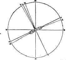
Let A represent a ship's apparent course by compass, steering East in the English Channel, when the variation observed is 20° 30′ West, which lay down from A to E, and draw the line W E which will be the apparent East and West Rhumb.
Then N S drawn at right angles, will be the apparent meridian, from which set off X the observed variation 20° 30′ West.
Let B represent the ship's apparent course by compass, steering West after tacking, and the observed variation 29° 30′ West, equal to W B equal to N Y.
Bisect X Y, and prolong n to s which will be the magnetic meridian. Then the angle N O n equal to 25° or half the sum of the observed quantities with the ship's head East and West, is the true variation. Therefore, the angle X O n equal to 4° 30′ is the aberration of the needle East of the magnetic meridian, produced by attraction when the ship's head was on the line A or steering East. And the angle Y O n 4° 30′ is the aberration of the needle West of the magnetic meridian when the ship's head was on the opposite line B or steering West. Then the apparent courses of the ship, being corrected by the quantity of the angle of aberration 4° 30′, her rectified course will be on the line e the magnetic East, or on w the magnetic West respectively; e w being the corrected magnetic parallel or East and West Rhumb, drawn at right angles to the magnetic meridian n. s.*
Remark by Capt. Ross.
Capt. Ross, of the Company's ship Discovery, observes in his journal, January 5th, 1813, as follows.
At the foot or base, of some of the high islands on the South coast of China, I have observed the needle of the theodolite to be horizontal or nearly so, when the plate of the theodolite was levelled; but when it was carried up about 800 feet high, to the summit of those islands, and there carefully levelled, with the needle pointing to the same part of the theodolite, there was observed to be a very sensible dip of the South end of the needle; which was not only experienced by one, but by two or three different instruments. Does this proceed from the attraction of some metallic substance on the South end of the needle, (it being always longer than the North end, and would more readily be depressed) or does the North end by being carried up so far, lose a portion of its magnetism, and therefore become lighter? If this effect is subject to a general law, proportionate to the elevation above the level of the sea, may not a long needle with its point traversing along a graduated vertical circle, be used to measure heights, after the exact dip at different elevations is known?
Remarks on the utility of chronometers.
CHRONOMETERS, would be highly useful for the improvement of marine geography, were navigators to adopt an uniform method, in marking in their journals the longitude obtained by these excellent machines. In taking a departure for chronometers at sailing from
* Mr. Thomas Yeates, with great labor and ingenuity, constructed a variation chart of the navigable globe, from lat. 60° North to 60° of South latitude, chiefly from actual observations made by European navigators and astronomers, as recorded in manuscript journals at the hydrographical offices of the Admiralty and East India House, compared with Spanish surveys in the Pacific Ocean, and collated with tables of the variation.
This chart is a valuable auxilliary to navigation in general, and interesting to those who investigate magnetical phenomena, the magnetic meridians or curves, being delineated at convenient distances on the chart, also the Halleyan lines, for every degree of change in the variation; and it is elucidated by much important information, with explanatory remarks, a brief description of the discovery of the variation of the needle, and its aberrations since that time.
[page] xxiii
any port or headland, the longitude allowed to that place should be marked distinctly in every ship's journal; and the longitude measured from it by chronometers (whether East or West) to every headland, island, or danger, during the passage, ought to be carefully stated; by which means, the relative meridians of those places will appear to view, and be ready to compare with the admeasurement of the same by other chronometers.*
But unfortunately, the generality of navigators, seldom mention in their journals the longitude allowed to the place of departure, and instead of carrying on the longitude made, daily from that meridian by chronometers, they mark longitude in, by chronometers. The journals therefore, are of little or no use, for any future purpose, on account of the indefinite manner in which the longitude is marked by chronometers.
Of lunar observations.
When the longitude obtained by lunar observations, is carried on daily by chronometers, or up to any headland, it ought also to be marked distinctly, in order to prevent any mistake.
When lunar observations are taken, the objects on both sides of the moon ought always to be observed if possible, and the mean taken; which will contribute to correct or modify the errors of the instrument, particularly when the distances are nearly equal, and fall on the same part of the arch of the sextant: and the difference of longitude run by log, between day and night observations, ought never to be applied in carrying on the one to the other, if there is a chronometer on board. If for instance, some observations of the sun and moon are taken in the afternoon for longitude, altitudes of the sun should be taken nearly at the same time to obtain the error of the chronometer, or what it is fast or slow for the apparent time at ship; having also marked down the time by chronometer when the distances of the sun and moon are observed, the error of chronometer must be applied to it, to reduce it to the apparent time of observation. When the observations are taken afterward by the moon and stars in the night, the time by chronometer ought likewise to be marked down, to which apply its error, and the quantity of loss or gain of the chronometer (proportionate to its daily rate) for the interlapsed time between these observations and those taken in the afternoon by sun and moon. The apparent time at ship when the observations of the moon and star were taken, will then be measured by chronometer to the meridian of the place where the observations of sun and moon were taken in the afternoon, and the mean of both should be taken for the longitude of that place, after comparing the apparent time of observations with the Greenwich apparent time. By using the chronometer in this manner, the errors liable to arise from currents, and from the admeasurement of a ship's run by log, between day and night observations, will be avoided.†
CONFORMABLY to the design of this work, which is the safety of lives and property, a few cautionary remarks to mariners, may be introduced, which are the result of the writer's personal observation.
Coral Shoals, when discernible.
CORAL SHOALS, particularly when they are white or variegated, will generally be visible from the mast-head when the sun is near the zenith, and shining bright. If the situation of the observer is between the sun and coral shoals, the latter may frequently be discerned
* To shew the utility of this, the following example may be given. In the journals of two ships, which saw the Brill Shoal, and Middle Island in the Straits of Salayer, at different times, I find they had lunar observations in both ships, which the journals assert, may be depended upon in fixing the longitude of those places. It nevertheless, happens, that the observations differ 20 miles, for those taken in one ship, make the Brill Shoal and Middle Island, 20 miles more easterly than those of the other ship; but having chronometers on board of both ships, they agree exactly in measuring the difference of longitude between the Brill Shoal and Middle Island, although there is a difference of 20 miles in stating the longitudes of these places by the lunar observations.
† It is very perplexing to young navigators, that nautical time, or that used at sea, is 24 hours later than astronomical time; because the nautical almanac, and all the tables in general use, are computed for astronomical time. As the security of navigation depends upon astronomy, it certainly would be of utility to resign this irregular prejudice, and make nautical time conform to astronomical time.
[page] xxiv
although the sun's altitude is not very great; but the glare of the sun will hide them from the observer, when they are situated between him and the luminary.
Detached clouds, passing with a slow motion under the sun's disc, have their shadows often reflected upon the surface of the sea, resembling greatly the appearance of coral shoals.
But as a general rule, it may be observed, that coral shoals are best discerned when the sky is clear, with the sun shining at a great altitude; and particularly, if the situation of the observer be between them and the sun, with his eye considerably elevated above the surface of the sea.
Coral reefs abound chiefly within the tropics, particularly in the Indian and Pacific Oceans, and round New Holland; many of the islands are either surrounded by these reefs, or stand upon a coral base. The formation of coral reefs by zoophytes is very remarkable, as these are neither perfect animals nor vegetables, but partaking of both. Most of them take root and grow up into stems, multiplying life in their branches, and in the transformation of their animated blossoms or polypes, which are endowed with spontaneous motion. Plants, therefore, resemble zoophyta, but are destitute of animation and the power of loco-motion; and zoophyta are, as it were, plants, but furnished with sensation and the organs of spontaneous motion. Of these, some are soft and naked, and others are covered with a hard shell; and it is astonishing with what rapidity they form coral reefs, by taking root often at the bottom of the sea in deep water, from whence the stems branch upward, and gradually, but speedily become transformed into solid rock. As these concretions of coral grow up near the surface of the sea, they become dangerous to ships; and after they appear above it, they are gradually transmuted into islands of various dimensions, according to the extent of their original basis.
A caution relative to unhealthy places.
SHIPS which stop on the East coast of Madagascar, at Cape Negrais, Tavay, Nicobars, Poolo Bay, Batavia, Borneo, or at any place within the tropics where the country is low, woody, uncultivated, and considered unhealthy, ought not to allow any of their people to remain on shore during the night, when wooding and watering at such places: nor should they be sent on shore in the mornings, until the noxious vapours are dispersed, by the influence of the sun penetrating into the forests.
On Swimming.
PERSONS who have not learned to swim, when they fall into the sea by accident, often drown themselves by lifting their hands above the surface, with a rapid and irregular motion. With proper resolution this may be avoided, for a gentle and slow motion of the hands under the surface of the water, either obliquely, or perpendicularly like the feet of a dog when swimming, will be sufficient to keep the face of any person above the surface, if there is no broken water. This will be more obvious, when it is generally known that the specific gravity of the human body is commonly lighter than sea water, as many persons float on the surface of the sea without any motion.
The natural position for persons to float, is with their backs downwards, and their arms extended close under the surface, which act as levers to preserve them in the natural position. If a person floating with his back downward, place his arms close to his side or across his breast, he will soon be changed from the horizontal position, for his feet will descend perpendicularly, and then his mouth and nose will gradually be immerged under the surface. If in floating, his arms are extended perpendicularly from his body, he will generally remain in the natural position a considerable time before his feet begin to descend from the horizontal to the vertical position. If his arms are extended beyond his head, with the palms of his hands spread just under the surface of the water, he will float steady in the horizontal position, with his face above water, and his toes touching the surface. In this manner the author has frequently floated in warm climates, half an hour at a time without the least motion, and generally was inclined to sleep: by placing the arms a little forward or backward, the natu-
[page] xxv
ral floating position is always adjusted to the greatest degree of regularity. It ought, however, to be observed, that the specific gravity of some persons is rather heavier than sea water, and such persons cannot float with their faces continued above the surface for any considerable time, without employing a little motion with their feet.
Remarks on the lading of ships.
WHEN SHIPS are chiefly laden with dead weight, such as iron, lead, zinc, &c., they labour and roll greatly; to modify which, part of the dead weight is generally placed high, in the hold, or between the decks. This, however, has little effect in retarding the quick rolling motion, which frequently endangers the masts when there is much swell; for the dead weight being placed over the whole breadth of ships, acts as a pendulum on the sides, to augment the rolling motion, produced by the swell. Returning from China in the Anna, by the eastern passage, laden deeply with sugar and tuthenag, we had a gale of wind near the Pellew Islands, in which the ship rolled very quick, broke some of the rigging, and the fore-topmast. In order to prevent this quick and dangerous rolling, tuthenag was taken from the hold, and placed in great quantities upon the decks, until the ship had scarcely stability left to carry proper sail; notwithstanding, there was very little diminution of her rolling.
Were it possible to compress all the dead weight contained in a ship, into a ball, and then place it at the centre of motion, she would in such case roll very little, because there would be no heavy weight near her extreme breadth. But as this cannot be done, an approximation seems desirable, which may be effected by stowing all the light goods along the sides and at the extremities, and the heavy articles in a longitudinal section over, and on each side of the keel, from the fore to the after hatchway, as circumstances require; and the dead weight may be carried up to the deck in this manner, or to any height thought consistent with the stability of the ship. This method was adopted in loading the Anna, when a great proportion of her cargo was iron, and she was very easy during the passage from London to Bombay; for the light goods being placed at the extremities, and in two sections along the sides of the ship, the cause of her pitching and rolling, was thereby greatly limited.
Remarks on the terms applied to winds, waves, and currents.
EXPLANATORY REMARKS, are here rendered necessary, on account of the ambiguous terms applied in common language to the direction of the winds, waves, and currents.
The point from which the wind proceeds usually gives to it a name; when the wind blows from the North, it is called a North wind, and vice versa. This order, however, seems to have been sometimes reversed by navigators; in the early voyages of the Portuguese to India, the wind that blows from N. E. is in some journals, called the S. W. monsoon; and that which blows from S. W. is called the N. E. monsoon; thereby, taking the name of the place to which the wind is proceeding.
The terms used by navigators to signify the direction of the waves, are also very vague and undefined; for although, (like the wind) the waves generally receive the name of the direction from which they proceed, the waves or swell running from North to South being called a northerly swell, and in like manner for those running in any other direction; this, however, is not always the case, as the waves or swell running from North to South, is called in some journals a southerly swell.
The terms applied to the direction of currents, are generally the reverse of those used to denote the direction of the wind and waves; as the direction to which the current is going, commonly gives it a name. Notwithstanding, a current running from North to South is almost uniformly called a southerly current, and that running from East to West called a westerly current, yet it appears, that some navigators are liable to reverse this order; for one of our circumnavigators in his voyage to the South Sea, calls a current running from East to West, an easterly current, and vice versa.
From the indefinite manner, therefore, in use amongst navigators, to mark the direction
e
[page] xxvi
of the winds, waves, and currents, it seems necessary to describe the method followed, in applying the terms throughout this work.
How named in this work.
The direction of the wind, is named from the point of the compass from which it blows.
The direction of the waves, swell, or sea, is named from the point of the compass from whence they proceed.
The direction of the current, is named from the true point or place to which it is running, if not otherwise expressed.
The course steered by a ship at any time, near land, or in the open sea, is by compass, or magnetic.
The bearings of land, taken from a ship at sea, or at anchor, are by compass if not otherwise expressed.
The direction of any coast, or bearing of any headland, island, or danger, &c. from any other place, when mentioned in this Directory, is the true bearing by the pole of the world, if not otherwise expressed.
Explanatory remarks.
THE GEOGRAPHICAL SITUATIONS of the principal places are stated, and the names of the Ports, Headlands, Islands, and Dangers, with which the paragraphs generally commence, throughout this work, have been set forth in capitals, in order to render them more conspicuous, and that navigators may not be liable to lose time, in searching for any place of which the description is required; because, it frequently happens in critical situations at sea, that a small loss of time, may occasion considerable danger. To facilitate the same object, side notes have been added, which will be found contiguous to, or fronting the principal matter contained in each paragraph. And to accomplish this object in the highest degree, a copious general index, is placed at the end of each volume, comprehending the names of all the Ports. Headlands, Islands, and Dangers; likewise of the principal Banks, Bays, Rivers, Mountains, Towns; or whatever is conspicuous, as marks, for the guidance of navigators.
Conclusion.
ALTHOUGH during the long and laborious prosecution of this work, the author has been constantly on his guard to prevent errors, and render it as complete as such an immense mass of heterogeneous materials would anmit of; yet, he is sensible, that with all possible care, it may still be liable to imperfections, which will readily be excused by those who can appreciate the difficulty of bringing forward a work of this nature and magnitude, digested not merely from his own observations, but also from documents, various in kind, often discordant in themselves, and seldom harmonizing with each other.
Since the publication of the former edition, however, he has received many highly important communications of newly discovered dangers, and navigable channels among the eastern islands not before known; these, with a careful examination of the journals belonging to the Company's ships during the 17th century, as well as those of a later date, have afforded him ample means for the improvement of this new edition of the India Sailing Directory.
Finally, the author having devoted the last two years to a careful revision and correction of his work, he trusts that its approximation towards perfection, has not been inconsiderable; and that all the discoveries which remain to be made during the present generation, cannot be of a nature to render it susceptible of being much improved for a long period of time; and he has great reason to infer, from his own observations, as well as from the information of others, that no similar work of equal magnitude and accuracy, was ever before published in this, or in any other country.
[page 1]
DIRECTIONS
FOR SAILING FROM
ENGLAND TOWARDS INDIA.
FIRST,
TOWARDS MADEIRA; PLACES OF SHELTER NEAR THIS ROUTE.
Geographical Site of the Lizard Point and Cape Finisterre.
On passing this Cape
THE LIZARD POINT, being from the best authorities, in latitude 49° 57½′ N. longitude 5° 13′ W. and CAPE FINISTERRE the westernmost promontory of Spain, in latitude 42° 54′ N. longitude 9° 18′ W., when clear of the Channel, if the wind continue fair, steer a course to pass well to the westward of Cape Finisterre, at 20, 40, or 50 leagues distance. Should the wind prevail at W. and W. S. W., as soon as a ship can round the Cape, she ought to stand to the southward, and not lose time by endeavouring to pass it at a great distance; for the wind will probably become more favorable as she proceeds southward, and in winter it is a great advantage to get out of the cold weather as soon as possible.
Geo. Site of Ushant.
If the projecting part of the French coast, at the entrance of the Channel happen to be approached, it is proper to observe, that the Ushant Lights are in lat. 48° 28′ N. and placed in lon. 5° 3½′ W., but Capt. Heywood, in 1809, made them in lon. 5° 13¼′ W. or 1°44¼′ W. from the anchorage of Torbay, by good chronometers. The soundings near Ushant, are 64 and 65 fathoms:—high water about 4½ hours on full and change of the Moon. Variation of the compass about 25¼° W.
Currents near the Channel and Bay of Biscay.
In the Bay of Biscay, and to the westward of Ushant, the current sets to the westward at times in winter; but in summer, it generally sets N. E. and easterly. It is often found to set eastward from March to November, particularly when westerly winds prevail; and off Cape Finisterre, and near the South part of the Bay, it sets mostly along the Coast to the Eastward; and along the East side of the Bay it sets to the Northward, parallel to the West Coast of France. Caution is, therefore, requisite, with a westerly wind, in standing to the southward, to weather Cape Finisterre; for should a ship's position not be ascertained by chronometers or lunar observations, it would be imprudent in gloomy blowing weather, to stand to the southward in the night, if not certain of being well to the westward of the Cape.*
* A deplorable example of this, was experienced by his Majesty's ship Apollo, with 69 ships under convoy for the West Indies, which sailed from the Cove of Cork, March 26, 1804. With a fair wind blowing strong, they steered about W. S. W. till the 31st, the wind then came more to the westward. At noon, April 1, the observed lat. 40° 51′ N. lon. 12° 29′ W. by account. At 8 P. M. the wind shifted to S. W. and increased to a gale with a heavy sea; they stood S. S. eastward, and at half-past three on the following morning, struck on the coast of Portugal, in latitude about 40° 22′ N. 3 leagues northward from Cape Mondego. They did not think themselves near the coast, judging, most probably, that the dead reckoning could not be much out, in 6 days. Captain Dixon, of the Apollo, and 60 men perished in making exertions to reach the shore; the other part of the crew, were two days clinging to a fixed fragment of the wreck, without nourishment. About 40 sail of the convoy were also wrecked on this rocky shore at the same time; some of these sunk with all their crews, and almost every ship lost from 2 to 12 men. It is to be lamented, that all ships of war have not chronometers, particularly those in charge of fleets. A few sights obtained, for even an indifferent chronometer, on the day preceding this fatal catastrophe, when the sun was visible, or by stars in the night, would have prevented this deplorable loss of lives, and immense property! No ship should be without two chronometers, excepting small coasting vessels.
VOL. I. B
[page] 2
N. W. gales have driven E. I. ships far into the Bay of Biscay.
Sometimes, gales of wind from W. N. W. blow into the Bay of Biscay, continuing for several days, and some of the outward-bound East-India ships, have been driven far into the Bay during these gales, in April and May. If a ship have the misfortune to lose any of her masts during one of these gales, the heavy sea rolling in from N. W. and W. N. W. with an easterly current, would unavoidably force her to leeward, and should the gale continue long and severe, she might be in danger of drifting on a lee-shore. It may therefore be expedient, to give a brief description of places, sheltered from gales at N. W. or W. N. W. in the Bay of Biscay.
Harbours in the Bay.
Geo. Site of Bilboa.
BAYONNE AND BILBOA, at the south part of the bay, are confined harbours, and have not sufficient water for large ships over the bars at their entrance. Off the eastern point of Bilboa entrance, there is said to be a reef of rocks, having anchorage of 7 or 8 fathoms within it, between the point and pier on the eastern side, where vessels lie sheltered from a N. W. wind. The entrance of Bilboa, is in about lat. 43° 24′ N. lon. 2° 54′ W.
Belle Isle.
Shelter may be found under it.
BELLE ISLE, in lat. 47° 18′ N. lon. 3° 5′ W.; and Basque Road, near Rochefort, are the best places in the bay, which afford shelter for large ships in westerly gales. Belle Isle is high, and may be seen at a great distance; the north-west end of it is surrounded with rocks, and directly in the line from it to Isle Grouais, nearly mid-way between them, is the Bank Bervidaux. The north-end of Belle Isle is in about lat. 47° 23′ N. and the south-end in 47° 15′ N. If a ship with the wind at N. W. or W. N. W. keep between these latitudes in running for the island, when she approaches it, she should steer along the south-side at 2 miles distance, to Point du Canon, the S. E. extremity; when abreast of this point, she ought to haul up for Point Locmaria, which is the easternmost point of the island, distant about a league from the former, then anchor under it in 8, 10, or 15 fathoms, where she will be sheltered from N. W. and westerly winds. Should it veer to S. W., she may run to the northward of the point, and anchor on the north-east side of the island.
Isle Hedic.
ISLE HEDIC, about 7 miles eastward from the east point of Belle Isle, has many contiguous rocks. To the S. E. lies a cluster of rocks called the Cardinals; the largest is distant from Hedic about 1 mile, and is always above water. If a ship be driven to the eastward of Belle Isle, she may pass to the southward of the Cardinals at a mile distant, then haul up to the northward, and anchor on the east-side of them and Isle Hedic, in 9 or 10 fathoms, sand and mud.
Geo. Site of Isle Re, &c.
Lavardin Shoal.
Ships when bound to Rochelle, or Rochefort, steer for ISLE RE in lat. 46° 14′ N. about lon. 1° 30′ W. which has a lighthouse on its N. W. end. In running for this island, care is requisite to avoid two reefs of rocks, partly above and partly under water, called Banches Vertes, and Roche Bonne: they are nearly 2 leagues in extent east and west, distant about 12 leagues west from Isle Re, in about lat. 46° 15′ N.† From the west point of Isle Re, a rocky bank extends under water about a league, called the Whales of Ars, or Les Balines d'Ars; and from the S. W. part of the Island, a ridge of rocks extends a full league to seaward, called Champ Chardon; but the Lavardin Shoal is most in the way, which is a small
† Near them to the westward there is 60 fathoms water, and 30 fathoms to the eastward of them.
[page] 3
rocky bank dry at low water spring tides, about 1½ mile S. Eastward from the S. E. end of Isle Re. Isle Oleron lies to the South of Isle Re, and between them is the channel called Pertuis d'Antioche, leading to Basque Road, which is about 2 leagues wide. It is safest to keep nearer Isle Re than Oleron, on account of some rocky banks which lie off the north end of the latter, distant near a league, called the Antioches. And nearly at the same distance from the shore, along the north and N. E. side of Isle Oleron, a chain of banks extends nearly from the Antioche to abreast the south end of Isle Aix. In running for Basque Road, keep nearer Isle Re than Oleron, till near the S. E. end of the former; then steer to the southward, to avoid the Lavardin Shoal already mentioned, lying 1½ or 2 miles off the S. E. end of Isle Re; afterward steer for the west part of Isle Aix, a flat island, with some houses on it, situated about half-way between Oleron and the main land, keeping nearer to Isle Oleron than the main.
Basque Road.
BASQUE ROAD, extends from the Lavardin Shoal to Isle Aix, having from 10 fathoms water close to this shoal, to 12 and 13 fathoms in the middle of the road; and from 5 to 9 fathoms about 1½ mile to the north and N. W. of Isle Aix. The soundings in mid-channel, between Oleron to the southward and Isle Re and the Lavardin Shoal to the northward, are generally from 12 to 15 fathoms, shoaling on each side toward the banks. On the northern extremity of Oleron, there is a tower called Chassiron, where two fires are kept in the night, one above the other, by which it may be readily known. Should there be much sea in Basque Road, a ship may run up along the west side of Isle Aix, taking care to keep nearer to it than to Oleron, to avoid the bank off the latter; and then anchor in 5 or 6 fathoms, off the S. W. end of Isle Aix, in the inner road.
Coasts of Portugal and Spain.
THE COASTS OF PORTUGAL, OR SPAIN, having been sometimes visited by India ships, when forced by stormy weather to take shelter in some of the nearest ports, in order to repair damage sustained, it may therefore be useful, to describe briefly, some of the principal headlands and best harbours on the western side of the Peninsula.
Geo. Site of Capes Ortegal and Prior.
CAPE ORTEGAL, the northernmost headland of Spain, is in lat. 43° 48′ N. lon. 7° 40′ W. and about 12 leagues to the S. westward of it, is Cape Prior, in lat. 43° 36′ N. having a very ragged aspect, with some rocks near it, which require a birth in passing. This Cape is above 2 leagues to the N. W. of the entrance into Ferrol, and between 4 and 5 leagues from the Iron tower, or light-house of the Groin, or Corunna.
To sail into Ferrol,
When a vessel comes near the bay of Ferrol, the haven begins to open, and you sail in mid-channel between two headlands, but when within, steer to the northward and anchor by the north point, for it is rocky and flat on the west side of the town, and therefore must be avoided.
To enter Ferrol from south or westward, after giving a birth to the north point of Ferrol, which is foul and rocky until the haven opens, then run right in, and you will be within the south point, clear of its projecting foul ground; steer now for the north point of the haven, and along by it, till the haven opens itself again; from thence keep in mid-channel, where are 12, 14, and 15 fathoms water, though the passage is so narrow that a stone may be thrown across it.
and Corunna.
CORUNNA, is situated at the bottom of a deep bay, within the mouth of a spacious haven, south-west of Ferrol, and on the opposite side of the gulf. To enter this port, having made the Islands Sizarga, which being foul, must have a good birth, steer for the light-house or iron tower, and run in E. S. E., and round the point steering S. E. and S. S. E. giving it a birth of 4 or 5 cable's-lengths. In passing the point, a small Isle will be seen
B 2
[page] 4
with a house on it, along which a ship may sail very close, and anchor off the Fishing Village in 6, 7, or 8 fathoms.
Geo. Site of Vigo, and Bayonne Isles.
VIGO in lat. 42° 13½′ N. lon. 8° 27½′ W. is situated on the S. E. side of an excellent bay or haven, which is fronted by the Bayonne Isles, extending from lat. 42° 11′ N. to 42° 15′ N., and on the East side of these Isles, there is safe anchorage and shelter from the sea, and westerly winds, in 10 and 12 fathoms. The best channel into Vigo bay, is to the South of these Isles; for the northernmost Isle has a sunken rock about a cable's-length off, which must have a good birth when a ship enters by the northern channel. When the bay is entered, a ship may run up in mid-channel, and anchor in 10 or 12 fathoms off Vigo; or farther in, about Point Rondal, she may be laid in the mud and receive no injury, if destitute of anchors.
Onza Isles, and Pontevedro Bay.
ONZA ISLES, lie to the northward of Bayonne Isles, and on the East side have safe anchorage from westerly winds, with fresh water, where our ships of war procured supplies, even while at war with Spain. The south extremity of these Isles is in lat. 42° 21′ N., and they front Pontevedro Bay, which like that of Vigo, is a good haven.
Salvora Isle, and Arosa Bay.
SALVORA ISLE, in lat. 42° 28′ N. fronts the bay or gulf of Arosa, which is a deep and excellent haven, extending from the Isle about true N. N. E. a great way inland, having good shelter and moderate depths, with several shoals. The channel into this bay is on the south and east side of Salvora Isle, where a ship is sheltered as soon as she gets inside the Isle; but there is no safe passage on the north-west side of this Isle, it being nearly joined to the main by shoals.
Geo. Site of Cape Mondego,
CAPE MONDEGO, in lat. 40° 11′ N. lon. 8° 53′ W. is a projecting headland on the coast of Portugal, with a reef stretching out about a cable's-length, having good anchorage, and shelter on the south side, from north and N. N. W. winds.
and Cape Carvoeiro.
CAPE CARVOEIRO, in lat. 39° 22′ N. lon. 9° 20′ W. is a rocky headland, with a light-house like a church on its extremity, and being separated by a low sandy isthmus from the inland country, makes it look like an island in thick weather, by which some ships, mistaking it for the Burling, have run on shore on the sandy isthmus.
Burlings, &Estellas.
BURLING ISLAND, is of middling height and size, bearing from Cape Carvoeiro true N. 55° W. distant 6 miles nearly; W. N. W. of the Burling ½ a mile distant, lie six islets called Estellas in a N. E. and S. W. line, with a rock about ¼ mile to the southward of the southernmost one, visible at low water; there is also a high rock, at a small distance N. E. of the Burling.
From Burling Island N. 23° W. true bearing, distant 4¾ miles, lies a large round steep islet, surrounded by other rocks. There is a safe channel between this northern group and the Estellas, about 3 miles wide, but as the current sets toward the latter, it should not be used without a commanding breeze.
The channel between Cape Carvoeiro and Burling Island, being 5½ miles wide, with soundings, may be navigated without fear of danger; and a ship may anchor occasionally under the Burlings.
Cape Roca. Geo. Site.
CAPE ROCA, in lat. 38° 46′ N. lon. 9° 30′ W. is formed of steep cliffs, with a rocky islet adjoining to it, termed by seamen, the rock of Lisbon, from which a reef projects about a musket shot, having 25 fathoms close to. Cape Razo, is a low rocky point distant 4 miles S. 7° E. true bearing from Cape Roca, having on it Fort Sanxete, and adjoining it there is
[page] 5
a small shoal. From Cape Razo the south point of Cascaes bears true S. 62° E. which is a steep cliff crowned with Fort St. George, and the Light-house of Our Lady of Guia; round this point the coast bends in to the N. E. forming the bay of Cascaes and the town of this name, where pilots are got for entering the Tagus.
Marks for entering the Tagus,
FORT ST. JULIAN, stands on a steep point, distant 4¾ miles S. 72° E. true bearing from Fort St. Martha near Cascaes, having a tower 120 feet high in the centre of the Fort, which serves for a light-house. From St. Julian to the tower of Belem the distance is 5 miles true N. 79° E. and the coast between them forms a bay with numerous edifices, part of which, situated about the middle of the bay, serve as marks for the great bar or principal entrance.
THE GREAT BAR, is formed between two banks called the North and South Cachops; the North Cachop extends about 2¾ miles to the S. Westward of Fort St. Julian, and the sea breaks on it with a westerly wind. The channel between this Cachop and the north shore, called the Corridor or Little Bar, has 8 to 10 fathoms water, but being narrow, can only be used with a fair wind.
SOUTH CACHOP, is a sand-bank, having the Tower of Bugio on it, formed of two circular concentric bodies, from the middle of which rises the little tower 63 feet high, and bearing from St. Julian true S. 55° E. distant 1½ mile. The tower is isolated by the sand-bank being covered every tide, and this bank extends 2 miles to the S. W. leaving the bar or great channel to the north. This channel is no where less than 1 mile wide, with from 10 to 18 fathoms good bottom; a bank stretches across the channel between the Cachops, having not less than 8 or 9 fathoms on it, and increasing to 15 and 20 fathoms inside. The water shoals suddenly to both the Cachops, having 6 or 7 fathoms close to.
and Sailing Directions.
To enter the Great Bar with a fair wind, the leading marks should be brought on, before the meridian of Cascaes is passed; or bring Cape Roca light-house on with that of Guia, which will be sufficiently to the westward of the Cachops till the Paps* be discerned; these must be brought in one with Jacob's Ladder,† and so kept until the Tower of St. Julian bear west or S. W., then the north shore of the river may be navigated to the anchorage of Belem.
To enter the Tagus without a Pilet.
If when near the bar, a strong westerly wind prevent pilots from getting on board, nor the marks be clearly discerned, pass not the meridian of Cascaes till Belem Tower be brought on with the north end of the outer wall of Bugio, bearing true N. 65° E., or the latter E. ¼ N.‡ by compass, if Belem Tower is not visible. Steer on this bearing till the Tower of St. Julian bear true N. N. E.; being then in mid-channel, steer for the Turret of Caxias, which bears true N. 45° E., keep this course till abreast of Paco d'Arcos, then coast the northern shore to Belem.
Should the Mirante or Turret of Caxias not be seen, then so soon as the Tower of St. Julian bears true N. N. E. you will be 2¼ miles from Bugio, for which steer no longer, but steer midway between St. Julian and Bugio, or so as to make good a true N. E. course until past the bar.
The north shore of the river is safest to approach, the anchorage being better, the depths less, and the tides not so strong as near the south shore. During the freshes, the ebb tide
* Two little mounts visible at a great distance, rising over the contiguous land.
† Seven walls or causeways, built to support the soil on the S. E. declivity of a round Hill of yellow colour near the sea, 260 feet high.—On the top of this Hill is a turret called Caxias 3 miles N. 60° E. from St. Julian, formed of two octagonal structures conjoined, each 33 feet high, and terminated in a cupola of similar shape. A good mark for Jacob's Ladder, is a long wall near it to the E. N. E. the buttresses of which, on the side of the Tagus, appear like the arches of a bridge.
‡ The variation at present is 22¾° Westerly, at Lisbon.
[page] 6
runs frequently 6 miles an hour in the channel, requiring a press of sail to stem it, and at such times, when westerly winds blow strong, the sea breaks all across the bar between the Cachops, and cannot be easily distinguished from the breakers on the Cachops.
Geo. Site of Lisbon.
It is high water on the bar at 2½ hours on full and change of the moon. The observatory of Lisbon is in lat. 38° 42′ 40″ N. lon. 9° 8′ 30″ W.
Pass to the west of Madeira in winter.
Westerly gales.
AFTER LEAVING THE ENGLISH CHANNEL, steer to pass to the westward of Madeira, at any convenient distance exceeding 7 or 8 leagues. In the winter months, it is preferable to pass to the west of Madeira, for strong gales from westward prevail in November, December, and January, producing eddy winds, and severe squalls near the land; which are occasioned by the high land obstructing the regular course of these gales. In November 1797, and December 1799, I was each time, forced to put to sea from Funchal Road. Severe westerly and S. W. gales, with hard squalls and rain, kept us at sea eight days each time, and prevented us from anchoring afterward, the W. S. W. wind continuing to blow strong. In these gales, the island of Madeira and the Desertas, were frequently obscured in fog; and the squalls so sudden and violent near the latter, and about the southeast end of the former, as nearly to overset one of the ships in company.*
Geo. Site and description of Porto Santo.
PORTO SANTO, in lat. 33° 5′ N. lon. 16° 16′ W., is a high island with several peaked hills on it, about 12 or 14 leagues north eastward from the east end of Madeira, and generally seen by ships bound to the latter: it has a bay on the S. W. side, where there is anchorage, water, and refreshments; and this road has a rock at its west end like that of Funchal. Although Porto Santo is not so high as Madeira, it may be seen 12 or 14 leagues from a ship's deck; and is easily distinguished from Madeira or the Desertas, by its Peaks and uneven appearance; these islands having a more regular outline.
The Reef said to lie 3 leagues to the N. E. of Porto Santo, on which a Dutch ship was lost, has been found by H. M. S. Falcon to bear about N. 18° W. true bearing, from the body of the island, distant from the nearest part about 7 miles.
The Falcon, Lieutenant J. Bowen, examined this reef, or rocky bank, on the 10th of January, 1802. When the easternmost rock, off the N. E. point of Porto Santo bore by compass S. E. the N. E. point of Porto Santo S. S. E. ½ E., northernmost rock S. ½ W., and the west point of Porto Santo S. S. W. ¾ W. had 22, 23, and 25 fathoms rocky bottom; the master in the cutter, at the same time, about ¾ of a mile S. ½ W. from the ship, had 30 fathoms rocky bottom; from whence rowing to the westward the depth gradually decreased to 16 fathoms, and then more suddenly to 12, 8, and 4½ fathoms on the shoalest part of the rock, which was plainly discerned from the boat. When she was on it in 4½ fathoms, the N. E. point of Porto Santo bore by compass S. S. E., the northernmost islet or rock S. by W., and the west point of the island S. S. W. distant from the nearest part of it about 7 miles.
This rocky bank extends east and west about 1 mile, terminating in a point of rocks to the westward, on which the least water appeared to be 4½ fathoms. Lieutenant Bowen, remarks, that when the bearings were taken upon it in the boat, the compass was agitated by her motion, and therefore may not be perfectly correct, but he is certain that the boat
* November 28, 1797, blowing hard at S. W. off the S. W. end of Madeira, and a high sea rising, we bore away in the Carron, to endeavour to find shelter under the lee of the island. In running between Madeira and the Desertas, blowing very hard at S. W. with dark weather and rain, we were suddenly becalmed; then followed an eddy wind from N. E., the sea so high as frequently to cover the bowsprit and jib-boom. At this time we were much nearer to Madeira than to the Desertas, with a dark cloud extending over us. At the same time, two ships about 2 or 3 miles more eastward, were in clear sunshine, running before a severe squall at S. W.; and one of them had her main topsail blown away. In December 1799, by carrying a press of sail on the Anna, we just cleared the southernmost Deserta, in very thick weather, during one of these westerly storms, which drove us 2° eastward from Funchal. Several outward-bound West-India ships, were not long ago, dashed in pieces on the Desertas in the night, by an error in their reckoning.
[page] 7
was on the shoalest part, otherwise the sea must have broke on it, had there been less water, by the considerable swell and fresh breeze which prevailed at the time. Coming on to blow, he was prevented from making farther observations.
Channel between it and Desertas.
With the wind from the northward or N. E., bound to Funchal, the channel between Madeira and the Desertas is the most convenient, and seems about 4 leagues wide from the east point of Madeira to the Flat or Table Deserta, which bounds it to the eastward.
Desertas, or Desert Isles.
DESERTAS, are high barren rocks, except the north westernmost, which is level and much lower than the others. The middle Deserta is the largest, between which and the southernmost, called Bogia, there is a narrow channel, never to be attempted unless from necessity, as a ship is liable to be becalmed in it by the northern Deserta, which over-tops the Bogia. The fleet under convoy of H. M. S. Lavinia, bound to India, and to touch at Funchal, passed through the channel between the Middle and South Desertas, in May, 1809. They mistook the Deserts for Madeira, and after steering for the south extreme of the Large or Middle Deserta, proceeded through the channel between it and the southern Island, which is 1 or 1½ mile wide at most, and seems perfectly clear of danger. None of the ships tried for soundings, but the fishermen say, that bottom may be got with 60 to 300 fathoms of line, according to the distance from either shore.
The Desertas stretch nearly N. N. W. and S. S. E., rather of an even appearance, and are about 5 leagues in extent. At the N. W. end of the great Deserta, is situated the low small N. W. Deserta, which bounds the channel between these islands and the east point of Madeira. This small level island is seen at 5 or 6 leagues distance, just appearing above the water, and close to it there is a pyramidal rock, which may be mistaken for a ship under sail.
Madeira.
Southerly gales.
Indication of them.
MADEIRA, is very high, generally clouded, except in sereno weather; the east point, in about lat. 32° 42′ N. projects out in a kind of peninsula, rather low and rugged, forming an indentation or bay to the southward. In this bay, soundings are said to be found near the shore. In summer, when the N. E. winds prevail, a S. W. current sets through the channel between Madeira and the Desertas: and in that season, when the weather is settled, off Funchal Valley there are regular land and sea breezes; the sea breeze setting in from S. Westward in the forenoon, and the land breeze comes from the shore generally about 10 o'clock at night, but sometimes not till 2 or 3 o'clock in the morning. These land breezes do not extend above 3 or 4 miles off shore. It has been said, that southerly winds never blow severe quite to the shore at Funchal, that the south-westers or south-easters are never expected, except in January, February, and the beginning of March, that large ships almost always ride them out; whereas, it is certain, these southerly gales blow quite home to Funchal, sometimes in November and December; and when they are apprehended, it is common for ships of every description to put to sea. These S. W. or S. E. gales, are in general preceded by a swell tumbling into the road, often accompanied by gloomy weather, drizzling rain, and a very unsettled breeze from the land, veering several points backward and forward very suddenly. By such indications, ships generally proceed to sea; for should it blow from southward, it would be almost impossible to clear the shore on either tack after cutting or slipping, the anchorage being near the land. Some ships have rode out these southerly gales, but others have been driven on shore.*
Directions for sailing to Funchal Road.
In passing through the channel between Madeira and the Desertas, a ship ought to keep at a considerable distance from both; for it would be unpleasant to be drifted near either in
* Not long ago, several ships at anchor in Funchal Road, were driven on shore, and wrecked by one of these gales. This, I think, happened in April or May. The S. W. gales are more frequent at Funchal than any other strong winds.
[page] 8
calm weather, on account of the want of anchorage. In November, 1797, the Anna drifted in a calm very near the shore to the northward of the Brazen Head, and brought up with the stream anchor in 60 fathoms water, her stern not far from the rocky cliffs. After being at anchor some time, a light breeze from the land, with the help of the boats towing, enabled her to get out from this precarious situation. When a ship has advanced through the channel, and approaching the Brazen Head, she should not keep near it, in case of being becalmed, as there is no anchorage close to this steep bluff point, which is the eastern extreme of Funchal Road.
Bent anchorage.
Near this bluff head land, ships are frequently baffled by eddy winds and calms, and obliged to get their boats out to tow; it is therefore, advisable, not to borrow too close to it in passing, nor to haul in for the road till nearly abreast the town. Should a ship enter the road by night, it is proper to shew a light at her ensign staff, to prevent being fired at from the forts. In working in with a land breeze, it is best to make short tacks opposite the valley, for here, both the land and sea breezes prevail. The Loo Rock situated near the shore, at the west end of the town, is a high rock with a fort on it; and the citadel is a brown square fort on a hill, over the W. N. W. part of the town. The best birth for large ships, is the citadel a little open to the eastward of the Loo Rock, in 30 or 35 fathoms water; the distance from the Loo Rock will then not exceed a large half mile.
A caution.
With the Loo Rock and citadel in one, bearing about N. N. E. ¼ E., Funchal steeple N. E. ¼ N. by compass, the anchorage appears equally good, in 35 faths. stiff ground. With the Loo and Citadel in one, the ground is also good in 45 fathoms, off the former about 1 mile. Farther to the westward the ground is not so good, and to the eastward the bank has a sudden declivity from 50 or 55 fathoms good ground, to 100 fathoms rock, and then no ground. If south-westers are expected, which are frequent in winter, to anchor with the Loo and Citadel in one, or the latter just open to the westward of the Loo, is the most convenient birth to put to sea from, or to ride out a S. W. gale. But the citadel well open to the eastward of the Loo, is the best anchorage when south-easters are expected. In coming into Funchal Road with a brisk wind, sail should be reduced in time, to prevent having too much way through the water, at the time of anchoring; and a ship should be brought up with her head to seaward, that in case any accident prevent her bringing up, sail can be made off shore, or otherwise as most expedient. It is best to ride with a whole cable, when there is the least appearance of unsettled weather, with a slip buoy on it, in case of being obliged to cut near the end or splice, and put to sea quickly; as there would not be time to weigh the anchor, from the sudden approach of blowing weather.
In light breezes and calms, it is proper to have a kedge anchor out to steady the ship, and prevent fouling the bower.
Current.
Rainy season.
Point de Sol.
The beach is composed of shingle, and has generally a surf on it, which prevents a ship's boat from landing abreast the town; but on the N. W. side of the Loo Rock, about half a mile from the town, is the only place safe to land from a ship's boat; the country boats are employed in watering, &c. The current along the south side of Madeira and the Desertas, mostly sets to leeward in strong gales; but at the conclusion of a gale, it sometimes changes suddenly, and sets contrary to the wind. The tides rise, and fall, about 7 feet in general, at full and change. The rainy season is said to be January, February, and March; October is also, frequently a wet month. And when hard westerly gales blow in November, or more particularly in December, they bring with them cloudy weather and rain. There is a perpendicular high cliff of majestic appearance, about 3½ leagues westward from Funchal, called Point de Sol, with a small bay to the eastward of it, said to have anchorage in it near the shore. In westerly gales and stormy weather, Point de Sol, (Point of the Sun) is often painted with beautiful portions of rainbows, which give it a grand appearance.
There have been instances, of hurricanes blowing down through the Valley of Funchal;
[page] 9
Storms.
lately, a condensed cloud poured a torrent of water on the mountain at the head of the valley, which deluged many vineyards in its passage, and washed away some of the houses in the town.*
Geo. Site of Funchal.
Funchal is in lat. 32° 38′ 40″ N. by above 100 meridian altitudes of Stars on both sides the zenith, observed by General Brisbane and Professor Rumker, in June, 1821. Variation about 23° W. Longitude as follows, viz. by
| ° | ′ | ″ | ||
| Gen. Brisbane and Mr. Rumker in 1821, | 16 | 54 | 55 | 16° 53¾′ West of Greenwich, mean Longitude of Funchal. The Owen Glendower, Frigate, went purposely in 1822, having 14 good chronometers on board, to measure the difference of Longitude from Greenwich to Funchal, and which she made to be 16° 53′ 45″ W. corresponding with the above. |
| Capt. Corry, 1821, | 53 | 40 | ||
| Capt. Heywood, 1810, | 51 | 6 | ||
| Do. Do. 1812, | 53 | 19 | ||
| Capt. M'Intosh | 50 | |||
| Capt. Craig | 52 | |||
| Flinders and Crosley | 56 | |||
| French Astronomers | 55 | |||
| Capt. Bartholemew | 58 |
Lat. of the anchorage in the Road 32° 37′ 40″ N.
Calms under the High Land.
At leaving Funchal, steer directly from the shore, to prevent being baffled by calms or eddy winds under Point de Sol, or the Brazen Head, for vessels are liable to calms under the high land to the westward.
DIRECTIONS for SAILING from MADEIRA to the SOUTHWARD:
SALVAGES, CANARY, AND CAPE VERD ISLANDS.
Proper to keep to the westward.
DEPARTING FROM MADEIRA, or after passing it to the westward, the best track is to the westward of the Canary, and Cape Verd Islands, at any discretional distance, or barely in sight of them. By adopting this route, steadier winds may be expected, than by passing close to, or among these islands. The Britannia outward bound in November, 1803, had W. S. W. and S. W. winds, and was several days close to the coast of Africa, in latitude 29° N. In January, 1795, the Swallow, after passing in sight of the Canary Islands to the westward, had westerly winds, which carried her to the eastward of the Cape de Verd Islands: it seems preferable to pass to the westward of all the islands, which is the track generally adopted, particularly early in the season; but many ships, after January, prefer the passage to the East of the Cape de Verd Islands.
If a ship be bound to Teneriffe, or intend to pass between the Canaries, or is laid off to the S. S. Eastward after passing Madeira, care is requisite to avoid the Salvages, which must not be approached in the night.†
Geo. Site of Great Salvage.
GREAT SALVAGE, in lat. 30° 8′ N. lon. 15° 50′ W. by the late survey of H. M. S. Leven, or 1° 3′ East from Funchal by chronometers, is a high bold rocky Islet that may be
* The small-pox is much dreaded at Madeira; were a ship discovered to have this distemper on board, she would be ordered to leave the port.
† Captain James Mortlock, an excellent observer and astronomer, passed within 1½ mile of the southern Salvages, or Piton, in the Young William, and made a plan of them. He made the Piton, or southernmost Islet, in lat. 30° 5′ N. lon. 15° 42′ W.; and the Great Salvage in lat. 30° 11′ N. The longitude from these Islets, was measured to Ferro by chronometers, in a run of 24 hours, and rests on Ferro, being in 17° 58′ W., as the chronometer measured 2° 16′ W. from the Piton, or southern Salvage, to Ferro.
VOL. I. C
[page] 10
seen at 8 or 9 leagues distance. By measuring the angle of the Peak of Teneriffe to the Sun, and also to the Pole Star, made that Peak bear S. 20° 4¼′ W. true, from the Great Salvage, distant 118 miles.
The Great Piton bears from the Great Salvage S. 55° W., distant 9 miles; the Pitons consist of two islets with several rocks about them, having a safe channel between them and the Great or North Salvage.
Canary Islands.
CANARY ISLANDS, are eleven in number, (four of them small) extending from lat, 27° 40′ to 29° 20′ N. and from lon. 13° 35′ to 18° 6′ W. They are mostly high, with steep rocky shores, rendering the landing often impracticable, and they are all destitute of safe harbours for large ships.
Palma.
Geo. Site.
PALMA, the north-westernmost of these Islands, 8 leagues long and 6 leagues broad, is frequently seen by the outward-bound East-India ships: being high, with a bold coast, some navigators have run toward it with great confidence in the night; and several ships have been nearly lost on it in dark nights, the lights on the impending mountains, first shewing their situation. Captain L. Wilson, a scientific observer, places Palma, the north point, in lat. 28° 51′ 20″ N. lon. 17° 48′ 40″ W., the west point in lat. 28° 46′ N., lon. 18° 4′ 30″ W., and the south point in lat. 28° 32′ N. lon. 17° 54′ 45″ W. This island is said to be more subject to westerly winds and rains, than any of the others. Santa Cruz, the chief place, is near the middle of the east side.
The channels clear.
The channels among the Canary Islands are clear of dangers, except a doubtful sunken rock in lat. 27° 52′ N., in the channel between Canary and Teneriffe, about 7 leagues from the latter, and 5 leagues west from the former; which many navigators think has no existence. Several of the outward-bound ships pass between Palma and Gomera, when laid off to the eastward by westerly winds, or otherwise.
Geo. Site of Santa Cruz.
SANTA CRUZ, in the Island Teneriffe, is in lat. 28° 29′ N. lon. 16° 22′ W. being the port generally used by ships which stop at these Islands to procure refreshments: it is on the east side of the island, and the road, though indifferent, is one of the best in the Canaries. Ships going in, should not bring any part of the town to the northward of west, for fear of being becalmed by the high land under the peak, and drifted on the rocky shore, where no bottom is found close to it with 200 fathoms line.
Anchorage.
Refreshments.
Merchant ships and small vessels anchor to the N. Eastward of the pier, off the town, in 18 and 20 fathoms, distant from the shore ½ mile. Ships of war anchor off the northern-most fort, about ½ mile distant from it, with their outer anchor in 36 fathoms, and the inner one in 15 or 18 fathoms. The Hindostan, in October, 1792, at anchor in 28 fathoms dark mud, had the southernmost steeple west, the northernmost fort north, and the easternmost point E ½ N. The bottom being foul in many parts of the road, it is customary to buoy the cables from the ground. Vegetables are plentiful, also the fruits common in Europe, and good water is easily procured when the surf is not great on the beach. This road is exposed to easterly winds, but these seldom blow hard, although it has sometimes happened, that ships have been driven from their anchors, on shore. Santa Cruz is an excellent place for procuring a supply of cheap wines, which are of a weak quality. The Peak of Teneriffe is in lat. 28° 18′ N. by Captain Cook; and in 28° 15′ 38″ N. by the Requisite Tables. It may be seen about 45 leagues when the atmosphere is clear, being about 12,300 feet elevated above the level of the sea. Variation 20° W.
Oratava.
ORATAVA, on the N. W. side of the island, has a very indifferent Road, where ships stop sometimes to take in wine: the anchorage is in 50 fathoms about 1½ mile off shore, with the Peak bearing S. W. and a pilot should be kept on board. Straggling rocks project
[page] 11
two or three ships' lengths from the shore, on which the sea breaks furiously: this Road is very dangerous in the winter months, from September to May.
Grand Canary.
GRAND CANARY, 12 leagues S. E. of Teneriffe, is nearly round, being about 11 or 12 leagues in extent; it is the best watered, and most fertile of the islands. Palmas, the chief town, is on the N. E. side of the island; its road is sheltered from N. Eastward by that point of the land stretching out in a peninsula, and having some rocks adjoining.
Gomera.
GOMERA, distant about 5 leagues to the S. W. from the coast of Teneriffe, is 6 leagues long, and its medium breadth 3 leagues. Palmas, the chief place, is in a bay on the east side, sheltered from the northward by a projecting point.
Ferro.
FERRO, the S. Westernmost of the Canary Islands, distant 10 or 11 leagues to the S. W. of Gomera, is 6 leagues long and 3 leagues broad. El Golfo, on the east side, is the chief village. These islands are destitute of harbours.
Fortaventura.
FORTAVENTURA, is about 20 leagues long, and from 2 to 5 leagues broad, the south end of it being about 10 leagues to the east of Grand Canary.
Lanzarote.
LANZAROTE, or Lancerota, about 6 leagues long and 4 leagues broad, lies to the N. E. of Fortaventura, being separated from it by the Bocayno channel, in which is the Island Lobos, 2 leagues long and ½ league broad, dividing the channel into two passages. That between Lobos and Fortaventura, is 2 miles wide with 5 fathoms water, and good anchorage. The channel next Lanzarote, is 4 miles wide, with 10 fathoms water. Off the north end of Lobos there is a large reef.
Harbours.
On the S. E. side of Lanzarote, are two ports within reefs, called Puerto de Naos and Puerta Cavallos: the former is the northern one, sheltered from N, E. by the reefs, and here vessels may refit. It has two entrances between the reefs, with only 14 feet at high water in the northern, and 17 feet in the southern entrance; the depth within, is 27 to 10 feet, rise of tide 10 feet.
Puerta Cavallos.
PUERTA CAVALLOS, 1 mile south of the former, has only 12 feet in the channel; and within, 17 feet
Gratiosa.
GRATIOSA, is 1 league north of Lanzarote, being 5 miles long and 1 mile broad, and the channel between them, forms the harbour of El Rio, in which the depth is 6 and 7 fathoms.
Santa Clara, &c.
SANTA CLARA, 6 miles N. W. of Gratiosa, and Alegranza, are small rocky isles destitute of fresh water.
The channel between Cape Juby on the African coast and these islands, is about 20 leagues wide, and clear of danger.
Cape Verd Islands.
CAPE VERD ISLANDS, consisting of ten principal and some small Isles, extend from lat. 14° 43′ to 17° 13′ N., and from lon. 22° 28′ to 25° 27′ W.; they are mostly high, and some of them have sheltered bays, with tolerable anchorage.
Channel within them.
Some outward-bound ships for India, or St. Helena, prefer the channel between Cape Verd and these islands, generally keeping in longitude between 19° and 20° W. in passing the islands, to avoid some doubtful dangers placed to the eastward of them, which seem to have no existence: others keep nearer to the continent, the channel being clear on that side, with soundings near the land. Were it not for the great haze contiguous to the coast, occasioned by the dust and dry vapour, driven to seaward by the N. E. winds from the hot sandy
C 2
[page] 12
desert, the passage near the main would be preferable to that outside the Cape Verd Islands, when the sun is far to the southward, for steady northerly winds then prevail near the continent, and the route is much shorter than that to the westward; but the obscure atmosphere, renders the inner passage unpleasant when observations are not regularly obtained.
In some charts, a reef is placed projecting from Cape Verd to a small distance, but the Cape seems safe to approach, the soundings decreasing regularly to 8 or 10 fathoms towards it.
St. Anthony.
Height.
ST. ANTHONY, the north-western most of the Cape Verd Islands, is often seen by ships passing to the westward of them: prior to the use of chronometers and lunar observations, it was desirable to see this island, Palma, or Madeira, in order to correct the reckoning; which is not requisite, if a ship have good chronometers; nevertheless, St. Anthony may be passed in sight, without fear of delay by calms or light winds, if not approached too close. By admeasurement, I made the summit of St. Anthony 7400 feet above the surface of the sea, it may therefore be seen near 30 leagues distance from a ship's deck in clear weather, which is seldom the case, hazy or cloudy weather mostly prevailing about these islands.
Geo. Site.
Point de Sol, or the North point, which may always be known by several white houses on it, projects in a low sand, with a reef extending about ½ a mile farther into the sea and 1¼ mile off the point, the Leven got no ground at 130 fathoms. From hence to the west end of the Island, the coast may be approached within 2 miles, where you must keep out, or otherwise get into the calm. Between the North and N. E. points, do not come within 5 miles of the land, as you may have light winds, and be set on the Island by the swell. By the survey of H. M. S. Leven, the North Point of the Island is in lat. 17° 12′ N. lon. 25° 9′ W. South Point in lat. 16° 54½′ N. lon. 25° 17¼′ W. East Point 17° 5½′ N. 25° 2¾′ W. West Point 17° 3¼′ N. 25° 25¾′ W.*
Fresh water at Terrafal Bay.
On the west side of the Island there is a small concavity, called Tarrafal Bay, where excellent fresh water may be got, and anchorage in from 35 to 40 fathoms, about ¼ mile off the sandy beach at that part of the Bay, where H. M. S. Leven remained some time in the summer of 1820, at which time there was very little surf, the anchorage being protected from the N. E. Trade Wind by the mountainous land; and this produced a light sea breeze or eddy wind sometimes in the heat of the day. A Plan of this Bay has been engraved at the Hydrographical Office, Admiralty, from the survey of Lieut. Vidal, who made the Tent, erected for observations on shore, in lat. 16° 57′ 10″ N. lon. 25° 24′ 48″ W. Variation 16° West.
This Bay is known by a small green plantation, and a black sandy beach under a cliff. The square sails should be furled, and all the boats got ready to tow a ship into it when she gets becalmed under the high land, and the jolly boat should be previously sent in, and anchored in 30 fathoms as a guide, opposite to a red mark in the cliff.
The best anchorage is in 39 to 35 fathoms, about ⅓ of a mile off shore, soft bottom, where a ship may lie very smooth under the Mountain, with its altitude about 25°, northern extreme of the land bearing N. 11° W., southern extreme S. 35° W., Red Mark on the cliff S. 30° E. This Bay is open from N. by W. to S. W. by S.
Channels;
other islands.
The channel between St. Anthony and St. Vincent is very safe; the Lord Eldon passed through it in July, 1802, and thought it near 5 leagues broad. In passing through, you may be guided by your eye to keep clear of the light winds occasioned by either Island.
Directions.
If an outward-bound ship is to stop at Porto Praya, in the Island St. Jago, which is frequented by ships in want of water, it will be prudent to steer for the Island Sal, or Bonavista; and to avoid the danger to the westward, and south-west of the latter, she may pass on the east side of these islands; or on the west side of Sal, if the wind be far from the
* The Russian Circumnavigator, Captain Krusenstern, made the S. W. point in lon. 25° 24′ W. Captain Lisiansky made it in lon. 25° 23′ W.; I made the summit of the island, by noon observation and chronometers, in lat. 17° 2′ N. lon. 25° 25′ W.
[page] 13
northward, then well to the westward of the shoals, and afterward for Isle May, passing also to the westward of it, she will easily reach Porto Praya Road. If the wind incline from eastward, to pass to windward of them will be most convenient for reaching Porto Praya with speed. In running for these islands it is proper to look out in time, the current generally setting to the southward amongst them, sometimes strong.
Sal.
SAL, is high and bold, with two peaks on it, and may be seen 14 or 15 leagues in clear weather. The easternmost peak is highest, and the land between them being low, they appear like two separate islands when first seen.
Geo. Site.
Mordeira Bay, on the west side of the Island, affords tolerable anchorage, excepting in the rainy season, when the wind comes from the southward at times; but a chain should be used as the bottom is foul ground: neither wood nor water is to be got here for shipping. In passing along either side of the Island to the southward, do not approach too close to the South point, which is low, extending out several miles in a sandy spit, not visible in the night, or in hazy weather. The North Point is in lat. 16° 51¼′ N. lon. 22° 58¾′ W. The South Point in lat. 16° 34½′ N. lon. 23° 1′ W. East Point 16° 39¾′ N. 22° 56¾′ W. West Point 16° 48′ N. 23° 4¼′ W.
Bonavista.
BONAVISTA, is high, very uneven, composed of alternate hills and vallies, and in some places, low points project into the sea; the south-east extreme, in particular, is a low projecting point, not discernible until near it. From this low point, a reef of rocks and foul ground extends a league or more to seaward, on which the outward-bound East-India ship, Hartwell, was wrecked, with loss of cargo and most of the treasure. The Resolution, Captain Cook, in her voyage to the South-Sea, was nearly sharing the same fate in the night, owing to a southerly current; and several other ships have suffered on this reef. The east side of the island, has a reef extending all along it, to a considerable distance.
Geo. Site.
There is anchorage here, in English Road, Portuguese Road, and off the Coral Reef, but there is no town except at English Harbour, where you may anchor inside or outside the Reef off the small Island, but it is often dangerous to remain at anchor, about the full and change of the Moon, more particularly, when heavy rollers generally prevail about the Island. In thick or misty weather, great care is necessary when approaching this Island, as the currents are sometimes strong and irregular; and the fine sand or dust blown off from the desart of Africa, makes the atmosphere frequently so thick, that the land cannot be seen before you are in the surf. The North Point of the Island is in lat. 16° 13¼′ N. lon. 22° 59½′ W. The South Point in lat. 15° 57¼′ N. lon. 22° 21¾′ W. East Point in 16° 3′ N. 22° 44′ W. West Point in 16° 11¾′ N. 23° 2′ W.
Island May.
MAY OR MAYO ISLAND, bearing from Bonavista nearly S. S. W., distant 14 or 15 leagues, has a reef of rocks projecting from the north end about 3½ miles; and this being a low point, makes it unsafe to approach in the night. This island may be seen 10 or 11 leagues, being high at the centre, uneven, making in hills, and has anchorage under the S. W. end in 7 or 8 fathoms, in a kind of bay, called English Road. The shore to the eastward, and abreast the town of May, is steep, bluff, and rocky; but to the westward, a low white sandy beach extends to a rounding point, from which a spit of sand and coral stretches out a few cables' lengths, at a small distance from which, there is no ground at 40 and 50 fathoms. This spit may be rounded in 17 to 15 fathoms, and a ship should not anchor in the road farther out than 16 or 17 fathoms, as these depths are on the edge of the bank. His Majesty's ship Polyphemus, at anchor in 16½ fathoms, had the west point of the bay bearing N. 10° W., the town East, and the south point of the bay S. 59° E., off shore 1 mile. From this anchorage, the chronometer measured 17½ miles west to the anchorage of Porto Praya, and 39 miles east to the east end of Bonavista. The north point of the island is 23
[page] 14
Geo. Site.
miles east of Porto Praya, by chronometers. There are 45 fathoms coral, 5 or 6 miles to the northward of the reef that projects from the north end of the island, and soundings extend from hence to Leton Rock, and from thence to the coral reef off Bonavista. A vessel may anchor in several places, and at the south side of the island, but there is no town except at English Harbour. The cattle are better here than at any of the other Cape Verd Islands, perhaps by their access to the Salt Pans. Salt is produced in great abundance, and a number of American ships load with it annually. No wood is to be obtained for shipping. The North Point is in lat. 15° 20¾′ N. lon. 23° 14¾′ W. South Point in lat. 15° 6′ N. lon. 23° 12′ W. East Point in 15° 14½′ N. 23° 8½′ W. West Point in 15° 10½′ N. 23° 17′ W. All the other Cape Verd Islands are high, and most of them have places under the south or south-west sides, where vessels may anchor.*
Leton Rock.
LETON ROCK, OR REEF; is very dangerous, and much in the way of ships passing to the westward of Bonavista. There seems to be another reef, considerably to the northward of the Leton Rock, and much nearer to Bonavista. These dangers, render the channel to the westward of Bonavista unsafe in thick weather, or in the night; for it is thought the sea does not break on these reefs with smooth water, but when there is much swell, breakers roll over them.
The London, in June, 1795, saw the northernmost breakers: after passing to the westward of Sal, she saw Bonavista, bearing S. E. by S. 7 or 8 leagues; from hence, she steered by compass S. ½ W. 6½ miles, S. by E. 5½ miles, S. by W. 6½ miles, being then 4 P. M. saw from the deck breakers, bearing from S. S. E. ½ E. to S. E., distant 6 or 7 miles; steered S. by W. ½ W. 6½ miles to 5 P. M., the breakers then distant 3½ miles to the eastward.
The Diana, in October, 1805, passed near the Leton or Southern Reef. At 1 P. M., October 21st, Bonavista E. S. E. 7 or 8 leagues, steered S. by W. 6 miles, S. by W. ½ W. 12 miles, being 4 P. M., breakers first seen at 3 P. M. now bore E. S. E. 4 miles.
By the relative positions of these ships from Bonavista, and their courses steered till near the breakers, the danger seen in the Diana appears to be about 4 leagues to the southward, and considerably to the westward of that seen in the London, if these were both real dangers.
The Bank.
The danger of running in the vicinity of these reefs in the night, has been fatally experienced by the loss of the Lady Burgess, one of the outward-bound India fleet, which ship struck among the breakers on Leton Rock, at 2 A. M. 19th of April, 1806. The Alexander, Sovereign, Lord Nelson, and other ships of the fleet, narrowly escaped, after the breakers were perceived close aboard. The Lord Melville struck three times, and slipped off the rocks into 25 fathoms, at the time the Lady Burgess was observed standing directly among the breakers. It appears from the journals of the fleet, combined with information received from several of the commanders, that the Leton Rock, or Reef, is composed of coral, no part of it above water. Captain Swinton, late commander of the Lady Burgess, thinks that the extent on which a ship would strike is not above a cable's length, and that there are no breakers on it in fine weather. To the northward, it is steep to, but this danger seems to he the northern limit of an extensive bank of coral soundings, which extends a great way to the southward, and a considerable distance to the eastward and westward. The Asia had 52 fathoms coral at day-light, when the breakers and wreck of the Lady Burgess bore E. by N., distant about 6 miles, and other ships had soundings from 25 to 50 fathoms to the west and south-west of the reef, at 2 to 5 or 6 miles distance. Directly after striking, the Lord
* On the south side of St. Nicholas, there are several indifferent anchoring places. Captain Davis watered there, 7th May, 1599, when pilot of a Dutch ship bound to India. He sailed from thence the 9th, and fell in with the coast of Brazil in lat. 7° S. on the 9th of June; not being able to beat round Cape St. Augustine, he bore away for Fernando Norhona, anchored there, in 18 fathoms water, on the north side of the island the 15th, where he remained until the 26th of August, having procured good water, provision, and refreshments of various kinds.
[page] 15
Geo. Site.
Melville had 25 fathoms, with her head to the eastward, and shortly after 30 fathoms; she love to, with her head easterly until day-light, and had from 30 to 40 fathoms, all coral soundings. Some of the other ships carried soundings on the Leton Bank for 10 or 12 leagues to the southward of the rock, generally coral, sometimes intermixed with sand and shells, and never had less than 20 fathoms. By mean of the observations and chronometers of the fleet, the Leton Rock is in lat. 15° 49′ N., lon. 23° 14′ W., and the survey of H. M. S. Leven placed it in lat. 15° 47½′ N. lon. 23° 13′ W.* Captain Cook, bound to the South Sea on discovery, had soundings 60 fathoms, the Island May bearing S. S. E. 5 leagues; these soundings were probably on the southern extremity of Leton Bank, as he had previously seen the breakers on the rock, after passing Bonavista on the east and south-east sides.
Directions.
St. Jago.
Porto Praya Bay.
A false bay.
In running for Isle May in the night, the north part of it must not be approached too close, on account of the reef already mentioned off its northern extremity. This island should also be passed on the east side, if the wind hang from eastward, and when round the south point, a ship should steer westward for the south-east end of St. Jago, with the wind at east or E. N. E. ward; but with the wind inclining from northward or N. N. west, the Island May ought to be passed on the western side, then a direct course followed for the south-east point of St. Jago. This point appears low, when seen either from north or southward, and projects considerably into the sea. To the S. W. about 7 miles from it, is Porto Praya Bay, the principal port in the island St. Jago. Between the east point of Praya Bay and the south-east point of the island, about 3 or 4 miles to the west of the latter, a bay resembling that of Porto Praya is situated, which has a brown sandy beach, several date trees, and houses at the bottom of it. Some vessels have been in danger by mistaking this rocky bay for that of Porto Praya, as its east point is fronted by sunken rocks. From hence to the east point of Praya Bay, the shore is mostly perpendicular, and may be approached within 1½ mile, or in 10 fathoms water.
Directions.
PORTO PRAYA FORT, situated on a small cliff, is a mark by which that bay may be distinguished from the false one; another mark is, that the north or east point of the latter is generally surrounded with breakers, whereas the east point of Praya Bay is high, steep, and free from danger; and its west point has a battery of earth or brown stones on it, by which the bay is often first distinguished, and the sea always breaks off this west point to distance. In running for this place with a brisk north-east wind, a ship should have a reef or two in her topsails when she approaches the east point of the bay, and this point may be passed within the distance of a cable's length, in 8 or 9 fathoms; the same distance from the eastern side of the bay, in 7 or 8 fathoms, is proper in sailing to the anchorage. The eastern shore of the bay is high, and all the land seems parched and barren.
Porto Praya is a fine bay, the two points which form it, bearing from each other about W. by S. and E. by N. 1½ or 1¾ mile distant; and it is of equal depth. After passing the east point, the fort at the bottom of the bay soon opens, to the westward of which, in a valley, are several date trees, and a small house. A small black island, flat at the top, called the Isle of Quails, is situated in the west side of the bay, having a rocky projection from its south end about half a cable's length; there is also a rocky ledge off the north end, where the water is in general shoal, for 3 fathoms is the greatest depth between this isle and the fort. Between it and the shore, the channel is only navigable for boats. From the west point of the bay, some rocks extend to seaward, and it requires care to avoid them, in sailing from the anchorage in the night.
Best anchorage.
The best anchorage is, to bring the fort N. W. ½ W. by compass, about 1 mile, the east part of Isle Quails W. by S. or W. by S. ½ S. 1¼ mile, in 7 or 8 fathoms; but nearer to the N. E. side of the bay, is more convenient to weigh from in light winds, or otherwise, to pre-
* By anchoring a Boat on it with a Flag, and measuring the angles from two High Hills on Bonavista to the Boat, which was visible from those hills.
[page] 16
vent being carried near the point of rocks to leeward by the currents, before a ship has good way through the water. The Earl Talbot, in 7½ fathoms, black sand, had the flag-staff on the hill N. W. by N., Jubaroon Point, or west extreme of the bay S. W. by S., south extreme of Quail Island W. by S. ½ S., and the east point of the bay E. S. E. ¼ S., off the landing place 1 mile, off the north-east shore 2 cable's lengths.
Winds and weather.
The winds are generally in the north-east quarter, and frequently the weather is cloudy with squalls; here, it seldom rains, but a dry haze mostly prevails about these islands. In December and January, the winds hang sometimes far to the eastward, but they veer at times in the same season to the northward.* In August, September, and October, strong southerly winds blow at times, forcing a heavy swell into the bay, which frequently breaks, and is said to make the anchorage dangerous at this season: therefore, ships touching here at this time should anchor well out, in order to clear the land in getting under weigh.
ST, JAGO, or YAGO, the chief of the Cape Verd Islands, is about 40 miles long and 20 broad; it is mountainous and generally sterile, having some fertile spots which produce fruits and vegetables.
Water in dry seasons scarce.
Geo. Site.
The cistern which supplies the ships with water in Porto Praya Bay, is at the bottom of the hill upon which the castle is built, about ¼ mile from the beach, and in common seasons, if drawn dry in the evening, is full again next morning. The water is not very good, being more or less brackish, particularly in dry seasons. At such times, there is a scarcity of all the necessaries of life, and the wretched natives perish in great numbers by famine. This is at all times, an indifferent place for a ship to procure refreshments; and in very dry seasons, the water although indifferent, is not to be had in sufficient quantity. The anchorage in the Bay of Porto Praya is in lat. 14° 55′ N. lon. 23° 30′ W., by mean of many ships observations and chronometers. Variation 16° West in 1820. The survey of H. M. S. Leven, makes Quail Island in lat. 14° 53¼′ N. lon. 23° 34′ W. North Point of the island in lat. 15° 20′ N. lon. 23° 49′ W. South Point in lat. 15° 7′ N. lon. 23° 39′ W. East Point in 15° 0′ N. 23° 29′ W. West Point in 15° 17½′ N. 23° 51′ W.
St. Vincent.
ST. VINCENT, 3 leagues E. S. E. of St. Anthony, has wood, water, and some indifferent cattle: it is high and rugged, said to have anchorage all around, with a bay on the S. W. side, where the Devonshire anchored, in 22 fathoms, sand and bits of coral, on her passage out to India in 1766, about 2½ or 3 miles off shore, and 4 miles from each of the extremes of the island. One well was discovered, and another was dug near it at the head of the bay, where she filled up her water during a stay of several days.
Porto Grande at the N. Western part of the island, affords the best anchorage of any of the Cape Verd Islands; here, you lie secure from the sea, with a fresh breeze generally blowing, and may cut as much wood in a short time as can be stowed away, and you may strip and refit your ship with safety. The harbour is open to the westward, but St. Anthony, being only 9 miles distant, will always shelter you from the wind in that direction. You may get water from the well, sufficient for daily use, and when refitted, you may run down in 5 or 6 hours to Tarrafal Bay, in St. Anthony, and there complete your water.
* When the weather is settled, there are often regular land and sea breezes in the Bay of Porto Praya; the sea breeze setting in near noon, with a great surf on the shore, and ending at four or five o'clock in the afternoon. The north east wind sets in towards evening, and continues during the night. As there is generally some surf on the beach, boats should lie at their grapnels, and the casks of water be hoisted into them, after being filled at the well or cistern, and rolled down and floated through the surf. His Majesty's ships Polyphemus and Africa, with a fleet of transports, watered at this place in January, 1807, and found the water then very good. Capt. Heywood, advises large ships to send on shore a pump to place in the well, by which they will be sooner watered than if the water were drawn up from it in the common manner with buckets. Some planks carried on shore will be useful to place under the casks in rolling them down, where the ground is stony or uneven, or where it is soft sand, which is often the case.
[page] 17
Geo. Site.
The North Point of St. Vincent is in lat. 16° 55½′ N. lon. 25° 0′ W. South Point in lat. 16° 47′ N. lon. 25° 3¼′ W. East Point 16° 50½′ N. 24° 55¾′ W. West Point 16° 50′ N. 25° 8¾′ W. Porto Grande Custom House 16° 53½′ N. 25° 3¼′ W. Bird Island 16° 54¾′ N. 25° 4½′ W.
St. Lucia.
ST. LUCIA, about 3 leagues E. S. Eastward from St. Vincent, having some rocky islets between them, is of considerable extent, hilly, and occasionally inhabited by fishermen; at the S. E. part, there is anchorage within the small isle called Round Island.
Geo. Site.
There is some water on St. Lucia, but not sufficient for shipping: soundings extend across between it and Round Island, where the Leven anchored in 12 fathoms hard bottom, the east end of St. Lucia. N. 28° E. West end of Round Island S. 4° W., where the flood was found to set to the westward, and the ebb to the eastward, about 2 miles an hour at spring tides, but the wind has great influence on them. On full and change of Moon, it is high water about 1 o'clock. In this channel, border not too close to the eastward of St. Lucia, the ground being uneven. There are soundings 2 or 3 miles to windward of St. Lucia, with discoloured water. Between St. Lucia and St. Vincent, there is a channel, in which the Leven passed; and here, when blowing fresh, with the tide setting to windward, it has the appearance of shoal water, but she did not find less than 6 fathoms in working through, with 15 fathoms in mid-channel. The North Point of St. Lucia is in lat. 16° 49′ N. lon. 24° 51′ W. South Point in lat. 16° 43′ N. lon. 24° 48½′ W. East Point in 16° 45¼′ N. 24° 45′ W. West Point in 16° 47′ N. 24° 51′ W.
St. Nicholas.
ST. NICHOLAS, about 5 leagues S. E. ward of St. Lucia, may be seen 16 leagues in clear weather; it is the most pleasant of these islands, and the residence of the bishop: on the south side, there are several indifferent anchoring places. Grand, or St. George's Bay, on the N. W. side, where the trade of the island is carried on, has anchorage in 7 fathoms clear ground, close to the shore, but out in 9 and 10 fathoms the ground is rocky. Here refreshments may be procured, but there is no watering place for a ship.
Geo Site.
This Bay may be known by the White Fort which stands on a hill, and is seen immediately after rounding the south point of the island from the westward; but ships requiring refreshments generally stand off and on, the anchorage being very close in. The chief town is about 4 miles inland from the landing place, and there the Bishop and Governor reside. From the west point of the island which projects out low and rocky, soundings extend 4 or 5 miles to the southward, from ½ to ¼ mile from the shore. A ship might anchor here in the calm to repair damage, about 3 miles to the southward of the west point, the breeze not reaching so far down, excepting in the rainy season, when it would be dangerous, as the wind then comes in from the southward. H. M. S. Leven anchored twice here, in 18 fathoms, the West Point bearing N. 16° E., off shore 1 mile. The North Point of St. Nicholas is in lat. 16° 41′ N. lon. 24° 24′ W. South Point in lat. 16° 28½′ N. lon. 24° 23′ W. East Point in 16° 35′ N. 24° 5′ E. West Point in 16° 38¼′ N. 24° 30′ W.
Raza.
RAZA, OR CHAON, in lat. 16° 38′ N. lon. 24° 39′ W., is a small uninhabited island, about 1½ mile in diameter, at times inaccessible: there is no fresh water on it, and the bottom near it is rocky.
Branco.
BRANCO, OR ROUND ISLAND, in lat. 16° 40′ N. lon. 24° 44½′ W., is about 3: miles in diameter, inaccessible excepting in fine weather. A low sandy point projects a short way from the eastward, with a reef off it, which is visible. The Leven, beat through the passage between this island and Chaon, and had irregular soundings. She also went through between Chaon and St. Nicholas, which is a good passage, but the tides and currents between these islands are sometimes strong and irregular, greatly influenced by the winds, rendering a good look out necessary when near them. Close in shore to the southward of
VOL. I. D
[page] 18
the west point of St. Nicholas, if blowing strong outside, you will find the tide run 9 or 10 hours to the northward.
Bravo.
BRAVO, about 18 leagues to the westward of St. Jago, is high, about 4 leagues in circuit, and one of the most fruitful of the group. Porto Furno, on the east side, is a good harbour for small vessels, with a narrow entrance, which obliges ships to warp out.
Porto Furreo, on the south side, and Porto Fajen Dago, on the west side, are said to afford good shelter for small vessels, where water and refreshments may be procured; but this island has no safe anchorage for large ships, neither can wood or water be got for such ships.
Geo. Site.
The North Point of the island is in lat. 14° 59′ N. lon. 24° 44′ W. South Point in lat. 14° 47¼′ N. lon. 24° 45′ W. East Point in 14° 51¼′ N. 24° 43½′ W. West Point in 14° 51′ N. 24° 48½′ W. There are two islets about 5 miles N. N. E. from the north end of Bravo.
Fuego.
Geo Site.
FUEGO, OR ST. PHILIP, about 5 leagues long, is very high, forming a volcanic peak, and generally clouded. It has no running stream, and but a few mulatto or negro inhabitants, who raise vegetables, and rear goats and cattle. A ship may anchor off the town, but the water is very deep, with a great surf on the beach, and the landing difficult. Fruit may be got in the season, but there is no water for the supply of shipping. At the north and N. E. points of the island, the currents are strong, influenced by the strength of the winds outside: do not approach these points close, being liable to light winds, under the high land. The North Point of the island is in lat. 15° 4¼′ N. lon. 24° 26′ W. South Point in lat. 14° 49′ N. lon. 24° 25½′ W. West Point in 14° 54′ N. 24° 34′ W. Peak in 14° 57′ N. 24° 24′ W.*
A TABLE
DENOTING the EQUATORIAL LIMITS of the TRADE WINDS BETWEEN AFRICA and AMERICA,
AS EXPERIENCED IN EVERY MONTH OF THE YEAR.
Table shewing the interior limits of the trades.
THIS TABLE is formed by extracts, taken from the East-India Company's ships journals, and will readily be comprehended, without any explanatory description. But it may be observed, that the limit of the north-east trade marked in the table, is the place where the wind was found steady between north and east; and the limit of the S. E. trade, is the position where the wind was experienced, settled between east and south-south-east. The winds which blow between S. by E. and S. S. W. to the northward of the equator; and the same winds which prevail from the equator to several degrees of S. latitude near the African coast, are not marked as part of the south-east trade, but included in the space of variable winds between the trades. These southerly and south-south-west winds, adjacent to the south-east trade, prevail through several degrees of latitude, generally speaking; but are most settled when the sun is in the northern hemisphere, particularly in June, July, August, and September; his rays having in these months, greatly heated the northern regions, draw the southerly winds far to the northward of the equator. In this season, the progress of outward-bound ships to the southward, is greatly obstructed between the trades, by the southerly winds, and north-west currents, which frequently attend them.
Many of the ships mentioned in this table, were in company with fleets, it being a period of war most of the time. The longitude is by chronometers, or lunar observations.
* To the liberality of the late Capt. Hurd, Hydrographer to the Admiralty, I am indebted for most of the Geographical Positions, and much new information concerning the Cape Verd Islands, given in this edition of the India Directory, which I transcribed from the survey of H. M. S. Leven.
[page] 19
| Year. | Outward-Bound Ships. | Lost N. E. Trade. | Got S. E. Trade. | Remarks on winds, &c. between the Trades. | ||||
| Month. | Latitude. | Longitude. | Month. | Latitude. | Longitude. | |||
| ° ′ | ° ′ | ° ′ | ° ′ | |||||
| 1794 | Nancy | Jan. 21 | 10 30 N. | 14 0 W. | Feb. 17 | 8 0 S | 6 0 E. | Had S. W. winds near the African Coast. Veered to south in lat. 8° S. |
| 1795 | Swallow | 29 | 10 30 | 18 0 | 24 | 4 0 | 2 30 | Had S. W. and S. S. W. winds till in lat. 4½° S. they veered to S. S. E. gradually. |
| 1799 | Taunton Castle | 24 | 5 0 | 22 0 | Jan. 31 | 2 0 N. | 22 30 W. | .. |
| 1802 | Arniston | 24 | 7 0 | 16 0 | March 5 | 9 0 S. | 1 0 E. | Had calms and faint airs to equator, and S. S. Westerly winds in south latitude. |
| 1803 | Royal George | 30 | 7 0 | 15 0 | Feb. 25 | 9 30 | 1 30 | S. W. Winds from 4½° N. lat. to 7° S. then veering gradually to S. &S. by E. |
| 1792 | Rockingham | Feb. 6 | 7 0 | 21 30 | 17 | 30 N. | 24 0 W. | Southerly and variable winds. |
| 1792 | Ganges | 26 | 10 0 | 21 30 | March 7 | 2 0 | 21 30 | Variable. |
| 1792 | Lord Macartney | 26 | 11 0 | 20 30 | 8 | 2 30 | 20 0 | From 11° to 6. N. had N. W. winds. |
| 1793 | Royal Charlotte | 1 | 8 30 | 16 12 | 9 | 11 0 S. | 1 0 | Light S. W. wind from leaving Cape Palmas 12th Feb. and afterward S. by W. &S. S. W. |
| 1793 | Triton | 3 | 5 30 | 21 0 | Feb. 11 | 1 0 N. | 18 30 | Variable winds mostly at southward. |
| 1793 | Woodcot | 3 | 7 0 | 21 30 | 10 | 1 0 | 20 30 | N. Westerly and variable winds. |
| 1800 | Arniston | 13 | 6 0 | 21 0 | 27 | 1 0 | 21 0 | Variable. |
| 1801 | Rose | 25 | 9 30 | 23 0 | March 5 | 2 30 | 20 0 | .. |
| 1803 | City of London | 21 | 8 30 | 16 40 | 27 | 7 0 S. | 2 0 E. | Had N. &N. Westerly airs to lat. 5° N.; then S. W. &S. S. W. light winds to 6° south lat. |
| 1792 | Europa | March 14 | 8 1 | 21 0 | April 3 | 1 0 N. | 22 0 W. | Southerly and variable. |
| 1792 | Middlesex | 10 | 4 40 | 23 0 | March 18 | 1 0 | 23 0 | Variable. |
| Sir Edward Hughes | 10 | 8 30 | 22 30 | 19 | 2 0 | 22 0 | .. | |
| Earl Weycombe | 15 | 6 30 | 21 0 | 27 | 1 30 | 22 0 | .. | |
| Duke of Buccleugh | 29 | 6 0 | 20 0 | April 12 | 2 30 | 22 30 | Variable and southerly. | |
| General Goddard | 22 | 5 0 | 21 30 | March 27 | 2 0 | 22 0 | .. | |
| Valentine | 31 | 7 30 | 14 30 | May 3 | 4 0 S. | 5 30 E. | Calms &S. W. breezes in N. lat. &S. S. Westerly from equator to 6° south. | |
| 1796 | Georgina | 18 | 10 0 | 18 0 | April 25 | 5 26 | 3 0 | N. W. &variable winds to 1° lat. south; then S. S. Westerly to 5° south. |
| 1797 | Sir E. Hughes | 24 | 2 0 | 19 30 | March 29 | 2 0 | 17 30 W. | Variable. |
| 1798 | Bombay Castle | 25 | 2 20 | 20 0 | 31 | 30 | 22 0 | .. |
| Earl Howe | 25 | 2 30 | 18 0 | April 4 | 0 | 21 0 | .. | |
| 1802 | Marquis of Ely | 12 | 4 0 | 22 0 | March 21 | 2 0 | 24 0 | .. |
| Canton | 14 | 3 30 | 23 0 | 25 | 4 0 | 25 0 | N. Westerly and variable. | |
| Cirencester | 20 | 4 0 | 23 0 | 25 | 0 | 23 0 | Northerly. | |
| 1802 | L. J. Dundas | 27 | 7 0 | 24 0 | April 10 | 3 0 | 19 0 | Variable. |
D 2
[page] 20
| Year. | Outward-Bound Ships. | Lost N. E. Trade. | Got S. E. Trade. | Remarks on winds, &c. between the Trades. | ||||
| Month. | Latitude. | Longitude. | Month. | Latitude. | Longitude. | |||
| ° ′ | ° ′ | ° ′ | ° ′ | |||||
| 1802 | David Scott | March 22 | 6 30 N. | 17 0 W. | April 8 | 5 0 S. | 9 0 W. | S. Westerly light, variable, and calms. |
| Marquis Wellesly | 25 | 8 0 | 23 0 | 7 | 3 40 N. | 17 0 | Variable. | |
| 1803 | Carmarthen | 11 | 3 30 | 21 0 | March 17 | 28 S. | 22 0 | .. |
| Walpole | 25 | 4 20 | 22 0 | April 5 | 0 | 21 0 | .. | |
| 1804 | Windham | 16 | 2 30 | 21 40 | March 24 | 0 | 23 15 | .. |
| 1803 | Experiment | 12 | 3 0 | 21 30 | 14 | 36 N. | 21 20 | .. |
| 1804 | Sir Edward Hughes | 6 | 6 0 | 18 0 | 16 | 20 S. | 13 0 | Variable. |
| David Scott | 31 | 13 0 | 18 0 | April 11 | 3 30 | 21.30 | N. Westerly and variable. | |
| 1792 | Melville Castle | April 1 | 6 0 | 24 0 | 5 | 3 30 N. | 25 0 | Variable. |
| Duke of Montrose | 5 | 5 30 | 21 0 | 16 | 30 | 22 0 | .. | |
| 1794 | Duke of Buccleugh | 20 | 11 30 | 19 0 | June 9 | 4 0 S. | 7 0 E. | Calms &S. W. winds from 5° N. to 3° S. and S. by W. near Anna Bona. |
| 1795 | Arniston | 27 | 4 0 | 18 0 | May 6 | 1 30 | 15 0 W. | S. W. and S. S. W. winds. |
| 1797 | Rose | 11 | 4 0 | 20 0 | April 15 | 1 0 N. | 20 0 | Variable. |
| 1798 | Walpole | 17 | 8 0 | 21 30 | 27 | 2 8 | 22 0 | .. |
| 1800 | Lord Nelson | 15 | 4 0 | 21 0 | 20 | 1 30 | 23 0 | .. |
| 1801 | Lord Duncan | 28 | 4 0 | 25 0 | May 1 | 1 0 | 25 0 | Variable at northward. |
| 1802 | Lord Nelson | 8 | 3 36 | 20 0 | April 20 | 1 0 | 20 0 | Variable. |
| 1803 | Huddart | 13 | 7 0 | 16 0 | 30 | 1 0 | 13 20 | South and S. Westerly. |
| 1804 | Lord Nelson | 15 | 6 0 | 24 0 | 20 | 2 0 | 25 0 | .. |
| L. J. Dundas | 15 | 5 25 | 25 0 | 20 | 2 0 | 26 0 | .. | |
| Fame | 22 | 5 28 | 21 30 | 29 | 3 0 | 21 30 | .. | |
| 1805 | Walpole | 8 | 1 40 | 21 0 | 14 | 0 | 21 0 | .. |
| Charlton | 15 | 3 30 | 17 30 | May 3 | 3 30 S. | 21 0 | .. | |
| 1791 | Kent | May 5 | 5 20 | 20 0 | 8 | 3 30 N. | 21 0 | .. |
| Dublin | 28 | 6 25 | 25 0 | 29 | 6 0 | 25 30 | No light winds. | |
| 1792 | Lascelles | 2 | 7 0 | 21 0 | 7 | 4 0 | 17 0 | Variable. |
| 1792 | Sullivan | 4 | 6 0 | 22 30 | 11 | 2 30 | 20 0 | Variable and southerly. |
| Rose | 17 | 6 0 | 24 0 | 25 | 2 30 | 26 0 | .. | |
| Busbridge | 18 | 7 0 | 22 0 | 25 | 2 0 | 25 0 | .. | |
[page] 21
| Year. | Outward-Bound Ships. | Lost N. E. Trade. | Got S. E. Trade. | Remarks on winds, &c. between the Trades. | ||||
| Month. | Latitude. | Longitude. | Month. | Latitude. | Longitude. | |||
| ° ′ | ° ′ | ° ′ | ° ′ | |||||
| 1792 | Thetis | May 30 | 10 0 N. | 19 30 W. | June 17 | 2 0 S. | 25 0 W. | Southerly. |
| 1793 | Exeter | 6 | 9 0 | 21 30 | May 25 | 4 0 N. | 20 0 | .. |
| 1796 | Canton | 7 | 13 0 | 19 30 | 23 | 30 S. | 24 0 | .. |
| 1797 | Ceres | 5 | 4 0 | 20 0 | 13 | 1 30 | 22 30 | Southerly and variable. |
| 1798 | Contractor | 31 | 8 0 | 25 30 | June 9 | 5 0 N. | 20 0 | .. |
| 1799 | Glatton | 4 | 6 0 | 18 0 | 27 | 7 30 S. | 5 0 E. | Had calms; near St. Thomas, and in south lat. S. S. Westerly and southerly winds. |
| Sir Edward Hughes | 4 | 3 40 | 20 30 | May 10 | 1 0 N. | 22 0 W. | Variable. | |
| Sir Step. Lushington | 16 | 6 0 | 21 30 | 23 | 4 0 | 20 30 | Southerly. | |
| Lord Hawkesbury | 19 | 7 30 | 18 0 | June 9 | 0 | 14 0 | Southerly. On May 30, was in 3° N. 5½° W. lou. stood westward, with southerly winds. | |
| 1801 | Princess Charlotte | 23 | 8 0 | 24 0 | May 31 | 1 40 N. | 24 30 | Variable. |
| 1802 | Earl St. Vincent | 10 | 7 0 | 22 0 | 21 | 3 0 | 20 30 | .. |
| Anna | 10 | 7 0 | 21 30 | 18 | 3 30 | 20 20 | Variable and Calms. | |
| Cuffnel's | 28 | 8 30 | 22 0 | June 4 | 5 0 | 21 0 | .. | |
| Britannia | 30 | 9 0 | 22 0 | 12 | 4 0 | 17 30 | Southerly and variable. | |
| Tellicherry | 10 | 7 0 | 25 0 | May 14 | 3 0 | 27 0 | Variable. | |
| Herculean | 30 | 11 0 | 21 30 | June 10 | 2 30 | 24 0 | Variable and southerly. | |
| 1803 | Warren Hastings | 5 | 9 30 | 23 40 | May 21 | 2 0 | 25 0 | .. |
| Earl Howe | 30 | 7 50 | 23 0 | June 6 | 3 40 | 19 30 | .. | |
| Lord Castlereagh | 25 | 9 0 | 22 0 | 5 | 3 30 | 22 0 | .. | |
| Ceylon | 29 | 9 30 | 21 0 | 8 | 4 0 | 19 0 | .. | |
| Preston | 29 | 7 0 | 23 0 | 5 | 3 30 | 20 0 | .. | |
| Warley | 29 | 7 38 | 21 0 | 7 | 3 40 | 16 0 | .. | |
| Alfred | 30 | 9 0 | 21 40 | 7 | 4 20 | 16 30 | .. | |
| Ganges | 31 | 8 0 | 22 30 | 6 | 3 50 | 19 0 | .. | |
| Coutts | 30 | 9 30 | 21 0 | 7 | 3 40 | 17 0 | .. | |
| Abergavenny | 28 | 8 0 | 22 0 | 6 | 2 0 | 20 0 | .. | |
| Union | 5 | 10 0 | 24 0 | May 21 | 2 0 | 23 0 | Southerly. | |
| Ocean | 30 | 6 30 | 23 0 | June 8 | 2 0 | 23 0 | Variable. | |
| 1805 | Coutts | 23 | 7 0 | 22 30 | 1 | 2 0 | 20 0 | .. |
[page] 22
| Year. | Outward-Bound Ships. | Lost N. E. Trade. | Got S. E. Trade. | Remarks on winds, &c. between the Trades. | ||||
| Month. | Latitude. | Longitude. | Month. | Latitude. | Longitude. | |||
| ° ′ | ° ′ | ° ′ | ° ′ | |||||
| 1791 | Bridgewater | June 16 | 16 0 N. | 19 30 W. | July 4 | 5 0 N | 20 0 W. | Had N. N. W. winds to lat. 12½° N. then variable |
| Essex | 23 | 13 30 | 16 0 | 13 | 3 0 | 16 0 | Calms and southerly winds. | |
| Bellmont | 26 | 10 30 | 23 30 | 3 | 3 0 | 20 30 | Variable. | |
| 1794 | Woodford | 3 | 8 0 | 23 0 | June 11 | 5 0 | 20 0 | Variable mostly at southward. |
| 1795 | Young William | 15 | 9 30 | 23 30 | 22 | 4 30 | 23 0 | .. |
| 1795 | Warren Hastings | 17 | 4 50 | 23 50 | 18 | 4 40 | 24 0 | Had no light winds. |
| 1798 | Tellicherry | 30 | 12 0 | 26 0 | July 10 | 3 0 | 24 0 | Variable and S. Westerly. |
| 1800 | Hugh Inglis | 1 | 10 0 | 25 0 | June 16 | 2 0 | 28 0 | Southerly. |
| Rockingham | 29 | 10 0 | 25 9 | July 14 | 2 0 | 26 0 | .. | |
| 1801 | Abergavenny | 22 | 13 0 | 22 30 | 12 | 2 0 | 17 0 | Northerly light winds to 8° N. afterward S. Westerly and S. S. W. winds. |
| 1802 | Fame | 13 | 11 0 | 25 30 | June 23 | 1 30 | 21 0 | Southerly and variable. |
| Sir W. Bensley | 28 | 12 0 | 25 0 | July 15 | 2 0 | 20 0 | .. | |
| 1803 | Woodford | 22 | 10 0 | 21 0 | 7 | 30 | 12 20 | Had light N. Westerly airs and calms, then S. Westerly winds. |
| 1804 | Asia | 15 | 8 30 | 23 0 | June 24 | 5 0 | 21 0 | Southerly and variable light airs. |
| Bengal | 16 | 8 0 | 23 40 | 24 | 3 30 | 22 30 | Variable. | |
| 1792 | Earl Talbot | July 9 | 13 0 | 24 0 | July 20 | 4 0 | 22 30 | Southerly. |
| 1794 | Sir E. Hughes | 23 | 10 0 | 22 0 | Aug. 2 | 4 0 | 20 0 | S. S. Westerly. |
| 1795 | Cirencester | 31 | 14 0 | 26 0 | 15 | 3 30 | 22 0 | .. |
| 1796 | True Briton | 17 | 17 0 | 25 30 | 16 | 2 0 S. | 8 0 | S. Westerly to S. by W. |
| 1797 | Queen | 5 | 8 30 | 22 30 | July 20 | 2 30 N. | 24 30 | Southerly. |
| 1798 | Osterly | 1 | 9 30 | 25 0 | 11 | 2 0 | 25 0 | .. |
| 1799 | Woodford | 12 | 9 0 | 23 0 | 20 | 2 40 | 15 0 | S. Westerly. |
| 1800 | Earl Spencer | 28 | 16 30 | 26 0 | Sept 23 | 13 0 S. | 5 0 E. | S. Westerly light winds and calms. Crossed equator in 2° E. Aug. 26. |
| 1801 | Minorca | 18 | 15 0 | 26 0 | Aug. 8 | 3 0 N. | 24 0 W. | Variable and southerly. |
| 1802 | Lord Eldon | 11 | 11 30 | 23 0 | 24 | 9 0 S. | 1 0 E. | S. W. winds. Crossed equator in 4½° E. July 30. S. W. &S. S. W. winds continued. |
| Minerva | 7 | 13 0 | 19 30 | 15 | 9 30 | 5 0 | S. W. &S. S. W. winds. Crossed the equator, July 25, in 4° E. longitude. | |
| Travers | 9 | 13 0 | 25 0 | July 24 | 2 0 N. | 22 30 W. | S. S. W. and S. W. | |
| 1803 | Essex | 29 | 13 30 | 27 0 | Aug. 11 | 3 0 | 19 0 | S. Westerly. |
| Princess Mary | 28 | 14 30 | 27 0 | 13 | 54 | 22 20 | S. and Westerly. | |
[page] 23
| Year. | Outward-Bound Ships. | Lost N. E. Trade. | Got S. E. Trade. | Remarks on winds, &c. between the Trades. | ||||
| Month. | Latitude. | Longitude. | Month. | Latitude. | Longitude. | |||
| ° ′ | ° ′ | ° ′ | ° ′ | |||||
| 1804 | Arniston | July 14 | 12 0 N. | 26 0 W. | July 27 | 4 0 N. | 22 0 W. | .. |
| Lord Eldon | 31 | 8 0 | 21 0 | Aug. 8 | 4 30 | 22 0 | S. W. and Southerly. | |
| 1793 | Earl Fitzwilliam | Aug. 1 | 12 30 | 25 0 | 14 | 2 30 | 17 0 | .. |
| 1802 | Skelton Castle | 10 | 16 0 | 25 0 | Sept. 24 | 9 0 S | 9 0 E. | S. Westerly on both sides of equator; crossed it Sept. 7, on meridian of London. |
| 1803 | Northampton | 9 | 11 30 | 25 0 | 1 | 2 30 N. | 25 0 W. | S. Westerly and southerly. |
| Ann | 8 | 13 0 | 25 0 | Aug. 31 | 4 0 | 23 0 | .. | |
| General Stuart | 16 | 14 0 | 27 0 | Sept. 10 | 1 0 | 27 0 | .. | |
| 1804 | Monarch | 7 | 13 0 | 25 0 | Aug. 24 | 1 0 | 13 0 | S. Westerly and variable. |
| 1794 | Dart | Sept. 26 | 9 0 | 21 0 | Oct. 6 | 1 0 | 13 0 | .. |
| 1796 | Carnatic | 5 | 11 0 | 23 0 | 10 | 11 30 S. | 7 0 E. | S. W. and southerly. Crossed equator 17th Sept. in 5° W. long. |
| 1796 | Queen | 5 | 11 0 | 23 0 | 9 | 8 0 N. | 3 0 | S. W. and southerly, Sept. 23. Crossed equator in 3° E. and saw Anna Bona, 25th. |
| 1798 | Georgina | 13 | 13 0 | 18 0 | 18 | 8 0 | 7 0 | S. Westerly, saw St. Thomas's Island, Oct. 1st, and next day the Coast of Africa. |
| 1799 | Swallow | 29 | 12 0 | 19 0 | 12 | 3 30 | 23 30 W. | S. Westerly and variable. |
| 1801 | Elizabeth | 9 | 15 0 | 27 0 | Sept. 24 | 2 0 | 19 0 | .. |
| 1803 | Georgina | 28 | 10 30 | 23 30 | Oct. 12 | 1 30 | 23 0 | Variable. |
| 1797 | Henry Dundas | Oct. 20 | 14 0 | 25 0 | 30 | 5 0 | 26 0 | Southerly and variable. |
| 1800 | Georgina | 16 | 8 0 | 23 0 | 20 | 4 0 | 24 30 | Variable. |
| Prince Wm. Henry | 18 | 7 0 | 24 0 | 24 | 3 0 | 24 0 | .. | |
| 1801 | Princess Mary | 9 | 12 0 | 26 0 | 30 | 1 0 S. | 19 0 | Southerly and faint airs. |
| 1804 | Ocean | 18 | 8 0 | 22 0 | Nov. 4 | 3 0 N. | 18 0 | Calms and S. S. Westerly faint airs. |
| 1805 | Diana | 29 | 8 30 | 21 0 | 9 | 3 0 | 22 30 | Variable. |
| Europe | 16 | 11 0 | 28 0 | Oct. 26 | 4 0 | 29 0 | Southerly and variable. | |
| 1792 | Hindostan | Nov. 10 | 10 30 | 22 30 | Nov. 15 | 5 0 | 22 30 | Variable. |
| Swallow | 27 | 6 0 | 21 0 | Dec. 1 | 4 30 | 21 0 | .. | |
| 1796 | Bellona | 13 | 5 0 | 27 0 | Nov. 13 | 5 0 | 27 0 | Wind fresh at E. veered gradually to S. Eastwd. |
| 1798 | Cuffnells | 5 | 9 30 | 25 0 | 19 | 4 0 | 23 30 | Southerly. |
| Sarah Christiana | 15 | 8 40 | 25 40 | 26 | 4 40 | 25 0 | Southerly and variable. | |
| 1803 | Lord Duncan | 10 | 9 0 | 23 0 | 15 | 4 0 | 22 0 | Easterly and variable. |
| 1803 &4 | Britannia | 25 | 13 0 | 20 0 | Feb. 1 | 7 0 S. | 1 0 | Calms &faint S. S. W. airs, near the Coast of Africa, and in general. |
[page] 24
| Year. | Outward-Bound Ships. | Lost N. E. Trade. | Got S. E. Trade. | Remarks on winds, &c. between the Trades. | ||||
| Month. | Latitude. | Longitude. | Month. | Latitude. | Longitude. | |||
| ° ′ | ° ′ | ° ′ | ° ′ | |||||
| 1797 | Carron | Dec. 16 | 6 40 N. | 23 0 W. | Dec. 26 | 1 0 N. | 24 0 W. | Southerly light airs. |
| 1799 | Earl Mornington | 26 | 5 30 | 18 30 | 29 | 4 0 | 20 0 | Variable. |
| Princess Mary | 13 | 6 0 | 21 30 | 17 | 4 0 | 22 0 | .. | |
| 1799 &1800 | Anna | 31 | 5 20 | 21 30 | Jan. 3 | 4 20 | 22 0 | Faint airs. |
| Year. | Homeward-Bound Ships. | Lost S. E. Trade. | Got N. E. Trade. | Remarks on Winds, &c. between the Trades. | ||||
| Month. | Latitude. | Longitude. | Month. | Latitude. | Longitude. | |||
| ° ′ | ° ′ | ° ′ | ° ′ | |||||
| 1793 | Ganges | Jan. 7 | 30 N. | 18 0 W. | Jan. 14 | 5 0 N. | 20 0 W. | Variable. |
| 1798 | True Briton | 20 | 1 0 | 22 0 | 28 | 5 0 | 23 30 | .. |
| 1802 | Rose | 18 | 1 30 | 22 0 | 21 | 3 30 | 24 0 | .. |
| 1802 | Georgina | 31 | 4 0 | 18 0 | Feb. 3 | 6 0 | 19 0 | .. |
| 1804 | Walpole | 17 | 3 20 | 22 0 | Jan. 20 | 5 40 | 23 0 | .. |
| 1805 | Britannia | 24 | 2 0 | 19 0 | 31 | 2 27 | 22 0 | .. |
| 1807 | Sarah Christiana | 21 | 3 0 | 23 30 | 21 | 3 20 | 23 40 | No calm between the trades. |
| 1793 | Ocean | Feb. 25 | 1 30 S. | 19 0 | March 3 | 2 0 | 20 30 | Light variable winds and calms. |
| 1793 | Europa | 12 | 1 0 N. | 19 0 | Feb. 23 | 7 0 | 22 0 | Variable. |
| 1976 | Mary | 5 | 1 30 S. | 20 0 | 5 | 0 | 20 0 | Got N. E. trade in a squall, same time as S. E. trade abated. |
| 1797 | Georgina | 12 | 2 50 N. | 20 0 | 17 | 4 40 | 23 0 | Variable and light airs. |
| 1800 | Georgina | 22 | 3 0 | 20 0 | 25 | 4 0 | 21 0 | Variable and light. |
| 1801 | Princess Mary | 17 | 2 37 S. | 20 0 | March 2 | 4 20 | 23 0 | Variable. |
| 1803 | Bengal | 27 | 2 0 N. | 19 0 | 10 | 7 0 | 19 0 | .. |
| 1803 | Britannia | 4 | 1 0 | 21 30 | Feb. 10 | 4 30 | 23 0 | .. |
| 1804 | Union | 22 | 2 0 | 22 0 | 26 | 5 0 | 24 0 | .. |
| 1793 | Bridgewater | March 7 | 30 S. | 20 30 | March 10 | 3 0 | 26 0 | Northerly. |
| General Goddard. | 16 | 0 | 19 0 | 21 | 4 0 | 23 0 | Southerly and variable. | |
[page] 25
| Year. | Homeward-Bound Ships. | Lost S. E. Trade. | Got N. E. Trade. | Remarks on Winds, &c. between the Trades. | ||||
| Month. | Latitude. | Longitude. | Month. | Latitude. | Longitude. | |||
| 1793 | Lascelles | March 10 | 1 40 S. | 19 0 W. | March 23 | 5 0 N. | 21 0 W. | Variable. |
| 1797 | Swallow | 27 | 1 30 | 19 0 | April 7 | 3 30 | 22 0 | .. |
| 1803 | Cirencester | 11 | 1 0 N. | 22 0 | March 16 | 2 0 | 25 0 | Northerly and variable. |
| Lady Jane Dundas | 19 | 1 0 S. | 16 0 | April 1 | 5 30 | 21 0 | .. | |
| Tellichery | 18 | 1 10 | 21 0 | March 27 | 4 40 | 22 40 | .. | |
| 1804 | Lord Duncan | 8 | 1 40 N. | 23 0 | 8 | 1 50 | 23 0 | No light winds between the trades. |
| Huddart | 22 | 1 0 | 15 0 | April 6 | 8 0 | 19 0 | Light and variable. | |
| Waller Brig | 28 | 2 0 | 21 0 | March 30 | 3 0 | 21 0 | Light winds one day. | |
| 1793 | Thetis | April 22 | 0 | 23 0 | May 8 | 6 0 | 27 30 | Northerly. |
| 1800 | Sir Edward Hughes | 9 | 1 0 S. | 22 0 | April 15 | 4 0 | 25 30 | Variable. |
| 1802 | Lord Duncan | 28 | 1 0 N. | 20 0 | May 5 | 5 0 | 21 0 | .. |
| 1803 | Canton | 13 | 3 0 S. | 21 0 | April 20 | 4 0 | 25 0 | .. |
| 1803 | Lord St. Vincent | 7 | 1 0 N. | 22 0 | April 14 | 4 20 | 26 0 | Variable. |
| 1804 | Earl Howe | 12 | 2 30 | 20 0 | 16 | 6 0 | 20 0 | .. |
| Charlton | 12 | 1 20 | 19 30 | 17 | 6 0 | 24 0 | .. | |
| 1793 | Melville Castle | May 4 | 30 | 22 0 | May 11 | 7 0 | 22 30 | .. |
| 1798 | Rose | 13 | 4 0 | 23 30 | 16 | 7 0 | 25 0 | Southerly. |
| Marquis Lansdown | 14 | 4 30 | 22 30 | 16 | 7 0 | 24 0 | .. | |
| Admiral Gardner | 24 | 2 30 | 22 0 | 31 | 7 0 | 25 0 | Southerly and variable. | |
| 1800 | Taunton Castle | 4 | 2 30 | 23 30 | 9 | 4 0 | 25 0 | .. |
| Manship | 16 | 1 0 | 20 0 | 22 | 6 0 | 20 0 | .. | |
| 1801 | Lord Nelson | 5 | 3 30 | 24 0 | 6 | 4 30 | 25 0 | .. |
| 1802 | Royal Admiral | 23 | 5 0 | 26 0 | 23 | 5 0 | 26 0 | No light winds. |
| 1792 | Kent | June 2 | 1 0 | 22 0 | June 9 | 8 30 | 24 30 | Southerly and variable. |
| 1794 | Northumberland | 2 | 2 0 | 21 0 | 17 | 12 0 | 21 0 | Variable and calms. |
| 1796 | Carron | 11 | 30 | 17 50 | 19 | 9 0 | 17 40 | .. |
| 1798 | Sir Edward Hughes | 12 | 1 30 | 19 30 | 24 | 12 0 | 25 0 | .. |
| 1799 | Bridgewater | 11 | 2 30 | 24 0 | 18 | 8 40 | 25 0 | .. |
| 1800 | Woodford | 7 | 1 30 | 23 0 | 17 | 8 30 | 26 0 | .. |
| Earl Howe | 29 | 5 30 | 21 0 | July 16 | 15 0 | 26 0 | Variable. | |
E
[page] 26
| Year. | Homeward-Bound Ships. | Lost S. E. Trade. | Got N. E. Trade. | Remarks on Winds, &c. between the Trades. | ||||
| Month. | Latitude. | Longitude. | Month. | Latitude. | Longitude. | |||
| ° ′ | ° ′ | ° ′ | ° ′ | |||||
| 1803 | Marquis Wellesly | June 1 | 3 40 N. | 22 0 W. | June 7 | 8 0 N | 22 30 W. | .. |
| Lord Nelson | 29 | 6 40 S. | 15 0 | July 16 | 11 0 | 27 0 | Easterly to 1° N. 22° W. July 6th. | |
| Cuffnells | 2 | 2 0 N. | 23 0 | June 7 | 7 0 | 23 0 | Southerly. | |
| Fame | 22 | 5 0 | 23 0 | July 2 | 12 0 | 26 0 | Southerly and variable. | |
| Sir W. Bensley | 10 | 5 0 | 24 0 | June 15 | 9 0 | 25 0 | .. | |
| Dover Castle | 5 | 4 30 | 22 0 | 14 | 10 0 | 22 0 | .. | |
| 1806 | Walpole | 4 | 4 0 | 21 0 | 9 | 7 30 | 21 0 | .. |
| 1793 | Bellmont | July 5 | 5 0 | 22 0 | July 15 | 11 30 | 24 0 | .. |
| 1794 | Exeter | 14 | 4 0 | 25 0 | 30 | 14 30 | 28 0 | Variable and northerly. |
| 1795 | Lord Hawkesbury | 13 | 0 | 21 0 | Aug. 1 | 11 40 | 27 0 | .. |
| 1799 | Tellicherry | 18 | 4 0 | 17 0 | July 29 | 13 0 | 27 0 | .. |
| Sarah Christiana | 28 | 4 0 | 23 0 | Aug. 6 | 14 40 | 25 30 | S. W. and westerly. | |
| 1802 | Earl Mornington | 9 | 1 30 | 20 0 | July 16 | 13 30 | 26 0 | S. W. and westerly. |
| 1804 | Abergavenny | 2 | 6 0 | 21 0 | 8 | 12 0 | 24 0 | S. W. and variable. |
| Sir Wm. Pulteny | 22 | 10 0 | 23 0 | 26 | 12 0 | 26 0 | Variable. | |
| 1805 | Arniston | 25 | 4 0 | 22 0 | Aug. 7 | 14 0 | 26 0 | S. W. and variable. |
| 1793 | Earl Talbot | Aug. 14 | 3 0 | 22 0 | 22 | 14 0 | 26 0 | .. |
| 1798 | Queen | 25 | 3 0 | 25 0 | Sept. 1 | 17 0 | 27 0 | S.W. brisk winds. |
| 1802 | Abergavenny | 2 | 50 0 | 24 0 | Aug. 9 | 13 0 | 28 0 | S. W. and variable. |
| 1803 | Travers | 12 | 5 0 | 26 0 | 18 | 13 0 | 28 0 | .. |
| 1804 | General Stuart | 26 | 5 0 | 21 0 | Sept. 6 | 16 0 | 27 0 | .. |
| 1795 | Duke of Buccleugh | Sept 17 | 2 30 | 24 30 | 24 | 11 30 | 26 0 | .. |
| 1797 | Malabar | 4 | 4 0 | 21 0 | 18 | 13 30 | 28 0 | Variable. |
| 1801 | Anna | 15 | 4 0 | 22 40 | 29 | 13 30 | 27 30 | .. |
| 1802 | Princess Charlotte | 18 | 3 30 | 19 40 | 24 | 11 0 | 23 0 | South westerly. |
| 1804 | Preston | 23 | 3 0 | 24 0 | Oct. 1 | 12 0 | 25 0 | Variable light winds. |
| 1796 | Cirencester | Oct. 5 | 4 30 | 25 0 | 12 | 8 30 | 26 0 | .. |
| 1801 | Hugh Inglis | 20 | 2 30 S. | 17 0 | Nov. 2 | 10 0 | 25 0 | .. |
| 1802 | Princess Mary | 7 | 3 0 N. | 22 0 | Oct 20 | 16 0 | 28 0 | .. |
| 1803 | Minerva | 6 | 2 0 | 22 0 | 14 | 10 30 | 22 30 | .. |
[page] 27
| Year. | Homeward-Bound Ships. | Lost S. E. Trade. | Got N. E. Trade. | Remarks on Winds, &c. between the Trades. | ||||
| Month. | Latitude. | Longitude. | Month. | Latitude. | Longitude. | |||
| ° ′ | ° ′ | ° ′ | ° ′ | |||||
| 1803 | Experiment | Nov. 30 | 3 0 N. | 21 84 W. | Dec. 7 | 7 0 N. | 21 40 W. | .. |
| 1804 | Princess Mary | 20 | 3 40 | 23 0 | Nov. 23 | 7 0 | 23 30 | .. |
| 1793 &4 | Swallow | Dec. 28 | 1 0 | 18 0 | Jan. 5 | 6 0 | 19 0 | .. |
| 1795 | Nancy | 25 | 3 0 | 19 30 | Dec. 29 | 6 0 | 21 0 | .. |
| 1796 | Earl Fitzwilliam | 23 | 1 0 | 21 0 | 27 | 4 0 | 22 30 | .. |
| 1797 | Carnatic | 25 | 2 0 | 22 30 | 26 | 3 0 | 22 0 | Southerly. |
| 1798 | Hawke | 19 | 2 30 | 21 30 | 23 | 5 0 | 23 0 | Variable. |
| 1801 | Travers | 5 | 4 0 | 26 0 | 6 | 5 0 | 26 30 | .. |
| 1804 | Ann | 20 | 1 0 | 23 0 | 27 | 5 0 | 25 0 | Calm and faint breezes. |
| 1805 | Northampton | 14 | 2 30 | 20 0 | 20 | 6 0 | 21 0 | Variable and light winds. |
An abstract table shewing the equatorial limits of the trades.
Excluding the few Ships which made the Eastern Passage to St. Helena, from the 238 contained in the foregoing Table, the Result exhibiting the Equatorial Limits of the Trades, betwixt the 18° and 26° West Longitude, will be shewn by the following Abstract.
The numbers in this last column is the space of variable winds, &c. between the mean limits of the Trades. The columns of means do not always exhibit the exact mean of the two extremes for each month, but these mean numbers incline a little from the true mean, towards the extreme limit experienced by the majority of the ships.
| Months. | Lost N. E. Trade Outward, in | Got N. E. Trade Homeward, in | Mean out and Home. | Lost S. E. Trade, Homeward, in | Got S. E. Trade Outward, in | Mean out and Home. | Diff. of the Mean Limits of N. E. &S. E. Trades. | ||||
| Latitude. | Mean. | Latitude. | Mean. | Latitude. | Mean. | Latitude. | Mean. | ||||
| ° ° | ° | ° ° | ° | ° | ° ° | ° | ° ° | ° | ° | ° | |
| January | 5 to 10 N. | 7 N. | 3 to 6 N. | 4½ N. | 5¾ N. | ½—to 4 N. | 2¼ N. | 2 to 4 N. | 3 N. | 2¾ N. | 3 |
| February | 5 10 | 7 | 2 7 | 5 | 6 | 2 S. to 3 | 1½ | ½ 1 | 1 | 1¼ | 4¾ |
| March | 2½ 8 | 5½ | 2 7 | 5 | 5⅛ | 1 2 | 1 | ½ 2½ | 1½ | 1¼ | 3¾ |
| April | 4 9 | 6 | 4 8 | 5½ | 5¾ | 2 2½ | 1 | 0 2½ | 1¼ | 4½ | |
| May | 5 10 | 7 | 4½ 7 | 6 | 6½ | 1 N. to 4 | 2½ | 0 4 | 3 | 2¾ | 3¾ |
| June | 7 13 | 9 | 7 12 | 9 | 9 | 1 5 | 3 | 0 5 | 3 | 3 | 6 |
| July | 8½ 15 | 12 | 11 14 | 12 | 12 | 1 6 | 4 | 1 5 | 3 | 3½ | 8½ |
| August | 11 15 | 13 | 11 14½ | 13 | 13 | 3 5 | 4 | 1 4 | 2½ | 3¼ | 9¾ |
| September | 9 14 | 11½ | 11 14 | 12 | 11¾ | 2 4 | 3½ | 1 3 | 2 | 3 | 8¾ |
| October | 7½ 13 | 10 | 8½ 14 | 10 | 10 | 2 5 | 3 | 1 5 | 3 | 3 | 7 |
| November | 6 11 | 9 | 7 0 | 7 | 8 | 3 4 | 3½ | 3 5 | 4 | 3¾ | 4¼ |
| December | 5 7 | 6 | 3 6 | 5 | 5½ | 1 4 | 2½ | 1 4½ | 4 | 3¼ | 2¼ |
The observations are rather few in number for some months, to obtain a correct mean; but the first column shewing the extreme limits for each, will be most useful to refer to, as it marks the situations where the trades may reasonably be expected to fail or commence.
[page] 28
John Seller's description of N. E. trade limits.
An interesting description of winds, printed in 1675, by John Seller, Hydrographer to the King, reprinted by Mr. Dalrymple, in 1807, agrees nearly with the above abstract, in fixing the southern limit of the north-east trade, as experienced in the different months of the year. The remarks relative to the southern limit of the north-east trade, in the treatise mentioned, seem judicious and concise, and are as follows:
How far the N. E. trade wind bloweth in January, &c. How far in April.
"In January, February, and March, the north-east trade wind bloweth commonly unto 4° N. lat, where at that time beginneth the south-east and easterly trade-wind.
In April, the north-east trade-wind bloweth commonly unto 5° N. lat., where then beginneth the south-east wind.
May.
In May, the north-east trade-wind bloweth unto 6° N. lat., where at that time beginneth the south-east wind, somewhat more southerly.
June.
In June, the north-east trade-wind bloweth unto 8° N. lat., where then beginneth the southerly wind.
July.
In July, the north-east trade-wind bloweth unto 10° N. lat., where then beginneth the southerly wind somewhat westerly.
August.
In August, the north-east trade-wind bloweth unto 11° N. lat., where the southerly wind begins somewhat westerly.
September.
In September, the north-east trade-wind bloweth unto 10° N. lat., where the southerly wind beginneth.
October.
In October, the north-east trade-wind bloweth unto 8° N. lat., where then the southerly wind beginneth somewhat easterly.
November.
In November, the north-east trade-wind bloweth unto 6° N. lat., where the south-east wind beginneth.
December.
In December, the north-east trade-wind bloweth unto 5° N. lat., where the south-east wind beginneth.
Variable winds between the trades.
It is to be observed, that between the north-east and the south-east trade-wind, the winds are subject to alteration, which variableness is sometimes found a degree or two sooner or later than the aforesaid latitude; and the more northerly you are, the more is the variableness found to be about the north and the north-east; and the more southerly you are, the more are the winds found to blow about the south-east and the south."
Southerly winds prevail.
Calms.
Sudden squalls.
This observation is partly correct, but it is generally experienced that the southerly winds prevail more than any other throughout the whole space of variable winds between the trades, more particularly when the sun has great north declination; then the homeward-bound ships are enabled to cross this space more quickly than the ships outward-bound, which they do generally, at all seasons. Calms and variable winds, are also experienced during every month of the year, in the space between the trades; the former seldom continue long, and the vicinity of the north-east trade seems most liable to them. Sudden squalls often follow these calms, which ought to be observed with great care, and sail quickly reduced when they are perceived to approach; for many of the East India ships lose their topmasts, and sustain other damage, by these equatorial squalls, which give very little warning.
Storms do not happen near the equator.
These squalls are sometimes accompanied by whirlwinds, in their first effort against the resisting atmosphere, and may blow strong for an hour or two; but a gale of wind, or storm of much duration, probably never happens far from land, near the equator in the open ocean, on any part of the globe; although in its vicinity, sudden gusts of wind and whirlwinds are experienced at times.
S. W. and W. S. W. winds, with much rain, often prevail in July, August, and sometimes in June and September, blowing toward the coast of Guinea, and sometimes as far north as the Cape Verd Islands; which winds are called the Line Westerly Monsoon, by the navigators who trade to the gulf of Guinea.
[page] 29
DIRECTIONS for SAILING from the CAPE VERD ISLANDS across the EQUATOR:
ISLANDS IN THE SOUTH ATLANTIC, OR ETHIOPIC OCEAN.
Trade wind deflected by Cape Verd.
The equator should not he passed far west-ward.
MANY journals seem to prove, that the north-east trade-wind is deflected by the projection of Cape Verd to the westward, and that ships which keep near the coast of Africa, lose the trade sooner than others which are at a greater distance from the coast. To guard against this, it is recommended by many commanders, to keep well to the westward at the time the north-east trade fails, with a view to continue it longer, to have fewer calms and baffling winds in the variable space, and to meet the south-east trade-wind sooner than if more eastward. By adhering to this precept, several ships have crossed the equator far west, then meeting with the south-east trade hanging far from the southward, with strong westerly currents, have made the Brazil coast about Cape Roque, or farther to the westward, which greatly prolonged their voyage.
In the summer months, particularly when the sun is in the northern hemisphere, outwardbound ships should not run too far to the westward; for in this season, it has sometimes happened, that the north-east winds have continued longer with ships in lon. 19° to 23° W., than with others which had separated from them, and lost the trade in 26° and 27° west longitude.
Best situation at losing the N. E. trade.
On whatever side of the Cape Verd Islands ships may pass, the most eligible situation at losing the north-east trade, is probably from lon. 18° to 23° W.
Where to cross the equator.
When the sun is near the northern tropic, the trade often fails ships near, or in sight of these islands; it is certainly best to pass to the westward of them at such times, at 8 or 10 leagues distance at least, to preserve the steady wind, and prevent delay, as light eddy winds prevail near, and amongst them in this season. When to the southward of the Cape Verd Islands, steer to the south-eastward, if the wind permit, and endeavour to get into lon. 18° to 23° W. at losing the north-east trade. If then the southerly winds commence, take advantage of the shifts to stand on the tack which gains most southing, and endeavour to cross the equator from 18° to 23° W., if the winds permit; but do not be induced to make a long tack either eastward or westward, with a dead southerly wind, in hopes of meeting a better, unless the wind should veer so far as to gain much southing.
Westerly currents near the equator.
The south-east trade, generally at its northern limit inclines far to the southward, particularly in July, August, and September; and the same has been known in other months. When a ship meets this trade, she should not be kept too close to the wind, or she will make little progress, but ought to be kept clean full, to enable her to make good way through the water to the south-westward, by which means she will soon get to the southward of the limits of the westerly* current prevailing about the equator, and to lat. 4° or 5° N.: it also extends to lat. 3° or 4° S. about Fernando Noronha; and from lon. about 27° W. to Cape Roque, it runs very strong, particularly from September to March.
In proceeding to the southward, the wind will draw more to the south-east, and finally to east and east-north-east at the southern limit of the trade.
Warley Shoal, doubtful.
WARLEY'S SHOAL, is described by Capt. Collins, of that ship, to be a small coral bank (which she passed over, at 7 A. M. May 7th, 1813) about 100 feet long and 50 feet broad, which was too distinctly seen to admit of any mistake; for its edges were clearly de-
* In winter, the currents sometimes from the Cape Verd Islands set easterly, and sometimes westerly to 4° or 5° N. lat., at other times they are variable; but to the southward of 3° or 4° N. lat., and westward of 20° or 22° West lon., the equatorial current perpetually runs to the westward.
[page] 30
lineated, and upon it several ridges of rock appeared, with sand between them. The ship passed too quickly over it to admit of time to sound, as it was accidentally seen by Capt. Collins, when looking over the quarter. He thinks there may be full 7 fathoms water over the shoalest part; and a quarter-master, who also saw it, thinks the least water on this shoal may probably be 10 or 12 fathoms.
The fleet at this time consisted of eight ships, including H. M. S. Salsette, their convoy; and by mean of all the observations and chronometers of those eight ships, this very doubtful rocky bank is situated in lat. 5° 4′ 23″ N., lon. 21° 25′ 40″ W.
It might have been a shoal of Devil-fish, which the Warley passed over, as they are gregarious, and very large near the equator; and as they swim at great depths, their variegated backs appear exactly like coral rocks.
Geo. Site of St. Paul's
ST. PAUL'S ISLAND, called also Panedo and St. Peter's, in lat. 0° 55′ N. lon. 29° 15′ W. by mean of many ships chronometers and lunar observations, is now correctly determined, as this small island has been seen by ships both outward and homeward-bound, although it is considerably to the westward of the common route of the latter, and no ship bound to the southward, should cross the equator so far west as this island.
Tellicherry passed near it, outward-bound.
The Tellicherry passed within 5 miles of it, May 17th, 1802, bound for India. A view was taken, when it bore from N. 30° W. to N. 37° W., distant 5 or 6 miles; by this view, St. Paul's seems to be a heap of rugged rocks, having low gaps between some of them; the northernmost is a small pyramidal rock, not so high as the others. The description annexed to the view in the journal, says, "This island is all rocks, about the height of a ship's mast out of the water.*
French account.
Mons. de Landeneuf, in the ship Le Curieux, was sent to explore this island in 1768; His account and the Tellicherry's are similar: He found it consisted only of a heap of steep rocks, covered with birds dung, without verdure, and had no place fit for anchoring, nor convenient for landing.
The variation off St. Paul's was 6° W. in 1802.
Fernando Noronha.
Dangers.
FERNANDO NORONHA, has not unfrequently been visited or seen by ships bound to India, occasioned by the currents having horsed them to the westward, after the failure of the north-east trade. This island has on it a high rocky peak, called the Pyramid, which is very remarkable, and seems to lean or overhang to the eastward, when it bears S. S. W. The S. W. point is perforated, off which is a sunken rock at a considerable distance, dangerous to approach. From the S. E. part of the island a reef extends to seaward, and some sunken rocks at nearly a league's distance from the shore. There is also said to be a reef, on which the sea always breaks, about 3 miles from the east part of the island, with a channel of 10 to 15 fathoms within it, and that the pyramid is shut in with the highest hill when upon the rocks.
Currents.
The currents generally run strong to the westward about Fernando Noronha, therefore ships intending to anchor here, should always pass round the north end of the island, which is formed by a chain of several small islets, very near each other, having forts on some of them that command the anchorage.
Extent, produce, &c.
This island extends nearly 10 miles about S. W. and N. E. and is about 2½ miles broad; the shore is rocky and the surf frequently high; at such times there is no landing. It is not advisable to touch at this island, except in cases of necessity; for it appears that water is a scarce article in the dry season, and when procurable, cannot always be got off from the
* It is about 35 feet elevated above the sea, and consists of a group of several rocks adjoining each other, with soundings of 30 to 80 fathoms near them, as found by a commander of the Navy, who surveyed and landed on it in 1813.
[page] 31
shore on account of the surf. There is little rain, and they have been sometimes two years without any, then the rivulets were dried up, and vegetation quite parched; at such times, it cannot be supposed a ship would obtain much benefit by stopping at this place.
The General Stuart anchored at Fernando Noronha, September 15th, 1803, (outward-bound) in 18 fathoms water, the N. E. end of Wood Isle E. N. E., the S. W. end of Fernando Noronha S. W. by W., the Peak S. by W., Water Bay S. ½ E. off shore about 2 miles. She remained here four days, and could procure only nine casks of water, the well being nearly dry.
November 20th, 1805, the Ann, outward-bound, anchored in 17 fathoms shells and rocky bottom, extremity of Fernando Noronha from E. N. E. to S. W. by W., the Peak S. by W., the Church and Round Castle S. by E., the large Fort E. S. E., off shore 2 or 2½ miles.
November 22d. 1805, the Tigris anchored in a ¼ less 9 fathoms, sand and rocky bottom, Cloven Rock N. E. ¼ N., Fort Island N. E. by E. ¾ E., Fort Remedios S. S. E. ¼ E., Pyramid S. W. ½ S., western extreme S. W. by W. ½ W., off shore about half a mile. These ships sailed in company 24th; the Tigris received 3 bullocks, the Ann received some stock and 12 butts of water, but they found great difficulty in getting the water from the shore, the surf being very high.
Anchorage.
Inconvenient for wooding and watering.
There is good anchorage in 13 fathoms, fine white sand, off shore about 1 mile, with Fort St. Antonio E. by S. ½ S., Fort Remedios S. by W., Fort Conception S. S. W. ½ W., Pyramid S. 42° W. The road of Fernando Noronha is unsafe to lie in, with northerly or north-west winds, which are said to prevail from December to April; at other times, they are mostly south-east or easterly, and sometimes at north-east. The well which supplies ships with water is near the governor's house, but landing the casks and getting off the water is inconvenient. The wood is cut on a little island near the north point of the large one, but is not conveniently got into the boats on account of the rocky shore.
Fernando Noronha is peopled with exiles from the coast of Brazil, and is well defended by forts built on the places most eligible for its security. It is hilly uneven land, and seen at 10 leagues distance in clear weather.
The tide rises about 6 feet, and flows to 4 hours on full and change of the Moon. There is very little variation of the compass here, at the present time.
Geo Site.
The Pyramid is in lat. 3° 55¼′ S. and in lon. 32° 16′ W. by General Brisbane and Mr. Rumker in 1821, measured from Funchal by good chronometers, and also by measurement to Rio Janeiro. Capt. Beechey, of the R. N., on his voyage to the Pacific, in 1825, made it in lon. 32° 15′ 9″ W. by chronometers, and in 32° 14′ 43″ W. corrected for the errors of chronometers after arriving at Rio Janeiro. By mean of 100 lunar observations he made it in lon. 32° 18′ 46″ W.*
Roccas.
ROCCAS, is a very dangerous low isle or reef, a little above water. Ships which pass between Fernando Noronha, and the Brazil coast, should be cautious in the night, if not certain of their relative position from Fernando Noronha; for the strong westerly currents are liable to sweep them to leeward.
Seen in 1761.
The Earl Elgin saw it in July, 1761, having first seen Fernando Noronha on the 13th, and on the 19th, she had soundings on the bank off Cape Roque; at noon 23d, the Roccas bore E. ½ N. to E. ¼ S., distant 4 miles, observed lat. 3° 50′ S. This ship's lon. by account, placed the Roccas 2° 12′ E. from Fernando Noronha, whereas it is about 50 miles west of the island; she had therefore, experienced a westerly set of 3° 2′ in ten days. In the Earl
* The mean of the observations of several ships which were near this island about 20 years ago, place it in about lon. 32° 35½′ W.; but this must be nearly 20 miles too far west, according to its position by those scientific gentlemen described above.
[page] 32
Elgin, they call it a low island, or more properly a shoal, that cannot be seen at 3 leagues distance; a sand bank, surrounded by rocks, with high breakers mostly all round, and a projecting point of breakers at the north and south ends of the shoal.
Portuguese account.
By the Portuguese, the Roccas is said to bear west, a little northerly, distance 15 leagues from Fernando Noronha.
Accounts of it from English ships' journals.
The Company's ship Britannia and King George, transport, were wrecked on this reef at 4 A.M. 2d November, 1805. Captain Birch, who commanded the Britannia, says, "the Roccas are only distant from Fernando Noronha 45 miles; their latitude the same as that island; the rocks most dangerous, are to the northward and north-eastward; the whole extent may be about 5 miles; the current set 2½ miles per hour to the westward; rise and fall of tide 6 feet."
In the fleet, several ships narrowly escaped the fate of the Britannia and King George, having separated several days before. The Leda frigate, with one division, led past the shoal, and just cleared it, when the Britannia and King George were wrecked. Several ships of the other division, under Sir Home Popham, saw the shoal on the following morning.
The Northampton's journal describes it as a dangerous shoal, very little above water, with breakers all round, except on the south-west, or lee-side, there appeared a white sandy beach, where a boat might land. The Glory's journal describes it as two low sand banks, when it bore S. S. E. 2 or 3 miles; and when on the west side of it, at 2 miles distance, she had ground 28 fathoms, coral rock.
Geo. Site.
By mean of the observations and chronometers of ten different ships, taken about 20 years ago, the Roccas shoal seems to be in lat. 3° 52½′ S. lon. 33° 31′ W.; but, allowing the longitude of Fernando Noronha stated above to be correct, and that the difference of their meridians is 50 miles, then the Roccas will be in about lon. 33° 6′ or 33° 7′ W., which is probably near the truth.
Martin Vas Rocks.
MARTIN VAS ROCKS, are high and barren, the central one is largest, and may be seen from a large ship's poop at 11 leagues distance; this is a little more easterly than the other two, although they are nearly on the same meridian, as they are all in one, bearing south. The northernmost and central rocks are near each other, but between the latter and the southernmost, there is a channel, through which the Chesterfield passed in March, 1800, and observed the lat. 20° 28′S. when in mid-channel. When through, she hove to, in 12 fathoms, with the largest rock bearing E N. E. about 1 mile distant, the bottom then visible, and caught plenty of rock-cod and other fish: the boat in sounding, found the depth decrease gradually over a rocky bottom, to 1½ fathom close to the largest rock.
The north rock is small, and it is the most westerly of them; they are all steep and inaccessible, and the distance between the two extremes is about 3 miles.
The breadth of the channel between these rocks and the island Trinidad, is about 8½ leagues.
Geo. Site.
By mean of the observations and chronometers of 12 different ships, the central Martin Vas Rock, is in lat. 29° 28′ 30″ S. lon. 28° 42′ W. Variation 3° 0′ W. in 1797.
Trinidad.
Difficult of access.
TRINIDAD, is about 6 miles in circumference, extending nearly south-east and northwest; it is high and uneven, and just discernable from a large ship's poop in clear weather at 18 leagues distance. It is rocky and barren in general, but in some parts, there are trees about 12 or 18 inches diameter on the heights, particularly about the south part of the island. The shore is rocky and difficult of access, occasioned by the high surf continually breaking on it in every part. At the east and south-west sides of the island, good water runs down in two small streams, it may also be procured at times from the rock that forms the south-west extreme. Excepting the times when rain prevails, these runs are very small, and it seems probable, that they may in some seasons be dried up. Ships should not stop at this island for water, unless greatly in want, for much difficulty is found in getting it from the shore:
[page] 33
Anchorage unsafe.
the anchorage is also unsafe, as the winds are often variable, and should a gale happen from west or south-westward, they would be in danger of driving on the shore. Although Trinidad is within the southern tropic, the south-east trade-wind is not regular; north-east and northerly winds often happen, particularly the former, and sometimes hard squalls or south-west gales have been experienced, which render the anchorage at this island hazardous.
The Georgina packet, anchored in October, 1799, at the north-west end of Trinidad, in 19 fathoms, fine black sand, and moored off shore about 3 cable's lengths; the extremes of the island from east to south, a large rock detached from it about a ¼ mile, bore S. S. W. ¾ W. about ¾ mile; found 10, 11, and 12 fathoms, coral, between the rock and the shore. The surf being great, they landed at one place with difficulty, and shot some wild hogs; good water was found about ½ a mile inland, but it seemed almost impossible to get it from the shore on account of the surf, and must have been carried about ½ a mile in small kegs, had they been in immediate want.
Particular description.
It is recommended for ships which may be obliged to stop at Trinidad, to endeavour to procure water, to anchor in 30 fathoms, about a mile from the west part of the island, that they may be able to clear it on either tack, should the wind blow from westward; for the Rattlesnake was wrecked in a westerly gale, and the Jupiter and Mercury, narrowly escaped destruction. On this side, almost detached from the island, there is a rock about 850 feet high, with trees on it, called the Monument or Nine Pin, which is of a cylindrical form. There is also a stupendous arch, which perforates a bluff rock, about 800 feet high; this is about 40 feet in breadth, near 50 in height, and 420 in length; the sea breaks through the arch with great noise, and there are more than 3 fathoms water under it, and in the bason formed at its east side. At the south-east end of the island, there is a rock of a conical form, about 1160 feet high, called the Sugar Loaf, with trees likewise on its summit, and whenever it rains hard, a beautiful waterfall of above 700 feet is projected from it.
Captain Charles Lesley, of the Orford man of war, in his journal of 1773-4, mentions three bays at the south and south-west sides of Trinidad. He recommends the easternmost as the best, the western or middle bay being rocky, and the northernmost having shoal water in it. The easternmost bay must be situated at the south-east part of the island. Captain Lesley says, a church, with a cross on it, stands at the upper part of the bay, and that a ship may anchor in 6 fathoms, the church bearing W. S. W., and a point like the South Foreland S. W. by W., and may moor with one cable on shore.
The watering place, he describes to be near the church, and that a long boat may fill the water there, with a spout or hose.
Notwithstanding this description of the bay at the south part of the island, it would certainly be imprudent for any ship to anchor there with the south-east trade-wind, and it probably ought never to be done unless the weather is very settled, and the wind fixed at northward; at all events, no navigator would approach so near as to moor with a cable on shore, except this were a safe harbour, which it certainly is not. Perhaps, there is at present, no vestige of a church at this place.
Trinidad is often seen by ships passing to the southward, through the S. E. trade, but is seldom visited by navigators, on account of its unsafe anchorage.
The Chesterfield rounded the north end of the island, very close, in March, 1800, and her boat went all round it, which appeared to be steep, and bold to approach; she anchored in 25 fathoms, with the Nine Pin bearing N. N. E. 1 mile: they could only land at one part about a mile from the watering-place, on account of the surf, and although good water ran down within 50 fathoms of the shore, they could only get it to the long-boat moored outside of the surf, by filling canvas bags holding about 10 gallons each, and hauling them off by a circular rope of communication, rove through a block in the boat. H. M. S. Bristol, anchored here about 40 years ago, and filled about 30 Tons of water in one day, with a long hose, when there happened to be little surf. The Chesterfield got about 30 young hogs,
VOL. I. F
[page] 34
which were very good; there are many wild goats on the island, but so shy, they cannot be caught.
Geo. Site.
By mean of the observations and chronometers of ten different ships, the centre of the island Trinidad, is in lat. 20° 22′ 50″ S., and in lon. 29° 10′ W. Capt. P. Heywood, and Capt. Corry of the Royal Navy, made it in lon. 29° 14¾′ W. by mean of chronometric admeasurements from Madeira, St. Helena, and Rio Janeiro, corresponding within 1 and 2 miles of each other, and some observers make it a little more westerly. Captain Flinders made the S. E. point in lon. 29° 19′ W., by lunar observation, and 29° 23′ W. by chronometers. Capt. Owen, made the same point in lon. 29° 23′ 12″ W. lat. 20° 31′ S. in 1821. The Chesterfield made the variation 2° 18′ West, in 1800. Capt. Wm. Owen, made it 5° West, in 1821.
Ascension.
ISLAND ASCENSION, about 3 leagues in length from N. to S. and 2 leagues broad, E. and W. may be seen 15 leagues or more, in clear weather, there being several peaked hills on it; the highest, called Green Mountain, is situated near the S. E. part of the island, about 800 yards high, and appears a double peak in some views. Most of the hills are covered with red earth, like brick dust, being a decomposition of volcanic rock, which forms this island. It has a most dreary aspect, the surface consisting of calcined rocks, and pumice stones, dangerous and difficult in some places to walk over, as they have little solidity, and are often sharp pointed and rough. There is no verdure except purslane, which grows mostly about the Green Mountain, and is found in April, May, June, and July. Captain Dampier (whose ship was lost on this island) is said to have discovered a spring of fresh water on the S. E. side of the High Mountain, about ½ a mile from its summit. At that time, 1700-1, he found plenty of goats and land crabs, near the spring of water: other navigators have not been so fortunate as to discover any spring on the island, but have found some rain water in hollows at the base of the mountain, which is probably evaporated in the dry season.* The wild goats are very lean: rats and mice abound, and there are a few insects. The summit of the mountain is frequently enveloped in clouds or vapour, but it seldom rains here.
Ships homeward-bound from India, and whalers, stop here at times for a supply of turtle, which were formerly in plenty, particularly in February, March, and April; but of late, so many American and other vessels have touched at this island, that turtle often cannot be obtained.
There is a bay of considerable depth and extent, close on the north side of the S. W. point of Ascension, about 2½ or 3 miles distant from the two bays where ships anchor. Captain Heywood, found the landing very safe in February at this bay, went to it in his gig, on the nights of the 24th and 25th of February, and turned 36 large turtles, whilst very few could be obtained by the people stationed at the bays contiguous to the anchorage. A ship intending to touch at Ascension, should stop in the usual place, and send parties to the westward round the extreme point, which bears about S. S. W. from the road; two or three sandy beaches will then open, the farthest of which is S. W. bay, and as this bay is not frequented nor much known, a large supply of turtle may reasonably be expected.
Directions for sailling to the auchorage.
A ship intending to stop at Ascension, should steer round the N. point of the island, which is a low rocky point with deep water close to it, and may be passed within two cable's lengths with a commanding breeze: when abreast of this point, Sandy Bay will soon be seen a little to the S. W., which is a small bay, with a white sandy beach, having a regular hill like a dome a little distance inland; this is called Cross Hill, because a cross was placed upon it long ago.
From the W. point of Sandy Bay, a reef of rocks projects out about 1½ mile, on which
* Since the time that Gen. Buonaparte was sent to St. Helena, a British naval force has been placed at Ascension, and the men composing it, have found means to form some garden grounds, wherein they cultivate a few vegetables for the use of the table.
[page] 35
W. part of the bay supposed rocky near the shore.
Geo. Site.
the sea breaks when there is much swell; at other times, there is no breakers on it. When a ship has passed the N. point of the island, she should haul up into the Sandy Bay, and anchor abreast of the beach, in 15 or 16 fathoms sandy bottom, with Cross Hill S. by E. ½ E. or S. S. E., off shore about ¾ of a mile.* The best landing place is at the W. end of the bay, behind an isolated rock: this rock makes a sort of division between the Sandy Beach Bay, and another bay to the westward, which has also a sandy beach in some places, and may be considered a continuation of the easternmost bay. In this western part, there are some detached rocks; on one of which the Egmont struck in 1771, which was found to be a very small rock, with ½ less 3 fathoms on it, and 13 fathoms close to it on the outside; there was 13 fathoms between it and the shore, from which it was distant about 2 cable's lengths. The summit of the rock, where the depth on it was ¼ less 3 to 5 fathoms, was not of more extent than 4 or 5 feet square. The bearing of this rock, from Cross Hill, is not known; Captain Mears says, it lies in the opening of the second sandy bay from the anchoring place under Cross Hill. Although the anchorage is to leeward, at the N. W. part of the island, there is often a high surf on the shore; caution is therefore requisite, as many ships have had their boats stove by the surf in landing. The summit of the mountain, or centre of the island, is in lat. 7° 58½′ S., and the anchorage of the road in lat. 7° 55′ S. lon. 14° 15½′ W. measured by many ships' chronometers from James's Town, St. Helena, allowing the latter to be in lon. 5° 36½′ W. Captain Heywood, made it also, in the above longitude, and in 14° 16′ W. by chronometers, measured from St. Anthony, one of the Cape Verd Islands. But Capt. Sabine, during his late scientific voyage of experiments, to ascertain the figure of the globe, by his observations while at Ascension, made that part of the island called Barrack Square, in lat. 7° 55′ 56″ S. lon. 14° 23′ 50″ W. Variation 13° 23′ W. in 1822. There is very little rise or fall of tide.†
S. E. Trade.
Some outward-bound East India ships, after crossing the equator, have found the S. E. trade far to the eastward, which enabled them to pass in sight of the Island Ascension; this can only happen to ships which cross the equator far eastward of the common track, when the sun is near the southern tropic. The trade-wind may then veer to E. by S. or E.; and at such times, a S. course may probably be made, by keeping close to the wind in crossing the trade, although ships bound to India, or the Cape of Good Hope, should not adopt this route with a view of shortening the distance; for their principal object is to get quickly through it, into the northerly and westerly winds, where they will soon run down the longitude.
Ascension in the route of ships homeward-bound.
Although Ascension is seldom seen by ships bound to India, it is directly in the route of those homeward-bound, for they generally see it in passing; particularly in times of peace, when no danger is apprehended from cruizers.
St. Helena.
ST. HELENA, is situated in the southern Atlantic Ocean, in the strength of the S. E. trade, but it is not the island most distant from its nearest continent of any in the known world, as has been said; for exclusive of the islands in the Pacific Ocean, St. Paul's, Ker-
* Along the N. W. side of the island, the bank of soundings extends about 2 miles off shore; the bottom said to be rocky, where the depth exceeds 18 or 20 fathoms.
† In places where the shores are lined with a sandy beach, and this bounded by a coral reef or a range of breakers, turtle are generally plentiful; and moonlight nights are the times when the females come on shore in the greatest numbers, to deposit their eggs in the sand. If there is a reef facing the beach, and a rise and fall of tide, they wait for the rising tide to float them over it, and reach the beach an hour or two before high water, that they may have time sufficient to dig large holes in which they deposit their eggs, and return to sea about high water, or before it has fallen much on the reef. If the beach has a gentle acclivity, they dig the pits at a considerable distance from high-water mark, among bushes, small sand hillocks, or in the most convenient secret places near the beach, and then deposit their eggs in them. Some of these holes or pits, are of considerable dimensions, employing the mother turtle upwards of an hour digging them. By those in search of turtle, the beach should not be frequented till near high water, or the time they are supposed to be mostly on shore. In walking along it, silence should be observed, for the smallest noise will alarm them, and those not already on shore, will in such case return to sea.
F 2
[page] 36
guelens, Tristan de Acunha, and others, are more distant from the continents than St. Helena. Before the use of chronometers and lunar observations, navigators were directed, in running for St. Helena, to fall into its parallel 50 or 60 leagues eastward of it, to lie by in the night, and steer west in the day till they made the land: this practice is no longer requisite, for most of the East India ships, homeward-bound, steer now a direct course from the Cape to St. Helena, and make the island day or night: as they generally know the longitude within a few miles of the truth, there can be little danger of missing it, although this has sometimes happened, the body and leeward part of the island being frequently enveloped in fog clouds, particularly in the night. Should a ship, in such case, fall a little to leeward, she will find little difficulty in working up to the anchorage, unless she sail indifferently upon a wind, for the current seldom runs strong to leeward near this island; this, however, may happen, when the trade blows strong with squalls for a few days, which is sometimes experienced about the full and change of the moon; but this lee-current is generally of short continuance. In times of war, when any of the enemy's cruizers visit St. Helena, they keep to the eastward and south-eastward of it, at the distance of 15, 20, and 25 leagues; single ships, which sail well, would avoid these cruizers, were they to make the island bearing from N. N. E. to E. or S. E., and afterward make short tacks under the lee of it, till they reach the anchorage. I have seen store ships from England, make the island bearing E. S. E. directly to windward of them, at the distance of 15 or 18 leagues; they sailed indifferently, but reached the anchorage the third day after making the island. There are sometimes calms near it; the Mead was becalmed from the 17th to the 22d May, 1710, within 6 and 8 leagues of the East part of the island, the current setting to the eastward, prevented her from being driven near it by the swell, and she did not get into the anchorage till the 24th of May.
This island is about 3 leagues in length, nearly N. E. and S. W., of oblong or circular form, about 26 or 27 miles round. The steep rocky cliffs facing the sea, present a sterile and unfavourable appearance to an observer in sailing round the east part of the island, but the chasms or vallies in the interior, and likewise the hills, are fruitful, and clothed with continual verdure, except in very dry seasons, when it is sometimes burnt up for want of moisture. The principal ridge of mountains in the centre of the island is called Diana's Peak, and is about 2,200 feet high. Nearer the S. W. part, there is a hill of a conical form, called High Peak, about 50 feet less elevated than the former. On these hills, and on the high grounds, the air is always cool and pleasant; fog clouds frequently cover the Peaked Hills, or being driven from the sea by the trade wind, strike against them, producing gentle showers, which quicken the vegetation and cool the atmosphere on the high grounds, although in the vallies on the leeward side of the island, the sun is often very powerful. There is very little level ground on this island, for it evidently appears to have been forced upwards from the ocean by subterraneous fire; the abrupt ridges and chasms into which it is split, seem to prove this origin, and the effects of amalgamation by fire, are visible from the summits of the hills to the cavities formed by the abrasion of the surge of the sea at the water's edge.
Thunder is seldom heard at St. Helena; lightning has been at times observed in cloudy weather, accompanied by a sultry atmosphere; showers of rain are experienced in all seasons, but in some months more than others. Some years back, a heavy condensed cloud broke on the mountain over Rupert's Valley, deluged it with a torrent of water, and carried a great part of the breast-work and some of the guns into the sea, although this valley is generally dry, there being no run of water in it, except in heavy rains.*
At the north-east extremity of the island, there is a pyramidal hill close to the sea, called
* Hitherto the inhabitants of this island have escaped that dreadful scourge, the small-pox, but the measles, were transported by some ship to this place in 1806, and swept away nearly one-third of the natives.
[page] 37
Batteries.
Signal Posts.
the Sugar Loaf, with a signal post on it:—At the base of this hill there are three batteries, at a small distance from each other, called Buttermilk, and Banks's upper and lower Batteries; a little to the south-west of these, Rupert's Battery appears, at the bottom of the valley of this name, which is a strong stone wall and battery, mounted with heavy cannon, and Munden's Point divides this valley from James's, or Chapel Valley, where James's Town (the only one on the island) is situated. On Munden's Point there is a fort of the same name, and several guns placed on the heights over it, which command that side of James's Valley. This valley has on the south-west side, a hill elevated nearly 800 feet perpendicular from the sea, called Ladder Hill, with a heavy battery of guns upon it, that commands the south-west entrance to the valley and anchorage. James's Valley is also protected by a wall, and strong line of cannon at its entrance close to the sea. There is also a battery at Sandy Bay, on the south side of the island, where boats might land when the surf is not great; but this and every other part, where there is a possibility of landing, are well secured by batteries or guns placed on the heights over them, and on the summits of the hills there are convenient signal posts all over the island, which communicate by telegraph with each other and with the castle, which add greatly to the natural strength of the Island. When a ship is descried, a gun is fired at the signal post where she is first seen, and this is repeated by the other posts to the castle, which is called an alarm; if more ships appear, a gun is fired for each, till five in number, then the signal is made for a fleet; but if more than two sail appear to be steering together for the island, a general alarm is beat, and every person immediately takes the station assigned him, and remains under arms till the governor is informed by the boats what ships they are.
Soundings.
All round the Island there are soundings of 15 or 20 fathoms near the shore, deepening quick to 150 or 200 fathoms about 1 mile from it in most places, then no ground; but South and S. by W. true bearing from the south point of the Island, a spit of soundings projects about 2 miles, which is about 1 mile broad, the bottom rocky and very uneven.*
Sperry Ledge.
Sperry Ledge has only 3¼ or 3 fathoms on it in some places, with 35 and 25 fathoms between it and the south point of the Island, from which it is distant a large mile true S. by W. This is the only danger at a considerable distance off the Island, and it is not in the way of ships unless they fall to leeward and round the south point, in such case they should give it a birth of 2 miles till it bear about N. E., then haul up for the S. W. or Western Point, which is bold to approach.
Barn Ledge.
Barn Ledge is about 1½ cable's length in circuit, with 12, 8, and 6 fathoms on it, to 3¼ fathoms, sharp rocks, on the shoalest parts. Barn Point bears from it N. W. ¼ N., distant about ¾ mile, and there is 24 and 20 fathoms between it and the shore, with 32 fathoms near it on the outside. Large ships coming from S. E. should keep the small islet, called George's Island, well open with Saddle Point until Sugar Loaf Point is open with Barn Point, which will carry them clear outside of the Ledge; or keep a mile from the shore till nearly abreast of Barn Point, which is the N. E. point of the Island.
Ships must heave to, &send a boat on shore.
All ships coming in from the eastward, heave to, before they pass Sugar Loaf Point, and send a boat with an officer to report them. The boat is generally hailed from the battery at Sugar Loaf Point, but she must proceed to James's Town, to give the governor information, before the ship is permitted to pass the first battery at the Sugar Loaf. Ships of war, and all others, must observe this precaution, or the batteries will open upon them and shut them out from the anchorage, which is well defended by the forts and batteries around.
Directions for the anchorage.
When the boat is perceived returning, a ship may make sail, and pass within a cable's length or less, of Sugar Loaf Point: she should afterwards keep the shore close a board in passing Rupert's Valley, with the head-sails braced well forward, as the gusts of wind from
* According to the survey of the bank of soundings, by Mr. G. Thoms of H. M. S. Northumberland in 1815.
[page] 38
A rock must be avoided.
Ships should not anchor far out.
the high land veer several points, and may take the sails aback, if precaution is not taken to prevent it. When passed Rupert's Valley, Munden's Point ought also to be kept pretty close to; but care must be taken to avoid the sunken rock lying off the fort, about 30 or 40 yards from the point—on which, by borrowing close to the shore, the Lascelles, Fox, and other ships have struck, and were nearly lost: several years past, there has been a small buoy with a red flag placed over this rock. When Munden's Point is passed, James's Valley and Town appears, off which is the proper anchorage. Lemon Valley is about 2 miles to the south-west of James's Valley, and has a run of good water in it; but it is difficult to water at this place, on account of the surf and rocky shore. Ships do not anchor off this valley, it being distant from the town. Abreast of Rupert's Valley they sometimes anchor, but the ground is not so good as abreast of James's Valley and Ladder Hill; here the bank extends about a mile from the shore, shelving with a steep declivity, when the depth is more than 40 fathoms. It is not prudent to anchor in deep water near the edge of the bank, for the gusts of wind from the Valley are liable to start the anchor when a ship lies far out; should this happen, it would avail nothing to let go another anchor, for the steep declivity of the bank would prevent it from taking hold of the ground. This I have seen several ships experience, and drive off the bank with two anchors down, and all the cables veered out, which occasioned great exertion and fatigue to recover them, and afterwards to work up to the anchorage.
Should a ship anchor in 35 or 40 fathoms water, and the anchor not hold, all the cable may be weered out, to make her ride if possible, till a convenient opportunity offer to warp farther in; but a second anchor should never be resorted to, for if she will not ride fast with one, it ought to be hove up, then sail set, to work her in by short tacks, under lee of the island, till she gain proper anchorage.
Proper anchorage.
Abreast of James's Valley, the anchor may be dropped in from 8 to 15 fathoms, with the flag-staff on the castle in James's Town S. S. E. or S. E. by S. The anchorage is equally good off the east corner of Ladder Hill, or abreast of it, with the flag-staff about E. S. E. If a ship anchor in less than 14 fathoms off Ladder Hill, she should be kept at a short scope of cable, till a kedge or stream anchor is laid out in the offing to moor by, for light eddy winds and calms prevail under the hill; she may therefore be liable to swing with her stern in shore and tail on the rocks, if there is much cable out and the anchor under 14 fathoms. In weighing from under the hill, the inner anchor must be first taken up, to prevent tailing on the rocks, which happened to the Melville Castle, and other ships. Ships generally moor with a strcam or kedge anchor to the offing, and sometimes with a bower anchor; those in the stream of the valley, seldom swing with their sterns towards it, for a continued breeze, and frequent gusts of wind blow from it to seaward.
When the wind is light, the ships swing with their heads to the eastward and westward alternately at times, this being the effect of a current or sort of tide; but this tide is very weak, and the rise and fall on the shore at full and change of moon, is not more than 2 or 3 feet perpendicular.
Jame's Town and Valley.
James's Town, is situated in the entrance of the Valley, almost obscured by the impending rocky mountains enclosing it; a row of trees behind the ramparts, and another behind the governor's house, give it a pleasing appearance; the houses are neatly built on each side of the principal street, which lies in a direct line up the Valley; higher up, there is a long walk between two rows of trees, having an enclosed square on the left side, and terminated by a garden belonging to the company. There is a run of water in James's Valley, proceeding from a small spring on the left-hand side, and from a water-fall, which pours over a concave precipice, about 200 feet perpendicular, into an antient volcanic crater at the head of the valley. Water cresses are often plentiful about the edges of this run of water, and are very serviceable to ships with scorbutic crews.
Roads.
On the right side of the valley, a zigzag road has been cut out with great labour, for as-
[page] 39
cending Ladder Hill; persons on horseback, and carts, can pass up and down it with safety. This road leads to the governor's country house, and to the south-west parts of the island.
On the left side of the valley, there is a good carriage road, called Side Path, which leads to the interior, and to the eastern parts of the island; other cross roads join these two, and lead to the various plantations. The interior forms a beautiful contrast to the rugged steep cliffs which surround the island; for here, in every valley, small houses and gardens are seen with excellent pasture, and sheep or cattle feeding in different places.
Near the east side of the island, the plantation called Long Wood, contains the greatest quantity of level ground; there is a considerable space, planted with trees here, but a scarcity of water prevailed, until General Beatson, the late governor, brought a supply by artificial means.
Watering Place.
Refreshments.
The water that supplies the garrison and shipping, is conveyed by leaden pipes from a spring in the valley, distant more than a mile from the sea. These pipes lead the water to the jetty, where there are two cranes for boats to load with goods or water casks, or receive stores from the shipping. Firewood cannot be had in sufficient quantity, furze being the principal fuel of the islanders, and is brought from a great distance by their slaves. Cabbages, potatoes, carrots, turnips, and other vegetables and fruits thrive well, but are sold dear, and not in sufficient quantity to supply half of the shipping, which at times anchor here, to procure water and refreshments.
Cattle are reared for the use of the company's ships, and supplied to them very sparingly when a fleet arrives, the quantity reared not being adequate to the demand; a greater number it seems cannot be reared, for in very dry seasons, the pasturage has been sometimes destroyed, and numbers of the cattle have died. The troops live mostly on salt provision brought from England, and on fish, with which the shores abound. Poultry is generally very dear, and frequently not to be had. A few hogs may at times be obtained at a high price, which, with a few bushels of potatoes*, are almost the only articles procurable when a fleet has recently departed, or is lying at the island.
During the time a ship or a fleet remains at St. Helena, the passengers are entertained as boarders by the most respectable of the inhabitants, at 30 shillings per day for each person. Until lately, one guinea was the daily charge for each person.
Geo. Site or James's Town.
James's Town is in lat. 15° 55′ S. and by mean of 32 sets of  * I made it in lon. 5° 36½′. W. Captain Mortlock, by many sets of lunar observations, made it rather less; and Capt. Krusenstern. the Russian circumnavigator, made the anchorage in lat, 15° 54′ 48′ S. lon. 5° 35′ 40″ W. Variation 17½ West in 1815.
* Most of the tropical fruits, as well as those found in Europe, thrive well in St. Helena. There is a valley near the south-east part of the island, having a run of water through it, which issues from the east-side of Diana's Peak. An orchard of apple-trees thrives here in a remarkable manner, the branches being loaded to the ground with fruit; and on the same tree, the blossom is seen, and the apple in all the different stages, from its first formation till it is ripe and falling to the ground: some of these, have a flavour equal to good English apples. The soil of this orchard is a rich black loam. On one side of this valley, the soil is 10 or 12 feet deep, sloping down with a considerable declivity; deep ravines are formed in it by the rains, which wash great part of it down into the valley.
The Gum tree is the only one in the island that appears indigenous; several of these grow on the hills, and a copse of them is situated at the south-west part of this remarkable island.
General Beatson, the late governor, made great exertions for increasing the agricultural productions of this island, which have been crowned by complete success, and for this, he deserves the gratitude of all oriental navigators.
[page] 40
ABSTRACTS, and REMARKS, on PASSAGES to, and from ST. HELENA.
1st. EASTERN PASSAGE.
1803-4. A tedious passage near the African Coast, afterwards to the westward of St. Helena.
EAST-INDIA Company's Ship Britannia, Nov. 11th, 1803, got soundings on the African Coast, in lat. 29° N. lon. 12° W. - Here she was several days embarrassed with S. Westerly winds in soundings, and near the coast, till in lat. 27° N. lon. 13° 20′ W. Nov. 15th, lost sight of the land: the weather was unsettled, and a heavy swell prevailed near the coast. She passed between the Island Forteventura, and the main-land, and between Cape Verd, and the islands of that name. Nov. 25th, in lat. 13° N. lon. 20° W. lost N. E. trade; then ensued calms and faint southerly airs. Dec. 28th, in lat. 4° 40′ N. lon. 9° 40′ W. got soundings 43 fathoms on the Coast of Guinea. At noon in 50 fathoms, lat. observed 4° 40′ N. lon. 9° 4′ W. by lunar observations, and 8° 59′ W. by chronometer. Calms and faint breezes continued, with a current to the northward, till January 8th, 1804, in lat. 3° 20′ N. lon. 1° 38′ W.; then a moderate S. W. breeze commenced, which carried her to lat. 1° N. lon. 4° 30′ E., January 12th. From hence, the wind continued between S. W. and S. by E. till in lat. 3° 0′ S. lon. 6° 30′ E. on the 23d; had then a return of calms and faint airs: the current set now, to N. Westward. With a moderate southerly breeze on the 28th, stood to the W. S. W. and westward; it continued till Feb. 1st, in lat. 7° S. lon. 1° W. and veered to S. S. E. and S. E by S. a moderate trade, which continued till in lat. 24° S. lon. 10° W. February 15th. Had calms and faint airs, till the 27th, in lat. 26° S. lon. 5° 46′ W. then a return of the trade, which enabled her to reach St. Helena, 4th March.
1803. A passage eastward of Cape Verd Islands, and near the S. W. extremity of Africa, to St. Helcns.
CITY OF LONDON, left the Isle of Wight, Feb. 1st, 1803, passed to the westward of Madeira and Canary Islands; then to the eastward of Cape Verd Islands, on the meridian 19½° W. in passing them. Lost the northerly winds Feb. 20th, in lat. 7° 50′ N. lon. 16° 40′ W.; had then faint airs from the northward and westward, till in lat. 5° 20′ N. lon. 11° W. the 25th; light S. W. and southerly airs then commenced, and increased to a moderate breeze when about 26 leagues southward from Cape Palmas, March 5th, which continued till in lat. 3° S, lon. 5° 30′ E., the 16th. Had then S. S. Westerly breezes till the 27th, in lat. 7° S. lon. 2° E. it veered to S. S. Eastward. Made two tacks afterward, and arrived at St. Helena, 3d April.
1803. Two ships bound to C. Good Hope, by a long track of S. S. Westerly winds, made the eastern passage to St. Helena.
SKELTON CASTLE, Union in company, August 10th, 1803, in lat. 16° N. lon. 25½° W. lost N. E. trade, soon after had S. S. Westerly winds. Stood on the starboard tack, and crossed the equator on the meridian of London, Sept. 7th. Light S. S. Westerly winds continued: tacked at times to the westward. On the 24th reached lat. 9° S. lon. 9° E. The S. S. Westerly winds continued till the 28th, in lat. 11° S. lon. 4° E., it veered gradually to S. by E. and S. S. E.; stood on the larboard tack, and arrived Oct. 1st at St. Helena: remained 3 days, and filled up the water.
1803. Minerva separates with Lord Eldon, passage to the eastward of Cape Verd Islands, and arrives at St. Helena ten days before her.
MINERVA, Lord Eldon in company, passed the Isle of Wight, June 18th, 1802; parted company, July 4th, in lat. 22° N. lon. 19° W., having passed to the westward of Palma. The Minerva passed to the eastward of the Cape Verd Islands, keeping in lon, 19° W. at the time. Lost N. E. trade 7th July, in lat. 13° N. lon. 19° 30′ W. Had westerly winds till the 12th, in lat. 7° N. lon. 16° W. it veered to S. S. Westward; stood on the star-
[page] 41
board tack, and crossed the equator, 25th July, in lon. 4° E. Continued on this tack with steady breezes, S. W. and S. S. W. till the 30th, in lat. 2° S. lon. 8° E.; had then calms, and variable breezes at southward. Tacked occasionally. In lat. 4° 20′ S. lon. 8° E. Aug. 6th, the wind steady at S. S. W. and S. W. by S., stood S. Eastward till the 9th, in lat. 5° 22′ S. lon. 11° E. Tacked to westward; and on the 15th, in lat. 9° 30′ S. lon. 5° E. it veered to S. S. Eastward. Arrived at St. Helena the 20th.
1802. Lord Eldon makes a part of the Coast of Africa.
LORD ELDON, after parting with the Minerva, July 4th, 1802, passed between St. Anthony and St. Vincent's; the channel appeared about 5 leagues wide, and very safe. She passed to the westward of the other islands, and lost the N. E. trade, July 11th, in lat. 11° 30′ N. lon. 23° W. S. W. and S. S. W. winds then commenced, stood on the starboard tack, and crossed the equator 30th, in lon. 4° 30′ E. Standing on S. Eastward, saw the land Aug. 3d, and thought it the Island Anno Bona, being in its latitude. Bore away to pass to leeward of it, had regular soundings from 13 to 10 fathoms; but the land opening as she stood to the northward, found it to be the main. By observations, of nearly agreeing with 3 chronometers, this part of the coast of Africa, is in lat. 1° 37′ S. lon. 9° 8′ E. From hence with light S. W. and S. S. W. winds, tacked at times. Aug. 24th, in lat. 9° S. lon. 1° E., it veered gradually to S. S. Eastward; stood on the larboard tack, and arrived at St. Helena 30th.*
1802. A passage eastward of Cape Verd Islands, to St. Helena.
ARNISTON, left the Isle of Wight, Jan. 2d, 1802, and passed to the eastward of the Cape Verd Islands 20th, keeping in lon. 19° W. in passing. In lat. 7° N. lon. 16° W. lost N. E. trade 24th, then calms and variable airs prevailed. On the equator, in lon. 3° W. Feb. 15th, the wind commenced at S. Westward, and continued from S. W. to S., with squalls at times, till in lat. 9° S. lon. 1° E., March 5th, it veered to S. S. Eastward; stood S. W. and arrived at St. Helena 10th. From the equator, this ship tacked frequently, in proceeding southward, and was never more to the eastward than 6° E. longitude.
1800. A tedious passage from England to the River Hooghly, to windward of St. Helena.
EARL SPENCER, with six ships in company, for Bengal, July 28th, 1800, lost N. E. trade, in lat. 16° 30′ N. lon. 26° W.; had then light S. W. and S. S. W. breezes and calms. Stood mostly to S. Eastward, and crossed the equator, Aug. 26th. in lon. 2° E. The S. S. Westerly light winds continued, and veered gradually to S. and S. S. E. on Sept. 13th, in lat. 9° 40′ S. lon. 13° E.; but did not get the steady S. Easterly trade wind, till in lat. 13° S. lon. 5° E., Sept. 23d.†
1798. Passage near the African Coast to St. Helena.
GEORGINA, Aug. 18th, 1798, left the Isle of Wight, lost N. E. trade, Sept. 13th, in lat. 13° N. lon. 18° W. On the 22d, saw the coast of Africa, in lat. 5° N., and stood to the S. Eastward with S. Westerly winds. Oct. 1st, at 8 A. M. the Island St. Thomas bore W. by S. 8 leagues; from hence lay up S. by E. ½ E., 84 miles, to 8 A. M. 2d, and made the lon. 8° 14′ E. by . Variation 21° W. Oct. 3d, latitude observed, 1° 9′ S. account
* The Minerva made a more direct course from the Cape Verd Islands to the southward, than the Lord Eldon, and gained on her 10 days in the passage after separating, but the former had the advantage of superior sailing.
† Three of these ships, the Melville Castle, Skelton Castle, and Travers, separated from the others in the night of the 13th of Sept., stood to the W. S. Westward, and arrived at St. Helena 22d; filled up their water, sailed 29th, and arrived in Bengal River Jan. 1st, 1801. The Spencer, Walsingham, Herculean, and Tellicherry, arrived in that river Jan. 2d, very short of water and other necessaries of life; their crews greatly debilitated by scurvy, having touched at no place during a 6 months passage from the Lizard, from which they took a departure, July 2d, 1800.
The other three ships, by procuring a plentiful supply of water at St. Helena, prevented the scurvy; and reached Bengal River one day before their consorts.
VOL. I. G
[page] 42
1° 10′ S. lon. 9° 7′ E. by *, the Coast of Africa extending from N. W. by W. to S. E., distant from shore 3 leagues, in 15 fathoms regular soundings. A heavy swell setting towards the land.
Oct. 4th, with the wind variable at westward, lay up S. by W. and S. S. W. along the coast, in regular soundings from 14 to 23 fathoms, off shore 3 or 4 leagues. At noon, latitude observed, 1° 52′ S. lon. 9° 33′ E. by distant from the shore 3 leagues. The extremes from N. E. by N. to S. E. ½ E. in 23 fathoms No current.
S. Westerly winds continued till Oct. 18th, in lat. 8° S. lon. 7° 30′ E., then gradually veered to S. by W. and S.; and shortly after to S. by E. and S. S. E., as she stood to the westward. Arrived at St. Helena 26th.
1799. A passage near the African Coast to St. Helena.
GLATTON, passed Portland, April 3d, 1799, and lost N. E. trade, May 4th, in lat. 6° N. lon. 18° W. Had then light airs and calms; S. S. Westerly breezes followed, and continued at S. W. and S. S. W. June 3d, at noon, Prince's Island, E. N. E. about 10 leagues, and three small islands from E. by N. to E. by S., the nearest, distant about 4 leagues. Lat. observed, 1° 16′ N. lon. 5° 53′ E. by chronometer.
June 5th, at noon, extremes of the Island St. Thomas, N. W. ½ N. to S. S. W., off shore about 9 miles. Lat. observed, 0° 20′ N. Saw a ship and 2 brigs at anchor in shore.
On the E. side of Island St. Thomas, the Glatton struck on a shoal.
June 6th, S. S. Westerly winds, working to windward to pass on the E. side of the island; kept the lead going in standing towards it after dark, had 24 fathoms, tacked, and struck on a shoal in the stays; hove all aback, and got off without damage. Finding a strong westerly current, bore away to leeward of the island. At midnight it bore from S. E. by E. to S. W. by W.: at day-light from S. E. to S. S. W., distant 4 leagues: at noon S. ½ E. to E. S. E. lat. observed, 0° 15′ N. S. S. Westerly winds continued. June 9th, saw at 6 A. M. very low land from E. ½ S. to S. E by E., stood E. S. E. ½ S. 8 miles, had ground 52 fathoms mud, and tacked. At noon, lat. observed, 0° 33′ S. lon. 8° 40′ E. by chronometer, the land bearing E. seen from mast-head.
June 10th, at sunset, in 27 and 28 fathoms, the southern extreme of the land S. by E. ½ E. Variable winds and a strong northerly current. June 12th; lat. observed, 0° 4′ S. lon. 8° 15′ E., S. S. Westerly winds; found the current set W. by S. ½ S. 1½ mile per hour. June 13th, at day-light, the land of Cape Lopez from S. S. E. to E. S. E. no ground 40 fathoms. Stood W. 10 miles to noon. Lat. observed, 0° 42′ S. lon. 8° 22′ E. by chronometer. Variation per azimuth, 25° W. The S. S. Westerly winds continued till 27th, in lat 7° 30′ S. lon. 5° E. they veered to the S. and S. S. E., stood to the S. W., and arrived at St. Helena 5th July.
1796. A passage to St. Helena by working in the open sea, at a considerable distance from the African Coast.
GEORGINA, left the Lizard, Feb. 25th, 1796, and lost N. E. trade, March 18th, in lat. 10° N. lon. 18° W. She had then variable light winds, S. Westerly and northerly currents to the equator, crossed it April 15th, in lon. 3° E. April 16th, a brisk N. N. W. breeze placed her in lat. 1° 25′ S. The S. S. Westerly winds returned, and continued between S. S. W. and S. by E., till the 15th, in lat. 5° 26′ S. lon. 3° E. She tacked to the S. Westward, and on this tack with S. S. E. and S. E. winds, arrived at St. Helena, 2d of May.
1796. A fleet for China, passage to the eastward of St. Helena, and stops there for a supply of water.
CARNATIC and fleet, bound to China, left the Lizard, Aug. 16th, 1796. Lost N. E. trade Sept. 5th, in lat. 11° 0′ N. lon. 23° W. Stood to the S. E. with S. S. Westerly winds, and crossed the equator, Sept. 19th, in lon. 5° W.: the same winds continued. On the 3d Oct. at noon, observed in lat 8° 52′ S. lon. 11° 40′ E. The wind veered to S. by W. Oct. 9th, in lat. 11° S. lon. 8° E. stood to the westward. On the 15th, in lat. 16° 14′ S. lon. 0° 30′ W., they bore away for St. Helena, to fill up their water, and anchored 17th.
[page] 43
1796. The Queen parts with the fleet in N. lat. and arrives at St. Helena only one day before it.
QUEEN, parted with Carnatic and fleet, Sept. 16th, in lat. 2° 30′ N. lon, 9° W. At noon the 25th, lat. observed, 1° 31′ E. lon. 5° 16′ E. by chronometer, the Island Anno Bona hearing from E. by N. to E. by S. distant 4 or 5 leagues. Tacked at this time, there being an appearance of shoal water, and low land projecting out from the island. Had mostly S. Westerly winds from losing the N. E. trade, veering at times to southward; these continued till Oct. 9th, in lat. 8° S. lon. 3° E., then veered to S. by E. and S. S. E. Arrived at St. Helena 16th.
1795. A passage to St. Helena, by working in the open sea.
SWALLOW, left the Lizard Point, Jan. 3d, 1795, lost N. E. trade 29th, in lat. 10½° N. lon. 18° W. After passing in sight of the Canary Islands, to the westward, had constant N. W. and westerly winds, which obliged her to pass to the eastward of Cape Verd Islands. The S. Westerly winds commenced when she lost the N. E. trade, but frequently inclined to vary several points. Crossed the equator, Feb. 13th, in lon. 8° W. On the 24th, in lat. 4° S. lon. 2° 30′ E. the wind veered to S. by E. From hence, she stood mostly to the S. W. till March 8th, in lat 18° 30′ S. lon. 8° W., made then several tacks, and arrived 14th, at St. Helena.
1794. A passage to St. Herena, and near the S. W. extremity of the African Coast, and Island Anno-Bona.
DUKE OF BUCCLEUGH, left Porto Praya, April 18th, 1794, lost N. E. trade 20th in lat. 11° 30′ N. lon. 19° W., then had N. Westerly and faint variable airs till May 6th, in lat. 5° 30′ N. saw the African Coast bearing from E. by S. to N. E. by N., distant 6 or 7 leagues, in 55 fathoms green ouze. Had now S. Westerly and southerly light breezes, and saw the land daily till the 10th, in lat. 5° N.: the current set to the northward: with S. Westerly light winds crossed the equator 28th, and saw the Island Anno Bona, 31st. Was baffled near this island several days by southerly winds. June 3d, lat. observed, 1° 19′ S., Anno-Bona from S. 24° E. to S. 50° E. A white rock to the southward, S. 18° E., and a small isle to the northward S. 53° E., distance from the shore 5 or 6 miles. June 4th, at noon, lat observed, 1° 19′ S. Anna-Bona, W. ½ N. 5 or 6 leagues. Variation 18½° W. In lat. 3° 30′ S. tacked to S. W. with the wind at S. and S. by E., and reached St. Helena 19th, without tacking.
1793-4. A passage along the S. W. Coast of Africa, to St. Helena.
NANCY, Dec. 30th, 1793, left the Lizard; passed to the eastward of the Cape Verd Islands, Jan. 18th, 1794. Lost N. E. trade 21st, in lat. 10° 30′ N., and had ground 63 fathoms same time, on the African Coast: had now light N. W. winds. In lat. 6° N. saw the land, in 40 fathoms. Jan. 31st, passed Cape Palmas at 7 miles distance, the wind now veered to S. W. Variation 19½° W. With S. W. winds crossed the equator, Feb. 6th, but at times it veered to westward. In lat. 6° S. Feb. 13th, the wind S. S. W. and S. by W. Tacked to the westward. It veered to S. S. Eastward, in lat. 8° S. on the 17th. Arrived at St. Helena, 28th, without tacking.
1792-3. A passage eastward of Cape Verd Islands, and along part of the Coast of Gulnea, &c., to St. Helena.
Longitude of Grain Coast.
ROYAL CHARLOTTE, left the start, Dec. 30th, 1792-3, Jan. 28th, passed to the eastward of Cape Verd Islands. The rigging is covered with brownish dust, and the clouds come from S. Westward in opposition to the trade wind. Lost N. E. trade, Feb. 1st, in lat. 8° 30′ N. lon. 16° 12′ W. Had now N. Westerly and light variable breezes. At 2 P. M. the 8th, saw the Grain Coast, N. E. ½ N. At 4 P. M. extremes from N. N. E. to E., distant 5 leagues in 36 fathoms. At noon, lat. observed, 4° 53′ N. lon. 9° 0′ W. by chronometers, extremes of the coast from N. to E. ½ S., vessels at anchor in Settra Krow Road, N. E. by E., off shore 4 leagues in 40 fathoms. The current has set S. Easterly these last 6 days. From hence steered S. E. 11 miles to 6 P. M. 9th, the coast then from N. W. ¾ W. to E. S. E., a vessel at anchor off a rocky point, with breakers, like the entrance of a river, N. E. ½ E. off shore 4 leagues, in 36 fathoms. The weather is hazy, and the coast very low. At noon, lat observed, 4° 36′ N. lon. 8° 25′ W. by chronometers, Niffou N, 1°
G 2
[page] 44
E., Village Little Sesters N. 60° E., off shore 3 leagues in 37 fathoms. Variation 17° W. Being nearly calm in the night, drifted into 17 and 15 fathoms sand, heard the surf on the shore and prepared to anchor; but a land breeze commenced at 3 A. M., stood out S. S. W. and soon deepened.
Grain Coast, Cape Palmas &c.
Feb. 10th, John George, master of the Brig Queen Charlotte, came on board. He is an experienced coaster, and advises falling in with the land about Cape Palmas, and by no means to the westward of it; as the land winds are generally very faint, and should the sea wind prove scant, a ship will receive little benefit from it; there is also a constant indraught which sets towards the shore; which we experienced last night. He says, Cape Palmas should not be rounded nearer than 28 fathoms: it is very woody, and from this depth no appearance of a town is perceived on it. The coast from Cape Palmas to Cape Three Points is clear of danger, and the anchorage good. At 6 P. M. the town Grand Sesters, N. N. E. ¾ E., distant about 3 miles in 30 fathoms. The chronometers make it in lon. 8° 11′ W., the lat. is 4° 39′ N. by noon observation.
Longftude of Cape Palmas
Cape Lopez, and Goast of Africa, to Angola.
Feb. 11th, by observations at noon, make Cape Palmas, in lat. 4° 30′ N. lon. 7° 41′ W. by chronometers. Departed from Cape Palmas, Feb. 12th, had S. Westerly winds and N. Easterly currents till the 16th, the latter abated in strength, and set to the westward of N. for 3 days. On the 21st, with the S. W. winds, passed to the eastward of St. Thomas. The chronometers made the N. end of this island in lon. 6° 37′ E.: had still northerly currents. Feb. 24th, spoke the Margery of Liverpool; Thomas Oliver, master, says Cape Lopez is low, and extends far out to seaward: it makes in a low point, and is seen before the back land. All the coast is rather low, but clear up to Angola, and may with safety be borrowed on in the night to 15 fathoms. Feb. 25th, in lat. 2° 7′ S. lon. 9° 0′ E. by chronometers, had ground 45 fathoms, and saw the appearance of land. March 3d, in lat. 5° 40′ S. lon. 9° E., tacked to westward; the S. Westerly winds continued four days, veering to southward on the 8th and 9th, in lat. 11° S. On the 11th, in lat. 13° S. it veered to S. by E. and S. S. E. Anchored 13th at St. Helena.
1792. A passage by working in the open sea, to St. Helena.
VALENTINE, left the Isle of Wight, March 9th, 1792, and passed on the east-side of Palma, and to the westward of Ferro the 20th. On the 25th and 26th kept in lon. 19° to 19½° W. in passing to the eastward of Cape Verd Islands. Lost the northerly winds the 31st, in lat. 7° 30′ N. lon. 14½° W.; had then calms and light S. Westerly breezes. Crossed the equator April 25th, in lon. 1° 30′ E. From lat. 4° N. to 2° N. the current set eastward. From the equator the wind was mostly from S. S. W. and S. by W. veering to S. by E. and S. S. E. at times. Worked to the southward till May 3d, in lat. 4° S. lon. 5° 30′ E. then with a S. S. E. wind stood to S. Westward, and arrived 11th at St. Helena.
1791-2. A passage to the eastward of Cape Verd Islands and along part of the Grain Coast to St. Helena.
OCEAN, Dec. 20th, 1791, left the Start Point: Jan. 11th, lost N. E. trade, in lat. 8° 40′ N. lon. 17° W. From hence had light variable winds all round, and calms, with S. Easterly currents at times, and during two nights much thunder and lightning. On the 20th, saw the land; at noon the extremes from Cape Mensurado N. 58° E. to N. 81° E., distance off the Cape about 9 leagues. No ground 120 fathoms. Lat. observed, 6° 7′ N. lon. 11° 0′ W. by chronometer, and 10° 50′ W. by , which mean will place the Cape in lon. 10° 35′ W., and in lat. about 6° 27′ N. from its bearing at noon. Saw yesterday several drifts and sea-weed, but no birds of any kind. Jan. 21st, the mean of observations ; and chronometer this day, makes Cape Mensurado in lon. 10° 36′ W. At midnight had ground 47 to 50 fathoms. At noon, the land in sight from the top E. N. E. lat. observed, 5° 24′ N. lon. 10° 0′ W., by mean and chronometer. No ground 90 fathoms. Steered S. S. E. ¼ E. 46 miles to 4 A. M. and had ground 48 fathoms. From the course steered, did not expect to be so near land. For some days past, the wind has been mostly westerly and N. W. it now inclines from S. W. Jan. 24th, mostly calm, but at 10 A. M. a
[page] 45
tornado squall blew strong for a short time, with thunder, lightning, and rain. Faint S. Westerly breezes, and generally N. E. currents prevailed, till in lat. 2° N. lon. 5° W. 30th, the latter began to set N. Westward, and light breezes continued mostly from S. S. W. to S. Crossed the equator, Feb. 9th, in lon. 1° E. and had now a weak current to westward. In lat 5° 40′ S. lon. 6° 30′ E. the 18th, the wind veered to S. and S. by E., tacked to S. Westward, and with a S. S. E. trade, most of the way, arrived 28th at St. Helena.
VANSITTART, Feb. 22d, 1821, left the Lizard, got N. E. trade 2d March, in lat. 28° N. Crossed the equator in lon. 3° 45′ E., touched at Anna Bona, May 3d, left it next day, and arrived at St. Helena, 23d May, being 92 days from England.*
2d, WESTERN PASSAGE.
1795. A passage to St. Helena, without going far to the westward or southward.
ARNISTON and fleet, lost N. E. trade, April 27th, 1795, in lat. 4° N. lon. 18° W. had S. W. and S. S. W. winds till May 5th, in lat. 1* S. lon. 15° W., and got the S. E. trade next day. She parted with the fleet, and was never more westward than lon. 25° W., nor to the southward of lat. 25° S., and arrived June 2d, at St. Helena.
1794. Another passage without going far west, nor so far south as the trople of Capricorn.
DART, Sept. 26, 1794, got westerly and S. W. winds in lat. 9° N. lon. 21° W.; these continued till Oct. 6th, in lat. 1° N. lon. 13° W., then veered to S. S. E., stood to the S. Westward. In lat. 20° S. lon. 16° W. tacked to eastward on the 21st; in lat. 14° S. lon. 10° W. tacked to southward, in lat. 17° S. lon. 10° 30′ W. tacked to eastward the 28th; afterward, made various tacks between 15° and 19° S. lat. and reached St. Helena Nov. 8th, having never been more westward than 16° 50′ west longitude, during the passage from the equator to the island.
1802. A passage by the route most frequented to St. Helena.
MARQUIS OF ELY, left the Isle of Wight Feb. 13th, 1802, lost N. E. trade March 12th, in lat. 4° N. lon. 22° W., and got S. E. trade 21st, in lat. 2° S. lon. 24° W. In standing across the trade she did not get to the westward of lon. 29° W. On the 4th April, her most southerly position was in lat. 29° S. lon. 21° W. She arrived the 19th, at St. Helena.
1801. A passage by going far southward.
PRINCESS MARY, left the Lizard Sept. 12th, 1801, with a fleet, and lost the N. E. trade October 9th, in lat. 21° N. lon. 26° W.; separated from the fleet and got the S. E. trade 30th, in lat. 1° S. lon. 19° W.; lost S. E. trade Nov. 9th, in lat. 18° S. lon. 25° W., had then light variable easterly winds till in lat. 31° S. lon. 11° W. on the 21st, then northeast and northerly winds. In lat. 32° S. lon. 9° W. on the 25th. stood northward, and arrived Dec. 2d, at St. Helena.
1800. A tedious passage far southward to St. Helena.
HUGH INGLIS, with a fleet, left the Start, May 4th, 1800; lost north-east trade June 1st, in lat. 10° N. lon. 25° W. and got the south-east trade 16th, in lat. 2 N. lon. 28° W. Separated with the fleet, went as far as lat. 33° S. and arrived August 14th, at St. Helena.
1800. A passage by the regular track to St. Helena.
ARNISTON, left Portland Jan. 8th, 1800, lost north-east trade Feb. 13th, in lat. 6 N. lon. 21° W. and got south-east trade 27th, in lat. 1° N. lon. 21° W. She went to lat. 29° S. and arrived April 4th, at St. Helena.
* The Waterloo left the Downs two days before the Vansittart; she pursued the Western Route, and arrived at St. Helena, May 3d, making a quicker passage than the latter by 18 days.
[page] 46
1799-1800 A passage far southward to St. Helena.
PRINCESS MARY, left Portland Nov. 19th, 1799, lost north-east trade Dec. 13th, in lat. 6° N. lon. 21° 30′ W., and got south-east trade 17th, in lat. 4° N. lon. 22° W. Between 27° and 31° S. lat. had calms and light winds, did not exceed lat. 31° S. and arrived Jan. 29th, 1800, at St. Helena.
1799. A tedious passage far southward to St. Helena.
LORD HAWKESBURY, left Portland, April 25th, 1799, lost north-east trade May 19th, in lat. 7° 30′ N. lon. 18° W.; on the 30th was in lat. 3° N. lon. 5° 30′ W., and got south-east trade June 9th, on the equator, in lon. 14° W.; July 25th, in lat. 31° 50′ S. lon. 10° W., had calms and light airs several days, then stood to the north-eastward with variable breezes till in the south-east trade, and arrived August 10th at St. Helena.
1798. A passage nearly in the most frequented route to St. Helena.
TELLICHERRY, June 11th, 1798, left the Lizard; lost north-east trade 30th, in lat. 12° N. lon. 26° W., and got south-east trade July 10th, in lat. 3° N. lon. 24° W.; on August 8th, her most southerly position was lat. 30° S. lon. 22° W., and arrived 18th at St. Helena.
1796. A passage to the eastward of Cape Verd Islands, and by the route beyond the southern limit of S. E. trade to St. Helena.
CANTON, left the Lizard April 15th, 1796; lost north-east trade May 7th, in lat. 13° N. lon. 19° 30′ W., having passed to the eastward of Cape Verd Islands; got south-east trade 23d, in lat. 0° 30′ S. lon. 24° W. For three days previous to crossing the equator had strong westerly currents; on it they changed, and set strong to north-east three days. In lat 25° S. lon. 21° W. June 11th, with westerly winds steered east; in lat. 23° S. lon. 11° W. the 15th, got easterly winds, then variable at north-east and northward till in lat. 21° S. lon. 7° W. on the 20th, the south-east trade returned, and arrived the 23d at St. Helena.
1815. A quick passage by the western route to St. Helena.
CERES, bound to St. Helena, crossed the equator the 7th May, 1815, in lon. 20° 20′ W. (having lost N. E. trade in lat. 5° N. lon. 19° W., and got the S. E. trade in lat. 0° 40′ S.) She lay up well to the southward, and went not farther west than lon. 25°, when in lat. 19° 20′ S. on the 15th. Here the winds veered to East and N. E. with which she stood to S. E. and E. S. E. the winds drawing to North, N. W., and West, as she ran to the eastward. On the 23d, she was in lat. 22° 15′ S. lon. 10° W., and was never farther south; from hence she steered E. N. E. to lon. 7½° W. with W. N. W. and W. winds, then steered N. N. E.; got the S. E. trade wind again in lat. 19° S. nearly on the meridian of St. Helena, where she arrived on the 28th, having 21 days passage from the equator.
1815. Western passage to St. Helena, longer than the above.
HEREFORDSHIRE, bound to St. Helena, crossed the equator the same day as the Ceres, on the 7th May, 1815, in lon. 22° 7′ W., and on the 15th was in lat. 17° 15′ S. lon. 27° 25′ W., being her farthest westerly position; with N. East and Northerly and S. S. E. winds, she steered first S. E. then East, nearly on the parallel of lat. 20° S. till in lon. 15° W. on the 24th. Here she got a return of the S. E. trade wind, and steered to the southward and S. S. E. till in lat. 28° 30′ S. lon. 11° W. on the 1st June, from whence she steered E. N. E. to lon. 7½° W. with northerly winds, then N. N. E., and got the S. E. trade again in lat. 26° S. and arrived at St. Helena 8th, having a passage of 32 days from the equator, or 11 days longer than the Ceres.
3d. COMPARATIVE VIEW OF PASSAGES TO AND FROM ST. HELENA.
BY these examples of ships which have gone by the eastern and western routes to St. Helena, combined with other information, it appears that the eastern route might be adopted
[page] 47
The winter months favourable for the eastern route to St. Helena.
Sun in northern hemisphere, the eastern route in precarious.
in November, December, January, February, and sometimes in March. If a ship bound to St. Helena, cross the equator in any of these months, and find the winds incline from S. Westward, by standing to the S. E. across the Gulph of Guinea close on a wind, and afterward tacking as it veers to the east or west of S. she may probably reach St. Helena nearly as soon as if she had proceeded by the western route. From the time of losing the N. E. trade, about 44 days to St. Helena may be considered a medium passage by the eastern route in these months, but the Swallow made it in 31 days. From the southern limit of the N. E. trade, the passage by the western route is seldom accomplished in less than 40 days. By this route, 43 days seems about the medium passage; and during any month of the year, it may be made in this time, from the situation mentioned. The Arniston made it in 36 days in May, &c. but she did not go more south than lat. 25° S. and the Ceres made it in 21 days from the equator, not going beyond lat. 22° 15′ S. When the sun has great, north declination, the eastern route seems precarious; and the other is most certain at all times. A ship that sails indifferently close hauled, or in light winds, should not attempt the eastern route in this season; but one that slides fast through the water in faint breezes, and holds a good wind, may probably proceed by the eastern route in any season with safety. The Britannia's passage of 95 days in the favorable season, from the southern limit of the N. E. trade to St. Helena, by the eastern route, is a singular case.* It has been the practice with ships going the western route, to run far south, sometimes to lat. 32° and 33° S.; this can seldom be requisite, as it lengthens the passage; the ships which have not proceeded so far south, have generally made the best passages to St. Helena.
From St. Helena to England.
From St. Helena to England, the passage with a fleet is generally about two months, or seven weeks in a single ship that sails well.
To Cape Good Hope.
From this island to the Cape of Good Hope, the passage is about a month. The Georgina was 26 days making it in November, 1798; in February, 1799, she was 28 days; and in April and May, 32 days completing the same passage.
From hence to St. Helena.
From Cape Good Hope to St. Helena, the passage may be estimated at 13 days; it is frequently performed in 10, and has been accomplished in 8 or 9 days.
From St. Helena to River Plate.
From hence to C. Good Hope.
The Georgina, departed from St. Helena, Sept. 18th, 1806, and carried the trade and N. Easterly winds to lat. 30° S. lon. 49° W. On the 13th Oct. she entered the River Plate, and grounded on the banks nearly in sight of Buenos Ayres on the 19th, but soon got off without damage, the bank being soft mud where she grounded. She got clear of the River Plate on the 21st Oct. and arrived at Table Bay, Cape Good Hope, Nov. 24th, and gave intelligence of the re-capture of Buenos Ayres.
St. Helena to Benguela.
GEORGINA, left St. Helena, May 22d, 1805. In lat. 27° S. and lon. 6° W. the 30th, got the wind at northward and N. E. three days, and then steered E. by S. June 2nd, in lat. 26° S. lon. 3° E. it veered to W. S. W. and S. W., and continued till in lat. 20° S. lon. 9° E. the 6th: it then veered to the S. Eastward. June 9th, at 7 P. M. heard the surf, and saw breakers on the lee-beam, hauled off N. E.; shortly after saw the land bearing S. S. E. and sounded in 38 fathoms, sand. At day-light the land from S. ½ E. to E. S. E., off shore 5 leagues, in 52 fathoms. At noon the high land from N. E. by E. to S. S. W., a remarkable hill like a turk's cap, which we suppose to be Mount Negro E. S. E., off shore 7 or 8 miles, in 45 fathoms, sand, coral, and shells. Lat. observed 15° 30′ S., lon. by 12° 28′ E. June 10th, steered along shore mostly N. E. and N. E. by E. with light westerly winds and hazy weather. At sun-set the coast from S. W. by S. to N. by E., off shore 6 or 7 miles; shortly after had 19 fathoms mud, steering N. E. by E. At 10 A. M. Tyger's Bay, S. S. E. ½ E. and a large bay open S. by E. off shore 7 or 8 miles.
* The Vansittart's passage of 92 days from England to St. Helena, in March, April, and May, by the Eastern Route, was also very tedious
[page] 48
June 11th, light winds from S.W. to W. and cloudy weather; at sun-set a bluff point S. E. by S.; a remarkable high round hill S. by E., off shore about 7 miles; at noon, lat. observed 13° 7′ S., account 13° 8′ S. June 12th, light westerly winds and fine weather, hove to, in the night; at 8 A. M. St. Phillip's Bonnet E. by S. ½ S. 3 or 4 leagues; at noon, lat. observed 12° 33′ S., St. Philip's Point S. E. ½ E. 2 leagues the extremes of the land from E. N. E. to W. S. W. ½ S., off shore about 4 miles; P. M. steered S. E. by E. into the bay: at 8 the master attendant came on board, and at 4 anchored and moored in Benguela Bay in 10 fathoms, with the best bower to seaward.
Return to St. Helena.
The Georgina received 84 bullocks, sailed June 21st, and had light winds from westward near the land; stood to the westward on the 22d, with a fresh breeze at S. W.; it continued at S. W. by S. and S. S.W. till in lat. 13° S. on the 26th, veered then to S. by W. and to S. on the following day. June 28th, in lat. 15° 30′ S. lon. 2° 30′ W. it veered to S. by E.; arrived the 29th at St. Helena.
St. Helena to Bengula.
Georgina, Sept. 15th, 1805, left St. Helena. In lat. 21° S. with southerly and light variable winds the 18th, stood E. N. Eastward; in lat. 12° S. lon. 7° E. on the 29th, they veered to S. and S. S.W. moderate and light breezes, which continued till she arrived, Oct. 4th, at Benguela.
Return to St. Helena.
Sailed from hence the 22d, had the wind mostly at W. and W. S. W. (often variable) till in lat. 10° 30′ S. lon. 7° 30′ E. the 26th; it now veered to S. W., next day to S. S. W. and S. fresh breezes and squally. From the 26th to the 30th it blew strong from S. by W. to S. by E.; afterward it continued steady at S. by E., arrived at St. Helena Nov. 1st, having experienced a confused head sea great part of the passage.
WINDS and CURRENTS in the GULF of GUINEA: COASTS, and adjacent ISLANDS, and from thence to the SOUTHWARD.
Prevalling winds.
Currents near the coast.
Near equator.
ALONG the Coast of Sierra Leone and the Grain Coast, to Cape Palmas, N. W. and N. N. W. winds mostly prevail. From this Cape, across the Gulf of Guinea to Cape Lopez, they are found to prevail in general from S. W. and southward. The currents are variable on the Grain Coast; in the S. W. monsoon when the sun is far to the northward they frequently run to the N. W. but at other times often to the S. E. They set mostly between north and east across the Gulf, from Cape Palmas to Cape Lopez, particularly from the Coast to lat. 2° N. From lat. 2° N. across the equator to lat. 1° or 2° S, the current frequently sets strong to the westward; this is mostly experienced about the equator, and a little to the northward of it, when the sun has great north declination.
Winds from Cape Lopex to Benguela and at a great distance from the coast.
Although in the Gulf of Guinea, the winds blow generally from southward and S. S. W. towards the Coast, in S. latitude they are observed near the land to take a more westerly direction; often prevailing from S. W. and W. S. W. along the African Coast between Cape Lopez and Benguela. As the distance is increased from the coast, the winds veer in proportion more southerly; it has been said, that the boundary of the winds which blow from south to S.W. along the west coast of Africa to lat. 28° S. is an imaginary line drawn from Cape Good Hope to Cape Palmas. It may be observed, that the winds are found in general, to draw to the S. by E. or S. S. E. considerably to the eastward of this imaginary line; some ships however have been perplexed with the winds from S. and S. by W. between
[page] 49
7° and 15° south lat. until several degrees to the westward of this imaginary line; although this seldom happens.
Harmattan a peculiar wind.
From Cape Lopez to Sierra Leon, a dry parching easterly wind sometimes blows along the Coast of Guinea, in December, January, and February, and is called the Harmattan by the Fantees, a nation on the Gold Coast. In these months, the Harmattan may come at any period of the moon, and it continues sometimes only 1 or 2 days, sometimes 5 or 6, and it has been known to last 15 or 16 days. There are generally 3 or 4 returns of it every season, and it blows moderately. On the Coast of Sierra Leon, its direction is from E. S. E., and the same farther northward. On the Gold Coast from N. E., and at Cape Lopez and the River Gabon from N. N. E. The Harmattan is accompanied by a dark haze; and it is a cold parching wind, destructive to vegetation, but purifies the atmosphere from infectious exhalations.
Rains on the Coast of Guinea.
Tornadoes.
Calms, &c.
The rains set in on the Coast of Guinea in May, and continue till October; as they do also on the west coasts of both peninsulas in India, and others situated to the northward of the equator, which have the ocean open to the west or S. Westward. Preceding, and subsequent to the rainy season, on the Coast of Guinea, tornadoes may be expected; these are hard squalls from East and E. S. Eastward, accompanied with thunder, lightning, and much rain. In the Gulf of Guinea, faint breezes and calms are also frequent at various seasons of the year.
Current variable near the coast.
About Cape Lopez, and from thence along the coast to the southward, the current often sets to the northward; at other times it is variable, with strong ripplings, near the rivers in the rainy season; when the freshes from these rivers, added to a body of water being driven toward the coast by the S. W. wind, is turned backward and forms a westerly current. In the dry season, there is frequently no current.
Rainy season in south latitude.
The rainy season to the southward of the equator, on the Coasts of Loango, Congo, and Angola, is the opposite to that on the Coast of Guinea; the sun in the northern hemisphere bringing the rainy season on the latter coast, at which time it is the dry season of the former; the southern sun producing the rains to the southward of the equator.
Land and sea breezes.
In the fair season, on the coasts which embrace the Gulf of Guinea, land and sea breezes prevail; but the winds blow almost constantly from the sea during the rains.
Headlands, &c. on the Coast of Guinea.
HEADLANDS OR ISLANDS, on the West Coast of Africa, and from Cape Verd around the coast of Guinea, are sometimes seen by East India ships, proceeding by the eastern route to St. Helena, the chief of which appear to be situated by lunar observations and chronometers as follows:
CAPE BAJADOR, in lat. 26° 8′ N. lon. 14° 30′ W.
CINTRA REEF, in lat. 23° 6′ 20″ N. lon. 16° 13′ W.
Geo. Sites.
RIVER OURA, N.W. entrance, in lat. 23° 38′ N. lon. 16° 0′ 30″ W.
CAPE BARBAS, in lat. 22° 20′ N. lon. 16° 43′ W.
CAPE BLANCO, West entrance, in lat. 20° 50′ 45″ N. lon. 17° 9′ 50″ W.
DO. DO. South point, in lat. 20° 46′ 30″ N. lon. 17° 5′ 30″ *.
Geo. Site of Cape Verd,
CAPE VERD, in lat. 14° 50′ N. lon. 17° 35′ W.
* The above are from the Survey made in H. M. ship Leven in 1819, 1820, and 1821.
VOL. I. H
[page] 50
GOREE, Governor's Garden, in lat. 14° 40′ N. lon. 17° 27′ W.
and other places.
CAPE NAZE, in lat. 14° 33′ N. lon. 17° 9′ 20″ W.
BIRD ISLAND, off the Garabia, in lat. 13° 37′ 15″ N. lon. 16° 43′ W.
CAPE ST. MARY RIVER, ditto, in lon. 13° 29′ 30″ N. lon. 16° 43′ 20″ *.
Bissagos Islands.
CAPE REXO, in lat. 12° 23½′ N. lon. 16° 50¼′ W.; and 18 leagues to the S. S. Eastward, lies the Bissagos Islands encircled by shoals, with other shoals between them and Cape Rexo.
St. Ann's Shoals.
ST. ANN'S SHOALS, front the coast to the S. W. of Sierra Leon at a great distance, and their western extremity in lat. 7° 34′ N. lon. 13° 28′ W. bears nearly south from the Isles de Loss.
and Cape.
CAPE ST. ANNE, the western extreme of Sherbro Island, is situated in lat. 7° 5′ N. lon. 12° 20′ W., and a group called Turtle Isles project from it to the westward, uniting with the southern extremity of the foregoing shoals.
Capes Mensurado,
CAPE MENSURADO, in lat. 6° 25′ N. lon. 10° 30′ W. is high; and from Cape Verd to this part of the coast of Guinea, soundings extend out to a considerable distance from the land.
Palmas,
CAPE PALMAS, in lat. 4° 30′ N. lon. 7° 41′ W. is rather low, like most parts of the coast of Guinea, and it should not be rounded under 28 fathoms. Variation 17° W. in 1793.
Three Points St. Paul,
CAPE THREE POINTS, is in lat. 4° 31′ N. lon. 2° 41′ W.; and Cape St. Paul, the western extremity of the Bight of Benin, in lat. 5° 29′ N. lon. 0° 50′ E.
and Formosa.
CAPE FORMOSA, in lat. 4° 5′ N. lon. 5° 5′ E. is very low, forming the eastern extremity of the Bight of Benin, and from hence the coast extends about 53 leagues nearly east to the north of Calabar River, all low land, where it turns round to the southward, forming the Bight of Biafra, into which flow several large rivers.
Fernando Po.
ISLAND FERNANDO PO, situated in the middle of the Bight of Biafra, is about 13 or 14 leagues west of the mouth of the great River Camaroons, the body of it being in lat. 3° 14′ N. lon. 7° 48′ E., and it is about 20 leagues in circuit, inhabited by negroes, well watered, abounding in sugar-cane and fruits.
Prince's Island.
Three Brothers, and
Caroco.
PRINCE'S ISLAND, in lat. 1° 30′ N. lon. 7° 3′ E. is about 27 leagues to the W. N.W. of Cape St. John, and about the same distance to the S. S.W. of Fernando Po. It is high, with a village and harbour on the east side, where bullocks, hogs, goats, and water may be procured. There are some rocks and islets adjoining, particularly those called the Three Brothers, about 4 or 5 leagues to the S.W., and that called Coroco, about 2 leagues to the southward. Variation 21° W, in 1816.
St. Thomas.
Geo. Site.
ISLAND ST. THOMAS, about 40 leagues west of Gabon River, is about 26 leagues in circuit, of a round form, its north extremity being in lat. 0° 30′ N. lon. 6° 37′ E., and the
* The last four are from the Survey made in the Leven.
[page] 51
islets off its south extremity lie on the equator. This island belongs to the Portuguese, and it affords some articles of refreshment for ships that touch at the bays on the eastern part, the chief of which is Anna de Chaves; but the shore to the northward of this bay being rocky and steep, it must have a wide birth in passing. Variation here in 1816 was 22° W.
Shoal off the anchoring bay of St. Thomas.
Anchorage.
The Chesterfield, working toward the road of St. Thomas, on the 18th of September, 1781, with the Blandford and Tartar in company, got no ground at 50 and 60 fathoms, until the rocks were seen along side, had then 16 fathoms, and the ship grounded in stays. When aground, the fort bore S. W. by S., a small island off the N. W. point of the road N. W., the eastern extreme S. by W., off shore about 4 or 5 miles, and off the small island nearly 3 miles. Hove the ship off the shoal with the stream anchor, and the assistance of a schooner: afterward, steered for the road, keeping the fort from west to W. by S.; had from no ground 60 to 16 fathoms, and shortly after 6 fathoms, shells, sand, and coral, then anchored with the small island bearing N. by W. ½ W., south end of St. Thomas S. ½ W., the northernmost point N. W. ½ W., and the fort W. S. W., off shore about 2 miles. The Tartar anchored in 5½ fathoms, with the fort S. W. by W., distant 1 mile, and the Blandford much farther out: by observation, they made the south end of the island to lie on the equator.
There are two large bays fit for large ships, with a small bay between them, and the principal one where the fort is, lies at the S. E. part of the island: in this bay, the depths are from 8½ to 4 fathoms close in shore, the bottom clear fine sand. The other large one, called Man of War Bay, has a few huts, with good anchoring ground, and is situated at the N. W. part of the island.
sailling directions.
To approach the bay where the fort is situated, the best way is to come round by the south end of the island, because the current sets mostly to the northward, and the winds prevail from southward. The shore to the southward of the fort can be approached with greater safety than to the northward, but not under the distance of 1½ mile until the fort is brought to bear W. by N.
The lead is no guide in turning in from the northward, because from no ground, a ship may have 12 fathoms, and be aground before another cast of the lead can be hove.*
Anno-Bona.
ANNO-BONA, in lat. 1° 30′ S. lon. 5° 48′ E. (the body) distant 56 leagues westward from Cape Lopez, is 7 or 8 leagues in circuit, rising in two high hills, the summits of which are often clouded, and on one of them is said to be a lake of pure water. This island is refreshed by constant breezes, which render it healthy; it abounds with tropical fruits, domestic animals, and poultry; the inhabitants are negroes, converted to the Catholic faith by the Portuguese. The best anchorage is at the N. E. part of the island, where there is a village: on the west side, the appearance of shoal water was seen by the Queen in passing, projecting from some low land. Variation 19° W. in 1794.
The Vansittart, Capt. Clarence Dalrymple, on the 3d of May, 1821, at 5 P. M. anchored at Anna Bona, in 11½ fathoms rocky bottom, with a conspicuous peak in the centre of the island, bearing W. ½ S., off shore about ¾ mile. Ships touching here should keep the lead going, the soundings being very irregular, with great overfalls from 19 to 11, then 3½ fathoms. Although the Vansittart lay in 11½ fathoms, a small anchor was necessary to steady her and keep the bower anchor clear, for half a cable's length in shore there was only ¼ less 3 fathoms rocks. The watering place is above a small rivulet to the S. W. of the village, and the process of getting water is tedious, which is first taken up in buckets, and passed to the casks on the beach, and they must be warped off, as a heavy surf sets constantly in upon
* The Glatton struck on a shoal here, as will be seen under that ship's name among the descriptions of eastern passages to St. Helena.
H 2
[page] 52
the shore. The natives were well disposed, exchanging their pigs, goats, fowls, and fruits, (being all the island affords) for linen cloth, cutlery, needles, &c.
Geo. Site of Cape Lopez.
CAPE LOPEZ GONZALVES, in lat. 1° 11′ S. lon. 8° 40′ E., is low and woody, and with the whole of the coast, which is generally low to Angola, may be approached to 15 or 20 fathoms. The coast in lat. 2° 10′ S. is in lon. 0° 45′ E., and here the bank of soundings deepens regularly from 16 fathoms about 3 leagues off shore, to 70 fathoms about 9 leagues off, then no bottom at 100 fathoms.
Loango Bay.
LOANGO BAY, in lat. 4° 38′ S. lon. 11° 27′ E., is surrounded by red cliffs; and from the southern extremity called Indian Point, in lat. 4° 40′ S., a reef projects nearly half way across the bay, with probably not less than 6 or 7 fathoms water on it, and the extremity is about 7 miles off shore, with Indian Point bearing S. E. There is good anchorage within the reef, in 4 fathoms ¾ mile from the shore; but the surf prevents landing, except in the canoes of the country.
Cango River
CONGO RIVER'S MOUTH, in lat. about 6° 5′ S. is wide, with rapid freshes running out of it to the N. Westward, particularly in the rainy season, which discolour the sea at a considerable distance from land, and carry floating islands of trees a great way out to sea, but being seldom visited by ships, this river is not well known;* although the late expedition, sent by government under the unfortunate Capt. Tuckey, for the exploration of the Congo, has in some degree improved our knowledge of that remarkable river.
St. Paul de Loando.
ST. PAUL DE LOANDO, a city of considerable extent, in about lat. 9° 0′ S., situated on the south shore of Bengo Bay, and on an island 10 leagues long, which with a peninsula of the main, forms a good port: this is the chief settlement of the Portuguese on the coast of Angola, and the best place for a ship to obtain refreshments. The articles most appropriate for the trade here, and at other parts of this coast, are coarse blue checked India cloths, English white coarse cottons, glass ware and cutlery of inferior quality, ready made woollen coats, and shoes.
Benguela Bay; Geo. Site.
BENGUELA BAY, in lat. 12° 32′ S. lon. 13° 29′ E. or 19° 5¼′ East of James's Town, St. Helena, by Capt. Heywood's chronometers, in H. M. ship Nereus, is called also the Bay of St. Antonio St. Philip of Benguela, being the chief Portuguese settlement on this coast.
The Nereus, on the 29th Jan. 1811, anchored in 10 fathoms, with the Flagstaff just touching the East side of the church, bearing S. 54° E. distant 1¼ mile.
The Georgina 12th June 1805, moored in 10 fathoms, with the northern extreme of the land N. by W. ½ W., St. Philip's Bonnet W. N. W. ¼ W., the flag-staff of the fort S. E. ¼ E., off shore 1½ mile, and found two ships and seven brigs in the road, under Portuguese colours.
This bay is formed on the S.W. side by a peninsula, the extremity of which is called Punta de Chapeo, from a single clump of trees on it, the shore on each side being barren; and this clump is called St. Philip's Bonnet or Hat. The extreme points of the bay, extend from each other about 7 or 8 miles; and from a transit line joining these points, the bay is about 2½ miles in depth to the beach: upon that transit line, and half way between St. Philip's Bonnet and the low sandy point of the bay, the depth of water is 17 fathoms, from hence, decreasing gradually to 6 fathoms within a mile of the shore.
* The freshes run almost constantly out of the Congo or Zahir River all the year, sometimes at the rate of 5 and 6 miles an hour, there being little or no tides; and as there is upward of 100 fathoms water in the middle of the entrance, the difficulty of navigating it is great, and its extent and source at present are enveloped from the knowledge of Europeans.
[page] 53
The surrounding country abounds with excellent fruit and vegetables in the proper season, but the water is not of the best quality, and procured with some difficulty, by bailing it out of wells of considerable depth, distant about 300 yards from the beach, where the surf runs high at times. The Nereus was well supplied with bullocks, sheep, goats, hogs, fruit and vegetables; and plenty of fine fish were caught by the seine in the bay. Variation 20° W. in 1806.
The Company's ship Thames, outward-bound to Bengal, after passing to the eastward of the Cape Verd Islands, had light westerly and S. S. W. winds, with which and a strong easterly current, she was drifted along the coast of Africa, at times approaching it within 60 miles, until abreast of Benguela, where she anchored 28th Sept. 1822, with the hope of procuring vegetables, &c., but no vegetables could be got at this season, and they only got a supply of fish, bullocks, and sheep, and found great difficulty in bringing off a few tons of water. Capt. J. Crawford, of the Bombay Marine, at this time a passenger in the Thames, made the flagstaff of Benguela in lat. 12° 32¼′ S. lon. 13° 30¾′ E. by mean of four chronometers, from observations taken on shore with a false horizon, who describes the bay to afford good anchorage in mud and sand, but that it is much exposed, being only a small indentation in the land. The town and fort are in a state of decay, garrisoned by about 300 native troops, having mostly European officers over them, banished hence by the mandate of their sovereign. This place is chiefly supported by trading in slaves, who are mostly carried to the coast of Brazil: as liquor shops are numerous, ships touching here, ought not to let their seamen visit the town without great circumspection.
Geo. Site of Cape Negro.
CAPE NEGRO, in lat. 16° 0′ S. lon. 11° 54′ E. by chro*, measured from Benguela, is the westernmost land of this part of the coast, of a level, brown, sandy appearance, discernible at 7 leagues distance, were it not for the atmosphere being generally hazy; but in passing at 3 leagues distance, in regular depths of 12 to 15 fathoms, no projecting headland was seen in the Nereus.
Bays.
Between Benguela Bay and Cape Negro, there are several bays near the former: and Village Bay, Turtle Bay, and Little Fish Bay, nearest the Cape. Village Bay is in lat. 14° 10′ S. where the Abington and Josiah anchored in 20 fathoms, in Oct. 1703, and got plenty of wood, and water from a pool near the shore.
Port Alexander.
PORT ALEXANDER, in lat. 15° 52′ S., is formed by the peninsula of Cape Negro, which terminates in a curve to N. E. ward, bounding the entrance on the west side. This port has from 12 to 20 fathoms water in it, and seems to be well sheltered from all winds, by the sketch of it made in H. M. sloop Star, in 1796.
Fish Bay.
FISH BAY, in lat. 16° 30′ S., formed by a narrow sandy peninsula on the West side, called Tiger Peninsula, has even soundings from 12 to 6 fathoms, being a spacious and safe harbour. But as there is said to be no fresh water on the coast, from lat. 16° to 31° S., these bays are seldom visited, except by Whalers.
Walvish Bay.
WALVISH BAY, in lat. 22° 54′ S. lon. 14° 36′ E., is spacious and well sheltered, except from northerly winds, which seldom blow here; and it is frequented by Whalers. Soundings extend a considerable way off the coast, from hence to Cape Negro.
Sandwich Harbour and Spencer's Bay.
SANDWICH HARBOUR, in lat. 23° 30′ S., is small, with only 3 fathoms water in it. SPENCER'S BAY, in lat. 25° 46′ S., has 5 and 6 fathoms water, but although sheltered by Mercury Island on the west side of the entrance, it is rather exposed to northerly winds.
Angra Pequena.
ANGRA PEQUENA, (Little Bay) or Santa Cruz, in lat. 26° 37′ S., has 3½, 4, and 5
[page] 54
fathoms water; and the best and deepest anchorage, is on the east side of the isles at its entrance, in 4 or 4½ fathoms, sheltered from all winds.
Geo. Site of Elizabeth Bay.
ELIZABETH BAY, in lat. 27° 0′ S. lon. 15° 37′ E., is formed by Possession Island, which lies about 3 miles from the land, having a channel between them of 8, 9, and 10 fathoms. A ship may anchor under the island, and be sheltered from west to S. W. Var. 22° 50′ W. in 1793. This place is the boundary between the Kaffer and Hottentot Countries.
Geo. Site of Cape Voltas.
CAPE VOLTAS, in about lat. 28° 42′ S. lon. 16° 20′ E., is the south point of the Orange or Giarep River; an extensive shoal projects from it, and to the south adjoining to the coast, there are several islets.
To the southward of Cape Voltas, soundings seem to extend far out, for the Hanover, from India, on the 2d June, 1715, in lat. 29° S., perceiving the water discoloured, sounded in 95 fathoms fine sand, and at noon had 115 fathoms, when the observed lat. was 29° 6′ S. and after steering N.W. 8 miles, the land was seen at 4 P. M. bearing N. E. by E., distant supposed about 15 leagues.
WINDS and CURRENTS, near the EQUATOR, and the BRAZIL COAST.
SHIPS WHICH HAVE BEEN CARRIED NEAR THE LATTER.
Periodical winds and currents on Brazil coast.
IT has been observed, that on the Brazil coast, the winds are periodical, blowing from S. S. E. and S. E. from March to September, the current then running to the northward; and from September to March, the wind blowing from N. E. and E. N. E. with a southerly current prevailing during the same period: vessels are therefore directed, to make the land to windward of the port they intend to touch at, according to the direction of the periodical winds blowing along the coast, which generally govern the currents.
When the sun is in the northern hemisphere, the winds on the Brazil coast, certainly incline more from south-eastward than in the opposite season, when that luminary is south of the equator, for at this time they prevail at eastward.
The coast should not be made far north.
It appears, that in any season of the year, if the coast be not made to the north of Cape St. Augustine, there is no difficulty in getting to the southward; for ships which have made the coast in lat. 7° and 8° S. which is considerably to the northward of this cape, even in the unfavourable season, found little difficulty in getting to the southward after making a few tacks, and experienced little or no current to the northward. But from March to October, in an indifferent sailing ship, it would be imprudent to make the land to the north of Cape St. Augustine, if it can be avoided. To the northward of Cape Ledo, or near Cape Roque, it certainly should not be made, on account of S. E. winds and W. N. W. currents, liable to sweep a ship round Cape Roque to the eastward, which has frequently been experienced,*
* The transports with the ordnance stores on board, for the army of Monte Video, in 1807, by crossing the equator too far to the eastward, were carried so far in this direction by the currents, that they could not get to the southward of Cape St. Augustine, and were twice obliged to stand to the northward, into variable winds, to regain easting, after having made two fruitless attempts to get into the regular south-east trade. This happened in May and June.
[page] 55
In 13° or 14° S. lat. the winds draw to E. S. E.
North-easterly at Cape Frio.
Outward-bound ships, which touch at St. Salvador in every month of the year, after leaving this place, proceed to the southward without difficulty, for the winds mostly draw to E. S. E. in lat. 13° or 14° S. even in the most unfavourable season for sailing to the southward, and they are frequently variable near the coast, with land breezes at times. About Cape Frio, the prevailing winds are north-easterly all the year, though often variable, and sea and land breezes, are mostly experienced in the entrance to Rio Janeiro.
By crossing the equator far west the King George saw Cape Roque.
KING GEORGE 1st June 1792, crossed the equator in lon. 30° W. with the view of getting quickly into the S. E. trade, but being in the stream of the equatorial current, she was carried greatly to the westward, and saw the land about Cape Roque at 5 P. M. 6th June, bearing from S. S. E. to S. W. by S.; having steered south 4½ miles till 6 P. M. she tacked to the N. E. Cape Roque bearing S. S. E., a remarkable hummock South, breakers on Cape Roque Shoal S. by W. distant 3 or 4 miles, and off the land 8 or 9 leagues. She stood from hence, close hauled, to regain the variable winds in north latitude, in order to make easting, which considerably prolonged her passage to India.
Active, by crossing the equator far west, ruins her voyage.
Salinas Bank.
ACTIVE, bound to Pernambuco, passed the Cape Verd Islands in lon. 31½° W., and on the 4th March 1811, she crossed the equator in lon. 35° W., and afterward made the coast of Brazil far to the west of Cape Roque. March 25th, a pilot came off, and carried her into Parrazira Bay, where she procured a pilot to conduct her to Pernambuco. Coasting along to the eastward, with land breezes at times, the boat was daily sent on shore for provisions, and she anchored in the night, or when the wind was contrary, as the tide or current ran mostly to the westward. Salinas Bank, was found to extend parallel to the coast a great way* to the westward of Cape Roque, being a steep coral reef above and under water, with a channel of 1 to 2 miles broad between it and the shore: here the pilot got the Active once aground, and at another time into 2½ fathoms. By crossing the equator far to the westward, and consequently getting far to leeward of Cape Roque, this ship's passage was so much prolonged, as to render her voyage unprofitable, which occasioned a suit at law between the Freighters and Proprietors of the ship.
1803. General Stuart saw Fernando Noronha and Brazil coast.
GENERAL STUART, August 19th, 1803, lost N. E. trade in lat. 14° N. lon. 27° W.; was then perplexed with light breezes from south to S. S. W. and stood to the S. E. On the 31st, was in lat. 6° N., lon. 15° W. stood to the westward till in lat. 1° N., lon. 27° W. September 10th, the wind then veering to S. S. E., saw Fernando Noronha and anchored there on the 15th. The well being nearly dry, and a high surf, procured only 9 butts of water at this place; sailed 19th, and made the Brazil coast on the 20th, in lat. 7° 10′ S.; on the 21st and 22d; the wind at S. S. E. to S. E., tacked several times at 5 or 6 miles from the shore; at noon 22d, in lat. 7° 48′ S. the wind veered to E. S. E. and E. by S., stood to the southward, and saw the coast no more.
1803. Warren Hastings saw Brazil coast.
WARREN HASTINGS, May 5th, 1803, lost north-east trade in lat. 9° 30′ N. lon. 23° 40′ W. and got S. E. trade 21st, in lat. 2° N. lon. 25° W. The trade being scant, made the Brazil coast 28th, in lat. 8° 30′ S.; on the 29th, the wind veering more easterly, lost sight of the coast in lat. 9° S. Whilst in sight of the land, had soundings from 25 to 40 fathoms.
1802. Tellicherry saw Fernando Noronha and Brazil coast.
TELLICHERRY, May 10th, 1802, lost north-east trade in lat. 7° N. lon. 25° W. and got S. E. trade 14th, in lat. 3° N. lon. 27° W.; had the trade far southerly, and saw Fernando Noronha 20th; tacked to north-eastward for 30 hours, saw the island again 22d, and
* The Brazil pilot says 30 leagues, in a N.W. direction.
[page] 56
passed to leeward of it; saw the Brazil coast 24th, and was obliged to tack frequently near it for several days, the wind south-easterly; in lat. 8° 6′ S. on the 30th, with a steady wind at S. E. and S. E. by E. was enabled to stand to the southward without tacking again.
1802. Strong westerly currents from equator to Brazil coast.
CUFFNELLS, May 28th, 1802, lost north-east trade in lat. 8½° N. lon. 22° W. and got S. E. trade June 4th, in lat. 5° N. lon. 21° W. From the equator, had a current setting W. and W. by N. from 30 to 52 miles daily, till the coast of Brazil was in sight 14th, in lat. 8° S.; tacked to the N. E. and stood on this tack near two days, then tacked to the southward, and saw the land no more.
1802. The same near Fernando Noronha &Brazil coast.
SIR EDWARD HUGHES, May 23d, 1802, lost N. E. trade in lat. 6° N. lon. 23° W. and got the wind at S. S. E. 25th, in lat. 5° N. lon. 23° 30′ W. The trade kept far south, and the current set westward strong. June 2d, saw Fernando Noronha, made several tacks till the Brazil coast was seen about Cape St. Augustine, June 7th; had some hard squalls here. In lat. 13° S. the wind veered to E. S. E. and to E. by N. June 13th, in 17° S. latitude.
1797, Saw Brazil coast.
HENRY DUNDAS, October 20th, 1797, lost N. E. trade in sight of the Cape Verd Islands, and crossed the equator November 4th, in lon. 30° 30′ W. with a scant S. E. trade. On the 8th, made the Brazil coast in 6° 50′ S. about Cape Ledo. The wind became more favourable near the land.
1795, Westerley current from Palma to Brazil coast.
BOMBAY CASTLE, and fleet, June 27th, 1795, at 3 A.M. in about lat. 7° S. had 18 fathoms on the Brazil coast, and tacked; the wind continued from south-eastward, with very little current, till she arrived at St. Salvadore, July 7th. They had 6½° westerly current from Palma to the coast of Brazil.
1805, Europe saw Brazil coast.
Two ships wrecked by going far westward.
EUROPE and fleet, October 16th, 1805, lost north-east trade in lat. 11° N. lon. 28° W. and got south-east trade 26th, in lat. 4° N. lon. 29° W. November 4th, in lat. 6° S. saw the Brazil coast; had the wind near the land at E. by S. and E. S. E. stood to the southward along the coast: on the 7th, were in 18 and 19 fathoms, off Pernambuco or Fernambuco point; on the 8th, in lat. 10° 40′ S. the wind veered from E. by S. to E. by N. and E. N. E. no land in sight; worked into the Bay of All Saints, on the 10th, the wind at E. and E. and S. By crossing the equator too far west, the Company's ship Britannia, and King George transport, were wrecked on the Roccas Shoal in the morning of the 1st November, and several other ships in the fleet, narrowly escaped this dangerous shoal.
BRAZIL COAST.
HEADLANDS, AND PRINCIPAL HARBOURS, WITH SAILING DIRECTIONS.
Geo. Site of Cape Roque.
CAPE ROQUE, the N. E. extremity of Brazil, appears to be in about lat. 5° 10′ S.* about lon. 35° 40′ W. by observations taken in the East India ship King George in 1792,
* Cape Roque, is probably a little more to the south-eastward than here stated, although formerly laid down in lat. 5° 0′ S. The Active, already noticed, of having fallen to leeward of this Cape, made it in lat. 5° 34′ S. by noon observation, when passing between it and the Bank in 1811; but probably, more confidence should be placed in the observations of the King George, though taken at a considerable distance from the Cape, as they seem to have been inexperienced observers on board the Active.
[page] 57
and the northern extremity of the breakers on the Bank of Cape Roque, she made in lat. 4° 53′ S. which lies 6 or 7 leagues northward from the Cape.
Geo. Site of Cape Ledo, and Paraiba river.
CAPE LEDO, in lat. 6° 52′ S. about lon. 34° 54′ W.*, by mean of several ships lunar observations, forms the outer extreme of the land bounding Paraiba River, which is a place of considerable trade, having 2½ fathoms on the bar at low water. Between Cape Roque and this place, the coast is generally lined by Reefs, with soundings extending to a considerable distance, but near Cape Ledo the bank is rather more steep, although 10 and 12 fathoms are got with the Cape bearing West, distance 10 or 12 miles. Reefs project out to a considerable distance from this part of the coast, rendering caution indispensible when approaching it in the night.
Geo. Site of Cape St. Augustine and Pernambuco.
CAPE ST. AUGUSTINE, in lat. 8° 28′ S. about lon. 34° 40′ W. is formed of a ridge of he sea, with the Fort N. S. de Nazareth on the summit of the hill over the Cape. Pernambuco, in lat. 8° 12′ S. about 6 leagues Northward of this Cape, is a place of great trade, being the Port of the City of Olinda: the entrance is narrow, with 4 fathoms in it at low water, nor is there room for many large ships inside, by which a pilot is necessary to conduct a ship into this Port. The Reef which forms the harbour extends nearly North and South, having a small Tower or Fort on its Northern extremity, and ships steering Westward for the entrance of the harbour, must haul close round this extremity of the Reef, and be ready to drop their anchor in the harbour which stretches southward within the Reef. Large ships in want of refreshments, may anchor in the road well out, and get the needful supplies, where they will be enabled to proceed to sea, on the appearance of blowing weather.
From Cape St. Augustine, the coast takes a direction about S. by W. several leagues, then S. S. Westerly to the Reefs of St. Francisco in about lat. 10° 48′ S. which lie about a league off shore, having a passage within them for small vessels. From hence, the coast lies nearly S. W. to the Bay of All Saints, having a reef lining it in many places, which forms a few intermediate harbours for small vessels.
If a large ship make the land about Capes Ledo or St. Augustine, it will be prudent not to approach it under 25 or 20 fathoms in proceeding to the southward, for with due caution, the soundings are generally a sufficient guide.
Bahia.
Geo. Site.
BAHIA DE TODOS SANTOS, or Harbour of St. Salvadore, is an extensive basin with several islands in it, the entrance being bounded by the large island Tapoa or Taporica on the west side, and on the east side by the Peninsula on which the city of St. Salvadore is built. Cape St. Antonio, or Cape St. Salvadore, is the S. W. extreme of the Peninsula, on which stands Fort Cabo, situated in lat. 12° 58′ S. lon. 38° 13′† W. by mean of lunar observations taken in the E. I. Company's ships: from the Cape, a shoal bank projects South and S. E. ward to the distance of 2 miles, called the Shoal of St. Antonio, on which the tide makes ripplings, but there is said to be not less than 4 fathoms water on it. The island Taporica is lined with a shoal bank that bounds the west side of the channel, and must be avoided: the depths are 10 and 12 fathoms in the fair track, a little outside the entrance of the harbour, deepening to 15 and 20 fathoms farther in.
Directions.
With a fair wind, when Cape St. Salvadore is approached within 4 or 5 miles, it should be brought to bear N. by E or N. by E. ½ E., and when Fort Cabo is on this bearing, steer N. ½ E. or N. by E. direct for the harbour, borrowing on the Cape bank if the wind
* General Brisbane, and Professor Rumker, made this Cape in lat. 6° 53′ S. lon. 34° 43′ W. by chronometers in 1821.
† Perhaps it may be a little more Westerly.
VOL. I. I
[page] 58
be easterly; or as soon as Monserrate Point is seen open with the Cape Point, (which is the first point to the northward on the east side of the harbour) steer right in.
The pilots say, that a ship may borrow on the Cape Bank to 5 fathoms with a steady breeze, but not under 15 fathoms with little wind. Should the wind be at E. N. E. or N. E., a ship may work in with safety, taking care to avoid the western shore; and a pilot will come off, if the signal be made. Having entered the harbour and neared Fort Balco, pass it in 14 fathoms about ½ a mile distant, then anchor abreast the city, in 8, 10, or 12 fathoms, about 1 or 1½ mile off; the bottom is sandy in some places.
Anchorage.
The Glatton, moored in 8 fathoms, sand shells and coral, had the flag-staff off the Fort abreast the city bearing E. N. E. ½ N. distant 1 mile, Fort Balco S. ½ W. about 1 mile, extremes of the island Taporica from N.W. by W. to W. S.W. distant 4 or 5 miles. There is a light-house on the Cape Point, to guide ships in the night. High water at 2¼ hours on full and change of moon.
Winds.
This port is sometimes visited by outward-bound East India ships in want of refreshments, but its situation being in the middle of the S. E. trade, navigators are cautious of touching here, thinking they may find it difficult to get to the south afterward, on account of adverse winds, said (in some old books) to blow along the coast from the southward from March to September; but the East India ships have never found any difficulty in getting from this port to the southward, even in the most unfavourable months, June, July, and August, for the wind generally draws well to the Eastward here, and more so, as you proceed to the southward.
Porto Seguiro.
PORTO SEGUIRO, or SEGURO, in lat. 16° 41′ S. is a place of considerable trade, but will not admit large ships, and the road outside is said to be foul ground: shoals lie about 5 miles to the E. N. E. of the river's mouth, which must be left to the northward in proceeding to the road. If a ship touch here, a pilot will be necessary.
Abrolhos or Brazil Bank.
ABROLHOS BANK, or BRAZIL BANK, extends from lat. 16° to 19° S., having various depths from 20 to 60 fathoms, and on the parallel of 18° 36′ S. it projects about 55 leagues East from Point Abrolhos, or to lon. 36° W.; but farther to the northward, it approaches much nearer to the coast. It seems not to be a continued bank, but probably is formed of several detached parts, with deep water between them; as soundings have been got by many ships far out on the bank, when others between them and the coast, had no bottom with 100 fathoms of line.
Royal Charlotte, Brunswick, and Glatton, left St. Salvadore 5th June, 1803, and on the day following, in lat. 16° 0′ S. lon. 37° 48′ W. had soundings of 22 and 25 fathoms: steered from thence 15 miles S. S. E. to S. E. gradually deepening to 60 fathoms.
Warren Hastings, 3d June, 1803, in lat. 16° 0′ S. lon. 38° 42′ W. by lunars, and 38° 54′ W. by chro*., had 23 fathoms, then steered between S. ½ E. and S. S. E. 19 miles, in 22, 23, 25, 30, and 35 fathoms, and soon after had no ground 70 fathoms.
David Scott, 28th June, 1810, in lat. 16° 35′ S. lon. 38° 26′ W. had from 19 to 24 fathoms; the coast in sight, bearing W. S.W. distant about 17 leagues.
The soundings of the ships stated above, appear to have been on the northernmost part of the Brazil Bank, which is probably a detached part projecting about 26 or 28 leagues from the coast, as all these ships lost soundings steering S. S. E. ward.
Busbridge, 5th June 1792, in lat. 18° 35′ S. lon. 35° 54′ W. by chro*., and 35° 56′ W. by lunars, had soundings 30, 32, and 33 fathoms coral rock, probably near the eastern verge of the Bank of Abrolhas.
Dorsetshire, got no soundings, in passing not far from the situation where the Busbridge had ground. Variation on the verge of the Bank 3° E. in 1803.
Sir Edward Hughes, 13th June 1802, in lat. 17° 18′ S. lon. 36° 15′ W. no ground with
[page] 59
100 fathoms line; steered S. E. by S. 32 miles, no ground 100 fathoms; steered S. E. 22 miles, no ground 65 fathoms.
Upon this outer Bank of Abrolhas, to the eastward of the islands of the same name, there is no danger, and it is a guide for ships approaching the coast, although there appear to be deep gaps or chasms in it, particularly to the northward of lat. 18° S.
Abrolhas Islands, Geo. Site.
ABROLHAS ISLANDS, in lat. 18° 1′ S. lon. 38° 25′ W., distant about 12 leagues from the coast, consist of 4 small isles near each other, with some rocks and shoals adjoining; they are destitute of water, but abound with rats and turtle. There is said to be 6 and 7 fathoms off the east point of the easternmost island, which is the largest, and that a ship might anchor between it and South Island, but Capt. Isbister in hauling round the south side of the latter, in search of turtle, got his ship aground on a coral shoal. They are apparently safe to approach from the eastward, as Capt. J. Crabtree, in January, 1811, passed outside of them at 8 or 9 miles distance, and had not less than 15 fathoms regular soundings, and they seemed clear of danger on that side.
Inner Channel.
To the west of the Abrolhos Islands, there is a channel 5 or 6 leagues wide, with 9 to 14 fathoms sand and mud, which is seldom used except by coasters. On the west side, toward the land, this channel is bounded by shoals and rocks above water, called the Hats.
Coast to the Southward.
From Abrolhas Point, the coast lies about S. by W., and is safe to approach, if a birth be given to the small isles which lie near it in some places, particularly the Three Brothers, in about lat. 19° 30′ S. When round Espirito Santa, the coast trends more to the S. W. to Cape St. Tome, to the S. Westward of which, lie the three Isles of St. Ann, about a league or more from the shore, affording shelter and good anchorage under them; and fresh water may be got at a village to the northward of them, in Formosa Bay.
Cape Frio.
Geo. Site.
CAPE FRIO (COLD), about 11 or 12 leagues to the S. W. of the Isles of St. Ann, is formed by an island, having a channel 1½ mile wide between it and the main land, but although the depths in it are 7 and 8 fathoms, it is not safe, on account of eddies and strong currents. Ships bound for Rio Janeiro, steer always to make this Cape, which is situated in lat. 23° 1′ S. and in lon. 41° 50′ W. or 1° 4′ E. from Rat Island in Rio Janeiro Harbour, by Capt. P. Heywood's chronometers, although the observations of Captains Torin, Mortlock, and Krusenstern the Russian circumnavigator, place it in lon. 41° 42′ W.
The Cape appears like two paps or hummocks, and close to it on the N. E. side, lie several small isles, which like the island that forms the cape, have deep water close to them. The land about the cape is of middling height, appearing at a distance like islands; to the northward, the land is higher. From Abrolhas Bank to this place, soundings are generally got at a moderate distance from the coast.
Sailling directions into Rio Janeiro.
RIO JANEIRO HARBOUR'S ENTRANCE, is about 20 leagues west from Cape Frio, and ships approaching the latter, must be careful not to run into the bay to the north of the Cape with the wind easterly or S.E. in the night, which has happened to several ships by mistaking the latitude of the Cape, and nearly proved fatal to them.
In steering from Cape Frio to the westward, keep 3 or 4 leagues off shore, and when the distance is 9 or 10 leagues west from Cape Frio, you will see the Sugar-Loaf, if clear weather, and soon after Rodondo, (or Round Island) bearing about west, appearing like a small hummock, and also the extremity of the land to the westward; steer direct for it, and you will soon see Raza, or Razor Island, and in sailing along, will pass the Marice Islands, situated near the shore, distant 5 leagues or more from the entrance of the harbour, which are 2 or 3 small low islands. Round Island, by chronometer, bears from Cape Frio S. 85° W., distant 64 miles, and is in shape a perfect haycock.
I 2
[page] 60
Razor Island is low, but has a kind of small peak, and seems as if sliced off to the northward, by which it probably got the name of Raza:—When you make it bearing to the westward, it resembles a slipper. The soundings are 30 and 35 fathoms near these islands on the outside, and to the eastward of them. Steering on for Razor Isle, you will make the islands Paya and Maya,* which are 4 to 6 miles eastward of the harbour, and lie near the shore, off Point Tarpu:—Paya is the outermost, and is on with the Sugar-Loaf bearing N. W. by W. ½ W. by compass; Maya is within it, and there is another small islet within these, so near the shore that it is not always perceived. Razor Island bears from Round Island, by compass, E. by N. ¼ N., and from the Sugar-Loaf S. by W.
The Great Channel, leading to the harbour, is between the Paya Islands to the eastward, and Razor Island westward:—when these islands are approached, the entrance of the harbour will be perceived, which is formed by the Sugar-Loaf to the westward, and Santa Cruz point to the eastward, on which is a fort. Having the Sugar-Loaf open to the westward of Paya, steer direct for it; and should the wind not be likely to carry you fairly into the harbour, anchor in 10 or 12 fathoms, when you are within ½ or ¾ of a mile of a small isle, called Cutunduba, with it bearing about N. W. by compass, which isle lies just without the Sugar-Loaf. If you go farther in, the swell on the bar will make you roll your ports in the water; and it is imprudent to anchor between the Sugar-Loaf and Santa Cruz, in the narrow part of the entrance to the harbour, where the depth is greater, the bottom rocky, the channel not a mile wide; with the tide rushing through it, between the rocky shores on each side, at the rate of 6 or 7 miles an hour on the springs.
The sea breeze generally sets in before mid-day in the entrance of the harbour, and continues till about sun-set. You should not enter between the Sugar Loaf and Santa Cruz point with an ebb-tide, and the sea breeze far expended. Several ships, at different times, have been nearly lost, by anchoring in the gut between them.†
Farther description and directions.
If you do not get a pilot outside, keep nearer Santa Cruz point than to the Sugar Loaf, in passing between them. There is a fort called St. John, a little above the Sugar-Loaf, which with Santa Cruz Fort on the opposite side, command the entrance of the harbour. When past the latter, the course up the harbour is about N. by W. ½ W., stand boldly on for the anchorage abreast the city, if there is a moderate commanding breeze; and you cannot have a more convenient birth for watering, &c. than with the principal church in one with the small Isle Ratos, or Rat, S. 53° W. by compass, and the flag on Villegagnon Fort on with the Sugar-Loaf S. 8° E., where you will be abreast the watering place, in 17 fathoms mud and sand. Isle Cobra lies before the city, and some ships pass round the north part of it, and anchor before the monastery at the N. W. end of the city.
If the breeze is light and flattering, as soon as you pass Santa Cruz point, haul up to the eastward; for should you be obliged to anchor short, the ground is good on this side. The inner harbour lies within the islands Cobra and Emaxados. On the N. W. side of the former, there is a most convenient place to heave down ships of any size.
Rio Janeiro Harbour is easy of access, readily known by the remarkable land about it, and is very commodious. You should moor as soon as possible, the tides being much influenced
* The Nereus passed between them, and Capt. Heywood observes, that there are good passages between all the islands which lie off the entrance of Rio Janeiro harbour.
† In September, 1803, H. M. ships Sceptre and Grampus, with the outward-bound fleet for India, steered in for the harbour in the afternoon, 16th September. At 7 P.M. it became squally and dark, with thunder, lightning, and rain; the shore was discernible only by the flashes of lightning. The journal of the Essex, states, that they anchored at 8 P. M. near the Sugar Loaf, and nearly drove on shore with two anchors down. The Earl Spencer, also anchored at 8 P. M. in 19 fathoms, with the best bower, and soon perceived they were near the Sugar Loaf, which obliged them to let go the small bower and sheet, to prevent being driven on shore. The ebb tide was setting round the point to the southward, near 7 miles an hour. This ship's journal, mentions, that all the fleet were in danger in different ways, and that a flash of lightning saved the Sceptre from running on shore on Santa Cruz point.
[page] 61
Caution.
by the winds, and the latter so variable, that it is difficult to keep a clear anchor 24 hours: it is high water at 4½ hours full and change of the moon, the ebb then running much longer than the flood, and the velocity 3½ or 4 miles per hour. Plenty of fruit, vegetables, and indifferent bee, are obtained at this port, but a ship intending to stop only a few days, ought to make application for a much longer time, as some of the governors have been known to refuse strangers sufficient time to repair, and refresh their ship's crews.
Rio Janeiro City, called also St. Sebastian, is the capital of all Brazil, formerly the residence of a viceroy, now of an Emperor. The water is conveyed in pipes to the jetty, where boats lie and fill their casks with ease, as the rise and fall of the tides are inconsiderable. Hogs, and poultry, are dear; yams and pumpkins are easily obtained, which are very useful for a scorbutic ship's company, as they will keep a long time at sea.
Directions for sailling out.
When bound out, if the wind is steady, steer direct for Santa Cruz point, but edge over to the eastward as soon as you can if it is light, till Santa Cruz bears about S. S. E. ½ E. Should you be obliged to anchor, go no farther out, than to bring Villegagnon flag-staff in one with the peak at the back of the town, bearing about W. by S. ¾ S., and Square Island Fort on with the west-end of Cutanduba Island, where you will have 15 fathoms mud and and:—this anchorage, is about midway betwixt Villegagnon Fort and the eastern shore. Farther out, the ground is foul and rocky. There is a small perpendicular islet with a church and house on its summit, elevated about 100 yards from the sea, having its communication with the main by a bridge: on the top of this islet, there is a well of excellent water, the water not more than 20 feet from the surface.
The reason for advising to keep to the eastward, as above described is, should you weigh in the morning with the land breeze, which is at first generally very light, you are in the fair way of the tide, which will set you right out; but if more to the westward, it would be liable to horse you upon Square Island, which consists of some rocks with a fort on them, just within the Sugar-Loaf. The bar is about ½ or ¼ mile without Santa Cruz point; the least water on it is thought to be 6½, or ¼ less than 7 fathoms at low water spring tides. It is about ½ a mile in breadth, the depth increasing gradually on each side. The Sugar-Loaf is in lat. 23° 0′ S. and about 62 miles west from Cape Frio.
Geo. Site.
Rat Island, in Rio Janeiro Harbour, is in lat. 22° 54′ S. lon. 43° 1′ W. by the observations of Capt. Heywood, General Brisbane, and Mr. Rumker. By an eclipse of the Sun, recorded in the Brazilian Gazette, it is said to be in lon. 43° 3½′ W. But Capt. Beechey, in 1825, made Gloria Observatory in lat. 22° 55′ 11″ S. by mean of 19 meridian altitudes of Stars, corrected for aberration; and in lat. 22° 55′ 14″ S. by mean of 5 meridian altitudes of the Sun. He made the lon. 43° 12′ 38.9″ W. by observations of right ascension of the Moon. 43° 12′ 46″ W. by mean of 113 lunar distances east and west. 43° 15′ 10″ W. by chronometers from Santa Cruz; and he made Cape Frio 1° 15′ 2″ east of Gloria Observatory.
Rio Janeiro, affording abundance of refreshments, is frequented by ships of war, and others bound to India with troops on board, for obtaining needful supplies; but unless they are in want of water or refreshments, or otherwise obliged to run for a port, it seems not advisable for ships destined to India, to touch at any of the ports on the coast of Brazil, as it must considerably lengthen the passage. Should a squadron of ships be absolutely necessitated to stop somewhere, it may however, be preferable to go into Rio Janeiro, rather than into False Bay at the Cape of Good Hope during the winter season, where supplies are not so abundant, nor the anchorage so safe for a fleet or large squadron.
Ilha Grande.
ILHA GRANDE, in lat. 23° 17′ S., is about 4 leagues in length, the eastern channel into its harbour being about 16 leagues to the W. S. W. of Rio Janeiro entrance, which is very safe, as is also the other channel to the west of the island. The whole of the channel formed between Ilha Grande and the Main, is a spacious and safe harbour for ships of any number and size, with soundings from 6 to 15 fathoms. There is fresh water on the west
[page] 62
end of the Island Meranbaye, which bounds the east side of the eastern channel, and wood may be got on the contiguous islands: refreshments may also be got at the Village dos Reis, situated on the main, opposite to the middle of Ilha Grande.
Island St. Sebastian.
ISLAND ST. SEBASTIAN, in lat. 23° 45′ S., about 22 leagues to the W. S. W. of Ilha Grande, forms a safe harbour between it and the main, by entering from the northward and keeping near the island, as the main land is lined by a shoal bank. Refreshments may be got at the villages on the island, or at those on the continent. The south entrance is not above a mile wide, but with proper caution, may be navigated in a middling sized ship, as Captain Heywood, passed between the Island St. Sebastian and the main, in the Nereus frigate, in 1810, where he lay 2 days during a S. E. gale, surveying the channel. He also passed between Ilha Grande and the main land.
Santos.
Alcatrases.
Isle Redondo.
SANTOS BAY, in lat. 24° 0′ S., about 13 leagues to the W. S. W. of St. Sebastian, affords safe anchorage from all winds, excepting those at S. E. and southward, and the town is 4 or 5 miles up the river. In this track, the Alcatrasses Isles, having foul ground about them, lie about 4 or 5 leagues off shore, and 5 or 6 leagues distant from the Island St. Sebastian to the S. Westward. ISLE REDONDO, or Round Isle, in lat. 24° 30′ S. and about 6 or 7 leagues off shore, has a reef a little inside of it, extending about 4 miles parallel to the coast; to avoid which, ships that happen to get to the westward of Redondo, ought to keep it bearing to the northward of E. by N., for with it bearing E. ½ N. a ship will be within ½ a mile of the reef.
From Isle Redondo, to St. Catherina, there are several other small islands nearer the coast than the former, and it is safe to approach, having in this space some harbours, the best of which, is that of St. Francisco, in lat. 26° S., and Garoupas Road, in about lat. 27° 0′ S.
Island St. Catherina. Geo. Site.
ISLAND ST. CATHERINA, extends about 10 or 11 leagues N. by E. and S. by W. the north end being in lat. 27° 19′ S. lon. 47° 50′ W.: the channel between this island and the main, forms an excellent harbour for ships of every description; and it is navigable to the narrow strait near the middle of the island, a little beyond which, stands the town of St. Catherina. From hence, to the south end of the island, the channel will only admit small vessels out to sea.
Directions.
The proper passage into the harbour, is round the north end of the island, between it and the Isle Alvoreda, distant about 2 leagues to the northward; but a ship may pass occasionally betwixt this isle and the other small isles to the N. W. of it, or between the latter and the main, if necessary, the depths being from 8 to 12 fathoms among those isles. Having rounded the north end of the island, steer to the S. W. and southward, keeping about mid-channel between St. Catherina and the main, and anchor under the small Isle Atomeri, situated near the latter.
Atomeri Isle, is in lat. 27° 22′ S. observed by Dr. Horner, Astronomer to the Russian Voyage of circumnavigation, under the direction of my friend, Captain Krusenstern, who made the variation here 7° 50′ E. in 1803.
Here, ships are well supplied with fruits, vegetables, and refreshments of various kinds, but the prices are not very low. Several small isles, line the shores of St. Catherina on both sides, those off the south end extending about 3 leagues to seaward; and the soundings increase to 65 or 70 fathoms about 10 leagues east of St. Catherina.
Coast from hence to Rio de la Plata.
Although neither the Spanish, or Portuguese charts, mark any soundings between Rio Janeiro and Rio de la Plata, yet every part of this coast seems to be fronted by soundings, stretching to a considerable distance off shore.
From the Island St. Catherina to Morro St. Marta, the coast extends about 20 leagues
[page] 63
S. S. W.; from hence to Cape St. Mary, at the entrance of Rio de la Plata, the direction of the coast is generally about S. W., and in this space it has no safe harbours for large ships, but the shore in most places may be approached to a moderate distance with safety.
INSTRUCTIONS and OBSERVATIONS for NAVIGATING the RIO DE LA PLATA, or RIVER PLATE:
BY CAPTAIN HEYWOOD OF THE ROYAL NAVY.
Rio de la Plata. Winds.
AT RIO DE LA PLATA ENTRANCE, the prevailing winds during the summer months, from September to March, are north-easterly, with tolerably clear weather over head, but a dense atmosphere near the horizon. These winds haul gradually to the eastward as you advance up the river: and about the full and change of the moon, strong breezes from south-eastward are common at this season, accompanied with rain and foul weather. At Buenos Ayres, during the summer months, the S. E. winds are generally fresh in the daytime, hauling round to northward in the night.
During the winter months from March to September, the prevailing winds at the entrance of the Plata are S.W., or more westerly; but up the river, more generally from the northward, than the southward of west.
In the winter season, is the best weather at Buenos Ayres, for the winds being chiefly from N. W. to S. W., the water is smooth, and the communication can be kept up between the shore and the shipping with more facility. The weather is sometimes foggy, but fogs are most common in the months of July, August, and September, prevailing more at the entrance of the river, and as far up as the S. E. tail of the Ortiz, than above these banks.
Tides or currents.
As it cannot be said regular tides exist in the Plata, but currents as uncertain in their duration as they are irregular in their rate and direction, no certain allowance can be made for them; therefore, a ground log should be used, to find the course made good and distance run.
The tides, when the weather is settled, and the winds moderate, seldom rise or fall more than 5 or 6 feet; though at Buenos Ayres, 8 miles distant from the city, we found in the Nereus, when the winds were strong at N. W., sometimes only 15 feet water; while with strong breezes from E. S. E. to S. S. W., the depth was upwards of 5 fathoms: but, except on such extraordinary occasions, we had between 17 and 22 feet water.*
The river Plata has many singularities; which arise, perhaps, from its formation being different from any other known river. Its entrance being very wide and shallow, it is affected by every change of wind in a remarkable manner; that a shift of wind may be predicted almost to a certainty, by observing carefully the state of the barometer, and the set of the currents, which usually shift before the wind. In calm weather the currents are generally very weak, setting up and down the river alternately, and nearly as regular as tides. When the winds are variable, the currents are equally so; and I have known the ship to be current rode four different ways in less than six hours. When the current comes in from eastward along the north bank of the Plata, a north-easterly wind may generally be expected to follow, and at the same time (should the wind have been previously to the S. E.) the ba-
* I have heard, however, some marvellous stories, of the river having been almost dried up, across from Buenos Ayres to Colonia, during heavy westerly gales.
[page] 64
rometer will fall a little; but much more, if the transition be quick from south-west, without stopping in the south-eastern quarter.
When the wind continues in the north-east quarter, proportionate to its strength, the mercury is more depressed than with any other wind, and then there is usually a set into the river on the north bank, and out on the opposite bank. Indeed, whilst the winds are between N. E. and S. S. E. the current generally runs to the westward, past Monte Video, though without much augmenting the depth of water off that place, but filling the river above the banks.
Winds between N. N. E. and W. N. W. make the water lowest; the out-set being then strongest along the south bank of the river, past the Points del Indio and Memoria; but very inconsiderable along the north bank.
Prior to a S.W. gale, or Pampero, the weather is usually very unsettled, with unsteady and variable winds in the north and north-west quarters; preceded by a considerable fall of the mercury, though it usually rises a little again before the wind shifts to the south-west; and often continues to rise, even though the wind may increase from that quarter. Before these set in at Buenos Ayres, the current runs up and fills the river unusually high; at the same time, as strong an out-set is experienced along the north bank, which centinues whilst the winds are strongest from W. S.W. to south, seeming to prove, that these winds force up from the southward, a large accumulated body of water past Cape St. Antonio, which can only find a passage out again by the north shore, where they increase the depth of water, as well as up the river, and particularly in the shallow harbour of Monte Video. Whilst these S.W. winds blow, the air is cold, and the atmosphere clear and elastic, in a degree rarely to be met with in any other part of the world. They are generally succeeded by some days of fine serene weather; the wind continuing moderate from the southward, or varying to the eastward.
I have never known the velocity of the tide or current in any part of the river, to exceed 3 knots per hour; although it is reported, sometimes to have run 6 to 7 miles an hour!
Geo. Site of Cape St. Mary.
As the winds outside the river Plata, and particularly about Cape St. Mary, are most frequently from the north-eastward and northward, except when the S. E. summer, and S.W. winter gales blow about the times of new and full moon, I consider it most advisable, for ships bound into the river, to get in with the land about the latitude of that cape, which is 34° 40′ S., and its lon. 53° 54′ W. of Greenwich, or 2° 9′ E. of Mount Video.
Bank of soundings.
In lat. 33° S. the bank of soundings extends off the land full 36 leagues, where the depth of water in lon. 50° 20′ W. is 94 fathoms, and the quality of the bottom dark olive-coloured mud, or ouze, as it is all along the outer verge of the bank. In lat. 34° S. and 30 leagues from the land, the bank is steep; and the soundings decrease quickly in standing to the westward, to 25 fathoms 20 leagues from land.
In lat. 34° 20′ S. lon. 51° 50′ W., or about 30 leagues east of the Great Castellos Rock, the depth is 63 or 64 fathoms dark mud. In standing for the land, between the Great Castellos and Cape St. Mary, the water shoals in a short distance from 60 to 25 fathoms; and the quality of the bottom changes to sand, which grows coarser as you approach the coast: and as far as 7 miles off shore, is intermixed with shells. This bottom is found only in, and to the northward of the latitude of Cape St. Mary, except very close in with this cape.
To the southward of 34° 40′ S. the bottom is chiefly mud, intermixed with fine sand or gravel; and if a ship happen to be set to the southward of Cape St. Mary, as she hauls in for the land, yet keeps to the northward of Isle Lobos, she will get out of fine sand, into dark mud; which is the quality of the bottom (chiefly) between Cape St. Mary and Lobos; as well as 8 or 9 leagues to the eastward of that island; and the depth of water between them, is generally 26 to 20 fathoms.
In lat. 35° S. lon. 52° W., or 42 leagues true east of Lobos, there are about 90 fathoms
[page] 65
water, dark sandy bottom; from thence, the bank of soundings takes a S.W. direction. East of Lobos 27 leagues, the depth is 25 fathoms; and in steering in, on its parallel, the same depth nearly continues till very close to that island. But if set a little to the southward of Lobos, the water will shoal even to 10 fathoms perhaps, on a hard sandy or gravelly ridge that extends all the way from the English Bank, in its parallel as far as lon. 52° 30′ W.; or full 18 leagues to the eastward of the meridian of Lobos.
Thus, the approach to this river cannot be considered dangerous, if proper care be taken in navigating, and due attention paid to the lead, and the course steered.
Captain Bouverie, gives the following remarks:—
Cape St. Mary.
"CAPE ST. MARY, is a low point, fronted by rocks, and the direction of the coast to the westward of this Cape, becomes more westerly than at any other part northward of it. About 6 miles north of it there is a house, with a row of trees northward of the house, (probably a fence of high, prickly pear-bushes) which is very remarkable.
About a mile south of the house, there is a bluff point, with a few rocks at the foot, which is remarkable, being different from the rest of the coast, the general character of which is a sandy beach. You cannot fail knowing the cape by these marks, when running down the coast near it: but at a considerable distance off, you will not perceive them.*
To the northward of the cape, between it and Palma, you have 10 or 11 fathoms at a little distance from the shore.
Directions.
Ships generally make the land with N. or N. E. winds; therefore it is best to keep in the latitude of the cape or a little to the northward of it, till you get soundings, as the current sets to the S.W.; but do not make the land north of the cape; for although there seems no real danger, yet the water in many places is shoal a long way off the land, and would alarm strangers.
In lat. 33° 27′ S. lon. 52° 9′ W. there is a shoal where we found 9 fathoms water; which is probably a ridge, running in that parallel of latitude all the way to the shore. In lat. 34° S. is some tolerably high land, on which is a Spanish fortress, called Fort Teresa; being a square, with bastions at the angles, and stands about a mile from the beach. About 6 leagues N. N. E. from it, is a mark set up, as the termination of the Spanish territories. Being in the latitude of Cape St. Mary, and having got ground in 28 or 30 fathoms water, fine sand and shells, you may reckon yourself 20 leagues off shore: with from 15 to 20 fathoms, sand and clay mixed, you are not far off the land. When you have not seen the land before night, be sure to keep to the northward of the cape by your reckoning, as the current sets to the southward, with north and N. E. winds: with south and south and S.W. winds, it runs strong the other way."
Agreeing with Captain Bouverie, that it is generally advisable to make the land about Cape St. Mary, I would recommend, if the wind between S. E. and N. N. E., to enter the river on the north side of the English bank, passing Lobos on either side, according to the wind and state of the weather. There is a good passage between Lobos and the main, having 17 to 14 fathoms water.
Geo. Site of Island Lobos.
LOBOS ISLAND, is in lat. 35° 1′ S. and lon. 54° 39′ W., or 1° 24′ east of the Mount Video. It bears about true S.W. from Cape St. Mary, distance 41 miles. Variation off it, 13° easterly in 1813.
Directions.
When within 2 or 4 leagues of Cape St. Mary, in 17 or 18 fathoms, S. S.W. by compass is a fair course to steer for passing outside of Lobos in the night-time; for, with the wind
* The Nereus tacked in 12½ fathoms water, the prickly pear-hedge, on with Cape St. Mary, bearing north by compass, and the breakers stretching to the S. E. of the Cape N. 7° E.; and her distance from the cape was about 3 miles.
VOL. I. K
[page] 66
Maldonado.
from the eastward, or N. E., the set along shore into the river must be guarded against. Steering this S. S.W. course, the depth of water will increase to 20 and 22; and some casts, perhaps of 25 or 27 fathoms, (if you are set neither to the westward nor to the southward of it), and the bottom will change, first to sandy mud and then to dark-blue mud, as you approach the latitude of Lobos. If you are set to the southward, in steering S. S. W. you will not deepen so much; the bottom will keep sandy; and when you approach the latitude of Lobos, you will have no more than 19, 18, and 17 fathoms; but if you are set to the southward of Lobos a few miles, you will have hard casts of from 16 to 10 fathoms, and may rest assured of being on the parallel of the English Bank, and may therefore make a west-northerly course true, till you find the bottom soften; as it is all dark-blue or greenish mud in the channel, between the foul ridge of the English Bank, and the north shore, all the way up to Monte Video, in the fair way from Lobos. When off Lobos, if the weather threaten, and it should be likely to blow, a ship will find safe anchorage in the harbour of Maldonado, sheltered from southerly winds by the island of Goritti, which bears N. 42° W. true, 11 or 12 miles from Lobos.
"Captain Bouverie, observes, that, the Spanish surveys of this bay, mark sufficient depth of water for any ship between every part of the island and the main: however, it cannot be safely entered but by small vessels, except to the westward; and you must not go farther in, than to bring the N.W. point of Goritti to bear S. S.W. half W., or S.W. by S. by compass, with 4½ or 5 fathoms stiff clay. With southerly winds, there is in the east passage a heavy swell; and the water, from the ground being uneven, breaks almost the whole way across in bad weather. The Diomede (fifty-gun ship) passed through it to the anchorage before its dangers were known, and had not less than 18 feet: but there are places with only 1½ fathom, very irregular soundings. There is a bed of rocks to the south of Goritti, from which the Tower of Maldonado, bears north, and the outer part of Point del Este, E. N. E. ½ E.
In the direct line of the entrance of the bay from the westward, lies a bed of rocks, having only 3, and 2¾ fathoms on some of the patches; from which the N. E. point of Goritti bears E. ½ S., North-west point of ditto E. by S. ½ S., South-west point of ditto S. E. by S., Point Ballena bears W. by N. ½ N., and the hill of Pan de Azucar, just within the extreme of Point Ballena.
In mid-channel between these rocks and the island, there are 6 and 7 fathoms; and their distance from the island is about ¾ of a mile: there is 7 fathoms close to them, all round the western side. The watering place is on the main, close by a battery; and the stream loses itself in the sand, except when swollen by heavy rains; you have to roll your casks about 60 yards over the sand, and the water is very good."
Directions.
Having Lobos bearing N. by W. by compass, distant 3 or 4 miles, you will have about 18 fathoms; and in making a compass course W. ½ S. by ground log; (having due regard to the wind and current at the time), you will make the island of Flores a-head of you. In this track, your soundings will gradually decrease from 18 to 12 fathoms due south of Black Point, and to 7 or 8 fathoms when you approach within 9 or 10 miles of Flores.
Though Captain Bouverie says, "you may run quite up to Monte Video, either by night or day, by making a due west course, first trying the current to make allowance for it;" and though I have frequently done it myself, yet I would not recommend it as a general rule to be followed by strangers. Great care and attention to the course made good, and to the soundings, are indispensably requisite to those who attempt to conduct vessels during the night, in any part of this river; and even these, have often been insufficient to save ships from destruction.
Flores Island.
FLORES, bears true W. 4° 30′ N. from Lobos, distant 52 miles; it extends nearly N. E. and S. W., having a small hummock in the middle, and one at each end, that to the S. W.
[page] 67
being 39 feet high. Between these, the land is low and marshy; and overflowed sometimes between the central and N. E. hummock. It may be seen at the distance of 5 or 6 leagues from a ship's deck, in clear weather.
Caretas Rocks.
English Bank.
There is good anchorage all round this island; but a reef extends in a N. W. direction from the north point about a mile. Seals and sea-lions, and various aquatic birds, resort to this small island as well as to Lobos; and, in the months of August and September, great quantities of very excellent eggs may be procured. With the wind easterly, boats may land on the western side of Flores, particularly in a small cove very near the S. W. part of the island. From Flores, W. N. W., the Caretas Rocks (above water) are distant about 5 miles, and there are 5 fathoms between them. True south, at the distance of 11 miles from Flores, lies the north part of the English Bank, having on it in that lat. 35° 8′ S., about 12 feet water: the depth of water, between Flores and the English Bank, is 7 fathoms all the way across, to within a very little distance of both. The English Bank, in lat. 35° 12′ S. generally has breakers; and, with a low river, is above water in some places. Its extent to the southward has not yet been accurately defined, and for 70 or 80 miles to the southeastward of it, the ground is said to be foul and uneven, and has not been explored.
Between the Archimedes Bank and the English Bank, there is a swatch about 5 miles wide, with 5 fathoms water, according to Captain Beaufort of the Royal Navy, who explored these banks in 1807.
Archimedes' Bank.
Monte Video.
ARCHIMEDES' BANK, the shoalest part with 2¾ fathoms, is 4 miles in extent about north and south by compass; and has 4 fathoms all round. The centre of it is in lat. 35° 12′ S., and the Mount Video bears true N. 22° W. from it, distant 20 miles. Besides this bank, there is a Small Knowl in lat. 35° 14′ S., which bears true south from the Mount Video, 21 miles, with not more than 3½ fathoms water on it, and about 4 fathoms all round. Passing to the southward of Flores, at the distance of 2 miles, you have 6½ or 7 fathoms, and may steer W. ½ S. by compass to pass Point Braba, which bears true W. 4° N., distant 4 leagues from the S. W. end of Flores. This point is bolder to, than the land to the westward between it and the town of Monte Video, and may be passed close, in 4½ or 5 fathoms, at 1 mile or 1½ mile distance. The best anchorage for a frigate off the town of Monte Video, is with Point Braba bearing by compass, E. by N. ½ N., the cathedral N. E. by N., and the Mount about N. W. by N., in 3½ or 4 fathoms, 2 miles or more from the town, with the harbour quite open. The bottom is all soft mud.
MONTE VIDEO HARBOUR, is very shoal, having only from 14 to 19 feet water; but the bottom being very soft, vessels receive no damage by grounding. Captain Bouverie says, "the wind at S. S. W. blows right into the harbour, causing a good deal of sea, and occasions the water to rise a fathom or more.
Geo. Site.
"In a long continuance of fine weather, the tides sometimes (though not often) assume the appearance of regularity. They are governed entirely by the winds, and southerly winds cause the water to run out on the north shore strongest: fine weather, and a N. W. wind, make the water lowest. It is usual, in Monte Video harbour, to have an anchor to the S. E., and another to the S. W., and to take one in abaft from the northward; for the water forced in by the southerly wind, sometimes rushes out with astonishing rapidity; when the anchor to the north is of the greatest service." The Mount Video is in lat. 34° 53′ S., lon. 56° 3′ W. of Greenwich; being 1° 24′ W. of the island of Lobos, and 2° 10′ E. from the cathedral of Buenos Ayres.* On the summit of this mount, there is a fortified building, whose base is 42 feet 6 inches by 20 feet, used sometimes for a light-house.
* By the observations of Captains Heywood and Beaufort of the Royal Navy, who together surveyed this place, and observed upon the Mount.
K 2
[page] 68
The diameter of the lantern is 10 feet 6 inches, and its elevation above the level of the sea 450 feet. At the base of the mount there are several runs of excellent water, particularly in two small smooth sandy bays, at the S. W. part of it, where ships in the outer road may supply themselves with ease; and another on the east side of the mount, just abreast of Rat Island, adapted to ships in the harbour.
Passage up by the South side of the river.
Giving the preference to the passage on the north side of the English Bank, especially when the wind is any where between S. S. E. and N. N. W. on passing Lobos, because it may be expected most probably to shift, if it does at all, round by the north to the westward; though, perhaps, not before that wind, and the in-set together, might carry a ship up to Monte Video: yet, if the wind should be to the north-westward at the time of making the land, it may be pretty confidently expected to shift next to the westward or S. W., and therefore a ship should not strive to beat up round Lobos in the north channel against an out-set, but stand at once over towards Cape St. Antonio; where by the time she could stretch across, she would most likely find a S. S. W. wind and N. W. current to run up with, along a weather shore to Buenos Ayres; or to Monte Video, if bound thither, passing to the westward of the bank of Archimedes, in about 5 fathoms water; or, if the Mount should be seen in time, it ought never to bear to the westward of north by compass, till approached within 5 leagues.
In standing to the southward from abreast of Cape St. Mary, with the wind south-westerly, a ship will have from 18 to 24 or 25 fathoms when in the latitude of Lobos, and about 12 or 13 leagues to the eastward of it; and making a S. S. E. course, the water will then shoal to 18, 16, 12, or 11 fathoms in crossing the ridge, which hereabout is generally composed of grey speckled sand, mixed with stones; after which, the depth increases gradually to 35 or 36 fathoms, over a sandy bottom, in lat. 35° 40′ S., and lon. 53° 25′ W. In lat. 36° S., and 15 or 20 miles farther to the eastward, you will deepen off the bank entirely. Having got as far to the southward as 36° S., you may consider yourself in the fair way for proceeding up on the south side of the English Bank, and if the wind serve, a true west course will be proper.
In lat. 36° S. the depth of water on the meridian of Cape St. Mary is 38 fathoms, the bottom fine grey sand like ground pepper. Steer to the westward on this parallel of 36° S., the depth will decrease to 19 or 18 fathoms true south of Lobos; and for 10 leagues further you have from this depth to 15 fathoms. But if from the lat. of 36° S. on the meridian of Lobos, you make a W. by N., or W. by N. half N. course true, you will shoal the water to 8, or 7½ fathoms in lat. 35° 45′ S., on the meridian of the English Bank. The quality of the bottom generally in this track is sandy, mixed with small stones; and the nearer you approach to the ridge of the English Bank, it is intermixed with bits of shells, and sometimes with clay or mud.
From lat. 35° 45′ S., due S. of the English Bank, a W. N. W. true course to lat. 35° 33′ S. will bring the Mount Video to bear true north, in about 6½ fathoms mud, at the distance of 13 leagues from Point Piedras: and from this position, the same true course may be made, to raise the land about Point del Indio, if bound up to Buenos Ayres; or N. W., or more northerly, to get sight of the Mount Video; having due regard to the set of current, up or down the river, that you may neither be horsed on the S. E. tail of the Ortiz Flats, nor on the western part of the Archimedes' Bank. The bottom above this, is soft mud or clay in the channels, fit for safe anchorage. In lat. 35° 30′ S., or thereabout, and due south of the Archimedes' Bank, or some miles further to the eastward, I have been told by some persons, they have had as little as 4 fathoms, hard ground.
To sail from Monte Video to Buenos Ayres.
Ships leaving Monte Video to proceed up to Buenos Ayres, must be very attentive to the lead; and the course steered across the river, must be very carefully regulated by the set of current at the time. If the weather be sufficiently clear, the Mount is the most sure guide, keeping it by an azimuth compass, on the magnetic bearing N. E. by N.; and when it sinks
[page] 69
to an eye in the top, a more westerly course may be steered to raise the land about Point del Indio. This direction is intended to apply particularly to frigates, or any ships drawing more than 16 feet water; because it is not advisable for them to cross the tail of the Ortiz Flats much further to the westward than a true S. W. course from the Mount will take them; for with a low river, I have had barely 3¼ fathoms in the Nereus, with the Mount bearing N. 35° E. by compass, distant 10 leagues. At other times, I have sunk the Mount on a N. 53° E. magnetic bearing, and had as much as 3½ fathoms water; but the river was then well filled.
Ortiz Bank.
On the south-eastern part of the Ortiz Bank, which is there hard stony sand, there is still remaining (in 1813) part of a mast, or beacon, about 12 or 13 feet high. It is in lat. 35° 2′ 15″ S., and 0° 45′ west of Mount Video; from which it bears true W. 14° S. 37 miles. There is about 12 or 13 feet alongside of it; 3 fathoms 2 miles to the eastward of it; but not more than 10 or 12 feet, as far as 3 miles S. W. of it. Point del Indio bears true S. 33° W. 16 or 17 miles from it.
To the distance of full 17 miles south-eastward of the Ortiz Beacon, there is generally no more, and often less than 3½ fathoms; the bottom tough clay nearest the bank; and in some places farther to the south-eastward, soft mud, not more than 3¼ fathoms.
After sinking the Mount about N. E. by N., and having 3½ fathoms, a W. S. W. course will raise the land (if the weather is clear) about Point del Indio, to the eye at the masthead; and probably you will not have more than 3¼ or at best 3½ fathoms. The Mount and the land near Point del Indio, are sometimes visible at the same time.
Point del Indio.
POINT DEL INDIO, is in lat. about 35° 16′ S. and 0° 56′ W. of the Mount Video, from which it bears true S. 63° W., distant 50 miles. There is little more than 3 fathoms at the distance of 10 or 11 miles off shore, when the river is in a mean state; farther to the southward, and off Point Piedras, there is only that depth 14 or 15 miles off shore. Very great caution therefore is required in approaching it, and a constant look-out should be kept for the land, as it is very low, and cannot be seen farther than 12 or 13 miles from the deck of a frigate, in clear weather.
When the land is barely raised to an eye 19 or 20 feet above the surface of the water, a W. N. W. magnetic course will lead along shore, between it and the south part of the Ortiz, which is distant about 14 miles from it; and between them there is no where more water than 3½, but mostly 3¼ fathoms. With a high river, I have had 3¾ fathoms: the nearer the Ortiz, the deeper the water.
Embudo Trees.
In steering up W. N. W. with the land seen from the deck, if clear weather, you will have 3½ or 3¼ fathoms, (yet if the river is low, perhaps some casts of three fathoms), and raise a remarkable clump of trees called Embudo, which are much taller than the rest, highest at the west end, and lie in lat. 35° 6′ S., and in lon. 1° 16′ 30″ west of the Mount Video, or 0° 57′ 30″ east of the cathedral of Buenos Ayres. At some distance to the westward of the Embudo Trees, there is another clump about the same height, but these being highest at the east end, are sufficiently distinguished not to be mistaken for the true Embudo.
When in 3½, or 3¼ fathoms, the Embudo Trees bearing by compass W. S. W., the S. E. end of the Chico Bank will bear W. N. W. or thereabouts, 10 or 11 miles: you must now determine from the water your ship draws, the direction of the wind, and state of the weather, whether you will pass between the Chico Bank and the shore, or between the Ortiz and the Chico.—I have passed up and down several times between the Chico and the south shore in the Nereus, lightened in her draft to 18 feet 3 inches, but I would never attempt it again from choice, now I am better acquainted with the middle channel between the Chico and the Ortiz, and have every reason to believe that the middle ground, some charts lay down in it, does not exist.
A ship not drawing more than 15 feet, may take either passage; and ought perhaps to
[page] 70
prefer that to the southward of the Chico Bank, particularly if the wind be well to the southward, as she might take her soundings from the weather shore, and keeping in somewhat more than her own draft, run up along it; and by not deepening above 3 fathoms, would ensure being to the southward of the Chico.
Chico Bank.
The S. E. end of the Chico Bank, bears from the Embudo Trees N. 32° E. true, distant 10 miles, and E. 9° N., 13 miles from Atalaya Church. Its latitude there is 34° 56′ 30″ S., and lon. 1° 9′ W. of the Mount Video. This bank runs in the direction of N. 52° W. true, or N. 65° W. by compass, about 13 miles to its N. W. end, which is in lat. 34° 48′ 50″ S., and 0° 47′ east of Buenos Ayres' Cathedral. From this N. W. end in 14 feet water, Atalaya Church bears S. 14° W., distant 11 miles; and Point Santiago, forming the Ensenada de Barragan, bears W. 4° N., distant 14 miles from it. The breadth of the Chico does not exceed 2 miles, or perhaps 1½ mile, and its inner edge is about 9 miles from the shore. The water between it and the shore is no where more than 3½ fathoms, and the deepest water is along the inner edge of the shoal, at the distance of ½ a mile from it, or less in some places. About midway between it and the shore there is 2¾ fathoms. On some parts of the Chico there is very little water, and within the limits I have assigned to it, no where more than 14 feet. There was for some years, the mast of a vessel called the Pandora, which was wrecked on this shoal in lat. 34* 54′ S., about 5 miles from its S. E. end, which proved an excellent beacon to guide ships passing it on either side; but it has disappeared. It is very necessary that three buoys should be placed on this dangerous shoal, to mark its centre and each end.
Point St. Jago.
To ships drawing less than 15 feet, it is only further necessary to recommend care and attention on approaching Point St. Jago, which forms bushy and distinct; and when it is brought to bear to the south-westward, haul out into the stream of 3½ fathoms, to round outside the Spit, which runs about N. W. by compass from Point St. Jago at least 10 or 11 miles; its extreme point, in 2 fathoms, being about 5 miles from the shore. When two remarkable trees on Point Lara are brought to bear S. by E. ½ E., or S. S. E. by compass, you are past the Spit. This mark, will also lead a ship of that draught of water, clear to the westward of the Spit, in running in towards Ensenada.
After passing the Spit off Point St. Jago, in 3½ fathoms, a W. by N. Northerly course by compass, will lead up to the outer road of Buenos Ayres, where any ship may safely anchor in the water she draws, if the river is low.
To sail between the Ortiz and Chico Banks.
Frigates, or any vessels drawing more than 16 feet water, should barely raise the land about Point del Indio to the eye on deck, and borrow nearest the Ortiz: more particularly when the Embudo Trees are brought to bear as far as S. W. by W. (magnetic;) for with the Embudo bearing from S. W. to S. S. W., the bottom is flat, off to three fathoms, full 7 miles from the shore, and chiefly hard clay. Therefore, when the Embudo Trees bear W. S. W. by compass, and you are about 9 or 10 miles off shore in 3½ fathoms, if you have a leading wind haul N. W. by W. or more northerly, as may be required to clear the S. E. tail of the Chico, and you will soon deepen your water to 4 fathoms, and more, in the middle channel, between the Chico and the Ortiz Shoal. The fair course through between them, is about N. W. by W. ½ W. (magnetic) and in mid-channel, the land can but just be distinguished from the quarter-deck of a frigate. When the Embudo Trees bear S. 20° W. by compass, you will be abreast of the S. E. end of the Chico, and may either take your shoal soundings along its northern or outer edge, to about 3¾ fathoms, if the wind is southerly, or if the wind be northerly, or easterly, borrow into a convenient depth along the southern edge of the Ortiz.—I believe the breadth of this middle channel may be 5 or 6 miles, the depth of water from 4 to 5½, and even 6 fathoms in the fair-way about the N. W. part of it, and abreast that end of the Chico. The quality of the ground all the way through this channel, is generally soft mud, fit for safe anchorage.
The N. W. pitch of the Chico Bank being passed, and the depth of water 5 or 5½ fathoms,
[page] 71
you may steer by compass W. by N. ½ N., or W. by N. for Buenos Ayres, taking care not to shoal under 3¾ off Ensenada, till Point Lara Trees bear S. S. E. A little more than half way from Point Lara to Buenos Ayres, there are two other remarkable trees.
Anchorage at Buenos Ayres.
Geo. Site.
BUENOS AYRES, when moored off it, in the Nereus in 19 feet water, soft mud bottom, these remarkable trees bore by compass S. 17° E., the Cathedral S. 67° W., and the spire of the Recoleta Convent S. 76° W.: the lat. observed was 34° 34′ 30″ S., and the lon. by the moon 58° 2′ W. of Greenwich, at the distance of 8 miles from the Cathedral. Variation of the compass 10½° Easterly in 1813.
Buoys placed on the Banks.
Description of Buoys placed in 1823, on the Chico and Ortiz Banks, Spit of Ensenada, and Bank of Point Lara, by Capt. Willis, of H. M. S. Brazen, with Sailing Directions:
On the Chico Bank, there are four red buoys, one at the S. E. extremity in 3 fathoms muddy bottom, Magdalena church bearing from it S. 15° W. by compass. One on the N. W. extremity, Point Atalaya bearing S. 24° W. muddy bottom. The third is placed in 2½ fathoms, W. N. W. from the one on the S. E. extremity, distant 4 miles. The fourth in 1¼ fathoms, 3 miles N. 15° W. of the third.
On the Ortiz, there are four black buoys; the first in 3 fathoms, bears N. E. from the one on the S. E. end of the Chico. The second in 3 fathoms, bears N. ¼ E. from the one on the N. W. end of the Chico. The third in 3 fathoms, to the N. N. E. of the one in the centre of the Chico. These, with the buoys on the Chico form the Large Channel between the banks of 4, 5½, and sometimes 6 fathoms, according to the state of the river. The fourth is placed at the S. E. extremity of the Ortiz, 5½ miles E. S. E. of the old wreck, called the Aguila Volante, Point Indio bearing S. S. W.
Point Santiago, or Ensenada Spit; a black buoy is placed on the Spit in 3 fathoms water, Point Santiago bearing from it S. 28° E. and Point Lara S. 53° W. On the Bank of Lara, or part of Ensenada Spit, a black buoy is placed in 3 fathoms, Point Lara bearing S. E. ¼ S. and Point Santiago, S. 63° E.
Directions.
Departing from Monte Video for Buenos Ayres, steer S. W. 30 miles, then W. S. W. till Point Indio is seen, and when it bears S. S. W. about 8 miles distant, steer N. W. At this distance you will find 3¼ to 3½ fathoms, deepening to 4½ and 5 fathoms gradually: continue the same course until you get into 3½ fathoms, then you will be near the Ortiz. Here change the course to W. N. W. until arriving at the outer roads; from 5 fathoms you may perceive the buoys.
The inside passage of the Chico being about 7 miles from Point Indio, steer W. N. W. until you see the farm-houses of the Magdalena, and when the second farm-house bears S. S. W. you will see the buoy on the S. E. end of the Chico, and by keeping on, will perceive the second 4 miles distant from the first W. N. W. on the sothernmost part of the Chico; and on reaching the second, continue your course with confidence, as the bank stretches to the N. W., and the third buoy is at N. N. W. After passing Atalaya, the wood of Santigo will be seen, and after it immediately, the point of this name; then the buoys off Ensenada. On no account ought a vessel to come within 6 miles of the land after passing Point Atalaya, for Ensenada Spit, extends far out, as will be seen by the buoy, which, with a smooth river, is visible at 5 miles distance.
The Atalaya may be easily distinguished by two small clumps of trees on the bank of the river, and some farm-houses with amber trees. After seeing Ensenada, the amber trees on Point Lara is the next point; afterward the steeples in Buenos Ayres; then the vessels in the outer roads.
[page] 72
DIRECTIONS to SAIL from the COAST of BRAZIL, toward the CAPE of GOOD HOPE;
ISLANDS NEAR THIS ROUTE.
Northerly winds prevail contiguous to S. E. trade.
Favorable for running eastward.
In 39° S. the winds are variable and revolving.
Southerly winds near the Cape land,
render it prudent not to fall to leeward.
DURING most months of the year, the south-east trade fails about the southern tropic, or 2 or 3 degrees beyond it, where the wind is found to veer from eastward to north-east and northward: the northerly winds prevail more than any other in the vicinity of the southeast trade, and as far as lat. 34° or 35° S. from the coast of Brazil to the meridian of London, or a little farther eastward. When, therefore, a ship departs from the Brazil coast, or has got to the southward of the south-east trade, she will most probably, in almost every month in the year, meet with brisk winds veering from N. E. to N. W., and sometimes to W. and W. S. W., which will carry her quickly to the eastward. These variable winds keep mostly between north-east and north, attended with smooth water and fine weather.* A ship, by running to the eastward in the track of these winds, gradually increasing the latitude as she proceeds, will often make greater progress than by going to 38° or 39° S. lat. in search of westerly winds. Although, here, the westerly winds prevail during most months of the year, they are often very unsettled—completing a revolution round the horizon, coincident with the course of the sun, every 2, 3, or 4 days, with intervening calms, particularly when the wind is from the south-west quarter. It seems, therefore, inexpedient to increase the latitude more than 35° S. till a ship has reached the meridian of London; she may then gradually proceed into 36° or 37° S. as she approaches the Cape, for the southerly winds which prevail around the Cape land from January to April, (and at times in other months) extend far to the westward. In February and March, these southerly winds are frequently experienced between the Cape and the meridian of London, on which account it is prudent for a ship bound to it, in this season, to increase her latitude to 35° or 35½° S. when she draws into east longitude. She ought then to keep in about 35½° S. if possible, till the Cape is nearly approached, to prevent being driven to the northward of Table Bay by the southerly winds.
On edge of bank, the current northerly and north-westerly.
Close in shore southerly.
We were to touch at Table Bay, to fill up our water in the Carron, in 1798, and crossed the meridian of London January 18th, in lat. 34° 50′ S. The N. W. winds continued a day afterward, placing us in lon. 2° 50′ E. then in lat. 34° 44′ S.; a calm followed, and was succeeded by a southerly wind, which continued variable between S. S. W and S. S. E., with cloudy weather and a high sea, till we made the land on the 27th. It was at times squally, and brought us under double reefs, which with the scant wind, forced us daily a little to the northward, although we experienced no lee current till the day we made the land at Dassen (or Coney) Island; had that day 25 miles of current to the northward. Distant 2° from the land, we had a strong westerly current; distant 1°, it set north-westerly: and close in shore, in soundings, from 17 to 50 fathoms between Dassen Island and Table Bay, there was a strong eddy current to the southward, with which we worked to Table Bay in 30 hours. The Polyphemus, with Admiral Murray's flag on board, fell also to the northward of Table
* When cloudy weather accompanies these northerly or north-west winds, there is a risk of a sudden shift to the south-west or south. This happened to H. M. S. Bristol, to the Queen, and to us, in the Anna, in January, 1800. We were in lat. 31° S. lon. 22° W. had run 230 miles the preceding 24 hours, and with steering sails set, were running at the rate of 10 or 11 miles per hour, when at 9 P. M. in a shower, the wind shifted from N. W. to S. S. W. in an instant, taking us aback; we lost all the light sails and booms, and the ship's head was thrown round against the north-west sea, before the sails were trimmed, which made her plunge bowsprit and forecastle under.
[page] 73
Bay in 1807, having made the land at Dassen Island with a southerly wind on the 10th March, in a thick fog, by the help of soundings.
To sail past the Cape bank.
From December to April, if it is not intended to touch at the Cape, a ship should get into lat. 37° or 38° S. about the meridian of London, and keep between 37° and 39° S. in running down her easting; for the winds will be found as favorable for this purpose in 38° or 39° S., or probably more so, than if she were in a higher latitude. In passing the Bank of Cape Aguilhas, the stream of current setting westward, ought to be avoided, by keeping at least in lat. 37° S., and she should not go to the northward of this parallel in running down her easting, after passing the Cape, or she may be greatly retarded by the south-easterly winds which prevail in these months to the northward of lat. 35° or 36° S.
Saxemburg Island, of the old Charts, has no real existence.
Tristan d'Acunha.
TRISTAN D'ACUNHA GROUP, consist of three islands, the largest and northern-most being named after the Portuguese discoverer, Tristan d'Acunha. Three Americans remained here in 1811, to prepare seal skins and oil, but they were taken away before 1813. A Naval Station was formed here by the British, when Buonaparte was confined at St. Helena, which was afterwards withdrawn.
The ship Berwick, on her passage to Van Diemen's Land, touched at Tristan d'Acunha on the 25th March, 1823, and found seventeen people, ten of whom constantly reside there: they had for disposal 25 tons of potatoes, vegetables, milk, and butter; and they had two good whale-boats, ready to afford assistance to such vessels as might require a supply of fresh water. In payment for their assistance, or supplies, they prefer clothes, salt-beef, pork, and rum, as of more utility to them than money.
This island is about 6 or 7 miles in extent, or 20 miles in circuit, of square form, being the base of a mountain, which terminates in a peak elevated 8,326 feet above the sea, sometimes covered with snow, when the sun is in the northern hemisphere, and may be seen at 30 leagues distance.
From the west point of the island, breakers appear to project about two cable's lengths, but the shore is bold to approach in other parts. At the north side of the island, the land rises perpendicularly 1,000 feet or more from the sea, then ascends with a gentle acclivity to the base of the Peaked mountain, which rises majestically over the Table Land. This island, like St. Helena, is formed of abrupt hilly ridges, with chasms or deep valleys between them, and seems to be of volcanic origin. The trees which grow on the sides of the ridges, are small, with spreading branches hanging near the ground, but burn well.* Wild celery, wild parsley, and sorrel, grow plentifully; and wild goats, and wild hogs, are found in the interior.
The cascade, or watering place, is about the middle of the north side of the island, where the water is excellent, and the landing on the east side of it, at four cable's lengths distance, upon a beach of round pebbles, is not difficult in fine weather.
There is anchorage near the cascade, in from 26 to 36 fathoms, from ½ a mile to 1 mile off shore. H. M. ship Lion, anchored there 31st Dec. 1792, in 30 fathoms black sand and slime, off shore 1 mile, a small rock off the west point of the island bearing S. W. by S. just open with the western extremity, and the cascade of water falling on the beach S. by E.
Geo. Site.
Capt. Heywood, who touched here in H. M. S. Nereus, on the 5th and 6th January, 1811, made the waterfall or cascade in lat. 37° 6′ 9″ S. lon. 12° 3′ West by chronometer, measured from Rio Janeiro.
Mr. Fitzmaurice, in H. M. S. Semiramis on the 5th of March, 1813, by observations taken on shore at the cascade, made it in lat. 37° 5′ 36″ S. lon. 11° 57′ 45″ W., by chrononometers, measured from the Cape of Good Hope: on a second cruize in the same ship,
* Probably the Gum tree, which is indigenous here, at St. Helena, and Gough's Island.
VOL. I L
[page] 74
on the 15th Nov. following, he made it in lon. 12° 2′ W., by chronometer, from the Cape of Good Hope, and in 12° 7′ W. by lunar observations. The mean of Mr. Fitzmaurice's observations makes the cascade of Tristan d'Acunha in lon. 12° 2′ W., corresponding within a mile of Capt. Heywood's observations.*
The variation of the compass in 1811, was 9° 20′ W., and in 1813, it was 9° 51′ W. by Mr. Fitzmaurice's observations.
Watering place.
Good water is got with great ease from a small lake at the east side of the bay, which is supplied by falls from the mountains: the casks may be thrown into the sea well bunged, and the surf will wash them on shore; when filled at the lake, they must be rolled about 130 or 150 yards over a soft sandy beach, hauled off by a line to the boats at anchor, and hoisted in by a mast or stump, fitted for this purpose. The Semiramis filled 75 tons of water in this manner in November, sending the boats on shore in the mornings, and hoisting them in at night, the ship keeping under sail.
It is dangerous to anchor without great caution, as the sea rises suddenly prior to a strong N. W. or North wind, which is liable to drive a ship on the rocks if she cut or slip from her anchor in order to gain an offing. The Julia, brig of war, was driven on the shore from her anchors, dashed in pieces on the rocks, and several of her crew perished; other ships have narrowly escaped the same fate. If a ship venture to anchor here, she ought to put to sea immediately on the least appearance of an unfavorable change, or if the wind incline to veer to the northward of west; but as the swell sets in often before the wind, it is in such case impossible to get under way, or a ship would be driven on the rocks, as the surf will then rise upon the shore, and it would be extremely dangerous to remain at anchor with a N. W. or Northerly wind. The water cannot be rafted off, on account of the sea-weed surrounding the island. There is a rise and fall of tide, about 8 or 9 feet at times.
The shores of this, and the adjacent islands, abound with seals and sea lions, and are fronted by strong sea-weed, which is seen floating on the water in their vicinity, and patches of it extend to a considerable distance.
Easterly winds seldom continue longer than 24 hours at a time near these islands; but S. W. and N. W. winds prevail with storms from N. W. in winter, and dark thick weather, requiring great caution in ships which happen to be running here at such times, if not certain of their situation.† As soon as the wind veers to the northward of West, thick fogs immediately darken the atmosphere.
Inaccessible Island.
Geo. Site.
INACCESSIBLE ISLAND, bearing by compass from Tristan d'Acunha, S. 67° W. dist. 19 or 20 miles, is the middle, and the westernmost of the group, situated in lat. 37° 17′ S. lon. 12° 22′ W. or 7 miles more west than Tristan d'Acunha, being about 9 miles in circuit, and may be seen about 16 leagues distance. It is level and barren, with only a few scattered shrubs on it; the Semiramis' boat landed at a small pebbly beach, of which there are several small spots, with the mountain rising perpendicularly over them.
There is no danger, only a rock like a boat under sail, is visible at the S. E. point: soundings are got within a mile of the N. E. point, and 20 fathoms black sand with small reddish stones, when the body of the island bears west. Several streams of water issue from the top of the mountain.
* Some ships have made it only in lon. 11° 44′ W.
† This has been verified by the late unfortunate loss of the Blendon Hall, from London, bound for Bombay, which ship was totally wrecked on Inaccessible Island, 23d July, 1821, where the crew and passengers suffered great privations, living on penguins and their eggs, till November 8th, when some of them reached Tristan d'Acunha in a small boat made out of the wreck, where they procured two whale boats, and returned to Inaccessible Island for the remaining part of the crew. On the 9th Jan. an English brig, from Brazil, touched at Tristan d'Acunha for water, took them all on board, and carried them to the Cape of Good Hope, where they arrived on the 18th.
[page] 75
Nightingale Island.
Geo. Site.
NIGHTINGALE ISLAND, the smallest and southernmost of these islands, bearing by compass from Tristan d'Acunha S. 33° W. distant 18 miles, is in lat. 37° 26′ S. lon. 12° 8′ W., being about 6 or 7 miles in circuit, having two rocky islets off the N. E. point, and some at the south point. On the east side there are soundings, and when the middle of the island bore W. S. W. Mons. D. Etchevery anchored in the L'Etoile du Matin, Sept. 1767, in 33 fathoms, coarse brown and reddish sand. The boat found some difficulty in reaching the shore, on account of strong sea-weed twined together, and after a landing was secured, the interior could not be penetrated for reeds, and the shore was covered with Penguins and eggs. The boat of the Semiramis, landed here in 1813, and found plenty of fresh water, sea elephants, and seals.
These islands are not unfrequently seen by ships which haul far to the southward after leaving the S. E. trade, with the view of getting strong westerly winds.
Gough's Island.
Geo. Site.
GOUGH'S ISLAND, OR DIEGO ALVAREZ; has been seen by several East India ships, at various times, and by mean of the observations and chronometers of 9 ships, its centre is situated in lat. 40° 19½′ S. lon. 9° 41¼′ W. Capt. Heywood, in H. M. S. Nereus, visited it on the 8th January, 1811, and made it in lon. 9° 45¼′ W. or 2° 18′ East from Tristan d'Acunha by chronomer. Variation 10½° West.
This island is about 5 or 6 miles in extent, or 15 or 16 miles round, elevated about 4385 feet above the sea; its surface is covered mostly with a light coat of mossy grass, and some of the small bushy trees may be observed, which abound on Tristan d'Acunha.
The steep cliffs rise almost perpendicularly from the sea, having several beautiful cascades of water issuing from the fissures between them. The boat landed with safety at a cove on the north side of the island, just to the eastward of one of the rocky islets that adjoin to it on that side.
The Church Rock, resembling exactly a church with a high spire on its western end, is situated near the N. E. point of the island; and to the southward of this rock, on the east side of the island, lies an islet near the shore, within which, the landing is safe and easy, being protected by the N. E. point from the swell and northerly winds. Here, some men resided belonging to the American ship Baltic, which ship the Nereus left at Tristan d'Acunha; these men had been rather unsuccessful during a long stay on Gough's island, most of the seals having deserted it, but they procured plenty of fish, and birds of good flavor for subsistence, by lighting a fire upon one of the hills in the night.
Between the islet and the S. E. point of the principal island, there seemed to be a small bay or cove, where the Americans said a ship might anchor in safety, about ½ a mile off shore, in about 20 fathoms sandy bottom, tolerable holding ground. H. M. S. Semiramis visited this island in Dec. 1813, and found none of the Americans there, but several had been buried, by inscriptions placed at the burying ground; three boilers for boiling oil, and a quantity of salt for curing skins were also discovered.
Three doubtful sunken rocks in lat. 37° 31′ S. lon. 4° 42′ W. were seen in the Hibernia, in April, 1817, with apparently about 9 feet water over them, when passing close to one of them, which she narrowly escaped. But although the wind was strong with a considerable swell at the time, the sea did not break on these supposed dangers, which is unaccountable, and gives reason to think that they might have been three whales or huge marine monsters asleep, and not rocks.
L 2
[page] 76
CAPE of GOOD HOPE.
DESCRIPTION OF THE BAYS, AND THE COASTS IN ITS VICINITY, WITH SAILING DIRECTIONS.
St. Helena Bay.
Geo. Site.
ST. HELENA BAY, on the west coast of South Africa, is formed on the west side by St. Martin's Point or Cape, in lat. 32° 40′ S. lon. 17° 55′ E., which is a low point projecting out from the high land on the west side of the bay. Cape Deseada is a high bluff headland, about 7 leagues N. E. ward from the former, and bounds the N. E. side of the bay, which stretches from St. Martin's Point in a S. E. direction, being about 4 or 5 leagues deep, with regular soundings from 12 or 10 fathoms, to 6 and 5 fathoms near the shores of the bay, the bottom mostly sand and shells.
Berg River, a small stream, falls into the bottom of the bay, having some springs near it, and a few houses on each side.
In summer, the anchorage is safe, as southerly winds then prevail; for this bay is only open to those winds which blow between north and west. During winter, when N. W. gales render Table Bay unsafe, St. Helena Bay is also unsafe, for these gales extend sometimes to the northward of this bay. The variation here was 23° 40′ W. in 1809. High water at 2 hours 30 minutes on full and change of the moon. Near 3 leagues to the southward of St. Martin's Point, there is said to lie a sunken rock 4 miles off shore. The Dutch used to have a resident at this bay to collect grain.
Saldanha Bay.
SALDANHA BAY entrance, in lat. 33° 6′ S. is about 16 or 17 leagues to the N. N. W. of Table Bay, having at its mouth the two islands Jutten and Malgasen lying north and south of each other, between which is the proper passage; and Marcus Island situated a little farther in, may be passed on either side.
Directions.
In running for this bay, you cannot easily miss it, if certain of your latitude, although the islands at the entrance are low, and so near the main, that they are not easily discerned, unless a trusty person be stationed at the mast-head. Marcus Island may be approached on all sides within ½ a cable's length, but the widest passage is to the south of it, and the best with a southerly wind; for in the summer, if you wish to anchor to the southward, in order to sail out with a S. E. wind, you will be able to fetch your anchorage; or if you run into Hoetjes Bay, you will have plenty of time to take in sail before you anchor.
Hoetjes Bay.
The best anchorage in Hoetjes Bay, is in 6 fathoms, with the natural granite pier on with Marcus Island bearing S. by W., where ships of all descriptions are completely sheltered.
Capt. Cramer examined Saldanha Bay in H. M. sloop Rattlesnake, in Nov. 1802, and describes it as follows.
Channels and dangers.
Between Jutten Island and the main, there is a safe passage, with from 7 to 11 fathoms sand and broken shells; both the shore of the island and the main may be approached within 100 yards, but to anchor, keep twice this distance from either, or you will have foul ground.
There is also a passage between Malgasen and the main, with from 10 to 20 fathoms foul ground, and several sunken rocks lie a full half mile off the N. W. end of the island; which, together, with a heavy swell always setting into this passage, and being destitute of clear ground for anchorage, renders it unsafe, without a leading wind.
In the principal channel between the islands Jutten and Malgasen, you will not have less than 13 fathoms sand. Marcus Island, as well as the north and south points of the main land, are bold to, there being 6 or 7 fathoms clear ground within 50 fathoms of this island, but when approached within about 50 yards, you will have 7 fathoms foul ground; the same
[page] 77
from the island to the north point of the main land which forms Hoetjes Bay, off which, about a cable's length, lies a rock not larger than a small boat, dry at low spring tides.
Hoetjes Bay is on the larboard side of the entrance, having regular soundings in it of 4 to 5½ fathoms sand and shells, till you open the passages, when the water deepens to 7, 8, 9, 10, and 11 fathoms. North-west from the point that forms this bay, lies a sunken rock of considerable extent, called the BLINDER CLIP, not visible even at low tide when there is 3 feet water over it, unless the wind blow strong. The distance from this rock to the sandy beach of the main, is more than a mile, with from 4 to 7 fathoms sand and broken shells. The mark for the Blinder Clip, is Marcus Island and the Mouse-Back in one, the latter being a piece of high land on the northern shore.
In working up from Hoetjes Bay, to the head of Saldanha Bay, the starboard shore was found to be bold to, till within 1½ mile of Schapen (Sheep) Island, as a bank commences at this island, and terminates at the north point of a small bay farther down, being of a triangular form, with the point out from the shore called Salamander Point, and having on it irregular soundings from 5 to 3½ fathoms.
On the starboard side the soundings are regular, 3½ and 3 fathoms till within half a mile of the beach. Adjoining to Schapen Island in a northern direction, lies a small isle, with shoal water 2½ fathoms about a mile off the island, and the soundings on it are very irregular, not exceeding 6 or 7 feet in some places: between this and the eastern shore of the main, there is a good channel up to Melvill's, or to the Old Post-House up the Lagoon.
In working up to Schapen Island, keep your lead going, as the soundings to the N. E. ward are regular, and will be your best guide; but in standing back to the S. W., get the N. W. end of Schapen Island in one with the Saddle Hill up the Lagoon, and then put about, as the water shoals quick afterward.
Bevian Bay, is well sheltered from the N. W., but having much foul ground about it, Hoetjes Bay is far preferable, from whence at all times, ships may work out.
We found the water very scarce, having to send our launch up the Lagoon for it, which was found to be very good, but they cleared the well every time. Upon the high hill called Whitter Clip, about 5 miles distant, we were told there was plenty of good water to supply a large fleet, if it could be brought down.
Capt. James Callander, states, that the Berg River, being contiguous to the Bay, could be turned down into it, at a small expence; by which, not only shipping and a town might be supplied, but it would facilitate the cultivation of large tracks of land.
The marks for mooring at the head of Saldanha Bay, are the Mouse-Back shut in half a cable's length with Salamander Point and the S. W. point of Schapen Island, distant from the latter 1½ mile. Here you will have from 4½ to 5¼ fathoms sand and shells, with plenty of room to swing clear of the banks, should you part one cable.
Refreshments.
Bullocks and sheep may be got from the farmers in the neighbourhood at a moderate price, and plenty of fish may be caught either with the net, or with hook and line: Reets Bay is the best place for the net or seine, having only 6 or 7 feet water, sandy ground; the other places being rocky, are only fit for the hook and line. The islands mostly swarm with wild rabbits.
In Hoetjes Bay, it is high water at 2 hours on full and change of moon, rise of tide from 6 to 7 feet.
This is an excellent harbour, for ships to repair any damage they may have sustained by stress of weather at sea. The Thames, bound to Bencoolen and China, when near the Cape of Good Hope early in May, 1812, found her bowsprit badly sprung, and not being able to get round the Cape to Simon's Bay, she bore away for Saldanha Bay, and secured her bowsprit there, in a few days stay. The water was brackish, and in small quantity at this time, all round the coast about the bay.
[page] 78
Dassen Island.
DASSEN, OR CONEY ISLAND, is in lat. 33° 24′ S. about 6 leagues southward from the entrance of Saldanha Bay, and 9 leagues N. N. Westward from Robben Island. It lies about 4 or 5 miles from the shore, is a low sandy island, dangerous and rocky on the W. side. When we tacked 4 miles from the W. part of it, in 17 fathoms sand, the sea broke over a sunken rock, distant 1½ mile from the S. W. end of the island. The S. side is also said to be rocky, but there is anchorage within it. If the lead is kept going, there is no danger running in for the land hereabout in the night, as there is 17 fathoms about 2 miles outside of the foul ground about this island. Between Dassen Island and Table Bay, the water has a black stagnated appearance. At 2 or 3 leagues distance from the shore, we found an eddy current setting to the southward; when a little to the westward of the bank of soundings it set N. Westerly. This part of the coast is of moderate height, barren and sandy near the sea; the interior is higher, and seems a better soil.
Soundings to the northward of Table Bay.
Should a ship, in running for Table Bay, be driven to the northward of it, by strong southerly winds in the summer season,* the soundings are a safe guide in approaching the land, if the lead is not neglected: between Saldanha and Table Bays, regular soundings extend out from the land several leagues.
In lat. 33° 30′ S. and 41 miles W. from Cape Town by chronometers, there are 110 fathoms. From Dassen Island to Penguin, or Robben Island, the depths are from 50 to 56 fathoms about 5 leagues off; from 20 to 22 fathoms 3 or 4 miles from the shore; and about 30 fathoms 10 or 11 miles to the N. Westward of the latter island.
Land near Table Bay.
TABLE BAY, is so remarkable that it cannot be mistaken, by the contiguous high land, which appears like an island when seen at a considerable distance from sea.
The highest part, from which the bay takes its name, is situated right over Cape Town, at the S. part of the bay, and is called the Table Mountain. It is about 3,500 feet high, level on the top, and falls down nearly perpendicular at the E. end till it joins the Devil's Mount, which is a rugged peaked mountain, nearly as high as the former, and separated from it by a small gap. The W. end of Table Mountain is also nearly perpendicular from the top to a considerable distance, and then has an abrupt declivity, till it joins the base of another mount called the Sugar Loaf or Lion's Head; which is about 2, 100 high. Near the summit of this rocky conical mount, there is a spring of good water, and a flag is generally displayed on it when a ship appears, although in some places it is so steep, that it can only be ascended by steps cut in the rock. This is joined on the N. side by an oblong mount about 1000 feet high, called the Lion's Rump, from a supposed resemblance these contiguous mountains have to this animal. The Lion is on the W. and S. W. sides of the bay, the Table Mountain, and the Devil's Mount, are on the S. side. On the E. side of Table Bay, and of these mountains, the low sandy isthmus between Cape Town and False Bay is formed. The land is high and uneven, from Table Mountain to the extremity of the Cape of Good Hope.
Strong S. E. &E. S. E. winds in Table Bay.
When the Table Mountain, in the summer months, begins to be covered with a white cloud, it indicates a strong S. E. or E. S. E. wind. In January, February, and March, these winds blow sometimes with great fury over the Table and Devil's Mount, and through the gap between them, driving the white clouds in rolling fleeces like wool, over the perpendicular sides of the Table Mountain, curious to behold; ships ought, therefore, to moor with good cables, for they are liable to drive, and bring both anchors a-head. I have known several ships driven from Table Bay by these south-easters, with all their anchors down; and did
* To the westward of the Cape, in the summer months, the atmosphere is at times remarkably clear; the planet Venus, and even Jupiter may be often seen at mid-day. About 1° W. from Table Bay, at 2 P. M. Jan. 27th, 1798, when the altitude of the sun was about 55°, then shining bright. I observed the latitude very correctly by the planet Venus on the meridian. This luminary was bright, and distinctly visible to the eye without the assistance of a telescope during most part of the day.
[page] 79
not regain the anchorage till after 5 or 6 days. When the Table Mountain is free from clouds, the S. Easter will be mild, and a gentle sea-breeze then generally blows in on the W. side of the bay, when there is a fresh S. E. breeze prevailing from the E. side of it, halfway across, during most of the day.
Prevalling winds at this Bay, &near the Cape.
The prevailing winds at Table Bay, and near the Cape of Good Hope, are from S. E. and southward during summer; the S. E. winds blowing more or less in every month of the year, and generally bring settled weather. These winds, extend more than 200 leagues to the eastward of the Cape. N. E. winds are less frequent than any, and never continue long. In May, June, July, and August, the W. and S. W. winds blow strong, attended often with fogs and cloudy weather; but the N. W. winds are most violent in these months, frequently blowing in severe storms for several days together, with a clouded sky, and sometimes accompanied with lightning, hail showers, or rain. These winds extend as far as lat. 27° S. in the track from the Cape towards St. Helena, and prevail far to the westward, but much farther to the eastward of this promontory, although they are generally most violent near the land.
Summer is the proper season for anchoring in Table Bay.
Dangerous there in N.W. winds.
The summer is from October to April, in which season it has been thought safe for ships to lie in Table Bay, notwithstanding, H. M. S. Sceptre, and several other ships were wrecked by a severe N. W. storm, in November, 1799. These N. W. gales are occasionally experienced about the Cape, in every season of the year; but they seldom blow home in Table Bay, from November to May; and although several ships have been driven on shore by them, more than once in April, the Dutch fixed on the 10th of May, as the period for all ships to leave this place; the strong N. W. winds being then daily expected. Such a mountainous sea is forced into the bay by some of these N. W. gales, that it is almost impossible for any ship to ride safe.*
Although an eddy current may be setting along shore to the southward, from Dassen Island to Table Bay, the regular current at the same time, often sets round the Cape to the N. Westward, as far as the high land on the west side of the bay; ships should, therefore, endeavour to make the land to the southward of the entrance, if bound into Table Bay, particularly if the wind incline from the S. W. or southward. From the Cape of Good Hope to Table Bay, the shore is mostly steep, and may be approached within 1½ or 2 miles distance, in sailing along towards Green Point, which is low, and forms the northern extremity of the peninsula. About 3 leagues south from this point, is
Hout Bay. Directions for sailing to Table Bay.
HOUT BAY, situated at the N. end of an excavation in the land. It is said, this bay can afford shelter from all winds, to a small number of ships; but it is rather confined, and has a reef of rocks at the entrance. A ship in passing the points which form this bay, should keep 1½ or 2 miles from the land, to give a birth to some straggling rocks detached from the shore; and she may keep about the same distance from it, till she reach Green Point, to avoid some rocks at a small distance from the shore, between the Sugar-Loaf and that Point. Most of these rocks are above water, and within half a mile of the shore; the depths of water about 1½ or 2 miles off, are from 50 to 60 fathoms.
Penguin Island.
PENGUIN, OR ROBBEN ISLAND, is low and flat, distant about 5 miles from Green Point to the northward; the point may be approached with caution, the soundings
* In cases of exigency, ships put into Table Bay in the winter months, notwithstanding the risk of N. W. gales; and the early navigators to India, seem often to have touched there for refreshments, in that season. About 2 centuries back it was called Soldania Bay.
The Hector lay in Table Bay, from the 15th of June, to the 4th of July, 1614, and made the variation 0° 35′ W., and the Watering-Place, in lat. 33° 54′ S., which is very near the truth, considering the imperfection of instruments, and tables of the sun's declination, at that period. In the 17th century, East India ships, both Dutch and English, frequented Table Bay at all times of the year, to procure refreshments, on their voyages to, and from Europe.
[page] 80
being regular towards it, but the island must not be passed nearer than 2 miles, on account of the sunken rock WHALE, about 1½ mile distant from its south extreme, on which the sea breaks when there is much swell; at other times, it is not perceived.
A ship may borrow towards Green Point, to 10, or 9 fathoms with caution;* then steer for the shipping in the road, in 8, 7, or 6 fathoms, regular soundings.
Land and sea breeszes.
In the fair weather season, regular sea-breezes from S. W. and W. prevail in the mornings, which continue till noon, or longer; these are followed by strong S. E. winds from the land, which blow fresh during the afternoon, and frequently till the following morning; then the sea-breeze returns.
The southeasters blow very strong.
The S. Easter sometimes comes from the land with great fury; it is therefore prudent to take a reef, or two, in the topsails, before a ship has reached Green Point, if near or a little past noon. By neglecting this precaution, I have seen ships rounding the point with all sail set in a light breeze, then suddenly meet the fiery south-easter on opening the bay, which compelled them to let fly every thing, to save their masts; and one of these ships, whilst the people were aloft securing the topsails, nearly ran on shore on the east side of the bay, in waring.
Anchorage under Penguin Island.
If abreast of Green Point, a ship should meet with a fiery south-easter, and be unable to work to windward, she ought to bear away and anchor under Penguin Island, taking care to keep at 2 miles distance from the S. and S. W. sides of it, to give a birth to the Whale, and a reef projecting from the S. W. end of the island.† She may anchor off the north end, about a large ½ mile from it, in 9 or 10 fathoms; but the N. W. end must not be approached very close, as the reef extends near half a mile out here; and it is said to project about 1 mile from the S. W. and S. E. ends of this island.
Different channels.
I have known the south-easters blow so strong, that a ship could not bring up under Penguin Island, but was driven to sea till the violence of the wind abated. Should a ship not wish to anchor under that island, she may make short tacks to the southward of Green Point, under lee of the High Land, until the violence of the S. Easter is abated, and this seems preferable to the risk of losing an anchor, by endeavouring to bring up in a strong gale.
It must be observed, that all ships going into Table Bay, should use the channel between Green Point and Penguin Island, but the channel to the northward of this island is most proper for ships bound out; for the strong S. E. winds blowing out of the bay, produce an outset, or partial current between the island and the northern shore; whereas, the current frequently sets past Green Point into the bay, to replace the quantity of water driven out by the strong winds along the N. shore.
N. Channel.
After working from Dassen Island, in January, 1798, to the entrance of Table Bay, we observed in the morning, that it was calm under the high land in the S. channel; but a steady light breeze was perceived on the water between Penguin Island and the N. shore. To preserve the breeze, we proceeded to work in, by the N. channel: about 2 P. M. the southeaster came to blow strong, carried away our topsail sheets, and we were obliged to close reef the topsails, when beating through between the island and the main. We found a lee current whilst the wind was strong, and gained little ground until it moderated about 8 P. M. In beating through, we did not stand nearer to the island than 8 fathoms; the soundings were from 8 to 12 fathoms sandy ground, but did not decrease much in nearing the main. From where we tacked on each side, the depths were generally from 9½, to 11 and 12 fathoms across the channel. On the main, three rocky points project a small dis-
* Two ships have been wrecked on the Reef fronting Green Point, by borrowing too close to it in the night.
† Or if well into the bay, she may run for the channel between it and the main, and anchor in 8 or 9 fathoms, at ¾ of a mile distant from its eastern shore; where she may lie till the morning, when the S. Westerly breezes, will enable her to weigh and run for the anchorage at Cape Town.
[page] 81
tance from a sandy beach; near which, several sunken rocks were seen shining under water, distant a quarter of a mile or more from the shore. Near the outermost of these rocky points, we shoaled from 10 to 7½ fathoms at a cast; whilst in stays, I perceived some sunken rocks about 2 cables' lengths within us, which render it unsafe to make too free with the shore in this part.
Anchorage in Table Bay.
Between Green Point and Penguin Island the ground is foul; should a ship be driven by the swell, towards the Whale or Penguin Island in a calm, and obliged to anchor, the stream will be most convenient for this purpose, where the ground is rocky. The proper anchorage in the bay, abreast the town, is sandy bottom; the W. side of it being clear ground all over. In the summer months, a ship may moor in 7, 6, or 5 fathoms, with Green Point N. W. ½ N., the body of Table Mountain S. W. ¼ S., and the flag-staff on Lion's Mount W., ½ S., off shore from ½ to 1 mile, and from the town 1 or 1½ mile. When N. W. winds are expected, do not anchor under 6 or 6½ fathoms, where the swell runs more regular than in shoal water. At these times, ships should ride with a whole cable, or more, for they are liable to drive if their anchors are not well seated in the sand; and when a ship drives, it is difficult to bring her up, as the anchors scrape along the surface of the sand, and do not take hold, whilst the heavy seas are striking against her. The best ground, is from 5 to 7½ fathoms. When so far out, as to have the Lion's Head in one with, or open to the northward of the Lion's Rump, the ground is rocky quite across the bay.
Refreshments.
Table Bay is an excellent place for obtaining refreshments: the water is good, but wood is very scarce. Sheep are to be had in abundance, at very moderate prices; also other provision of various kinds, and the vegetables and fruits are good. The water is brought down in pipes to the wooden pier, where boats fill it with hoses, leading from the pipes to their casks. The atmosphere about the Cape is generally cool in the night, although the sandy soil is often greatly heated by the rays of the sun: this occasions the land winds which blow out of Table Bay, to come off in hot gusts in the evenings, when their course is over sandy ground.
Refraction at the borison very changeable.
In this bay, it is difficult to obtain rates for chronometers on ship board, in the fair weather season; for correct altitudes of the sun cannot be obtained, the refraction is so mutable near the horizon. During seven days stay here. I took nearly 100 sets of forenoon and afternoon altitudes of the sun, to correct the rates of seven chronometers, but did not get their rates very exact. Objects in the horizon at the entrance of the bay, were sometimes reflected double; a picture of a vessel under sail, was seen distinctly in the atmosphere above her, and other objects were reflected in various ways. It is therefore advisable, if a ship remain several days at this place, to take the chronometers on shore, where their rates may be corrected by altitudes taken with an artificial horizon, or in a bason of water when there is little wind.
Geo. Site of Cape Town.
CAPE TOWN, by mean of six meridian altitudes of the sun, taken on board with an indifferent horizon is in lat. 33° 58′ S. lon. 18° 28½′ E. by mean of the observations of different astronomers. The mean of several good chronometers measured 24° 11′ W. from Cape Town to the anchorage at St. Helena, in a run of 13 days, in 1807; this would place Cape Town in lon. 18° 34′ E. allowing James's Town in 5° 36½′ W: but Capt. Owen, sent by the Admiralty to survey on the Coasts of Africa in 1822, made the Devil's Mount, in lat. 33° 57′ 12″ S. lon. 18° 20′ E., which would place it and Cape Town 9 or 10 miles farther West than the longitude stated above.
The tide seldom rises more than 5 feet perpendicular in Table Bay; high-water at half
* Capt. Beaufort of the Royal Navy, by observations taken on shore with an artificial horizon, made Cape Town in lat. 33° 55′ S.
VOL. I. M
[page] 82
past 2 o'clock on full and change of the moon. Ships moor with their anchors about N. W. and S. E.
| Table Mountain E. 12 leagues, the var. was 25° 40′ W. in Feb. 1798 | Mean of many morning azimuths, each time by 2 compasses. |
| Table Mountain E. 14 leagues, the var. was 25° 40′ W. in Feb. 1800. |
Light House.
Directions.
A Light House, with a double Light, is now building, on the projecting Point of Land between the Great Mouille, or Moulin Battery, and Three Anchor Bay, under the Lion's Rump, at the entrance of Table Bay; and the following are Directions for Sailing into Table Bay, by Night, after the Light House is finished:
Coming from the southward and westward, with a leading wind, and not having made the Light-House before night, steer along the coast to the N. E. until you open the lights of the rising land, about the Lion's Head, when the two lights will be their breadth open of each other, and bear about E. by N.; then haul in towards them, taking care as you approach, to keep them well open on the starboard bow; steer to the Eastward, until the lights come on with each other, i. e. are in one, or until they bear S. W. ½ S. you will then be abreast of the North Western extremity of Table Bay, and may haul in S. by E. or S. S. E. according to circumstances, for the anchorage; when the lights are shutting in by the rising land of the Upper Mouline Battery, bearing N. W. by W., you will be approaching the outer anchorage, and may safely anchor for the night, in 7 or 8 fathoms water, fine sand. Care should be taken not to run into less than 5½ or 6 fathoms, unless well acquainted.
Ships coming from the northward and westward, should observe the same Directions, with respect to passing the lights, &c.
Ships working in, with the wind from the South and Eastward, after being abreast of the lights, should not stand to the Eastward farther than 2½ or 3 miles, or until they shoal the water to 8 or 7½ fathoms.
| N. B. The bearings are all by compass. | Variation 27° westerly.* |
| (Signed) | J. GOODRIDGE, Master Attendant, |
| 28th Sept. 1821. | H. M. Naval Establishment. |
Geo. Site of Cape Good Hope.
CAPE OF GOOD HOPE, is the southern extremity of the peninsula which separates False and Table Bays from each other, and the terminating promontory of the west coast of Africa to the southward. From Table Bay to this Cape, the land is of considerable height, rugged and uneven, ending in hummocks at the Cape point. The latitude of the extreme point is about 34° 24′ S.† and about 3 miles E. from the meridian of Cape Town, in Table Bay. If the lon. (above) 18° 28½′ E. is adopted for Cape Town, it will place the Cape of Good Hope in lon. 18° 31½′ E.
Bellows Rock.
THE BELLOWS, is a large rock even with the water's edge, about 2½ or 3 miles distant from the true Cape Point, nearly S. by W. from it, true bearing. In 1803, when the Bellows Rock was on with Cape Point, by compass, it bore N. 35° E.; and in one
* On the 1st day of September next, a Flag-staff will be erected on the Lion's Rump, for the purpose of communicating with ships entering Table Bay, by means of Captain Marryat's Code of Signals, now in general use in the Merchant Service.
Vessels approaching the land, have, therefore, only to make use of that Code, as directed, for the purpose of either conveying, or receiving, communications to, or from the Signal Post on the Lion's Rump.
It is to be recollected, that at this Flag-staff, a Colonial Telegraph is also in use; but no mistake can arise therefrom, if ships in the Offing pay attention to Capt. Marryat's Code, the flags of which are entirely different from those of the Colonial Telegraph.
| Cape of Good Hope, 8th Aug. 1821. | By His Excellency's Command, |
| (Signed) | C. BIRD, Secretary to Government. |
† Some navigators make it in lat. 34° 23′ S.
[page] 83
Anvil and other rocks.
with the western extreme, N. 17° W. the Cape Point then bearing N., variation 26° W. On this rock, the sea generally breaks. About 2 miles or more N. E. of this, there is another sunken rock, called the ANVIL, distant about 2 miles from Cape Point; there is a passage between these rocks, and another betwixt them and the land, with soundings from 20 to 7 fathoms, but they are not frequented,* the bottom being rocky, and the current sometimes strong. The Colebrook was lost in August, 1778, on a rock, said to be about 1½ league N. E. Easterly from the Bellows, which had not been known before. By many navigators this is thought to have been the Anvil, the true situation of which seems not exactly known. It is said to bear S. E. by E. from Cape Point by Capt Fraser; S. E. by the Colebrook's journal, distant 4 miles; Mr. Bligh places it E. S. E. 2 miles, and Capt. Huddart thinks it bears about E. from the same point, variation allowed. There is thought to be 14 feet water on the Anvil Rock, and it is of small extent; it is so differently placed in bearing from Cape Point, that there is reason to think another rock † exists hereabout, exclusive of the Anvil. When the Colebrook struck, the Royal Admiral passed within the rock about a mile, between it and the land; before and after striking on it, the former ship had 30 fathoms water.
Cape False and Bay.
FALSE BAY entrance, is formed by the Cape of Good Hope on the west side, and Cape False to the Eastward; the latter being a steep bluff, resembling a quoin, which may be seen at 8 leagues distance, and appears to lean over to the west when viewed from the southward: it is called Hang-lip, by the Dutch, and sometimes Hottentot's Point. The entrance of the bay from Cape to Cape is about 5 leagues wide, and these are nearly on the same parallel—Cape False being a little to the southward of the Cape of Good Hope. It extends northward into the land about 5½ leagues, being a large open bay of square form, having several dangers in it, none of which are situated near Cape False, or in the eastern side of the bay.‡
Soundings
Across the entrance of False Bay, the depths of water are from 40 to 50 fathoms, but a little to the westward of the middle of the entrance, there is a bank of rocky ground, with soundings on it, from 16 to 30 fathoms, having 45 and 46 fathoms within it, and 60 fathoms to the southward.
Directions.
The middle and Eastern parts of the bay, are thought free from dangers, but the ground is foul and improper for anchorage. If a ship, coming from the westward with a N. W. wind, is bound to Simon's Bay, she may pass to the southward of the Bellows Rock at any discretional distance. When abreast of it, at 2 or 3 miles distance, the course ought to be E. S. E. to E. by S. by compass, till she has run 5 or 6 miles; she may then haul up E. N. E. and N. E. taking care not to approach the Cape Point nearer than 5 miles, till it bear W. N. W. by compass; being then to the northward of the Anvil and Colebrook Rocks, she may haul in, within 2 or 3 miles of the western shore, into moderate depths for anchoring.
Land around.
As you enter False Bay, a ridge of rugged mountains is perceived to the northward, which ends at the entrance of Table Bay. The Table Mountain is seen in clear weather, when the distance from it is 60 miles to the southward, and very distinctly from the entrance of False Bay. From Cape False, another ridge of mountains extends to the northward, along
* The Cumberland, with the direct ships for China, under convoy of H. M. S. Doris, 15th June, 1813, at ¼ past 8 A. M. had the Cape of Good Hope bearing N. W. by N. distant ¼ of a mile, with the wind at N. Westward: she then steered into False Bay between the Bellows Rock and Cape Point, keeping about E. by S. in nearly mid-channel, 1½ mile from the Cape of Good Hope.
† A master of the navy, who has lately surveyed False Bay, asserts, that there are other rocks near the Anvil.
‡ At its N. E. angle there is a small concavity called Gordon's Bay, where a ship might be sheltered from south and easterly winds, in 8 or 9 fathoms water. Pringle's Bay is a sort of cove on the north side of Cape False, not so much sheltered as the former.
M 2
[page] 84
the eastern shore, to the bottom of the bay. The space between these ridges is low-land, the mountains seen over it, being at a great distance in the country.
Simon's Bay.
Dangers near Seal Island.
SIMONS, OR SEAMONS' BAY, is situated 4 leagues northward from Cape Point, near the north-west corner of False Bay, at the foot of the highest mountain on the coast. From April to September, when Table Bay is unsafe, ships put into Simon's Bay, and in every month of the year, this is considered a place of safety. Although it is open to northeast and easterly winds, which come from the bottom of False Bay, or from the mountains on the coast, these never blow strong; so that it may be considered a safe retreat for 13 or 14 sail of ships, where they will be moored in security at all seasons; but being small, it cannot contain a numerous fleet, sheltered from south-east winds. The ships in this bay, receive refreshments and supplies of provision from the interior, and from Cape Town, distant from hence about 6 leagues; water is conveniently obtained, and is excellent. At a small distance from the south point of the bay, there is an islet or rock, in the form of a barn, called Noah's Ark; about a mile N. N. Eastward from this, a small reef is situated near the water's edge, called Roman Rocks; between these, is the common channel for ships. From Roman Rocks, about 2 leagues to the E. N. E., lies Seal Island, having straggling rocks above and under water near it, some of which extend 2 and 3 miles to the southward, and near 4 miles to the eastward; breakers are always seen when the sea runs high. The Warren Hastings in 1795, struck on one of the southernmost of these rocky patches, whilst in stays—False Cape bore S. by E. ¾ E. by compass, Cape Point S. W, ¼ W., a high peak at the bottom of False Bay, N. by W., and the ships in Simon's Bay, W. by N. ¾ N. Ships turning to windward in False Bay, should be cautious not to approach Seal Island nearer than 4 miles on the south side, or 3 miles on the south-west side.
Whittle Rocks.
The danger most in the way of ships working into, or out of False Bay, is the WHITTLE ROCKS, which is an extensive ledge of rocks, nearly a mile in circumference, covered with from 5 to 15 fathoms water excepting the shoalest spot, which has only from 12 to 15 feet water on it at low spring tides, and appears to be about 6 feet in diameter. It is steepest on the S. E. side; and another rock with 4½ fathoms water on it, lies south by compass 40 fathoms from the shoalest part of the Whittle Rocks. There are others to the N. W. about a cable's length from it, with 4 and 5 fathoms water on them.
The Trident, Asia, and several other ships, have struck on these dangers.
In October, 1811, a beacon was placed N. N. E. 50 fathoms from the shoalest rock, which has since been broken away by the sea. From this beacon, Cape of Good Hope Point bore by compass S. 51½° W. Outer Smith's Winkle West—Commandant's House, N. 40° W. Noah's Ark N. 35° W. West Point of Fish-hook Bay N. 20° W. Muyzenberg Point N. 3° W. Peak of the Devil's Mount N. 5½° E. Seal Island N. 34° E.,—and the extremity of Cape False S. 33½° E. Variation 28° W.
It lies 4½ miles E. from the north point of Little Smith's Winkle Bay, and about 8 miles from Cape Point. Lieutenant Whittle examined this danger, and found it to be a rocky bank, about a ¼ of a mile broad, on which there is a rock with only 12 feet water over it at low tide. On the 12-feet rock, the angle of Cape False and Cape Point, taken with a quadrant, was 87°, and the summits of two hills over Fish-hook Bay, just touching each other. To avoid this danger, a ship should go to the westward of it, keeping within 2 or 3 miles of the land, in passing between Little and Great Smith's Winkle Bays, taking care in passing abreast of it, that the angle of Cape False and Cape Point is not increased to 85° when measured by a quadrant. Close to this dangerous patch, the soundings are 20 and 22 fathoms. The Francis struck on a spot about a mile to the northward of the Whittle Rocks, but probably the bearings were not correctly taken, and that it was on one of the northernmost of the Whittle Rocks where she struck.
Sailing Directions into
A ship coming into False Bay from the eastward, should steer for the middle of the bay,
[page] 85
False Bay, and Simon's Bay.
or for the west side of it, with a S. W. or westerly wind. When the Cape Point bears W. by N. by compass, she is clear to the northward of the Anvil, or other sunken rocks supposed to be situated near the Point, and may then borrow on the western side of the bay, within 2 miles of the shore, or less if requisite. When she is about 6 miles within Cape Point, and abreast the rocky hill over Little Smith's Winkle Bay, she ought not to stand farther from the shore than 3 miles in passing the Whittle Rocks, and should it fall calm, she may anchor in moderate depths near the western shore. Ships may pass to the eastward of the Whittle Rocks, and between them and the reefs to the southward of Seal Island; but the western channel seems preferable for strangers, the land affording them a sufficient guide. After passing the Whittle Rocks, a ship may continue to steer or work along the western shore, at the distance of from 1 to 3 miles; when she approaches Simon's Bay, Noah's Ark will be discerned, which is a level islet near the south point of the bay; but the marks most conspicuous, and seen farthest off, are white sand downs, appearing like snow, in the hollows between the mountains to the N. W. of Noah's Ark, as represented in the plan of False Bay, by Captain Joseph Huddart.
Noah's Ark is steep to, having 9 fathoms close to it; the soundings in the channel, between it and Roman Rocks, are from 10 to 15 fathoms: from hence, a ship should steer direct for the white sand downs, till she reach the anchorage in Simon's Bay. If working with a N. W. wind, she may proceed by the channel outside of Roman Rocks, which is clear and much wider than the common channel between them and Noah's Ark, taking care not to borrow very close to the N. W. side of Roman Rocks, as a rock, with 3 or 4 fathoms water on it, is said to lie at a small distance from them in this direction.
Eastern Channel.
To work into False Bay, and to the eastward of the Whittle Rocks, toward Simon's Bay, a ship should not bring Cape Point to the southward of S. W. by W. by compass, till Noah's Ark bear N. W. by W.; and when on the starboard tack, bring Noah's Ark nothing to the northward of this bearing, by which the Whittle Rocks will be avoided; but she must not stand far to the north, towards the sunken rocks extending southward from Seal Island.
Anchorage.
Feriodical winds.
The latitude of Simon's Bay is 34° 15′ S., the depths of water, 8, 9, and 10 fathoms; a good birth for a large ship, is Noah's Ark on with Cape Hanglip S. 33° E., and the north battery N. 13° W. by compass, off shore about 1 mile; or a ship making a long stay, may moor farther in, with Cape Hanglip shut in by the south point of Simon's Bay, but it is best to moor at a convenient distance from the shore, to have room in case of driving. Although the bottom is sand, the anchors hold well when seated in it. Ships moor in this road N. W. and S. E., from May to September, with the stoutest ground-tackle to N. W., for this being the winter season, the winds prevail from that quarter, and often blow in strong gusts over the hills; from September to May, the S. E. and southerly winds may be expected to predominate, then the best bower should lie to the S. E., but in this season, ships generally prefer Table Bay.
In Simon's Bay, it is high-water at ½ past 3 o'clock, on full and change of the moon; the rise and fall of tide is seldom more than 3 feet, and there is little current perceptible here at any time.
To sail from Simon's Bay.
From October to April, the south-easterly winds generally prevail, but do not continue longer than 5 or 6 days at a time, and are constantly succeeded by variable winds. In Simon's Bay, as in Table Bay, it frequently happens, that these winds after blowing very strong for a day, and part of the night, abate towards morning, and are succeeded by a land-breeze from W. N. W. By taking the advantage to weigh with the first of this breeze, a ship may sometimes get to sea before the return of the S. Easterly wind; if she cannot get clear out before the strong S. E. wind set in, the most prudent plan will be to return to the anchorage in Simon's Bay.
Ships bound to the eastward, should leave the bay when N. W. winds begin to blow; if bound westward, in the winter season, they ought to remain till these winds are on the de-
[page] 86
cline, and get under sail when they shift to westward, as it is probable they will veer from W. to S. W. South and S. E. which will be favorable for doubling the Cape.
A caution in the summer season.
Ships from the eastward, bound into False Bay, or even into Table Bay, should be particular, when the south-east winds prevail in the summer months, not to fall to leeward of the Cape; for it will often be found very difficult to gain the former of these bays, if a ship make the land about the Cape bearing to the eastward, during strong south-east winds. Ships from India, at different times, bound into Table Bay with stores, have been obliged to bear away for St. Helena, on account of passing the Cape in the night, and were unable to beat up against the strong easterly winds and leeward current.
The Cape of Good Hope, is frequently the boundary of very different kinds of weather; for ships homeward-bound, have in general unsettled cloudy weather, and the winds variable to the eastward of it; but so soon as they get round to the westward of this promontory, the weather generally becomes favourable, with a steady S. Easterly wind; this usually happens, but more particularly in the summer season.
Coast eastward of Cape Hanglip.
From Cape Hanglip the coast takes an easterly direction 8 or 9 leagues, then turns round to the southward in a headland, named Point Danger, by which a deep concavity called Sand Down Bay is formed between them. A reef projects a considerable distance from the latter point, and near it there is a Bluff Hill, with a small isle about 3½ leagues to the eastward of the point, near the shore, called Dyer's Island, which is also fronted by rocks. Betwixt Dyer's Island and Cape Aguilhas there is a small projection, called Quoin Point, a little to the westward of the Gunner's Quoin.
CAPE and BANK of AGUILHAS.*
DESCRIPTION OF THE LAND, THE BANK, AND CURRENTS.
Cape Aguilhas.
Geo. Site.
Struy's Bay dangerous.
CAPE AGUILHAS, OR LAGULLAS, bears from the extreme point of Cape Good Hope E. 20° S. (true bearing) distant about 30 leagues, and it is the southernmost land of Africa, situated in about lat. 34° 53′ S.† lon. 20° 18′ E. This cape being more to the southward than stated in some nautical works, has been the cause of dangerous mistakes to several navigators bound to the westward. In December, 1795, the Milford got into Struys Bay on the east side of Cape Aguilhas in the night; they were first alarmed by the noise of breakers on the shore, when they thought themselves clear of all the land to the southward; at this time the wind was light, and the swell setting on the shore, obliged them to anchor; when day-light appeared, the breakers on the beach were not above 2 miles distant. With a fresh wind, which set in from S. E. this ship had some difficulty in working out of this deep bay.
The ship Star, from Amboina, bound to London, got into this bay in the night of October 2d, 1801. The journal says, "Got into the bay eastward of Cape Aguilhas, heard the noise of breakers, had 6 fathoms, and tacked to the eastward; after tacking, had 7, 7, 7½, 8, 7½, and 7 fathoms, then heard the noise of other breakers a-head; tacked, and lay up S. by W. with a light S. Easterly air, and deepened to 8½ fathoms; being then 3 A. M. a
* Called by its discoverers, the Portuguese, Aguilhas, or Needle's Cape, because the magnetic needle had no variation there at that time. The Portuguese name has been corrupted by the English sailors into Lagullas, or Lagullus. In 1598, the variation at this Cape was 0° 30′ W., at Cape Good Hope 25′ E., and at Cape False no variation.
† Some navigators state it to be in lat. 34° 50′ S.
[page] 87
breeze at N. N. W. came from the land, steered out S. by E. till day-light; hazy, no land seen in the morning."
This bay is about 2½ leagues wide between Aguilhas Point and the first low point to the N. Eastward. The Arniston, transport, from Ceylon, bound to England in 1815, thinking they were to the westward of the Cape, edged away to the N. W. for St. Helena, and got into Struys Bay during a strong southerly gale; not being able to ride at her anchors, she drove on shore, and out of upward of 300 persons, only 5 or 6 survived that catastrophe.
Directions.
Cape Aguilhas is low even land, about the height of the North Foreland, and may be seen at 5½ or 6 leagues distance from the deck of a large ship. There is no high land within several miles of it in any direction; but to the W. N. Westward, at the distance of about 3 or 4 leagues from the Cape, an isolated hill is situated near the sea, called the Gunner's Quoin, which it resembles when seen from the eastward. This hill may be seen 9 or 10 leagues off, and is a mark for ships passing at too great a distance to see the low land near the Cape. Ships coming either from the east or westward, and only arriving in sight of the Quoin, or other high land in the vicinity of Cape Aguilhas in the evening, should, if the wind is scant from southward, be aware that the low land of the Cape projects much farther to the south than any of the high land adjacent. By attending to this, they will avoid getting into the bays on either side of this Cape.
Aguilhas Bank.
From the Cape of Good Hope, along the south coast of Africa to Algoa Bay, a bank of soundings projects out a considerable distance from the land; from Cape Aguilhas this bank extends a great way to S. S. Eastward, and is generally called the CAPE BANK, or Bank of Aguilhas. The southern extremity of the bank is nearly on the meridian of Cape Vaches, or in lon. 22° E. and is said to extend nearly to lat. 37° S. in this part;* but a little to the southward of lat. 36° S., it converges quickly, and becomes of a narrow conical form, having very deep water on its southern end. The soundings on the bank westward of Cape Aguilhas, to the south of lat. 35° 15′ are generally found to be mud; to the southward of the Cape, frequently green sand, or sand of various kinds; and on the south-east and eastern parts of the bank, to the eastward of Cape Aguilhas, the quality of the ground is mosly coral, or coarse sand, shells, and small stones.
Before lunar observations were practised at sea, it was customary for ships to get soundings on the Bank of Aguilhas, to correct their reckoning; which is no longer requisite, for the longitude obtained by observation must be more exact than can be ascertained by sounding on the bank.
Grampusses, or whales, are frequently seen floating with their backs a little above water, more particularly in moderate weather with easterly winds, when the water is smooth on the bank; at such times, a ship may be liable to run against one of them before it is awake, which has actually happened to some ships, and greatly alarmed all on board. Very large seals also frequent the Cape Bank and its vicinity.
Gannets (or Soland Geese) are generally seen on the bank in moderate weather; they are about the size of the domestic goose, entirely white, except that the extremities of the wings are tipped with black. They beat their wings quick in flight, like a duck or pigeon, and are easily known from other large aquatic birds, whose wings are much longer.
Abreast of Cape Aguilhas, the Gunner's Quoin, and the land to the eastward of that Cape, the depths of water are from 40 to 50 fathoms, at 3 and 4 leagues distance from the shore.
Current.
THE SET OF THE CURRENT, round the Cape Bank, was first explained by Major
* It has been said, that soundings of 91 fathoms were got on the tail of the bank in lat. 38° 15′ S. lon. 20° 40′ E.; but it remains uncertain, if the bank really extends thus far south. The Warren, however, had ground 125 fathoms in lat. 36° 46′ S.
[page] 88
Rennell, in 1777, who published a chart of the bank, exhibiting the direction of the current, and its velocity in the winter months.
Runs generally westward,
As he has observed, the current in general, is strongest during the winter months, but it is sometimes found in other months to run equally strong. It runs with the greatest velocity along the verge of soundings, and a little outside of them, the direction of the stream nearly all round, conforming to the outline of the bank. Far in upon it, near the land, the current is very weak, it is therefore advisable for all ships bound to the westward, to keep near the edge of the bank when they have contrary winds, that they may benefit by the current.*
Obstructed at times.
It produces a high sea.
Although a strong current sets round the Cape Bank to the westward, during both the winter and summer seasons, it is frequently obstructed by various causes, particularly with strong gales from the W. and S. Westward. When these blow, the current is sometimes completely repressed for a short time, but runs with redoubled strength immediately after, when these gales abate; at other times, it continues to run with considerable velocity against the strongest gales, producing a very high sea; but far in upon the bank, towards the land, where the current is generally weak, the sea is always more smooth, and the winds more moderate.
Eastern limit of the current.
Direction and velocity.
Ships coming from the eastward, begin to experience the Cape Current when they approach the eastern verge of the bank in lon. 28° E. to the eastward of Algoa Bay; sometimes it prevails much farther to the eastward, and along the coast of Africa, a considerable way to the N. Eastward. Bound from Bombay to London, in the Anna, we began to experience the westerly current, July 28th, 1801, in lat. 30½° S. lon. 37° E. On this day it set W. 38 miles by chronometers; on the subsequent day, W. 35 miles; July 30th, it set W. 16° S. 48 miles; on the 31st, it set W. 12° S. 77 miles; lat. at noon 32½° S. lon. 31° 40′ E.; during this time, the winds were light at S. E. and Eastward. August 1st, the current was checked by a strong gale, veering from N. E. to N. W. and W. S. W.; on the 2d and 3d, had a set of 30 miles to the westward each day, saw the land near Cape Recife on the 3d; from hence had the winds variable with two gales at westward, till we got round the Cape of Good Hope on the 13th, in which time the current set generally 15 or 20 miles to the westward daily, and on one day 45 miles in this direction. During the westerly gales, the current was completely checked, and by the force of these winds, it sometimes set eastward. From China, bound to London, in the same ship, we got into the stream of the Cape current April 21st, 1799; on the preceding day, the noon lat. was 35° 11′ S. lon. 27° 59′ E. had no current; on the 21st, lat. 35° 3′ S. lon. 26° 52′ E. the current had set W. 32° S. 27 miles by chronometers; from noon 21st to noon 22d it set W. 19° S. 52 miles, lat. 35° 13′ S. lon. 25° 5′ E. at noon 22d, light winds from westward; from the 22d to 23d, the current set W. 36° S. 87 miles, being above 3½ miles an hour, lat. 35° 56′ S. lon. 22° 51′ E. on the 23d at noon. By the strength of the current this day, the ship was greatly agitated, the sea it produced rising in confused heaps, although the breeze was moderate at W. N. Westward. Noon the 24th, lat. 35° 30′ S. lon. 18° 58′ E. the current having set W. 19° S. 32 miles; at noon 25th, abreast of Cape False, this day no westerly current, but a set of 9 miles northward.
The Arniston and fleet saw the land, May 28th at noon, 1805, in lat. 30° 57′ S. lon. 31° 0′ E., and until the 29th, at 5 P. M. At noon, 29th, lat. 32° 25′ S. lon. 30° 0′ E., the current set S. 38° W., 88 miles from noon 28th. At noon 30th, lat 34° 14′ S. lon. 27° 46′ E., current set W. 14° S. 44 miles from 29th. Noon 31st, observed lat. 34° 21′ S. lon. 26° 36′ E., current W. 22° S. 65 miles from preceding noon. Noon 1st June, lat. 34° 53′ S.
* But they ought not to stand too far to the southward beyond the verge of soundings, where they will be subject to violent gales from the westward in the winter months, outside the stream of the current; and may perhaps get disabled, and be obliged to bear away for St. Augustine's Bay, or Port Louis to refit, which has happened to many ships.
[page] 89
lon. 25° 15′ E., current set W. 16° S., 66 miles from the preceding noon. Noon 2d, lat. 36° 12′ S. lon. 22° 36′ E., current set S. 40° W. 74 miles from noon preceding. Noon, 3d June, lat. 36° 23′ S. lon. 21° 42′ E. by chronometers, current set S. 35° W. 27 miles from noon 2d. When more to the westward, lost the current.
The abstracts here adduced, are to shew the general direction and velocity of the current, in its course round the edge of the Bank. Although it may at a medium rate, be taken at less than mentioned above, yet at some particular times, the velocity of this stream seems to be greater than exhibited in these abstracts, as appears by the Northampton's journal, and those of some other ships.
Singular instance of its strength.
Northampton, Dec. 23d, 1802, at 9 A. M., saw the Coast of Africa bearing N., about 25 leagues. At noon, lat. 35° 0′ S. lon. by chronometers 24° 54′ E. Dec. 24th, variable light airs, and a very confused swell, which makes the ship very uneasy. Find we have had a current of 47 miles to the southward, and 160 miles to the westward by chronometers, these 24 hours. Lat. observed at noon 36° 33′ S. lon. by chronometers 21° 53′ E., which gives the direction of the current W. 20° S. velocity 139 miles, or 5½ miles per hour.
It is difficult to assent to a current of such velocity as this, although it may be possible, for constant gales from westward prevailed along the Bank during the first and middle parts of the month, which prevented the ships bound round the Cape from making any progress, until these winds abated about the 20th December. It is therefore probable, that the current at this time, began to set very strong to the westward along the Bank, as it had been repressed a considerable time by the strong westerly gales.
The general course of the current round the Cape Bank, appears to be comfortable to the following description.
In June, July, and August, from about lon. 37° or 40° E. the current generally sets westward, between lat. 30° and 35° S., till it reaches the eastern part of the Cape Bank, off Algoa Bay.
General Direction.
On the coast of Natal, it sets along shore to S. Westward, till joined by the oceanic stream, on the edge of the Bank, in lon. 27½° or 28° E. between Algoa Bay and Infanta River. After the junction, it increases in strength abreast of Cape Recife, the south extreme of Algoa Bay, and takes the direction of the outline of the Bank, which is about W. by S. nearly, to about lon. 23½° W. In this space, it often diverges a little from the outline of the Bank, setting W. by S. ½ S. or W. S. W.; but seldom or ever to the northward of West. In lon. 23½° E. the edge of the Bank begins to take a S. Westerly direction, soon after about S. S. W. ½ W., nearly to its southern extremity. Here also the current follows its concave outline, taking a S. Westerly course in lon. 24° E., and from 23° E. it generally sets about S. W. by S. to the southern extremity of the Bank, in lon 21¾° or 22° E. The velocity of the current is greatest from lon. 25° to 22° E., along that part of the Bank which takes the most southerly direction. At the southern extremity of the Bank, it seldom runs strong* beyond lat. 36½° S. or to the westward of lon. 21° E. From hence, a part of it seems to set weakly to the westward, and is lost in the ocean; but the strongest part follows the convex extremity of the Bank, and continues to set along the western edge of it to the N. Westward, directly towards Cape Good Hope. This N. Westerly current, seldom exceeds half the velocity of that setting to the S. Westward, on the other side of the Bank.
Contra, or easterly current
AN EASTERLY, OR CONTRA CURRENT, often prevails outside of the regular stream that sets along the edge of the Bank to the westward. This easterly current is frequently experienced in lat. 36½° to 40° S., about 2 degrees from the eastern part of the
* Keeping nearly in lat. 36° S. outward-bound in June, 1802, the wind strong at westward, we had a very weak current against us in passing the Bank of Aguilhas, only from 10 to 20 miles per day.
VOL. I. N
[page] 90
Bank contiguous to Algoa Bay, between lon. 26° and 30° E.; and it sometimes extends to lat. 36° or 35½° S. within about 20 leagues of the Bank.
From the 17th to the 20th April, 1799, we had in the Anna, a strong current to the S. E. in lat. 36° S. lon. 27° and 28° E.; and did not perceive any set to the westward, until in lat. 35° S., then near the verge of soundings.
In July, 1792, the Thetis was in 24 hours set 38 miles to the eastward by a current, in lat. 36½° S. lon. 28½° E. This ship had, in the same latitude and longitude, a stronger current to the eastward, in the voyage preceding; and also on her first voyage, a little farther to the southward, in the same longitude. The sea was much agitated at these times.
Nov. 28th, 1800, at noon, the Sir Edward Hughes was in lat. 39½° S.: on the subsequent noon in lat. 38¾° S. lon. 26° E.; the current having set N. N. E. ¼ E. 54 miles during the 24 hours.
In Feb. 1798, we kept mostly in 40° and 41° S., from the meridian of Cape Aguilhas to the meridian of the S. W. part of Madagascar; had in general a daily set of from 20 to 30 miles eastward; and at two different times, 60 miles in 24 hours. From the meridian of Cape Aguilhas, to the meridian of Cape St. Mary, we had 4° of easterly current in 10 days, with variable winds from every quarter, but strongest from westward.
WINDS and WEATHER near the BANK of AGUILHAS.
DOUBTFUL DANGERS, TO THE SOUTH, AND EASTWARD.
Periodical winds.
From May to Sept. westerly winds blow strong.
Ships bound to the westward in this season should be in good condition.
FROM September to April, which is the summer season, the S. E. winds are said to predominate in the vicinity of the Cape of Good Hope, and N. W. and Westerly winds from April to October, which is the winter or stormy season. But it must be observed, that the S. E. winds are more constant on, and near the Bank of Aguilhas, during part of January, the whole of February and March, than at any other time of the year. In April, also, they are expected, though in this month, short gales from the westward frequently happen. In May, the winds between N. W. and S. W. prevail more than the S. E. and Easterly winds, sometimes blowing in hard gales along the edge of the Bank. In June, these westerly and N. W. winds set in strong: during this month, July, and August, they blow with greatest force, producing very high seas, and were it not for the help of the westerly current setting along the edge of the Bank, ships would find it very difficult to get round the Cape in these months. All ships from India, which on their passage to Europe, reach the eastern part of the Cape Bank from April to September, should be in good condition if possible, and well prepared to resist bad weather; for they will be liable to encounter storms from W. N. W. to W. S. W., which may continue two or three days at a time, with short intervals of easterly and variable winds. Many ships by not being in condition to resist these gales, have sprung leaks, and were obliged to bear away for St. Augustine's Bay, in Madagascar, to repair their damages;* some have anchored in the Bays to the eastward of the Cape in great distress; others have reached Simon's Bay with much difficulty, where they repaired their damages, and refreshed their crews, worn out with fatigue.
Westerly gales in August not so constant as in the preceding month.
In August, the westerly winds blow not so constant as in June and July, although very hard gales of short duration may be expected. On the 4th of August, 1801, we were in
* Several ships have perished in these gales:—the Princess of Wales, with her crew and passengers, in a fleet homeward-bound from India, also the Ganges, and probably the Skelton Castle, the William Pitt, the United Kingdom, and other ships.
[page] 91
But happen also in the subsequent months.
the Anna, near the eastern part of the Bank abreast of Algoa Bay, and got round the Cape of Good Hope on the 14th, having encountered a very severe storm of two days continuance from W. N. W. and W., in lon. 24° E. Westerly winds are also frequent in September, October, and November; and even in December, ships have been beating round the Bank against westerly winds during the whole month, before doubling the Cape. They had sometimes very severe sudden squalls; but in general, westerly gales are of short duration in this season, although they may blow very strong.
Ships sometimes get speedily round the Cape in the winter months.
Notwithstanding what has been mentioned above relative to winds, it sometimes happens, that ships get easily round the Cape Bank to the westward in every month of the year: many have been known to get round in May, June, July, and August, more speedily than others in November and December; for the winds are often different in one season, from what they are in another, even in the same month.
The winds revolve with the course of the sun;
But are very mutable.
Around the Cape Bank, as in the open sea far to the S. W., S. E., and southward of the Cape, the winds in changing, follow the course of the sun, seldom veering from N. to Eastward, &c.; but mostly from N. W. to W., S. W. and Southward. After blowing strong from N. W. or W. if the wind veer to S. W. and Southward, it becomes light, or is succeeded by a calm. If a light breeze continue, it veers to S. Eastward, where it may keep fixed for a considerable time, but not above a day most probably, if it be the winter season. From S. E. it veers to E. and N. E. then to N. N. E. and N. In the vicinity of the Bank, the N. E. and Northerly winds are very transitory, but in lat. 39° and 41° S. from the meridian of Cape Aguilhas to lon. 45° or 50° E. the N. N. Easterly winds frequently are experienced in both seasons, which sometimes blow steady for a day or two at a time.
Indications of westerly gales.
There are sometimes N. W. or Westerly gales, near, and upon the Cape Bank, which blow very hard with a clear sky, but those most to be dreaded are generally preceded by heavy black clouds rising from the N. W. and Westward, with sometimes lightning issuing from them, or a noise of distant thunder; shortly after, the gale may be expected to commence by sudden gusts*, or whirlwinds from the heavy dense clouds.
Cautions of the Dutch.
When the wind at S. E. or E. S. E. shifted to N. Eastward, the Dutch commanders were directed by the company to take in the mainsail. If lightning appeared in the N. W. quarter, they were to wear and shorten sail; for in the first case, they expected a hard gale at N. W.; and if lightning was seen in that direction, they thought the gale would commence in the sudden shift, or whirlwind, which might be fatal if they were taken aback.
The marine barometer essential for anticipating storms.
I have found the Marine Barometer of great utility, in anticipating the storms near the Cape Bank, by a considerable fall of the mercury. A careful attention to this instrument, combined with the knowledge, every navigator ought to obtain by observing the appearance of the atmosphere, and surface of the sea, or celestial orbs, will be sufficient to warn him of the approach of the storms. Although a fall of the mercury, generally precedes a gale of wind in these latitudes, it is seldom disturbed by hard squalls of short duration.
Mercury rises with southerly, and falls with northearly winds, in the southern hemisphere.
In the vicinity of the Cape Bank, and in most parts of the southern hemisphere, the mercury rises with southerly, and falls with northerly winds; these proceeding from a warmer atmosphere are more rarefied, consequently the mercury falls in the barometer, whereas southerly winds coming from the frozen regions near the pole, are more dense, and cause the mercury to rise. This ought to be kept in remembrance; for I have several times when the wind was from south-east, observed the mercury to fall considerably before it changed to the northward, and expected a gale, but the fall resulted only from the warmer air coming in contact with, and repelling the former.
Hard gales happen to the eastward of the Cape Bank, with dangerous lightning and thunder.
From the Cape Bank to the meridian of the south-end of Madagascar, hard gales of wind happen in the winter season, accompanied with lightning, thunder, and much rain; which sometimes prove very dangerous to ships, particularly near the land.
* And sometimes heavy showers of hail.
N 2
[page] 92
The Britannia, and Bombay Castle, homeward-bound at different seasons, were struck by lightning off the Cape; the latter ship was near the land at Algoa Bay, in company with a fleet. These ships had each her foremast set on fire by the lightning, which penetrated from the head to the centre, bursting out in that part, and could not be got under: the Britannia was laying to, at the time, in a storm. Both ships were fortunately saved by cutting away their foremasts, which fell clear of them in a body of fire.*
Many oceanic birds are seen before, and during the storms.
In the storms off the Cape Bank, and to the eastward, the sea is turbulent, and they are generally accompanied with a black overcast sky. When they are about to commence, and during their continuance, numbers of albatros, peterels, and other oceanic birds, are seen flying about; although in moderate weather, few are perceived, for at this time they rest on the surface of the sea to fish, which they cannot do in a storm.
Telemaque Shoal very doubtful.
TELEMAQUE DOUBTFUL SHOAL, said to have been discovered by Capt. Geraud, on the 22d January, 1786, in the French brigantine, Telemaque, bound to Madras, who, with his passengers, were firmly of opinion, that they had passed over a dangerous coral shoal of great extent, having apparently not more than 2 fathoms on some parts of the rocks; but they did not sound, owing to the anxiety of considering themselves in imminent danger at the time.
This supposed danger, they made in lat. 38° 11′ S. lon. 21° 57′ E. by account; but its corrected situation was supposed to be lat. 38° 50′ S. lon. 22° 2′ East of London.
The following discordant positions have been assigned to the Telemaque Shoal, by different ships which have passed in sight of apparent dangers, since the existence of that shoal was first reported.
Discoloured water in lat. 39° 9′ S. lon. 23° 24′ E. seen by the Crown Prince Frederick, in 1796.
Discoloured water extending as far as the eye could reach, in lat. 38° 5′ S. lon. 22° 58½′ E. seen by the American ship, Pallas, in January, 1807.
This apparent danger seems also to have been seen by the brig Macedon, in May, 1816, who made it in lat. 38° 0′ S. lon. 22° 54½′ E. by sun and moon; it appeared to consist of several patches of breakers, one of which seemed extensive, and soundings of 90 to 40 fathoms were said to have been obtained when near them.
It is satisfactory for navigators to know, that they have no longer any cause to apprehend danger on the supposed Telemaque Shoal, for although it is said to have been seen by several ships, as stated above, H. M. S. Heron, Capt. Hanmer, has recently been employed in endeavouring to discover this shoal; and its non-existence has been published in the Government Gazette at the Cape of Good Hope, in a letter from Capt. Hanmer, to Capt. F. Moresby, senior officer there at the time of the Heron's return.
Appearance of an extensive shoal in lat. 33° 56′ S. lon. 36° E., no part of it above water, seen by the Otter, sloop of war, in November, 1810.
The Brunswick thought soundings of 85 or 95 fathoms were struck in lat. 37° 20′ to 37° 30′ S. lon. 36° 19′ E.
A rock 20 yards in length, and 6 feet above water, surrounded by a sand-bank, with breakers, as far as the eye could discern from the top-mast-head, in lat. 35° 23′ S. lon. 41° 29′ E. by chronometer, and 41° 12′ E. by lunar observations; was supposed to have been seen in the American ship, Union, in July, 1812.
* The Thames, a small ship from Bengal, was near the edge of the bank, in lat. 35° 15′ S. lon. 25° E., Nov. 30th, 1801. She had then strong gales at westward, hard squalls, hail showers, a high sea, and much lightning all round. At 7 A. M. with a sudden explosion, several fire-balls were seen to strike the ship, when sending down top-gallant yards. Two men were thrown from the main-top-mast head into the sea, and perished: one thrown from the main-top on deck, and two much scorched in the top. One was killed in the fore-top by the lightning, and one man much scorched on deck; the fore-topsail yard, it also set on fire. Hail showers, and hard squalls at the time.
[page] 93
A Dutch officer, in October, 1795, stated that he had discovered a shoal in lat. 31° 44′ S. lon. 44° E. by estimation, upon which he had soundings, the sea running high and confused; and the water appeared shoal, with breakers to the northward.
Soundings thought to have been struck in H. M. S. Belliqueux, August, 1801, ground 80, then 132 fathoms, in lat. 28° 43′ S. lon. 42° 50′ E. by , and 42° 26′ E. by mean of seven ship's chronometers. Three ships of the fleet sounded at the time, but got no ground at 110, 150, and 170 fathoms.
A high rock 26 feet above water, with another rock just above the surface of the sea, about ½ a mile to the westward of it, and the appearance of shoal water extending to the E. S. E., as far as the eye could reach from the mast-head, were thought to have been seen by the Swallow, in 1815: when at 3 miles distance, had no ground 120 fathoms. By chronometers and lunar observations nearly corresponding, these apparent dangers are in lat. 28° 20′ S. lon. 42° 13′ E.
A shoal in lat. 37° S. lon. about 52° E. is said to have been seen by the American brig, Atalanta. This shoal is also said to have been seen by the Dutch ship, Samarang, in August, 1818, and stated to be an extensive reef under water, with some pointed rocks above the surface of the sea on its western part, situated in lat. 36° 44′ S. lon. 51° 52′ E.
Doubtful Slot Van Capelle Shoal.
The Slot Van Capelle Shoal, or Dutch Shoal, said to have been seen by Capt. Jacob Bows in the ship of this name in 1746, with breakers on it, and soundings of 62 fathoms grey sand to the S. W. about 4 or 5 leagues, has had various situations assigned to it, viz. lat. 38° 24′ S. lon. 38° 50′ E., lat. 37° 24′ S. lon. 38° 50′ E., lat. 38° 20′ S. lon. 43° 30′ E. lat. 36° or 36½° S. lon. 41° E., and lat. 40° S. lon. 43° 30′ E.
The last situation but one, viz. lat. 36½° S. lon. 41° E. assigned to the Slot Von Capelle Shoal, nearly corresponds with the following account transcribed by me from the journal of Capt. William Bennett, who was an officer in the ship Atomatia, when she got soundings, apparently, on that shoal.
"May 16th, 1801, strong W. N. W. winds, steering east at the rate of 10 and 11 knots, came suddenly into a smooth sea at 10 P. M., and supposing we were in soundings, hove to, got ground 82 fathoms, small glittering shells and grey sand. Steered east by compass 4½ miles, and at ½ past 10 sounded again in 62 fathoms, small white shells and sand, with black specks. Steered 5 miles N. E. by compass, and at ½ past 11 P. M. again sounded with 120 fathoms line, but got no bottom. We supposed ourselves to be on the Dutch bank."
At noon the observed lat. was 36° 11′ S., from which time, computing the run back to ½ past 10 P. M. when they sounded in 62 fathoms, would place that part of the bank in lat. 36° 30′ S. or 36° 35′ S. and in lon. 43° 43′ E. by dead reckoning, carried on from the Island Trinidad, seen on the 21st of April. But they had an observation of the sun and moon for the longitude on the 6th of May, from which, computing the run to the 16th at ½ past 10 P. M. will place that part of the bank thought to have 62 fathoms on it, in lon.* 41° 8′ E. or 2° 35′ West of its situation by account from Trinidad.
Notwithstanding the above account, the existence of the Slot Van Capelle Shoal seems still very doubtful.
French shoal doubtful.
A French ship is said to have passed close to breakers in lat. 38° 8′ S. lon. 43° 6′ E. of London by account, on her passage from Marseilles to the Island Mauritius, in 1788.
Spots of discoloured water were seen in the ship Wellington, 9th January, 1817, in lat. 39° 53′ S. lon. 71° 43′ E. with apparently 8 to 10, or 12 fathoms water over them, resembling coral shoals; she sailed 7 miles among these patches, which were separated from each other about one or two hundred yards, and none of them appeared above 60 or 70 yards in dia-
* This is nearly the longitude of the shoal said to have been seen by the Union as stated above, but upward of a degree farther to the south.
[page] 94
meter. She did not sound, as it blew a gale whilst running through amongst these patches, with an officer on the topsail-yard to direct the course; afterward she got into clear water, and soon lost sight of them.
There is great probability, that the exuviæ of fish, patches and beds of spawn, dead whales, or part of the wrecks of ships, which are not unfrequently seen floating on the sea in these latitudes, during the summer months, have been mistaken at times for banks, shoals, or rocks near the water's edge; for some of these patches are of a reddish† or brown colour, others resemble saw-dust, and might easily be mistaken for sand-banks. The supposed rock seen by the American ship, Union, also those seen by the Swallow, might probably have been a dead whale, surrounded by a bed of fish-spawn resembling a sand-bank, with ripplings like breakers extending from it, occasioned by a collision of currents, which phenomenon has deceived many navigators. It may, however, be prudent to keep a good look out, when near any of the situations described above, although the existence of most, or all of these dangers, appears to be very doubtful.
Fishes of uncommon size seen at times in the Southern Ocean, may be mistaken for dangers, which happened to the ship Hercules, in June, 1816, as may be perceived by the following extract from her journal.
At 2½ P. M. the man at the mast-head said he saw a rock on the larboard bow, which was thought to be the Slot Van Capelle Shoal, as we were looking out for it; the weather being fine, steered towards it to have a good view. About 2¾ P. M. another was seen about 2 miles on the starboard bow, and we appeared to be passing between them; shortly afterward, to our astonishment, saw one right a-head not far from us, and while in the act of hauling away from it, we observed it disappear suddenly, shewing an immense fish's tail as it descended below the surface of the sea. The ship no doubt had disturbed it, as it lay without motion before we got close, the sea then making a small break on the head or fore part of the body of the animal, which was about 16 feet above water, and about 30 feet in circumference, of a white grey colour, covered with a mixture of barnacle, sea-weed, &c. like a wreck that had been long in the water. The length could not be determined, but it must have been great, by the appearance of the discoloured water over the animal. If we had not got suddenly close to it, should positively have declared that we had seen rocks above water about a mile distant from each other, as these huge animals lay without motion, part of them about 16 feet above water, and the sea breaking upon them.
It is much to be regretted, that modern navigators have reported so many dangers to the southward and eastward of Cape Aguilhas, without having examined any of them, leaving their existence in great doubt. Whereas, in none of the Journals of the Company's Ships, during the 17th and great part of the 18th century, is there any notice of dangers supposed to exist in those seas.
Ice Islands.
ICE ISLANDS, have sometimes been mistaken for land by ships which have proceeded far to the southward; such probably are Denia and Marseveen, two small islands placed near each other in some old charts in lat. 41° S. lon. 21° 30′ E., but ships now seldom steer so far south as to meet with Ice Islands.
Ships should not go too far south.
Proceeding toward India in the Carron, in Feb. 1798, we went into lat. 42½° S. in search of westerly winds, where the atmosphere became very cold, with almost constant fogs and sleet, the sea being covered with snow peterels, indicating that we were not far from ice; we were therefore glad to return into lat. 40° and 39½° S. where we got speedily to the eastward.
Ships bound to New South Wales, should be careful not to proceed too far south, in run-
† When the water in some of these reddish patches is taken up and examined by the microscope, it is sometimes found to contain minute cray fish and other young fry.
[page] 95
ning down their easting, particularly at the beginning of summer, for H. M. ship Guardian, bound outward with stores, struck against an ice island in a dark night in lat. 46° or 47° S. She soon after nearly filled with water, and the chief part of the crew left her in the boats; but Capt. Riou, and a few of the people, remained in the ship, and suffered great hardships, as she continued nearly full of water, and was tossed about a considerable time without a rudder, till at last a French frigate discovered them, and towed her into Table Bay at the Cape of Good Hope, where she was wrecked, by driving on the shore with several other ships in a storm.
ISLANDS in the SOUTHERN OCEAN.
DIRECTIONS TO SAIL FROM THE CAPE OF GOOD HOPE TOWARD BASS' STRAIT, AND CAPE VAN DIEMEN.—WINDS AND CURRENTS.
Bouvet's Island.
BOUVET'S ISLAND, OR CIRCUMCISION, was seen in 1808, by the Swan and Otter, at different times, both vessels belonging to Messrs. Enderby, employed in the Southern Fishery.
The Swan, Capt. Lindsay, on the 6th of October, 1808, discovered high land, and from this time till the 11th, they made every effort to get close to it, without being able to get nearer the land than 3 miles, on account of a mass of solid ice surrounding it, and the land itself was covered with snow.
Their situation was rendered very perilous at times, being beset with loose masses and islands of ice, in dark blowing weather, which forced them to depart from this inhospitable place on the 11th of October.
Geo. Site.
The observations taken in the Swan make this island in lat. 54° 16′ S. lon. 6° 14′ E.; it appeared about 5 miles in extent east and west, and the west end, which is very high land, Capt. Lindsay called DALRYMPLE'S HEAD. This must be the Cape Circumcision of Mons. Bouvet, discovered by him on the 1st January, 1739, who placed it in lat. 54° 8′ S. lon. 11° 10′ E. Capt. James Cook, could not find this land, although he got into its parallel of latitude considerably to the westward of the meridian assigned to it by Bouvet, and he appears to have passed about 6 or 8 leagues to the southward of its situation as determined by Capt. Lindsay. Our celebrated circumnavigator, was therefore of opinion, that Mons. Bouvet had mistaken ice islands for land, but the existence of the Island of Circumcision, seems now proved beyond all doubt.
Although the Swan was prevented by the ice from approaching close to it in October, this might probably be effected in January or February.
Prince Edward's Islands.
Geo. Site.
PRINCE EDWARD'S ISLANDS, two in number, were named by Capt. Cook, who passed through the channel between them in December, 1776, and found it about 5 leagues broad, and very safe. These islands are high, and were then covered with snow, and the largest was thought to be about 15 leagues in circuit, the body of it being in lat. 46° 53′ S. lon. 37° 46′ E.; the other in lat. 46° 40′ S. lon. 38° 6′ E. and about 9 leagues in circuit.
Crozet's Islands.
CROZET'S ISLANDS, four in number, were discovered by the French navigators Marione du Fresne, and Crozet, in 1772, but their true geographical situations are not yet determined. They are said to lie from 9° to 12° to the east of Prince Edward's Islands, the N. Westernmost being nearly in the parallel of the southern Prince Edward's Island; and
[page] 96
the two easternmost islands lie a little more to the south, and farther to the eastward. These, and Prince Edward's Islands, are sometimes visited by the southern fishers, in search of seals or sea elephants, but as they appear to be destitute of any harbour or places of shelter, the landing difficult, and the weather often tempestuous, they present an unfavourable aspect for commerce.
Kerguelen's Island.
KERGUELEN'S ISLAND, discovered by the French Navigator of this name, (called DESOLATION, by Captain Cook,) is the largest of those situated in this part of the southern ocean, and it is frequented by English and American fishers, several of whom, remain many months there, preparing seal skins and oil, which they collect from the numerous herds of seals, and sea elephants, that bask on the shores of this island.
Geo. Site.
Bligh's Cap.
Cape Louis, the western extremity, is in lat. 49° 3′ S. lon. 68° 20′ E.; Cape Digby, the east point, in lat. 49° 23′ S. lon. 70° 33′ E.; Cape George, the southern extremity, in lat. about 50° S. lon. 70° 10′ E.; and Cape François, the northern promontory of the island, is in lat. 48° 40′ S. lon. 69° 4′ E. This Cape forms the north side of Christmas Harbour, which has 45 fathoms water at the entrance, 16 fathoms farther in, and near the bottom of it, good anchorage in 8 fathoms black sand, where ships are sheltered from all winds, the harbour being only open to two points of the compass, and these covered by the islands in the offing. The south point terminates in a high rock, perforated like the arch of a bridge, which is a good mark for distinguishing this harbour. There are several bays on the coasts of Kerguelen's Island, with many rocky shoals and islets, which render the approach to the shore dangerous in some places. And at a small distance from the N. W. extremity, lies a group of small isles, the northernmost of which, called Bligh's Cap, is a high barren rock, situated in lat. 48° 29′ S. lon. 68° 40′ E. The tides are considerable here.
Island St. Paul.
ST. PAUL, is the southernmost of two islands, situated nearly on the same meridian, distant from each other about 17 leagues; the Dutch Navigator, Vlaming, who examined these islands in 1697, called the northernmost Amsterdam, and the other St. Paulo, which is better known, and more accessible than the former; and may be seen about 20 leagues distance in clear weather. It extends about 8 or 10 miles N. W. and S. E. and is about 5 miles in breadth, having a level aspect, and sloping down at each extremity when bearing to the N. E.
Anchorage.
On the east side of the island, there is an inlet to a circular basin, through which the sea ebbs and flows over a causeway at its entrance. A head-land appears on each side the entrance, and a rock 80 or 90 feet high, resembling a nine-pin or sugar-loaf, stands at a small distance from the shore on the northern side. Abreast of the bason, there is good anchorage in 21 or 23 fathoms black sand, like wet gun-powder, about a mile from the shore, where ships are sheltered from westerly winds. This is the only safe anchorage; in other parts, the bottom being rocky, with deep water near the shore; and from the western extremity of the island, a reef on which the sea breaks, projects out to a considerable distance.
One of the vessels that frequent this island for the seal fishery, was driven on shore from her anchors, and wrecked, by a sudden shift of wind; ships, therefore, ought to avoid this anchorage, if there be the least indication of an easterly wind.
Mr. J. H. Cox, in the ship Gustavus, on the 30th of May 1789, anchored here in 20 fathoms black sand, with the S. E. point of the island S. W. by S. (compass bearing) distant 2 miles, the N. E. point N. ½ W. 2 miles, entrance into the bason W. by N. 1¼ mile, sugar-loaf W. N. W. 1 mile, which was nearly in the spot where Vlaming anchored in 1697.
With some difficulty the cutter got over the bar of the entrance into the lagoon, as the tide was running out of it about 2½ knots, being then ½ ebb. Long coarse grass obstructed their ascent to the top of the hill, in order to look for fresh water, where it was thought
[page] 97
Vlaming found it; but although fresh water had been discovered there, it would have been very difficult if not impracticable to have watered the ship; for present expenditure, it might however be valuable, to any vessel that intended to remain at the island for a considerable time.
Bason.
Hot Springs.
In rowing round the bason, smoke was observed to issue from several places among the stones close to its verge, and a pocket thermometer which stood at 62° in the open air, rose to 190° when immersed in the water, and then in about a minute fell to 185°; and this was found to take place in several of the hot springs, at different parts of the bason. Sometimes in the same hole, the thermometer fell from 185° to 182°, and rose again to 187° or 188°. Our people who were on shore sealing, constantly boiled their dinner of fish in some of these springs, which are in all parts close to the bason, mixing with its waters in some places, and heating them to a considerable extent. And as the bason abounds with fish, and no art required to catch them, one of the boys, in five minutes, caught a sufficiency for our whole party to eat, so that, as Vlaming says, you may really throw the fish fastenend on the hook, out of the cold into the hot water, and boil them.
June 1st.—The weather being clear at day-break, saw from our anchorage the Island Amsterdam, bearing by compass from N. 10° E. to N. 22° E.
June 5th, P. M. blowing hard from N. E. with a great swell, we resolved to put to sea, and run under lee of the island; at 5, got a spring on our cable to cast, cut it close to the splice, and went to sea.
The anchorage unsafe in blowing weather.
We lay in a good birth to clear the island on either side, but it would be safer for a large ship to lie about two cables lengths farther to the eastward, and at the appearance of blowing weather from this direction, to put to sea immediately, and run to leeward of the island, where smooth water will be found: and as the easterly wind is never of long continuance, she would soon regain the anchorage.
There is not a shrub on the island, coarse grass and reeds being the only verdure seen: a sort of turf composed of the decayed fibres of the grass and reeds, burnt very well.
During our short stay here, we killed 1200 seals: many whales were constantly playing about the ship, said to be of the spermaceti kind, by several of our people who had been in Greenland.
Abundance of fish.
In the bason, we caught bream, some red perch, and a fish resembling a tench. Those caught on board were generally a sort of bream, striped like a mackarel; of these, so many were caught the first day, that besides salting and pickling several barrels, we threw some hundreds over board. The instant fish are caught, they should be gutted and salted: if exposed to rain before they are salted and packed, they will perish, as we experienced to our cost.
The ship Clyde, Capt. Blair, in October, 1820, procured vegetables here, which had been planted near the basin, by a Frenchman, with four slaves under him, who cure fish for a vessel which transports them annually to the Island Mauritius. To the southward of the entrance of the basin, 1½ mile, in 23 fathoms water, two boats caught about five tons of fish in a few hours, a species of excellent cod, which were served to the crew and troops on board the Clyde.
Vlaming's description of the bason.
Vlaming says, "near the right road is a salt water pond, whereto the seals go over the rock that separates it from the sea, about 20 paces. This pond is shaped like a half-moon, and about pistol shot long." But this pond is now a large bason, at least 2½ miles in circuit, forming almost a complete circle; it is therefore probable, that since his time, the sea has formed the present channel into it, and enlarged it to its present size.
Hindostan's description.
The Hindostan anchored here in 1793, about 1¼ mile east from the entrance of the bason, when bound out with the embassy to China. On examination, the bason was found to be the crater of a volcano, its circumference at the water's edge being 2980 yards, or nearly 1¾ mile. By taking the perpendicular height of the surrounding sides at 700 feet, and the
VOL. I. O
[page] 98
angle of their inclination at 65°, the circumference of the crater will be 2 miles and 160 yards. The depth of water 29 fathoms, or 174 feet, added to the average height of 700 feet, will make the whole depth of the crater 874 feet, and it is a pretty regular ellipsis.
The entrance into the bason, is about 25 yards wide, formed by two narrow causeway or ridges of rocks, that run out from two peaks, which terminate the sides of the crater, one on each side; that on the right is 743 feet high, and at its foot, on the causeway, there is a hot spring, where the thermometer stood at 212°, at which were boiled some fish; and this is the general standard of heat at all the springs round the water's edge. From the ship at anchor, fire was seen to issue from various crevices on the island during the night, it being fraught with subterraneous fire.
Tides, &c.
From the north, and from the west points of the island, breakers project about ¼ of a mile into the sea. The tide rises about 3 feet, high water at full and change of the moon about 11 o'clock.
Variation.
Geo. Site.
Sealers who have resided on this island, state the weather to be fine in summer, but stormy in winter, whirlwinds sometimes tearing the water from the surface of the crater. Torrents of rain, which burst over the hills, pour down and form ravines in them. The variation here in 1747, was 17° 35′ W.; in 1764, it was 18° 45′ W.; in 1789, it was 19° 45′ W.; and it was 19° 50′ W. in the crater, in 1793. By good observations, the anchorage off the bason is in lat. 38° 42′ S., and the south end of the island in 38° 47′ S. The mean of ten ships observations by moon and chronometers, made it in lon. 77° 51′ E., and the fleet bound to China in 1804, under convoy of H. M. Ship Atheniene, hove to, under lee of it on the 11th of October, and by mean of nine ships observations by moon and chronometers, made it in lon. 77° 53′ E., the mean of which places St. Paul, in lon. 77° 52′ E.
Amsterdam.
Geo. Site.
AMSTERDAM ISLAND, situated on the same meridian as St. Paul, distant about 17 leagues from it, lies in about lat. 37° 52′ S., lon. 77° 52′ E.; being about 12 miles in circuit, and high land, it may be discerned 18 or 20 leagues in clear weather.
Description.
In 1697, Vlaming, the Dutch Navigator, anchored in 16 fathoms black sand, on a spot about a cannon-shot from the shore, at the south part of the island: they landed, but found no water, and the bushes and rushes on this side, made it difficult to penetrate into the interior. In 1770, the Morse sent her boat on shore, part of the crew landed with difficulty, and found the island covered with high grass and shrubs, but very little water could be discovered.
Admiral D'Entrecasteux, in passing this island 29th March, 1792, observed it to be all in a blaze, the smoke indicating vegetables on fire, which were probably set on fire by sealers, or by lightning; consequently, the vegetation on it may be now diminished. Some little rivulets were perceived on the S. E. side, and it was thought that the sloping of the mountains here, would afford an easy landing in favourable weather.
Strong westerly gales prevail near these islands in the winter months, with thick hazy weather, rendering caution necessary when they are approached. Although patches of seaweed extend to a considerable distance from them, yet these are not always observed in coming from the westward, particularly when the winds blow from this direction.
Passage from St. Paul to Bass' Strait.
THE PASSAGE from ST. PAUL, through BASS STRAIT, and round CAPE VAN DIEMEN, has sometimes been followed by ships which departed too late from England to pursue the common route for China, and instead of passing through any of the straits east of Java, as usual, when late in the season, they proceeded round New Holland by the route of the Pacific Ocean; which although circuitous, and ought not to be adopted under usual circumstances, yet some ships have made tolerable passages to China by this route.
The Walpole left the Cape of Good Hope 21st Sept. 1794, with a fleet, parted company 7th Oct. in lat. 39° 5′ S. lon. 61° 42′ E., rounded the south Cape of Van Diemen's Land
[page] 99
Land 31st, passed to the east of New Caledonia, and reached Canton River, 5th January, 1795.
H. M. Ship Atheniene, with a fleet for China, passed St. Paul 11th Oct. 1804, entered Bass' Strait 28th, passed to the east of New Caledonia, and reached Pedro Branco on the coast of China, on the 28th December. Since the discovery of Bass' Strait, the passage through it is generally preferred to that round Van Diemen's Land, as it is equally safe, and greatly shortens the distance.
A ship having passed the Island St. Paul, and intending to pass through Bass' Strait, may get into lat. 39° or 39¼° S., then steer east on this parallel; as she advances, the variation will rapidly decrease; in about lon. 132° E. there will be none; and having advanced 1° or 2° more to the east, she will begin to have easterly variation; at King's Island, in the west entrance of Bass' Strait, it was 7° 38′ East, in 1807.
Cape Leeuwin, Geo. Site.
CAPE LEEUWIN, (Lioness) the S. W. extremity of New Holland, or Terra Australis, is in lat. 34° 22′ S. lon. 115° 6′ E. by Captain Flinders, who says, it appeared to be formed by islands adjoining to the main land.
On the N. W. side of this Cape, there is said to be an inlet or river, fronted by an island at the entrance, which obscures it from the view of a ship passing outside, but there is said to be a navigable passage on each side of the island leading into the river.*
There is a bay on the east side of the Cape, destitute of shelter, and thought to be dangerous. Soundings of 80 or 85 fathoms, are found about 9 or 10 leagues to the S. S. W. of this promontory.
Places of shelter.
The chief places of shelter on the south coast of Terra Australis, between Cape Leeuwin and Bass' Strait, where a ship might procure fresh water in case of necessity, are the following:—
King George's sound.
Geo. Site.
KING GEORGE'S SOUND, the entrance of which, is formed on the south side by Bald Head, situated in lat. 35° 6¼′ S. lon. 118° 1′ E., is well sheltered from all winds, but those from eastward. Fresh water is found near the anchorage on the south side of the sound; the approach to Bald Head may be known by the Eclipse Isles, which lie about 3 or 3½ leagues to the S. Westward. Oyster Harbour, and Princess Royal Harbour, at the bottom of the sound, are perfectly secure, but will admit only small vessels.
Port Lincoln. Geo. Site.
PORT LINCOLN, in lat. 34° 48′ S. lon. 135° 45′ E. about 7 leagues north from Cape Catastrophe, the south-west extremity of Spencer's Gulf, is a very secure harbour, discovered by Captain Flinders, in February, 1802, where fresh water is got by digging pits at the head of the port, or western extremity.
Nepean Bay. Geo. Site.
NEPEAN BAY, in lat. 35° 44′ S. lon. 37° 55′ E. at the N. E. part of Kanguroo Island, is sheltered from all winds but those from north: Captain Flinders seems not to have found any fresh water convenient for ships at this place, but plenty of Kanguroos were shot. The south and west coasts of Kanguroo Island were not explored, but the Investigator's Strait, formed between the north side of the island and Cape Spencer, is wide and safe; Back Stairs passage, is above 2 leagues wide, formed between the east end of the island and Cape Jervis, having some islets called the Pages at its entrance, but it affords a safe approach, and is the shortest route to Nepean Bay.
A small Island discovered.
Hammant's Island, was discovered by Capt. Hammant in the brig Endeavour, 6th July, 1817, at 7 A. M., which he made in lat. 36° 27′ S. lon. 127° 2′ E., and it appeared to be about 30 feet in height and 400 yards in circuit, with breakers bearing from it S. W. 3 miles,
* This account I received from Captain Scott and Mr. Wright after their return from Port Jackson.
O 2
[page] 100
another breaker, N. W. by N. 6 miles, and a third breaker bearing from it N. E. by E. about 1 mile. Afterward, at 10 A. M. saw Kanguroo Island, distant about 7 leagues.
There appear to be no places of shelter between Kanguroo Island and Bass' Strait, and few parts of the coast afford any fresh water. Soundings extend a considerable way out, along the whole of the coast from Cape Leeuwin to Bass' Strait.
Geo. Site. of Cape Otway and King's Island.
CAPE OTWAY, in lat. 38° 53′ S. lon. 143° 30′ E. is a high promontory, bounding the west entrance of Bass' Strait on the north side, which is about 14 leagues wide between the Cape and north end of KING'S ISLAND, the latter being in lat. 39° 36′ S. lon. 143° 55′ E. A Reef projects from Cape Otway about a mile.
Harbinger's Reefs.
New Year's Isles, &c.
About 5 or 6 miles to the West and N. W. of the north point of King's Island, lie the Harbinger's Reefs, consisting of high breakers in patches, with a passage through between them, and another between them and the island. New Years' Isles are a little farther to the southward, fronting a bay on the N. W. side of King's Island, where vessels can anchor well sheltered from easterly winds; here the brig Harington rode close under New Year's Isles, during a gale at S. W.; but the best anchorage in westerly winds, is on the N. E. side of King's Island, in 10 or 12 fathoms sand, where there is a fresh water lake inland.
King's Island, is about 10 leagues in extent north and south, and 6 leagues from east to west, and may be seen 10 or 12 leagues. Sea-Elephant Bay, on the middle of the east side, and the Bay of Seals at the S. E. side of the island, also afford shelter from West and N. W. winds. The tide rises here 12 feet, high water about 3½ hours on full and change of the moon.
The channel between the south end of King's Island, and Hunter's Isles, fronting the N. W. end of Van Diemen's Land, may be adopted if necessary, but as REID'S ROCKS lie nearly in mid channel, and it seems not sufficiently explored, the north channel is preferable.
BELL'S ROCK, with the sea breaking over it, was discovered 13th Nov. 1824, by Capt. Bell, in the Minerva, who passed between it and Reid's Rocks, within a short ½ mile of the breakers. When on with the Black Pyramid, the breakers bore E. S. E. a short ½ mile distant, Reid's Rocks then bearing North about 5 or 6 miles; cloudy weather obscured King's Island at the time.
Wilson's Promontory. Geo. Site.
WILSON'S PROMONTORY, in lat. 39° 11′ S. lon. 146° 24′ East, projects nearly due south about 8 leagues from the low land of the main, forming the northern boundary of the east part of Bass' Strait, and may be seen 15 leagues. This is the southernmost land of Terra Australis, easily known by its height, and several groups of islets around. RODONDO, a white pyramidal rock, distant about 3 leagues, nearly due south from the promontory, and bearing E. ¾ N. true from the north part of King's Island, distant 37 leagues, may be be discerned 10 or 11 leagues. MONCUR'S ISLES, a small group, lie 2 leagues east of Rodondo, and HOGAN'S GROUP, lies east of Rodondo about 8 leagues, being in lon. 147° 2′ E., and are high islands.
Sir Roger Curtis' Isles.
Devil's Tower.
SIR ROGER CURTIS' ISLES, distant 39 or 40 leagues true east from the north end of King's Island, may be seen about 11 leagues off, the southernmost of them being two small and high peaked rocks, situated on the parallel of the north end of King's Island, but the northern island is much larger. DEVILS TOWER, lies about 2 or 3 leagues to the N. E. of the north, or largest isles of Sir Roger Curtis' Group; it is called, also, Fortification Isle.
Crocodile Rock.
CROCODILE ROCK, lies nearly in mid-channel, between Rodondo and Sir Roger Curtis' Isles, and is very dangerous. The Castle of Good Hope, Captain M'Askill, 7th February, 1803, running at the rate of 9 miles per hour, in order to get through Bass' Strait
[page] 101
before night, saw when entering the channel between Sir Roger Curtis' Isles and Rodondo, breakers a-head very close; the helm was put down, sail instantly reduced, and the ship cleared the rock about ½ a cable's length, upon which the sea foamed with breakers. It appeared about 12 or 14 yards in extent where the sea broke, but has probably a greater base, and although a part of this rock is only 2 feet under water, the sea perhaps does not break on it at high tides when the weather is fine. From Rodondo, it bears about S. E. ½ E. by compass 7 miles, and from Sir Roger Curtis' Isles N. W. ¼ W., distant about 11 miles, and it is steep to. Captain Park, of the Cato, 3d April, 1803, saw also the Crocodile Rock, and passed within a mile of it, in 45 fathoms water, the sea then breaking high upon it: he states, that it bears S. E. by E. 2½ leagues from the Round Island or Rodondo, and 5 leagues S. E. by S. from Wilson's Promontory.
Kent's Groups, Geo. Site.
KENT'S GROUPS, in lat. 39° 29′ S. lon. 147° 17′ E. (the body) bearing true east from Sir Roger Curtis' Isles, distant about 9 or 10 leagues, consist of two detached groups, the smaller lying about 2½ or 3 leagues to the W. S. W. of the largest isles, one of them being of a remarkable form, and called Judgment Rock. All these isles are steep, rocky, and barren, and the two largest may be seen at 10 or 12 leagues distance, between which, there is a safe channel, where small vessels might be sheltered from easterly or westerly winds, in two small coves, with sandy beaches at their head. The large isles have also a safe channel between them and the small group to the westward.
Pyramid.
Wright's Rock.
Craggy Island.
THE PYRAMID, in lat. 39° 48′ S. is a high rock, bearing true S. by W. from the body of Kent's Group, distant about 5½ or 6 leagues; another rocky islet, called sometimes Wright's Rock, lies about 4 or 5 leagues to the S. E. of Kent's Group, and about 2½ leagues farther in the same direction Craggy Island is situated, nearly at equal distance W. N. W. ward from the N. W. end of the Great Furneaux's Island.
Endeavour Rock.
ENDEAVOUR ROCK, discovered in 1817, by Capt. Hammant, in the brig of this name, and placed by him in lat. 39° 38′ S. lon. 147° 35′ E., is described by him thus:— when the south end of Kent's Group bore W. by N., Craggy Island S. S. E., the islet called Wright's Rock S. W. by S., saw a reef with two small rocks on it, visible at the rebound of the sea, (being then low water) bearing S. ¾ W.; this danger lies in a line between Craggy Island and Wright's Rock, about a third of the distance from the latter, and directly in the track recommended by some navigators for passing through the strait.
Channels.
THE CHANNELS between all these groups of islands from Wilson's Promontory to Furneaux's Islands, are safe in the day time with moderate weather, taking care to avoid the Crocodile Rock, if the channel between Rodondo and Sir Roger Curtis' Isles be adopted; and the Endeavour Rock, if the channel to the south of Kent's Group is followed; but great caution will be necessary, if a stranger should attempt to pass through any of them in the night.
Banks' Strait.
BANKS' STRAIT, formed between Furneaux's Islands and the N. E. end of Van Diemen's Land, is also safe, but not so much frequented, nor so wide as the channels to the northward; it lies out of the direct route of ships coming from the westward through Bass Strait, bound to Port Jackson, or other parts to the northward.
Directions for sailing through Bass' Strait.
BASS' STRAIT, should be approached with caution, by ships coming from the westward, if not certain of their latitude, which ought to be correctly ascertained, before they reach lon. 143½° E.: and the strait ought not to be entered in the night, unless the land has been previously seen, or both the latitude and longitude be known by observation. The parallel of 39° or 39° 20′ S. according as the wind may incline, is the best track for passing between
[page] 102
King's Island and Cape Otway; and a sight of either, or preferably of both, will point out the true situation.
Westward of the north end of King's Island at 10 leagues distance, there are soundings from 65 to 70 fathoms sand, which will indicate the proximity of the Strait in thick weather. The only danger to be apprehended here, is the Harbinger's Reefs, two patches situated nearly 2 leagues to the N. W. of the north end of King's Island; but are so far separated from it, and from each other, as to leave passages between them, in case of necessity, where the shoalest water found by the Cumberland schooner was 9 fathoms.
Having passed the north end of King's Island, a course should be made good from it true east for Sir Roger Curtis' Island, and part of this distance may be run in the night with a good look out: the soundings in this track to the eastern part of the strait are regular, from 35 to 48 fathoms, fine sand and shells. The best track, is on the south side of Sir Roger Curtis' Isles, and on either side of Kent's Groups, keeping near the southernmost island of the group, if the south channel is chosen, to avoid the Endeavour Rock; then steer E. N. E. by compass, if nearly before the wind, or on either side of this course, as the wind may incline, taking care not to approach the northern Long Beach formed between Wilson's Promontory and Cape Howe, which becomes a concave lee shore with a S. E. gale. This makes the channel south of Kent's Groups preferable, at times, to those between them and Wilson's Promontory; but with a steady N. W. wind and settled weather, either of the channels south of Rodondo might be pursued occasionally; then a course steered well to the eastward to give a birth to the Long Beach, and Cape Howe may be rounded at any reasonable distance.
Anchoring places with easterly winds.
The most convenient places for anchoring in the strait with easterly winds, are, (according to Capt. Flinders, from whose survey, the preceding directions for Bass' Strait are chiefly taken) under the N. W. end of King's Island, near the New Year's Isles. Port Phillip, anchoring just within the entrance, on the south side: when a fair wind comes, a ship can get out of the port by help of the strong tides. Hunter's Isles, between Three-Hummock and Barren Islands; taking care not to anchor too close to the weather shore, lest the wind change suddenly. On the west side of Wilson's Promontory, in a case of necessity; but this place is dangerous, should the wind change suddenly to S W., as a deep bay is formed between the Promontory and Cape Liptrap. Kent's Large Group, for brigs and small vessels, in one of the small sandy coves under the eastern island. Furneaux's Islands, between Clarke's and Preservation Islands; and if a ship be not able to weather Clarke's Island, and pass out to the S. E. ward through Banks' Strait when the wind becomes fair, she may run through Armstrong's Channel, with a boat a-head and a good look out.
Port Phillip.
PORT PHILLIP, is the westernmost harbour on the north side of Bass Strait, distant 17 or 18 leagues to the N. Eastward of Cape Otway, and the entrance is in lat. 38° 19′ S., about 4 leagues to the eastward of a bluff headland without trees, rising from low land thickly wooded. The soundings about 3 miles from the entrance are 12 and 13 fathoms, decreasing to 7 or 8 fathoms near it, and until 3 or 4 miles within the entrance, irregular from 6 to 12 fathoms. A reef projects from each side of the entrance, and the ebb tide runs out of it at the rate of 5 or 6 miles an hour on the springs, resembling breakers. Although this is an excellent harbour, or rather a very extensive lagoon, having a rivulet falling into the upper part of it, there is no fresh water in the vicinity of the entrance, the nearest being found at the S. Eastern angle of the harbour, to the westward of the hill called Arthur's Seat.
Western Port.
WESTERN PORT, entrance, in lat. 38° 31′ S., distant about 8 or 9 leagues E. S. E. ward from Port Phillip entrance, is formed by Cape Schanck on the west side, and the west point of Phillip's Island called Point Grant bounds its eastern side. The north side is lined by shoals, which make it necessary to keep near to Point Grant and the north side of Phillip's Island, in steering in E. N. E. ward into the port. This harbour may be chosen as a place of shelter, if a ship is driven near its entrance by a southerly gale, being much wider
[page] 103
than the entrance of the former port; and there is fresh water up a rivulet at its S. Eastern angle. The coast between Port Phillip and Western Port, presents a continued barrier of rock, with a heavy swell generally tumbling in upon it from the S. Westward.
Sealer's Cove.
SEALER'S COVE, at the eastern angle of Wilson's Promontory, has depth of water for a ship, and room for a small vessel to swing, with plenty of wood and fresh water: it is only open from E. N. E. to E. S. E., but these winds throw in very little sea; the tide rises 10 or 11 feet, high water 2 hours before the moon passes the meridian. Seal Islands lie N. E. ward from the Cove.
Winds near Cape Leeuwin, and to Bass' Strait.
WINDS NEAR CAPE LEEUWIN, blow generally from westward; in summer, varying from N. W. in the night, to S. W. in the latter part of the day, though not regular; and in winter this variation is not experienced. A long swell appears to come at all times from S. W. ward, indicating that the strongest and most durable winds blow from that quarter, which is confirmed by experience.
From the Archipelago of the Recherche, along the south coast to Bass' Strait, from the middle of January to the middle of April, the prevailing winds are between S. E. and E. N. E.; coming more from the land at night, and from sea in the day, but seldom strong; whereas, the winds which occasionally blow from westward, are always fresh, and sometimes become gales, veering in this case, invariably to the S. W.
Gales in Bass' Strait,
In Bass' Strait, the gales and strongest winds come from S. W., and during nine months of the year, they generally blow from the western quarter. In January, February, and March, easterly winds with fine weather are not uncommon; but these are not to be depended on at any other season. The gales usually come between S. W. and S. E., most frequently from the latter direction, rendering it hazardous to approach the coast between Cape Howe and Wilson's Promontory. At the eastern side of the Strait, and of Van Diemen's Land, north or N. E. winds not unfrequently happen, but seldom blow strong.
on the South Coast,
Off the south coast of Terra Australis, speaking generally, it may be considered, that during the six or eight winter months, the winds blow almost constantly from some western point; and that gales of wind at S. W. are frequent. The progress of the gales, is usually this: the barometer falls to 29½ inches, or lower, and the wind rises from the N. W. with thick weather, commonly with rain; it veers gradually to the west, increasing in strength, and when it veers to the southward of that point, the weather begins to clear up; at S. W. the gale blows hardest, and the barometer rises, and by the time the wind gets to south or S. S. E., it becomes moderate, with fine weather, and the barometer above 30 inches. Sometimes, the wind may return back to west, or more northerly, with a fall in the mercury, the wind diminishing in strength, or dying away; but the gale is not over, although a cessation of a day or two may take place. In some cases, the wind flies round suddenly from N. W. to S. W., and the rainy, thick weather, then continues a longer time.
and East Coast.
Such is the usual course of the gales along the South Coast, and in Bass' Strait; but on the east side of the Strait, the winds partake of the nature of those on the East Coast, where the gales often blow hardest between South and S. E., with thick weather, and frequently with heavy rain.
Barometer.
The barometer rises generally with southerly winds on the South Coast, and falls with northerly winds. On the south, east, and west coasts of Terra Australis, sea winds mostly always rise the barometer when the weather is moderate, and it falls with land winds.
Northerly winds west of Van Diemen's Land.
Northerly winds do not prevail near the land, but in lat. 40° and 44° S. to the westward of Van Diemen's Land, strong north and N. N. E.* winds often happen, shifting sometimes suddenly to N. W. and westward.
* These winds also happen in the same latitudes, from the meridian of Cape Aguilhas to Van Diemen's Land and sometimes shift in a similar manner.
[page] 104
Several ships have experienced these northerly winds when steering for Bass' Strait, which drove them to the south of that route, and obliged them to proceed round Van Diemen's Land. In July, 1802, the Perseus running in lat. 40° S. for Bass' Strait, had strong north and N. N. E. winds, with a southerly current, several degrees to the westward of the Strait, which forced her to go round Van Diemen's Land: here, the winds were very changeable, much from S. E. ward, with northerly currents till her arrival at Port Jackson late in July.
In Nov. 1800, the Royal Admiral, in lat. 43° to 44° S., running east for Van Diemen's Land, had the winds mostly at N. N. E. and N. W.; sometimes at West and W. S. W. When round Cape Van Diemen, she had north and N. E. winds three days, then variable between east and S. S. W. till her arrival at Port Jackson on the 20th of November.
Current from Cape Leeuwin to Bass' Strait.
CURRENT, NEAR CAPE LEEUWIN, is separated into two branches, one running northward along the west coast of Terra Australis, and the other branch runs to the eastward along the South Coast; which Capt. Flinders attributes to the strength of the prevailing S. W. winds, impelling the water of the ocean toward the land, and this meeting with the Cape, is deflected in different directions as mentioned above. From Cape Leeuwin to King George's Sound, the current was found to set eastward in May and December, about 27 miles daily. From thence to a little beyond the Archipelago of the Recherche, in with the shore, it set N. E. 13 miles; and at a considerable distance from the coast, it ran N. E. by E. 16 miles per day, the wind being more from the south than from the northward in both cases.
In coasting all round the Great Australian Bight, from the Archipelago to Cape Northumberland, very little current was perceived, and it generally followed the impulsion given to it by the winds; but in May, crossing the Great Bight, it ran about 14 miles per day to N. E. ward, the winds prevailing strong from the southward.
In Bass' Strait, the current does not set to the eastward in common cases, as the flood comes from that direction, and flows westward to Hunter's Islands and King's Island, where it meets another flood from the southward: but the Bight on the north side, between Cape Otway and Wilson's Promontory, lies out of the direct set of the tides. Nevertheless, if the wind blow strong from the westward, it will be prudent to allow for an easterly current; which during a west and S. W. gale, has been found to set S. 73° E., about 35 miles in one day.
DANGERS near the WEST COAST of NEW HOLLAND,
NEAR. SANDALWOOD ISLAND, AND TIMOR.
GEOGRAPHE BAY, lies on the east side of Cape Naturalist, this cape being in lat. 33° 28′ S. lon. 115° 0′ E.; the bay is open to northerly winds, but sheltered from S. W. and Southerly winds.
Island Rottenest.
ROTTENEST ISLAND, in lat. 31° 59′ S. lon. 115° 29′ E., is the southernmost island, situated at a considerable distance from the west coast of New Holland. By the Dutch accounts, it is about 5 leagues in length, extending E. and W., covered with trees, having soundings from 10 to 16 fathoms round it; and it lies opposite to Black Swan River, about 10 leagues off shore, having several islands between it and the main-land to the S. Eastward.
[page] 105
Houtman's Abrolhas.
HOUTMAN'S ABROLHAS, situated between lat. 28° and 29° S. (from Van Keulen's account) are the same on which the ship Batavia in 1629, and the ship Zeewyk in 1727, were lost. The crew of the last ship, found them to consist of ten or twelve Sandy Islands, united to one another by reefs, supposed to be 32 or 36 miles from the main-land, which was not seen from the shoals: between these shoals and the coast, the sea is clear with deep water. On the easternmost Island, lying 16 miles distant from them to the S. E. they found some pieces of wrecks, and a little underwood; but no fresh water was got in the pits which they dug, though Peisart in 1629, found good water on one of the Islands, in two small holes: the said crew built out of the wreck a vessel, wherewith they arrived at Batavia.
Captain Daniel, in the London, saw these shoals in June 1681. "With the wind S. W. by W., steering by compass N. E. by E., at 10 A. M. the water was discoloured: a man at the fore-top, saw a breach rise a-head of us; we put our helm hard a starboard, and stood away N. W. by W. and weathered the N. W. end of it about ½ a mile: at that distance the depth was 35 fathoms white corally ground, with some red mixed; next depth (about two hours after we tacked) was about 40 fathoms, the same ground; and at 9 P. M. having ran off by log on a N. W. by W. course, about 24 miles, had no ground at 65 fathoms.
"The breach, which we first saw, happened to be the northernmost of all, there being several; and by our computation are near 20 miles in length. Within the breaches, several small white sandy Islands were seen, with some bushes on them; a very heavy sea broke against the south part of these shoals. When close to them, the main land was not seen."
Shark's Bay, and circumjacent coast.
Geo. Site.
SHARK'S BAY, of Dampier, on the east side of Dirk Hartog's Island and Road, is a spacious and safe harbour, in about lat. 25° S. There are two channels leading to this bay; one in about lat. 25° 15′ S., between Dirk Hartog's Islands and Barren Island, the other to the northward of the latter, in about lat. 24° 25′ S., between a high red sloping point on the main and these islands. Barren Islands extend north and south along the N. W. part of the Bay, and Dirk Hartog's Island secures it from the sea to the S. W. and westward. These Islands facing the sea in this part of the coast, are in about lon. 113° 10′ E., and have soundings several leagues to the westward of them.
The land around Shark's Bay, is sandy, barren, destitute of inhabitants, fresh water,* or other necessaries; but as the approach to this part of the coast is safe, ships have frequently made it here. To the southward of Dirk Hartog's Island, in lat. 26° S., it should not be seen by any ship bound to the northward, that the vicinity of Houtman's Abrolhas may be avoided.
CLOATES' DOUBTFUL ISLAND, is said to have been seen in 1719, by Capt, Nash in the Imperial ship, House of Austria, who gave it this name. The day before, and several days after, much sea-weed and small birds like lapwings, both in size and flight, were observed. He made the island in lat. 22° S., and from it he made 7° 26′ Westing to Java Head. This Island, is said also to have been seen in 1743, by the Haeslingfield; and according to the description of both ships, it is about 8 or 10 leagues in extent, N. E. by N. and S. W. by S., of moderate height, level, with a gradual slope at both ends, and high breakers projecting about 3 miles from them. The Haeslingfield made it in lat. 22° 7′ S.; they steered from it nearly north, for seven days, made the land of Java, in lat. 8° 30′ S., and in three days more, made Java Head 7° 12′ W. from Cloates' Island.
The longitude made by these two ships from this Island to Java Head, agrees within 14 miles of each other; allowing Java Head in lon. 105° 11′ E., Cloates' Island, will be in
* Such parts of the West Coast, as the Dutch examined, were found destitute of fresh water.
VOL. I. P
[page] 106
112° 30′ E., by mean of the longitude made by both ships, or 1° 46′ W. from the Coast of New Holland; this Coast in lat. 22° S. being in about lon. 114° 16′ E.
An Island on the coast of New Holland mistaken for it.
Cloates' Island, has also been supposed, to lie very near the coast of New Holland. The Belvedere's Journal states, January 12th, 1796, at ½ past 8 A. M. steering E. ½ S., saw Cloates' Island on the lee bow, bearing E. by N. 5 or 6 miles, hauled up N. N. W; at 9 the Island E. ½ S. to S. E., breakers off each end from E. to S. E. by E., in 25 fathoms. Steered N. ½ W. 3 miles to 10 A. M., a bluff point of land then seen from the mast-head S. E. ½ E., distant 8 or 9 leagues, in 25 fathoms. Steered N. E. by N. 4 miles, N. E. 6 miles to noon, the observed lat. 21° 10′ S., then the body of Cloates' Island seen half-way up the mizen shrouds, bearing S. by W., distant 4 or 5 leagues, in 38 fathoms. Wind at N. W. and westward. From noon, steered N. E. 9½ miles, then saw the coast of New Holland from the deck, hauled on a wind N. N. W., being in 17 fathoms red coarse sand, at ½ past 1 P. M., January 13th. At 2 P. M., the southern extreme, a bluff point, with high breakers, extending out to a great distance S. 78° E., the northern extreme N. 50° E., the nearest land N. 76° E. distant 5 leagues.
This was evidently not Cloates' Island, seen in the Belvedere, but some of the low islands in the bight to the eastward of the N. W. Cape of New Holland, as the island and land she saw, are to the northward of the Cape, It seems very proable that Cloates' Island has no real existence, but that some of the islands near the coast of New Holland were mistaken for it, when ships were navigated by dead reckoning.
Tryal Rocks very uncertain.
TRYAL ROCKS, like Cloates' Island, are of doubtful existence, and named from the English ship Tryal, said to have been lost upon them in 1622. A Dutch sloop sent from Batavia to explore them, in consequence of one of their ships* having seen them in 1718, marks in a plan, the extent of the whole range E, and W. about 40 miles, and about 15 miles broad, in lat. 19° 30′ S., 80 leagues from the coast of New Holland. They are placed in different latitudes; in some of the old charts, from 19° 45′ S. to 21° S., and on the meridian of Java Head; also from 1° to 2°, both to the eastward and westward of this meridian. In July, 1777, Captain Matthias Foss, of the Dutch ship Fredensberg Castle, saw the Tryal Rocks, and made them by good observation, when they bore E. distant 12 miles at noon, in lat. 20° 40′ S., meridian distance 23° 45′ E. from St. Paul, but by the run afterwards, S. ¼ W. 840 miles from Java Head. The Danish account says, "these rocks lie N. W. and S. E. and extend in length 24 miles; the centre of them appears very broad, and not higher out of the water than a small vessel's hull; the extremes are clusters of small broken rocks, now and then appearing as the sea retires, and are about 4 miles from each extreme of the main rock."
Captain Wilson searched for the Tryal Rocks, as placed from the Danish account, and remarks, that neither these nor the island laid down in Thornton's chart exist, near lat. 20° 50′ S. betwixt lon. 104° 41′ and 105° 44′ E. He also observes, that the Lascelles, in 1789, passed lat. 20° 50′ S. in lon. 104° 12′ E. by chronometer; and that he passed the same latitude in the Carnatic, in 1786, in lon. 103° 34′ E. by chronometer; then concludes with this useful remark:—
"If rocks of the Dane's description were situated within these limits, i. e. betwixt 103°
* Van Keulen says, they were seen in the ship Vaderland Getrouw, found to lie in 20½° S., and that she had 57 to 65 fathoms fine soft sand, when they bore E. N. E. 8 miles. The Jane frigate's journal, has the following remark:—June 27th, 1705, according to custom, hove to, on account of the Tryal Rocks (if such rocks exist) for although they are reported to extend 20 leagues in length, I was informed by the Commodore of the Dutch ships, with whom I went home last voyage, that he never heard of these rocks having been seen. If they exist, they must lie much farther east than in the route toward Java Head, or they must have become more familiar to us.
[page] 107
34′ E. and 105° 44′ E., it is barely possible, that the Lascelles, the Carnatic, and the Vansittart could have passed without seeing them; and I have not a doubt, if the tracks of other direct ships, with chronometers on board, were examined, even these limits would be extended to the westward, in which no such island, or rocks can lie. Whoever, therefore, would look for the Tryal Rocks, as reported by the Dane, will do it with much greater probability of finding them to the eastward of 105° 44′ E., than to the westward of that limit."
As the Danish account places the Tryal Rocks about 44 miles to the westward of Java Head, or in about lon. 104½° E., and the Dutch account within 80 leagues of the coast of New Holland, upward of 10° more easterly; it may be inferred, that it cannot be one and the same, but two different shoals seen by them; the latitude differing also more than one degree, strengthens this opinion; and we are still left in doubt, whether or not the Tryal Rocks and Cloates' Island have any real existence.
In 1770, the Harcourt, Captain Nathaniel Paul, is said to have sounded in 40 fathoms stiff clay, on a bank which they reckon in lat. 21° 0′ S. and 28° 30′ E. from St. Paul, or about lon. 106° 23′ E.
Captain L. Wilson, in the Vansittart, July 5th, 1789, thought they had soundings 75 fathoms stiff mud, and broke the deep-sea line, in lat. 20° 54′ S. lon. 105° 25½ E., which Captain Wilson called the Harcourt's Bank; but as no soil came up on the arming of the lead, the quarter-master was probably deceived.
Moffat's Shoal doubtful.
Geo. Site.
MOFFAT'S DOUBTFUL SHOAL, seen at 1 P. M., Nov. 26th, 1818, by the ship of this name, at which time she passed over the tail of an apparent shoal, the water being very white, but no breakers, and there may be 8 or 10 fathoms water over the white coral, or perhaps sandy bottom. After taking in sail and heaving to, got no ground at 100 fathoms, the shoal then seen from the mizen-top, bearing from S. W. ½ W. to N. by W. ½ W., which we made in lat. 21° 37′ S., lon. 112° 25½′ E. by mean of chronometers, and lunar observations, differing only 9 miles.
Clark's Reef.
CLARK'S REEF is in lat. 20° 18′ S. and bears N. W. by compass, distant about 9 or 10 miles from Rosemary Island,* off the coast of New Holland, by the account of Captain Clark, who discovered it, and found from 7 to 9 fathoms water, close to the rocks. Captain Piddington saw this Reef in 1818, and made it in lat. 20° 17′ S.
Greyhound's Shoal.
Geo. Site.
GREYHOUND'S SHOAL, discovered by the brig of this name, bound from Calcutta to Batavia and Port Jackson, was seen 15th Jan., 1818, at noon, while observing; the breakers bearing from S. E. ¾ E. to E. by S. ½ S. distant about 6 miles, and extending about N. E. and S. W.; an opening was perceived in the middle of the shoal, no part of which appeared above water, but the breakers were high. Our noon observation made the body of the shoal in lat. 19° 58′ S. lon. 114° 40½′ E. by lunars.
Imperieuse Shoal.
IMPERIEUSE SHOAL, discovered by Captain Rowley, Dec. 30, 1800, in H. M. S. Imperieuse. At day-break, saw a shoal extending about 3 miles from N. E. to S. W.; on the S. W. end, shoal water with high breakers; the N. E. part a low sand, in some places covered with water, and several small rocks appearing above the surface.
As far as could be seen from the main-top, when the shoal bore from N. by E. ½ E. to W. N. W. ½ N. distant 2½ miles, the water appeared discoloured, and in many parts high
* Dampier, who named Rosemary Island, places it in lat. 20° 21′ S. (the Belvidere's noon observation will make the island seen by her in 21° 23′ S.) Dampier says it is 6 leagues long, and 1 in breadth, with several islets about it. No water could be found there.
P 2
[page] 108
breakers were observed. Noon observation made it in lat. 17° 35′ S. lon. 118° 27′ E. by account; no ground with 90 fathoms line. By observations of  eight days afterward, the ship was about 10 miles to the westward of account.
Rowley's Shoals. Geo. Site.
Lieutenant King, in his survey of the N. W. coast of New Holland, marks three shoals under the name of ROWLEY'S SHOALS; the first in lat. 17° 34′ S. lon. 119° 0′ E.; the second in lat. 17° 56′ S. lon. 119° 28′ E., and the third in lat. 17° 9′ S. lon. 119° 37′ E.
One of these shoals seems to have been seen by the ship Good Hope, from Banda, bound to Batavia, 14th February, 1813; when under a closed-reefed main-topsail and foresail, with a N. W. wind and heavy sea, head to the S. W., saw at ½ past 11 P. M. breakers a-head and on the lee bow, instantly wore, and set more sail. At 4 A. M. the weather more moderate, wore, and at 8 saw the breakers from the mast-head, bearing west. At 9½ A. M. tacked within 1½ mile of the shoal, no ground 150 fathoms, it then bearing from N. N. W. to S. W. ½ S., the N. Eastern extreme being distinctly seen, but breakers were visible to the S. W. as far as the eye could reach from the mast-head. Several spots of dry sand appeared, and on the north end of the shoal were black rocks, on which the sea broke very high. At noon, observed in lat. 17° 47½′ S., the north extreme of the shoal bearing west about 5 miles, and we made that part of it in lon. 119° 18′ E. by chronometer, and 119° 21′ E. by an observation of the moon and Aldebaran taken 8½ hours afterward. The chronometer was found to be very correct, when we made Christmas Island on the 7th of March following.
Minstrel's Shoal. Geo. Site.
MINSTREL'S SHOAL,* is said by Capt. Clark (who discovered the Reef described above under his name) to bear N. 49½° E. from the North part of Rosemary Island distant about 230 miles; when it bore East 3 or 4 miles he made the North part of the shoal in lat. 17° 28′ S. lon. 119° 2′ E. by observations of sun and moon.
This shoal was seen by the Minstrel, Capt. Barnes, at 4 P. M. 7th May, 1820, and at 5½ P. M. she tacked within 1½ mile of the N. E. part of the shoal, had no ground 60 fathoms; a very white sand bank about 4 or 5 feet above water, was observed near the northernmost end of the shoal, with several black rocks to the northward and eastward of the sand bank, and the breakers from thence extended to the S. S. Westward as far as visible from the mast-head. The N. E. point of the shoal, by noon observation, brought up to 5 P. M. we made in lat. 17° 14′ S. lon. 118° 57′ E.; or 5° 28′ E. by chronometer, measured from the coast of New Holland, in lat. 23° 10′ S.; and by lunar observation, taken yesterday, made the same part of the shoal in lon. 118° 59′ E. This must certainly be the shoal mentioned by Capt. Clark, but these observations taken in the Minstrel, make its Northern extremity 14 miles more northerly than that navigator's position of the same part of the shoal.
Dampier's Shoal.
DAMPIER'S SHOAL, according to the account given in the voyage of this celebrated navigator, lies S. by W. from the eastern part of Timor, in lat. 13° 50′ S. He describes it to be a small sandy bar, that shews itself on the surface of the water, surrounded with rocks, which appear 10 feet above water: it is of triangular form, and each side about 1½ league long; no ground at ½ a league distant from it.
This shoal seems to be in about lon. 122° 36′ E. by Dampier's account, in a run of two days from the S. W. end of Timor.
The Cartier in 1800, struck on a shoal, March 6th, at midnight, apparently Dampier's Shoal. It was then blowing strong from the westward, the ship under double-reefed topsails, "Hove all aback, and got off. While on the rock, which was 8 or 10 minutes, had five fathoms rocks over the stern."
* Probably one of those called Rowley's Shoals, by Lieut. King.
[page] 109
"This shoal, I am led to believe," says Capt. Nash, "is of great extent, as we were about 20 minutes in much smoother water, which, I think, was occasioned by rocks or breakers to windward, (as we had a very heavy sea before and after) although not any in sight of us."
Another account adds, "That the ship from being in a heavy sea, suddenly came in smooth water, and ran 2¼ miles, before striking. Although nothing was seen above water, it is very probable there are rocks, or a sand above water, of considerable extent, on account of the sea being so smooth."
Geo. Site.
"These rocks, we suppose are those seen by Dampier in 1688; by observation from the preceding noon, they are in about lat. 13° 58′ S. lon. 122° 20¾′ E. by chronometer brought on from last sights.
One of the journals states, that when she struck, the lon. was 122° 3′ E.; another account says, she was then in lat. 13° 57′ S. lon. 121° 55′ E. by chronometer.
Capt. Heywood's account of a Reef,
SCOTT'S REEF, is, probably, that seen by the ship Cartier, and by Dampier: Captain P. Heywood, in H. M. S. Vulcan, gives the following description of a reef, seen by him, February 22d, 1801. "At noon, by account, in lat. 13° 46′ S. lon. 122° 19′ E. by chronometers, or 97 miles due E. from the position assigned to Dampier's Rocks, in Robertson's chart, when the man at the mast-head discovered a long range of breakers at 1 P. M. This reef on all parts is even with the water's edge, and the breakers only visible. The N. W. end is in lat. 13° 52½′ S. lon. 121° 59′ E. From thence it extends about S. 62° E., 18 or 19 miles to the N. E. point, in lat. 14° 1′ S. lon. 122° 16′ E.; from each of these points, it takes a sharp turn to the southward, but the extent of either tail in that direction, I know not, as they both broke in the mast-head horizon.
This day, unfortunately, was gloomy, which deprived me of a sight of the sun; but the course was free, and the distance run from the preceding noon not great, the error in the log account, I think could not have been much. The nearest land to this dangerous reef, is Red Island, on the coast of New Holland, from which it bears N. 62° W. distant 143 miles."
Called Scott's Reef.
Captain Heywood observes, that as this Reef differs essentially in situation, from that assigned to Dampier's Rocks in the charts; of much greater magnitude, and not answering the description given by Dampier, he cannot say if it is the same; but thinks it should be considered as another danger, that ships may be on their guard against both. He therefore named it Scott's Reef, after the man at the mast-head, who first saw it. There seems little reason to doubt, that this and the shoal on which the Cartier struck in the night, are the same; the positions agreeing so nearly, although computed from the observations of the preceding days, and the Cartier having experienced very smooth water for a considerable time, give cause to think, they are one and the same shoal.
It also agrees nearly with the position Dampier assigned to the rocks seen by him; although his description of rocks 10 feet above water, and the extent of the shoal, differs from Captain Heywood's remarks; but this difference, might arise, from being viewed at high and low water, as the tides rise considerably hereabout.
Sahul Bank, Geo. Site.
Other banks.
SAHUL BANK, and other Banks or Shoals between Timor and the coast of New Holland, are imperfectly known. The Sahul Bank is projected on the charts as dangerous and rocky, of great extent, the west end of it commencing nearly due east from the south part of Rotto, and about 16 or 17 leagues from the south point of Timor; from thence stretching to the eastward upward of 2°, betwixt lat. 10° 40′ and 11° 30′ S. There is reason to think this bank is not so extensive as here mentioned, but many other coral banks, some of which are very dangerous, lie to the southward of it, at a great distance; and one of these was seen in the Cartier, March 5th, 1800, the day before she struck on another shoal, which has been already described.
[page] 110
Cartier's Bank.
The Cartier left Amboina, February 12th, 1800, with a cargo for England; she had westerly winds, and passed the east end of Timor 22d: strong westerly winds prevailed when to the southward of this island. "March 5th, at 5 P. M. saw a DRY SAND BANK, bearing S. 40° W. about 4 miles; a shoal joins it to the northward, and the danger appears to be about 4 miles in circumference. We were going so fast through the water, could not heave the lead. From noon observation, it lies in about lat. 12° 29′ S., and by a good chronometer, in lon. 123° 56′ E., allowing Amboina to be in 128° 14′ E."
Ashmore's Shoal.
Geo. Site.
ASHMORE'S SHOAL, discovered by Capt. Ashmore, in the Hibernia, on the 11th June, 1811, is very dangerous and extensive:—At 4 A. M. being calm, they heard the noise of breakers, and at day-light were about a mile from the nearest part, in a deep bight at the N. E. end of the shoal, and nearly embayed. A barrier of black rocks, 6 or 8 feet above water, was observed, to the westward of which were several sand banks, with the appearance of some vegetation on the highest of them, and the surf broke violently on the S. E. point of the shoal, which seemed to extend from the N. E. point about W. ½ N. 6 or 7 miles, but its extent to the S. Westward could not be discerned for the sand banks and haze at the horizon. The water was not discoloured near the shoal; many birds rose from it in the morning, and flew towards it in the evening. The N. E. end of the shoal, by noon observation, we made in lat. 12° 11′ S. lon. 122° 58½′ E. by chro. allowing the South Head of Port Jackson in 151° 25′ 25″ E., and we made 18° 57¼′ West from Booby Island to the Shoal by chro. On the 19th June saw Christmas Island, and made it in lon. 105° 37½′ E. by chro. being then 43 days from Port Jackson.
Hibernia Shoal.
Geo. Site.
HIBERNIA SHOAL, seen by Capt. Ashmore, May 8th, 1810, at 8 A. M. from the mast-head, two small sand banks, distant 5 or 6 miles to the S. Westward, situated upon a shoal, the breakers on which appeared to extend nearly east and west about 4 miles. The two sand banks lie near the centre of the shoal, elevated about 10 feet above water, and each appeared to be in extent about a cable's length.—At 9 A. M. the Shoal bore from S. S. E. to S. W. by S., distant about 3 miles, and some rocks were visible above water upon its western extreme. This shoal was found to be in lat. 11° 56′ S., lon. 123° 28′ E., deduced from Port Jackson by chronometer, in a run of 34 days through Torres Strait.
Sourthern route from Amboina.
Captain P. Heywood, passed over many of the banks between New Holland and Timor. January 1st, 1801, in H. M. bomb vessel, Vulcan, with three transports, under convoy, he left Amboina, and was ordered to proceed to Madras by the southern route; January 8th, owing to the indifferent sailing of the ships, and the wind veering from W. N. W. to W. S. W., he was obliged to pass to the eastward of Wetter, and next morning he passed the east end of Timor.
New Holland.
Red Island.
Having a strong monsoon to the southward of this island, veering between W. N. W. and W. S. W. with a heavy sea, and gaining no ground, he stretched to the southward, and on the 23d, made the coast of New Holland in lat. 15° 9′ S. This part of the coast was low, the aspect barren and sandy. An island of the colour of red ochre, situated about 5 or 6 miles from the main, was very conspicuously seen in contrast with the low land behind it, which lies in lat. 15° 9′ S. lon. 124° 22′ E., and named Red Island.
Soundings on the Sahul Bank.
On this part of the coast the soundings were regular, the bottom green ouze; at 5 leagues distance, to the N. W. of the island, 35 fathoms, deepening gradually to 60 and 70 fathoms, as far to the northward as lat. 13° 40′ S. From Red Island, with strong westerly winds, he stood back to the northward, and at noon, January 28th, saw the water discoloured a-head; immediately after got ground in 30 fathoms water on the edge of Sahul Bank; shoaled quick, and tacked in 19 fathoms; when about, had only 12 fathoms. The water was very clear, and the bottom appeared white sand, with coral patches. The part where 12 fathoms was got on the southern edge of the bank, is in lat 11° 34′ 50″ S. lon. 120° 14′ E. From this
[page] 111
position (Captain Heywood remarks, that) the western extremity of the shoal appeared to extend some miles to the W. N. W., as the water was much discoloured in that direction. To the eastward, the shoal water extended beyond their mast-head horizon, although, on the 20th January, when they tacked in lat. 11° 35′ S. lon. 125° E. no ground was obtained at 59 fathoms, nor any appearance of shoal water from the mast-head.
Geo. Site of other banks
From the edge of the Sahul Bank they stood to the southward, with strong westerly winds and squally weather; on the 31st, at 9 A. M. shoaled suddenly from no ground to 15 fathoms, wore instantly, and saw the coral rocks and sand under the ship, carrying 12, 10, and 9 fathoms; when about, deepened as quick to 20, 60, and 70 fathoms. This shoal is in lat. 13° 25′ S. lon. 124° 12′ E., and on the preceding day, 30 fathoms was got only 2 miles farther southward. February 2d, past 1 P. M. they shoaled again suddenly from 65 into 12 fathoms, and had only 7 fathoms when about, the bottom (distinctly seen) white sand and coral rocks, this position being in lat. 12° 46′ S. lon. 124° 32′ E. Being thus embarrassed between the Sahul, and these, perhaps, dangerous shoals, they were obliged to stand to the northward, had a gale from westward, and then light winds till the 6th, when the depth again decreased from 60 fathoms quick, to 20 and 17 fathoms coral. This third discovered shoal is in lat. 13° 32′ S. lon. 124° 29′ E. After tacking from it, the depth quickly increased to 70 fathoms. With constant westerly winds, beating about till the 21st, they tacked in 10 fathoms, coral bottom, about 4 miles to the eastward, and 1 mile to the southward of the place of the bank discovered on the 2d. Captain Heywood, observes, that between the parallels of 11° 30′ S. and 13° 40′ S. and the meridians of 124° and 125° E. is a space interspersed all over with banks of sand and coral rocks, shooting up out of deep water, the soundings near them irregular; but close to them, the bottom was generally coarse sand and bits of shells; farther off, fine white sand; and when clear of them altogether, a sort of green sandy ouze.
Whose positions are well determined.
The positions of these banks were correctly ascertained by two excellent chronometers, corroborated at times by lunar observations. Although he saw no breakers on any of them, there can be no doubt of danger existing on some of these banks, which is rendered certain, by the Cartier and Hibernia having seen dry sand banks; and although these dangers were not seen by Captain Heywood, he must have passed within a few leagues of the shoals discovered by those ships.
We may, from the observations of this correct navigator, and those made in the Cartier and Hibernia, infer, that there are many banks, at considerable distances from each other, in the sea between New Holland and the Island of Timor, some of which are dangerous; and that probably, the northernmost of these banks is the Sahul Bank of the charts, not of so great extent as generally delineated.
Southern route from Amboina.
Geo. Site of another Bank.
The Bellona, and Echo, had also soundings on one of these banks. They left Amboina Jan. 1st, 1798, passed to the eastward of Wetter and Timor; afterward, with strong westerly winds, they continued to beat from January 5th, (sometimes in sight of the island) till the 12th. In the Echo, at 8 A. M. they saw the rocks under her bottom, and had 14 fathoms sand by the lead, the lat. 11° 16′ S. lon. 125° 50′ E. by chronometers. This, perhaps, was the eastern part of Sahul Bank, or another Bank detached from it to the eastward. From hence they had W. N. W. and N. W. winds till in lat. 14° S. lon. 121° E. the 19th; westerly and N. W. winds continued till the 31st, in lat. 17° S. lon. 115° E., then veered to S. S. W. and to S. on February 3d, in lat. 17° S. lon. 110° E.
[page] 112
SAILING DIRECTIONS from ST. PAUL, toward the NORTH-WEST CAPE of NEW HOLLAND,
AND THE STRAITS EAST OF JAVA.
NORTH-WEST COAST OF NEW HOLLAND AND ISLANDS.
To proceed from St. Paul to China, late in the season.
THE MOST ELIGIBLE ROUTE for ships late in the season, bound to China direct, if they are in the vicinity of St. Paul, part of September, October, November, and December, is to proceed through some of the Straits east of Java, then enter the Pacific Ocean by Macassar Strait, the Molucca Passage, Gillolo Passage, or by Dampier's Strait.
Probably, the most preferable of these, is the Ombay Passage; that is, to make Sandalwood Island, pass between Timor and the Islands to the northward of it, haul close round the east end of Ombay to the northward, and pass to the westward of Bouro if the wind permit, or between it and Manipa; then through the Pitt's passage, and enter the Pacific Ocean by Dampier's Strait, or the Gillolo Passage.
If late in January or February, before a ship pass St. Paul, she ought not to enter the Pacific Ocean, but steer through Allas or Lombock Straits, then through Macassar Strait, and between Baseelan and Mindanao, or to the southward of Baseelan into the Sooloo Sea, and along the west side of Mindanao, Panay, Mindora, and Luconia; where she will find the winds favorable for getting to the northward.
Prevailing winds, &c.
It has generally been the practice with ships destined for the Straits between Java and Timor, to make the Coast of New Holland. With good chronometers, and other instruments on board for obtaining lunar observations, this is not requisite. The N. W. Cape of New Holland, may in such case, be passed at any convenient distance judged prudent, according to the season of the year, and the Strait intended to be taken. It must be remembered, that southerly and S. W. winds prevail greatly on the west coast of New Holland, from Cape Leeuwin the S. W. extremity, to the N. W. Cape; and this southerly wind is generally experienced near the shore, although at a distance from it, the S. E. trade wind may be expected at all seasons near the tropic.
From April to November, the easterly monsoon blows along the shores of Timor, Sandalwood Island, Sumbawa and Java; at this season, S. E. and Easterly winds may be expected in the sea between these islands and the N. W. part of New Holland; but in November, December, January, February, and March, when the westerly monsoon should prevail along the shores of the islands mentioned, the winds are often very variable between New Holland and these islands, though generally from westward.
Directions.
Ships departing from the N. W. Cape of New Holland in these months, lose the southerly winds frequently in lat. 19° to 15° S., which are followed by light variable breezes at first, and afterward by the westerly monsoon. In December, January, and February, the westerly monsoon often blows strong, with squally weather and rain, between New Holland and the islands to the northward, producing a current to the eastward. At such times, a ship should make the land to the westward of the Strait to which she is bound; and to the eastward of the same, when the easterly monsoon is prevailing.
When the westerly monsoon is expected, ships bound to Bally, Lombock, or Allas Straits, certainly have no occasion to make the Coast of New Holland; but may pass the N. W. Cape at any discretional distance, and steer direct for the strait to which they are bound; if the southerly winds fail in from lat. 18° to 14° S., and are followed by the westerly monsoon, they should take care not to fall to leeward of the intended strait, for the wind is often
[page] 113
at W. N. W., and sometimes at N. W. along the southern coasts of the islands, between Java Head and Timor.
In running across the S. E. trade, care is requisite, on account of several dangers to the westward of New Holland, and to the northward of the tropic, the true situations of which are very imperfectly known.
Route to China during the S. W. monsoon, in times of war.
DURING WAR, should it be thought unsafe to proceed through Sunda Strait, or by Malacca Strait, ships bound to China, may, after passing St. Paul, run to the eastward with the westerly winds at any season of the year, not decreasing the latitude under 30° S. in winter, nor under 35° S. in summer, till they have increased the longitude 16° or 18° more easterly than the meridian of St. Paul; then edge to the E. N. Eastward, into the S. E. trade, and pass the N. W. Cape of New Holland either in sight, or at any distance thought requisite. If it is the season when the S. E. monsoon prevails to the southward of the equator, and the S. W. monsoon to the northward of it, they ought not to enter the Pacific Ocean, but pass through Allass, or more preferable Sapy Strait, from March to September; and by the Strait of Macassar, then through the Sooloo Sea, up the west coasts of Mindanao, Panay, Mindora, and Luconia. If any danger from an enemy is apprehended on these coasts, they may, if the season is not far gone, pass to the westward of Sooloo, and enter the China Sea by Balabac Strait, then run along the west coast of Palawan, and keep at any desirable distance from the Coast of Luconia.
Geo. Site of N. W. Cape of New Holland.
NORTH-WEST CAPE OF NEW HOLLAND, by the observations of Capt. Torin, of the Coutts, is in lat. 21° 50′ S. lon. 114° 26′ E. by chronometers and lunars nearly agreeing, on two different voyages; but Capt. Balston, of the Princess Amelia, in 1816, made it 2° 32′ West of Bally Town, in the Strait of Allass, by chro. which allowing to be in lon. 116° 33′ E. would place the Cape in lon. 114° 1′ E. The mean lon. 114° 13½′ E. by these navigators is probably very near the truth, for Capt. King, in his minute survey of the N. W. Coast, makes the extreme point of the N. W. Cape of New Holland in lat. 21° 47′ S. lon. 114° 14′ E. This extreme point is low, from whence the land rounds to S. Westward, increasing in height, and resembles the Bill of Portland, the land near the Cape being lower than the coast more to the southward. Here the aspect is barren, without any diversity of appearance, and the land may be discerned at 7 or 8 leagues distance. A good mark in coasting along near the N. W. Cape, (Capt. Torin observes) is to keep the southern extremity of the land bearing south. About 2 miles north from the extreme point of the cape lies a shoal, having a channel with 7 and 8 fathoms water between it and the point. To the southward of the cape, in lat. 21° 54′ to 22° 4′ S. the coast is fronted by a reef projecting 1 and 1½ mile from the shore; and it seems to have been here that a Portuguese ship was wrecked in 1816, bound from Lisbon towards Macao.
Capt. Balston, fell in with the coast in lat. 22° 19′ S. where it is very low, with small hummocks, no soundings 5 or 6 leagues off with 90 fathoms line; he therefore recommends to fall in with it in lat. 22° 8′ to 21° 55′ S. where the land is higher, and of even appearance.
Capt. Barnes, in the Minstrel, 29th April, 1820, made the coast well to the southward of the Cape, in lat. 23° 10′ S., where the land was discerned at 7 leagues distance, then had soundings 60 fathoms, coarse yellow sand with small pebble stones.
Directions.
It is certainly prudent to make it to the southward, between Shark's Bay and the N. W. Cape, where there are soundings several leagues from the shore in most places, and it may in general, be approached within 2 or 3 leagues with safety: but no ship should make the land to the N. E. ward of the Cape, for there are many low islands and dangerous shoals, several of which are situated at a great distance from the coast, and very unsafe to approach in the night.
When approaching any part of this coast in the night, run toward it under easy sail,
VOL. I. Q
[page] 114
heaving the lead every hour, or every half-hour if the velocity of the ship is great, by which means, soundings will be obtained before too near the shore.
It has been said, the never-failing guides in approaching this coast, are great quantities of skuttle-bones, weeds, and drifts; also grampusses, with an amazing number of tropic birds. These guides are however not always observed, as Captain Torin remarks, on making the coast, December 9th, 1800, that he saw a flock of birds the day before, which is noticed, because it was the third time he had steered in for the coast, and never saw any of the birds, skuttle-fish-bones, weed, &c. Sometimes snakes may be seen on the surface of the water, when in soundings, and birds with brown wings and white bellies, resembling the lapwing in their flight, but the lead and a good look out, are the best guides in approaching this coast, particularly if the longitude be uncertain.
The variation off the N. W. Cape of New Holland was 4° westerly in 1797, and the same in 1819.
Exmouth's Gulf.
EXMOUTH'S GULF, situated on the east side of the N. W. Cape of New Holland, is 6 and 7 leagues wide, and extends southward to lat. 22° 30′ S., having many small islands in it, with shoal soundings of 12 and 10 fathoms at the entrance, to 4, 3, and 2 fathoms at the bottom of the Gulf, the coast around it barren and sandy.
Mairon Islands.
Islands called MAIRON, by Capt. King, extend 4½ leagues to the N. E. ward of the N. W. Cape of New Holland: and it may be useful to give the following brief sketch of the islands and dangers not hitherto mentioned, which are interspersed along the N. W. Coast of New Holland to the northward and eastward of the N. W. Cape, some of them at a great distance off the main land, and most of them have either been discovered or explored by Capt. King, during his arduous survey of that coast.
Piddington's Islands.
PIDDINGTON'S ISLANDS, were discovered in the brig, St. Antonio, Jan. 15th, 1818, being at day-light unexpectedly within 2 miles of a long low sandy island, bearing S. E. ¾ S., then in 10 fathoms sandy bottom. The westernmost or largest island, appeared to extend about 3 or 4 leagues nearly N. W. and S. E., separated by a gap in the middle, into two islands, but connected by a reef: the north point is highest, forming a bluff 50 or 60 feet above low water mark, from which a reef projects about a mile. Here Capt. Piddington landed near the reef, on a steep sandy beach, having 5 fathoms water about a cable's length off, and 7 or 8 fathoms about a mile off shore. Round the north point of the island, on its western side, the water seemed deeper, probably about 20 fathoms within ½ mile of the beach. A few straggling bushes and tufts of sand grass, parched for want of moisture, were the only vegetation on the island, nor was there any appearance of fresh water, the soil being sandy and sterile.
There are two other islands, one of which bears about east, nearly 4 leagues from the north part of the principal island, and the other nearly east from its southern extremity; but these are mere sand banks, of tabular form, considerably elevated above the sea, and they altogether extend semi-circular, with the chief opening to the northward, and regular soundings from 13 to 7 fathoms inside, where the brig had to work out against a N. W. wind. By marks on the shore, the perpendicular rise of tide appeared to be 20 feet on ordinary springs, and at times much more. The vessel was carried speedily away from the islands by a change of tide, after 6 P. M. 16th January, but the opposite tide drifted her back in sight of the bluff point of the westernmost island on the following morning.
No other land could be discerned from these islands, which lie much in the track of ships steering from the N. W. Cape of New Holland to the northward, and they are very dangerous to approach in the night.
Geo. Site.
When the Bluff Point or N. W. extreme of the westernmost island bore W. N. W. 3 miles, the observations at noon made it in lat. 21° 36′ S. lon. 114° 56′ E. by chronometer, or 1° 37′
[page] 115
West from Bally Town, in the Strait of Allass, and 54 miles west from the body of the westernmost Rosemary Island.
Rosemary Islands.
Geo. Site.
ROSEMARY ISLANDS, OR MONTEBELLO ISLANDS, were seen by Capt. Piddington, and appear to consist of two principal low sandy islands, having several gentle risings, the highest part of which is the N. E. extremity of the Eastern Island, and this island extends about 10 miles in a N. N. E. and S. S. W. direction. The Western Island extends about 12 miles nearly N. E. by N. and S. W. by S., and they appear separated 8 or 9 miles at the nearest parts, but a reef projects nearly 3 miles from the north end of the Eastern Island, and from thence extends to the north end of the Western Island, admitting of no safe passage between them, as the open space seemed to be occupied by shoal water as far as the eye could discern. To the southward of the two principal islands, lie two small islets of black aspect, resembling quoins, with a small black Table Island outside of them; the islands seemed very sterile, formed of variegated sand hills, and probably destitute of fresh water. The tides are strong, and appear to rise about 20 feet perpendicular on the springs. By noon observation, I made the N. E. point of the Eastern Island in lat. 20° 26′ S. North extremity of the western one in lat. 20° 35′ S. by meridian altitude of the moon, and the latter I made in lon. 115° 30′ E.* by observations of sun and moon, and 115° 50′ E. by chronometer, or 43 miles west of Bally Town, in the Strait of Allass. The Eastern Island is about 10 miles east of the meridian of the western one.
These islands, called by Capt. Piddington, Rosemary Islands, are no doubt the group examined by Capt. King, during his exploration of the N. W. Coast of New Holland, named by him MONTEBELLO ISLANDS, extending from lat. 20° 21′ S. to 20° 27′ S. lon. 115° 30′ E.; and BARROW'S ISLAND from lat. 20° 40′ S. to 20° 53′ S. lon. 115° 22′ E. to 115° 30′ E.
Geo. Site of Dampier's Archipelago.
DAMPIER'S ARCHIPELAGO,† by Capt. King's survey, extend from lat. 20° 19′ to 20° 30′ S. lon. 116° 30′ to 117° 7′ E. near to the Coast of New Holland, with shoal soundings amongst these islands from 7 to 3 fathoms; and from hence to the N. W. Cape the coast is fronted by a broken chain of small barren sandy islands, having shoal soundings near to most of them, and between them and the main land.
Geo. Site of Brunswick Bay;
BRUNSWICK BAY, in lat. 15° 14′ S. lon. 124° 45′ E., is of considerable extent, and forms the entrance of Prince Regent's River, which river seems, by Capt. King's survey, to have good depths of water for ships, with a rise of tide about 20 to 24 feet on the springs, and it is fronted by an archipelago of islands, forming several bays or harbours, Brunswick Bay being the outermost, open to North and N. W. winds. Fresh water can be got at a rivulet on the west side of the entrance of Prince Regent's River, at the bottom of Hanover Bay, which forms the south termination of Brunswick Bay.
of York Sound.
YORK SOUND, in lat. 14° 55′ S. lon. 125° 17′ E., forms the entrance of Prince Frederick's Harbour, into which flow Roe's River and Hunter's River.
Admiralty Gulf,
ADMIRALTY GULF, in lat. 14° 10′ S. lon. 126° E., forms the entrance of Port Warrender.
Vansittart's Bay,
VANSITTART'S BAY, in lat. 14° 0′ S. lon. 126° 25′ E., is separated from Admiralty Gulf by a peninsula.
* This is probably nearest the truth, by corresponding almost with Capt. King's longitude of these Islands.
† One of the westernmost islands of this Archipelago, is called Rosemary Island, by Capt. King, which name seems to have been applied to several of the islands situated to the N. E. ward of the N. W. Cape of New Holland, by different navigators who have seen them.
Q 2
[page] 116
Cambridge Gulf,
CAMBRIDGE GULF, entrance, in lat. 14° 40′ S. lon. 128° 20′ E., fronts the mouth of a river which extends S. S. Westward to lat. 15° 35′ S.
Cape Van Diemen,
CAPE VAN DIEMEN, in lat. 11° 9′ S. lon. 130° 30′ E., is the northernmost point of Melville Island, which with Cobourg Peninsula to the eastward, forms Van Diemen's Gulf, having two large openings, one between the above mentioned island and peninsula; the other called Clarence Strait, round the west and south sides of Melville and Bathurst Islands, these two islands being separated by a narrow strait, called Apsley Strait, which forms a good harbour, named Port Cockburn, with moderate depths of water.
Port Cockburn.
PORT COCKBURN, was established as a British settlement, in 1824, by Capt. G. Bremer, of H. M. ship Tamar, who took formal possession of the north coast of New Holland, comprehended between the meridians of 129° and 135° East longitude, and the following directions have been given for vessels proceeding to the new settlement.
On approaching the north part of Apsley Strait, care is requisite to avoid the Mermaid Shoal, which extends to the westward of Cape Van Diemen, about 5 leagues. Piper's Head, a steep and remarkable red and white cliff, situated a little to the southward of Cape Van Diemen, being brought to bear east, and kept on this point, will lead a vessel into the narrow part of the entrance, (which is about 2 miles wide) then the lead should be kept going, with a good look out, the soundings being generally from 5 or 6 to 9 or 10 fathoms. From hence an E. S. E. course will carry her into St. Asaph Bay, which is spacious, with good anchorage, where ships may stop, until they communicate with the settlement, which is about 4 leagues farther down the strait.
Geo. Site.
The flag-staff of Fort Dundas, in Port Cockburn, is in lat. 11° 25′ S. lon. 130° 28′ E. The tides are strong, especially in the springs; and the flood sets to the southward. The master of the colonial brig, Lady Nelson, stationed here, has been directed to afford his assistance as a pilot (as far as he is acquainted) to any vessel requiring it.
King's Cove, another good harbour, is beyond Port Cockburn, farther into the strait.
and of Port Hurd.
PORT HURD, in lat. 11° 40′ S. lon. 130° 20′ E., situated on the north side of the S. W. point of Bathurst Island, is a snug harbour, with moderate depths for anchorage. Alligator's Rivers, two in number, fall into the S. E. part of Van Diemen's Gulf, and by Capt. King's chart, the westernmost seems a fine river, navigable for ships of large size; and all these rivers have a great rise and fall of tide, from 19 to 22 or 24 feet on the springs, the velocity of the stream from 2 to 3 or 4 miles per hour.
Currents between the Island St. Paul and the Coast of New Holland.
When Captain Torin made the coast of New Holland, 3d October, 1797, in the Coutts, he had, during the run from St. Paul, experienced a current of about 30 miles to the westward. When he made the coast, in the Pigot, November 7th, 1780, had an easterly current of 1° during the run from the island to the coast; and an easterly set of 3° 22′ from the one to the other, when he made the coast, December 9th, 1800, by which it appears that the current runs strong to the eastward as the season advances.
From the N. W. Cape the fleet steered N. E. by N. 71 miles, N. E. 12 miles, had then 55 fathoms, fine sand; steered N. E. 7 miles, then 55 fathoms, and the same course 6 miles to noon, lat. 20° 5′ S. lon. 115° 34′ E. by chronometers, in 47 fathoms, the wind at W., December 10th.
Passage from N. W. part of New Holland, by Sapy, Salayer, and Dampier's Straits, to China.
December 11th, steered N. 8 miles, in 48 to 44 fathoms; N. E. by N. 8 miles, 43 fathoms, and 4½ miles more on the same course; had then 23 and 28 fathoms; soon after no ground at 60 fathoms, continuing the same course till noon; observed lat. 18° 54′ S. lon. by lunar observations 116° 30′ E. From hence, had faint westerly and S. W. winds two days, then variable light breezes from N. E. to S. E. till Sandalwood Island was seen on the 19th. They entered Sapy Strait 23d, watered there, passed through Salayer Straits, Dampier's Strait, and arrived the 17th February, 1801, at Macao.
[page] 117
By Ombay, and the Gillolo passage to China.
December 7th, 1801, with a southerly wind, at 10 P. M. in the Elizabeth, the Coast of New Holland, in lat. 22° S., was seen bearing east, distant 4 or 5 miles; they hauled off N. W., sounded, and had 55 fathoms; passed on the east side of Sandalwood Island the 17th, with westerly winds; on the 21st, passed the east end of Ombay; on the 25th, between Bouro and Xulla Bessey; on the 28th, between Gagy and Geby; and to the westward of Yowl Islands the 30th. Here, the current set strong to the eastward; among the islands it set to the southward. This ship arrived in Canton River, January 18th, 1802, by the Bashee passage.
By Allass, and Bally Straits, and through Macassar Strait, to China.
September 23d, 1798, the Dublin, and fleet, made the coast of New Holland in lat. 21° S., had southerly winds till in lat. 15° S. on the 25th; from hence easterly winds prevailed till the 28th, when they found themselves off Banditti Island. With the easterly wind, part of the fleet worked along the south side of Lombock, and arrived at Bally Town, in Allass Strait, October 4th; sailed from this Strait the 10th, with the wind S. E.; reached Pulo Laut the 14th, and passed Cape Donda on the 19th. The other part of the fleet went through Bally Strait, watered there, sailed October 4th, passed between Pondy and Madura, cleared Cape Donda the 16th, and arrived at Macao the 15th November, by the Bashee passage.
By Sapy and Macassar Straits to China.
September 20th, 1798, at 10 P.M. they saw the coast of New Holland, in the Caledonian, in lat. 22° S., bearing E. ½ N., distant 3 leagues; sounded, and had 42 fathoms. They had easterly winds both to the northward and southward of Sapy Strait, passed through it the 28th, and were obliged to make a tack in passing to the eastward of the Postillions, at 4 leagues distance, 30th September. On the following day, they went over a coral bank of 13 fathoms in running for Macassar Strait; October 13th, cleared Cape Rivers; November 2d, saw Formosa, and arrived the 4th at Macao.
By Ombay and Dampier's Strait to China.
January 13th, 1796, the Belvedere left the coast of New Holland in lat. 21° S., having made a low island the day before; after leaving the coast, calms and faint westerly and N. W. winds continued two days, then light and variable winds from southward till the 24th, at making the west end of Sandalwood Island. With light westerly winds, land and sea breezes, she passed along the north coast of this island, sometimes within 3 miles of the shore, and had strong ripplings. The boat was sent to range along it in search of the watering place, but it could not be discovered. On the 5th February, she passed the east end of Ombay, and round the west end of Bouro 10th; cleared Dampier's Strait 20th; saw Bottel Tobago Xima, March 17th, was delayed here four days by westerly winds; it then came at N. E. and S. E. which carried her to Macao on the 25th.
ISLANDS to the South and S. Eastward of JAVA; adjacent STRAITS, and SOUTH COAST.
DIRECTIONS TO SAIL FROM ST. PAUL, TO THE STRAIT OF SUNDA.
Cocos Islands.
COCOS ISLANDS, are low, covered chiefly with the cocoa-tree, and not visible above 5 leagues from the deck of a large ship; some navigators who have landed on them, found no article of utility, except cocoa-nuts, and their extent is not more than 10 or 11 leagues. The northernmost is a single low island, 5 or 6 miles long, and 3 or 4 miles broad, with breakers projecting from it in several places, having apparently safe landing on the west side. The channel betwixt this and the southern islands is about 3 or 4 leagues wide, through which the General Coote passed. Captain Robertson (then an officer in that ship) describes
[page] 118
the southernmost to be a circular group of low islands, extending from lat. 12° 4′ S. to 12° 28′ S., the eastern extremity being 7° 50′ W. from Java Head, and the western extreme is on the meridian of the northernmost island, which he places 8° 1′ W. of Java Head, and in lat. 11° 50′ S., bearing due north from the westernmost of the group 14 miles. In ranging along the north part of the group, no danger was seen detached from the shore, which seemed steep to, with a beautiful beach of sand, or probably white coral. A reef projects near a ¼ mile from the N. W. part of the group. The Houghton, in 1788, passed along the east side of the southern group; a fine sandy* beach appeared on the easternmost island. In the centre of the group, there is an extensive bason of smooth water, which is probably a safe harbour for small vessels, although these islands are generally supposed to be steep to, and without anchorage.
Geo. Site.
The southern limit of this group 12° 23′ S., as placed by Captain Robertson, is no doubt nearly correct, although the observations of some other persons make it several miles more northerly. Observations taken in six different ships by chronometers, and moon, make the North Coco in lat. 11° 49¾′ S. lon. 97° 4′ E.
Christmas Island.
CHRISTMAS ISLAND, about 3 leagues in length each way, of square form, may be seen 12 leagues off in clear weeather; it abounds with trees, many of which are said to be cocoa-nut and limes.
Captain G. Richardson, in the Pigot, endeavoured to find anchorage at this island in 1771; two boats were sent to examine it, but they could find no place where a ship might anchor, during a search of two days, sounding round the island. All round, it was found steep to, with 95 fathoms, within a cable's length of the shore; and the only accessible part they discovered, was at the north-west part of the island, at a small white beach, resembling sand, but formed of white stones and coral, where they landed, and got a number of land-crabs and boobies. Some wild hogs were seen, but they could find no runs of water.
Geo. Site.
Ship Earl Wycombe, made the body of the island in lat. 10° 34′ S. lon. 105° 33′ E. by good observations. Lieutenant Davidson, in the brig Waller, made it in lat. 10° 32′ S. lon. 105° 33′ E. by . Captain L. Wilson, a very correct observer, made the north end in lat. 10° 27′ S. and the body in lon. 105° 33′ E. or 19¼ miles E. from Java Head by chronometer, to the west end of the island. Lascelles, by chronometer, made it also in lon. 105° 33′ E.
These observations nearly correspond with each other, and with those made in the Asia, by Mr. William Stone, in July, 1805. This ship, in proceeding from China to Bombay, by the eastern passage, sailed close to Christmas Island; observations by agreed nearly with the chronometers, one of which was excellent. Sights taken with the island S. made its centre in lon. 105° 34′ E. The whole of the observations for latitude and longitude taken in the Asia, make Christmas Island extend from lat. 10° 27′ S. to 10° 35′ S., and from lon. 105° 29′ E. to 105° 39′ E., which position is corroborated by the observations of other ships since that time.
TO SAIL FROM THE ISLAND ST. PAUL toward the Straits east of Java, directions have been given in the preceding section; but some additional remarks may be requisite, to convey a knowledge of the situation and appearance of the head-lands contiguous to the southern parts of these straits.
To sail toward Sandalwood Island, and the Ombay passage.
If a ship in the vicinity of the N. W. part of New Holland, intend to enter the Pacific Ocean by the shortest route, which is to proceed through the Ombay, and Pitt's Passage, she ought to make the east part of Sandalwood Island, and pass between it and Savu; or
* Perhaps white coral.
[page] 119
between the latter and Rotto, should she fall to leeward with N. W. or westerly winds. Ships generally make the west part of Sandalwood Island, and pass to the northward, between it and Flores; but the route to the eastward of it is more direct, and should be preferred, particularly with variable winds, and it can never be requisite to pass to the westward of Sandalwood Island, unless the wind blow strong from N. Westward, with a lee-current; then it may be desirous to pass to windward.
Sandalwood Island.
Geo, Site, &c.
SANDALWOOD ISLAND, called Jeendana, by the natives, being the Malay name for sandal, is of middling height: near the west part of the island there is a peak, which can be seen about 20 leagues distance, and in most parts, the south coast may be discernible at the distance of 9 or 10 leagues. It extends about W. by N. and E. by S.; the N. W. end, called Bluff or Breaker's Point, (on account of some breakers projecting from it) is in lon. 119° 0′ E. or 5 miles west of the meridian of Gunong-apee Peak, and the east end of the island in lon. 120° 40′ E. by mean of several ships observations. The N. W. or northern extremity is in about lat. 9° 15′ S.; Bluff, or West Point, in about 9° 42′ S.: and the southern extreme, in about 10° 22′ S. Near Bluff Point, there are soundings from 30 to 60 fathoms, at the distance of 3 or 4 miles from the shore; when this point and the S. W. end of the island were in one bearing, S. 39° E., the extremity of the breakers then bore S. 32° E. and the peak S. 75° E. The west end of Sandalwood Island bears about S. S. W. from the entrance of Sapy Strait, and the S. E. end of Sumbawa.
Geo. Site of Savu.
Banjoan and New Island.
Between Sandalwood Island and SAVU, the channel is wide and safe, the body of the latter being in lat. 10° 37′ S. lon. 122° 0′ E. by lunars, agreeing with chronometers in a run of six days from Amboina, by Captain Heywood's observations, or 6° 15′ W. from Amboina flag-staff. Savu may be seen 7 or 8 leagues from a ship's deck. BANJOAN lies near its S. W. end; NEW ISLAND, 13 or 14 leagues to the westward, in lat. 10° 40′ S. lon. 121° 3′ E.; they are both low, and covered with trees.
Straits between Ombay and Sapy Strait.
STRAITS OF ALUER, PANTAR, SOLOR, AND FLORES, situated between Ombay and the Islands Flores or Mangerye, are not much frequented by English ships; if the Ombay passage be not preferred, they generally proceed through some of the straits to the westward of Flores, as those to the eastward are narrow, with strong tides in them.
SAPY STRAIT has been much used, but ships intending to pass through Salayer Straits in the westerly monsoon should not choose it, for they may find great difficulty in weathering Salayer, if the W. N. W. winds blow strong with a lee current. This frequently happens during the strength of the westerly monsoon, which makes Allass Strait preferable in this season, it being farther to windward.
Directions to steer toward Sapy Strait.
South coast of Sumbawa.
Ships steering for Sapy Strait, with light variable or easterly winds, may fall in with the west end of Sandalwood Island; but with westerly winds, which blow strong, with a lee current, the south coast of Sumbawa should be approached. This coast extends nearly in the parallel of lat. 9° S. upward of 50 leagues, and is mostly high land, except near the middle of it, there is a low point covered with trees, opposite to the bottom of the great bay, which enters into the north side of the island, and nearly cuts it in two.
Entrance of Sapy Strait.
Geo. Site of S. E. end of Sumbawa.
Sapy Strait, at the entrance from the southward, is about 4 leagues wide, formed on the east side by the Island Comodo, which is high, and to the westward by the S. E. end of Sumbawa, and the islands contiguous. The south-east end of Sumbawa, by recent observations, is in about lat, 8° 42′ S. lon. 119° 14′ E., having rugged islands at a considerable distance to the westward, and the Camara Islands on the east side, several of which are small islets.
From the entrance of Sapy Strait, in clear weather, the peak on Sandalwood Island is
[page] 120
visible, bearing S. 2° W. Wood and water may be always procured at Sapy, or in the bays near it.
Geo. Site of the south entrance of Allass Strait.
How to approach it.
ALLASS STRAIT, is safe, much frequented, and may be easily known in coming from the southward, the S. W. end of Sumbawa, which bounds it to the eastward, being high rugged land; whereas, the S. E. end of Lombock, forming the W. side of the entrance of this Strait, is composed of steep cliffs facing the sea; the land here, appearing low and level, at 5 or 6 leagues distance. The S. W. end of Sumbawa is in about lat. 9° 2′ S. lon. 116° 42′ E., from observations I made in 1796, by * and chronometers, (to construct a plan of the Strait of Allas) which agree exactly with those of the Boddam and Asia, by and chronometers. The S. W. end of Sumbawa extends about 3½ or 4 leagues more south than the S. E. end of Lombock; and the breadth of the channel from this point to the Sumbawa shore is about 3 leagues. A ship should borrow toward Lombock, there being soundings near the S. E. point, and along the shore of this Island throughout the Strait: but the Sumbawa shore is steep to. Near the pitch of Lombock Point, there is a rock high above water, distant about ½ a mile from the shore; and several rocky islets lie near the steep cliffs to the westward of the point, outside the entrance of the Strait. At Bally Town, and at Segar, (both on the Lombock side of the Strait,) water and other necessaries are procured.
LOMBOCK STRAIT, formed by the Island Bally to the west, and that of Lombock to the east, is about 13 leagues W. N. Westward from the S. E. point of the latter Island.
South coast of Lombock, entrance into Lombock Strait.
Between the Straits of Lombock and Allass, the south coast of Lombock is indented by several bays or inlets, one of which lies a few leagues eastward of the S. W. point of the Island, having some rocks near its west point 2 or 3 miles from the shore. The south entrance of Lombock Strait is easily known, the large Island Banditti lying nearly in the middle of it, which has a level contour resembling a table, with a small nob or peak on the east end, when seen from southward: and the cliffs facing the sea, are steep like the forelands.
Rapid Tides.
The common channel into the Strait, is to the eastward of Banditti Island; but the passage between this Island and the Bally shore, is sometimes used by the Eastern traders.* The Cirencester during a calm, was horsed between Banditti Island and those close to the west side of it, by a rapid current or tide. This happened in the night. The channel so narrow, that they thought the ship would touch against the steep shores on either side, which appeared over of the top of the masts, although no soundings could be obtained. She was carried through this critical gut by the strong currents or tide, fortunately without damage. Ships should, however, avoid the west end of Banditti Island, and not approach the Islands near it, particularly with baffling winds.
Marks to know this Strait.
In clear weather, Lombock Strait may be easily distinguished from the others, when the Peaks of Bally and Lombock are visible, at 7 or 8 leagues distance from the entrance. Bally Peak, situated at the east end of the Island of this name, is a sharp pointed mountain, and is in the centre of the opening of the Strait bearing N. by W.; same time, Lombock Peak bearing N. E. ½ N. (appearing double in this view) is seen topping over the western high land of the Island. This peak is situated near the north end of Lombock, and bears N. N. W. from the entrance of Allass Strait. It may be seen near 30 leagues distance in clear weather.
In entering Lombock Strait, a ship should keep mid-channel between Banditti Island
* Captain Ashmore, went twice through this passage in the brig Emily, and represents it safe, with soundings in some places within three miles of the Bally shore, which is low near the sea, opposite to Banditti Island.
[page] 121
and Lombock, and afterward nearest the eastern shore; this will prevent her from being set toward the north shore of Banditti Island, should the winds be light, and the tide of ebb make to the southward after she has entered the Strait.
Geo. Site of Island Banditti.
The tides are rapid with strong eddies, and no bottom to be had in the fair channel in passing through. From the best accounts, Banditti Island is in lat. 8° 46′ S. and in about lon. 115° 15′ E.
South entrance of Bally Strait,
Geo. Site of Java, S. E. point.
BALLY STRAIT, situated between the Island of this name, and the east end of Java, is 5 or 6 leagues wide at the entrance from the southward, and 14 or 15 leagues to the westward of Lombock Strait. Table Point, and the other land of Bally on the east side of the Strait, is higher than the east end of Java, which is an even piece of land resembling Banditti Island, sloping down at each end, when viewed from the southward at 6 or 7 leagues distance. The S. E. point of Java is in lat. 8° 46′ S., lon. 114° 33′ E., by mean of several ships observations, of moon and chronometers.
To approach the Straits eastward of Java, in the easterly monsoon.
From February to September, southerly winds generally prevail near the south coasts of the islands which form the Straits now mentioned; a ship should then, at leaving the S. E. trade, be nearly on the meridian of the strait through which she is to pass, and steer north for it. After losing the S. E. trade, the winds may often be found variable, but generally between S. S. W. and S. E. near the Islands.
If on drawing near them, the wind incline far to the eastward, she must keep a little to windward of the entrance of the intended Strait, for the current will probably set to the westward.
And in the westerly monsoon.
From November to March, strong westerly winds are frequently to be expected, which produce an easterly current, setting along the south coast of Java, and the islands to the eastward. She ought, therefore, in this season, to keep a little to the westwasd of the entrance of the strait intended to be used, particularly, if the wind incline to the westward as she approaches the land.
South coast of Java.
THE SOUTH COAST OF JAVA, extends from the entrance of Bally Strait, nearly W. by N. to Wine Cooper's Point, excepting in several places, where bays or inlets cause a deviation from this general direction. On most parts of this coast, there are soundings near the shore, and anchorage in several bays, over a bottom generally black sand; but they are seldom visited by strangers.
Vleer Muys Bay.
VLEER MUYS (Flying Mouse) BAY, situated about 8 or 9 leagues eastward of Noesa Baron, seems to afford no shelter, the shores being rocky, the water too deep for good anchorage, and the Bay much exposed, with some islands in it.
Geo. Site of Noesa Baron.
NOESA BARON, in lat. 8° 38′ S. lon. 113° 35′ E.* distant from the coast 3 or 4 leagues is an island about 7 or 8 miles in extent east and west, of a low and level appearance, presenting a front of bold cliffs on the south side, with a high surf beating against them; all the other isles or rocks on this coast, lie much nearer the shore. About 7 leagues to the eastward of Noesa Baron, far inland, Moneroo high Peaked Mountain is situated, which may be seen when coasting along in clear weather. There are soundings of 40 to 25 fathoms between Noesa Baron and the main, where shelter might be found under the Island from southerly winds, in a case of necessity.
Tangala Isles.
TANGALA ISLES, are small, three in number, situated near each other, and appear joined together when viewed from the westward, but separated, when seen from the south-
* Some persons have made it about 4 leagues more westerly.
VOL. I. R
[page] 122
Geo. Site.
ward: the central or largest isle, is in lat. 8° 26′ S. lon. 112° 26′ E. by chronometers, and is on with a remarkable hill bearing N. ½ E. To the westward of Tangala Isles, there are two remarkable hills near the sea.
Pachitan Bay.
PACHITAN, OR PATEJETAN BAY, in lon. 111° 6′ E., is said to afford shelter from all winds, in depths of 9 to 13 fathoms black sandy bottom, although there is generally a heavy surf beating against the shore at the bottom of the bay. The course into this bay is about north, having 40, 30, to 25 fathoms in the entrance, which is 1 or 1½ mile wide, opening inside into a circular basin or bay.
Turtle Bay.
TURTLE BAY, in lat. 7° 48′ S. separated from Maurice Bay by the island Kambangan, or Cambangan, distant about 7 leagues from the latter Bay, seems to be well sheltered from westerly winds by the island mentioned, where ships may lie in from 7, to 8, or 9 fathoms, in fine black sand; and the eastern side of this Bay affords shelter from easterly winds. The Strait that separates Cambangan from the main is narrow, with soundings of 20 to 3 fathoms, the Eastern entrance being called the Eastern Harbour, having depth of 7 to 4 fathoms, by keeping close to the Island. The other entrance or Western Harbour is rocky, with a winding channel, and the Island Noesa Waru at the South part of it.
Penanjong Bays.
EAST PENANJONG BAY, called Maurice Bay by the Dutch, in about lon. 108° 30′ E. is formed by a peninsula on the west side, and on the east side by the island Cambangan, mentioned above, which island extends about 6 leagues from W. N. W. to E. S. E.; the Strait that separates it from the main, communicates with a large inland lagoon, called Segara Anakan Bay. Penanjong Bay affords good shelter in the westerly monsoon, also fresh water easily obtained, and other refreshments may be got, as appears by the journal of the Company's ship Anna, bound to Bencoolen, which ship anchored here in 7 fathoms black sand, on the 24th of December, 1703, and moored with the extremes of the land from E. S. E. to S. S. E. ½ E., the latter being the S. W. point of the Bay. She struck her top-masts, examined her rigging, wooded and watered, obtained rice, some buffalos, fruits and vegetables in this bay, and sailed from hence on the 10th of Jan. 1704, for Bencoolen.
When entering Penanjong Bay, a rock perforated like the arch of a bridge will be discerned, also three rocks in a line like three sugar-loafs; there is no danger, the soundings decreasing gradually till within a mile of the shore, where a ship may anchor, or nearer if requisite. Fresh water is easily got in a small sandy bay.
WEST PENANJONG BAY, or CHIKAMBULAN BAY, called Dirck Vries Bay, by the Dutch, situated in about lat. 7° 50′ S. is separated from the Bay last described, by a peninsula projecting into the sea. This Bay, also affords shelter from the westerly monsoon, where refreshments may be got, but not fresh water, without great difficulty.
The Anna, anchored here in 11 fathoms fine black sand, on the 11th of December, 1703, with the western extreme of the land bearing S. ½ W., the eastern extreme E. by N., and a mountain, probably Tegal Hill, N. E. by E. ¼ E., appearing like a sugar loaf, high over the other land. Here she remained till the 24th, and finding the natives friendly, got timber for spars and fuel, plenty of rice, fowls, vegetables, some buffalo beef; abundance of fish may be caught in the sandy bays, but she was obliged to proceed for Penanjong Bay to fill up her water.
The land on the south coast of Java is not easily known, the alternate high and low lands having a similar appearance in coasting along. From the west part of the last-mentioned Bay, the coast stretches about W. by N. to Wine Cooper's Point; it then takes a direction northward, and N. Eastward, to the parallel of 7° S., by which an extensive concavity is
[page] 123
formed, called Palatasan, or Wine Cooper's Bay, at the bottom of which there are soundings and anchorage within a mile of the shore, with shelter from the Easterly monsoon. From the bottom of this Bay, the direction of the coast is nearly W. ½ N. about 28 leagues to Java Head.
Geo. Site. of Anjol Point.
ANJOL, or WINE COOPER'S POINT, in lat. 7° 28′ S. lon. 106° 36′ E., is environed by rocks and breakers, having a small low sandy islet near it, on which several trees appear. In coming from the eastward, this point is easily distinguished, the double land having a declivity towards it, and the point itself low, covered with trees, and terminates the coast in this part to the westward.
Clap's and Trower's Islands.
Appearance of the land about Java Head.
CLAPS' ISLAND, called also Breakers' Island, bears W. N. W. about 20 leagues from Point Anjol, and is distant about 3½ leagues from the shore of Java, and about the same distance W. by S. from Trower's Island, which lies about 2 leagues off shore; they are both low, covered with trees, with soundings near them, and anchorage inside of Claps' Island; to the northward of it and Trower's Island, the land of Java is low; a little farther eastward it is high, with steep cliffs facing the sea; the land over Java Head is also high. Ships running for the land to the eastward of Java Head, have often mistaken the high land first mentioned, for that over Java Head, and the space of low land between them, for the entrance of the Strait, as this is not discerned, till well in with the coast. The high land over Java Head and that to the eastward, are similar in appearance, the west end of each, having a sharper declivity than their eastern extremities.
Geo. Site of Java Head.
JAVA HEAD, is in lat. 6° 48′ S. lon. 105° 11′ E. by mean of many chronometers and lunar observations taken in different ships, or 1° 41′ W. from Batavia City, measured by good chronometers: it is a bluff promontory, at the foot of the high land that forms the west end of Java, and from Clap's Island, it is about 7 leagues N. W. by W. Near the shore, to the southward of Java Head, there is a reef on which the sea breaks; and several rocks near a mile off, may be perceived in coasting along from the southward. The variation near Java Head, in 1790, was 1½° Easterly.
To sail from St. Paul toward Sunda Strait.
In the easterly monsoon.
FROM THE ISLAND ST. PAUL, ships bound to Sunda Strait or Bencoolen, may run several degrees to the eastward of its meridian before they edge away to get into the S. E. trade; they may afterward, keep away gradually to the N. Eastward, and cross the tropic of Capricorn in about lon. 102° E.—From March to September, they should get on the meridian of Java Head, several degrees from it, and steer north: the S. E. trade sometimes prevailing easterly, in March, April, and May, with a current setting to the westward along the south coast of Java, during the easterly monsoon, from March to September, render it indispensible to keep to the eastward, and not fall to leeward of Java Head if bound into Sunda Strait in this season; ships should, therefore, endeavour to make Clap's Island, or Java Head itself, if certain of the longitude by observation, or by good chronometers.
In May, June, and part of July, those bound to Bencoolen need not make Java Head, but they will probably make the quickest passage, by steering direct for Engano, and from thence for Bencoolen, as the winds may admit; because, in these months the winds often veer to N. W. with S. Easterly currents, which enables the small coasting vessels to come from the northward to Bencoolen.
Westerly monsoon.
From September to March, N. W. and Westerly winds frequently prevail between the northern limit of the S. E. trade and the equator, which is called the Westerly or N. W. monsoon. In December and January, the westerly and N. W. winds are generally strong, extending from lat. 1° or 2° N. to lat. 12° or 14° S. These winds force a lee current before them to the eastward, which runs strong along the south coast of Java; the weather being
R 3
[page] 124
then mostly dark and cloudy, with much rain. Several ships, in this season, having fallen in with the land to the eastward of Java Head, found it impossible to beat round against the westerly winds, and strong currents setting to the eastward; they were, therefore, obliged to steer southward, re-entering the S. E. trade, where they made westing sufficient to pass to the westward of Java Head.
To sail toward Sunda Strait in this monsoon,
In the season when westerly winds prevail, a ship bound to Sunda Strait ought not to proceed to the northward on the meridian of Java Head, but should steer direct for the S. W. end of Sumatra, or the Island Engano, taking care to pass Java Head well to the westward, as the winds are often variable between W. and N. N. W. near Engano and the entrance of Sunda Strait. When nearly on the parallel of Java Head, and 1° or 2° to the westward of it, a direct course may be steered for the strait, with an allowance for a probable current setting to the southward. These instructions may be followed from September to March, and ought certainly to be adopted in November, December, January, and part of February, when the easterly monsoon generally predominates.
and to Bencoolen.
In this season, a ship bound to Bencoolen should steer to the northward after losing the S. E. trade, keeping nearly on the meridian of Achen Head till she is well to the northward of the Cocos Islands, or approaching the latitude of Java Head; she will then probably meet with N. Westerly winds, with which a course may be followed to fall in with Trieste (or Reefs) Island; or she may pass this island to the northward, between it and the Island Larg, should the wind prevail from northward; but should it incline from S. W. or Southward as she approaches the former island, a direct course to the southward of it, may be pursued for Bencoolen.
Instances of great delay by falling to leeward in the westerly monsoon.
One of the ships from London, bound to Bengal for rice, fell in with the Island Engano in January, 1796. From hence, with N. Westerly winds and a current setting to the S. E., she was carried to the southward of Java Head, and obliged to stand to the southward with the westerly winds, till in lat. 10° S. they became variable, which enabled her to make westing. This mistake occasioned the loss of several men by scurvy, as they were short of provision, &c., and no supply obtained, till after this protracted passage, she reached Bengal.
Another instance may be adduced, to shew the care requisite in running for the Strait, and not to make the land to the eastward of Java Head in the N. W. monsoon.
Captain G. Richardson, of the Pigot, fell in with the land 5° to the eastward of Java Head in December, 1771; this proceeded from the instructions advising the land to be made to the eastward of the Head, without noticing the seasons. He was obliged to stand to the southward into the S. E. trade, finding it impossible to get to the westward otherwise, the westerly winds being constant, with a current setting to the eastward along the south coast of Java. Having made sufficient westing in the trade to weather Java Head, he entered Sunda Strait, six weeks after falling in with the south coast of Java.
The Anna, bound to Bencoolen, made Java Head bearing N. N. W. ½ W. on the 5th December, 1703; having strong westerly winds and lee currents, she could not beat round it, and was forced to bear away on the 9th, in search of water and refreshments, in some of the bays on the south coast of Java; and she got all these with facility in Maurice Bay, as may be seen in the description of the south coast of Java.
[page] 125
DIRECTIONS for the OUTER PASSAGE, to Places on either Side the BAY of BENGAL;
PREVAILING WINDS IN THE INDIAN SEAS.
Different routes toward India.
NAVIGATORS have the choice of proceeding by the Mosambique channel, or any of the routes east of Madagascar, when the S. Westerly monsoon prevails to the northward of the equator, which is from March to October. The outer passage, to the eastward of the Chagos Archipelago, may also be adopted in the same season, or at any time of the year, but ought certainly to be followed by all ships from Europe, or the Cape of Good Hope, which cross the equator from September to April, when N. Easterly winds mostly prevail in north latitude.
Winds in the Indian Seas. S. E. Trade.
Between the Island Madagascar and New Holland, the trade wind generally prevails from S. E. in from lat. 26° to 12° S. In February, March, April, and May, the southern limit of this trade is frequently extended to lat. 23° or 30° S.; and in these months, the wind is often fixed at E. or E. N. E., continuing from these directions, many days together; this happens more particularly in the ocean, for near the west coast of New Holland, the trade wind blows from southward and S. W.; and eastward of Madagascar, near the Islands Mauritius and Bourbon, the trade wind is often obstructed by sudden changes.
Easterly monsoon, in S. latitude.
Westerly monsoon.
From the equator to lat. 12° S., the winds prevail from E. and E. S. E. during six months; which is called the easterly monsoon, and continues from April to November. From October to April, the westerly winds prevail within the same limits, blowing often at N. W. and N. N. W., with cloudy weather and rain; which is called the westerly monsoon, and brings the rainy season; the easterly monsoon being the dry season to the southward of the equator.
The westerly winds are strongest in December and January, but never so constant as the easterly winds in the opposite monsoon, which frequently extend to the equator, in June, July, and August, from the meridian of Madagascar to lon. 90° E.; but in proportion as the distance from Sumatra is decreased, the northern limit of the easterly monsoon recedes to the southward, leaving a space of variable winds between it and the equator.
S. W. monsoon in N. latitude.
When the S. E. or Easterly monsoon is prevailing to the southward of the equator, on the north side of it, the S. W. monsoon predominates, which is the rainy season in north latitude on most of the coasts of India. It commences in April at the north part of the Arabian Sea, Bay of Bengal, and China Sea; but seldom till May near the equator, which is its southern limit; from thence, it blows home to all the coasts of India, Arabia, and China, continuing till October: this is a changeable month, liable to gales of wind on the Malabar Coast, and in the Bay of Bengal.
N. E. monsoon.
In October, or early in November, when the N. W. or Westerly monsoon begins to the southward of the equator, the N. E. monsoon commences in the Arabian Sea, Bay of Bengal, and China Sea, which continues till April. This is the fair weather monsoon in the Arabian Sea, and in the Bay of Bengal, the winds being more moderate and settled than in the S. W. monsoon. The equator is the southern boundary of the N. E. monsoon, or general limit between it and the N. W. winds prevailing in south latitude; but there is often a considerable space between them, subject to light variable breezes and calms.
It may be observed, that the N. E. monsoon should commence in October; but this is seldom the case in the southern part of Bengal Bay, for between Ceylon and the entrance of Malacca Strait, from the equator to lat. 8° or 10° N. westerly winds are frequently experienced in October and November, which blow strong and constant several days at a
[page] 126
Westerly winds in October and November, from Ceylon to Achen Head.
time: near the equator, these winds are mostly at N. W. and N. N. W. In a direct line from the Island Ceylon to Achen Head, they are from W. S. W. to W. N. W.; and more northward into the Bay, from S. W. and S. S. Westward.
Not to make the N. W. end of Sumatra.
In October and November, these westerly winds prevail much about the Nicobars, and the entrance of Malacca Strait, and from hence to Ceylon, so that it appears very detrimental for ships bound to that island, or to the Coromandel Coast, to fall in with Achen Head in these months; nor is this requisite during any period of the N. E. monsoon, for it must frequently lengthen the passage.
It is generally very tedious passing from the west coast of Sumatra or Sunda Strait to Ceylon, in October and November, on account of the N. Westerly and variable light winds.
To proceed into the S. E. trade, and from thence to the Bay of Bengal.
SHIPS BOUND TO THE BAY OF BENGAL, when they are entering the southern limit of the S. E. trade, or in about lat. 26° to 28° S., should be in about lon. 80° to 83° E., if they expect to pass the equator from March to October, whilst the S. W. monsoon prevails to the northward of it. In standing across the trade, it often happens that no easting can be made, the wind blowing more from E. and E. N. E. than from S. Eastward; this has been experienced in different seasons of the year, but more particularly in March, April, and May. Between the meridians of Cape Comorin and Madagascar, in the western part of the Indian Ocean, the trade wind is most liable to hang far eastward; for near Java, and the west coast of New Holland, it is found mostly at S. E. and Southward.
As the S. E. trade is liable to veer to the eastward, ships ought not to enter it far to the westward, in hopes of running down much longitude whilst crossing, in case of getting near the Maldiva Islands with a scant trade.* When they get into lat. 1° or 2° N. from April to October, they may be certain of the westerly monsoon to carry them to any part of the bay. Ships bound to Ceylon or Madras in this season, should steer to the northward through the trade, keeping a little to the west of the meridian of Point de Galle, if bound there. If bound to Trincomale, they should make the land to the southward of it, from March to September, and to the southward of Madras from the 1st of February to September, when bound to that place.
Ships expecting to pass the equator between October and April, bound to the Bay of Bengal, may run to the northward in about lon. 85° E. through the trade, which will probably carry them about lat. 12° to 8° S.; variable winds, mostly from W. to N. W. and squally weather may be expected to follow, and continue from the northern limit of the trade to the equator.
Ships bound to Bengal should not make the land of Achen.
With these winds, ships bound to Malacca Strait, should steer for Achen Head; but those proceeding for Bengal, should keep at a reasonable distance from Hog Island and the N. W. end of Sumatra; for here, they are subject to delay by baffling winds and N. Westerly hard squalls, with a current setting into Malacca Strait, particularly in October and November, when N. W. and W. winds prevail about the Nicobar Islands and Achen Head.
It is improper to pass to the eastward of the Nicobar and Andaman Islands, which was formerly thought the only secure route to Bengal, during the N. E. monsoon; but it is now well known, that light N. W. winds and southerly currents prevail along the Aracan Coast in this season, which makes the passage along it to the northward, very tedious. Should any navigator, however, think the passage to the eastward of the islands requisite, during the strength of the N. E. monsoon, he ought to pass to the westward, by the Preparis, or Cocos Channel, and not approach the coast of Aracan.
But pass to the westward of the Islands.
After passing Achen Head at any discretional distance, from 1° to 2° or 3°, the west side of the Nicobar or Carnicobar Islands may be approached if the wind permit, by ships pro-
* This happened to the Contractor, as may be seen under the description of the southern part of the Maldiva Islands, and other ships have experienced the same.
[page] 127
ceeding to Bengal during any part of the N. E. monsoon. If the wind incline to keep at westward, the islands need not be approached close; if at E. N. E. or N. E., they ought to steer up the bay close on a wind, to the westward of the islands. In lat. 16° or 17° N. the wind often veers more to the northward, favorable tacks may then be made to the eastward at times, to keep from the west side of the bay; neither should the coast of Aracan be approached, but ships should work to the northward in the open sea, where there is smooth water and moderate breezes, which will enable them speedily to reach the Sea Reefs. It has frequently happened in the strength of the N. E. monsoon, that ships by passing close along the west side of the Nicobar Islands, have reached the Sea Reefs at the entrance of Hooghly River, without making a tack. Navigators from Malacca Strait bound to Bengal, who have great experience, never proceed along the eastern shore, but adopt the channels between the Andamans, or to the southward of the little Andaman, or even to the southward of the Nicobars, in time of war. They also proceed through the channels to the northward of the Great Andaman frequently, but always avoid the coast of Aracan.
To keep in the west side the Bay is proper in March.
Ships that cross the equator in March, should keep well to the westward in passing up the bay, for the current then runs to the northward, along the Coromandel Coast, and the winds are often between S. W. and S. E.; whereas, in the middle of the bay, they are variable and light from N. W. to N. E. in this month, with a drain of current at times setting to the southward.
To proceed to Madras in Oct. and Nov.
and during the N. E. monsoon.
SHIPS BOUND TO MADRAS, in October, or early in November, ought not to proceed too near to Achen Head in hopes of benefitting by the N. E. monsoon, for they may be delayed by N. W. and Westerly winds. In the middle or western part of the bay, in October, the winds will often be found variable from southward and westward; with which, a ship may speedily get to the northward. During any period of the N. E. monsoon, there seems no occasion if bound to Madras to exceed lon. 86° or 87° E.; and this probably is farther than necessary, for ships which sail well.* These making the ports on the Coromandel Coast, should fall in with the land to the northward of the place to which they are bound, after September; for the current begins to set along shore to the southward in October, and is strongest in November and December; but this like the monsoons, commences in some seasons, near a month sooner than in others.
Winds near Ceylon, and directions.
At Point de Galle, and along the south side of Ceylon, and also in the Gulf of Manar, between that island and Cape Comorin, westerly winds prevail nearly eight months in the year. These winds commence in March, and continue till November, sometimes till the latter end of this month; ships, therefore, which pass the equator after the middle of March, bound to Ceylon by the outer passage, should steer north nearly on the meridian of the place to which they are going, or rather keep a little to the west of that meridian, as westerly winds may be expected to the south and westward of the island, after the period mentioned, although not always constant. The same course of proceeding is advisable till November, and even in this month, strong westerly breezes may be generally expected; but in part of October and November, the current runs strong to the westward between Ceylon and the equator, which might render it unpleasant, were a ship to have no westerly winds in the vicinity of the Maldiva Islands.
Strong westerly currents in November near Ceylon.
In the Anna, we passed Point de Galle, November 24th, 1792, bound to China. On the 2d December, we were in lat. 3° N., and nearly on the meridian of Point de Galle, having experienced a constant current of 38 to 56 miles to the westward daily, by chronometers and lunar observations, from leaving Ceylon. During this time, we could gain no easting, the
* But in January, February, and March, the equator should not be crossed too far to the westward, in case of the N. E. Trade being scant, and leeward currents prevailing, which might carry a ship to the southward of Madras, or even near to the Island of Ceylon, which has been experienced, and thereby greatly prolonged the passage.
[page] 128
current being so strong, and the winds light and variable from northward. On the 2d December, the westerly current abated, and subsequently a drain set to the eastward.
Ships should not go far eastward in this month.
It is, however, improper, for ships bound to Ceylon or the Malabar Coast, to cross the equator far eastward in November, for by doing so, their passage may be considerably delayed. The Woodford, and Albion, bound to Bombay, in 1799, after crossing the equator, stood into lon. 88° E. in the early part of November, expecting to get the N. E. monsoon; but they had constant westerly winds, and made the S. E. part of Ceylon in the middle of that month: a continuance of these winds, obliged them to beat round the island, which occasioned great delay. Had they crossed the equator in lon. 80° or 81° E., then steered direct for Point de Galle, or more westerly from Cape Comorin after experiencing the wind constant from this quarter, their passage to Bombay would have been greatly accelerated.
The Belvedere, bound to Bombay, lost the S. E. trade, 19th October, 1793, in lat. 7° S. lon. 86° E., and had from hence N. W. and W. N. W. winds, to lat. 1° N: these N. W. and Westerly winds continued till the 30th, then in lat. 7½° N. lon. 85° E., at which time they veered to W. S. W. and S. W., enabling her to make the Friar's Hood, 5th November. She reached Point de Galle the 10th, where she was obliged to enter the Harbour, to renovate the health of her crew, and did not reach Bombay until the 5th of January, 1794. By losing the S. E. trade so soon, and crossing the equator so far to the eastward, her arrival at the port of destination was greatly prolonged.
The Travers, bound to Colombo, after crossing the equator with Southerly and S. W. winds, 22d October, 1802, in lon. 82° 30′ E., had constant westerly winds; she worked against them, and arrived 2d November at Colombo; had she crossed the equator on the meridian of the west part of Ceylon, she most probably would have reached her port with the westerly winds without tacking.
DIRECTIONS to sail from the CAPE of GOOD HOPE to BOMBAY, the MALABAR COAST, or CEYLON,
ALSO FROM MAURITIUS TO CEYLON, BY THE MIDDLE PASSAGE, &c.
Middle Passage.
MIDDLE PASSAGE, is that to the eastward of the Madagascar Archipelago, having this and the Mahe Islands to the westward, and the Chagos Archipelago to the eastward.
Boscawen's Passage.
BOSCAWEN'S PASSAGE, named after Admiral Boscawen, (who in 1748, with a fleet of 26 sail, proceeded from the Island Mauritius to India by this passage) is more to the westward, or directly to the northward of the Islands Mauritius and Bourbon, toward the Island Galego, and to the west of Cargados Garajos and Saya de Malha Bank; then from Galega, to the eastward of the Mahe Islands. This route is shorter than the Middle Passage, and would be generally preferred, were the positions of all the low dangerous islands and banks adjoining to it correctly known, but as all of them are not, ships proceeding by this passage, if not certain of the longitude, should get a sight of Mauritius or Bourbon in passing, and afterward of Galega, steering the course requisite to avoid the dangers on either side of the passage.
Ships destined for Bombay or the Malabar Coast, which do not pass the Cape before the 1 st of September, ought not to proceed through the Mozambique Channel, but should adopt one of the passages on the east side of Madagascar; and the Middle Passage, or Boscawen's, may be considered the most advantageous, the route by these being more to the eastward;
[page] 129
consequently, a ship proceeding by them, will be nearer to the coast to which she is destined, at the approaching N. E. monsoon.
Directions.
If a ship pass the Cape of Good Hope between the 1st* of September and 1st of October, bound for the Malabar Coast, or Bombay, and intending to adopt the Middle Passage, she should get in about lon. 67° or 68° E., when crossing the parallels of 26° or 27° S. in case the trade should hang far to the eastward, which frequently happens: this, however, is most common in March and April.
When she has got into the S. E. trade, a true north course is proper, keeping in about lon. 66° E., which will carry her well to the eastward of Cargados Garajos Shoals, and the Bank Saya de Malha: the variation will decrease quick, in running to the northward.
Winds and Currents uncertain.
It is impossible to say, how far a ship will carry the trade by this route in September or October, for in these months, the winds may be found very different in one year to what they are in another. The currents are also liable to the same changes, between the equator and the northern limit of the trade, in the same months.
Examples.
Bound to Bombay by the southern passage from Malacca Strait, in the King George, we crossed the equator in lon. 65° E., September 5th, 1791. On the 8th, in lat. 3° N. the wind shifted from S. to N. N. W. and N. W., and the current set N. Eastward till the 11th, in lat. 5° N. lon. 66° E. From hence, the current set to the southward, 6 to 20 miles daily; and mostly gentle breezes prevailed, constantly between N. and N. W. till we made Barsalore Peak and Pigeon Island, October 1st, having passed to the westward of the Laccadiva Islands. The wind sometimes veered to N. W. by W. and N. by E., but in general it was fixed between N. W. by N., and N. Next year, in the Anna from China, we lost the S. E. trade, August 22d, in lat. 1½° S. lon. 65° E. From hence, had light variable winds, and a current to the southward of 16 to 30 miles daily, till we crossed the equator 29th, in lon. 63° E.; had then a southerly wind two days, and lost the adverse current; in lat. 4° N. we got a steady S. W. monsoon on the 31st, with which we reached Bombay, on the 9th of September. In the King George, the preceding season, we were only seven days later in passing the equator, nearly in the same longitude, and found the S. W. monsoon completely vanished.
In the Anna, the voyage following from China, proceeding (improperly) by the same route, to the northward of the Chagos Archipelago, the S. E. trade failed September 7th, 1793, in lat. 4° S. lon. 75° E. The wind then veered to S. W. and W. S. W., and soon after to W. and W. by S. We kept tacking with these winds till the 11th, to endeavour to get to the westward, but finding this impossible, bore away to the eastward of the Maldiva Islands, and made the land near Anjenga on the 18th September, having experienced steady winds at west, till we made the land. On the Malabar Coast, the current set constantly southward, and the winds were unsettled at N. W. and Westward, which made it very tedious getting to the northward, and prevented us from reaching Bombay till the 21st of October.
Where to cross the equator;
When a ship has lost the trade, she should in proceeding to the northward, endeavour to keep between lon. 65° and 68° E., in case of meeting with light winds and easterly currents near the equator, which might carry her near the Maldivas. When she has reached lat. 3° or 4° N., in October and November, northerly winds may be expected, which will probably hang more to the westward than to the E. of the N. point.
And proceed northward, &c.
With the shifts, advantage must be taken to tack as expedient: the sea being generally smooth, a ship after getting into lat. 6° or 7° N., will soon get to the northward of the Laccadiva's, if every advantage is taken of the favorable changes of wind; she may then stand to the N. Eastward upon a wind, till the coast is seen. Or if bound to the southern part of
* If they pass the Cape sooner, the route on the east side of Madagascar may be followed.
VOL. I. S
[page] 130
the Malabar Coast, she may pass through the 8° or 9° Channel, between the Maldiva and Laccadiva Islands; or through the 1½° Channel, if bound to Ceylon.
Should a ship bound to Ceylon adopt this passage, in March, April, September, or October, she may run to the eastward, keeping nearly on the equator or a little south of it, and pass the Maldivas through the 1½° channel, the equatorial channel, or to the south of the whole of these isles.
To sail from Mauritius.
Ships which sail from Mauritius for Ceylon or the Bay of Bengal, from March to September, may steer to the northward on either side of Cargados Garajos, then to the eastward of the Seychelle Islands, and pass through the equatorial channel, or 1½° channel of the Maldivas. And the latter channel is preferable to the 8° or 9° channel, for ships coming from the Mozambique Channel, toward Ceylon or Madras in the S. W. monsoon.
Some ships bound from Mauritius to the Bay of Bengal in November, December, and January, have steered to the N. N. E. ward by Boscawen's Passage till they got within 2° of the equator, then with the westerly winds which are found near the equator, they steered eastward as far as requisite, but this route is sometimes tedious: the parallels of 1° to 2° or 3° south, are considered the best for getting N. W. and Westerly winds for running down the easting.
From the Cape of Good Hope, the route by the Middle, or Boscawen's Passage may be taken previously to the setting in of the S. W. monsoon, but the passage on the east side of Madagascar, seems preferable at such times. I have, however, twice in March, proceeded by the Middle Passage to Bombay.
We left the Cape in the Carron, February 6th, 1798, got the trade March 6th, in lat. 26° S. lon. 67° E. In crossing it, the wind was seldom at S. E., or even E. S. E., but in general fixed at E. by N., veering from E. N. E. to E. by S. On the 13th, lost the trade in lat. 10° S. lon. 64° E., having experienced a daily current to the westward. On the 20th, in lat. 4° S. lon. 62½° E., the current changed, and set four days to the eastward, at the rate of 62 and 64 miles daily. When in lat. 2° S. lon. 60° E., on the 23d, it abated.
From the 13th, at losing the trade, the winds were very variable till April 1st, in lat. 4° N. lon. 60½° E. we unexpectedly got a remnant of the N. E. monsoon, and a daily current to the westward till in lat. 11½° N. lon. 56° E. on the 7th. Here, we were involved by calms and faint airs seven days. On the 14th, in lat. 14° N., a steady breeze commenced at west, and veered gradually to N. W. and N. N. W., with which we arrived the 24th of April, at Bombay.
In the Anna, we left the Cape, February 15th, 1800, and got the S. E. trade 8th of March, in lat. 28° S. lon. 69° E. The wind in crossing it at this time, kept generally at E. S. E. and S. E. by E., but we lost it in lat. 13° S. lon. 69° E., on the 14th.
From this time we had the current changeable, mostly setting southward, with very light variable winds till we passed the equator 29th, in lon. 68° E.; had then the wind from N. N. E. to N. N. W. in general, with which we tacked often till April 12th, then in lat. 7½° N. lon. 69° E. From hence, the wind kept mostly between N. by W. and N. W., with a southerly current in general. Stood to the N. N. Eastward, only making a few short tacks to the westward occasionally, till we cleared the N. W. limit of the Laccadiva Islands on the 18th, without seeing any of them. After making the coast at Geriah, arrived the 29th at Bombay, having experienced no remnant of the N. E. monsoon, as we did on the former voyage in the Carron, April 1st, in lat. 4° N.; although at this time, we reached the same latitude on the 2d of that month, or only one day later.
[page] 131
DIRECTIONS for the PASSAGE to the EASTWARD of MADAGASCAR.
The passage east of Madagascar and the Inner Passage compared.
IN THE MOSAMBIQUE CHANNEL, there being several dangers, whose positions are not well known, and light variable winds in it at times, particularly in August and September, many navigators now prefer to pass to the eastward of Madagascar, where the winds are more steady. Ships may proceed by this route from February to October; and although the distance by it, is somewhat greater than the passage through the Mosambique Channel, this is rendered of no importance, as you have better winds, more particularly in August and September.
Directions.
Fort Dauphin winds.
A ship intending to follow the route to the eastward of Madagascar, after passing the Cape, should get into about lon. 52° or 53° E. before entering the trade, or in crossing the parallel of 27° S.; for she may find it impossible to make any easting in the trade, till she get to lat. 18° or 19° S. Adjacent to the S. E. part of Madagascar, E. N. E. winds prevail, extending several degrees from the land. These are called Fort Dauphin winds by the French, as they are most constant along that part of the coast, and sometimes force a current to the southward of 40 and 50 miles per day, near the shore; consequently, a ship intending to touch at Fort Dauphin for refreshments, ought to fall in with the land to the northward of the bay. Should she fall to leeward, it will be difficult to beat up against the current, but it does not extend far from the land.
These winds and currents, do not however, appear always to prevail, for the London, on the 30th April, 1699, made the south part of Madagascar bearing W. S. W. about 6 leagues, then in soundings 46 fathoms at 6 A. M. She steered east 19 miles till noon, observed lat. 25° 26′ S., then in 50 fathoms, and had fresh gales from S. S. W. to S. S. E. From hence, she steered for Bourbon, passed in sight of that island on the west side, and anchored at Port Louis on the 17th of May.
To pass up the east side of Madagascar.
In steering to the northward through the trade, a ship should continue in lon. 51° to 52° E. till she is in lat. 15° S., being then past Cape East, where the coast trends to N. by W. true bearing, she may edge in, and make the land at discretion. It should not be made to the southward, near the Deep Bay of Antongil, as there might be difficulty in getting to the N. Eastward, round the east part of the island, called Cape East.
Geo. Site of Cape Ambre, and Cape East.
N. E. part of Madagascar should be seen.
CAPE AMBRE, the northern extremity of Madagascar, is in lat. 12° 2′ S. lon. 49° 25′ E. by mean of several ships observations and chronometers. In a run of 12 days from it to Bombay, I made it by 3 chronometers, in lon. 49° 22′ E., allowing Bombay in 72° 58′ E. Mr. Stevens, (a correct observer) on the passage to Bombay in the Elphinstone, June, 1803, made it in lat. 12° 2′ S. lon. 49° 25′ E. by mean of upwards of 200 lunar distances, measured to it by chronometers. But Capt. Owen, in his late survey, makes it in 49° 11′ E. by chronometers. CAPE EAST is about 65 miles east from the meridian of the former, by recent observations, which will place it in lon. 50° 30′ E.; and it is in about lat. 15° 14′ S. If a ship do not make the land to the northward of Cape East, she ought certainly to see Cape Ambre, for a point of departure, which is a low point of land, terminating in a ledge of rocks at the water's edge, with several conical hills near it to the southward. In passing along the N. E. part of Madagascar, the coast appears sterile, and the shore rocky; a little inland, the country is mountainous.
A course made from Cape Ambre, between true N. and N. by E. is the safest track, till clear of the small islands which lie to the N. Eastward and N. Westward of it.
To proceed from it to Bombay.
The variation in lat. 10° S. nearly on the meridian of Cape Ambre, was 13° W. in 1802,
S 2
[page] 132
therefore, a course from it by compass N. N. E. is very proper till past the African Islands, in lat. 5° S.; she may from thence, steer a direct course N. E. for Bombay. A ship should not make above 1½° or at most 2° E. by chronometer from Cape Ambre, till past the African Islands.
Current.
It must be observed, that off the north end of Madagascar, the current generally runs strong to the westward all the year round. From Cape East to Cape Ambre, it sets along shore to the northward, and the wind on this part of the coast, generally veers to the southward when the sun is in the northern hemisphere.
Abstract of the route of two ships by this passage.
The Ocean and Addington went this passage early in the season; they left the Cape, February 25th, 1803, and did not go to the eastward of lon. 51° 20′ E., in passing Madagascar. The trade prevailed mostly at E. by S. and E. S. E. On the 16th March, they stood to the westward to make Cape Ambre, but did not see it. From lat. 13° 40′ S. lon. 50° 40′ E. they made a north course by compass 154 miles, then steered N. by E.; from lat. 5° S. to 10° N. the winds were very light and variable, which prevented their reaching Bombay till the 7th of May.
Another abstract.
In the Anna, we passed Cape Aguilhas the 27th of June, 1802; got the trade July 11th, in lat. 27° S. lon. 51° E. Between lat. 25° and 20° S. the wind was mostly at E. by N., and E. N. E. sometimes N. E. by E. which obliged us to make two short tacks: our lon. being 50½° E. we were afraid of getting near the land with the Fort Dauphin winds, but experienced no westerly current. In lat. 19° S. the wind veered to E. S. E. next day to S. E.; on the 17th, made the coast in lat. 14° 20′ S. and steered along it to Cape Ambre; at 8 A. M. this Cape bearing S. by W. ¾ W. by compass, steered N. N. E. ½ E. 84 miles, then N. N. E. till in lat. 5° S., then N. E. till we reached Bombay, July 31st. On the day we passed Cape Ambre, had 45 miles of northerly current; it set strong in this direction along the shore south of the Cape, and also beyond it to the northward.
DIRECTIONS for SAILING to the Islands RODERIGUE, MAURITIUS and BOURBON:
DESCRIPTION OF THEM, AND THE PASSAGE FROM THENCE TOWARDS INDIA.
Instructions for proceeding to Mauritius, and the adjacent islands.
IN SAILING FROM THE CAPE OF GOOD HOPE, toward any of these islands, the easting must be made in a high southern latitude, as best corresponds with the season of the year, agreeably to the instructions already given for proceeding toward India.
In entering the trade, or passing the parallel of lat. 27° S. a ship should be nearly on the meridian of the island to which she is bound, that she may not be obliged to haul close to the wind, should it hang from the eastward. If bound to Roderigue, (called also Diego Rais) lat. 27° S. may be crossed in about lon. 63° E.; if to Mauritius, in about lon. 57½° E., or in 56° E. if bound to Bourbon.
Winds.
Gales and burricanes.
When the sun has great north declination, it may not be absolutely requisite for ships which sail well, to reach the meridian of their port so far southward, the trade wind then blowing more from S. E. and E. S. E. in general, than from E. and E. N. E. It must also be observed, that there is a kind of northerly monsoon in the vicinity of Mauritius and Bourbon, from November to April, during which period the winds are very variable, often from N. E. to N. W. particularly from the latter quarter. From October to May, gales of wind are liable to happen in these seas: at Bourbon, there is generally one or two each
[page] 133
season, and in some years a hurricane. Although the latter have been known to happen in December, at Mauritius, also in January and February, they are more liable to be encountered in March or April, when they blow very severe; but like the hurricanes in the West Indies, they are not very frequent.
Geo. Site of Roderigue.
Descriptions
RODERIGUE, situated in lat. 19° 41′ S. lon. 63° 20′ E. (the body) by chronometers from Mauritius, extends E. and W. about 15 miles, and is about 6 or 7 in breadth from N. to S.: it is high uneven land, which may be seen 12 or 14 leagues in clear weather. Reefs and shoals encompass it, extending 3 to 5 miles from the shore, except at the N. E. part of the island, where it is bold, having within ½ a mile of the shore 16 and 18 fathoms; from this depth, in standing to the northward, it increases to 25, 30, 40, and 45 fathoms, 3 miles from the shore, then no ground; farther westward, the soundings are more gradual. The Road or Harbour is called Mathurin Bay, and near the middle of the island, and south from the road, there is a remarkable peak, which answers as a mark or guide. You may stand in shore to 16 or 18 fathoms, but the bottom in general is coral rocks, though in some spots, sand and mud. There is a small level spot of land between two hills, with some houses, where a resident and some soldiers were usually stationed. An extensive shoal, called the Middle Ground, fronts the harbour, on some parts of which, there are 3, 2, and 1½ fathoms, with gaps of 6, 7, or 8 fathoms, between these shoal patches. The harbour is in general good holding ground, the bottom being a mixture of sand and mud. The tide rises about 6 feet, high water at 1¾ hours on full and change of the moon, the flood runs to the eastward and the ebb to the westward, about 2 miles per hour. Variation 10° W. in 1810; at which time, there were only three French families on the island, and about forty slaves.
There are two channels for entering or leaving the harbour, the eastern one being only about 250 yards in breadth, renders it very intricate for large ships. The western or leeward channel is free from danger, being about ¼ mile in breadth, formed by a small shoal of 2¾ fathoms on the edge of the Middle Ground, and a rocky patch of 3½ fathoms to the westward; this channel being far to leeward, should only be used by ships going out of the harbour. There is another channel over the Middle Ground, of the same breadth, which was used for bringing in ships previous to the survey of the harbour, but often attended with danger, by violent gusts of wind descending from the valleys, making a ship liable to miss stays when near the reef, where she might be on the rocks before the anchor could bring her up. Ships, therefore, should always go in by the eastern, and out by the western channel.
Hurricanes.
Directions.
Hurricanes are liable to happen here, from the beginning of November till the end of March, and in some years there are two, but generally only one, and sometimes none: they blow with great violence, commencing from southward, and veering round to East, N. E. and N. W. where they gradually decrease after continuing about 36 hours. When at anchor in the harbour, the approach of these hurricanes may be known without the assistance of a barometer, by the darkness of the atmosphere, rising of the water above its usual level, and the hollow roaring of the breakers on the reef and shoals, and they generally give about 24 hours warning. If a ship have occasion to touch here, she must go in by the Eastern Channel, and after having made the East or N. E. part of the island may stand in within 1½ mile of the reef, and coast along it at this distance until Booby Island is seen, which bring to bear W. ¾ S. by compass, and steer toward it with this bearing, keeping a good look-out for the Peak, which will bear about S. S. W. ¼ W. when first seen; steer for Booby Island till the Peak bears S. by W. ¾ W., or about two ships lengths open to the eastward of the White Rock,* then Diamond Island will be just touching Diamond Point, and you will be at the entrance of the channel with the Peak S. by W. ¾ W., Booby Island
* A rock close to the shore, whitened to make it conspicuous.
[page] 134
W. ¾ S., and Diamond Island touching, or a little on with Diamond Point:* steer in W. by S. ½ S. until the Peak and White Rock are in one, (observing not to open Diamond Island with the Point) then haul up S. W. ¼ W. or S. W. keeping a good look out on the larboard bow for a 2¼ fathoms shoal, which is generally visible, and when Diamond Island is open with Diamond Point you are within the shoals, and may run down to the westward, and anchor in 12 or 12½ fathoms sand and mud, with the Peak bearing from S. ¼ W. to S. ¼ E., and Diamond Island between two Knobs or Hummocks,† near the point, which is the most convenient birth for watering.
The wind is too scant to sail out by the Eastern Channel, ships leaving the anchorage, therefore, should use the Western Channel, and as soon as the anchor is weighed for that purpose, get the ships head round to W. N. W. and run down till the Peak bears S. by E. nearly, then haul up N. by W. or N. ½ W. (observing how the tide sets you, so as to keep the Peak bearing S. 10° E.) by compass, and when the N. E. point of the island is open with the East point of the Bay, you are clear of all the shoals, and will have 16 or 17 fathoms water.
These Directions for sailing into, and out of Mathurin Bay, were given by Lieut. Grubb, of the Bombay Marine, and accompanied his excellent plan of that bay which has been published, and ought to be obtained by those navigators who may have occasion to stop at Roderique, for it contains views and land marks as guides.
The soundings decrease regularly from 30 fathoms, 2 or 3 miles off, to 8 or 9 fathoms, within a cable's length of the reef.
In sailing into, or out this harbour, a good look-out from the fore or fore-topsail yard is advisable, for the shoal coral reefs‡ may often be easily seen when the water is clear: a boat a-head, is also a necessary precaution for those who are unacquainted.
Wood and water.
The only inducement a ship can have to touch at this place, is the want of fresh water, there being plenty of this necessary article in the harbour, and also wood for fuel. Fish may be caught in abundance, but some of them are of a poisonous § quality; which the people in Commodore Tiddeman's squadron found, was confined to those caught in deep water, with hook and line, whereas those got by the net or seine, in shore, were good and wholesome.
Winds and currents.
At Roderique the trade wind blows more constant than at Mauritius or Bourbon, prevailing between E. and S. E. greatest part of the year; the weather is sometimes cloudy, with showers of rain, when the wind is strong; but more frequently hazy and dry, with a moderate trade. The stormy months here are January, February, and March, when a hurricane is liable to happen, and also in November and December. The current throughout the S. E. trade, generally sets with the wind to the westward, from 5 to 15 miles daily; but at times it runs eastward, in opposition to the wind, as is the case at Roderique.
* See View A, in Lieut. Grubb's Plan of the Bay.
† See View B, in the Plan.
‡ A Rocky Patch of 3½ fathoms, has been discovered nearly in the middle of the western channel, and when the Island was in possession of the British in 1810, there was a blue buoy placed on it. The peak just open to the west of the large house, leads a ship between the Rocky Patch, and the western extremity of the Middle Ground.
§ These fish which are noxious, probably feed on the vegetating poisonous coral at the edges of the reefs. Abbe Rochon states, that several kinds of poisonous fish are found on the coast of Madagascar, which are discovered by placing a piece of silver under their tongue; for it loses colour, and turns black when the fish are noxious. He also mentions, that the squadron of Admiral Boscawen suffered a considerable loss at Roderigue, for having neglected this precaution. At several places within the tropics, a poisonous quality is supposed to pervade some kinds of fish, at particular seasons. It is generally thought by sailors, that a piece of silver placed along with such fish, when boiled, will turn black, but this may be only a vulgar opinion. The Baracoota, at some of the West India Islands, is considered dangerous to eat at a particular season, although at other times it is generally considered a wholesome and delicate fish; and is thought so, at all times in the Gulf of Persia, and on the Malabar Coast.
[page] 135
Tempests in S. M. trade.
The storms or hurricanes which happen near these Islands, are sometimes experienced to extend far to the eastward in the S. E. trade, or nearly to the coast of New Holland. On the 21st of November, 1808, the homeward-bound fleet from Madras, was in lat. 9½° S. lon. 90° E. when a violent storm came on from Westward, which veered to Eastward after moderating, then blew with redoubled violence, veering to South, S. W. and N. W: with a very cross high sea, till the weather moderated on the 23d. In this tempest, the Company's ships, Lord Nelson, Glory, and Experiment, foundered with their crews, and the Diana was nearly sharing the same fate. The Ann, one of the ships in this fleet, suffered very little during the storm.
On the 14th of March, 1809, the homeward-bound fleet from Madras and Ceylon, was in lat. 23° S. lon. 62° 40′ E. when a violent gale commenced at S. E., and increased on the 15th from the eastward with constant rain, then moderated without veering, round the compass. In this gale the Bengal, Calcutta, Lady Jane Dundass, and Dutchess of Gordon, four of the Company's regular well built ships, foundered with all their crews; and it is remarkable, that the Earl St. Vincent, and some other ships of this fleet, suffered no damage in the gale, nor did even appear to consider it as very tempestuous, although their distance from the ships that perished could not be great, so partial are these tempests in their local range.
Mauritius.
Geo. Site.
ISLE OF FRANCE, called MAURITIUS, by the English and Dutch, situated about 100 leagues to the west of Roderique is mountainous, and may be discerned 16 or 18 leagues off in clear weather, but it seldom can be seen at a great distance, the summits of the mountains and other elevated parts of the island being frequently enveloped in clouds. This island extends in a N. E. and S. W. direction, the S. W. point being in lat. 20° 27′ ½ S. lon. 57° 16′ E., and the N. E. point in lat. 19° 53′ S. lon. 57° 35′ E.
Directions.
Great care is requisite when running in with the eastern part of the island in the night, as dangerous reefs project from several places nearly a league into the sea. When a ship approaches the N. E. part, in lat. 20° S. four small islands will be seen, at different distances from the N. E. part of the main island. The channel generally used in sailing to the N. W. Port, is between the inner island, called the Gunner's Quoin, and the others which lie farther from the shore. Round Island is the most remarkable, and lies about 4 leagues off, in lat. 19° 50½′ S. lon. 57° 45′ E., being about 1 mile in length; it is high, appearing like a haycock, and can be seen at 10 or 12 leagues distance. A ship coming from the eastward, in the latitude of the island, will discover it sooner than the main island, especially in cloudy weather, or when the horizon is hazy. In approaching Round Island, a large barren islet or rock is perceived; this is called Serpent's Island, and lies N. N. E. ½ E., about a mile from the former. If a ship pass outside of all the islands, with the wind far to the southward, she will have to work in afterward; it is, therefore, proper to pass to the southward of Round Island, keeping at least a large ½ league from it, to give a birth to the reef projecting out to the westward.
About 3 or 4 miles N. E. from the Gunner's Quoin (or Coin de Mire) and about 7 miles W. S. Westward from Round Island, Long or Flat Island, is situated, the greatest part of which is very low land; it is cut in two by a small arm of the sea, and close on the north side there is a large rock, resembling a tower, called Le Colombier, or the Pigeon House, which seems separated from Flat Island, though joined to it by a ridge of rocks even with the water's edge.* The only part of Flat Island that is high, is the west end.
* Captain W. Owen of the Royal Navy, says, there is a narrow channel with 11 and 12 fathoms in the middle of it, between Columbier and Flat Island. He makes Cooper's Island, in lon. 57° 25′ E., or 39° 5′ East of Devil's Mount, Table Bay, by excellent chronometric admeasurements, during his survey of East Africa.
[page] 136
When a ship has passed Round Island on the south side, keeping it at least 2 miles distant in passing, she should steer for the Gunner's Quoin, bearing from the former about S. W. by W. ¾ W. distant 10 miles, and give a birth to the west end of Flat Island in sailing along, on account of a reef of rocks extending about a cannon-shot from the S. W. point of a sandy cove, directly opposite to the Gunner's Quoin; as this reef is very dangerous, she ought to keep at least in mid-channel, or nearest to the Gunner's Quoin, taking care not to approach very close to the latter, there being several rocks above and under water, extending from the north side of it, about a musket-shot distant.
Currents or tides.
Having passed the westernmost of these rocks, the Gunner's Quoin will be approached, from which the island takes its name; it is situated on the west part of the island, which is high and steep close to the sea. From the highest part of the Quoin, Point des Canonniers, (or Canonniers' Point) bears S. W. 2° W., about 5 miles; but this Point must not be approached near, as a reef of breakers projects from it about the distance of a cannon-shot. Among these islands the currents set strong for about an hour at a time, often at the rate of 3 miles an hour. The flood sets N. W., and sometimes westward; the ebb to the S. E. and Eastward. They ought to be attended to with care, that a ship may be navigated a little more to one side, or to the other, as circumstances require.
Between the Gunner's Quoin and the main, close under the Quoin, there is tolerable anchorage in 10 to 20 fathoms, and here the fleet of transports anchored on the 29th November, 1810, and landed the troops prior to the capture of the Island Mauritius.
Anchorage in the channel.
Should a ship in passing through the channel among the Islands, experience a calm, she ought to anchor with a stream or kedge, in 15 or 20 fathoms gravel or coral, which is the common ground here; this will prevent her from driving on the reef joining Flat Island by currents, or being carried between it and Round Island, where are several shoals, particularly a ledge of rocks extending near 3 miles to the W. N. Westward from Round Island. This ledge, which has no breakers on it but when the sea runs high, renders this channel narrow and dangerous; a ship may notwithstanding, pass through it without accident, but should she fall to leeward of Round Island, it is safest to pass outside of Flat Island also, keeping about 1½ mile from it, and then steer for the west end of the Gunner's Quoin, and Canonniers' Point.
To sail toward Port Louis.
Having cleared this Point, she should run along shore to the Point of Sea Arm, which is about 3 miles farther to the S. Westward, and continue the course, keeping near a mile from the reefs that extend along the coast, taking care to avoid those at the entrance of the Baie des Tortures, (Turtle Bay) as well as those of the Baie du Tombeau (Monument Bay) which project farthest out; to avoid these, she ought to keep in 13 or 14 fathoms at least, in the day-time, and in 20 fathoms during the night.
From the Reef du Tombeau, the course is about S. S. W. till the starboard point of Great River, and the mountains of the guard-house, with a small hummock, are brought to bear all in one. When you have got into this bearing, steer S. W. for two buoys at the entrance of the harbour, close to the reef's end of l'Isle aux Tonneliers, (Cooper's Island) which are distinguished by two small flags. This course should be continued till you open the most advanced point of Cooper's Island, near the small hill in the hollow of the cape; then anchor in 14 or 15 fathoms, about a cable's length from the two flags mentioned.
If the wind happen to be at N. or N.W. which is sometimes the case, it will be needless to anchor outside, because you may then easily enter the harbour, if acquainted, the channel being marked out by buoys, with small flags upon them; you must then steer S. E. and S. E. by S. for two heads of mountains, which are called the Two Peter* Boats, or Butts, keeping them a little to starboard, till quite within the first point of Cooper's Island.
* Two knobs like chimneys or upright stones, one of them on a mountain inland, the other on a hill nearer the harbour; these should be kept in a transit line with each other till inside of Fort Tonneliers.
The highest mountains on this island are about 2600 feet above the level of the sea, and this is one of them.
[page] 137
In case you should not make Round Island till the evening, and are unable to pass the Gunner's Quoin before night, as it would be extremely dangerous to lie exposed between the islands, when the darkness does not permit you to distinguish objects, it is much safer to make small trips in the offing, or in sight of Round Island, with this caution, however, not to stand off farther than 2 leagues from it, and when you tack to keep your broadside toward Mauritius, for fear of the reefs round it; for in this part they extend far out, by which you might get on the shelves before the land is seen. You ought by no means to lie to, in this track, because of the tides.
After passing Round Island, if you are able to discern Flat Island, and the Gunner's Quoin, so as to keep sight of them, which may be done in a bright moonlight night, with fine weather, you may then keep on your course, and sail betwixt them; it will be sufficient if you guard against the ledges of Flat Island, and of the Gunner's Quoin. Having passed the latter, and being about 1½ league to the west of it, you should steer W. S. W. by compass, to range along the reef of Canonnier's Point, on which a fire is generally lighted when any vessels are in sight. When that fire bears S. E. about 3 miles, you will have doubled the reef, and may then keep coasting along, taking care not to approach the shore nearer than 15 fathoms.
It is, however, difficult to distinguish the entrance of the harbour in the night-time, and as you may be easily deceived by the different fires on the mountains, it is much safer, after having passed Canonnier's Point, to anchor in 18 or 20 fathoms, and wait for day-light; above all, when there is little wind you must never venture to come near Canonnier's Point, whether in the day or night, because of eddy tides, which run there with great velocity.
These directions for sailing into Mauritius, are chiefly those of M. d'Apres de Mannevillette: English navigators, have given the following instructions for sailing to the ports of this island:—
Further directions for proceeding to Port Louis.
In approaching the N. E. end of Mauritius, when Round Island is seen, steer to pass it on the south side, at 2 or 3 miles distance; Gunner's Quoin will then be seen to the westward; steer direct for it, until it is approached within a mile, then edge away to the N. Westward, between it and Flat Island, which has a white rock, called the Pigeon House, on its north side. In passing through, keep nearest the Quoin, and having passed it, at 1 or 1½ mile distance, on the north side, steer S. W. for Canonnier's Point, if the wind is from the land; but should there be the appearance of a sea breeze, steer more westerly, on account of the swell it commonly brings in with it, setting toward the shore. In steering along, keep about ¾ or 1 mile from the reefs projecting from the points; you will pass several batteries before reaching the Pavilions, which are two small flags* close to the extremity of the north-east shoal, at the entrance of Port Louis Harbour, about 8 leagues distant from Round Island. In the day, the discoloured water on the reefs will be seen at a considerable distance, if a good look-out is kept from the fore-yard, should a ship by chance approach any of them too close. The pilots generally come out to the distance of 2 or 4 miles from the harbour, to carry ships in, particularly if the necessary signal is made. As the wind generally blows directly out of the harbour, ships are obliged to warp in, by coir hawsers laid along one of the lines of buoys, to each of which the hawser is stopped by a rope-yarn to keep the ship in the fair channel between the two lines of buoys, and a diver attends to cut the rope-yarn as each buoy is approached. Mid-channel between the lines of buoys is the best track to have the deepest water, and to keep clear of the different wrecks sunk near the edges of the channel.
From October to February, when the winds are inclined to vary, and sometimes blow
* In Lieutenant Evans' excellent survey of this Port, there is only one Flag marked on the outermost buoy, which is placed at the entrance of the Channel, beyond all the other buoys.
VOL. I. T
[page] 138
from North and N. Westward, the current is then liable to run to the eastward along the north side of the island; at such times, ships may approach Port Louis with facility, by coming round the west side of the island. This is the best season for ships crossing over from Madagascar to Mauritius and Bourbon.
Geo. Site of Port Louis.
Port Louis, is in lat. 20° 9′ 45″ S. lon. 57° 28′ E. by the observations of Abbé de la Caille, and d'Apres, corresponding with each other within a mile of longitude. In 1788-9, the mean of 70 distances of , made it in lon. 57° 29′ E. from Greenwich, the lat. 20° 9′ 33″ S., and the variation in the road at the same time 16° 20′ W. Captain Flinders, made it in 57° 29′ 57″ E. by lunar observations, taken while he was detained a prisoner of war.
Geo. Site of Port Bourbon.
Directions.
Port Bourbon, is the south-east Port of the Island Mauritius, situated in lat. 20° 22′ S. lon. 57° 41′ E. It is little frequented, being on the windward side of the island; the trade wind blowing generally into it, the navigation out, is thereby rendered very difficult; more so, as the two channels are narrow, and formed between reefs. At full and change of moon, there are breezes at times from the land, when a ship may be enabled to get out of this harbour. The eastern channel is of great length, winding in various directions, narrow, and intricate. The western channel, although narrow and winding, is more safe; in entering it you keep Passe, (or Passage Island) which is on the edge of the eastern bank, close a board, and when round it you haul to the eastward, to avoid the point of the western reef, and may then anchor in the bason, in 25 or 30 fathoms. If you are to proceed for the harbour, the channel may be perceived by the colour of the water, as the dangers plainly appear. This harbour is secured from all weather by a reef, great part of this being dry at low water.
Island Bourbon.
ISLAND BOURBON, or MASCARENHAS, is of a round form, about 14 leagues from N. W. to S. E. which is its greatest length. There is a volcano near the S. E. part, and the high peaked mountain near the centre of the island, is in about lat. 21° 9′ S. Although this island is larger than Mauritius, it is only a great mountain, in a manner cloven through the whole height, in three different places; the summit is covered with wood, and its declivity, which extends down to the sea, is cleared and cultivated in two-thirds of its circuit; the remainder is covered with lava of the volcano, which generally burns gently and without noise; it only appears a little violent in the rainy season.
Geo. Site of St. Denis.
St. Paul.
Stormy season.
St. Dennis, at the north part of the island, is the principal place, lying in lat. 20° 52′ S. and in lon. 55° 27′ E., but the anchorage here, is near the shore, and unsafe. There is another bay at the N. W. part of the island, in the district of St. Paul, where there is anchorage, and the sea tolerably smooth, but the landing is difficult. The island has no port where ships can be sheltered from bad weather, on which account vessels seldom remain at anchor, especially during the rainy season. Hurricanes are liable to happen from November to the latter end of April, and are more particularly dreaded about the full and change of moon. In this season it is thought unsafe to anchor, except four or five days after the new or full moon, and vessels do not remain more than five or six days or even less, for fear of storms at the phases. The hurricanes at Bourbon, are thought to be more violent than at Mauritius; notwithstanding, ships touch at the island in the stormy season, to load coffee, and take in provision.
Passage from Mauritius toward India.
THE PASSAGE, from the Islands Mauritius and Bourbon toward India, may be followed at all seasons. When the wind is fair, or inclined to keep at S. E., ships leaving Port Louis, will often be able to steer direct to the E. N. Eastward, and pass to the east of Cargados Garajos without tacking, also to the east of Diego Garcia, if bound to the Bay of Bengal; or they may pass on the west side of Cargados Garajos without losing time, if un-
[page] 139
able to weather those isles and shoals, which require great care when crossing their parallel. When the N. E. monsoon prevails in north latitude, it is prudent to get to the eastward as speedily as possible.
The Alexander, left Port Louis, 30th December, 1810, bound to Madras, had variable winds, chiefly between N. W. and E. N. E., with which she passed to the southward of Diego Garcia, and had light winds and calms, by keeping so far south of the equator, which she did not cross till in lon. 92° E. Light winds continuing, she touched at Achen for refreshments and water, having troops on board, where she arrived 26th February, 1811. Sailed from thence, the 4th March, and arrived on the 11th, at Madras.
The Sir Stephen Lushington, left Port Louis 22d December, 1810, bound to Madras, and with easterly winds, she steered to the northward, saw the Islands Agalega, Coetivy, and passed over the Fortune Bank in 10 and 12 fathoms; she passed to the west of the Chagos Islands, then steered to the eastward, mostly in lat. 4½° to 5° South, with light variable winds, till she got within 2° of the equator, in lon. 85° E., and had then strong N. W. and W. N. W. winds, with which she arrived the 6th February at Madras.
This ship kept too far south of the equator in running down her easting; ships following this route from September to March, should keep very little to the southward of the equator, for by keeping within 1° or 2° of it, they will be more likely to have N. Westerly winds, to run down their easting, than by continuing in a higher parallel of south latitude.
Ships bound from Mauritius to Bengal Bay, in the N. W. monsoon, may steer to the northward and N. N. E., passing to the east of the Seychelle Islands, then through the 1½° channel, or the equatorial channel of the Maldivas, which is more direct than the channels to the north of those islands.
Passage from Bourbon by the 1½° channel to Madras.
The Cornwallis, Captain Burnet Abercrombie, passed the Island of Bourbon about 10 leagues to the east of it, 1st September, 1784, then to the eastward of Galega and the Seychelle Islands, without seeing them. When near the equator, the wind veered to North, W. N. W., and West, with which she steered east on the parallel of 1° 30′ N., and passed through the Adoumatis or 1½° channel of the Maldivas, on the 27th September, being at 6 P. M. in lat. 1° 28′ N. lon. 73° 35′ E. by chronometer and lunar observation, without seeing any of the isles on either side. The westerly winds continued brisk, and enabled her to steer direct for Ceylon, saw the Great Basses on the 2d of October, steered along the east side of the island, and arrived at Madras on the 8th of that month, having 11 days passage from the Adoumatis Channel.
EASTERN COAST of MADAGASCAR.
WITH SAILING DIRECTIONS.
Geo. Site of Fort Dauphin; winds and currents.
EAST COAST OF MADAGASCAR, has lately been more frequented by English ships since the Island Mauritius became a British colony: several of His Majesty's ships visit the ports on the east coast to obtain refreshments, or otherwise as duty renders necessary, and along the east side of Madagascar, a bank of soundings extends from 3 to 5 miles off shore in most places, containing few hidden dangers. FORT DAUPHIN, the southernmost port on the coast, is in lat. 25° 5′ S. and about lon. 46° 45′ E.* A ship bound there, should make the land to the northward of this port, on account of strong N. E. and
* Lieut. Evans made it about 10 miles more to the eastward.
T 2
[page] 140
E. N. E. winds, called Fort Dauphin Winds, which prevail greatly, forcing a current to the southward along this part of the coast, rendering it very difficult to gain the bay, if a ship fall to leeward. Between Fort Dauphin and Cape St. Mary (the south extremity of the island) the coast is generally bold to approach, with soundings within a moderate distance of the shore.
In approaching Fort Dauphin, as the current sometimes sets 16 leagues in 24 hours to the southward, a ship should anchor in the night, to prevent being driven to leeward, if the weather is favorable, and the bottom not rocky.
Instructions to sail toward Fort Dauphin.
When the land is seen in lat. 24° S. you perceive a chain of very high mountains;* and in 24° 15′ to 24° 18′ S. a hummock in the form of a sugar-loaf, is distinguished amidst some small hills near the sea. Sailing along the coast, at 2½ leagues distance, a reef may be perceived in lat. 24° 22′ S. which projects to a considerable distance from the shore; and a little farther southward, you discover, through St. Luce's Islands, some small rocky shoals under water, at a considerable distance from the shore, between lat. 24° 35′ S. and 24° 45′ S. which require great care. Continuing to sail along at the same distance from the shore, a point will be discerned S. W. by W. by compass, appearing to stand by itself, with two hummocks, more flat than round; and after this, another point, with hummocks of the same shape. These two points have been often taken for Point Itapere, which is the next, or third in order, having sharp pointed hummocks. When you come near the second point, steering along the coast, at 1½ league distance, there are shoals, some of which extend above 2 miles from the shore: it is therefore, advisable, to keep an offing of 1½ league, or more.
Itapere Rock, whose breakers are always seen, is the surest mark to distinguish the Point, from which it is distant about 1 mile to the S., but there is no passage between them; these breakers, sometimes, rise very high.
Two leagues W. S. W. (true bearing) from this rock, lies Fort Dauphin: the coast between Itapere Point and that on which the fort stood, forms a cove or bay, named Tolonghare, by the natives, and Anse Dauphine by the French, who were formerly settled there, and of whose fort, the remains are still visible. Ships generally go within the elbow made by the point.
Anchorage there.
Having passed Itapere Rock, at the distance of a mile, or a little less, steer for Fort Dauphin Point, which is encompassed with a reef to the distance of a cable's length, having good anchorage within it. A good birth is with Point Itapere E. 5° or 6° S. by compass, and the extreme of the breakers nearest the anchorage S. E. by E., the larboard anchor to the N. Eastward, in 7 fathoms sandy ground; the starboard anchor in 6 fathoms, having 28 or 29 feet water under the ship; a third anchor is placed to the N. Westward, if requisite.
When there is not sufficient day-light to reach the road, having doubled Itapere Rock, you may anchor in any part of the bay, if the weather admit, observing that the quality of the ground is not every where the same.
Indifferent water is obtained at the landing place, by digging in the sand, which may answer for cooking and for the stock; but at a small distance inland, there are plentiful springs of very good water.
The natives of Madagascar not to be trusted.
To the southward of Fort Dauphin Point, there is a bay of foul ground, called St. Luke's, Galleons, or False Bay. The Point is even land, of middling height; and the country mountainous inland, to the N. W. of Fort Dauphin Bay. It is under the government of several chiefs, with whom you must always behave with caution, and the same conduct ought to be observed in all parts of Madagascar where you may have occasion to land.
TAMATAVE, in about lat. 18° 12′ S., is a village on a low point of land, having good anchorage within the coral reefs, which secure ships from N. E., easterly, and southerly
* The perpendicular height of this chain is supposed to be near 3600 yards above the sea level.
[page] 141
Reefs near Tamatave.
winds. A reef projects N. E. ward from the northern point of the road, and another about a mile to the S. S. W. of Plumb's Island, which require care; as neither of them are laid down in M. D'Apre's plan of Tamatave Bay. To the southward of this place, from 3 to 7 leagues distance, several reefs exist about 3 or 4 miles from the shore; and also about 6 miles N. N. E. from Tamatave, in lat. 18° 7′ S. there are some reefs.
PLUMB'S ISLAND, (L'Isle aux Prunes) distant about 2 miles from the nearest part of Madagascar, is covered with trees, and seen at the distance of 5 leagues.
Directions for sailing to Foul Point.
When the southerly winds prevail, it is proper for ships bound to Foul Point to make this island, and as that place is often preferred to Fort Dauphin on account of its greater facility and better anchorage, those bound there for refreshments, may attend to the following observations.
The land about that part of the coast adjacent to Plumb's Island, is low and covered with trees. Three leagues N. N. E. from Plumb's Island, there is a rocky bank with breakers, and 1½ league farther on the same bearing, a shoal with 3 fathoms water on it; one league to the N. N. E. of this, there is another with 4 fathoms, which dangers are about a league from the shore.
From Plumb's Island to Foul Point, the Coast of Madagascar is of moderate height, uneven and woody, rising gradually inland, till double and treble mountains are seen at a great distance. The shore consists of white sand, lined with breakers, projecting 2 or 3 cable's lengths into the sea. When Plumb's Island bears N. W. by compass, about 2 leagues distant, you perceive on the north side, a small hill nearer the shore than the others, and forming two Paps; they are called the Paps* of Natte, from the village in that quarter, where the Natives often hoist a white flag. Several vessels have mistaken this place for Foul Point, which lies 3 leagues farther north; but this error will be avoided, if you observe that Plumb's Island is visible from Natte, but cannot be seen from Foul Point; if therefore, you bring the island to bear S. 30° W., by compass, when it is disappearing in the horizon, you may steer N. 15° E. for Foul Point, which is on this bearing.
These directions must be followed only during the season of the S. E. winds, for in the season of the N. E. winds, you ought not to make the land to the southward of the place to which you are bound.
Anchorage there.
The bight of Foul Point, where ships anchor, is formed by a large reef, which begins on the shore a mile to the southward of the village, and extends about ¾ of a league N. N. E. true bearing. Come no nearer this reef than a ¼ league, and range it along, so as to double its northern point at a large cable's length. You distinguish the breakers, but they show less at high water, and with a fresh breeze. When round the north end of the reef, haul to the S. W., and anchor under shelter of it in 6 or 7 fathoms sand and mud. The north point of the reef will bear E. by N. or E. N. E., by compass, the south point of the bight S. by W. ½ W., the village S. W. 1 mile, the land towards Manivoul N. by E. 6 or 7 leagues. You moor E. N. E. and W. S. W.; if you are to remain a considerable time, it is requisite to have a third anchor to the N. W. Within the reef, there is a basin where large ships may anchor, the depths being 6 and 7 fathoms; but it is not very safe, and the cables are exposed to be cut by the rocks.
Geo. Site.
Periodical winds.
The village of Foul Point in lat. 17° 41′ S. lon. 49° 36′ E., affords plenty of bullocks and refreshments, but the harbour is full of shoals, over which a boat cannot pass at low water. It must be also observed, that Foul Point should only be frequented in the fine season, when the Southerly and S. E. winds prevail, the reef affording no shelter against northerly winds, or stormy weather. The winds here are periodical, the S. E. and Southerly, prevailing from
* These inland mountains, called also Foul Point Paps, (and are the mark for this place) lie about 15 leagues to the westward. There are four of them, but in coming from Plumb's Island only two are seen.
[page] 142
April to October or November, and the N. E. or Northerly winds during the rest of the year. This kind of monsoon is experienced in all these seas, from the equator to the parallels of Mauritius and Bourbon, and extends a considerable way to the eastward of these islands.
Indication of the proximity of land.
A certain sign of land in the season of the northerly winds, and during the greatest part of the year, is a large bank of black clouds, of an even appearance, which gathers during the day, and extends over Madagascar. When seen from the land, this cloud has about 10° of elevation above the horizon; it may be discerned at 12, 15, and 20 leagues distance from sea, and is a sure indication of your approach to the land.
Manourou.
MANOUROU, in lat. 20° S. is a village where vessels are sheltered within the reef, extending from it to the northward; but this place, and Tamatave, appear by the plans of them, rather confined for large ships; and ought not to be adopted as places of refreshment, unless in a case of necessity, during the fair weather season.
Manivoul.
LONG POINT, OR MANIVOUL, in lat. 17° 13′ S., about 6 leagues to the S. W. of the south end of St. Mary's Island, affords shelter in the S. E. monsoon, or fair weather season.
Island of St. Mary.
Gen. Site.
ST. MARY'S ISLAND, the south point, is about 13 leagues N. N. E. ½ E., true bearing, from the road of Foul Point. This island, called by the natives Nossi Ibrahim, or Abraham's Island, extends from lat. 17° 4′ S. to 16° 37′ S. in a direction about N. E. by N.: and Capt. Owen places the S. W. point 31° 25′ East from Devil's Mount, Table Bay, which will make this point in about lon. 49° 54° E., allowing Devil's Mount to be in lon. 18° 29′ E.; but as he makes the latter in 18° 20′ E., this would place the S. W. point of St. Mary's in lon. 49° 45′ E.
Channel within it.
Between it and Madagascar, the channel is safe for ships of any size, the narrowest part being about 5 miles wide, having from 40 to 45 fathoms in mid-channel.
This part of it is formed by Lokinsin Point near the middle of the island, and Laree Point opposite, on the Madagascar shore. From this point, a bank projects E. N. Eastward about a mile, with only 2 or 3 fathoms water on it, and the former point is also environed by a reef.
The south point of St. Mary's is formed by a flat islet, separated from it by a very small channel, around which is a reef extending nearly 2 miles to the southward. The whole of the eastern side of St. Mary's, is likewise lined with breakers, with two sand banks detached, the northernmost about 4 miles off, and the southernmost one about 3 miles from the islet that forms the south point of St. Mary's.
Anchorage.
On the west side, about 2 leagues from the south point, there is a bay, with an island called Quails Island at the entrance, where small vessels may find shelter. On it, the French had a factory, which they were forced to abandon in 1761, the place being unhealthy, and the natives treacherous.* To anchor at this place, steer along the S. W. end of St. Mary's, in 18 or 20 fathoms, and having rounded a large rock off the S. W. point of the Bay, anchor in 18 or 20 fathoms, with Quails Island bearing about south, true bearing; Point Laree will then bear nearly true north, distant about 4 leagues. The tide rises here about 4 feet perpendicular. The months most liable to storms or hurricanes, are January, February, and March.
Teintique.
TEINTIQUE, situated within the Island St. Mary's, about 3½ leagues N. W. from Point Laree, is a bay or cove, full of shoals at the entrance, having a channel between
* It was first settled by the French, in 1740, and 120 men left there, who were three months after cut off by the natives. They re-possessed it in 1743.
[page] 143
them, with moderate depths for anchoring inside, in 5, 6, or 7 fathoms, sheltered from all winds, according to the French plan, but too confined for large ships.
Anton-gil Bay.
ANTON-GIL BAY, named Manghabes by the natives, takes its name from Antonio Gil, a Portuguese captain, supposed to be the first European who entered it.
From the north end of St. Mary's Island, the entrance of this Bay is distant about 10 leagues, bearing true north. It is about 14 leagues in length from north to south, and 8 leagues broad at the entrance between Cape Bellones and Point Baldrish, these bearing about N. E. ½ E. and S. W. from each other.
To sail toward it.
In sailing towards Anton-gil Bay, a ship may in the southerly monsoon, pass through the channel between St. Mary's and the main land, or to the eastward of the Island at discretion; but in the northerly monsoon she should not make this island, for then, a direct course ought to be steered for the entrance of the Bay; she may sail along either side of it as most expedient, the depths of water and quality of the ground being nearly the same, and decrease to 30, 25, 20, and 15 fathoms, as the head of the bay is approached.
Anchorage.
Here are several Islets, the principal one called Marosse, is about a mile in extent, and the same space from the shore. It is in lat. 15° 25′ S., having four smaller islets to the southward, the farthest of these distant from it about 2 leagues. The common anchorage is to the northward of Isle Marosse, at the distance of a musket-shot, opposite to two small sandy coves, in 11 or 12 fathoms. Wood and water are procured here with great convenience, and tents may be erected, safer than on the main, where you must trade for provisions. The river bears N. N. W. true bearing from Isle Marosse, and is navigable by boats. The anchorage off this river, is called by the French, Port Choiseul; the water rises about 5 feet on full and change of moon. Rice, bullocks, &c. are procured here.
To sail from the Bay.
N. E. Coast of Madagascar.
Departing from Anton-gil Bay, bound to the northward, steer along the eastern shore, taking advantage of favorable breezes with the ebb tide. At a small distance southward from Baldrish Point, lies a small Island, called Behenter, to the southward of which, ships anchor when trading to this place. From hence, the coast extends about 2 leagues eastward, and is lined with a reef projecting 2 miles out, till it joins another islet, called Nepatte; from this islet, the direction of the shore is about N. E. by N. true bearing, four leagues, then about N. N. E. ¼ E. to Cape East.
Veninguebe Bay.
VENINGUEBE BAY, in lat. 15° 52′ S. about 1½ league to the northward of the east point of Anton-gil Bay, is about ½ a mile wide between the reefs that form the entrance. It appears unsafe, particularly for large ships. On the point of the reef forming the north side of the bay, which is very extensive, the French frigate La Gloire was lost, going out in 1761.
Geo. Site. of Cape East,
and Cape Ambre.
CAPE EAST, is in lat. 15° 14′ S. lon. 50° 30′ E., and the whole of the coast to this Cape, is also lined with reefs, which in several places project 2 miles from the shore; it is therefore, proper, to keep at least an offing of 1 league in sailing along. From Cape East to Vohemare Bay, in lat. 13° 25′ S. the direction of the coast is about N. by W. ½ W. true bearing; and N. N. W. to N. N. W. ½ W., from this Bay to CAPE AMBRE, which is the northern extremity of Madagascar, situated in lat. 12° 2′ S. lon. 49° 25′ E.,* as described in a preceding section, of "Directions for the Passage to the Eastward of Madagascar." From Cape East to Cape Ambre the land is generally high and uneven, except near the sea, in some places, it is level, and of moderate height. The shore is rocky, with some islets and coral reefs in different parts, projecting out 1, 2, 3, to 4 miles.
* But in lon. 49° 11′ E. by Captain Owen's chronometers, in H. M. Ships Leven and Barracouta.
[page] 144
Cape East Bay and Harbour.
CAPE EAST BAY, AND HARBOUR, in lat. 15° 15′ S. are situated on the S. side of the Cape of this name. They are formed by reefs, the soundings in them 4,. 5, and 6 fathoms. The Harbour is a small inlet between the reefs, a little to the southward of the Bay, apparently more safe than the latter, but they seem too confined for large vessels.
Port Louquez.
PORT LOUQUEZ, in lat. 12° 48′ S. seems a safe Harbour by the French plan of it. The entrance is in lat. 12° 43′ S. between an extensive coral bank to the eastward, and another to the westward; the latter having an Island on its north part, called Sandy Island, which is about 3 miles long. When abreast of the south end of this island about 1½ or 2 miles distance, the course is about S. by W. true bearing between the reefs which form the entrance, and the distance about 5 miles to a safe cove or harbour, having an even bottom of sand, from 5 to 9 fathoms, where ships are sheltered from all winds. The entrance leading to it is about ½ a mile wide, with deep water in it, from 20 to 40 fathoms.
False Port.
About two miles above the harbour, at the head of the inlet, there was formerly a village, and an inner harbour, having 4, 5, and 6 fathoms sand bottom, where the French vessels moored, when they visited this port. Between the outer and inner harbour, an extensive bank projects from the point on the eastern shore more than two-thirds across the channel, which makes it very narrow in this part. It is high water at 3 o'clock, and the tide rises 5 feet. A little to the southward of the entrance to Port Louquez, there is a bay very open to the northward, called the False Port.
Geo. Site of British Sound.
BRITISH SOUND, entrance, is in lat. 12° 14′ S. lon. 49° 15′ E. by the observations of Capt. Owen, of H. M. S. Leven, who surveyed this excellent Harbour in 1824, it having been previously discovered by Capt. Chapman, of H. M. S. Ariadne. Capt. Owen gave it the general name of British Sound, but within the entrance it branches out into several bays, named by him Irish Bay, Scotch Bay, English Bay, and Welch Pool. The entrance of the Sound is about ⅔ of a mile wide, with about 24 fathoms water close to its south side, and from thence to mid-channel, and shoaling gradually to 4 and 3 fathoms at the northern side, which is formed by a small island close to the main. In the middle of the Sound there is 35 fathoms, shoaling gradually to the banks and shores of the bays inside. Variation 12° 40′ W.
East coast of Madagascar unhealthy in the northerly monsoon.
Relative to the eastern coast of Madagascar, it should be observed, that Fort Dauphin is generally healthy at all times. That from Foul Point, which is unhealthy only in the bad season, the country is more so, as you proceed northward. To prevent your crew from the diseases prevailing there during the unhealthy season, allow none of them to sleep on shore after November.
Currents between Cape Ambre and the African Coast.
From Cape Ambre, the currents set generally strong to the westward all the year, toward the Comoro Islands and the Coast of Africa. Several navigators have experienced a set of 15 or 20 leagues in 24 hours to the westward.
[page] 145
ARCHIPELAGO of ISLANDS, and DANGERS,
NORTH, AND NORTH-EAST, OF MADAGASCAR.
Geo. Site of Sandy Island.
SANDY ISLAND, or L'Isle de Sable, in lat. 15° 52′ S. lon. 54° 40′ E. is a flat sandy spot about 15 feet above water, ½ a mile long from N. N. W. to S. S. E. and about ¼ of a mile broad, having a sand bank projecting ¾ of a mile towards the S. S. E. It was discovered by the ship La Diane in 1722; and in 1761 the Flute l'Utile* was cast away there. Ships passing to the eastward of Madagascar, if not certain of their longitude, should be careful in crossing the parallel of this low and dangerous island.
The Alexander, passed on the west side of Sandy Island, within 5 or 6 miles of it, on the 3d Jan. 1810; the breakers on that side, did not appear to extend far out from the Isle, which she made in lat. 15° 49′ S. lon. 54° 48′ E. by chronometer.
Capt. Moresby, visited this island on the 6th March, and again on the 24th of July 1822, having at this time reached it after a run of only 40 hours from Port Louis; and 60 hours from the same place at the first time to this isle, which he made in lat. 15° 51¾′ S. lon. 54° 33¾′ E. by chronometric measurement from Port Louis, and in lon. 54° 38′ E. by observations of . He found it to be very low and sterile, about ¾ of a mile in length, with a reef extending from the south point. The north point appeared to be a steep sand bank, up which the sea rolled a considerable distance. Off the N. W. end about 1 mile distant, the boat sounded in 11 fathoms uneven bottom, sand and coral; which soundings are on a spit that extends a mile or more in a N. W. direction. The Wizard rounded the island on the west side, whilst the Menai did on the east side at ½ a mile distant, and except on the spit mentioned, could not obtain soundings with 100 fathoms of line. The wreck of a vessel apparently of 140 tons lay half embedded in sand, and from her position and aspect, probably had been several years in this situation. There was also a small hut and flagstaff on its eastern end; the people who erected these were taken off by H. M. sloop, Harpy.
Cargados Garajos.
CARGADOS GARAJOS, consists of a chain of low islets or sand banks, from 8 to 12 feet above water,† with channels between some of them, having anchorage on the N. W. side, to leeward of the isles.
Geo. Site by the French.
The North Isle, by the French account, is situated in lat. 16° 28′ S. lon. 59° 31′ E., having on it some shrubs, wild sallad, and plenty of good water. A great variety of fine fish, may be caught in abundance at the edge of the reef, and there used to be a few Europeans, and 30 or 40 negroes on the Isle.
Soundings.
Soundings extend 7 or 8 leagues to the N. Eastward of this Isle, and continue to increase in a N. N. E. direction to 80 or 90 fathoms on the north end of the Bank of Cargados Garajos, called also Nazareth Bank, which extends about 56 leagues in that direction from the Islands, as will be found in the sequel of this description.
Directions.
An English commander, who was captured by the Semilante, French frigate, states, that coming from the eastward, and after getting soundings on the Bank in the Semilante, they steered westward, the soundings regularly decreasing in a run of 6 or 7 leagues, and having
* This ship had on board 80 blacks, men and women; the whites, who composed the greatest part of the crew, arrived safe at Madagascar after a short passage, in a flat-bottomed boat they made out of the wreck. The blacks were left on the island, with a promise of speedy relief, who all died except seven women; these remained on it 15 years, living on the shell-fish they could pick up, with now and then a turtle, and having nothing but brackish water to drink. Captain Tromelin, of the ship La Diligente, had the courage and good luck, to land on this dangerous spot, and brought them back to Mauritius in 1776. Abbè Rochon's Voyage.
† In 1812, an inundation of the sea, it is said, nearly proved fatal to the few fishermen residing on these isles.
VOL. I. U
[page] 146
got into the proper latitude, they passed between the largest North Isle of Cargados Garajos and another sandy isle to the northward of it; and after hauling round the extremity of the reef until the tuft of trees bore about S. E. she anchored in 15 fathoms sandy bottom, with the watering place bearing about east.
The Semilante with four prizes, remained a month here, waiting for intelligence from Mauritius; the people eat the wild sallad that grew on the Isle, caught plenty of fine fish close to the edges of the reefs, and were very healthy.
From this place, they steered to the southward 6 or 8 leagues, till clear of the numerous sand banks, the southernmost danger being in lat. 16° 48′ S.: they were obliged to bear away for one shoal, and haul up for another, but there is safer passages by steering out in a westerly direction.
A ship coming from the eastward, may haul to the northward of all the banks, and run down to the west of them, which passage is free of danger, excepting the visible reefs, with breakers on them. A shoal bears west 6 or 7 miles from the north point of Sandy Island.
Cargados Garajos, is the St. Brandon Reef of the old charts; H. M. Ships Cornelia, and Sir Francis Drake, visited this chain of islets and shoals, in January, 1810, and Lieut. J. Henderson, an excellent observer, determined their situations as follows:—
South Islet anchorage, in lat. 16° 47′ S. lon. 59° 34½′ E. by and 59° 33¼′ E. by chronometer.
North Islet anchorage, where there are several huts, in lat. 16° 27½′ S. lon. 59° 39′ E. by chronometer, and 59° 40¼′ E. by . On this islet there is brackish water, but none at the South Islet; fresh water being procured at an islet called Water Isle, which bears S. by E. 7 miles distant from North Islet.
Geo. Site by the English.
South Islet Flagstaff, bears S. 27° W. from North Islet Flagstaff, distant 23 miles. The south point of the shoal bears from its north point S. 20° W., distant 30 miles. These are all true bearings, the variation of the compass being 9° Westerly.
This narrow chain of islets and reefs, is steep to, on the east side, having in general 32 or 34 fathoms water within a ¼ or ½ mile of the breakers; but the west side is not so steep, and may be approached in several places to 18 or 20 fathoms.
The late unfortunate loss of the Company's ship, Cabalva, with Capt. Dalrymple, and part of her crew on the shoals of Cargados Garajos, by crossing their latitude in the night, when correct observations were not obtained for ascertaining the longitude of the ship, and the chronometers being faulty; forcibly prove the necessity of great caution when approaching the parallel of these dangers in the night.
H. M. S. Magicienne brought the survivors to the Mauritius, and while she remained at the wreck of the Cabalva, made the Bank of Cargados Garajos extend from lat. 16° 9′ to 16° 52′ S., and from lon. 59° 25′ to 59° 50′ E.
Lieut. Hay, of H. M. Ship Menai, in April, 1821, anchored of the South Isles in lat. 16° 47′ S. The northernmost isle, called St. Pierre, he made in lat. 16° 11′ S., between which and a small sandy isle (N. N. E. of the North Isle anchorage) there is a good passage, by hauling round inside of a coral patch which generally breaks, 2 or 3 miles W. N. W. of North Anchorage Isle. The southern reef extremity is in lat. 16° 55′ S. From the eastern edge of the Reef to the westernmost dangers is about 11 miles, and the meridian assigned to North Isle 59° 39′ E. will pass through the centre of the group.
Nazareth Bank.
The Huddart, 25th December, 1810, made the south islet in lat. 16° 47′ S. lon. 59° 31′ E. by chronometer, and after tacking from the east side of the chain, she stood 28 miles to the southward, then tacked to the N. E. and weathered the islets and dangers without seeing them. On the 27th, at 2 P. M. she sounded in 25 fathoms coral, in lat. 14° 50′ S. lon. 61° 1′ E. by chronometer and noon observation; she steered from hence N. E. ½ N. 26 miles, and sounded in 21 fathoms at 8 P. M.: steered N. E. ½ N. 33 miles till 3 A. M. in soundings from 21 to 32 fathoms coral and weed, which was the last soundings, then in lat.
[page] 147
13° 41′ S. lon. 61° 15′ E. after steering 13 miles to the northward, had no ground at 80 fathoms. These soundings of the Huddart, were on the NAZARETH BANK, which is thought to be a continuation of the Bank of Cargados Garajos, although it is uncertain, whether or not they be separated by deep water chasms.
Capt. Smyth, who lately surveyed the coast of Lybia, when an officer in H. M. S. Cornwallis, Nov. 10, 1808, in lat. 13° 56′ S. lon. 60° 59′ E. by three chronometers, had soundings on the Nazareth Bank, 20 fathoms sand and coral, and carried from 19 to 40 fathoms until the 11th at noon, in lat. 14° 54′ S. lon. 60° 53′ E., then carried from 40 to 25 fathoms, steering to the S. S. W. ward, and after having no ground at 60 fathoms, again got soundings of 40 to 23 fathoms, then no bottom at noon, the 12th, with 80 fathoms, in lat. 17° 1′ S. lon. 60° 17′ S.
The Ganges, Capt. Falconer, 22d February, 1817, saw a low sandy isle, bearing S. 20° W., distant about 7 miles, then in lat. 16° 12′ S. lon. 52° 49′ E. by observation of Sun and Moon, in soundings 20 fathoms sand and coral; from this situation steered East about 28 miles till 11 P. M., had then 45 fathoms, and shortly afterward got off the Bank of Cargados Garajos. Feb. 26th, at 9 P. M. again got soundings 30 fathoms white shells in lat. 15° S. lon. 60° 40′ E. by chronometer, and continued in soundings of 20 to 30 fathoms till 8 A. M., steering N. by E., and at noon lost soundings in lat. 14° 14′ S. lon. 60° 43′ E.
The Acteon, Capt. Mackie, 16th March, 1816, at 7 A' M. in lat. 15° 20′ S. lon. 60° 14′ E. by chronometer, got soundings 35 fathoms sand and coral: steering from hence N. E. by E. and E. N. E., she had generally from 25 to 16 and 14 fathoms at 7½ P. M., when a strong smell of sea-weed was experienced, as if passing under the lee of a shoal or reef of rocks: at this time the lat. 14° 30′ S. lon. 61° 23′ E. by chronometer; shortly after deepened to 40 fathoms at 8 P. M., and at 9 P. M. lost soundings, steering N. E. by E. as before.
Saya de Malha Bank.
Extent.
SAYA DE MALHA BANK (or Coat of Mail) has lately been found to extend above a degree more to the northward than formerly supposed. Its southern extremity is thought to be in lat. about 11° 30′ S. and its northern extremity is known to extend to lat. 8° 18′ S.
Geo. Site of N. W. part.
His Majesty's ship Galatea, on the 26th July, 1811, got upon a bank of 9 and 10 fathoms, the coral rocks distinctly seen under the ship, then in lat. 8° 35′ S. lon. 59° 58½′ E. by chronometer, and the bank appeared to extend east and west about 5 miles.
This place where the Galatea got upon, was probably the N. Western patch of the Saya de Malha Bank, which appears at the N. W. and Western parts, to consist of detached* large coral patches, with very deep water between them; for several of the Company's ships have lately had soundings near the same situation, and carried them far to the northward, and also to the eastward. The Lady Carrington, in July, 1814, got soundings of 12 and 13 fathoms, on Saya de Malha Bank, in lat. 10° 30′ S. lon. 61° 50′ E. by chronometer, and steered from thence N. N. E. and N. E. by N., deepening regularly on these courses, to 75 fathoms in lat. 9° 43′ S. lon. 62° 20′ E., then lost soundings: the Bank, therefore, seems to be of great extent in longitude, as well as in latitude.
* The doubtful bank, called St. Michael's, is probably only one of the N. W. patches of Saya de Malha, as the situation assigned to it is nearly where the Galatea had soundings.
In lat. 17° 10′ S. lon. 58° 18′ E. by chronometers, breakers were thought to have been seen by Capt. Ball, of the Biramgore Grab, which might probably be occasioned by ripplings, although he considered them to be on a shoal.
U 2
[page] 148
Geo. Sites, and soundings on it.
| Lat. S. | Lon. E. | ||||
| ° | ′ | ° | ′ | ||
| Northumberland, 1st Jan. 1811, had soundings on the bank in | 9 | 19 | 60 | 26 | By lunar observations agreeing within 3 miles of chronometers |
| She had from 7 to 10 fathoms coral | 9 | 3 | 60 | 43 | |
| 18 ditto | 8 | 55 | 60 | 38 | |
| 40 ditto | 8 | 51 | 60 | 37 | |
| Huddart, in December, 1810, had 32 ditto &sand | 10 | 44 | 60 | 44 | By chron. |
| 14 &15 ditto &sand | 9 | 55 | 60 | 56 | Then no ground steering N. by E. |
| Preston and Phœnix in company, 10 ditto &sand | 9 | 45 | 60 | 32 | By the Phœnix chronometers. The Preston's chronometers made the lon. about 15 miles more easterly. |
| December, 1810, No ground | 9 | 42 | 60 | 31 | |
| 6¾ &7 fath. coral | 9 | 21 | 60 | 14 | |
| 9¾ &10 ditto | 8 | 44 | 60 | 10 | |
| No ground | 8 | 42 | 60 | 10 | |
| Ditto | 8 | 31 | 60 | 7 | |
| 12 &13 fath. coral | 8 | 30 | 60 | 5 | |
| 12 to 15 ditto | 8 | 19 | 60 | 3 | |
| No ground | 8 | 17 | 60 | 3 | |
| Marchioness of Ely &Lady Carrington in July, 1814, had 49 fathoms | 10 | 58 | 61 | 40 | chron. from Port Louis. |
From this situation, they steered N. Eastward in soundings from 41° to 20 fathoms, till in lat. 10° 25′ S. lon. 62° 10′ E. and from hence to lat. 10° 0′ S. lon. 62° 20′ E., had regular soundings of 12 to 14 fathoms, then deepened gradually to 75 fathoms in lat. 9° 44′ S. lon. 62° 30′ E. which was the last soundings got on the eastern edge of the bank, steering N. E.
Extent east and west,
The bank is also of great extent east and west, as appears by the soundings and observations of these ships, which has also been experienced by others.
and N. E. part,
Brig, Tweed, Jan. 14, 1817, at 6 A. M. saw the rocks under the stern, and had from 13 to 9 fathoms coral rocks, steering N. E.ward with a light breeze till 11¾ A. M., then suddenly no ground; at noon, observed lat. 8° 18′ S. lon. 60° 46′ E. by chronometer, from Mauritius. H. M. S. Cornwallis, June 10th, 1806, at noon, observed lat. 9° 47′ S. lon. 61° 13′ E. Variation 6° 20′ W. at 10 P. M. steering N. E., sounded in 40 fathoms on Saya de Malha Bank; and thought we were well advanced on it; at 12 P. M. had 42 fathoms, and generally 45 to 37 fathoms till 11 A. M. passed over a knowl or patch in 10 fathoms red coral and shells, the bottom clearly seen, having from 9 to 8 and 7 fathoms, nearly ¾ of an hour; afterward lost soundings with the hand-lead, and at noon 11th, observed lat. 7° 23½′ S. lon. 62° 24′ E., having experienced a current S. 75° W. 39 miles, since the preceding noon.
The Ganges, Captain Falconer, after having sounded on the Cargados and Nazareth Banks, already mentioned, got soundings 40 fathoms on Saya de Malha Bank at 8 A. M. 4th March, 1817, and shoaled gradually to 15 and 14½ fathoms at noon, then in lat. 10° 37′ S. lon. 62° 10′ E. by chronometers, having run 9 miles E. N. E. from 8 A. M. till noon; shortly afterward lost soundings, by which it appears that this edge of the bank is steep, with rather shoal soundings, and extends farther to the eastward than generally supposed.
The ship Colombo, on the 2d January, 1822, got 70 fathoms on the Saya de Malha Bank in lat. 10° 57′ S. lon. 61° 3′ E. and steered to the northward upon it; in lat. 10° 15′ S. lon. 61° 20′ E. she had 21 fathoms; in lat. 9° 50′ to 9° 47′ S. lon. 61° 21′ to 61° 29′ E. she carried soundings of mostly 8 and 7 fathoms rocky ground, and had twice only 6¾ fa-
[page] 149
thoms on separate patches about 4 miles distant from each other. The rocks were distinctly seen under the ship whilst sailing over this shoal part of the bank, appearing in large white patches.
The ship, Charles the Second, from Bombay, bound to England, 25th Feb. 1698, got soundings 45 fathoms ouze, on Saya de Malha Bank, in lat. 10° 34′ S., and hauled up E. S. E., thinking themselves on the eastern edge of it. Having run 27 miles E. S. E. in soundings not less than 40 fathoms, then at 1 A. M. shoaled fast to 12 fathoms coral and shells; and now, thinking they were rather on the west, than on the east side of the bank, tacked and steered W. by N. to N. W. till day-light, deepening to 43 fathoms ouze as before. At day-light steered S. W. with a fresh N. E. wind, and at noon shoaled again to 14 fathoms coral rock, and weeds; afterward, deepened gradually to 50 fathoms, having run 31 miles on a S. W. course, then got no ground with 60 fathoms of line.
May be dangerous.
Navigators are still left in a state of uncertainty, whether or not any part of this bank is dangerous, but as the Cornwallis had 7 fathoms, the Northumberland 7 fathoms on another part, the Preston only 6¾ fathoms coral rock on a different part, and the Colombo 6¾ fathoms on the Eastern edge, caution ought certainly to be used by those who happen to get upon this bank; more so, as a French navigator of the island Mauritius, states, that there are dangers on the southern extremity, where a ship would be liable to strike on some of the coral patches; and the Eliza, French schooner, is said to have been in 4 fathoms, close to breakers on this part of the bank.
Agalega.
AGALEGA, or GALEGA, was examined by Captain Briggs of H. M. S. Clorinde, on the 12th of January, 1811, who seems to have fixed its situation correctly, which was previously not well ascertained. The landing was found difficult on account of the heavy surf, the island being surrounded by a reef. A person who formerly had commanded a French privateer, was at this time settled on the island, having under him a colony of negroes, who cultivated part of the ground with maize, wheat, &c.
This Island is little more than a mile in breadth, extending about 11 miles, nearly N. W. and S. E., all low land, with a gap in the middle, (where the sea breaks through on high tides) which gives it the appearance of two islands, if viewed at a distance.
Geo. Site.
| The north end was found to be in | lat. 10° | 20′ S | lon. 56° | 37′ E. |
| South end | 10 | 31 | 56 | 40 |
By the chronometers of the Clorinde and Minerva in company.
The ship, Sir Stephen Lushington, passed in sight of this island on the 28th of January, 1811, and made it in lon. 56° 39′ E. by chronometer, and other ships have lately made it nearly in the same longitude.
Capt. Moresby, on the 29th August, 1821, visited this Island, and landed on the N. W. point, which he made in lat. 10° 21′ S. lon. 56° 32′ E. by chronometers, from Port Louis; and although he had not time to examine the S. E. point, he states that the eastern extremity of the reefs extends to lon. 56° 42′ E. At this time a schooner was at anchor in 8 fathoms water, two cable lengths from the shore under lee of the N. W. point. Variation 9° 40′ West in 1821. Although the island is low, the trees may be seen 5 leagues distance.
Geo. Site. of John de Nova Group.
JOHN DE NOVA, extending from lat. 10° 5½′ to 10° 26′ S. lon. 51° 2′ E. (the body) is the southernmost of the groups of islands, north-eastward from Cape Ambre; and it is an elliptical chain of low islets and reefs, extending N. E. and S. W. 6 or 8 leagues, having a bason in the centre, with 7 or 8 feet water on the bar leading to it, at the north part of the chain, where there is good ground for anchoring. The soil of these islets is mostly coral, on which grow trees of small size. Turtle and fish of various kinds are plentiful, and some fresh water is to be obtained by digging. The tide sets about N. E. and S. W., and rises 4 or 5 feet.
[page] 150
Capt. Moresby, of H. M. ship, Menai, on the 26th July, 1822, anchored at the northern part of John de Nova in 17 fathoms sandy bottom, and made the lat. of the anchorage 10° 6′ 47″ S. by good observations, lon. 51° 5′ 30″ E. by three chronometers, measured in a run of 84 hours from Port Louis, Mauritius. By the same means, he made the extreme of North Reef in lat. 10° 6′ S. lon. 51° 7½′ E. Northwest Isle in sight from the ship, lat. 10° 11′ S. lon. 50° 59′ E. South extreme, lat. 10° 26′ S. lon. 50° 54′ 20″ E. Variation 8° 30′ W. Some lunar observations gave the lon. 51° 20¾ E., but as the weather only admitted a few sights to be taken, Capt. Moresby, is of opinion, that the chronometers gave the true longitude of John de Nova. He remained at anchor here till the 29th, turning Turtle, the wind fresh from S. E.ward; the flood tide then ran N. N. E. 1½ mile per hour, and the ebb to the S. W. Water was got by digging at the depth of two butts in the sand.
Capt. Hugh Scott, of the Company's ship, Charles Grant, on the 8th of May, 1819, at 4 P. M. saw the western part of this group bearing E. by S. 3½ or 4 leagues distant, which part he made in lat. 10° 15′ S. lon. 50° 54′ E. by chronometers, measured from lunar observations, corresponding nearly with the longitude stated above, by Capt. Moresby. Captain Francklin, of the Northumberland, in June, 1810, made the western part in lon. 51° 21′ E. by lunars, and the mean of six ships of the fleet at the same time, made it in lon. 52° 2½′ E. by their chronometers, but this appears to be above one degree to the eastward of its true longitude, as determined by Capt. Moresby.
Twelve Islands.
The group called the TWELVE ISLANDS, said to be situated about 10 leagues to the N. W. of John de Nova, seems to be one and the same group, as John de Nova, consisting of two islands of considerable extent, and ten small ones, making twelve in number.
Geo. Site of St. Pierre.
ST. PIERRE is in lat. 9° 20′ S. lon. 50° 47¾′ E. by Capt. Moresby's observations, who visited it in 1822, and found it to be a low island, about 1¼ mile long, bearing W. S. W. by compass from Providence Island: it is peculiar from being cavernous, through which the sea is thrown a great height, appearing like whales blowing near it, when first discerned, and its formation differs from the neighbouring islands, having a thin bed of soil resting on rock, which is neither granite nor lime stone. The anchorage for small vessels is close to the reef, the bank not extending a cable's length. Variation 8° 52′ W. in 1822. The tallest trees on it are scarcely 10 feet high, and may be seen 5 or 6 leagues distant. It is the nearest island on the eastern side of the channel, in steering from Cape Ambre to the northward for India.
Geo. Site of Providence Island.
PROVIDENCE ISLAND, in lat. 9° 10′ S. lon. 51° 4¾′ E. (the north point) by Capt. Moresby's observations, is low, about two miles in length North and South: water is got by digging in the sand. There is anchorage on the west side ½ a mile from the shore upon uneven ground, sand and coral. The tide rises and falls 8 feet, high water at 3 hours 30 minutes on the shore at full and change of the moon. The north part of the island is covered with cocoa-nut trees, and the south part with a spungy tree resembling the fig tree, and growing to the height of 40 or 50 feet. Turtle are plentiful, and land crabs of large size, which are considered palatable and wholesome food. The reef which surrounds the island, begins at the north end, and projects 1½ mile from the southern extremity, nearly joining the Providence Reef, to be described hereafter, which extends 6 or 7 leagues to the southward.
St. Pierre and Providence Islands, were seen by Capt. Driscoll, in the ship Lonach, bound from London to Bombay, who passed between them, on the 11th September, 1818. At 11 A. M. St. Pierre bore N. N. W. by compass distant 4 leagues: at noon it bore W. by S., the observed lat. 9° 24′ S. which made the Island St. Pierre in lat. 9° 28′ S. lon. 50° 42′ E. by two chronometers, corrected from Cape East Madagascar, in a short run of two days. Same time saw Providence Island bearing E. N. E., about 4 leagues, which will
[page] 151
place it in lat. 9° 13′ S. lon. 50° 58½′ E. We passed through the channel between these two Islands, which appeared safe; they bear nearly N. E. and S. W. of each other, and have reefs projecting from their extremities.
Geo. Site of Providence Reef.
PROVIDENCE REEF extends about 7 leagues to the southward of Providence Island, and its S. W. extremity lies in lat. 9° 34′ S. lon. 50° 55½′ E. by Capt. Moresby's observations and chronometers, who on the 29th July, 1822, steered from the anchorage of John de Nova N. by W. 32 miles, then had the S. W. extremity of Providence Reef, bearing N. E. by N. 3 or 4 miles. He steered N. N. E. 14 miles along the west side of the Reef at ½ mile distance without obtaining soundings, then saw Providence Island, and shortly afterward St. Pierre. There are two small Isles on Providence Bank, which have apparently been mistaken for the Isle St. Lawrence, and Providence Island has also been mistaken for St. Lawrence, which seems to have no real existence.
The greatest breadth of Providence Reef, near the middle, is about 2 leagues, by the French account, the whole space within, being filled with banks of sand and coral, several of which are above water, so that it is scarcely passable in a canoe at low tide. The French frigate L'Heureuse, was lost here, after sailing from Mauritius on the 30th August, 1769, for Bengal; she passed in sight of John de Nova on the east side, about 5 leagues distance, September 5th, and on the following night she struck on the south part of the Reef, and went to pieces. The crew got upon a dry sand a league within, from which they came to a small island joined with the Reef, and about 7 leagues to the northward of its southern extremity, to which they gave the name of Providence Island. After having remained two months on this island, the crew, 35 in number, left it November 8th in a boat, which had been lengthened 5 feet; and with the help of N. E. winds, they landed four days after on Madagascar, 8 leagues to the south of Cape Ambre.
Cosmoledo Islands.
COSMOLEDO ISLANDS, were visited by Capt. Moresby on the 31st of July, 1822, who made the circuit of the group within a mile of the reefs, the Wizard passing to the southward, and the Menai to the northward, but did not get soundings at that distance. This group consists of a ring of coral about 10 leagues in circumference, ¼ mile broad in some places, and others interspersed with islets and banks, inclosing a magnificent lagoon, into which there did not appear a single opening. The S. W. isle, named Isle Menai, from its position being correctly ascertained, is more elevated than the others, and having some cocoa-nut trees, and a small variety of other trees. At noon, when within a musket-shot of the centre of Isle Menai, observed the lat. 9° 40′ 55″ S. lon. 47° 36¼′ E. by chronometers. Variation 11° 51′ West.
Geo. Site.
The geographical situation of the group is as follows:—North point, lat. 9° 38′ S. lon. 47° 41½′ E. South point, lat. 9° 46′ S. lon. 47° 42¼′ E. East point, lat. 9° 42¾′ S. lon. 47° 44′¼ E. West point, lat. 9° 41′ S. lon. 47° 36′ E. These Isles are sometimes resorted to for fish, where a few blacks are left, who wait the vessels return. On the southern side there is a small patch of sand, where, during the northerly monsoon, small vessels may anchor.
Astova.
Supposed Geo. Site.
ASTOVE, or ASTOVA, in about lat. 10° 10′ S., and distant 8 leagues to the southward of the Cosmoledo Islands, is a small low island, upon which the French ships Le Bon Royal, and La Jardiniere, are said to have been wrecked. Capt. Moresby thinks it is situated in lat. 10° 13′ S. lon. 47° 31′ E., but he did not see it, having been carried to the N. W. by the current when endeavouring to steer for it.
Geo. Site of Glorious Islands.
GLORIOUS ISLANDS, two in number, are low, small, situated on a reef, about 38 or 40 leagues to the W. N. W. of Cape Ambre. Capt. Moresby, in the Menai sloop of
[page] 152
war, touched at these islands in 1821, and made the eastern one in lat. 11° 32½′ S. lon. 47° 39′ E. and the western one in lat. 11° 34¾′ S. lon. 47° 30′ E. by observations of sun and moon, nearly agreeing with chronometer. They are covered with brush wood and trees 20 or 25 feet high, and are about 15 feet above the sea level, connected by a coral bank nearly 3 miles in breadth in some places, which space is filled with small isles, sand banks and lagoons, through which no passage appears, neither could soundings be got with 100 fathoms 1 mile from the reef, on which the sea breaks with great violence. West Island, on which the boat landed, is about 1¼ mile long and 1 mile broad: a small basin is formed of its eastern end by a curve of the sand bank, in which is 7 fathoms water, but with a rocky and uneven bottom, where a small vessel might probably find shelter. Turtle and birds are plentiful, but no fresh water, although it might perhaps be found by digging. The Eastern Island is not more than a mile in length, but has a very extensive reef stretching off it, in a N. E. direction. On account of the strength and uncertainty of the currents, the islands should not be approached but with a commanding breeze. The whole of these dangers appear to extend in an E. by N. and W. by S. direction by compass, about 15 miles. The tide rises about 10 feet. Variation 13° 15′ W.
Marquis of Huntly's Bank.
MARQUIS OF HUNTLY'S BANK, was discovered on the 28th March, 1818, by Capt. D. MacLeod, in the ship of this name, with the Duke of York in company, bound to Bombay, and it is situated in the fair track in steering from Cape Ambre to the northward. The Journal states, that steering N. by E. with a light breeze at S. S. W. the rocks were observed under the ship's bottom at 7 A. M., and had 10 fathoms; the breeze being light and the water clear, stood on till 7½ A. M. in 10, 10½, 11, and 13 fathoms, then hove to, and sent two cutters, one to the northward, which deepened gradually from 13 to 40 fathoms about 1¼ mile from the ship, then no ground at 40 fathoms. The other cutter, which went to the eastward, deepened from 13 to 20 fathoms, then no ground at 30 fathoms about 1 mile from the ship. The Duke of York hove to, bearing S. S. W. ½ W. about 2 miles distant, and showed soundings 10, 13, and 17 fathoms. At 8½ A. M. bore away and steered N. by E. keeping a cutter a-head of the ship until 9½ A. M. having run 4 or 5 miles N. by E. from 7 A. M. when we first sounded: after 9½ A. M. got no soundings at 75 and 105 fathoms.
Geo. site.
When we hove to, on the bank at 7 A. M. we were in lat. 9° 57′ S. (deduced from observation at noon taken 5 hours afterward) lon. 50° 18¾′ E. by chronometers measured from lunar observations taken on the 29th, 30th March, and 1st April. The mean result of various lunar observations taken before and since the 28th March, measured to our position in 13 fathoms, places that part of the bank in lon. 50° 20′ E. latitude stated as above; and our last soundings of 40 fathoms in lat. 9° 53′ S. and on the same meridian. Probably this bank is not dangerous, as the ship appeared to pass over the shoalest part, by the water deepening all round, but we had not the means of forming a correct opinion of its extent. During the morning, no appearance of shoal water or breakers could be discerned from the masthead, but only ridges of strong ripplings at short distances from each other, in one of which the boat found the water much agitated, and the particles striking against each other with considerable force, but no ground was got with 40 fathoms; and here the current was found setting strong to N. E., and when out of the rippling it appeared to set weakly to N. N. W.
While in soundings the ship was surrounded by many sharks, and rock-cod, several of which were caught, and the bottom seemed to be white coral rocks in ridges, with apparently deep chasms between them; but from the regularity of the soundings, this was occasioned by the various colours of the coral.
Assumption Island.
ASSUMPTION ISLAND; in lat. 9° 43′ S. lon. 46° 32¾′ E. by Capt. Moresby's observations in August 1822, and distant about 18 leagues westward from Cosmoledo Group is low, with some sand downs, covered with shrubs, being about 7 miles in length, according
[page] 153
to the French plan, extending nearly E. S. E. and W. N. W. Mr. Morphey, who examined it August 15th, 1756, anchored on the west side; on the north and east sides, it is fortified by a coral reef, steep to. From Isle Menai of the Cosmoledo Group, Capt. Moresby made a true course N. 88° W. 53½ miles when Assumption bore S. W. by W. 2 miles.
Aldabra Islands. French account.
ALDABRA ISLANDS, (called also Aro, Arco, Atques, and Albadra) are three in number, joined by islets and rocks, which make them appear as one island. A bason is formed between them, having an opening to the eastward. After leaving Assumption, Mr. Morphey, on the 18th August, 1756, discovered Aldabra, and found their lat. 9° 24′ to 9° 35′ S.
These were probably the islands seen in the Asia, which ship made Cape Bassas, 20th November, 1766, homeward-bound from Bombay; light winds followed, with frequent strong ripplings, and at noon, December 15th, a low island bore from W. by S. to W. by N. ½ N. distant 2½ or 3 leagues: observed lat. 9° 19′ S. which made the island in lat. 9° 21′.
Asia's description.
It seemed covered with tufts of trees or shrubs on the east side, steep to, without breakers, having red cliffs on that side, and appeared to extend E. S. E. and W. N. W. 6 or 8 miles in length, and 3 or 4 miles in breadth. From noon she steered S. by E. 8 miles, with the wind westerly, squally and rain, when at 2 P. M., 16th December, another island was seen from the mast-head, bearing S. W. about 8 leagues. At sunset, it had the appearance of a hummock, bearing west, with low land extending from it W. by N. ½ N., distant 4 or 5 leagues. Hove to, during the night. At sunrise the island bore from W. ½ S. to S. W. by W. distant about 3 leagues; the wind being now from southward, she could not weather it, then bore away to the N. W., and passed between it and the island seen the preceding noon. At 8 A. M. the body of the southernmost island bore south, distant about 2 leagues; same time, the body of the other to the northward bore north, distant about 6 leagues. At noon, 16th, observed lat. 9° 44′ S. the southernmost island distant 4 or 5 leagues, the hummock bearing E. ½ S., which makes it in lat. 9° 42′ S. This island is low, with a small hummock near the centre; it consists of white sand, with a few shrubs, about 4 miles in length east and west; a sand, with breakers, projects about ½ a mile from the east point, but no other breakers were seen, nor had she any soundings near these islands, which were supposed the Atque's (or Aldabra's.) From thence, the Asia had light winds, and four days after, passed Mayotta on the east side, at 6 leagues distance, without perceiving any shoals or dangers: she got on the Parcel Bank the second day after passing Mayotta, and continued on it a whole day, steering to the S. W. and Westward. Afterward, she made the Island John de Nova, and the Bassas de India; from the former to the latter she made lon. 2° 16′ West by dead reckoning, which seems to be nearly the exact difference of longitude between these islands, as may be seen by the description of them given in this work.
The ship Castlereagh's description.
The ship Lord Castlereagh, Capt. Laing, belonging to Bombay, saw these islands, December 15th, 1815. At daylight, thick weather, saw land from the deck, bearing from S. by W. to W. by S., distant from the nearest part about 3 leagues: the wind being light and variable at eastward, bore away to leeward of the land, in case of unknown dangers.
Steered along the coast for the most projecting part, and passed it at 2 or 3 miles distance, which after doubling, found the north side of the island to lie nearly east and west.
This land consists of three principal islands, named East, Middle, and West Islands; the two former appeared to be of equal extent, and West Island about ⅔ of that extent. East Island appeared to lie in a S. E. and N. W. direction, the east end of which forms the projecting part mentioned above: Middle, and West Islands, extend nearly true east and west. A reef of breakers projects from the east end of East Island, at least 3 miles in an easterly direction; and the north side of this island, appeared to be fronted by several rocks with high breakers, situated close to the shore; otherwise, the sea appeared deep and clear of danger. This island is of moderate height, here and there interspersed with a few trees, and a hummock near the eastern extreme, close to which the beach is fronted with white patches
VOL. I. X
[page] 154
of sand, and there are other white patches, almost hid by the brushwood and verdure that covers this island, and gives it a beautiful appearance.
The gap between East and Middle Island, is about ½ a mile wide, with breakers stretching across, and some isles covered with bushes, extending to the southward as far as could be discerned.
Middle Island, is the highest, the east part of it being elevated, and covered with very high trees, for at least a mile in extent, that may be seen 8 or 9 leagues from the deck of a moderate sized ship. The other parts of this island are well covered with verdure, and trees interspersed, with some white patches inland and on the beach, which give it a fine appearance. In coasting along this island, the beach seemed to be steep to, the water not discoloured, therefore did not try for soundings.
The channel between Middle and West Islands appeared perfectly clear, about ¼ mile wide, without any indication of breakers or danger; with smooth water inside, where any boat might land, there being no surf whatever, and as far as could be distinguished through the gap, no islands or dangers were visible.
West Island, is of level appearance, and although clothed with verdure, has very few trees or bushes on it of considerable size, like those on the two former islands; but it has like them, several white patches. The coast of this island, is also clear of danger, the N. W. end being fronted by a white beach of at least ½ mile in extent, and it may be seen at 6 or 7 leagues distance from the deck of a large ship.
When abreast of the central part of the coast of these islands, the beach of the extremities could not be seen from the poop, by which it may be inferred, that their northern coast extends about 38 or 40 miles in length; and the north and west sides of them, may be approached with safety, by night or day.
Geo. site.
At noon, when the N. W. end of West Island bore S. S. E. by compass, distant 6 miles, the observed lat. 9° 19′ S. lon. by chronometers 45° 44′ E. And when the Island Comoro was seen, on the 17th December, the chronometer placed it in the situation assigned to it by Horsburgh, by which it may be inferred, that the situation of the foregoing islands is pretty well ascertained, their N. W. extremity being in lat. 9° 23′ S. lon. 45° 46′ E.
From the appearance of these islands, water is perhaps plentiful, and the timber of sufficient size, to be useful to any ship that might be in distress for spars.*
Shortly after the bearings were taken at noon, a squall from the eastward with rain, obscured the land till ½ past 4 P. M. having run 22 miles per log: it then clearing up, the island was just visible from the deck, bearing E. S. E. distant about 8 leagues.
Capt. Moresby, in August 1822, passed on the south side of the Aldabra Islands in the Menai, and made the east point bear nearly N. by W. from Assumption distant 19 miles, or in lat. 9° 24½′ S. lon. 46° 25′ E., and according to Mons. Hodoul's plan, the extent of the Aldabra Islands east and west is 11 leagues, making the western extremity in lon. 45° 51′ E. nearly agreeing with Capt. Laing's observations, in the Castlereagh.
Natal Island doubtful.
NATAL ISLAND, is generally placed about a degree to the northward of Aldabra, or in lat. 8° 25′ or 8° 35′ S.; but it seems doubtful whether such island exists.
Alphonse.
ALPHONSE ISLAND, is low, of considerable extent, having on it some small trees or shrubs, and during these last 14 years, it has been seen by several English ships. It appeared to Captain Ross of the Carmarthen, who passed it on the 12th of April, 1811, to be surrounded with breakers. Capt. Moresby made the north point in lat. 6° 59½′ S. lon. 52° 41′ E. by chronometers, and 52° 45½′ E. by observations of . Var. 7° 55′ W. He rounded this point ¼ mile from the reef which extends ½ a mile from the point. The
* These Islands abound with land turtle, and probably have a good harbour.
[page] 155
southern extremity of these dangers (Capt. Moresby observes) is fast rising into an island of greater extent than Alphonse; when in lat. 7° 14½′ S. at noon this isle bore true East, and the extent of the reef still farther south, so that between. lat. 6° 59½′ S. and 7° 20′ S. dangerous reefs nearly unite North and South Alphonse; there is a passage, but it is very intricate and dangerous, and the currents are strong and uncertain. The above named officer, in March 1822, remained two days under sail on the lee side of the island, whilst the people were on shore turning turtle.
Geo. site.
The mean of four other ships observations, by * and chronometers, place this island in lat. 7° 3¾′ S. lon. 52° 49′ E.
Sand Bank or Isle.
About 4 leagues due south from Alphonse, lies a sandy isle or bank already mentioned, called South Alphonse, a little above water, with a reef of high breakers surrounding it, and extending N. E. and S. W. 5 or 6 miles. There are no soundings within a mile of the sand.
Mahe Islands.
MAHE, OR SEYCHELLE ARCHIPELAGO, is an extensive group of islands, the southern extremity of which, is about 15 or 16 leagues to the northward of Alphonse.
Harbour and read of Seychelles.
Geo. site.
The principal islands of this Archipelago, were explored in 1743, by Lazarus Picault, and named after Mahé de la Bourdonnais, then governor of Mauritius. These are situated on the middle of a great bank of soundings, Seychelles being the largest, named also Mahe, and is about 16 miles long, and 5 broad. On its N. E. end there is a harbour, off Bat River, secured by reefs from all winds; and farther out is the road, sheltered from Easterly and S. E. winds by the Island St. Ann, and Stag Island, but exposed to northerly winds. To the northward of this road, there is a reef about 2 miles off the N. E. end of Seychelles, having a safe channel within it, of 18 and 20 fathoms water. St. Ann's, and the anchorage on the west side of it, is in lat. 4° 35′ S., and that island is in lon. 55° 35° E. by observations of Abbe Rochon.
Mr. Russel, of H. M. ship Topaze, made the town of Mahe in lon. 55° 31½′ E. by lunars, and in 55° 26¾′ E. measured by three chronometers, from Port Louis, in a run of 15 days.
Capt. Moresby, of H. M. ship Menai, in 1821 and 1822, made the anchorage at Mahe in lat. 4° 35′ S. lon. 55° 33′ E by lunar observations agreeing with chronometers. Capt. Owen made St. Ann in lon. 55° 26¾′ E. or 1° 58½′ and 2° 0′ West, from Cooper's Island, Port Louis, Mauritius.
The flood sets about S. S. W. and rises 6 feet, high water at 3¾ hours on full and change of moon; variation 7° W. in 1821. The Island Seychelles is high land, probably more than 2000 feet above the sea, rising in most places nearly perpendicularly from it, and was inhabited in 1812 by about 60 families, who cultivate cotton, make cocoa-nut oil, collect tortoise shell, and build small vessels such as brigs and schooners.*
During the hurricane months at the Island Mauritius, the ships of war, in order to avoid them, sometimes are ordered to Seychelles, as these tempests do not approach so near to the equator.
Captain Moresby's Remarks.
Capt. Moresby, who explored great part of the Seychelle Archipelago in 1821 and 1822, states, that Mahe is crowned with wood, and may be seen 12 or 13 leagues; that its eastern side is bordered by extensive reefs of coral, the openings of which opposite to St. Ann's Island forms the Port, capable of holding five or six large ships of war moored, with sufficient room for many small vessels. The anchorage between the coral reefs and St. Ann's is excellent, with the centre of St. Ann's bearing East ¾ of a mile, the town of Mahe W. S. W. in 8 to 15 fathoms sandy bottom. There are three coral patches between St. Ann's and the entrance of the port, having ¼ less 4 fathoms on some parts, which must be avoided by large ships. In the S. E. monsoon the wind never blows hard, and seldom strong. In the N. W. monsoon heavy gusts blow from the land, in which the wind varies: in this season, ships
* The Seychelle Islands belong now to Great Britain.
X 2
[page] 156
might conveniently lie between St. Ann's and Isle Moyenne; there is a good passage between these islands. A large ship has been known to come to the road of St. Ann's between Isle Cerf and the main, but the passage is very intricate and dangerous. During the S. E. monsoon, there is good anchorage on the western side of Mahe, but heavy gusts come over the high land, when the winds are moderate and steady on the eastern side. Water and wood may be procured either at St. Ann's or Mahe: a large boat loaded, cannot pass over the coral reefs when the tide is low. A supply of about 150 cattle could be obtained, a large quantity of rice, and refreshments for the sick in abundance at a moderate price, excepting wine.
Mahe is without fortifications, but easy to defend from its precipitous hills and deep ravines; nor could ships approach sufficiently near the town to fire effectually, without entering the port, which is narrow and intricate.
Anchorage at Praslin, &c.
PRASLIN, is a high island, N. 58° E. true bearing from Mahe 23 miles, next to it in magnitude, and about equal height. The anchorage here is safe, where vessels lie sheltered by the small circumjacent islands, Curieuse protecting it from northerly winds. Praslin is in lat. 4° 19′ S., about lon. 55° 50′ E. and the watering place is on the adjacent island Curieuse: the tide rises 6 or 7 feet; and most of the Mahe islands abound with land-turtle. On the hills, the trees are generally hard wood, and cocoa-trees are plentiful in many of the valleys. The French were used to feed cattle on some of these islands, and have colonized those of the greatest value, with slaves from Madagascar. Thirty families inhabited Praslin in 1821, who prepare cocoa-nut oil, and cultivate cotton by numerous slaves.
Dangers.
Dangers between Praslin and Mahe are as follows, from Capt. Moresby's observations. Northward of the anchorage of St. Ann's about 4 miles the Brisans are situated, two rocks which bear from each other by compass S. E. ½ E. and N. W. ½ W. From the North Brisan, N. by W. ¾ of a mile, there is a small coral patch with 6 fathoms water on it. Between the Brisans and the Mamelles the bottom is uneven, having from 7 to 13 and 15 fathoms at one cast. A musket shot W. N. W. of the Mamelles there is a rock with 6 feet water on it, on which the sea generally breaks; but when the weather is fine it is difficult to be seen: two ships lengths from the north point of the Mamelles, lies also a sunken rock. Half way between the Mamelles and Praslin are two dangerous rocks covered in high tides, distant from each other between two and three cables lengths N. E. and S. W.: in the S. E. monsoon, the sea usually breaks high, but when Capt. Moresby passed them within two cables lengths, the southernmost appeared now and then above water, and the position of the northernmost was only indicated by the reflux of the water. The marks for these rocks are, the highest part of St. Ann's on with the Mamelles, south part of La Digue bearing East, Silhouette W. ¾ S. From these rocks E. by N. ¼ N. there is a bed of rocks called Le Trompeuse, from its being often mistaken for those last mentioned. N. E. of Trompeuse are two islands called the Cousins; between the South Cousin and La Trompeuse the channel is intersected with dangers, which a ship cannot pass with safety; but between the Cousins there is a safe channel, likewise between the North Cousin and the reef that extends from Praslin. From the North Cousin N. W. 4 or 5 miles, lies a small dangerous rock called the Baleine, covered at high water. Capt. Moresby observes, that he searched for this rock, but could not find it, not having any decisive marks; it is, however, frequently seen, even with the water's edge at half tide. From the North Cousin W. N. W. distant 1½ mile, lies a coral patch, having 2½, 3, and 4 fathoms, between which and the Baleine Capt. Moresby passed, steering for Isle Aux Fous, leaving on the starboard hand a coral patch with 4 fathoms on it, situated about half way between Isle Aux Fous and the N. W. part of Praslin. Having Isle Aux Fous and Isle Aride in one bearing N. ¾ W. and S. ¾ E. of each other, Isle Marianne being just open of Isle Curieuse, you may haul up with safety to anchor, or pass between Curieuse and Praslin.
[page] 157
Geo, Site of Silhouette.
SILHOUETTE, in lat. 4° 27′ S. lon. 55° 18′ E. is the highest of the Seychelle Islands, the next to Praslin in magnitude, being about 12 miles nearly circular, and situated to the N. Westward of Seychelles, distant 6 or 7 leagues: it abounds with timber, has five families residing on it; the landing is difficult from the surf which beats over the coral reefs. Most of the other islands in this Archipelago are small, some of them very low, with extensive reefs about them.
Bank of soundings, and of the islands on it.
The bank of soundings on which these three islands and the adjacent small ones are situated, is in length N. W. and S. E. about 54 leagues, being of a triangular form, with the acute angle to the S. E. The most easterly islands on the bank, are FREGATE'S ISLE, about 6 or 7 leagues S. Eastward from Praslin, and the THREE SISTERS, FELICITF, and MARIANE ISLANDS, 5 or 6 leagues to the eastward of it.
Geo. Site of Island Denis
DENIS, OR ORIXA, the N. Easternmost island of the Archipelago, isin lat. 3° 49′ S. lon. 55° 44′ E. by the observations of Capt. Tanner of the Bombay Marine, who passed close to it on the 28th July, 1821, in the Company's cruizer Antelope, and describes it as follows. This island is about 2½ or 3 miles in extent north and south, with several thatched habitations on its northern side; it is very low, covered with trees, and may be seen from a ship's deck about 4 leagues. A reef appeared to project from its southern end nearly a mile, with discoloured water beyond it; and a coral bank or spit extends from it to the northward and westward nearly 3 miles, upon which we shoaled suddenly, and found 7, 6, and 5 fathoms, and there may be less water on some of the patches. In approaching from S. E. the soundings at 3 and 4 leagues distance are from 25 to 30 fathoms, sand, coral, and shells; and when the island bears from S. W. to South you are then off the spit that stretches out from its northern extreme. If a ship suddenly shoal under 10 fathoms in passing, she should immediately haul out to the northward or N. Eastward. From 10 fathoms the soundings gradually deepen as you stand to the N. W. and the bank slopes down to 40 fathoms when the island disappears from the deck. As this island is situated near the N. Eastern extremity of the great bank of soundings which circumscribes the Mahe Archipelago, it is convenient for a ship to make, when proceeding by the southern passage, for the Arabian Gulf, as there is no danger in steering towards it in the night, for the lead, if attended to, will give timely warning of your approach to it in any direction.
Geo. Site of Sea Cows Island.
SEA COWS, or BIRD ISLAND, the northernmost of these islands, in lat. 3° 40′ S. lon. 55° 8′ E., is a small low sandy isle, with a few shrubs on it, and environed by a reef, about 1¼ mile in length. There is anchorage off it in moderate depths, the bottom rocky, mixed with sand. When this island was explored by the Eagle cruizer, from Bombay, in 1771, many sea-lions (probably Manutees or large seals) were seen on the beach, with birds innumerable. A bank extends from the south end, having 9 fathoms sand and coral at 6 miles distance from the island. L'Hirondelle, French privateer, with 180 people on board, was lost on it, having sailed the preceding day from Mahe, to cruize in the Red Sea. They procured water by sinking a pit in the sand, remained there 22 days, and part of them got to Mahe on a raft.
French shoal.
Geo. site.
FRENCH SHOAL, on which a French ship is said to have been lost, has been twice passed over in 1824, by Capt. Mc. Lean, of the Swan, southern whaler, belonging to Messrs. Enderby, who describes it to be a dangerous shoal, about 5 or 6 miles in extent, with depths of 9, 5, and 3 fathoms the least water found on it, over a bottom of coral rock. This shoal was found to be in about lat. 3° 55′ to 4° 1′ S. lon. 54° 42′ E. and about 10 leagues to the westward of the meridian of Bird Island, or 9½ leagues to the West of the meridian of the N. W. end of the Island Silhouette: and it is situated
[page] 158
a little within the verge of soundings on the Great Bank that surrounds the Seychelle Islands.
Dangers.
To the N. W. of the Mamelles, distant 1½ mile, there are several rocks. About 1½ mile east of the rocks called the Chimnies, between the Isles of Mahe and Praslin, there are several rocks at the water's edge, on which the French frigate Regeneree was nearly lost; and to the N. E. of the Chimnies about 1½ mile distant, lie several rocks under water.
Captain Moresby describes the small Islands on the Seychelle Bank, as follows:—
Curieuse, &c.
CURIEUSE, is a small island of moderate elevation, to the north of Praslin; the channel between them is from 1½ to 2½ miles wide, affording excellent anchorage at all seasons of the year. A coral patch with 4 fathoms on it, is distant 1 mile from the S. E. end of Curieuse, and a detached rock bears N. W. from its N. E. end.
Between Praslin and Les Sœurs the bottom is generally uneven from 6 to 25 fathoms, but there are safe channels between Les Sœurs and Isle Felicite: a bed of rocks extends from Les Sœurs southward, chiefly above water. Isle Ave Marie is a rock about half-way between Praslin and Felicite, having a shoal projecting S. W. from it about a cable's length.
La Digue and adjacent dangers.
LA DIGUE, inhabited by thirteen families, is surrounded by a reef, the landing difficult: between it and Praslin in mid-channel lie two dangerous rocks covered at half tide, distant nearly a mile from each other in a S. S. E. and N. N. W. direction. Around the southernmost rock, at a boat's length from it, Capt. Moresby had 6 fathoms, and 9 and 12 fathoms at a ship's length; but he thinks a ship ought not to pass between these rocks, till the space between them is better known.
From the Round Island, united by a coral reef to the east end of Praslin, distant 2 or 3 miles S. S. W., are two rocks above water, called the Reguins', bearing from each other about N. N. E. and S. S. W., distant two or three cable's lengths; the south point of La Digue on with the south point of Mariane will lead to them. From La Digue five miles south, a little easterly lies a bed of rocks, called the Chimnies, and W. N. W. of these 1 mile, there is a dangerous rock covered at half tide.
Geo. Site of Fregate's Isle.
FREGATE'S ILE, or ISLE AUX FRIGATE, in lat. 4° 32′ S. lon. 56° 0′ E., is the most eastern of the Seychelle group, elevated 550 feet above the sea, about 2½ miles in length, having a rocky reef off its S. W. end, over which the sea breaks. This island is inhabited, and has anchorage under its lee: ships running for St. Ann's Roads in hazy weather, will pass it before they see Mahe, and sometimes they may be as far as Isle Recif.
Geo. Site of Isle Recif.
ISLE RECIF, in lat. 4° 34′ S. lon. 55° 49′ E. elevated about 150 feet, and 1½ mile in length, has a remarkable white rock like a building on its summit, the resort of millions of birds, which give it this colour. With it bearing S. S. E. 1½ mile, the Menai anchored in 17 fathoms sand and shells.
Eagle Island.
Geo. site.
The S. Western group of the SEYCHELLE ISLANDS, formerly called Amirante Islands, consist of several detached small Islands, coral reefs, and banks. EAGLE ISLAND (one of them) was examined in 1771, by the Eagle cruizer, which is a low sandy Island, about 3 miles round, covered with shrubs, and encompassed with a chain of reefs to the northward and eastward, at the distance of 2 and 3 miles from the shore, on which the sea breaks very high. Between these reefs and the island, there is a channel, with soundings in it from 9 to 14 fathoms. This island, called by the French, Remire, is in lat. 5° 8′ S. lon. 53° 22½′ E.; on it there is no fresh water. The tide rises about 9 feet, high water at 3½ hours, on full and change of the moon.
[page] 159
African Islands.
AFRICAN ISLANDS,* two in number, are very small and low, situated about 6 leagues northward of the bank which surrounds the Amirante Islands, and were discovered about 1795, by some of the small French vessels which belong to, and navigate in these parts. Captain Adams, of H. M. S. La Sybille, examined them in 1801, and found a few shrubs on them. They are almost overflowed at high spring tides, and abound with turtle and aquatic birds, but are destitute of fresh water.
Geo. Site.
The largest island is the southernmost, joined to the other by a sand bank, which is dry at low water, spring tides; their length from N. to S. is not above 2 miles. On the east side a reef of breakers environs them, and on the west side there is safe and commodious anchorage in a bay, formed by the extremes of the isles and the reef which joins them. Observations taken on the southern island made it in lat. 4° 55′ S. lon. 54° 9½′ E. by stars on each side of moon. But Lieutenant Hay of the Menai, in 1821, observed on the North Island, and made it in lat. 4° 50½′ S. lon. 53° 27½′ E. allowing Eagle Island to be in lon. 53° 22½′ E.; so that the position of these Islands, and others on the southern part of the bank, seem all to have been placed too far to the eastward by former navigators. Variation 8° W. in 1821. The tides rise about 8 feet, high water at 9h. 39m, on full and change of moon. These islands lie about 6 leagues to the N.ward of Remire or Eagle Island, and 4 miles N. W. by N., from the latter, there is said to be a reef; also, a bank extends 4 or 5 miles from the south end of the African Islands, with 5 to 9 fathoms on it; but there is a safe channel between them and the others which lie to the southward. The Mary passed through this channel, 17th December, 1694, and afterward steered to the eastward, between the Seychelle Islands and the small isles on the south part of the bank, without perceiving any danger.
Geo. Site of Isle de Neuf.
Marie Louise.
ISLE DE NEUF (Isle of the Nine) in lat. 6° 53¼′ E. is the southernmost of the Amirante Islands, very small, and covered with bushes. Marie Louise, situated 7 miles E. N. E. from Isle de Neuf, is also woody and small, surrounded by a reef, on which there is ¼ less 4 fathoms 2 miles West from the island. Capt. Moresby passed in the Menai between these islands, in soundings of 12, 15, and 17 fathoms, and continued the latter depth steering N. E. 3 miles.
Geo. Site of Isle Boudeuse.
ISLE BOUDEUSE, in lat. 6° 11′ S. lon. 52° 55′ E. is situated on the western extremity of the Amirante Bank, and like the two Islands last described, is small, crowned with wood; they are all environed by coral reefs, excepting a few narrow openings. Ships should use a chain if they anchor among these islands; the white sandy bottom may be distinguished from the coral patches when in 12 to 15 fathoms water.
Isle L'Etoile.
ISLE L'ETOILE (Star Island) in lat. 5° 57′ S. and bearing by compass N. ¼ E. from Marie Louise, is about 1½ mile in length, low, and covered with bushes: the surrounding reef projects to the southward about a mile, and to the N. N. W. of the Isle, there is a bank with breakers on it.
Geo. Site of Isles Poivre.
ISLES POIVRE, in lat. 5° 43′ S. lon. 53° 20′ E., are two small islands, within a mile of each other in an East and West direction, bearing N. by E. ¾ E. from Isle Marie Louise, by compass. Reefs extend around them to a considerable distance, and 7 or 8 miles to the northward, there is a bank dry at low water.
* His Majesty's schooner, Spitfire, was wrecked on the reef at the southern part of these Islands, on the morning of 21st August, 1801. Lieut. Campbell, the commander, with four men, left the Isles in a small boat on the 27th, saw Silhouette 29th, reached it the 31st, and got a supply of water and cocoa-nuts; he then left this Island, and reached Mahe Roads 2d September, where he found the Sybille frigate, Capt. Adams, who proceeded immediately to the African Islands for the remainder of the Spitfire's crew.
[page] 160
Geo. Site of Isle de Roches.
ISLE DE ROCHES, in lat. 5° 41½′ S. lon. 53° 42′ E. or 22 miles to the east of Poivre, has a bank extending around it about 4 leagues to the north or N. W., and 2 leagues to the East, with only 2½ fathoms on it in this part, and mostly from 5 to 13 fathoms to the N. westward; but in a southerly direction, the bank extends only a small distance from the Isle.
St. Joseph Isle.
ST. JOSEPH, in lat. 5° 27′ S. and 4 or 5 miles east of Isle de Ros, according to the observations of Mr. Russell, of H. M. ship Topaze, who explored most of these Islands in a small vessel, while the frigate lay at Mahe during the hurricane months at Mauritius; and the descriptions and positions here given of the Amirante Islands, and most of the others of this archipelago, are from the late observations of Mr. Russell, or Capt. Moresby, which correspond with each other, but differ much from the positions assigned to them by the French; the latter is now ascertained to be erroneous, and therefore exploded from the India Directory.
Isle de Ros.
ISLE DE ROS, in lat. 5° 24′ S. is nearly on the meridian of Eagle Island, by Mr. Russell's observations. To the northward of it about 3 miles, is the southern extremity of a shoal bank, marked with 2 fathoms in that part, from thence stretching nearly to Eagle Island, with soundings of 4 to 9 fathoms. When Isle de Ros bore S. E. 12 miles, Lieut. Hay found 4½ fathoms rocky bottom, then steered N. by W. 3 miles and was off the bank. Sand banks and coral reefs extend far West of St. Joseph, making the channel between that island and de Ros narrow and dangerous.
Isle Platte.
ISLE PLATTE is in lat. 5° 48½′ S. lon. 55° 27′ E. by Capt. Moresby's chronometers, and observations, on the 30th March, 1822, who left Mahe on the preceding day; and in passing 3 miles to the eastward of it there is no bottom at 100 fathoms, but off its S. W. end a bank extends 4 or 5 leagues, having from 5 to 12 fathoms sand and coral. From the North part of the Island a reef extends W. N. W. 4 or 5 miles, and also 1 mile E. S. E. from the north point. This island is composed of coral, and is about a mile in length.
The Amirantes differ little from each other, being generally from 1½ to 2½ miles in length, situated on coral banks, and seldom exceeding 20 or 25 feet in height; but they are crowned with trees, rising 24 or 25 feet above the land, and cocoa-nut trees now cultivating by slaves from Mahe, will soon be abundant. By digging 12 or 14 feet, water may generally be obtained. Calms, and uncertain currents, with the want of good anchorage, make it desirable not to approach these islands in large ships, unless obliged by necessity.
On the extensive bank which surrounds the Seychelle Islands, the depths are generally from 14 to 40 or 45 fathoms, but there is less water on some parts of it, particularly at the eastern and western extremities. About 6 or 7 leagues East and E. S. E. from Fregate's Island, the soundings are from 8 to 10 or 12 fathoms coral, on an extensive part of the bank. The Mary had 10 and 11 fathoms on the S. Eastern part, and true W. 7° S. from the Island Seychelles 18 leagues, she had 11 fathoms rocky bottom. Some French navigators, mark shoal patches on the western verge of the bank, where a large ship would be liable to strike; and this has been verified by the Swan southern whaler, as stated in a preceding page.
Cœtivy Island.
CŒTIVY ISLAND, discovered July 3d, 1771, by the Chevalier De Cœtivy, is low and sandy, extending about S. W. by S. and N. E. by N. 8 miles, having off the North and N. W. points, in the S. E. monsoon, anchorage on a bank of sand stretching ½ mile from the shore, in 7 to 17 fathoms. Capt. Moresby touched here in H. M. S. Menai, i April, 1822, and found abundance of turtle, and water may be procured close to the anchorage. The reef extends far to the southward. By Capt. Moresby's observations an
[page] 161
Geo. Site.
chronometers, the north end of the island is in lat. 7° 6′ S. lon. 56° 16½′ E. The Lord Eldon and Carmarthen, on the 10th October, 1808, made the island (probably the south end) in lat. 7° 19′ S. lon. 56° 20′ E., and the Sir Stephen Lushington, in 1811, made it in lat. 7° 14′ S. lon. 56° 32′ E. by chronometers. Variation 9° 2′ West in 1822. Captain Malfie carried on a manufactory of cocoa-nut oil here in 1811.
Bank Adelaide and Success.
BANK ADELAIDE, very little known, is thought to be situated about 15 leagues N. E. from the above island; and in lat. 6° 9′ S., N. N. W. 6 or 7 leagues from Bank Adelaide, Success Bank is said to be in lon. 56° 40′ E. Capt. Moresby thinks these banks unite on the meridian of 56° 35′ E. between lat. 5° 10′ and 5° 40′ S., and that they are a continuation of the Grand Mahe Bank.
Fortune Bank.
FORTUNE BANK, named by Mr. Kerguelen after his vessel, in which he left Mauritius, 13th September, 1771, made a north course corrected from thence, and at 1 A. M. 19th, had ground 30 fathoms, next cast only 19 fathoms rocky. He stood on the other tack under a foresail, until the anchor was ready, and shoaled to 17, 15, and 14 fathoms sand, then anchored, being apprehensive of driving upon some sand bank. The multitude of sharks about them, made the sea luminous like breakers; of these they caught above 50, and a great quantity of crabs, with which the sea was covered. When day-light appeared, no danger was discernible. On weighing, he let the vessel drive, and continued sounding; for a long time they had 14 fathoms, then 20, 25, and 28; then at once no ground. M. Kerguelen, states it to be in lat. 7° 16′ S., lying N. W. and S. E., but does not mention its extent, which is 3 leagues, according to M. D. Apres.
This bank was discovered, 31st May, 1770, by the Verelst, Captain Compton; who observed on the 30th in lat. 7° 24′ S. and thought they were then on the bank, but did not sound till about ¾ before 1 P. M. when he had 15 fathoms coral rock, then 14 fathoms several casts. The weather was fine and clear, with a smooth sea, could see no appearance of shoal water or breakers from the mast-head. Steered N. E. ½ E., going about 4 knots, and had shoaled to 12 fathoms by 1¼ P. M.; continued that depth till 2 P. M., then deepened to 14 fathoms a few casts, and shoaled again to 12 fathoms. From 2½ to 3 P. M. had 11 fathoms very regular, from 3 to 3½ P. M. had 10½ fathoms very regular, then as fast as the line could be passed along, no ground at 20, 50, and 100 fathoms. Though the N. E. edge be steep, it is supposed the S. W. part shoalens gradually, as some of the people had observed the water discoloured, as early as 10 A. M. the preceding day. They found the N. E. end of the bank to be in lat. 7° 11′ S. Immediately after losing soundings, the sea regained its proper colour, with the usual swell. Numbers of ground sharks were seen during the time they were on the bank.
The Surat Castle, on her passage from Mauritius to Madras, crossed over this bank, 22d February, 1789. The first cast of the lead was 15 fathoms irregular, and in running over the bank from 15 to 10 fathoms, the least water, coral rocks and coloured shells.
The appearance of breakers was seen on the western edge, with strong ripplings round it. By lunar observations taken in this ship, the bank was found to be in lon. 57° 38′ E.
Geo. Site.
The Sir Stephen Lushington, in Jan. 1811, after passing the Island Coetivy, next day got upon Fortune Bank, and carried soundings of 10 to 12 fathoms steering east 7 miles; coral rock and sand were plainly visible under the ship, and as far as could be seen from the mast-head to the northward and southward. At noon had 38 fathoms, and soon after no ground; by observations taken on the bank, it was found to be in lat. 7° 7′ S. lon. 57° 4′ E. or 31 miles east of the Island Coetivy by chronometers. This would place it in lon. 56° 47½′ E. by adopting Capt. Moresby's longitude of Coetivy, but this officer says, it is 14 leagues East of Coetivy, or in lon. 56° 58½′ E.
VOL. I. Y
[page] 162
About 45 leagues N. N. Eastward from Fortune Bank, in about lat. 5° 12′ S. there is another Bank according to the French, with soundings on it from 13 to 31 fathoms.
Roquepez.
ROQUEPEZ, a low sandy island, is thought to lie, in lat. 6° 24′ S. about lon. 60° E. but if it exist, it is probably the SANDY ISLE, with breakers extending about 3 miles from it, said to have been seen in the Bridgewater at 10 A. M. the 6th Dec. 1812, then distant 6 or 7 miles, and situated in lat. 6° 27′ S. lon. 60° 4′ E. (its southern extremity), may perhaps, be the doubtful Island Roquepez.
Swift's Bank.
SWIFT'S BANK, from the journal of the vessel of this name, who passed over it going from Mauritius to Ceylon, in 1744, Mr. Dalrymple places from lat. 5° 17′ to 4° 35′ S. lon. 61° 5′ to 61° 30′ E. The soundings found on it were from 18 to 35 fathoms.
Rose Galley Rocks.
ROSE GALLEY ROCKS, are said to be a ledge of rocks and breakers, seen by Capt. Gentleman, in the Rose Galley, going from Madras to Bombay in 1746; since which time, they appear never to have been seen, rendering their existence doubtful. This danger is said to be in lat. 5° 30′ S., and thought to be nearly on the meridian of the N. E. end of the Swift's Bank, or about 61° 33′ E. The run from Madras, places the Rose Galley Rocks in about lon. 61° 52′ E.
Space of clear sea between the Mahe and Chagos Archipelagos.
Which route may be adopted at times.
This danger, said to have been seen in the Rose Galley, is thought to be the most easterly of those in the vicinity of the Mahe Archipelago, between which and the western limit of the Chagos Archipelago, there is a space of above 8° in longitude, where the sea is considered free from shoals or islands; which is frequented by ships from the Eastern parts of India going the Southern Passage to Bombay, and was formerly used by ships in early times, proceeding from Bombay to England. This route is now seldom frequented by homeward-bound ships, although it appears eligible when the Northerly and N. W. winds may be expected between the equator and Mauritius, in December and January.
In 1796, the London proceeded by this passage. January 29th, she was in lat. 3° N. lon. 67½° E., got the winds then at W. and S. Westward, afterward at N. W., until in lat. 1° S. lon. 68° E. on the 2d February. From hence, brisk winds between W. S. W. and W. N. W. continued till in lat. 12° S. lon. 75° E. on the 7th, then veered to N., where they kept till she reached lat. 21° S. lon. 75° E. on the 10th; had then light N. W. winds one day, and got the trade at S. S. E. on the 12th, in lat. 22° S. In 23° S. it veered to E. S. E. In 24½° S. lon. 62° E. had strong N. N. W. gales two days, then S. W. and Southerly winds three days more. On the 21st February, in lat. 25½ S. lon. 59° E. had a return of S. Easterly winds.
CHAGOS ARCHIPELAGO.
WITH SAILING DIRECTIONS.
General remarks on the Chagos Archipelago,
CHAGOS ISLANDS AND BANKS, were very imperfectly knowon, until Capt. Archibald Blair, then a Lieutenant of the Bombay Marine, surveyed them in 1786. They formerly had the general name of Basses de Chagos, from the largest Island which forms the southern limit of the whole, called Chagos Island, or Diego Garcia. These were formerly
[page] 163
placed on the charts as separate Islands, and Diego Garcia generally laid down about 2½° to the westward of Chagos, but it is now well ascertained, that they are one and the same Island.*
The extent of the Chagos Islands and Banks, is from the south end of Diego Garcia, in lat. 7° 29′ S. to the north end of Speaker's Bank, in about lat. 4° 40′ S., which is thought to be 4 or 5 leagues to the eastward of the meridian of the former, the islands between them forming a large curve to the westward.
Geo. Site of Diego Garcia.
Environed by a reef.
Entrance of the harbour described.
DIEGO GARCIA, or CHAGOS ISLAND, extends from lat. 7° 14′ S. to 7° 29′ S. and by mean of two immersions of the first satellite of Jupiter, taken by Captain Blair, on Flagstaff Point, in the harbour, lon. 72° 22′ E. This island is one of the wonderful phenomena of our globe; its length from north to south being about 14 or 15 miles, and the general breadth from 3 to 4 miles, having the form of a crescent, with the convex side to the eastward. But it may be considered as a steep coral wall standing in the ocean, for the whole interior of the island is a lagoon or natural harbour, nearly of the same length and breadth as the island itself, as there is no part of the circumjacent wall above ½ a mile broad, and the greater part of the eastern side is only about 1/10 of a mile in breadth. This Island (or contour of an island) is low, generally 8 or 10 feet elevated above the sea at high tides, but inundations of the sea appear to have pervaded the wall in some places, and imparted their waters to those in the harbour. Although low, the island is covered with tall cocoa-trees, which make it visible 5¾ or 6 leagues at sea. A steep coral reef fronts the sea all round, on which it breaks very high, and renders the landing on the exterior impracticable. This reef is steep to, in most places, there being no anchorage for a ship on the outside of the island, except in the entrance of the harbour at the N. W. end. The points which form the entrance, are called by Captain Blair, the East and West points; between them three Islands are situated, called East, Middle, and West Islands; this lies near the west point of the main island, and the two former nearest the east point.
West Point and Island, are joined by a reef dry at low water, and Middle and East Islands, are situated on the edge of an extensive coral bank, which projects from them about 2 miles to the southward into the harbour; several parts of it are dry at low water, with dangerous patches of 1½ and 2 fathoms coral in other places. The same coral bank extends to the east point, which renders the passage between it and either of these islands unsafe, except for very small vessels. It appears, however, that M. la Fontaine went into the harbour in 1770, betwixt East Island and East Point, where 4½ fathoms is marked on his plan of the Island Diego Garcia; but Capt. Blair in 1786, found only 2 and 2¼ fathoms in the same place; and the ship Hampshire, of Bombay, was wrecked (about 1793) in attempting to enter by this dangerous and shoal passage.
The only safe channel into the harbour, is between West Island and the sand projecting from Middle Island above ½ a mile to the S. W., leaving a channel near a mile wide between it and West Island, which is safe to approach on the N. W. and N. E. sides. There are no soundings until a ship is close to the entrance, the water then shoals suddenly, from 100 fathoms no ground, to 20, 10, and 7 fathoms.
The French used to keep a small settlement on this Island, consisting of slaves and a few Europeans, who prepared cocoa-nut oil and salt fish, for small vessels which came annually from Mauritius.
Productions, &c.
A variety of fish abound in the harbour, and excellent green turtle visit the shores on the outside of the island; the land crabs, which feed on the cocoa-nuts as they fall from the trees, are also wholesome food; and good fresh water may be had in almost every part of the island, by digging eight or ten feet deep.
* Ady and Candy, and the London's Bank, have no real existence.
Y 2
[page] 164
Perodical winds and currents.
Instructions for sailing toward the Island.
The S. E. winds prevail here from April to November, but are strongest in June, July, August, and part of September, during which time the current generally sets between W. and N. W., from 12 to 20 miles daily. In March and April the winds are often very variable and light; October and November are also changeable months, but more unsettled, and more squally than the former. In December and January, the N. W. winds prevail almost constant, producing a current to the S. Eastward. A ship proceeding by the southern passage for Bombay, and desirous of getting a sight of Diego Garcia, should keep in about lat. 7° 30′ S. to 7° 35′ S. when approaching its meridian, and pass to the southward of the island if the wind is favourable. Should she intend to stop here for a supply of water, or other refreshments requisite for a scorbutic crew, she ought to steer for the N. E. part of the island, keeping in the parallel of 7° 18′ S. When the S. E. winds blow strong with hard squalls, much rain, and cloudy weather, in July, August, and part of September, she must guard against the currents setting generally to the N. Westward, as she might be carried to the northward of the Island, if observations were not obtained.
As the shore is free from projecting shoals, she may in the day, run for it without danger, if the weather is not so thick as to prevent land from being seen at the distance of 2 or 3 miles. The Island being low, and sometimes enveloped by a cloud in the night, great caution is requisite in running for it at such times, and it should not be approached in a dark night.*
To approach it with the S. E. monsoon.
and sail into the harbour.
Running for it in a clear night, or in the day with thick weather, when near its situation a ship should be kept under such sail as she can bear on a wind; and if the Island is seen, her head ought immediately to be laid to the N. Eastward off shore, if it is night; and it may be prudent to ply to windward till morning, to prevent being carried to leeward by the current. In the day, she should steer along by the N. E. point boldly, passing close on the north side of East and Middle Islands, and round the spit that extends near a mile to the westward of the latter, as close as consistent with safety, to enable her to fetch higher up the harbour. In clear weather, the dangers are always visible from the masthead; an officer stationed there to look out, is the safest guide. Care must be taken in working up, not to stand farther westward than to bring West Island North, that the shoals in the bight to the southward of this Island may be avoided; nor too much to the eastward, that the extensive bank and shoals to the southward of Middle Island may also be avoided.
Proper anchoring birth.
Entering the channel during S. E. winds, it is proper to keep near to the sand projecting from Middle Island to the westward, which has 5½ and 6 fathoms close to its western point: by keeping this close a-board, a ship may fetch into good anchoring-ground without tacking, with West Island bearing N. ½ W.; but attention is requisite, not to stand to the westward of the meridian of this island, on account of the shoal in the bight.
This part of the harbour to the southward of the entrance, is the safest when the N. Westers blow, and equally secure with any other part in the south-easters. Its vicinity to the sea, and the facility with which ships may be brought in or carried out, make it preferable to any other part of this capacious harbour; and if necessary, ships may be warped between the shoal patches, within 500 yards of the shore.
The anchorage at this part is generally sandy clay, with bits of coral in some places,
* The Atlas was wrecked on the S. E. side of the island, about half an hour before day-light, May 30th, 1786 in which vessel I was at the time. The Charts on board were very erroneous in the delineation of the Chagos Islands and Banks; and the commander trusting too much to dead reckoning, was steering with confidence to make Ady or Candy (which do not exist) for a new departure, being in their longitude nearly by account, and bound to Ceylon; but, unfortunately, a cloud over Diego Garcia prevented the helmsman from discerning it (the officer of the watch being asleep) till we were on the reef close to the shore; the masts, rudder, and every thing above deck, went with the first surge; the second lifted the vessel over the outer rocks, and threw her in to ward the beach, it being high water, and the vessel in ballast; otherwise, she must have been dashed in pieces by two or three surfs on the outer part of the reef, and every person on board have perished. We had been se 4° to the westward of account, in the passage from Bencoolen of 20 days.
[page] 165
and there is good water found in digging on this N. W. part of the island, abreast the anchorage.
Description of the harbour, &c.
In the channels between the coral banks, which are interspersed through the harbour of Diego Garcia, the bottom is generally fine white sand, mixed in many places with coral, which makes it prudent to anchor with a chain, or to have good ground service on the cables. About half-way up the harbour, it is contracted by a large flat projecting from the western shore, and several coral patches in the channel make it in this part intricate for large ships, should they be inclined to proceed so high up. To the southward of this intricate channel, on the east side of the harbour, there is good anchorage beyond the point that projects from the eastern shore.
In the upper part of the harbour, the depths are from 5 to 10 and 11 fathoms, and between the entrance and middle part of it, from 7 or 8, to 16 or 18 fathoms, except near the shores, or on the coral patches or flats; the depths on these, are from 1 to 3 fathoms.
If a ship is obliged to anchor at the entrance of the harbour, on the outside, it should be with the channel open, for the wind has been known at times in the S. E. monsoon, to veer to the N. W., and blow from this quarter, a short time, in squalls.
From October to February, when westerly and northerly winds may be generally expected, a ship from Bombay intending to stop at this Island, should pass to the westward of the Maldivas and Chagos Banks, and steer eastward for it, keeping in its parallel.
It is high water here on full and change of moon at 1 h. 30 min., and the tide rises 6 or 7 feet. The variation was 2° 16′ W. in 1786. An earthquake in 1812, is said to have torn asunder one of the small isles at the entrance of the harbour.
Blair's Bank.
BLAIR'S BANK, in lat. 6° 40′ S., about 14 leagues N. Westward from Diego Garcia, is thought to be the nearest to this Island. Captain Blair, in crossing over it, had soundings from 9½ to 30 fathoms.
Pitt's Bank.
PITT'S BANK,* is situated directly west from the same Island, the eastern verge of which, is about 16 or 17 leagues distant from it, and the western edge about 5 leagues farther. The south end of this bank, is thought to be nearly in the latitude of the south end of Diego Garcia, and its north end in about lat. 6° 50′ S. In crossing the north part of this bank the depths were from 9 to 18 fathoms, and the least water found near the south part of it was 7½, but there may be less, the bottom being coral and sand, and it was not surveyed.
It lies directly south from the Six Islands, Danger Island, and Eagle Islands, which are the most westerly in this Archipelago; and it was considered the most southerly and western-most bank of the whole, its western limit being about 66 miles distant from Diego Garcia, but the following Banks have since been discovered, more to the westward.
CENTURION'S BANK, was discovered by the squadron under Admiral Rainier, proceeding to Bombay by the southern passage. Capt. P. Heywood, of the Dedaigneuse frigate, gives the following extract from his journal, relative to this discovery.
Centurion's Bank.
Geo. Site.
"H. M. S. La Dednaigneuse, 1803, September 27th, at noon H. M. S. Centurion, bearing S. ½ W. a small distance from us, made the signal for soundings 17 fathoms, and soon after for 25 fathoms. My observed lat. was then 7° 39′ S. lon. by observation of 70° 52′ E. and by chronometer 70° 53′ E.; and the course made from the south point of Diego Garcia W. 7° S. distant 99 miles. I hove the lead immediately, but had no ground at 100 fathoms."
Nearly in the same place, the frigate Bombay, had soundings, in proceeding by the
* The Pitt passed over it in 1763.
[page] 166
southern passage with some merchant ships. Captain Hayes, of the frigate, states, that on discerning the rocks alongside, the lead was passed forward and hove, and the depth was found to be 21 fathoms. He thinks when the rocks were first seen, that the depth was not more than 7 or 8 fathoms over them, for the ship had deepened the water greatly before the lead could be hove.
Ganges Bank.
Geo. Site.
GANGES BANK, appears to be a new discovery of the ship of this name, 12th of March, 1817, when at 10½ A. M. they saw discoloured water, with rocks under the bottom, and had soundings 17 to 11 fathoms, which continued a few minutes steering East, and afterward at 11 A. M. got no ground. The water seemed to be discoloured on the bank about 1½ mile in a North and South direction, and about ¾ mile from East to West: the ship crossed over nearest to the North end of the bank, and when on it in 11 fathoms were in lat. 7° 26′ S. from noon observation, lon. 70° 47′ E. by chronometer from the last lunar observations, and 70° 54′ E. by chronometer, measured from the Island Diego Garcia, allowing that Island to be in lon. 72° 22′ E.
This bank is more to the northward than the Centurion's, consequently cannot be the same; the Ganges steered from it E. by N. 26 miles till 5 P. M., then got soundings of 9½ and 9 fathoms on the Pitt's Bank, the rocks plainly seen under the ships' bottom.
Owen's Bank.
Geo. Site.
OWEN'S BANK, situated to the westwerd of Diego Garcia, and considerably to the westward of the Pitt's Bank, and to the N. W. of the Centurion's Bank, was discovered 20th November, 1811, by Capt. W. Owen, of the Royal Navy, when giving convoy to some transports from Batavia towards Bombay. He accidentally saw the bottom, and carried soundings of 19 and 20 fathoms for ½ an hour on the bank, although the other ships had no soundings: at the time, lat. 6° 46½′ S. lon. 70° 12′ E. by chronometer, from Diego Garcia in three days, and he observes, that the bank may be of considerable extent, as they probably were on it some time before it was perceived.
How to avoid these Banks.
As neither of these newly discovered banks, nor the Pitt's Bank, have been explored, it is uncertain if any part of them be dangerous, or if there may not be several detached patches of coral banks, which form this S. W. limit of the Chagos Archipelago; it therefore seems prudent to avoid them. To effect this, a large ship proceeding by the southern passage, after getting a sight of Diego Garcia, or passing the meridian of this Island, should get into the parallel of 8° S., and not decrease this lat. till she has made 2° of lon. west from Diego Garcia, being then to the westward of all the banks in this Archipelago, she may edge away to the N. Westward as judged most expedient.
Six Islands.
SIX ISLANDS, or EGMONT ISLANDS,* are the nearest to Diego Garcia, bearing from it N. 55° W., distant 68 miles. They are all very low, covered with wood; three only abound with cocoa-nuts. The four southernmost extend to W. N. W., the other two to N. E. They are connected by shoals which appear fordable, and a small harbour seems to be formed on the N. E. side of them, by reefs and breakers which project from the two extreme Islands; but it is difficult of access, and dangerous within, from the proximity of numerous shoals. There is no safe anchorage near these Islands, the soundings extending so little without the breakers. To the S. W. a small coral bank extends about ½ a mile off.
About 4 or 5 leagues southward from the Six Islands, the north end of the Pitt's Bank is supposed to be situated, which has already been described, and is thought not to be dangerous.
* These islands were seen by M. de Surville in 1756, by the Egmont in 1760, by M. du Roslan in 1771, and by the Eagle in 1772, by the Rumbold in 1773, by the Drake 1774, and were surveyed by Captain Blair in 1786
[page] 167
Geo. Site.
The Six Islands extend about 6 miles N. W. and S. E., lat. 6° 37′ S. about lon. 71° 24′ E.
Danger Island.
DANGER ISLAND, in lat. 6° 21′ S. about 16 miles distant from the Six Islands, bearing from them N. N. W., is covered with wood, and a few cocoa-nut trees near the centre: it is small, with a reef projecting from it 3 or 4 miles to the southward, and a coral bank to the E. and S. Eastward of the reef. Nearly north from the northernmost of the Six Islands, and S. Eastward from Danger Island, about equal distance from both, there is a coral bank with 7 fathoms water.
Eagle Islands.
EAGLE ISLANDS, bear from Danger Island N. 25° E., distant 11 miles; the southernmost is an inconsiderable spot covered with bushes; the other in about lat. 6° 10′ S. is about 2 miles in length, covered with cocoa-nut trees, and others common to these islands. No soundings obtained except very close to it on the west side; but to the eastward, there is 9 or 10 fathoms about a mile east from the small island.
Three Brothers.
THREE BROTHERS, in lat. 6° 9′ S. bear from Eagle Islands about E. by N., distant 12 miles. They are small, connected by shoals, and by a fourth island, having small bushes on it, which cannot be seen unless very close in. Two of these islands abound with cocoa-nut trees.
Extensive bank, eastward of these Islands.
The Calcutta passed to the southward of the Three Brothers, and between Danger Island and Eagle Island; she had 5, 6, and 7 fathoms in this channel, and due east from it carried soundings from 8 to 40 fathoms, to the distance of 10 or 12 leagues. About 20 leagues to the E. S. Eastward of the Brothers, this ship first got on the bank, and shortly after had 4½ fathoms coral, in about lat. 6° 40′ S.; from hence she steered in a direct line for the Three Brothers, until they were seen, in various depths from 6 to 38 fathoms on this extensive bank.
In about lat. 5° 53′ S., and N. by E. from the Three Brothers, distance about 5 leagues, there is a steep coral bank, on which Captain Blair found 4½, 5, and 6 fathoms.
Peros Banhos.
PEROS BANHOS ISLANDS, are the largest group in the Chagos Archipelago, being 5 leagues in length at the western part, extending from lat. 5° 16′ to 5° 31′ S., and the breadth about 4 leagues east and west at the north part. This circular group is composed of several chains of islands and banks, having channels between them; one of these, divides the western part of the group nearly in the middle, through which the French vessel, Elizabeth, passed in 1744. Between the N. W. and N. chains, there is an opening about 2 miles wide. The N. W. chain consists of seven islands and several dry sands, connected by very shoal water, and bears the appearance of becoming one island. The northern chain consists of eight islands, with several dry sands and rocks, having a channel with 10 fathoms water in it at the N. E. part of the group; but within, it is full of dangerous shoals.
From the N. E. angle, several dry sand banks and breakers extend S. 4 miles; an apparent channel is formed between these, and a detached island more to the southward. There is another channel on the east side of the S. W. chain, at the south part of the group, between which and the S. Eastermost Island, there seems to be an extensive bank.
An eclipse of Jupiter's 2d satellite, taken by Captain Blair, on the island next to that which forms the N. E. angle, made it in lon. 72° 3′ 30″ E. The north part of these islands, Peros Banhos, are those called Bourde Islands in M. d'Après charts.
Salomon Islands.
SALOMON ISLANDS,* in lat. 5° 23′ S. are a circular group, extending N. E. and S. W. near 5 miles, and about 3 miles in breadth. They are eleven in number, the southern
* From the French ship, Salomon, Captain Bourde, who saw them in 1766. They are called by Captain Blair, Governor Boddam's Islands, which name Mr. Dalrymple appropriates to the harbour, and not to the islands.
[page] 168
Anchorage, &c.
parts joined by rocks and sands with breakers; the other islands are also connected by reefs, except at the N. W. part, there is a channel leading into a large harbour, formed by these islands. The centre of the group bears E. 18° S. from the N. E. islands of Peros Banhos, distant 17 miles. At the entrance of the harbour there is a bar, on which Captain Blair found 3 fathoms, and judged that there may be about 4 fathoms on it at high water, spring tides. When over the bar, regular soundings from 10 to 18 fathoms coral, and some spots of sand, were found in working up the harbour; and several shoals seen, on which there appeared little water. He anchored in 13 fathoms sandy clay, near the S. E. island, the entrance of the harbour bearing N. N. W., distant about 2 miles.
From November 21st to the 25th, he remained here, taking in wood and water. The well was dug 5 feet deep, about 30 fathoms from high water mark, in a copse of cocoa-nut trees on S. E. Island; the water was perfectly clear, well tasted, and in abundance. They caught 20 turtle, and a sufficient supply of fish, but the latter were not so plentiful as at Diego Garcia, probably occasioned by the great number of seals.
Harbour secure, but has a bar at the entrance.
"If a judgment may be formed from the soil and productions, these islands" Captain Blair remarks, "may be supposed much older than any we have visited; the soil is tolerable, and much deeper than at Diego Garcia, or Peros Banhos; consequently, the trees take much deeper root, and grow to a greater size. One sort peculiar to these islands, which appears to be very good timber, grows to the height of 130 feet, many very straight, some 4 feet diameter, and 40 feet from the ground to the branches. The young timber is white, but the old decayed trees are of a deep chocolate colour, and the timber perfectly sound. The harbour is very secure, but the bar at the entrance, on which there is not more than 4 fathoms at high water, spring tides, makes it impossible for large ships to anchor. There are a number of shoals within, which may be easily avoided by keeping a good look-out from the mast-head, as the clearness of the water makes them easily distinguished."
The articles with which these islands abound, are cocoa-nuts and the timber mentioned; a small quantity of tortoise-shells may sometimes be procured. The tide rises 6 feet, and it is high water at 1h. on full and change of moon.
Sandy Islands.
SANDY ISLANDS, in lat. 5° 17′ S. are distant about 6 leagues from Salomon Islands, to E. N. Eastward. These are three low sandy islands, connected by rocks and breakers, seen by the Griffin, in 1749, and by other ships; also by Captain Blair, in his survey of the Chagos Archipelago, in 1786.
Speaker's Bank.
Geo. Site.
SPEAKER'S BANK, takes its name from the ship Speaker, Captain James Dewar, who sailed over great part of it in 1763, although the Griffin had previously been upon it in 1749. The latter vessel, after passing on the west side of Sandy Islands, steered north to the south part of the bank; from which, and Captain Blair's run, the south end of Speaker's Bank appears to bear N. by W. from Sandy Islands, distant 6 leagues, and is in about lat. 5° S., very little to the eastward of the meridian of Diego Garcia, or in lon. 72° 26′ E. At this part, it is 5 or 6 miles in breadth, extending in a direction about N. by E., 20 miles distance, the northern extremity being in lat. 4° 40′ S. and not more than half the breadth that it is at the southern part.
Probably some parts of it unsafe for large ships.
This bank consists mostly of coral rock, the bottom may be seen in 14 or 15 fathoms when the weather is clear; and the depths on it are from 5 to 27 fathoms, irregular soundings, as experienced by the Speaker, which ship passed from the north part to the southward, and anchored on it November 11th, 1763, in lat. 4° 52′ S. during the night. On the following morning the boats were sent to sound, one to the northward and one to the southward, and found several patches of 6 and 7 fathoms. The eastern part of the bank seemed more shoal than any other, although no appearance of breakers was discernible; the com-
[page] 169
mander and officers of the Speaker, therefore, supposed, the depths on it to be much the same as they had passed over.
Probably some parts of it unsafe for large ships.
This bank is not considered dangerous for small vessels, but it would be imprudent for a large ship to make too free with it, particularly when there is much swell, as it is known that some of the patches have scarcely 5 fathoms on them, and it is probable there may be less. Speaker's Bank, is the northern limit of those banks and islands which form the Chagos Archipelago; the south-west extremity of it and Chagos Island (or Diego Garcia) are on the same meridian. Between them, in the concave space formed by the islands to the westward, there is an extensive bank, or rather several banks, with deep gaps between them, some of which have been noticed already. The general depths on them are from 12 to 30 or 40 fathoms, but on some of the patches not more than 4½, 5, and 6 fathoms; on which account, these islands and banks are generally avoided by large ships. They have been long known by the name of Basses de Chagos, the exterior limits of which, were until lately, imperfectly known.
CHANNEL of MOZAMBIQUE and ST. AUGUSTINE'S BAY.
SOUTH AND WEST COAST OF MADAGASCAR; ISLANDS, SHOALS, WINDS, AND CURRENTS.
Mozambique Channel.
MOZAMBIQE CHANNEL, OR INNER PASSAGE, formed between the Coast of Africa and the Island of Madagascar, is in the narrowest part nearly opposite to the town of Mozambique, about 71 leagues wide; but much broader at the southern part, opposite to Cape Corrientes.
Periodical winds and currents.
THE SOUTH-WEST MONSOON, which is the fair season in the Mozambique Channel, begins in April and continues till November; the N. E. monsoon then commences, and prevails until April.
During the S. W. monsoon, the winds vary from S. W. to S. E. and E. S. E., particularly near the south end of Madagascar, they blow often from S. E. and Eastward, brisk and moderate breezes; close to the African Coast, land breezes are frequent. In mid-channel, they are more steady, generally blowing right through, when the distance is equal from either shore. But there are exceptions to this general observation, for in the southern part of the channel, light variable winds, and westerly currents, have sometimes retarded ships bound to India by this channel.
From lat. 24° or 25° S. to 15° or 16° S. light variable winds from the E. and N. E. with westerly currents, have sometimes been experienced during the S. W. monsoon; this happened to the Sir Edward Hughes, in July, 1802, although at such times, Southerly and S. E. winds may be generally expected.
On the west coast of Madagascar, the current at times sets to the northward during the S. W. monsoon; and on the African Coast, generally to the southward. It is often changeable about mid-channel. Among the Comoro Islands, and between Cape Ambre and the coast of Querimba, it sets westerly all the year round.
THE N. E. MONSOON, commences early in November, at the northern part of the Mozambique Channel, but toward St. Augustin's Bay, not till the end of this month, and
VOL. I. Z
[page] 170
seldom extends farther south, the prevailing winds between Cape Corrientes and the S. W. part of Madagascar being southerly, varying from S. E. to S. W. during both monsoons.
In the N. E. monsoon storms at times.
In the Mozambique Channel, squalls from W. to N. N. W. may at times happen during the S. W. monsoon, but never continue long. It is chiefly during the N. E. monsoon that storms arise, when the S. E. and S. W. winds, which prevail without, are blowing strong; these winds blow into the channel, and are resisted by the N. E. and N. W. winds, which produce a high turbulent sea, and sometimes whirlwinds, by their opposing force. At such times, the sky is overclouded, and the rain heavy.
CURRENTS in the Mozambique Channel, during the N. E. monsoon, generally set to the southward along the African Coast, and also in the offing, from 18 to 28 miles daily; but on the coast of Madagascar, they run to the northward. On the African side, they set southerly most of the year, though they are liable to change in both monsoons, when the weather is precarious, and set to the northward for a short time.
Mozambique Channel, the most direct route for ships bound to India in the S. W. monsoon,
The route by the Mozambique Channel, is more direct than any other, for ships bound to Bombay, Ceylon, or the Coromandel Coast, when the S. W. monsoon prevails on those coasts; for it predominates in the Mozambique Channel at the same time. This route is generally preferred in times of peace: but in war, many navigators have adopted the passage to the east of Madagascar, where they are not so liable to light winds, nor to fall in with shoals, as if they proceeded by the inner passage. The passage outside of Madagascar, although the distance is greater, may, by these advantages, be made as quickly as the other; and some instances have occurred, of ships separating to the eastward of the Cape, part of them adopting the Inner Passage, the others the Passage east of Madagascar, and the latter were the first that arrived at Bombay.
but unsafe when ships were navigated by dead reckoning.
The positions of the dangers in the Mozambique Channel, being now tolerably well known, this route is much safer than formerly, since marine chronometers have become in general use. Before the use of lunar observations and chronometers, ships running for the Mozambique Channel were liable to great errors in their longitude after leaving the Cape, or the Cape Bank, occasioned by the strong S. W. and Westerly currents. Many ships, after shaping a course for the middle of the channel, have fallen in with the African Coast. The Doddington, in 1756, steering in the night E. N. E. by compass, struck a little to the eastward of Algoa Bay, and most of the crew perished.* The Grosvenor, bound home, was wrecked farther to the N. Eastward, 4th August, 1782; the crew and passengers, after reaching the shore, and suffering great hardships, were thought to have fallen a sacrifice to the natives, but three or four of them reached the Cape. Since that time, other ships have been wrecked on this coast, occasioned by errors in their reckoning, from westerly currents.
on account of the strength and uncertainty of currents.
Although the current generally sets to the W. and S. W. between the south end of Madagascar and Cape Aguilhas Bank, it sometimes sets to the S. Eastward between Cape Corrientes and the Island Madagascar with considerable velocity, which produces a contrary error in the reckoning.
The Prince of Wales and Britannia, in company, in 1762, fell in with the land about midnight, near St. Augustine's Bay, when they supposed themselves near mid-channel.
The St. Jean Baptiste, French Indiaman, was lost on the Star Bank in 1777, on account of the ship being to the eastward of her reckoning, and 39 only, of 120 people, were saved these survivors reached St. Augustin's Bay in the boat, and on landing were made slaves by the natives; 19 only of the 39, survived their captivity, in which they remained 7 months and then were ransomed by a Dutch ship.
Caution requisite when steering for the Mozambique Channel.
The French ship, Notre Dame du Mont Carmel, in 1785, made the Star Bank, having experienced an easterly set of 4° from soundings on the Cape Bank.
* By the dead reckoning, this ship was near 6° to the eastward of the place where she unfortunately struel and went to pieces in 20 minutes.
[page] 171
These examples of errors in the reckoning, both to the east and westward, evince the propriety of caution in running for the Mozambique Channel, when not confident of the longitude being correct.
How to proceed towards it.
Ships bound to the Mozambique Channel, to guard against the S. W. and Westerly currents, which may be expected after passing the Cape Bank, should not edge away too soon to the northward, particularly if it be intended to see the Coast of Madagascar to the southward of St. Augustin's Bay, or to stop there for refreshments. At most times, it will be proper to reach lon. 37° E. before crossing the parallel of 34° or 35° S. or shaping a direct course for the channel.
Mid-channel is the most expeditious, and safest route,
It was the practice of most navigators to get a sight of Madagascar, near St. Augustin's Bay, and then to steer a course along this side of the channel, to get soundings on the Pracel (or Precella) Bank, on which are several dangers, and the soundings mostly coral rock; and there are other dangerous spots in several places near this shore: it therefore, appears, that the track near mid-channel is preferable when the longitude can be relied on, for here, the winds are more steady, and no dangers except the Island Bassas de India and Europa Rocks, the parallels of which, must be crossed with great caution, particularly during the night. These may be passed either to the westward, or eastward, and when to the northward of them, a course should be steered to pass to the westward of the island John de Nova, direct for Mohilla, or Comoro.
although seldom frequented.
Although the mid-channel track was seldom frequented, from a dread of the Bassas de India and Europa Rocks, it appears, however, preferable to the route along the Madagascar shore, when the navigator is confident of his longitude being correct; for many ships have been in great danger, by falling in unexpectedly with straggling islets or reefs near the coast of Madagascar. With a steady wind at S. or S. S. W. the track to the westward of the Bassas de India and Europa Rocks seems preferable to that along the Coast of Madagascar, it being clear of dangers. If a ship approach the African coast, she may be subject to light winds and southerly currents: but in mid-channel, the monsoon is generally strong, and more steady, than on either side of it; although in April, and early in May, the best winds will be found, by steering up to the west of Comoro, rather to the westward of the mid-channel track.
Geo. Site of Cape St. Mary.
CAPE ST. MARY, the south extremity of Madagascar, is situated in about lat. 25° 40′ S. lon. 45° 16′ E., from whence the coast extends in a N. E., N. N. E., and North direction to Cape Ambre, its north extremity; and from Cape St. Mary eastward to Fort Dauphin, the coast is mostly bold, with depths of 40 and 50 fathoms about 4 or 5 miles off shore, on a bank of regular soundings that fronts the southern part of Madagascar; which is here composed of mountainous land.
Star Bank.
Geo. Site.
STAR BANK, is distant from Cape St. Mary about 60 miles, bearing nearly W. N. W.; there are soundings between them from 20 to 40 fathoms several leagues from the shore, but this part of the coast should not be approached in the night, because the Star Bank is very dangerous. This bank is thought to extend from lat. 25° 7′ S, to 25° 25′ S., and is in about lon. 44° 16′ E., distant at least 5 leagues from the land, and is partly above water. H. M. S. Intrepid, at the distance of 3 miles from it, had no ground 150 fathoms; her noon observation was 25° 30′ S., the outer part of the shoal bearing E. N. E. ½ E. by compass, about 7 miles distance, the land then in sight from the mast-head. This shoal is steep to, on the west side, with high breakers on this part, but between it and the coast of Madagascar there are soundings in a channel near 3 leagues wide, through which several French ships have passed, and it is said to be safe, if a ship keep in mid-channel. There is shelter and spacious anchorage under the Star Bank during the S. W. monsoon.
To the N. W. of the Star Bank, in about lat. 24° 55′ S. two small islands lie near the
Z 2
[page] 172
coast, surrounded by rocks and breakers; and several small islands lie contiguous to the S. W. end of Madagascar hitherto little known.
S. W. part of Madagascar.
Ships intending to touch at St. Augustin's Bay, or to make the land to the southward of it, should not approach the coast to the south of lat. 24° 30′ S., as that part in the vicinity of the Star Bank, is little frequented. From this latitude to St. Augustin's Bay, the direction of the coast is generally about N. by W. (true bearing) having a reef fronting the sea, at the distance of 2 or 3 miles from the shore, upon which the sea breaks in most places. The land hereabout, is of middling height near the sea; inland, the S. W. part of Madagascar is high.
Geo. Site of Sandy Island.
SANDY ISLAND, in lat. 23° 36′ S. lon. 43° 35′ E.* situated at the entrance of St. Augustin's Bay, about 2 miles from the southern shore, is a small low island, with shrubs on it, and a white sandy beach.
To sail towards it and St. Augustin's Bay.
A ship coming from the southward, bound to St. Augustin's Bay, should steer along shore at 2 leagues distance; when it is approached near, the high land about it will be seen, which near the sea is of middling height, but much higher at some distance inland, and a table hill, called Westminster Hall, will be discerned on the north side of the bay, which is situated at a considerable distance in the country.
When Sandy Island is perceived, a course must be steered to pass it on the north side; a ledge of rocks projects from it a large half mile to the N. W. and to a small distance it is encompassed by foul ground, which is steep on the west side, but a bank of soundings extends about 1½ or 2 miles to the N. E. of the island. A ship may borrow on this bank to 12 or 13 fathoms in passing Sandy Island, to avoid the shoals on the north side of the bay, on which the sea does not always break; the outermost of them is a reef of rocks, distant about 4 miles to the N. E., and the sea breaks on it in stormy weather.
After passing Sandy Island in 13 or 14 fathoms water, in steering to the eastward, a piece of high land, close to the sea, on the south side of the bay, will be perceived, and another piece of high land at some distance in the country. The entrance of Onglahé River, called by the English, Dartmouth River, will then be open, and serve as a leading mark in sailing to the anchorage, by observing the marks near it.
St. Augustin's Bay.
The north point of this river is a steep bluff, and the south one, which is also steep, has a low woody point terminating it to the northward. The high bluff point ought to be kept a sail's breadth† open with the low woody point, then the bluff point of the north side of the river will bear E. ½ S.
After having lost soundings on the bank off Sandy Island in running to the eastward, no more bottom will be obtained till abreast the first low sandy point on the southern shore. A reef projects from this point to a considerable distance, on which the sea breaks. There are 9 and 10 fathoms water close to the breakers, and 14 or 15 fathoms 2 cable's length without them, from whence it deepens gradually to 28 fathoms, and at a small distance farther out no soundings.
Geo. Site of Tent Rock.
The southern shore of the bay is low and sandy to the Tent Rock, which Capt. Owen places in lat. 23° 35¼′ S. lon. 43° 39′ E.; this is an isolated rock, situated below high-water mark, about half a cable's length to the westward of the steep cliff at the water's edge, which is the west end of the piece of high land on the south side the entrance of the river.
From the low sandy point to the Tent Rock, the south shore is lined by a reef, distant
* Navigators differ much in the situation of this island, some placing it in lat. 23° 35′ S. lon. 43° 27′ E., others in lat. 23° 42′ S. lon. 43° 4′ E. In Requisite Tables, 23° 28′ S. lon. 44° 9′ E. The Hon. Thomas Howe made it 44° 3′ E. by an eclipse of the first satellite of Jupiter. The longitude assigned to it above, is taken from the late surveys of Capt. Owen.
† This is the mark given by Mr. Nichelson for steering up the bay, but it is, probably, too distant as a guide for the entrance, particularly when it is considered that a sail's breadth is an indeterminate angle.
[page] 173
from it about a large half mile. This reef is covered at half-tide, but the constant surf generally shews the limit of danger, except near the eastern part, where two rocks are situated on its outer edge; these are always visible when the tide is not high, appearing at ¾ flood, or ¼ ebb, like two small boats or canoes, but they are covered at high spring tides. From these rocks, the reef converges toward the shore near the Tent Rock, leaving a bank of soundings to the northward, which is the proper anchorage.
About half way between the low sandy point where the breakers are, and the two small rocks mentioned, there is a swatch in the reef, with 16 or 17 fathoms close to it, which makes the soundings not a certain guide in passing along; for some ships have struck on this part of the reef, by hauling in towards it, when they could not get ground with the hand-lead.
Directions to proceed to the anchorage.
With the sea-breeze, which generally sets in about mid-day, a ship after passing Sandy Island may steer direct for the bottom of the bay, keeping a moderate distance from the edge of the reef; at other times, when the wind generally prevails from S. W. and Southward, she ought to pass the breakers off the low sandy point in 14 or 15 fathoms, and the swatch in the reef may be passed in 21 fathoms, there being 34 fathoms about 2 cable's lengths farther out, and then no soundings.
Between the swatch and the two rocks that appear at ¾ tide, the reef is nearly steep to, in some places, but a ship may steer along, getting a cast at times, in 29 or 30 fathoms. There are 12 fathoms a small distance outside of the two small rocks mentioned, 20 fathoms a small cable's length from them, and 30 fathoms N. ½ E. from them about 3 cable's lengths, from whence the bank shelves suddenly into deep water.
A ship should continue to steer to the eastward, with the north point of the river bearing about E. ½ S. till Westminster Hall is on with a low sandy point on the north side of the bay, bearing N. E. ½ N.; she will then begin to get into regular soundings on the bank, and the two small rocks on the edge of the reef will bear about S. W. The depth decreases gradually on the bank, from 26 fathoms near the outer edge, to 8 and 9 fathoms toward the Tent Rock.
Proper situation to anchor.
The common anchorage is in 8 to 12 fathoms, the Tent Rock bearing from S. ½ E. to S. ½ W. good holding ground, which is the best situation, and where there is most room.
The broadest part of the bank is with the Tent Rock S ½ E. there being soundings two-thirds of the bay over from it, with this bearing. No ship should let go an anchor in more than 15 or 16 fathoms, unless it is with this bearing of the Tent Rock, and then in not more than 18 or 20 fathoms, for the bank shelves off suddenly from 24 fathoms in most places. The Intrepid, in 10½ fathoms, had the Tent Rock bearing S. ¾ W. off shore 1 short mile. The Preston, in August, 1801, anchored in 14 fathoms, the Tent Rock, S. 6° W., distant 1½ mile, the bluff point on the south side the entrance of the river, S. 81° E., distant 3 miles, the low green point on the north side of the entrance, E. 3¼ miles, a white rugged cliff elevated nearly perpendicular, N. 63° E., and Westminster* Hall N. 40° E. distant about 14 miles.
And to moor
A ship should moor east and west, that she may ride between the two anchors with an open hawse when the wind blows strong from the northward, which sometimes happens; should she moor north and south, in some places, the outer anchor would be in very deep water. During the N. E. monsoon it is considered dangerous to lie in this bay, the Northerly and N. W. winds, which prevail much in that season, blowing directly into it, accompanied by a heavy swell.
Tides.
The time of high water at full and change, is stated by Mr. Nichelson to be at 2 hours 15 minutes. In August H. M. S. Intrepid, remained there 20 days, and found the tide
* This Table Hill, at some views, is thought to resemble Westminster Hall, having a kind of acute nob at each end, like that building, from which it has been named.
[page] 174
flow to 5 hours 15 minutes on full and change, and rose in perpendicular height at the entrance of the river 13 feet. Variation 24° west in 1804.
Wood and water.
Wood and water, are got near the entrance of the river. The Intrepid towed her water on board in rafts, but found it tedious, the distance being near 3 miles, and several casks were lost on the bar by the surf. At low water, spring tides, the depth on it is only 2 feet, and the stream runs almost constantly down the river, although the perpendicular flow of tide is 12 and 13 feet on the springs. Aligators are seen in it at times.
Refreshments, &c.
Ships generally get a good supply of bullocks, sheep, and poultry, at this place; but it has been customary to give the King of Baba a present when a large supply is wanted, to induce him to encourage his people to trade: vegetables are scarce. The inhabitants are hospitable, but subtle and prone to revenge. The anchorage abreast the Tent Rock, is about 6 or 7 miles distant from Sandy Island, and nearly on the same parallel.
Tullear Bay.
TULLEAR BAY, is situated about 4 leagues to the northward of Sandy Island, where there is anchorage within the reefs near a small river. From hence, to the north point of Dartmouth River, the coast on the north side of St. Augustin's Bay has a reef † parallel to it; within which, there is an intricate channel for small vessels, leading from Tullear Bay to the entrance of Dartmouth River. This reef projects above a league from the shore in some places, is steep to, on the S. and S. W. sides, fronting St. Augustin's Bay.
The entrance to Tullear Bay is by a gap in the reef; the anchorage is in 6 and 7 fathoms, but the entrance being intricate, and the bottom rocky, this place is not frequented.
The Arabella, on the 4th June, 1714, sent her boat a-head to sound, and followed the boat into the passage leading into Tullear Bay, least water ¼ less 7 fathoms a few casts on the Bar, then deepened gradually to 12 fathoms, keeping nearest the southern shore, and steering S. S. E. to bring Westminster Hall to bear about S. E., afterward anchored in 6 fathoms ouze, with the Table bearing S. E. ½ E., mid-channel between the shore and the breakers, the latter bearing N. W., distance off shore 1 mile, and had 7 fathoms within a cable's length all round the ship. Procured some bullocks, &c., and on the 14th, at 6 A. M. weighed with a land breeze at S. E., least water 8 fathoms in running out over the bar. Variation in 1714, was 23° W.
Mouroundava Road.
MOUROUNDAVA, situated in lat. 20° 10′ S. is a place where some trade is carried on, and where a ship may get refreshments. Water is procured in the rivers adjacent to the road. The anchorage is in 8½ or 9 fathoms, with a remarkable high tree bearing E. S. E. by compass, near the sands which bar the rivers Youle and Moroundava. This place is seldom frequented by European ships, being exposed to N. W., S. W., and Westerly winds.
The Arabella, on the 14th August, 1714, was in lat. 20° 12′ S. Youncoule or Youle, bearing S. E. about 5 miles, sent the pinnance to a canoe who had one of the king of Timinirobus people in her, who gave us a woman pilot to conduct us to the anchorage. She anchored us in 8½ fathoms, Youncoule bearing S. E. 2 or 3 miles, but being too near the bar and a shoal that lies off the river about a mile, weighed and steered N. by E 1½ mile, then anchored in 9 fathom, Youncoule bearing S. S. E. distant 3 miles, extremes of the land from S. W. to N. E. by E. and the large Tree S. E. ¼ E., which stands a little to the northward of the river. Var. 22° 30′ W. The Clapham galley, had sailed 2 months before with 300 slaves, and the Arabella got 203 slaves here, and sailed on the 24th September, for Bencoolen.
Coora Ryka, &c.
COORA RYKA, is a small place, in about lat. 17° 40′ S. to the S. Eastward of Coffin Island, where a ship may anchor, and procure water in case of necessity; close to the
* The company's ship, Winterton, was wrecked on this reef, by standing too near the land in the night.
[page] 175
northward of this place, lies the small river Vulla, directly opposite to Coffin Island, and 9 leagues farther northward is the river Manumbaugh, in about lat. 17° 12′ S. Between Coffin Island and the coast, there is a channel with 5 and 6 fathoms in it. If a ship should pass through it, or intend to anchor at any of these places, caution is requisite to avoid the coral patches about this part of the coast of Madagascar. The tides set strong through this channel, between Coffin Island and the main land.
Geo. Site of Cape St. Andrew
CAPE ST. ANDREW, is about 33 leagues to the northward of Manumbagh River, in a direction about N. E. ¼ N. It appears to be situated in about lat. 16° 2′ S. lon. 45° 16′ E., and is the north-western extremity of Madagascar, the land from hence taking an E. N. Easterly course. The N. W. coast of Madagascar from this Cape to Cape Ambre, has for a century been little known to English navigators, until Captain David Inverarity explored the harbours, and nearly the whole of this part of the coast, during a trading voyage along it, in 1802.
and of Table Cape.
TABLE CAPE, is placed by him in lat. 15° 43′ S. lon. 46° 6′ E., the direction of the coast being E. N. E. from Cape St. Andrew to the former. Directly south from Table Cape, there is a large opening in the land, called Boyana Bay, which seemed spacious, but was not explored. Table Cape forms the N. W. extremity of this Bay, and has a Table Hill on it.
Geo. Site of Bembatooka Bay.
BEMBATOOKA BAY, is large and safe, the entrance of which is in lat. 15° 43′ S. lon. 46° 28′ E.* about 7 leagues east from Table Cape. The entrance of this Bay is about 3 miles wide, the depths from 18 or 20 fathoms on the west side, to 7 and 8 fathoms near Point Sareebingo, east side of the entrance, on which is the village Majunga, or Majemghai. The depths from the entrance are 18 and 20 fathoms to Bembatooka Point, which is about 3 leagues within, on the east side, having a small Island close to it, and a reef projecting to the westward. Bembatooka Town is on the south side of the point, where ships may lie land-locked, sheltered from all winds, in 5, 6, or 7 fathoms, close under the point near the town. Bullocks are plentiful at this place, at 2 dollars each; rice and other articles, may also be procured at reasonable prices. From Bembatooka Point, the Bay extends in a circular form about 3 leagues farther inland. Several small rivers discharge their contents into this part of it, which is generally shallow, having two Islands near the southern shore. Variation here 17° 30′ W. in 1802. Rise of Tide about 13 feet. This Bay is an eligible place to refresh a fleet of ships.
Geo. Site of Majambo Bay.
MAJAMBO BAY entrance, in lat. 15° 10′ S. lon. 47° 6′ E., bears N. E. ¼ E. from Bembatooka Bay entrance, distant 50 miles, having 9 and 13 fathoms in it, and from 18 to 30 fathoms to the distance of 3 leagues within, which part is about 3 miles wide; from hence, it extends in a circular form about 3 leagues farther to the southward. This part is large, but the bottom is shoal all over, except at the N. W. point towards the entrance of the Bay, there is anchorage under it in 6, 7, and 8 fathoms, land-locked, and sheltered from all winds. This Bay has several rivers around, which fall into it, with a Table Hill near the rocky point on the east side of the entrance. The tide flows here on full and change, at 5 hours, and rises 13 feet. Variation 16° 25′ W.
Geo. Site of Narreenda Bay.
NARREENDA BAY entrance, is between the Island Nosu Sancassee and Moormona Point; the latter bearing N. E. from Rocky Point at the entrance of Majambo Bay, distant about 15 leagues. The Island Nosu Sancassee is in lat. 14° 31′ S. lon. 47° 45′ E. Be-
* Perhaps this is too far east, as Capt. Owen in his late survey, makes Majemghai Point in lon. 46° 13¾′ E.
[page] 176
tween this Island and the Point mentioned, the entrance into Narreenda Bay is more than two leagues wide, from whence it takes a direction about S. by W., extending about 8 leagues inland, and is of an oblong form, 8 or 9 miles broad near the entrance, and 5 or 6 miles in breadth at the village Narreenda, near the bottom of the Bay. The general depths are 15 to 11 fathoms near mid-channel, and along the western shore, 5 fathoms toward the bank on the eastern side, and 4, 5, and 6 fathoms where the anchorage is, opposite to the village Narreenda, where the governor resides. The deepest water here, is near the western shore. High water at 5¾ hours. Variation 15° 50′ West.
Geo. Site of Mambacool Eay.
MAMBACOOL, or DALRYMPLE'S BAY, is in lat. 13° 31′ S. lon. 48° 9′ E., situated at the north extremity of the Peninsula on the west side of the great bay, Passandava.
It has 8 fathoms in the entrance, 5, 6, and 7 fathoms inside, and is recommended as particularly safe and commodious for wooding, watering, and refitting ships. In coming in, keep the west point of the entrance a-board. About 3 miles N. W. from this Bay, there is a small Island near the north point of the land; when it bears west 1½ or 2 miles, the course is directly south (true bearings) into Mambacool Bay, which abounds with fish, but is not inhabited.
There are several Islands, and dangerous coral patches, between this bay and Nosa Sancasse Island. Some of these patches lie 4 leagues from the shore, and have only 2½ or 3 fathoms water on them.
Passandava Bay, Geo. Site of the town.
PASSANDAVA BAY, is on the east side of the Peninsula already mentioned. It is a large bay of a square form, extending directly south from the entrance to the distance of 6 leagues.
Passandava Town is at the bottom of the bay, in lat. 13° 45′ S. lon. 48° 23′ E.; about 2 miles off it, the depths are 4, 5, and 6 fathoms, from hence increasing to 20 and 22 fathoms at the entrance. The large Island Noss Bey, is situated to the northward of this bay, having two small Islands between it and the entrance. The great channel is to the westward of these Islands, but there is a passage to the eastward of them, by which small vessels may enter the bay. Variation here 14° 45′ W.
Provisions obtained at these places.
Bullocks, and refreshments, wood and water, may be procured in great plenty, and on most reasonable terms at all the above places. The inhabitants are shy to strangers until acquainted with their business; but they seemed to be an inoffensive, fair dealing, and hospitable people.*
Cape St. Sebastian;
From the Island Noss Bey, Cape St. Sebastian bears about N. E. ¼ N., distant 18 leagues. About half-way between them there is a group of Islands, some of which are 6 leagues off shore, and the coast from Cape St. Sebastian lies nearly south 10 or 12 leagues, then S. by W. and S. S. W. 8 leagues farther; from hence it turns sharp round to the west towards Noss Bey, forming a bay called Chimpayke, to the eastward of an Island of the same name, which is situated near the east end of Noss Bey.
West Island Geo. Site.
Close around Cape St. Sebastian, there are several small Islands; that called West Island is about 3 or 4 miles due west from the Cape, and is situated in lat. 12° 28′ S. lon. 48° 50′ E. Wood Island is in lat. 12° 14′ S., and about 5 leagues to the N. Westward of it, lies a small Island environed by a reef of rocks. The variation 5 leagues north from it is 13° 35′ W.
The verge of the bank of soundings,
From Cape St. Sebastian, the coast takes a direction about N. E. nearly to Cape Ambre,
* The peaceful natives of Johanna, however, affirm, that their villages are destroyed, and many of their people cruelly maimed or massacred, by the inhabitants of Madagascar, who come over in boats and prey upon them.
[page] 177
the distance between these Capes being about 15 leagues, with a concavity in the coast to the N. E. of the former. Cape St. Sebastian has a hill over it, and a regular sloping oblong mountain to the eastward of it, at a small distance inland.
dangerous in many places.
From Cape St. Andrew to the north end of Madagascar, a bank with soundings extends along the whole of the coast, projecting from it 2 or 3 leagues in some places, and in others to the distance of 8 or 9 leagues from the shore. Ships drawing more than 12 feet water, should be very careful in approaching the edge of the bank, where in many places there are only 3 fathoms coral. Several of these coral flats are of considerable extent, and generally situated on the verge of the bank of soundings; it is therefore, requisite, to keep a good lookout from the mast-head for discoloured water, or keep a boat a-head sounding.
To sail from St. Augustin's Bay to the northward.
IF BOUND TO THE COMORO ISLANDS, a ship departing from Sandy Island, or having seen the land about St. Augustin's Bay, may steer N. by W. or N. N. W. by compass, until she is 8 or 10 leagues from the shore, then steer about N. by E. or N. The direction of the coast to Point St. Felix, in lat. 22° 36′ S. is about N. N. W. true bearing, or rather a little more westerly in some places. A North and N. ½ W. course by compass, may be steered in the day, which is parallel to the coast as far as Point St. Felix, but in the night the coast should not be approached close, for high breakers stretch along it, and it is low in several places near the sea, composed of sand downs, with verdure interspersed. Point St. Felix is a sand hill, with some trees on it. The variation here in 1798, was 23° 30′ W.
In lat. 21° 58′ S., nearly on the meridian of Point St. Felix, a small Island is situated, called First Island, and 8 leagues farther northward is Second Island, which are distant about 3 leagues from the coast: a rocky bank is said to lie about half-way between them. Nearly abreast of Second Island, the projecting part of the coast is called Cape St. Vincent, from whence it takes a N. N. Easterly direction toward Moroundava, having several sand banks between them, from 3 to 4 leagues off shore.
Crab Island, in about lat. 21° 8′ S. is nearly on the meridian of First Island; it is small, and placed in De Apre's chart about 12 leagues from the coast; probably it is not so much, for in August, 1803, it bore S. E. by S. from the Huddart, when the high land of Madagascar was in sight.
After leaving the coast about St. Augustin's Bay, or Point St. Felix, steer to pass well to the westward of Crab Island, by getting 30 or 40 miles west of Sandy Island by chronometers, when near the parallel of the former; then steer true north, keeping in lon. 40 or 45 miles west from Sandy Island, which will lead to the westward of the Pracel Bank; and when near the lat. of the Island John de Nova, it will be proper to reduce the lon. made by chronometers from Sandy Island to about 25 miles west, in passing. This will carry you to the eastward of John de Nova, and the same meridian preserved, will lead to the westward of the Chesterfield Shoal.
A good look-out is requisite when crossing the parallels of these two places, and from hence a direct course may be steered for Johanna, if to touch there; in such case, it will be proper to pass between it and Mohilla. If not to stop at any of the Comoro Islands, pass through any of the channels between them, or to the westward of the principal Island, as circumstances require. Amongst these Islands the current generally sets westward, rendering it prudent, when bound into Johanna, early or late in the season, not to fall to the westward of Mohilla, as the winds are frequently light and variable at these times.
The route here described, is recommended in preference to that along the coast of Madagascar, over the Pracel Bank; but the latter having been much used in former times, it is proper to point out the dangers contiguous.
Pracel Bank.
PRACEL,* or PRACELLA BANK, extends a great distance from the coast of Ma-
* Signifying hidden, or invisible.
VOL. I. A A
[page] 178
dagascar, having on it several dangers, the true situations of which are not correctly determined.
The southern limit of this bank is at the Barren Islands, and it reaches nearly to Cape St. Andrew; the soundings on it are in many places very uneven, it being generally composed of coral and sand; at the western edge it is steep, having a sharp declivity to seaward.
Barren Islands.
Geo. Site.
BARREN ISLANDS, are a group of Islands, with reefs and breakers projecting from some of them to a considerable distance, and joining several of them together. The Islands are low, with white sandy beaches, and shrubs on them; the westernmost or outermost Island of the group, is in about lat. 18° 26′ S. lon. 44° 15′ E., by mean of several ships chronometers and lunar observations, or 15 miles east of Sandy Island, at St. Augustin's Bay; and is distant from the coast 8 or 9 leagues. These Islands are situated on the southern edge of the Pracel Bank, and several ships have been in danger of running on them in the night, when steering for the edge of the Bank.
Dangerous to approach in the night.
The Fox, in June, 1783, was close to the breakers which lie a few miles to the southward of the Barren Islands; this happened at dawn of day, when the Islands were perceived at 2 or 3 miles distance, and the reef much nearer. She was obliged to make a tack or two, to round the outer end of the group, and when close to these Islands, the high sloping land of Madagascar was in sight from the deck to the eastward, distant 10 or 11 leagues.
June 12th, 1792, the Montrose at day-light saw part of Madagascar E. N. E. distant about 9 leagues, and the southernmost Barren Islands bearing N. N. W. she immediately hauled to the westward and cleared them.
Coral banks to the N. W. of them.
June 30th, 1799, the Walmer Castle and Hughes, in company, at day-light saw the northernmost of the Barren Islands, bearing S. E., distant 4 or 5 leagues. They sounded and had 13, 10, 7, and 7½ fathoms coral rocks, hauled out west 3 miles, and had from 10 to 15 fathoms; from hence stood 3 miles more to the westward, and deepened to 90 fathoms on the edge of the Pracel Bank; then observed at noon in lat. 18° 6′ S. lon. 44° 10′ E.* by chronometer. Variation 21° W. Current setting N. E. 1 mile per hour.
Soundings on the west part of the Pracel Bank, Geo. Site.
June 30th, 1801, the Fort William, Worcester, Airley Castle, and Hawkesbury, got soundings on the bank at 10 P. M. in 20, 18, and 16 fathoms, and anchored. They weighed and stood to the northward in the morning, with boats a-head sounding, the least water was 8 and 9 fathoms white coral and sand, and the shoal part of the bank which they passed over, is from lat. 17° 34′ S. to 17° 16′ S. lon. 43° 31′ E. Two of these ships at noon, made the observed lat. 17° 17′ and 17° 18′ S. when in 14 and 19 fathoms, and by three different ships' chronometers at the same time, lon. 43° 29′ E. 43° 31′ E. and 43° 35′ E.; the Hawkesbury about 2 or 3 miles more to the westward, was on the edge of the bank in deep water.
June 16th, 1800, the Brunswick and fleet got soundings on the Bank, 23 fathoms coral; at noon in 22 fathoms, the observed lat. 17° 30′ S. lon. 43° 32′ E. 43° 29′ E., and 43° 29′ E., by three ships lunar observations; from hence they steered N. N. E. ½ E. to N. E. by N. 37 miles, in soundings from 23 fathoms, increasing irregularly to 38 fathoms, afterward no ground 40 fathoms, steering N. E. ½ N.
May 10th, 1799, observed lat. 17° 9′ S. lon. 43° 40′ E. by chronometers, the Taunton Castle was on the edge of the Bank, no ground 45 fathoms; a little before noon she had 25 fathoms on it.
July 19th and 20th, 1798, the Walpole had light winds on the Pracel Bank, soundings generally from 15 to 30 fathoms. She lay by, during these two nights, and made sail at day-light each morning: she first got soundings, 60 fathoms on the edge of the Bank, in lat. 17° 51′ S. lon. 43° 30′ S. by ; on the following day in 29 fathoms, observed lat.
* Their lon. seems to have been rather too much to the eastward.
[page] 179
17° 50′ S. lon. 43° 56′ E. by , and 43° 49′ E. by chronometers; from hence, she continued to have soundings, till in lat. 16° 30′ S. lon. 44° 4′ E.
Result.
From the above extracts, taken from original journals of the ships mentioned, the western limit of this bank appears to be in about lon. 43° 28′ E.; and from the S. W. end, contiguous to the Barren Islands, it extends nearly on the same meridian to lat. 17° 16′ S., or probably farther to the northward, before it diverges from the meridian to the eastward.
Rocky bottom and dangers on the S. W. part.
The Worcester, in 1790, got 10 and 12 fathoms rocks on the S. Western edge of the Bank, at 2 P. M., August 20th, when in lat. 18° 1′ S. from noon observation, lon. 43° 38′ E. by observation of at the time; and from the mast-head, the appearance of breakers was seen to the eastward.
The Thistleworth on the 28th July, 1714, saw rocks under the bottom, and on sounding, had only 3 fathoms coral rocks, low land then discerned bearing E. S. E., distant about 5 leagues, thought to be on the main, steered N. W. and deepened fast to 30 fathoms no ground. When in 3 fathoms, was in lat. 18° 11′ S. computed from noon observation, and it was probably the northernmost of the Barren Islands, and not the land of Madagascar seen at that time.
The Nathaniel, on the 25th April, 1712, before day-break, struck on the reef that projects about a mile from the northernmost Barren Island, and beat off her rudder; but the anchor having been previously let go in 4 fathoms, she quickly warped off into 11 fathoms and hung her rudder again. Observed lat. 18° 14′ S. the northernmost Island bearing N. by E., one South, another S. E., and another S. by E. 5 or 6 leagues, being then ½ a mile off the reef, bearing from East to N. by W. ½ W.
As the Walmer Castle had only 7 fathoms, and the Thistleworth only 3 fathoms on the shoal coral patches to the N. W. of the Barren Islands, these Islands and the S. W. part of the Bank, ought to be approached with great caution, and a ship should haul out instantly to the westward, if she happen to get soundings on this part of the bank.
Coffin Island,
and a sand bank,
COFFIN ISLAND,* small and low, of black appearance, with a white sand beach, has been mistaken for the Island St. Christopher's by several navigators in passing it, from their not having seen the adjacent coast of Madagascar, which is low near the sea opposite to this Island, but has a conical peak inland, and generally mountainous. This Island is dangerous to approach on the S. and S. W. sides, as shoal coral banks project from it 5 and 6 miles in these directions, and it is probably surrounded by shoals, extending out several miles. To the westward of it, at two leagues distance, there is a sand bank, which stretches to the northward a considerable way, and is nearly covered at high-water spring tides.
Taunton Castle grounded on a coral bank;
The Taunton Castle, saw the land from the mast-head at day-light, April 18th, 1791, appearing something like a sail, bearing E. N. E. She then steered between N. E. and N. N. E. 18 miles to 9 A. M., when the water appearing discoloured, she struck on a bank of coral and sand in 3½ fathoms, in the act of heaving to, to sound. When aground, Coffin Island bore E. N. E. about 5 miles, and a sand bank N. N. E. about the same distance. To the N. W. the water was found to be very shoal, but deepened fast to the S. Westward. A small anchor being laid out in this direction, the ship was hove into deep water; the water had flowed 13 feet when the ship floated, the sand bank nearly covered, just visible from the mast-head, the tide setting 2 miles an hour to the N. E. Whilst she lay on the coral bank, the weather was very fine, and the sea smooth; notwithstanding, her fore-foot was found much injured, on examination in Bombay dock.
having mistaken it for St. Christopher's.
When they first saw this island, they supposed it to be St. Christopher's, trusting to observations of , taken five days before, which agreed with the chronometer, but made the
* Called Savou, in the French charts, by the Dutch Dodkist, i. e. Coffin.
A A 2
[page] 180
lon. above 1° to the westward of observations by moon and Antares,* taken 12 hours before the ship struck.
Channel inside this Island.
The cutter was sent to examine the bank to the southward and eastward of the island, and found the depths about 3 leagues to the S. E. and Southward of it, generally sandy bottom, from 10 to 7 and 8 fathoms. To the eastward of the island, between it and the Madagascar shore, the depths decreased to 5 and 6 fathoms soft ground, in mid-channel, shoaling as the island or the coast were approached to 3 and 3½ fathoms hard ground. It was therefore concluded, that the channel between Coffin Island and the adjacent coast, has from 4 to 5 fathoms in it at low water, shoaling towards either shore; the water in it was thick, containing a quantity of weed, and the tide set strong through it to the northward.
A shoal spit to the westward of the sand bank.
When the Taunton Castle struck on the coral bank, the land last seen was the Island Trinidad, near the coast of Brazil; after getting clear of the ground, she remained at anchor near the shoal, with light northerly winds till the 20th; on this day, she passed the sand bank on the S. W. side, at the distance of 4 or 5 miles, deepening gradually to 22 fathoms when 3 leagues to the westward of it, then shoaled at once to 7 and 8 fathoms on a coral spit, in passing over which, the rocks were visible under the bottom; afterward, she steered about N. by W. by compass, in soundings from 15 to 32 fathoms till in lat. 16° 56′ S.; from hence she steered N. E. by N., deepening to 56 fathoms, in lat. 16° 34′ S., and then no ground at the same depth.
Coffin Island† was seen by the Princess Amelia, and London, in company, August 12th, 1795. They steered E. N. E. and N. E. by E. 8 miles from noon, had three casts during this run, of 13, 20, and 22 fathoms, when at half-past 2 P. M., an island was seen from the mast-head, bearing east.
Captain Millet's description.
Captain Millet, of the Princess Amelia, states in his journal, "at 3 P. M. I saw from the mast-head, a small island bearing about E. S. E. by compass, also a sand bank, with a large extent of breakers, bearing east, about 4 leagues distance; then in lat. 17° 30′ S. from noon observation, and from Sandy Island, St. Augustin's Bay, 19 miles west by time keeper. The breakers of the sand bank are therefore 7 miles west from Sandy Island, which may be depended upon."
Coffin Island is distant from the coast of Madagascar about 4 leagues, and this part of the coast is certainly much farther to the westward, in its relative position from St. Augustin's Bay, than represented on the old charts.
Geo. Site of Coffin Island.
By mean of several ships chronometers and lunar observations, Coffin Island is in lat. 17° 30′ S. lon. 44° 4½′ E. or 4½ miles E. from Sandy Island.‡
The Bank extends far westward.
The soundings on the Pracel Bank, in the lat. of this island, appear to extend 11 or 12 leagues to the westward of it;—this may be inferred, from the observations of the fleet in 1801, (already mentioned,) and those of other ships. To the northward of lat. 17° S., the edge of the bank declines more to the N. Eastward.
Our previous knowledge of this part of the channel of Mozambique very imperfect.
Coffin Island, having been so frequently mistaken for an imaginary island called St. Christopher's, which was thought to be situated 12 or 14 leagues distant from the coast of Madagascar to the westward, has been the cause of great embarrassment to the navigation of the Mozambique Channel; for John de Nova and St. Christopher's have been projected on many charts as two different islands, distant from each other more than 1° of lon., although
* These observations were found to be right, but no confidence was placed on them, as they differed greatly from the chronometer, and those taken five days previously by  . This is an example, evincing how cautious navigators ought to be in trusting to a single chronometer, during a great interval of time; or to lunar observations, by an object only on one side of the moon.
† In the London's journal, it is called St. Christopher's, but Captain Millet remarks in his journal, that it was Coffin Island.
‡ In May, 1803, the Experiment saw Coffin Island, and the breakers on the bank to the N. W. of it; she had 25 fathoms, and made the island in lat. 17° 29′ S. lon. 44° 5′ E. by * and , but thought it was St. Christopher's
[page] 181
they are one and the same island. The Chesterfield Shoal is erroneously placed from the same cause.
Chesterfield Shoal,
erroneously placed in the charts and directories.
CHESTERFIELD SHOAL, so named from the ship Earl Chesterfield, having, with the Walpole and Hector in company, passed close to it on August 13th, 1756. These ships passed in sight of Coffin Island* the preceding evening, which is called in the Chesterfield's journals, St. Christopher's. In this ship, therefore, Coffin Island was mistaken for the imaginary Island, St. Christopher's, and the situation of the Chesterfield Shoal has been placed in the old charts, and described in former Directories, according to the run of this ship from St. Christopher's, or N. 5° E. from it, distant 24 leagues; whereas, the relative position of the shoal is really from Coffin Island. The journals of the Chesterfield only, have been consulted in assigning to this shoal its geographic situation, by which it has continued for ½ a century projected on the charts, at the distance of nearly 1½° from the coast of Madagascar, considerably detached from the edge of the bank; whereas, had the journals of the Walpole been equally consulted as those of the Chesterfield, this error might have been avoided.
Walpole's description.
Captain Fowler's journal of the Walpole, in company with the Chesterfield, states, that the island seen in the evening could not be St. Christopher's, but an island nearer Madagascar; although they did not sound at the time, nor till 2 A. M. when the water was observed to be discoloured;—at this time, they sounded in the Walpole, had 23 fathoms, and made the signal; from hence, steering N. E. by compass, the soundings decreased to 16 and 17 fathoms, at 5 A. M.; at ¼ past 5, breakers were seen close a-head, and a rock on the middle of a sand bank; at ½ past 5 the breakers bore N. after hauling to the westward to clear them; at 6 they bore N. E. by N., 1 mile, deepening fast from 7 fathoms near them, to 20 fathoms in standing westward.
Chesterfield's.
They passed to the westward of it.
By the Chesterfield's journals, from passing the island in the evening, they steered N. N. E. 38 miles, and N. E. 36 miles, when the shoal was seen in the morning, bearing from N. N. W. to N. W. ¼ N., distant about 2 miles; they directly hauled out W. N. W., had 6, 7, and 8 fathoms in passing near the breakers, then at once 19, 20, and 25 fathoms; and when 12 miles to the westward of it, no ground 40 fathoms. The shoal is here said to be about a mile in length east and west, having on it a rock, with a patch of reddish sand to the eastward of it, on which the sea broke furiously, though the weather was moderate.
Warren Hasting's description;
she passed to the eastward of it.
The Warren Hastings, saw this shoal on the 8th July, 1787, and carried a series of soundings on the Pracel Bank, in steering toward it, and also after passing. From 6 P. M. she steered E. by N. 27 miles, and E. 16 miles to 5 A. M., in regular soundings 26 fathoms; at 6 P. M., increasing to 30 and 32 fathoms sand and shells, about midnight, and from 36 to 24 fathoms, till 5 A. M., frequently blue mud, at which time she hove to, until day-light. From 6 A. M. steered N. E. by N. 14 miles, when at 8 a rock was seen bearing N. 5 or 6 miles, the depths were at this time 10, 13, and 18 fathoms, brown sand. From this time she steered till noon, N. E. 7 miles, and N. E. by N. 21 miles, in 18 and 20 fathoms, having passed to the eastward of the shoal, and observed in lat. 16° 0′ S. From noon she steered N. E. by N. 10 miles, increasing the depth regularly, afterward no ground 30 fathoms.
Worcester passed over the west part of the Pracel Bank.
The Worcester also fell in with the Chesterfield Shoal, on the 21st of August, 1790. At 2 P. M. she sounded in 22 fathoms, then in lat. 17° 44′ S. lon. 43° 37′ E., with the wind at north she stood to the W. N. W. 5 miles, deepening to 54 fathoms, it then veering to N. W. and Westward, she steered during the night mostly N. E., in various soundings from
* Commander's journal of the Chesterfield states, at 5 P. M. August 13th, saw an island, (Coffin Island) bearing N. E. Easterly about 4 leagues. At 6 P. M. it is marked in the First Officer's journal, E. 2 or 3 leagues. In First Officer's journal of Walpole, it is said to be distant 6 leagues, at 5½ P. M.
[page] 182
saw the shoal, passed to the westward of it.
30 to 13 and 16 fathoms, hauling off north at times when the depth decreased. At ½ past 10 A. M., when in 22 fathoms mud, the shoal was seen from the mast-head, bearing N. E. by E., about 3½ leagues; steered north till noon, in soundings 22 and 20 fathoms, the shoal then E. 32° S. 7 or 8 miles. She steered northward till 3 P. M. 22d, in different depths from 27 to 13½ fathoms, then deepened from 25 fathoms to 30, 40, and 65 fathoms no ground, and bore away N. E. by N.
Description.
In this ship, they judged the extent of the shoal to be about a ¼ of a mile from north to south, where it is dry, consisting of reddish sand, with a black rock in the middle, and breakers surrounding the sand.
The true situation of the Chesterfield Shoal, may be approximated from the following observations.
In the short run of 12 hours from Coffin Island to the shoal, made during the night by the Walpole and Chesterfield, will place it 6½ or 7 miles east of the meridian of that island, allowing the latter as already described, in lon. 44° 4½′ E. the shoal will be by their run in,
Geo. Site.
| Lon. 44° 11′ E. | In a run of 24 hours from it to the merid. of Valentine's Peak,* Mayotta, in |
| 44 6 | and in lat. 16° 21′ S. by Warren Hastings. |
| 44 5 | 16 20½ or 5 miles E. of Sandy Island, St. Augustin's Bay, by Worcester's journal. |
| 44 13 | or 13 miles E. of Sandy Island, by Walpole's do. |
Mean. 44° 8¾′ E. lon. 16° 20¾′ S. lat. by these ships from account, which corresponds with the situation of it obtained by Mr. R. H. Gower, of the Worcester, from many lunar observations, viz. lon. 44° 7′ E. and in lat. 16° 19′ S. by noon observation in sight of it, bearing E. 32° S.
General remark.
From the foregoing descriptions, it appears, that the Chesterfield Shoal, Coffin Island, and Sandy Island, at St. Augustin's Bay, are nearly on the same meridian, although in the old charts, this shoal is generally placed about 40 miles to the westward of Coffin Island, which has originated from the cause already mentioned.
Directions to avoid the Chesterfield Shoal.
In running to the northward, the Chesterfield Shoal may be avoided by keeping to the westward of the edge of the Bank, or by getting soundings on the edge of it, a few leagues to the southward of the parallel of the shoal; then edging away to the northward to get out of soundings when crossing its lat., or just venturing to get a cast of deep soundings at times, on the verge of the bank. Proceeding to the southward, this shoal may be avoided in the same manner, by keeping outside, or barely on the verge of the bank of soundings.
The Chesterfield Shoal, is the most northerly danger on the Pracel Bank, and the farthest from the Madagascar shore. In about lat. 16° 48′ S., at the distance of 5 leagues from the coast, there is said to be a sand bank even with the water's edge. It may be observed, that the Pracel Bank along the S. W. and Western verge is generally steep, having a sharp declivity from 30 or 35 fathoms, to 50 and 60 fathoms no ground.
General remark relative to John de Nova.
JOHN DE NOVA, OR ST. CHRISTOPHER'S, has in most old charts been marked as two islands, at a great distance from each other; the Dutch, however, seem to have known that only one island did exist at a great distance from the coast of Madagascar in this part of the channel, which is called Juan de Nova, in Van Keulen's chart.
By mean of many ships chronometers and lunar observations, this island was fixed in
* Allowing Valentine's Peak in lon. 45° 14′ E., she made 68 miles difference lon. east from the shoal to this Peak. The Chesterfield made the shoal by account. 30 miles west from Westminster Hall; but Captain Fowler's journal makes it 2 miles east, and the Second Officer's journal 12 miles east from the same place, although these ships were in company from St. Augustin's Bay to the shoal.
[page] 183
Geo. Site.
lat. 17° 2′ S. lon. 43° 9′ E.; but Capt. Owen, in his late survey of East Africa and the Islands, places it in lat. 17° 4′ S. lon. 43° 40′ E.*
Farther description.
The Sir Edward Hughes, passed in sight of it in June, 1797, and made it in lat. 17° 4′ S. from noon observation. This ship's journal, states it to be about 1½ or 2 miles in length, with breakers projecting 3 miles from the S. W. side, and nearly the same distance from the N. E. part; that it is low, and dangerous to approach in the night.
When it bore N. E. by N. about 3 miles, at 11 P. M., H. M. S. Intrepid had no ground 150 fathoms. In passing to the eastward of it at 3 leagues distance, the Lord Nelson had no soundings.
Other accounts, state this island to be 3 miles long from north to south, with a small elevation at the centre, where it is covered with shrubs, and breakers extending 2 miles from the south end, having a black rock at their extremity.
John de Nova, appears to be the rendezvous of aquatic birds, for there are generally great numbers in its vicinity. It may be seen about 4 leagues from the poop of a large ship, or 6 leagues from the mast-head.
The Scaleby Castle, in company with the Bombay and China ships, passed it on the west side, on the 3d June, 1807. At noon it bore east, true bearing, distant 3 or 4 miles, had then no ground 60 fathoms; from hence, she made a true north course 1½ mile, and had 2 casts no ground 60 fathoms, steering the same course about ½ a mile farther, she got soundings 9½ fathoms sandy bottom, the body of the island bearing then S. 34° E., true bearing, distant about 3 or 4 miles. From this station, steering N. and N. N. W. about 1½ mile, she carried regular soundings, deepening from 9½ to 15 fathoms, then suddenly no ground 40 fathoms, when about 4½ or 5 miles to the N. W. of the island. The other ships farther out, had no ground in passing. The island appears to be only about a mile in diameter, of round form (by a plan of it made in the Scaleby Castle) with a reef projecting at least 2 miles to the southward of it, and nearly the same distance to the N. W. and N. E. of the island, with discoloured water projecting from the reef at the N. W. end. Captain Loch, thinks, that it was on the tail of the N. W. reef, where they got soundings in passing, and advises not to come nearer the island than 3½ or 4 miles on the west side, there being no danger at that distance. Capt. Owen says, east and west from it the dangers extend about 3 miles.
The observations taken in the Scaleby Castle, made the island in lat. 17° 5′ S. lon. 43° 2′ E. by lunars and chronometers. Variation 20° W. Captain Loch, thinks it is elevated about 40 feet above the sea, but cannot be seen more than 6 leagues from the mast-head. It is completely surrounded with breakers, and the first probable intimation of its proximity that a ship would have in the night, he thinks would be the noise of them.
The other dangers in the Mozambique Channel, nearly mid-way between Madagascar and the coast of Africa, are near the southern entrance; the northernmost of these is the
Europa Rocks very dangerous.
EUROPA ROCKS, OR SHOAL, seen by the ship of this name, December 24th, 1774, bearing from S. W. by S. to S. E. by S., distant 2 or 3 leagues; the largest of the rocks appeared about the size of a long boat, with the sea breaking over them, which makes it a very dangerous reef, for there are no soundings until very close to the rocks. The Europa made this reef or shoal, in lat. 21° 28′ S., (probably the north end) and 5 miles east of Mozambique, by dead reckoning. It was seen by H. M. S. Norfolk, in 1764, and mistaken for the Bassas de India, which ship made it in lat. 21° 45′ S., (probably the south
* This great difference is perplexing in the longitude of John de Nova, as the first mentioned, was considered to be near the truth, it being the mean of several ships chronometers nearly corresponding. But as Capt. Owen makes this island 10 leagues more to the eastward, great caution is required in passing it in the night or in hazy weather. Captain Beaufort, of H. M. S. Woolwich, a very scientific officer, made it in lat. 17° 3′ S., and about 52 miles west from Mohilla by chronometers.
[page] 184
end) but it is not perhaps quite so far south. From Cape St. Sebastian, she made, by dead reckoning, 4° 20′ E. to the shoal, but this, and also the Europa's account, would place the shoal about a degree to the eastward of its real situation, arising probably from the westerly currents these ships may have experienced, during their run from the coast to the shoal.
Geo. Site.
Captain Huddart, saw it in the Royal Admiral, 23d of August, 1784. Nothing was perceived above water, except scattered rocks like hay-ricks, though probably some part of the flat may dry at low water; at the exterior part, the sea breaks heavy all round. The pinnace was sent to the back of the surf, and sailed round the south and west sides in from 3 to 12 fathoms, within 20 or 30 yards of the breakers, while the ship kept from about 1 to 1½ mile off them, and had no soundings with 40 to 70 fathoms of line, for an extent of 14 miles on the said south and west sides, but could not ascertain how far it extended to the eastward. The part visible, lay in a direction from E. S. E. to W. N. W. 13 miles, and from N. N. E. to S. S. W. 6 miles. The northernmost extreme of the shoal, was found to be in lat. 21° 28′ S., and the westernmost in lon. 40° 8′ E. by mean of 12 lunar observations, and by chronometer in 39° 58′ E.* From the known accuracy of Captain Huddart in making observations, and in every thing pertaining to nautical knowledge, the longitude of the Europa Rocks, as observed by him, may be considered nearly correct; but there is reason to think that this danger is rather a little to the west, than to the eastward of its position as stated above.
Geo. Site by the Kellie Castle.
Since making the above remark, in the former editions of this work, the Company's ship, Kellie Castle, on her passage to Bombay, fell in with the Europa Rocks on the 21st May, 1821, and passed to the westward of them about 6 miles distance. When the small rocks like Haycocks on the N. E. end of the shoal bore E. by S., a large rock E. S. E., with a long dry sand bank extending to the S. W., the south-west end of the shoal then bore S. S. E. ½ E., with high breakers on this part; and the limits of the danger were distinctly seen, except to the eastward. The north end of the shoal was observed to be in lat. 21° 27′ S., and its western part in lon. 39° 45′ E. by observations on both sides of the moon taken two days previously, and carried on by chronometer, and in lon. 39° 57′ E. by observations of sun and moon taken on the 22d, after passing the shoal. Capt. Owen of H. M. ship, Leven, made the S. E. end of the shoal in lat. 21° 30′ S. lon. 39° 40′ E. by chronometers, which seems to be about 18 miles more westerly than placed above by the observations of the Company's ships. He thinks, these rocks are properly the Bassas de India, and ought to be named accordingly; and that the Bassas de India should be called Europa Island.
Island Bassas de India.
BASSAS DE INDIA,† though long the dread of navigators, does not seem so dangerous as the Europa Rocks, for it is not a shoal, but an island about 5 or 6 miles in length north and south, and 3 or 4 in breadth, (from angular bearings taken in the Royal Charlotte, by Captain Joseph Cotton) highest at the northern part, with several small hummocks in other places, and a sandy beach fronting the sea.
The David Scott, June the 4th, 1804, having steered N. E. by N. 4 miles from lat. 22° 38′ S. observed the preceding noon, the Bassas de India was seen from the mast-head at half-past 1 P. M. bearing E. by N. or E. N. E. about 5 leagues. At this time they sounded, and had two casts, 55 and 52 fathoms rocky bottom. From hence, an E. N. E. course was steered to get a nearer view of the island, when at 5 P. M. the N. W. part bore S. 88° E., distant about 4 miles, and the other extreme S. 55° E. After having the two casts of ground
* In a run of three days, the Royal Admiral measured by chronometer 22½ miles difference longitude east, from the Europa Rocks to the northernmost of the small islands on the Coast of Angoxa, in lat. 16° 21½′ S.
† Named by the Portuguese discoverers, Baxos da Judia, or the Banks of the Jewess; and are still called so by that nation, as well as by all European navigators, except those of our country, where the first charts of these parts copied from the Portuguese, having changed the letter u into an n, substituted the word India, for that of Judia.
[page] 185
when the island was first seen, no more soundings were obtained in standing towards it, and it is thought none are to be had at the distance of 2 and 3 miles from the shore. Captain Jones's journal, describes it to be a low Island with many trees on it, and a white sandy beach all along the west side, without any appearance of shoals or rocks on that side, and that it may be seen from the mast-head at the distance of 5 or 6 leagues in clear weather.
Geo. Site.
The lunar observations of Capt. Jones, of the David Scott, and one of his officers, made the body of the Island in lat. 22° 28′ S. lon. 40° 34′ to 40° 39′ E. Variation 23½° W.
The Neptune, Capt. Donaldson, on the 27th March, 1812, saw the Island Bassas de India from the mast-head at 10¾ A. M. bearing N. by W. At noon it bore N. 40° W. to N. 70° W. distant 5 or 6 miles, the south end of the Island then bore true west, and by good observation that part was found to lie in lat. 22° 26½′ S. lon. 40° 37′ 33″ E. by mean of lunar observations and chronometers, corresponding within 5 miles.
Capt. Rush, of the Royal Charlotte, in company with the Neptune, measured by chronometers 3° 44′ East from Bassas de India to Saddle Island at the west end of Johanna, which is situated in lon. 44° 21′ E.; and by this measurement the former Island will lie in lon. 40° 37′ E., corresponding with Capt. Donaldson's longitude, as stated above.
Capt. Owen, nevertheless, in examining this Island in 1825, made it in lat. 22° 20½′ S. lon. 40° 21′ E., or 16 miles to the Westward of the situation assigned to it from the above observations. He states it to be much larger than hitherto supposed, easy of access, abounding with turtle, and he thinks this Island should be called Europa Island, and that Europa Rocks should be named Bassas de India.
When first seen from the Neptune, as stated above, it seemed merely a sand bank, but on a nearer view, was found to be covered chiefly with brush-wood, excepting some trees on the north end, which made that part of the Island look more elevated than the rest of it, although these trees were far from lofty.
The east side of the Island, and every part seen by these ships, had a beautiful white sandy beach (or perhaps white coral) with the appearance of being safe to approach, as nothing like a reef or breakers could be discerned. A reef projects ½ a mile or more from the south end of the Island.
Although the Island is low, it may be seen about 6 leagues distance from the mast-head; it seemed narrow, and appeared to extend N. N. E. and S. S. W. about 4 leagues. These ships did not sound, as they were sailing at the rate of 9 miles per hour when passing the Island.
Middle of the Mozambique channel, best route.
It has been already intimated, that mid-passage through the Mozambique channel, seems preferable to that along the Madagascar shore, when ships are certain of the longitude being correct; but caution will ever be requisite, when the parallels of Bassas de India, Europa Rocks, and John de Nova are approached in the night, for a ship might be close to the breakers before they are perceived, particularly in hazy weather, which prevails in this channel. Neither should the African coast be approached close, on account of southerly currents, and baffling winds, often experienced there.
COMORO ISLANDS, and adjacent DANGERS;
DIRECTIONS FOR SAILING TO THE ANCHORAGE OF COMORO, MOHILLA, MAYOTTA, AND JOHANNA.
Comoro Islands.
COMORO, the largest and highest of these four Islands, gives its name to the others, which are Mohilla, Mayotta, and Johanna: they are all very high, and may be seen at the distance of from 14 to 20 leagues in clear weather. The inhabitants are Mahometans, de-
VOL. I. B B
[page] 186
scendants of Arabs incorporated with Africans, and at present, they are generally found to be courteous and hospitable.*
Grand Comoro anchorage not good.
Comoro, called also Angazecha, is about 12 leagues in length north and south, and about 5 or 6 leagues broad. The anchorage at this Island is inconvenient, and water not easily procured; European ships, therefore, do not now visit it, though formerly they sometimes touched here for supplies.
Where to anchor.
The anchorage is at the N. W. part of the Island, said to be in lat. 11° 18′ S., about 1¼ or 1½ mile to the westward of Muchamahola, the King's Town, opposite to a small sandy beach, but it is not advisable for a ship to anchor under 30 or 35 fathoms water, for in this depth, she will be only distant from the breakers about 2 cable's lengths.
This remark was given by Captain Webber, who was there in the Oxford, in 1759, and the bearings recommended for anchorage are, the easternmost point of land in sight East, King's Town, E. S. E., and the black rocky point S. by W. The Suffolk at anchor in 24 fathoms sandy ground, had the King's Town, E ½ S. distant near 2 miles, the easternmost land E. by N., and a black bluff point, like two rocky islands, S. S. W. Captain Mitcham says, a ship may anchor with the easternmost land in sight E. by N., and the black bluff point S. by W. ½ W., but these and the Suffolk's bearings are probably too close for a large ship.
The shores of this Island are steep,
Excepting the anchorage at the N. W. end, the Island is generally steep, having no soundings at a small distance from the shore; there are, indeed, two bays called Ingando and Moroon, to the northward of the S. W. point, where the bottom is coral, and the depth 35 fathoms within a cable's length of the breakers, but no vessel should anchor there.
and the tides set strong.
If a ship intend to anchor at this Island, she ought to have the boats prepared to tow when the shore is approached, for she will be liable to baffling light airs and calms, the high land obstructing the regular monsoon, and the tides, which are strong, may be liable to drift her past the anchorage, if precaution is not taken to counteract their impulse.
The town is large, with many cocoa-nut trees, and a sandy beach before it; at low water a boat cannot land, as shoal water extends ¾ of a mile from the town, which is the only landing place. Steering for the anchorage, a boat should be sent a-head to sound, for the bank is steep, and the distance small, from 35 fathoms on its outer edge to 12 fathoms close to the breakers. Ships may be sheltered here from the southerly monsoon, but it would be dangerous were the winds to blow strong at any time from the north-westward; this, however, seldom happens, particularly during summer, when the southerly monsoon predominates. Bullocks, sheep, goats, and tropical fruits are plentiful, but no water to be procured.
In 1759, the price of bullocks was settled with the king, from 4 to 6 dollars each; and it is prudent to give him a present, when a supply is wanted.
Geo. Site.
It is high water at 4¾ hours, and the tide rises about 12 feet on the springs. The body of Comoro is in lat. 11° 32′ S. about lon. 43° 25′ E.
Island Mohilla.
Geo. Site.
MOHILLA, at one time was considered, of all these Islands, the best for obtaining refreshments; but the preference, for many years, has justly been given to Johanna, on account of the anchorage being safer than at any of the others. Mohilla is the smallest† of these Islands, situated about 12 leagues S. E. by S. from Comoro, and about 10 leagues to the W. S. Westward of Johanna. The body of it is situated in about lat. 12° 20′ S. lon. 43° 50′ E.
Anchorage at south end,
At the south end of the island, several small Isles are situated, with a coral reef around
* The natives of Comoro, appear not to have merited this appellation when the Company's ships first traded to India, for the Penelope had part of her crew enticed on shore, and destroyed by the inhabitants of this Island.
† It is not so high as Johanna or Comoro; the most elevated part is near the N. W. end.
[page] 187
and on the N. and E. sides.
them, behind which, Van Keulen, describes good anchorage; and that there is 8 or 9 fathoms least water, in crossing the coral reef to the eastward of these Isles, where the ground is plainly seen, but no danger. The soundings within the reef, are said to be from 45 to 30 fathoms sandy bottom, where is the anchorage. There is also an anchoring place near the shore, at the north part of Mohilla, and one on the east side, where refreshments may be obtained.
Directions
for the anchorage; water and refreshments.
Description.
Captain Wilson, of the Suffolk, was at this island in May, 1756, when at noon, observed lat. 12° 29′ S., the extremes of Mohilla bore from E. ½ N. to N. N. E. distance from the Islands off the S. W. part of it 5 miles, the high land of Comoro North. They passed these islands at the distance of 4 or 5 miles, and when clear of them, hauled in for the N. W. end of Mohilla; no ground with 40, 50, and 60 fathoms of line was obtained in rounding the Island. About 2 miles short of the N. W. point of the island, there is a black rock always above water, which lies about 2 miles from the shore; in passing this about 2 miles distance, they had no ground with 30 and 40 fathoms. The reef of rocks above water, which projects from the N. W. point of Mohilla about ¼ mile, was passed about the distance of 1½ mile, no ground 30 fathoms; when clear of the point, and the land opening to the eastward, they hauled in for it, and soon got soundings 30 fathoms, small stones and coral, decreasing to 15 fathoms as the shore was approached. On edging off to 24 fathoms, a small town was seen on a bluff hillock, close to the sea. Having previously sent a boat to examine this place, the Suffolk stood in, with boats a-head sounding, and anchored at 6 P. M. in 24 fathoms, small stones, shells, and coral, then moored with the stream to the northward, in 26 fathoms, off shore ¾ of a mile, the N. W. point of Mohilla bore W. S. W., the easternmost extreme E. by S. ½ S., and the town S. S. W.
The watering place at this town was found to be about 200 yards from the beach, up an easy ascent, but the run of water was in a ravine about 12 feet deep, which seemed to have been formed by the torrents from the hills; this was steep, which made it necessary to fill the casks with the engine; they were then rolled with great ease from the beach, which is soft sand. The run of water is clear, and constant from the mountains, but is lost among the rocks and sand, about 10 yards below the place where the casks were filled, and it was observed to issue from the beach afterward at low water. A reef of rocks extends from the point on which the town is built, across the little bay where the watering place is, to two rocks to the eastward which are always above water; this prevents boats working the last quarter ebb, and the first quarter flood, as the reef is dry at low water.
It is high water at 6 hours on full and change of moon, and rises 15 feet: the stream sets along shore, the flood to the westward, but changes before the water has done rising on the ground, as does the stream to the eastward before it has done falling. Mr. Jackson, the second officer, was sent at day-light, 29th, in the pinnace, to examine the coast to the eastward, between this place and the King's Town; he returned next day, and reported that the King's Town is about 4 leagues S. E. by S., that the coast between it and where the ship lay is very dangerous, having several reefs of rocks projecting far out into the sea; that a ship cannot lie nearer than 2 miles from the land off the King's Town, that there is a large surf on the shore, and that boats cannot go in after ebb. The watering place is a mile beyond the town, and not convenient, there being a chopping sea which prevented the boat's rowing. He landed, and walked about 4 miles farther along shore to the S. S. E., and came to a large run of water, like that at Johanna. The coast appeared very rocky, and being open to the S. E. a large swell came in, and the surf was great on the shore, which would, apparently, make it very difficult to water there.
Anchorage on the eastern coast,
Fruit was had in abundance where the Suffolk lay, but only 27 bullocks could be procured, and many of them small. She weighed on June 4th, at mid-way, and the first cast after the anchor was up, was only 15 fathoms, deepening gradually to 40 fathoms, at the
B B 2
[page] 188
distance of about 5 miles from the shore, steering N. N. E. to N. E.; afterward, no ground.
Capt. Mitcham, describes the anchorage on the east side of Mohilla, to be in muddy ground, betwixt two reefs or shoals, when an islet or rock will bear S. by E. ½ E., the southernmost point S. E. by S., and the westernmost point in sight, low and flat with some trees on it, and a reef of rocks dry at low water N. W. ½ N. distance 3 miles. The King's Town is near this point, but ships cannot anchor there, the ground being foul.
Since these observations were made, about 70 years ago, at Mohilla and Comoro, the variation of the compass has not essentially changed at these places.
and north coast.
The Winchelsea, in 1762, anchored in 22 fathoms, on the north side of Mohilla, about ½ a mile to the eastward of a place where she watered; Johanna bore from E. 9° S. to E. 27° S., south part of Comoro N. ½ W. to N. 21° W. and Mohilla the N. N. E. point, called Cocoa-nut Tree point, S. E. distant 4 or 5 miles, the N. N. W. point West, distant 3 miles; observed on shore at the watering place in lat. 12° 13′ 30″ S. The bottom was rocky, as the cable was injured, and the hawser cut in two.
In 1749, the Warren, Capt. Glover, lay some time within the Isles which front the south part of Mohilla.
Island Mayotta.
Geo. Site.
Surrounded by a reef;
anchorage at the N. W. end.
MAYOTTA, the easternmost of the Comoro Islands, and Johanna, bear from each other about E. S. E. ½ S. and W. N. W. ½ N. true bearings; the breadth of the channel, between the N. W. end of the former, and the S. E. end of the latter, is about 12 or 13 leagues. On the south part of Mayotta, there is a sharp conical mountain, called Valentine's Peak, which makes it easily known. By selecting a number of observations, made by different navigators, this Peak appears to be in lat. 12° 54′ S. lon. 45° 14′ E. The Island lies in a direction S. S. E. and N. N. W., the southern extremity being in about lat. 13° 5′ S., and the N. W. part where is the anchorage, in lat. 12° 42′ S. This Island is completely surrounded by a coral reef, at the distance of 3, 4, and 5 miles from the shore, in some places, (having smooth water within it,) which prevents ships from anchoring here. There is, however, an opening in the reef at the north part of the island, leading to a place of anchorage, which has been frequented by English ships in former times, when they wanted refreshments; or when this Island happened to be mistaken for Johanna, which has sometimes been the case.
Channel and road;
to proceed into it.
A Saddle Island, like that of Johanna, is situated at the N. W. end of Mayotta, which is thought to have occasioned the mistake here mentioned; between Saddle Island and the reef to the eastward of it, the channel is formed which leads to the anchorage, having deep water in the east side, near the sunken reef; but, toward Saddle Island, there are only 5, 6, and 7 fathoms, on a spit projecting to the N. E. and Eastward of it. Within this Island, the depths are from 16 to 30 fathoms in proceeding to the anchorage near the town, which is about 4 or 5 miles south-eastward from the Island, and abreast a bluff headland with rocks overhanging the sea.
It is high water here on full and change, at 5¾ hours; the rise of tide 11 or 12 feet. Variation off Mayotta in 1798, was 17° 36′ W. To the southward and S. W. of Saddle Island, reefs of breakers extend 4 or 5 miles from the shore.
The channel leading to the anchorage, at the N. W. end of Mayotta, being imperfectly known, not having been frequented by English ships these last 60 years, it would be prudent for any ship, intending to touch there for refreshments, to keep boats souding a-head, until she reach the anchorage, which is in 26 and 28 fathoms, sandy bottom.
A reef said to be eastward of Mayotta.
Ships are frequently liable to calms and light winds near these Islands, particularly at the changes of the monsoons, when the currents are also variable. If carried to the eastward of Mayotta, at such times, by the current, take care to avoid a reef, said to lie near 4
[page] 189
leagues off shore. When the north point of Mayotta bore N. W. by N. by compass, and the south point S. W. by W. 6 or 7 leagues, this reef bore N. W. by W. distant 2 leagues: it appears to have been seen by the Devonshire, 10th December, 1766, at 4 P. M. when Mayotta bore from S. by E. to W. S. W., the three small isles off its north end from W. S. W. to West, distant from the nearest shore 3 leagues, breakers were then seen from the masthead bearing N. W. by N.
Island Johanna much frequented.
Geo. Site.
To sail for the anchorage.
JOHANNA, or ANZUAN, is now more frequented by European ships, than any other place of refreshment in the Mozambique Channel; it is higher than Mohilla or Mayotta, though not so much elevated as Comoro. The mountain, called the Peak, has not this appearance in every view, but is rather of an oblong form, and situated near the east part of the Island. This Peak, or summit of the highest mountain, is in lat. 12° 15′ S. lon. 44° 34′ E. by mean of lunar observations, taken in ten different ships, at various times. The south extremity of the Island is in about lat. 12° 25′ S., and the anchorage of the bay, is on the north side, in lat. 12° 7½′ S., lon. 44° 30′ E.* The Island is of a triangular form, with rocky reefs extending from its extremities; and from the S. W. to the N. W. point, the shore is bounded by a reef, at the distance of 2 miles from it in many places. Ships, therefore, should not in light winds, come too near the southern shore of this Island, in case of a calm ensuing, and the current or swell drifting them on the reef.† But they ought to steer direct for the N. W. point, near which a small Island (from its form called Saddle Island) is situated, and connected with the main Island by the reef already described, which extends to Saddle Island, and projects around it to a considerable distance. This Island should not be passed nearer than 1½ mile, as the foul rocky ground extends from it about a mile on the north side, and is steep to, having no soundings with 20 fathoms close to its outer edge. If a ship happen to pass so near as to have soundings on the verge of the foul ground off Saddle Island, she ought to edge away to the northward immediately, for it is dangerous to make free with this foul ground or reef, there being great overfalls and shoal water on its outer verge; and farther in, it is nearly dry at low water spring tides. When past Saddle Island, which is the N. W. extremity of the bay, she should steer along to the anchorage, hauling up gradually for the shore, on account of the reef, which extends from Saddle Island about 4 miles along shore to the eastward; and the shoal water on it, is generally visible. When thus far advanced, the sudden gusts, which often blow from the hills, make it prudent to keep well in with the land in sailing to the anchoring place, which is about 3 or 4 miles to the westward of the town, abreast a range of cocoa-nut trees, near the sea, called Brown's Gardens; and having a large black rock to the eastward, betwixt them and the town, with the rivulet where the water is procured at their western extremity.
Captain Moffat, who in 1814, made a survey of the bay of Johanna, says—care should be taken not to make too free with the shore, after luffing round Saddle Island. It may be approached very close in some parts, but 1½ mile distance is sufficiently near to venture, for in several places coral rocks extend out to a considerable distance. This is the case to the eastward of the Black Rock, also to the westward of the fort. Be on your guard, by having your ship under proper sail for working, as flurries of wind often blow from the land; and when you approach near the Black Rock, luff in if you can, and get soundings, and be ready to tack if you cannot fetch into the anchorage. Keep the deep sea-lead going, then standing toward the shore, with the hand-lead also ready. Have the boats ready to tow, in case it should fall calm, as they may often be found very useful.
* Captain Owen makes Brown's Gardens, or the Watering Place, in lon. 44° 20¾′ E.; or 3° 40¼ East of Mozambique Flagstaff, and 26° 0¾′ East from the Devil's Mount at Table Bay, Cape of Good Hope.
† The Brilliant, in 1782, drifted toward the shore, and was wrecked on the reef, at the S. W. part of the Island, and several other ships, with great exertion, have been towed clear of it by their boats, when becalmed near the S. W. side of this Island.
[page] 190
Best anchorage and watering places.
The most convenient situation to moor, is abreast the rivulet bearing S. by W., with the peak S. by E. ½ E. the Mosque East, and the extremes of the bay N. E. Easterly to N. W. by W.* In this situation, with the inner anchor in 10 fathoms, a ship will be a ¼ mile or more from the shore at low water, and a line of light cordage may be extended from the ship to a small anchor or grapnel near the shore, to conduct the boats on board with water, and they may haul off to the anchor by a rope placed from it to the shore. The anchorage here, is good holding ground. There is another watering place, with good anchorage off it, some distance to the westward of the Black Rock, and Brown's Gardens; and a third watering place near midway between the Black Rock and the town.
There is a fourth place where water comes through the first cocoa-nut tope to the eastward of the town, but the anchorage before the town being very indifferent, it is not frequented; for here, with the outer anchor in 25 fathoms, and the other in 7 fathoms, a ship will not be distant from the shore above 2 cable's lengths at low water.
Reef of rocks.
Tides.
Between Brown's Gardens and the Mosque Town, there is a reef of rocks projecting from the shore near a ¼ of a mile, dry at low water. Having anchored at high water, a ship may appear to be at a proper distance from the shore, but the declivity from the beach at this part being very gradual, and the rise of tide considerable, she may at low water when the rocks appear, be found to have anchored very near them; the best birth is, therefore, abreast the proper watering place, already mentioned. High water at 3½ hours on full and change, and rises 8½ feet perpendicular. Variation 13° 45′ West in 1822.
Water and other refreshments.
At the eastern extremity of the bay, a reef of sand and coral, lines the shore along the N. E. part of the island, having deep water on its outer edge.
The water at Johanna is excellent, but wood is a scarce article. The bullocks are small, weighing 300 or 350 lbs. each, but the meat is good. Goats, kids, and poultry, may also be procured at high prices. On the whole, this is a proper place for obtaining refreshments, or restoring to health a scorbutic crew, for the island abounds with cocoa-nuts, limes, oranges, plaintains, and other tropical fruits; yams and sweet potatoes, may also be procured.
A caution.
As the wind blows from the hills and valleys in variable gusts, it is prudent to bring a ship under proper sail on approaching Saddle Island, for hauling close to the wind, or for tacking, should that be requisite before she reach the anchorage.
The natives are hospitable, but they possess a considerable degree of low cunning, and some of them are addicted to theft.
Monsoons.
In November the weather is precarious, heavy rains are expected here at this time, with the changing of the monsoon, which generally happens about the middle of the month; the northerly monsoon then commencing, it is considered not perfectly safe to remain in Johanna Road during these northerly winds, which may at times be liable to blow strong. The currents are variable about this island, particularly at the change of the monsoons, but their general course is to the S. Westward.
Banks to the east of Mayotta,
DANGERS probably existing in the vicinity of the Comoro Islands are the following;—
A bank on which the Devonshire, 10th September, 1766, at 11½ P. M. had from 17 to 20 fathoms coarse sand, with red and black specks, when she wore immediately, and soon lost soundings steering N. W.
On the following noon, they observed in lat. 12° 45′ S. with the Island Mayotta bearing from S. by W. to W. by N., distant about 4 leagues, from which, computing her course and distance made good, will place the bank above mentioned in lat. 12° 18′ S. and 60 miles east from the eastern part of Mayotta, which Captain Mercer supposed to be the bank dis-
* The Cirencester abreast the watering place, at anchor in 16 fathoms, had the extremes of the Bay from N. E. ½ N. to Saddle Island W. N. W., and the town E. ½ N., off shore ½ a mile.
[page] 191
covered by the Firebrass in 1682. But the Firebrass Bank, is sometimes placed about 16 leagues to the eastward of Mayotta, in lat. 13° 16′ S. Another bank or shoal, was placed about the same distance S. S. Eastward of Mayotta in the old charts. Ships that pass to the eastward of this island, ought to keep a good look out, as there possibly may be dangers on some of these doubtful banks, situated between it and Madagascar, which are not yet ascertained.
and near Comoro.
Near Grand Comoro, a shoal or bank is placed by the Portuguese, distant 3 leagues from the S. W. point of Comoro; it is said to be 5 or 6 leagues long, N. W. and S. E., having 6 fathoms on the south part, and 4 fathoms on the N. W. part, at half flood.
A reef of breakers, about 8 or 10 leagues to the westward of Comoro, is said to have been seen in the Devonshire, in 1764, and appeared to extend N. E. and S. W. about 2 miles in length.
Doubtful shoals.
These seem to be very doubtful, as many ships have passed to the westward of Comoro without perceiving any appearance of danger.
St. Lazarus Bank.
ST. LAZARUS BANK, in about lat. 12° S., said to be 12 or 14 leagues to the eastward of the Querimbo Islands, is very little known, although several ships have sounded on it. The Dorset had soundings of 12 to 18 fathoms on it in 1737, in lat. 11° 56′ S. and 1° 10′ E. from the main, and the south part seemed very shoal. The Edgecote, had 10 and 12 fathoms on it in 1757, in lat. 12° 4′ S. and 1° 12′ E. from Querimbo; and the Raymond in 1784, in lat. 12° 13′ S., about 33 miles east from Cape Delgado, had soundings on it. The soundings obtained on it by these ships, seem to have been from 9 to 50 fathoms; but the extent of this bank, its real distance from the adjacent coast, and from Comoro, and whether any part of it is dangerous, remain imperfectly ascertained.
The Portuguese describe it to be dangerous. The Kaunitz, Imperial ship, in 1791, is said to have seen breakers from the quarter-deck bearing east, distant about 3 leagues, when the land was visible to the westward, about 11 leagues distance: Mr. Osborn, 1st officer, made this shoal in lon. 42° 25′ E. by lunar observation, and it is said to be in lat. 11° 3′ S.; although this does not agree with the latitude assigned to the St. Lazarus Bank, they are considered by some as the same shoal.*
PASSAGE from the COMORO ISLANDS, towards INDIA.
ADJACENT ISLANDS, AND SHOALS.
The Mozambique channel not advisable after September, for ships outward bound.
Essex went through it late in the season.
WHETHER BOUND TO THE RED SEA, the Persian Gulf, or to India, it seems improper to proceed through the Mozambique Channel after September, on account of light baffling winds and strong S. W. and Southerly currents, which frequently prevail in October and November among the Comoro Islands. The Essex, bound to Bombay, got the winds from northward, 15th September, 1791, and reached Johanna the 28th. She left this island October 3d, and the day following was carried to the westward of Comoro by the current, which drifted her almost close to the rocks during the night when calm; it was then deflected by the bluff rocky shore, by which she was swept round a point of the island, and had no soundings, although the boat lay upon a rock where the water was shoal, at a small
* Little Comoro, a doubtful island, is now thought to have no existence; it was placed in the old charts in lat. 10° 20′ S. and on the meridian of the north end of Comoro.
[page] 192
distance in shore. From hence she had S. E. winds to the equator, and crossed it on the 15th, S. W. and Westerly winds then prevailed, till in lat. 6° N.; N. N. Westerly winds followed, till in lat. 10° N., on the 27th; she had N. N. E. and Northerly winds afterward, until her arrival at Bombay, on the 17th November.
Leopard long perplexed on the African Coast.
H. M. S. LEOPARD, Commodore Blankett, bound to the Red Sea, anchored at Johanna, October 29th, 1798; the Dædalus, saw the Island Mayotta on the same day, but did not reach Johanna Road till the 5th November, owing to light winds and southerly currents. They sailed on the 11th, had light variable winds, made the coast of Africa on the 24th, in lat. 0° 44′ N., the current began to run strong to the southward along the coast, sometimes more than 2 miles an hour during the time they continued to beat against it and the N. Easterly winds, which was until the 14th February, 1799, without gaining ground. During this period, they were generally within 30 miles on either side the equator, and kept near the shore. Provisions began to fail, and the Dædalus was dispatched, 14th January, to the Cape of Good Hope, after transporting most part of her provisions to the Leopard. This ship, with the Orestes sloop in company, continued to beat without effect till the 14th February, when they bore away to Zanzibar to procure provision and refreshments, and arrived there on the 20th. They sailed again on the 5th of March, coasted along to the northward, and had now the current generally favorable, but the wind often contrary. Continuing to coast along shore, they passed Cape Gardafui, April 8th, and anchored the 11th, in Aden Road.
Passages from the Mozambique Channel to the Arabian Coast against the N. E. monsoon.
THE ASCENSION, was close to the Comoro Islands, late in October, 1608, and had stormy weather in the southern part of the Mozambique Channel; she touched at the Island Pemba on the African coast to obtain refreshments, but was obliged to leave it by the perfidy of the natives, who appeared friendly until some of the crew were enticed on shore, and then assaulted them. After leaving this place, she continued to beat at sea until she fell in with a group of uninhabited islands,* abounding with cocoa-nuts, and other refreshments. The contrary winds continued till late in March, which prevented her reaching Aden Road before April.†
THE MARY, Capt. Oyles, from England, bound to the Gulf of Persia, left Table Bay at the Cape of Good Hope, 15th August, 1694, saw the Coast of Natal in lat. 29½° S. on the 7th September, having experienced a current of 180 leagues to the westward, from leaving Table Bay. She had light winds and southerly currents in the Mozambique channel, watered at Johanna, sailed from thence on the 4th November, had variable light winds and calms, passed between the African Isles and those of the S. W. part of the Seychelle archipelago on the 6th December, then stood to the eastward on the south side of the Island Seychelles and those near it, left the eastern edge of the bank on the 21st December, and steered East and N. E. for a few days with variable winds between North and S. W., which veered to N. E. and East when near the equator; steered then between N. N. E. and N. N. W., making a tack to the eastward at times. Saw the east end of Socotra on the 16th January, 1695, having experienced 140 leagues of westerly current from leaving Johanna, saw the Coast of Arabia near Cape Chansley on the 20th, had here land and sea
* Probably some of those in the Seychelle Archipelago.
† Captain Saris, with the Clove, Hector, and Thomas, left Mohilla, in November, 1611, made the coast of Melinda in December, and were carried back to 5° S. by the currents. They made Cape Bassas, January 1st, 1612, had strong easterly winds here, and southerly currents; but more to the southward, light airs and strong ripplings, when they stood out to seaward. From Cape Dorfui (which they made early in February) they stood out to sea, and saw it again 8 days after, owing to westerly currents, and arrived at Tamarida Road, in the Island Socotra, having a passage of 14 weeks from Mohilla, against the monsoon. These ships made a passage by keeping mostly out from land, while the Leopard could not effect it along the coast.
[page] 193
winds from N. E. to S. E., which drew to the southward when off Cape Isolette, with which, rounded the Island Mazeira on the 30th, made an occasional tack at times, passed Ras-el-had 1st February, and arrived at Gombroon on the 18th.
A remark.
These ships, so late in the season, ought to have avoided the Mozambique channel and the African coast. Had they proceeded to the eastward of Madagascar, and between Diego Garcia and the Seychelle Islands, the Essex would probably have reached Bombay more speedily; and the others destined for Aden and the Red Sea, by following the same route, then keeping within a few degrees of the western limit of the Maldiva Islands until they had reached lat. 6° or 7° N., and met with N. N. Easterly winds, there is reason to think their passage would not have been very tedious.
Geo. Site of Latham's Shoal.
LATHAM'S SHOAL, OR SANDY ISLE, by Capt. Moresby's observations in August, 1822, in H. M. S. Menai, is situated in lat. 6° 59′ S. lon. 39° 50′ E., bearing nearly North from the north point of Monfia, distant 41 miles, and it is a low sand bank about ½ a mile in extent, with a rocky point projecting from the eastern part, and generally high breakers on the rocks around. This shoal was discovered by the Latham on the 8th Dec. 1758, about 14 feet above water, and her journal states it to be in lat. 7° 0′ S. from noon observation.
Bassas de Patram. doubtful.
BASSAS DE PATRAM, is a doubtful shoal, there being no satisfactory account concerning it, except that given by Capt. Wilson, of the Pitt, should be considered as such. His journal states, August 16th, 1758, that breakers were seen from the mast-head, bearing from E. by N. to E. N. E., distant 5 leagues, supposed to be the Bassas de Patram. He made them in lat. 4° 30′ S. and 50 miles E. of Comoro by account.
Bassas de Amber also doubtful.
BASSAS DE AMBER, thought to have been seen in H. M. ships Norfolk and Panther, May 17th, 1760, on their passage from Johanna towards India: the sand was visible in several places, and the bank appeared about 9 miles in extent. They made 5° 49′ mer. distance east from Johanna, and the lat. about 0° 9′ S. It is sometimes placed in 51° 50′ E., whereas, the run of these ships from Johanna, would place it in about lon. 50° 30′ E. The Huddart, in Aug. 1803, saw the appearance of broken water, which they supposed might be the Amber Shoal, lat. 0° 5′ S. lon. by chro. 48° 50′ E. But probably neither this, nor Bassas de Patram really exist.
To sail from the Comoro Islands toward India.
DEPARTING FROM JOHANNA, towards India, a course about N. N. E. is proper to the parallel of lat. 8° S., to avoid falling in with the Aldabra Islands, and in crossing their latitude, a good look-out is requisite. From the parallel of 8° S. a course more easterly ought to be steered, to cross the equator in lon. 53° or 54° E., taking care to avoid Alphonse Island near the parallel of 7° S., and the African Islands near the parallel of 5° S. By crossing the equator well to the eastward, the situation assigned to the Amber Shoal will be avoided.
In running from the Comoro Islands to the equator, during the southerly monsoon, the winds generally prevail at S. S. Eastward, increasing in strength as the latitude is decreased; and they veer to S. S. W. and S. W. in north latitude.
How to approach Bombay.
From the equator, a ship bound to Bombay, may steer a direct course for that place, taking care to get on the parallel of the Island Kanary, at a considerable distance from the coast, and then steer directly east for it. In steering east for the entrance of Bombay Harbour, the soundings denote the approach to the land. On the parallel of Kanary, at the distance of 40 leagues to the westward, the depths are from 52 to 60 fathoms; at 20 leagues distance, 46 and 48 fathoms; at 10 leagues distance, 36 or 37 fathoms; and 5 leagues west from it, 19 or 20 fathoms.
VOL. I. C C
[page] 194
At the conclusion of the southerly monsoon, a ship leaving the Comoro Islands, should steer more easterly than during the strength of the southerly winds, to counteract the prevailing westerly currents.
Channels that may be chosen.
If bound from the Mozambique channel, or from Mauritius, to the southern part of the Malabar Coast, or to Colombo, near the close of the S. W. monsoon, a ship may steer a course from the equator to pass through the Eight or Nine Degrees' Channel; but if bound to the south part of Ceylon or the Coromandel Coast, the One and a Half Degree Channel seems preferable, being more direct, and equally safe as the former.
In passing through the 9° Channel in thick weather, and uncertain of the exact latitude, should a ship see the Island Minicoy, she may pass on either side of it as seems most expedient; but great caution is requisite in approaching any of these islands in thick weather, or in light winds, for they are all very low, with extensive coral reefs contiguous to them; close to which, there are no soundings.
To steer for Ceylon.
If this channel is adopted by a ship bound to the Coromandel Coast, and certain of being to the eastward of Minicoy, a direct course may be steered for Point de Galle: if uncertain of the longitude, she ought to steer to the eastward, until soundings are obtained on the bank adjacent to Cape Comorin, any where between lat. 8° 4′ N. and 9° N. The depths are from 45 to 50 fathoms 8 or 9 leagues off the coast, at which distance the high land will be easily seen in clear weather; but the weather being generally hazy during the S. W. monsoon, the land is seldom visible until near it; a course, therefore, must be steered to the southward, so soon as soundings are obtained. In steering from Cape Comorin for Point de Galle, a course should be adopted to place a ship in the latitude of the latter, at a reasonable distance from it, for the current at times sets into the Gulf of Manar; and near Point de Galle, the wind is sometimes at S. S. Westward, which might cause considerable delay were a ship not able to round the S. W. extremity of Ceylon.* Should a ship's position be correctly known by lunar observations or chronometers, or any of the islands be seen in passing through either the 8° or 9° Channel, there will be no cause to steer for soundings off Cape Comorin, but a direct course may be adopted for Point de Galle.
SOUTH COAST of AFRICA, from CAPE AGUILHAS to ALGOA BAY;
BAYS, HEADLANDS, AND SAILING DIRECTIONS.
Bays of South Africa.
THE BAYS ON THE SOUTH COAST OF AFRICA, are mostly open to S. E. and Easterly winds, seldom visited by large ships, except in exigent cases, but small vessels from the Cape frequent several of these bays, to procure timber, and grain.
Struy's Bay.
From Cape Aguilhas, Cape Infanta bears about E. N. E. ½ N. true bearing, distant 15 or 16 leagues; the coast between them is low, and sandy in some places near the sea, extending from the former Cape, in a circular direction to N. Eastward, by which Struy's Bay is formed to the eastward of that cape; being open to easterly and southerly winds, and the coast around sterile, this bay ought never to be entered by any ship voluntarily, as may be seen in a preceding section, where the Cape and Bank of Aguilhas are described.
* Many ships from England, bound to Madras, got into the Gulf of Manar about a century ago, in the strength of the S. W. monsoon, sometimes falling in with Manapar Point, or the land near Tutacorin; but their journals show, that by making a few tacks, they all got round Ceylon without difficulty.
[page] 195
St. Sebastian Bay.
Geo. Site of Cape Infanta
ST. SEBASTIAN BAY, is formed on the north side of Cape Infanta, the land turning sharp round from this cape to the N. W. then taking a circuit to northward and eastward, forms the bay, which is open to southerly and easterly winds, and not frequented: the coast around this bay has deep water near it, and seems clear of danger; about 2 leagues off shore, the depths are 36 and 38 fathoms. At the bottom of the bay, to the N. W. of Cape Infanta, there is a valley between the mountains, through which Infanta River descends to the sea, and there is said to be good anchorage off the entrance of the river, where a ship might be sheltered from N. W. and Westerly winds, but there is generally a considerable swell tumbling into this bay. Cape Infanta, the southern extreme of St. Sebastian Bay, is of middling height, with sand downs over it, having an arid appearance; this cape is in about lat. 34° 35′ S. lon. 20° 54′ E. To the northward of the Bay of St. Sebastian, there is a flat table hill, and further to the N. eastward, a mountain with a hummock on it, resembling a cupola.
and Cape Vaches.
From St. Sebastian Bay, the coast extends east a little northerly to Cape Vaches, in lat. 34° 24′ S. lon. 21° 58′ E., the distance between them being about 23 leagues: in this space, the coast is high, and has a regular appearance.
Flesh Bay.
Fish Bay.
FLESH BAY, formed on the north-east side of Cape Vaches, in lat. 34° 21′ S., was sometimes entered by the early Dutch navigators, where they got water, bullocks, and other refreshments: there is said to be a reef projecting a little way from Cape Vaches, and an island near the shore at the bottom of the bay. Fish Bay, in lat. 34° 15′ S. lies to the N. N. E. ward of the bay last mentioned, between it and Cape St. Blaize, which cape separates it from Mossel Bay.
Mossel Bay.
Geo. Site of Cape St. Blaize.
Anchorage, &c.
MOSSEL BAY, called also the Bay of St. Blaize, or St. Bras, is bounded to the southward by Cape St. Blaize, in lat. 34° 10′ S. lon. 22° 9′ E., situated 6 or 7 leagues north-eastward from Cape Vaches. There is a reef off Cape St. Blaize, at the distance of a short ½ mile to the S. Eastward, on which the sea generally breaks; it is steep to, on the outside, and between it and the cape there is a narrow channel, with 5 fathoms water. The western reddish bluff, kept open of the craggy point, (which is about ¾ of a mile to the westward of the cape) bearing W. by N. ¼ N. will lead a ship about ½ or ¾ of a cable's length clear of the reef in 16 or 18 fathoms, and when the cape bluff is brought to bear W. N. W. she may haul directly into the bay, and anchor in any situation thought convenient, the soundings being regular over a sandy bottom.
Seal Island, is near the shore in the west side of the bay; when it bears N. W. by W. the corn magazine (a long white stone building) S. W. by S. and the outer point South, a ship will have a good birth in 7½ fathoms water, distant from the shore nearly 1 mile.
Water may be conveniently got near the landing place, which is on a sandy beach, at a cove or small bay, near the point Holders. There is another small bay about ¾ of a mile to the S. E. of it, where the landing is most convenient when there is a great swell.
Mossel Bay is open to the wind from south to east, and when blowing fresh from these points, a great swell rolls in; the S. E. gales seldom blow more than 24 hours at a time, and generally moderate in the evening.
Several brackish rivers fall into this bay, none of which will admit a boat. Near the shore, brush wood is only to be had, but a little way up the Great Brack River, there is plenty of large timber: and the new settlement of George Town is on the bank of this river, about 7 or 8 leagues to the N. Eastward of Mossel Bay.
Beef and mutton may be procured at moderate prices, but vegetables and fruit are scarce. Fish are plentiful near Seal Island, and oysters may be got on the rocks and reefs about the Cape.
C C 2
[page] 196
The tide flows to 3 hours on full and change of moon, and rises 6 feet perpendicular, variation 27° 54′ W. in 1797. The bearings, here mentioned, are magnetic.
Coast to Cape Delgado.
From Mossel Bay to Seal Cape, or Cape Delgado, the distance is about 23 or 24 leagues; the coast between them lies nearly east and west, (true bearing) extending a little to the southward of the parallel of lat. 34° South. It is a bold coast, the land generally of moderate height near the sea, and mountainous inland.
Geo. Site of Knysna River.
KNYSNA, OR NYSNA RIVER, in lat. 34° 4′ S. lon. 23° 1′ E. situated about 20 miles to the westward of the entrance of Plettemberg Bay, is formed between two perpendicular rocky headlands, and it looks like the entrance of a large dock when viewed from seaward.
His Majesty's sloop Podargus, Capt. Wallis, went into it in 1817, having arrived off the mouth of the river, April 20th, and the tide being then unfavorable, were obliged to haul off. The day following was calm; but early on the 22d closed with the entrance, but the tide not serving, she anchored in the fairway, which afforded an opportunity of sounding. When the flood made (being neap tides), she weighed and entered the river with great ease, having never less than 20 feet water, the Podargus drawing only about 13 feet. Capt. Wallis observes, that any vessel drawing under 15 feet, attending to the tide, might run for this river with safety, which is 288 yards wide at the only dangerous part. It is high water at full and change of the moon at 3 hours 45 minutes: extraordinary tides rise 7 feet, ordinary tides 5 and 6 feet, and the ebb tide runs out at the rate of 3 or 3½ miles an hour on the springs. The middle of the channel is the deepest water, but it is proper to keep nearest to the western head on account of the straggling rocks lining the opposite side, which are mostly visible, excepting the Emu Rock, about ⅓ channel over, which lies on the west side of the innermost of the straggling rocky islets; and upon this the brig Emu was lost, before its situation was known. A pilot will come off by making the signal, and a boat should be ready with a line to run out to the rocks in order to steady the vessel, in case of falling calm under the high land, and being obliged to anchor in the narrow part of the entrance. There is good anchorage outside, the depths decreasing gradually toward the entrance of the river, which affords room inside for about thirty sail of ships as smooth as in a dock, and if necessary a ship may be hove down to the steep bank, where vessels may also be built, forests of fine timber being contiguous to the river.
Plettemberg Bay.
PLETTEMBERG BAY, is formed by the projecting Peninsula, called Seal Cape, or Cape Delgado, which is the southern extreme, and may be easily known by a gap in the land, about a mile to the westward of Seal Hill, which gives the Cape the appearance of an island, when viewed from the southward at a few leagues distance.
To sail into it.
Anchorage.
The only danger in approaching the bay, is the Whale Reef, a circular shoal of rocks bearing S. E. by E. by compass from the Cape, near 1 mile distant; the sea in general breaks over it very high, and between it and the Cape there is a channel, in breadth about ¾ of a cable's length, with 9 fathoms, the least water. This channel should not be attempted but in case of necessity, as there is generally a great swell, and when it blows strong, the wind is unsettled and baffling near the Cape. By giving the Cape point a birth of a large mile, ships may pass safely to the southward, and round the east side of the Whale, which is steep, having 18 fathoms water about ¼ of a cable's length from it; and when the south end of the long sandy beach is open with the high rocky point on the north side of Seal Hill, they are to the northward of the shoal, and if the wind permit, may haul close into the bay. The common anchorage is in 17 or 18 fathoms water, about ¾ of a mile from the governor's store houses, bearing from them S. by E. ¾ E. which is convenient for taking in timber; but by bringing the Cape to bear S. by E. ½ E. and the gap S. W. a ship will be in 8¾ or 9 fathoms water, good ground, and more sheltered.
Geo. Site, &c.
Cape Delgado, the southern extremity of the bay, is in lat. 34° 6½′ S. lon. about 23° 22′ E.
[page] 197
the variation 28° 42′ W. in 1718. From the extremity of the Cape, the bay extends about 5 miles to the westward, sheltered from all winds, except those at S. E. and Eastward. The wind from E. S. E. to S. S. W. sets in a great swell, but S. Easterly gales are of short duration here, as at Mossel Bay. The landing place is on a sandy beach near the governor's store-houses, at the south-end of which, there is a small river that descends from a farm at the distance of 1¼ mile, the entrance of which is generally closed with a dry sandy bar. At both ends of the beach, rocky points project, and from the S. point E. S. E. 1 cable's length, are some rocks dry at low water, which break off the sea. Wood may be cut near the landing place; watering is difficult, as the casks must be rolled near 300 yards over a heavy sand, and then rafted through the surf, which frequently runs high. Beef and poultry may be had at reasonable prices; vegetables are scarce; fish are plentiful near the Cape, and about the rocks off the landing place. Vessels from the Cape load timber at this bay, for 12 miles to the N. W. of the landing place there is a forest, where various sorts of timber may be had; some of large dimensions, proper for either house or ship building.
Mountains near the Coast.
The tide flows to 3h. 10m. on full and change of the moon, and rises 5 or 6 feet perpendicular; a strong current at times sets out of the bay, between the Cape and the Whale. Several brackish rivers fall into the north side of this bay. Around Plettemberg Bay the land is hilly, and inland to the northward, there is a mountain of an irregular shape, called Buffalo Mountain, the highest part of which is to the eastward. About a degree to the eastward of Buffalo Mountain, there is inland, another of a sharp conical form, called Peaked Mountain; 9 leagues farther eastward, there is a table hill, called Flat Mountain; and between these a round hill, called Round Mountain, or Grenadier's Cap; all of which, are at a considerable distance from the sea.
From Plettemberg Bay, the coast diverges a little southward from the true east point, to the distance of 30 leagues, being generally of middling height near the sea, and destitute of any places of shelter, the depth 60 fathoms about 5 leagues off shore.
St. Francis Bay.
Anchorage.
ST. FRANCIS BAY, called also (Kromme) Crooked River Bay, has been visited by some ships in distress. The Pigot got water and other refreshments there in June 1785; and the Countess of Sutherland remained in it, (after losing her masts at sea) from July 18th to August 17th, 1801; while she continued at this place, had frequent land and sea breezes, with strong winds at times from S. E. blowing into the bay, rendering her situation very dangerous, for the cables were much injured, and some of the anchors were broken by the rocks, although she moved from 10 fathoms on the east side, to 7 fathoms on the west side of the bay, to endeavour to get better anchorage. A little to the eastward of the entrance of the river, the Pigot found a spot of 7 fathoms, sandy bottom, where she moored at a large mile distant from the shore, the eastern extremity of the land in sight bearing E. 10° N. true bearing, and a round mount in one with the entrance of the river, which is the best situation to moor.
Crooked River is the only landing place, and that not always practicable, on account of the high surf; the most water on the bar at high water, is 7 or 8 feet on the springs. The tide flows to 5 hours, 15 minutes, on full and change of the moon, and rises 5 or 6 feet. In the river the water is brackish, but about a mile up, there is a spring on the larboard shore. A boat should be anchored outside of the surf, and the casks hauled through it by ropes to her, when filled and brought down the river.
The Countess of Sutherland, had her long boat stove, which was hauled on shore to repair, but she buried in the sand, and could not be extricated.
Bullocks and other refreshments may be procured in this bay; it abounds with fish, but is much exposed to southerly and easterly winds, and the ground being generally rocky, it ought not to be chosen as a place of refreshment, except in a case of necessity. From Cape St. Francis the S. W. point of the bay, a reef of high breakers projects out to a considerable
[page] 198
Geo. site, and Mountains near it.
distance, with deep water close to it, which point is in lat. 34° 14′ S. lon. 25° East, and is called the Cape of Mountains by the French, although it is not high land; but on the same meridian, about 7 or 8 leagues inland, there is a remarkable rugged piece of high land, the flat and round mountains, already mentioned, being 12 or 14 leagues to the westward of the bay.
Coast to the eastward.
From Crooked River Bay, the coast lies nearly in the direction of the true east point, to the distance of 7 or 8 leagues, then bending to the northward of east 4 or 5 leagues farther, forms Cape Recife, or Arrecife, the southern extremity of Algoa Bay; on this part of the coast, there is 60 fathoms water within 2 leagues of the shore, in some places.
Algoa Bay, Geo. site of Cape Recife.
ALGOA, OR ZWARTKOP'S BAY, is very extensive, but it is only in the western part of it to the N. W. of Cape Recife, where ships may anchor and find shelter, or under the Isles St. Croix. Cape Recife, (Rocky Cape) is in lat. 34° 2′ S., lon. 25° 42′ E. by correct observations; it is low and sandy, with a small conical hill near the extremity, not perceived unless close in shore, having several rocks above water adjacent, and reefs projecting out to the southward and S. W. to the distance of 1½ mile from the shore, on which the sea generally breaks high, when there is much swell. This place is not easily known, although the Islands St. Croix lie in the north part of the bay, about 4 leagues distant from the Cape, the highest of which appears like a saddle; for they resemble small sandy hummocks on the main, not discernible in coming from the westward, unless close in with the shore.
Sailing Directions.
Coming from the westward, a ship ought to pass round Cape Recife, at the distance of 3 or 4 miles, until it is brought to bear W. by N. or West by compass, she may then haul in, and keep within a mile of the shore, (or less) to the next rocky point, 4 miles distant from Cape Recife, called Beacon's, or Rocky Point, carrying from 9 to 12 fathoms, the course being N. ½ E. A Sunken Rock, called Despatch Rock, with only 6 feet water on it, bears E. by S. or E. ¾ S. by compass, from the rocky point about 3 miles, and 4 or 5 miles N. by E. from Cape Recife; as this rock is a small pinnacle, upon which the sea does not break in fine weather, large ships must give it a proper birth, keeping 3½ or 4 miles from Beacon's Point, in passing outside; although a ship may occasionally use the channel inside of the rock, by borrowing within 1 mile or less of the Point. About 1 mile S. ¾ E. true bearing from Despatch Rock, there is a bank of 6 fathoms coral, situated nearly as far off shore as that rock. Redwing Rock, discovered by Capt. Frederick Hunn, of H. M. sloop Redwing, in 1819, is situated farther into the bay, and appeared to be about 8 fathoms in length and 2 or 3 fathoms in breadth, having 2½ fathoms on it the least water, with 8 fathoms close to. When upon it the extremity of the breakers off Cape Recife bore by compass S. 8° E., Cape Recife S. 2° E., Bird Island off Beacon Point South, Fort Frederick W. ½ S., St. Croix northernmost Island N. E. by E. ½ E. off shore about 1½ mile.
Isles St. Croix.
From abreast of Beacon Point or Despatch Rock, to the anchorage off the landing place at Markham's Cove, or Baker's River, the course is N. N. W. ¾ W. and N. W. by N. distance 2½ miles, the soundings regular and clear; the coast, sand hills, covered with bushes. The bottom is sandy all over the bay, except between the grand and south Isles of St. Croix, to the eastward of them, where the bottom is foul. The channels betwixt any of these Isles are safe; between the N. W. Isle and the grand Isle, the depths are 10 and 12 fathoms; between the latter and the south Isle, 15 and 15½ fathoms; and between the N. W. Isle and the main, 7 fathoms, in a channel about ¾ of a mile broad. To the S. W. of the grand Isle, ships may anchor and receive shelter against the S. E. winds, and it is an eligible situation for clearing Cape Recife, when the gale moderates sufficiently to permit a ship to carry sail.
Directly over Markham's Cove, stands Fort Frederick, which from several positions is not easily seen, but Lady Donkin's Pyramid (lately erected) half a mile to the S. E. of Fort Frederick, is conspicuous to ships approaching Port Elizabeth.
[page] 199
Anchorage.
From Markham's Cove to Ferrara's River, is N. 13° E. by compass nearly 4 miles, between which and Beacon's Point, may be considered the anchorage of Port Elizabeth: the water deepens gradually from the shore over a hard sandy bottom, in which the anchors hold well, but many of these have been lost where merchant vessels lie near the shore, liable to cut the cables if chains are not used; therefore, no ship should anchor nearer the shore than 6½ fathoms until the bay is cleared of anchors, unless she have chain cables. Capt. Moresby, of H. M. S. Menai, lay off Port Elizabeth from the 29th of April until the 25th of June, 1820, during which period, there were only two days that they could not communicate with the shore. A swell rolled in with a S. E. wind, but never any high breaking sea: ships have from time to time, (Capt. Moresby observes) rode during the whole year in this bay, and some of His Majesty's ships have rode out the heaviest S. E. gales that have been known.
Ferrara's River is closed at the mouth by a bank of sand, except at spring tides, and is not worth notice.
The common anchorage off the landing place, is in 6½ or 7 fathoms, sandy bottom, the mouth of Bakers River W. ½ S. about ¾ of a mile, and the outermost point of the land S. by E. ¼ E. If at the Isles St. Croix, bring the grand Isles to bear from S. S. E. to S. S. W. distant ½ mile, or rather more, in 10 or 10½ fathoms, sandy bottom.
Description.
The usual landing place is on a small beach close to the northward of Baker's River, the mouth of which is generally closed with a dry sandy bar; about 100 yards within it, there is a good spring of fresh water, and about ¾ of a mile to the southward there is a small run of water, called Baker's Fountain. With a westerly wind, any number of casks may be easily rafted off from the shore. Bullocks and sheep are good and plentiful, fish may be caught in abundance with hook and line near the reefs, and oysters are got at low water on the springs; a ship may also refit here with spars, as there are large forests inland, but wood is scarce near the sea.
Zwartkop's River, in lat. 33° 51½′ S., bears by compass N. ¾ E. distant 10 miles from the Cape, W. ½ S. from the Grand Isles St. Croix 7½ miles, and N. E. by E. ½ E. from Farrara's River about 4 miles; at a favourable opportunity, a boat may pass through the surf over the bar into this River, where it is navigable for small vessels 8 or 9 miles up; a little below this, the water is fresh. This river may become of great consequence if Port Elizabeth continue to flourish, but the anchorage here is more exposed than at Baker's River.
The coast is generally sandy around the bay; to the westward there is a range of hills, and to the north-west of Zwartkop's River, the craggy mountain may be seen inland, when the weather is favourable. It is high water at 3h. 30m. at full and change of the moon, and rises 6 feet perpendicular; variation 28° 48′ W. in 1817. Bullocks and sheep may be had at moderate prices, but vegetables are scarce. Fish are caught near the Isles, and about the reefs of Cape Recife. Oysters may be got on the rocks along shore, and plenty of fish may be obtained in Zwartkop's River with the Seine. The Isles St. Croix, abound with seals; and this, and Plettemberg's Bay, abound with whales, in July, August, and part of September.
Captain Dighton, of the Upton Castle, carried a detachment of 450 troops from the Cape to Algoa Bay in October, 1811, and as he found considerable difficulty in discerning it, having ran to the eastward as far as the Bird Islands, before he found his mistake, and was obliged to work back to the westward; he thinks, therefore, that the following directions may prove useful in approaching Algoa Bay from the westward.
Sailing direction by Captain Dighton.
Ships coming from the westward bound into Algoa Bay, after passing St. Francis Bay, and getting abreast of Christian Vogels River, ought to keep near the shore in about 25 fathoms water: the entrance of this river is in lon. 25° 26′ E. and may be known if near the land, by a large patch of sand on its western side, and there are no sand patches for 2 miles east of it, this space being green, or covered with brush-wood close to the sea. When the
[page] 200
entrance of this river bears N. E. you will perceive the mouth of a larger one about ½ a mile to the westward called Stadden River, from whence the course is E. S. E. ½ S. by compass, to Cape Recife. If the weather be clear when off the latter Cape, Craggy Mountain will be seen bearing N. by W. ½ W., and a high mountain with a flat summit N. W. by N. Cape Recife is a low sandy point, (of which there are several on this coast) not otherwise remarkable, having rocks projecting a mile into the sea, which at a little distance resemble islets. The small round hummock near the extremity of the Cape, is not easily perceived, unless in a particular point of view. Having rounded the Cape, steer north for the next Rocky Point, and pass it at 3 miles distance at least, as a Rock lies E. by S. from the point about this distance, with 6 feet water on it; from hence to the anchorage in Algoa Bay, the course is N. W. by N. in regular soundings from 18 to 7 fathoms. We anchored in 7 fathoms fine brown sand, with the flagstaff near the landing place bearing S. W. ½ W. 1½ mile distant, Blockhouse W. S. W. ¼ S., St. Croix Island E. N. E. ½ N., Craggy Mountain N. by W. ¾ W., farthest extreme of land to the Eastward E. ½ S., extremity of Rocky Point, S. by E. ½ E.
There is a small Fort on an eminence near the landing place, called Fort Frederick, but the chief military station is several miles inland.
Kuga River.
Kuga River, in lat. 33° 48½′ S. and 5 miles distant from Zwartkop's River, is barred up at the mouth, and the water which is very salt, flows into a small lake; the coast between these rivers, consists of sand hills, with a flat sandy beach.
Sunday River.
Sunday River, in lat. 33° 48′ S. lon. 25° 15½′ E., and 9 miles to the Eastward of Kuga River, falls into the sea close to a remarkable rock, named Read's Monument,* between which and Cape Recife, may be denominated Algoa Bay. The bed of this river is deep on the northern side, but the surf beats violently over the bar across its mouth; and as the coast here is exposed to the constant rolling swell, there is little chance of the river ever becoming navigable for commercial purposes. Sometimes, boats may pass over the bar, but at the mouth of this river the coast becomes dreary and inhospitable, destitute of shelter for any class of shipping.
Geo. Site of St. Croix Isle.
St. Croix Grand Isle, in lat. 33° 47½′ S. lon. 25° 41½′ E. distant 3½ miles S. E. by S. from the mouth of Kuga River, and 6 miles W. by S. ¾ S. from the mouth of Sunday River, is about 2¼ miles in circumference. Another small rocky Island, called Brenton's Isle, is a large mile S. W. from St. Croix, and about ¾ mile in circumference. South from the mouth of Kuga River ⅔ of a mile, lies the Island Jahleel, about the same size as Brenton's Isle.
COAST of AFRICA, from ALGOA BAY, to CAPE CORRIENTES.
Geo. Site of Bird Island.
BIRD ISLANDS, or CHAOS, in lat. 33° 48′ S. lon. 26° 22′ E. distant about 12 leagues E. ¾ S. of Cape Recife by compass, consist of three low Isles, with several black rocks above and under water, extending about 3 or 4 miles nearly W. by N. and E. by S. true bearing, and distant 6 or 7 miles from the main land opposite. H. M. Ship Stag, examined these Isles in March, 1814, in search of the wreck of the William Pitt; entering between them and the land from the westward, she anchored in 17 fathoms within them, and passed
* In commemoration of a promising youth, a midshipman of H. M. S. Menai, who with three seamen, perished, whilst surveying the coast.
[page] 201
Doddington Rock.
through to the eastward between them and Cape Padron on the following day. In midchannel, the least water was 12 and 13 fathoms, inside of the Isles, and in some parts 17 and 18 fathoms rocky bottom, but sounding in the boats, the depths decreased regularly to 6 or 7 fathoms close to the main, where the ground was found better for anchorage than near the Islands.* Bird Island is the easternmost, about ¼ mile in extent, of round form, where the landing was found difficult, on account of the rocks, and myriads of birds, particularly Gannets and Penguins, which covered the Isle. The next Isle, about ½ a mile in length, called Seal Island, and the third called Stag Island, with black rocks that extend from it to the westward, were all covered with seals. There are two sunken rocks surrounded by others, partly visible at low water, but in fine weather, the sea probably does not break on them at high tide; one of these lies 2½ miles West from Bird Island, and S. W. by S. from the west end of the reef, by compass. The other is the DODDINGTON ROCK, bearing by compass S. W. from the centre of Bird Island at 6 or 7 miles distance,* being in lat. 33° 53′ S., and it was on this rock, that the Doddington East Indiaman struck in the night, when steering E. N. E. by compass, in 1756, where she soon went to pieces, and only about 23 of her crew, with the chief mate, reached Bird Island on pieces of the wreck, where they remained several months, and built a boat, in which a few survivors reached the Comoro Islands.
There are 25 and 26 fathoms water near the east and west extremes of Bird Isles, and the depths are thought to be from 35 to 40 fathoms near the Doddington Rock on the outside, which is very dangerous for ships making the land hereabout in thick weather, or in the night, more particularly, if standing toward the shore when working to windward.
Geo. Site of Cape Padron.
CAPE PADRON, in about lat. 33° 40′ S. about lon. 26° 34′ E. bears E. N. E. by compass from Bird Islands, distant 3 or 4 leagues, being a projecting point of land, with a bay on the western side between it and Bird Islands; but although there is a channel between these Islands and the main, through which the Stag passed, as mentioned above, that might be used in case of necessity, yet it is uncertain if there be any secure anchorage inside of these Islands in bad weather, on account of the bottom being rocky near them, as far as that ship explored.
Coast eastward of Cape Padron.
Great Fish River, and Keiskamma River, Geo. Sites.
The Craggy Mountain over Algoa Bay, forms the eastern boundary of the chain of mountains on the coast of South Africa, there being no remarkable high land farther to the eastward, for the coast is then of moderate height, with sand downs and steep cliffs in several places. To the eastward of Cape Padron, the sand hills become higher, and appear in square patches, the coast extending true E. N. E. 13 or 14 leagues to the mouth of the Great Fish River, or Rio de Infanta, which is in lat. 33° 25′ S. lon. 27° 34′ E. and continues nearly in the same direction 9 or 10 leagues farther, to the entrance of the Keiskamma River in the Kaffer country, which is in lat. 33° 12′ S. about lon. 28° 4′ E.
The following rivers fall into the sea between Sunday River and the Great Fish River, most of which were examined by Capt. Moresby, in H. M. S. Menai, and found to be merely
* This description of the Bird Islands, Doddington Rock, and adjacent coast, is chiefly taken from L. Fitzmaurice, of the Royal Navy, who went from the Stag Frigate, in the boats, to examine the Isles and the Channel.
Although the Bird Isles were environed with high breakers, two small inlets or creeks were discovered at the west end of the easternmost Isle, with smooth water, where the boats landed. On the beach of the main opposite to the Isles, the high surf rendered it impracticable to land, and steep cliffs with sand hills, seemed to present an impenetrable barrier into the interior.
In Mr. Fitzmaurice's plan of these Isles, the Doddington Rock is placed 7 or 8 miles to seaward of the easternmost Bird Island, whereas Capt. James Callander, who was also in the Stag, at a former visit to these Isles, places the Doddington Rock only 3 or 4 miles outside of them. Cape Padron is placed at 8 or 9 miles distance from the easternmost Bird Island by the former officer, and at 6 leagues distance from the same Island by the latter, but Mr. Fitzmaurice's plan seems to be nearest the truth.
VOL. I. D d
[page] 202
Bosjesman's and other rivers.
streamlets in the dry season, viz. Bosjesman's River, Karega, and Kasowka Rivers, the mouths of which were nearly closed, only a weak stream running over a bed of light sand, in the dry season. Kowie River lies to the eastward of these, and receives its inland stream (like the other rivers) into a sandy basin, from which it forces its way through a narrow channel on its eastern side, not wider at low water than 20 yards; the sun broke across a bar about a ¼ mile from the entrance, but not violent, and at a low tide there must have been several feet of water. The water appeared deep close to the shore, but S. E. by S., about 2½ miles from the rivers mouth, there are two extensive beds of rocks.
Kleine Monden, is the next appearance of a river, to the eastward, which seemed to have at times, three outlets into the sea, but they were all closed in the dry season, and probably open only at high spring tides, or when the mountain waters come down.
From the Kowie to the Great Fish River's mouth, the coast has a more verdant aspect, than it has between the former and Sunday River, the sand hills being covered with luxuriant bushes; but there is not an inlet or curve of any sort that offers shelter for ships, and the surf rolls in high breakers along the coast.
Great Fish River.
The country at the mouth of the Great Fish River, is open, interspersd with picturesque ravines, generally clothed with bushes: from the S. W. side of the entrance, a sand bank projects within twenty yards of the N. E. side, which contracts the stream, part of the ebb is thereby thrown back on the flat beach, runs to the westward, and finds an outlet close to the rocks, on the western side. At this spot the water appeared deep, and the sea did not break successively for the space of ten yards, but at times, there was an interval of five minutes, when a boat could easily have landed; when, however, the sea did break in this space, it was with treble the violence of the constant rolling surf along the sand before the mouth of the river.
The position of the Great Fish River may be easily known in fine weather, by some distant hills of undulating form; when bearing N. N. W. by compass, they are between the ravines through which the river flows. This river, at particular seasons, swells to a considerable height, then, from the violence of the stream, no vessel could possibly enter; but when the causes have ceased that filled its bed, the river becomes a mere brook.
Becca River.
Becca River, the next to the eastward of the Great Fish River, is not more at low water than 12 or 14 fathoms across at the entrance, which contracts the stream, makes the tides rapid, and the water apparently deep; the breakers not more than would be expected at a depth of 8 or 10 feet, resembling those seen at the mouths of rivers known to be navigable. This river, therefore, may perhaps admit coasting vessels, but the coast in its vicinity seems sterile and forbidding.
Keiskamma River.
Keiskamma, or Keiskahama River, is about 15 miles from Becca River in an E. S. E. direction by compass, which has an extensive basin as a receptacle for the inland stream; the extreme points between which the river flows, when its bed is full, are distant about a mile from each other N. E. by E. and S. W. by W.; but it can only be full, when produced by the mountain torrents. Capt. Moresby, from whose observations, this description of the Coast and Rivers to the north and eastward of Cape Receife is chiefly taken, states that it was nearly high water when he visited the Keiskamma River, the mouth of which being then about 70 or 80 yards across, with the stream running south into the sea, strong and deep. Part of the stream was forced back along the shore, similar to the Great Fish River, but the greater part ran close along the low rocky shore, forming N. E. point; and here, the breakers were not constant, affording the hope, that there may be a channel at high tides for small vessels; but the wildness of the coast, with a flat reaching 1½ or 2 miles to seaward, precludes every reasonable expectation, that this river can ever be constantly open to the most enterprising trader. It probably never can be the resort of His Majesty's ships, the tides being too feeble, and of too little elevation to answer any great purpose, the highest rise observed by marks on the shore being only 7 or 8 feet; and at low water the
[page] 203
river did not exceed 40 yards in breadth. The ravine through which it serpentines, extends in a N. W. and S. E. direction, and the entrance may be known at sea, in clear weather, by a range of mountains in the interior, one an isolated cone flattened at the top, another high mountain a short distance to the eastward, having three distinct elevations and falls: when these mountains bear N. N. W. they are on with the Keiskamma River. The N. E. point of land, close to which the river flows into the sea, is low and rocky; projecting from a remarkable little green hillock, detached from the one where the bank begins to rise: the S. W. point is a sandy hillock. Along the coast hereabout, the sand is covered with bushes, through which, at different places the sand is visible.
Remark.
After an exploration of the coast and rivers from Cape Receife to the Keiskamma, Capt. Moresby, concludes his remarks concerning those rivers as follows, viz. "If, therefore, trade is ever carried on, it is my opinion, that by Port Elizabeth, or the Zwartkop's River alone, it can be effected with security."
First point of Natal, Geo. Site, and of the third point.
St. John's River and others.
The northern extremity of Cape Aguilhas Bank converges toward the coast, as the distance is increased to the eastward of Algoa Bay, the soundings being 80 or 85 fathoms, about 7 leagues off the Great Fish River's entrance, and from thence towards the Keiskamma, nearly the same; but abreast of the river last mentioned, there are no soundings to be got about 7 leagues off shore. From this river's mouth, the coast takes a direction more N. Eastward, to the First point of Natal, in about lat. 32° 22′ S. about lon. 29° 25′ E., which has three small hills over it; from hence, it continues in a direction nearly N. E. ¾ N. to the Third or Last Point of Natal, in about lat. 30° 15′ S. and about lon. 31° 22′ E. Between these points there is another called the Second or Middle Point of Natal, in about lat. 31° 8′ S. This coast, called Natal by the Portuguese, because they discovered it on Christmas Day, is destitute of good harbours, and little frequented; being inhabited by negroes who are thought to be inhospitable to strangers, and the coast generally sterile near the sea, there is no inducement for any ship to touch here. The River St. John's falls into the sea, between the first and middle points of Natal, Christian's River on the south side of the latter point, and Ant's River, and Bloody River, between it and the third point. Mostly all of these rivers on the S. E. coast of Africa, are closed up at the entrance by sandy bars, on which there is generally a high surf. St. John's River may be known by the two bluff points which form the entrance; between it and the first point of Natal, a concavity is formed, and to the northward of the middle point, the coast assumes the same form, opposite to Ant's and Bloody Rivers.
Geo. Site of River and Port Natal.
RIVER, AND PORT NATAL, are situated about 4 leagues to the northward of the third point; and the southernmost point of the Bay is in lat. 29° 55′ S. lon. 31° 28′ E. by lunar observations. This place is only navigable by small vessels, the bar being very dangerous, having only 5 feet on it at low water, and the rise of the tide is but 5 feet more, except in September and October, when there is about 12 feet in spring tides. There is generally a heavy swell on the bar, and as it is very narrow, two or three of these will carry a vessel over; the water will then deepen to 2, 3, 4, and 5 fathoms, and she ought to keep along the larboard shore at a ship's length distance. When about a mile within the river, a piece of barren ground is perceived at the declivity of a hill, opposite to which there is anchorage in four fathoms, at a cable's length from the shore; but it is confined, and not frequented at present by European vessels. The tide flows here till 10 o'clock on full and change of moon.
Coming from the northward, the south point of Natal River is most conspicuous, and by its projection the bay is formed, where a vessel may anchor with a S. W. wind, in 9 fathoms sandy bottom, the point bearing S. W. by S. 2 miles, the northern extreme N. 52° E., and the extreme of the Bay S. 70° W. by compass. From the north point, some sunken rocks extend out a ¼ mile; and in going into the river, the passage is between these and the sandy
D d 2
[page] 204
point on the larboard side. To the S. Westward there is a table mountain, with another of the same form under it. The banks of the river are low, abounding with hippopotami, and overflowed at high tides. This place was frequented by the early voyagers to India; at present there is no trade carried on here, but poultry may be procured for metal buttons, &c. The natives go nearly naked, are shy of strangers, and though apparently inoffensive, are armed with lances, bows, and arrows.
The coast of Natal is generally high land, or of moderate height, interspersed with sand hills; and in many places the shore is rocky, with deep soundings near it. The country is said to be fertile inland, abounding with cattle and elephants.
Fisher's Point, &c.
Coast of Fumos.
Fisher's Point is distant from Port Natal 9 or 10 leagues to the N. E., having a river and bay on the north side of it; about 21 leagues farther, in a direction nearly N. E., lies Point St. Lucia, both of which are low land; and 6 or 7 leagues farther, lies the River St. Lucia. From hence to Cape Fumos, the coast continues nearly in a N. E. direction, the distance about 30 leagues, and then extends nearly north, about 23 leagues more, to the Island St. Mary's, at the entrance of Delagoa Bay. This extent of coast from Point St. Lucia, has been called Fumos by the Portuguese, on account of the discoverers having perceived smoke in different places. It is generally composed of low land near the sea, and little frequented by Europeans, consequently, its true contour is very imperfectly known. About 11 or 12 leagues to the S. W. of Cape Fumos, Gold Downs River is situated, which to Capt. Webster, of the ship Mary Ann, from Bengal, who was becalmed some time off its entrance, appeared to be navigable, with a large lagoon or harbour inland; and on the north side of the Cape, there is another river. Several parts of this coast, have no soundings except near the shore.
Extent of Delagoa Bay.
DELAGOA BAY, called also the Bay of Lorenzo Marques, from its discoverer, is of great extent, being 7 leagues in breadth east and west from St. Mary's and Elephant Islands at the entrance, to the mouth of the principal river, called Delagoa River, also English River, and Rio de Lorenzo Marques. The length of the bay from north to south is about 10 or 11 leagues, but all the southern part is shallow and unsafe.
Geo. Site of Cape St. Mary's.
Cape St. Mary's, the N. E. point of the island of the same name, is in lat. 25° 58′ S. lon. 33° 15′ E., which is a high undulating land; near the middle of the island on the east side, there is a single hill with white spots, and this island is separated from the point of the main land by a narrow rocky channel. On this peninsula of the main, there is a high hill, called Mount Calato, and the northern extremity bears the name of Point Inyacke,* or Unhaca.
Elephant Island.
A little to the N. W. of St. Mary's Island, there is another small one called Elephant Island, from which an extensive reef projects about 5 miles to the northward and westward; between this reef and others, projecting 5 or 6 miles from the land on the north side of the bay, is the proper channel, about 5 miles broad. From Elephant Island, the south side of the bay is barred by a reef, which extends from the island to the main land on the west side of the bay.†
Directions.
A ship bound into this bay, should keep boats a-head sounding, as the sands are said to shift with the tides, which are irregular. Outside the entrance, the general depths are from 5 to 7 fathoms, and in some places only 4¼ and 4½ fathoms at low water, about 3 leagues distance from it, and nearly on the meridian of the east end of Elephant Island; a little more to the westward, there are from 6 to 8 fathoms. When a ship has steered in, about
* Capt. Owen made this point in lat. 26° 1¾′ S. lon. 14° 35½′ E. from the Devils Mount at Table Bay, which would place Point Inyacke in about 33° 4½′ East.
† Between Elephant Island and the reefs which project to the N. and N.Westward of it, there is a narrow channel with various depths. The bank of soundings extends but a small distance to seaward; and after getting ground, a vessel soon comes into shoal water, in running into the bay; the bottom is rocky, with very irregular soundings in general, which require care in a large ship.
[page] 205
Anchorage.
mid-channel between Elephant Island and the northern shore, the point at the entrance of English River will be perceived, which is of a reddish colour; she may then steer towards it; the depths will be irregular, decreasing to 3 and 3½ fathoms, when past the Island Shefean, which is on the north side of the channel, about 2½ leagues outside of the river's entrance. A reef surrounds this island, projecting farthest out from the N. E. part, to the eastward and northward. When the entrance of the river is approached, Point Mawhone on the south side, must be avoided, as an extensive bank projects from it to the eastward and northward; and from the same point, a bank extends along the western shore of the river; Point Rewbun, the north point of the entrance, must therefore be approached nearest in entering this river, where the depths are 3 and 4 fathoms at low water between the points, increasing to 7 and 8 fathoms about 2 miles inside. Ships may anchor at discretion, 1 or 2 miles within the entrance, or farther up, where the depths are 8, 9, and 10 fathoms, to the distance of 4 or 5 miles from the outer point of the river. There is a good watering place on the southern shore, opposite to the anchorage; and a little above Point Talloqueen, a long sandy point on the same side, there is a small rivulet, where the Portuguese have a resident; opposite to the point on the other side of the river, the ruins of the Portuguese fort are visible.
Geo. Site of English river.
Captain D. Inverarity, in 1802, observed the lat. 25° 58′ S. at the anchorage of this river, and made it by lunar observations in lon. 32° 41′ E. Variation 28° 7′ W. High water at 5h. 15m. on full and change of the moon, and the rise of tide was 14 feet.
General description.
Sailing into, or out of Delagoa Bay, the shoals will generally be seen in clear weather from the mast-head, but it is advisable to keep a boat a-head sounding, as the sets of tide are not regular, and there are often strong ripplings. The depths above mentioned, are at low water spring tides; the bar of the river, which is outside the entrance, is more shoal than any other part of the channel, there being only 2½ and 3 fathoms on some places of it at low water; ships ought, therefore, to cross it with the flowing tide.
Delagoa, or English River, extends a great way into the country, and is the only one navigable for ships of moderate size; for although several other rivers fall into this bay, the shallow water on the bars, prevents vessels of burden from entering them. The largest of these is Manice River, on the north side of the bay, opposite the Island Shefean, and Mapoota River at the southern part of the bay, where the water is very shoal. A considerable trade was formerly carried on at these rivers for elephant's teeth, but few English ships now visit this bay. Although the Portuguese still retain a little trade with the natives, ships which trade here, ought not to place much confidence in them, particularly if boats are sent a great distance up the rivers with goods to barter; for in such cases, the natives have been known to attack them, and massacre the crews. At present, they appear more hospitable, if the chiefs are treated in a friendly manner, when they visit a ship trading here. Elephants teeth are procured in abundance, in barter for India goods, and coarse stuffs of various kinds.
The bay abounds with fish, and inland the country is fertile, producing grain, bullocks, sheep, and other articles of refreshment. Poultry may also be procured, and fruits, among which, pine apples and water melons are the chief. Sugar canes are also cultivated by the natives. This bay is much frequented by southern whalers, who kill here the black whale, but it is a very unhealthy place, being subject to Jungle Fevers.
The country inland is mountainous, but low where it fronts the sea, adjacent to the rivers.
Coast from this Bay to Cape Corrientes.
CAPE CORRIENTES,* bears about true E. 33° N. from Delagoa Bay, distant about 68 leagues. The coast between them forms a small degree of concavity, having several rivers, the largest of which is Inhampura, about 24 leagues from the Cape, and Gold River, a few leagues farther westward.
* Current Cape; the current generally setting round it to the S. W. and afterward along the coast of Natal.
[page] 206
This part of the coast is seldom seen by European ships at present, and therefore very little known.*
Geo. Site of the Cape.
Cape Corrientes has a hill over it, which may be seen 10 or 12 leagues distant: the coast about it is clear of danger, with deep water, the edge of the bank of soundings, not extending above 3 or 4 miles off shore. Observations taken in 1802, by Captain Inverarity, make this Cape in lat. 24° 1½′ S. lon. 35° 51½′ E.
COAST of AFRICA, from CAPE CORRIENTES to MOZAMBIQUE.
Inhamban Bay and River.
FROM Cape Corrientes to the point of land that forms the eastern extremity of Inhamban Bay, the distance is 5 leagues true north; this is a sandy point, with a sand hill over it, called Burrow Hill, from which the coast turns sharp round to the westward, and at 3 miles distance, forms the low point at the entrance of Inhamban River. The anchorage is about 2 miles to the northward of this point, in 7 or 8 fathoms, having the sandy islands and banks to the westward.
Geo. Site.
Between the low points which form the entrance of the river, the distance is about 4 miles, but it is almost barred up with low sandy islands and banks: the best channel is near the western shore, having from 4 to 6 fathoms in most places, but it is narrow, and not frequented except by small vessels. Inhamban Town is on the eastern shore, about 8 miles up the river, where some trade is carried on by the Portuguese in slaves, &c., having here a resident, and a few troops for his protection: ivory may be procured here. The sand point forming the east side of the bay and entrance to the river, by observations taken in 1802, by Captain D. Inverarity, is in lat. 23° 47′ S. lon. 35° 52′ E. Inhamban Town in 23° 51½′ S. lon. 35° 42½′ E. Between the sandy point and Cape Corrientes, the current sets strong to the southward great part of the year, which will oblige a ship to anchor near the shore, should the wind fail in steering to the northward.
Coast to Cape St. Sebastian.
The coast from Inhamban River, extends nearly north to Cape St. Sebastian; between them there are several rivers, of small size, not navigable; the first called French River, about 12 or 13 leagues to the northward of Inhamban, and another farther northward, called Robber's River. This part of the coast has in general a sterile appearance, with sand points at the entrance of the rivers, and is high in some places, particularly to the northward of the river last mentioned.
Geo. Site.
CAPE ST. SEBASTIAN, being of considerable height, may be seen at 10 or 12 leagues distance: it is in about lat. 22° S. lon. 36° E. In approaching it, the land appears highest on the south side, having a barren aspect; and there are no soundings at a greater distance than 2 or 3 miles from the shore. From this cape the land trends to the westward, forming a deep bay, and the whole of the coast of Sofala from hence to Luabo River, the southernmost branch of the Cuama, is low and woody, with a sandy beach in most places.
Bazaruto Islands.
Directly north from this cape, the Bazaruto Islands are situated, which appear like one island in coming from the southward. The northern extremity of these islands is said to be in lat. 21° 12′ S., having a reef projecting from it, which is covered at high water; a large cove is formed by them, where a ship might find shelter from westerly winds, and procure wood and water. It would be imprudent to pass through between any of these islands, until first examining the channels by boats a-head; it seems probable, that they are not so far to the northward as generally laid down.
* But it is to be hoped, that the laborious survey of the African coasts, by Capt. Owen, will soon supply this deficiency.
[page] 207
Sofala River.
SOFALA RIVER, is distant from the Bazaruto Islands about 29 leagues to the N. W., and cannot be entered by vessels of great burden, there being only 12 or 14 feet water on the bar at low tide.
The Island Inhancato is situated opposite the river and town, extending north and south, and forms the harbour; the entrance to which, is between the north end of the island and the main land. As the sands which form the channels in the entrance of the harbour are liable to shift, it is not prudent to sail into it without a pilot.
Shoals near Sofala.
In hauling in, to the northward of the Bazaruto Islands for the land, the soundings decrease regularly on the bank, from 15 fathoms soft to 8 fathoms sand, about 4 leagues from the shore: but ships running for the land to the southward of Sofala, must be careful of several dangerous shoals covered at half-tide, stretching far out from the coast, which lie directly in the way of ships coming from the southward, and bound into Sofala with a westerly wind. One of these shoals is situated in lat. 20° 47′ S. lon. 35° 38′ E. by observations , taken in 1802, and nearly 3½ leagues from the land.
Geo. Site of Chulawan.
CHULAWAN, or Holy Island, situated near the main, in lat. 20° 36½′ S. lon. 35° 4′ E. is 5 or 6 miles in length, low, and covered with trees. In 1802, the ship India anchored here in 7 fathoms water, with the island bearing from S. 17° W. to N. 84° W. distant 2 or 3 miles, and the main-land bearing from S. 12° W. to N. 66° W. There is anchorage inside this island, and directly facing it, lies the entrance of a river; but several shoals projecting from the points of the island, and others detached from it, make the channel inside dangerous.*
Geo. site of Sofala.
From the anchorage under the Island Chulawan, the India steered along shore in from 12 to 5 fathoms water, until abreast of Sofala, and there anchored in 5 fathoms at low water, the flagstaff bearing N. 33° W. Matto Grossa N. 54° W. extremes of Sofala Bay from N. 53° W. to N. 35° W. Ponta de Zemba N. 8° W., and the extremes of land then from N. 6° W. to W. 16° S. off the flagstaff about 4 miles, Matto Grossa 5 miles, and off Ponta de Zemba 4½ miles. The fort situated on a point of land, insulated at high water, is in lat. 20° 15¼′ S. lon. 34° 45′ E. by lunar observations,† and the village consisting only of a few huts, lies on the north side of the river. The Island Inhancato, at the mouth of the river, appears as part of the main, being separated from it on the south side by a small channel, fit only for boats. In moderate weather, at high water spring tides, a vessel drawing under 14 feet may pass over Sofala Bar. The channel at present is between Sofala Spit or Sand, and Matto Grossa Sand, on the south side of the former.
Matto Grossa Sand, on which the sea breaks at a quarter ebb, bears from the point of this name S. S. E. ½ E. 1 or 1½ mile, and joins to the point. Ships ought not to enter this place without a pilot, or it will be necessary to buoy the tails of the sands, the channel being narrow, and deficient of proper land marks to guide a stranger.
* Ships touching on different parts of the east coast of Africa, little frequented, ought to be careful in landing with their boats, for the natives have reason to be prejudiced against Europeans. It has been said, that both French and English vessels have visited the coast, and at different places, after enticing the natives on board, carried them away, and sold them as slaves. It is pretty well understood, that a vessel from the Cape of Good Hope used to procure slaves in this manner; it is said, when she was at the Island Chulawan, to the southward of Sofala, that the son of the Prince (or Chief) governing the country on the banks of the river opposite the island, with several of his subjects, were allured on board under pretence of friendship, and carried away. This vessel returned to the Cape with a full cargo of slaves, and there is much reason to believe that the greater part of them were procured in this perfidious manner!!
[page] 208
A Portuguese resident, with a party of men, are stationed at Sofala; there are also some merchants, who procure ivory, slaves, &c. and some gold, for the ship that comes annually from Mozambique. Bullocks and poultry may be purchased from natives on moderate terms, but the reverse, if procured from the Europeans.
Coast of Sofala.
About 30 leagues to the N. E. of Sofala, in about lat. 19° S. the entrance of Luabo River is situated, which is the southern mouth of the Great Cuama River. In this extent of coast, the land is low near the shore, with sandy plains; and several small rivers fall into the sea on this part of the coast of Sofala. The soundings are regular toward the shore. From Luabo River, in proceeding to the N. E., the coast is more elevated, with some red patches, where there is an inlet called India Cove, from whence a sandy plain extends to the northward 4 or 5 leagues.
Quilimane River.
Geo. site.
QUILIMANE RIVER's S. W. point, terminates this sandy plain, and the entrance of this river, or principal mouth of the Cuama, is half a league broad between the points which form it; that on the south side being called Seahorse Point, and the northern one, Point Taugalane. The course of this river is 180 leagues in length; about 6 leagues up, on the northern shore, the first Portuguese factory was situated; and from the undulations of the river, the distance to Sena, the principal settlement, is more than 60 leagues, which is in about lat. 17° 37′ S. The entrance of Quilimane River is in about lat. 18° 10′ S. lon. 37° 30′ E., and is not easily known, the land on each side being low, with cocoa-trees; but on the southern point, there is a small sand hill. About 4 or 5 leagues up, fresh water may be had from a stream on the north shore. There is generally a considerable swell on the bar, which has 2½ fathoms water on it; inside the river, the depths are from 4 to 7 fathoms.
In sailing into this river, it must be observed, that two spits of sand project to seaward in a S. S. E. direction from the points that form the entrance, which considerably contract the channel on the bar. Being bound in, steer for Point Taugalane, on which a few cocoa-nut trees will be perceived bearing about N. N. W., and the river's mouth will be seen open in this direction. Keep mid-channel between the breakers, which run very high in bad weather on the tails of the sands. Observing the set of the tide, and with the precaution of keeping a boat a-head of the vessel, a stranger may enter without fear, and proceed, keeping the northern shore aboard, to the town, which is about 5 leagues from the entrance, on the north bank of the river.
When southerly winds prevail, it is prudent to anchor in the road to the southward of Seahorse Point, in 4 or 5 fathoms at low water, about 3 miles off shore, in lat. 18° 8′ S., which point may be known by sandy spots to the southward. In the opposite monsoon, the anchorage should be to the northward of the entrance of the river, as the winds frequently blow strong in both monsoons, and the current runs along shore with the wind. From this river, the Portuguese export slaves, elephants teeth, and some gold.
Quizungo River.
Bank of Sofala.
About 32 leagues N. Eastward from Quilimane River, the river Quizungo is situated, where trade is carried on by boats from Mozambique: between these, there are two other rivers of smaller size. From the Bazaruto Islands, near Cape St. Sebastian, the Paracel, or Bank of Sofala, extends along the coast to the Premeira Islands, which are the southernmost of a chain of islands extending along the coast of Angoxa. The soundings on this bank are mostly regular, and no danger on it to be apprehended with proper care. Many whales of the black kind are seen; and the land may be generally discerned in 20 fathoms water. The winds on the coast of Sofala, prevail from S. and S. Eastward; but in Dec. Jan. and Feb. the northerly monsoon extends along this coast; the current frequently sets to the southward, and at other times, it is very changeable.
Geo. site of Fogo.
FOGO, or FIRE ISLAND, is situated (opposite Quizungo River) in lat. 17° 12½′ S., lon. 38° 52′ E., named by the Portuguese from a lighthouse on it, which was formerly kept
[page] 209
Primeira Islands, Shoals near them. Geo. site.
burning from the 1st of July to the end of October. This is the southernmost of those small islands adjacent to the coast, called Ilhas Premeiras, or First Islands, and may be seen about 5 leagues from the deck, with breakers projecting from it about a mile, or rather more. About 12 leagues to the S. Westward of Fogo, and 7 leagues from the main, in about lat. 17° 39′ S., lon. 38° 27′ E., there is a rocky bank, which the India, in 1802, crossed over in 6 fathoms rocks, with several discoloured spots to the northward of her, which appeared much shoaler. This bank is a little outside the verge of soundings, and is probably very dangerous. When on it, the land was not seen from the mast-head.
Geo. site of Razor Island.
About 1½ league to the S. W. of Fogo, there is a sand bank, between which and the island, a ship may pass in 14 and 15 fathoms, taking care to keep nearer to the island than to the bank. There is another channel between Fogo and a bank to the eastward of it, with the same depth of water as the former; and farther eastward, a third passage between the bank now mentioned and Trees Island, having in it 14 and 15 fathoms water. Trees Island is about 4 leagues E. N. Eastward from Fogo, and is very low. A little more to the eastward, Razor Island is situated, in lat. 17° 5′ S., lon. 39° 12′ E., which is also low, and called sometimes Flat Island, and Palm Trees Island. To the northward of Trees Island lies the Crown Sand, with some verdure on it, and breakers around. This chain of islands and banks, is about 3 leagues distant from the main land, lying parallel to it, by which a channel is formed, navigable for ships. Opposite to Razor Island, the channel is contracted by a point of land projecting to the S. Eastward. In passing through this channel, inside the islands, a ship ought to keep much nearer to them than to the main, and will in such case, have probably about 10 fathoms water in passing through; but to the N. Eastward of Trees and Razor Islands, at 3 to 5 leagues distance, there is no ground with 60 fathoms line.
Angoxa Islands;
Geo. site of Caldeira.
About 8 leagues to the E. N. E. of Razor, or Flat Island, a Sand Island is situated, called also the Bank of Moma; and in the interval lies a reef with breakers, between which and the bank there is a passage, and another with 8 and 10 fathoms water between the bank and the island. From hence, the Island Caldeira, or westernmost of the Angoxa Islands, may be perceived, which lies in about lat. 16° 40′ S., lon. 39° 40′ E. These islands are four in number, with two reefs of breakers between them, and lie parallel to the coast, about the same distance from it as the Premeira Islands. Through among them, ships may pass with safety; and also between them and the coast, in 8 or 10 fathoms soft ground, by keeping much nearer to the islands than to the main; but it would be imprudent to run through these channels in the night.
Geo. site of Mafamale.
ISLAND MAFAMALE,* is the easternmost of those called Angoxa Islands: Capt. Huddart, on the 26th Aug. 1784, made it in lat. 16° 21½′ S., and 22½ miles east from the Europa Rocks, in three days run, by chronometer. He made those rocks in lon. 40° 3′ E. by mean of lunar observations and chronometer, which will place the Island Mafamale in lon. 40° 25½′ E. To the N. W. of this island, lies Angoxa River, the bar of which is very shallow, but frequented by the boats of Mozambique.
St. Antonio's Shoal.
About 7 or 8 leagues to the N. Eastward of Mafamale, lies the Bank or Shoal of St. Antonio, covered at high water, between which and the land there is a channel; in passing through, a ship should not approach the coast nearer than 7 fathoms, nor deepen more than 11 fathoms in the offing. Capt. Huddart, in the Royal Admiral, had soundings 13 fathoms, distant 10½ leagues N. 36° E. (true bearing) from Mafamale, and 2 leagues off shore, which were thought to be on the above-mentioned shoal. From this island a reef projects out a considerable way to the eastward, and all these islands are small, none of them more than 2 or 3 miles in extent, and generally surrounded by reefs.
A dangerous rock.
About 4 or 5 leagues to the N. E. of St. Antonio's Shoal, at the distance of 4 or 5 miles
* Called also Mafamede, and Matamede.
VOL. I. E e
[page] 210
from the shore, there is a dangerous rock on which the sea does not break at high water; to avoid it, a ship ought to keep in 20 fathoms water, or more, in passing along the coast at this place.
Mogincale Shoal.
MOGINCALE SHOAL, situated about 2 leagues from the high part of the coast of the same name, renders the preceding caution more necessary, on which the sea breaks at low water spring tides, but there are 2 or 3 fathoms on it at high water. The Scarborough at 10 A. M. 22d June, 1735, in 16 fathoms hard sand, saw breakers on this shoal bearing from N. E. ½ N. to N. E. ½ E., distant about 2 leagues; she steered out S. E. and at noon observed in lat. 15° 37′ S. extremes of the land from N. by E. ½ E. to W. by N. ½ N., the breakers then bearing N. W. by W., no ground 30 fathoms, and distant from the shore 6½ or 7 leagues. This shoal, or another near it, appears to have been seen by the ship Duke of York, bound from England to Mozambique in 1723, as will be seen by the following extract from her Journal.
Firebrass Shoal.
August 6th, 1723, at 10 A. M. saw the breakers of the Firebrass Shoal, which extend across it; and it is above 2 miles in length, in the form of a triangle, the outer point projecting about 2 leagues from the shore, and lies in lat. 15° 30′ S. The best mark for this shoal, is an opening bearing W. by S. from it, like the entrance of a river, there being no other opening in the land of a similar kind, between lat. 15° and 16° S. The land abreast of the shoal, is rather higher than to the southward, interspersed with patches of trees, of black aspect, when contrasted with the sandy coast.
When to the N. E. of this shoal, several palm trees on an island called Mafalane Movya, will appear as part of the main; and to the northward of this island, there is a sandy beach 4 or 5 leagues in length, ending at Bajone Point, which is the south point of Mocamba River. Along this beach called Movinxes, there are tall trees, resembling pines when viewed from sea. Between Mogincale and Mocamba River, the coast should not be approached nearer than 15 fathoms, on account of another shoal of small extent, said to have 3 fathoms water upon it, and distant about 3 leagues from the shore, a little to the southward of Point Bajone. This seems to be the rocky shoal on which the Firebrass struck, having only 10 feet water upon it, situated in about lat. 15° 30′ S.
From Mafamale (the easternmost of the Angoxa Islands) to Mogincale Point, the distance is about 18 leagues to the N. E.; from that Point to Mocamba River 8 leagues; and from hence to the entrance of Mozambique Harbour, 3 leagues.
Mocamba River.
Mocamba River is broad at the entrance, and vessels of considerable size may navigate it to the distance of 2 or 3 leagues up with the tide. In steering toward the mouth of this river, a ship must avoid the northern point, from whence a rocky bank projects 3 miles to the eastward, then taking a direction more to the N. E. joins the Island St. Jago; it is called St. Jago Bank, is steep to, composed of rocks, and very dangerous: the sea breaks on it in bad weather.
Mozambique Harbour.
MOZAMBIQUE HARBOUR, is one of the best on the east coast of Africa: the land around it is in general low near the sea, with topes of cocoa-nut trees in several places. The two islands, St. Jago and St. George, lie to the southward of the entrance of the harbour. On the north side of Cabeceira Shoal, extends around, land of the same name, bounding the channel on the north side; and near the northern extremity of this shoal, there is a small low island, called Arbores, or Tree Island, having two small islets near a mile to the southward. The Island Mozambique, is about 3 miles to the N. Westward of the Islands St. Jago and St. George, to the westward of which is the harbour, under the fort and town. St. Jago Bank extends from that island to Mozambique Island, and from thence to the western shore.
Directions.
To sail into the harbour from the offing, steer for the Island St. George, giving a birth of
[page] 211
a ¼ mile to the east end, from which projects a reef of rocks. Having passed this island, steer for the flag-staff of Mozambique Fort, keeping Pao* Mountain open a sail's breadth with the North Bastion, if the wind is northerly; and on with it, if the wind be southerly, which will carry a ship up with Nostra Senhora de Ballawerty, a low church at the foot of the eastern angle; from which a spit projects to the eastward about 300 yards, that drys at low water spring tides, and is steep to. The pilots have no mark for this spit, but go entirely by their distance from the fort, and Cabeceira Shoal, which is generally discernible by green water on it. The passage between St. George and St. Jago, with a southerly wind, may be taken by small ships coming from the southward, it being nearer. Keep mid-channel between these islands until Arbores, or Tree Island, is open with the white sand on the west side of St. George's Island, then steer for Cabeceira church, or the north angle of Mozambique Fort, if the wind is scant from the westward, which will carry a ship over the sand in 3 to 3½ fathoms at low water spring tides; and having opened Pao Mountain with the Fort, observe the former directions. The passage to the southward of Mozambique, is only fit for boats. When inside of St. George's Island, a ship may anchor and make the signal for a pilot.
In the proper channel to the northward of St. George's Island, the general depths are from 7 to 14 fathoms in passing the island, and in sailing from it to the Fort, with Pao Mountain a little open from the North Bastion. To the westward of the Fort, the water becomes more shoal, the general depths being from 3 to 4 fathoms abreast the town where the ships moor, at less than a ¼ mile from the shore. When past the Fort, a ship should, in steering for the anchorage, keep near the shore, on account of a bank of sand, with 2 fathoms on it at low water spring tides; the nearest part of it, is distant a large ½ mile from the town, bearing to the northward. Ships may moor a little within the Fort, before they come to the bank now mentioned, or directly betwixt it and the town, at discretion. From Mozambique Island, the harbour extends in a westerly direction to the distance of 4 miles, and is about 1½ to 1 mile in breadth between the banks which line each shore, the general depths being from 4½ to 6 fathoms at low water. At the upper end of the harbour, where it converges and forms a kind of cove or inner harbour, with 4 and 5 fathoms water, the rivers Ampapa, and Mushereel fall into it, near which are some villages, and garden houses. Off the south point of Mozambique Island, St. Lorenzo Fort is situated, and ½ a mile farther to the N. Eastward, a church called St. Antonio.
Geo. Site.
Capt. Inverarity, (from whose survey this account of Mozambique Harbour is mostly taken) by observations made in 1802, places the Island Mozambique in lat. 15° 1½′ S., and lon. 40° 47′ E. by lunars. Observations by the French, make it in lon. 40° 46′ E.; the Portuguese survey of that part of the coast, places it in lon. 40° 43½′ E.; Capt. Owen, in lately surveying East Africa, made Mozambique at one time, in lon. 40° 39′ E.—at another visit, he made it in lon. 40° 40½′ E., or 22° 20½′ East of Devils Mount, at Table Bay, by chronometers, and 5° 33½′ West from the point of Bembatooka Bay, Madagascar. The variation was 18° 40′ W. in 1802. High water on full and change of moon at 4h. 15m. The rise of tide 12 feet.
This port depends on Madagascar and other places for supplies of provisions; bullocks are, therefore, not procurable under 15 dollars a head, and rice from 2 to 3 dollars per bag. Water is a scarce article when the harbour abounds in shipping, there being only two good wells, one on the island, the other on the main: the rest are all brackish, the water in them being only fit for cooking.
From this place 10,000 slaves are said to be annually exported to India, the Islands
* Pao Mountain is a hill of round form, resembling a foot or shoe, distant about 9 miles from St. George's Island; and is situated a little inland, to the westward of the upper end of the harbour. There is a Table Hill inland to the N. Westward.
E e 2
[page] 212
Mauritius, and Bourbon, the Rio de la Plata, and coast of Brazil, at an average price of 45 dollars each! The other articles exported, are ivory, Columbo root, gold brought from Zeno and Sofala, the latter in small quantities; also ambergrease, some amber, and cowries. Although it is intended by the Portuguese Government to exclude strangers from trading here, there is, nevertheless, a considerable contraband trade carried on.
The prevailing winds on the coast about Mozambique, are northerly, from October to April; and from the southward, during the rest of the year. The current sets strong to the southward, when the winds blow from the northern quarter.
Quintangone River.
About 2 leagues to the northward of Tree Island, the Island Quintangone is situated near the point of the same name; and Quintangone river is 4 or 5 miles farther to the westward; off which, there is a small island called Kissangula. This river, like Mocamba River, is broad at the entrance; from the south point of it, a shoal extends along the shore to Tree Island, which is distant about 4 miles.
COAST of AFRICA, from MOZAMBIQUE to the EQUATOR.
Coast northward of Mozambique.
Pinda River and Shoal.
THE LAND NEAR THE SEA, is low about Quintangone Point, and takes a northerly direction to Quisimasugo River, which is distant about 7 leagues from the Point: about 6 leagues farther, lies the River Fernando Veloso, said to be spacious and safe, with deep water from 15 to 25 fathoms, and affording good anchorage on the west side, within the entrance. From hence, the distance is about 3 leagues to the River Pinda, or Tapamandy, abreast of which, at the distance of 1½ league from the shore, there is a very dangerous Reef with Breakers, in lat. 14° 10′ S. called Pinda Shoal, making it prudent to keep 3 leagues from the coast, in passing along here. Opposite to the north point of this reef, there is said to be a safe bay with an islet on the north side, where ships may anchor in good ground, sheltered from all winds, and find plenty of fish, wood, and water.
Mancabala Bank.
Indujo Bank.
Road Almedoes.
From Pinda, to Camonco or Camouco River, the distance is about 6 leagues; and from hence to Sirancapa or Sinnacapa River, about 12 leagues more. From the point of the latter river, the bank of Mancabala extends 6 or 7 leagues to the southward, parallel to the coast, and is distant from it about 3 leagues in some places. About 4 or 5 miles southward from the southern extremity of Mancabala Bank, there is another called Indujo Bank, extending east and west 3 or 4 miles. Between these banks there is a channel, with 5 and 6 fathoms in it, and betwixt them and the coast, the depths are from 7 to 10 fathoms to the southward, shoaling to 2 or 3 fathoms toward the Point Sinnacapa, inside Mancabala Bank. These banks are dangerous. The River Minsangegy is opposite to Indujo Bank, near the southern part of the remarkable craggy peaks. Inside of Mancabala Bank, the anchorage is safe in all winds, and is called Almedoes Road, or Port.
Geo. Site of Pico Fragos.
A ridge of hills extends from Pinda River to that of Sinnacapa, which is very remarkable toward the latter river, this part of it being composed of sharp craggy mountains. The highest and most conspicuous of these mountains, called Pico Fragos, or Craggy Peak, is in about lat. 13° 30′ S., lon. 40° 50′ E. by lunar observations, taken in 1793, corroborated by chronometer. These craggy peaks are the best mark for this part of the coast.
It may be observed, that the currents generally set to the southward along the coast of Mozambique, as they do on the coasts of Sofala and Natal.
From Sinnacapa Point, the direction of the coast is nearly north about 8 leagues to Pemba Bay and River, which are very little known to Europeans. To the northward of this bay,
[page] 213
there is a projecting part of the coast called Point du Diable, or Devil's Point, by which a bay is formed to the westward of it: and from this place the coast extends about N. by W. and N. N. W. nearly to Cape Delgado.
Querimba Islands.
QUERIMBA ISLANDS, form a chain, extending along this part of the coast to Cape Delgado; which with these islands, is mostly low land, generally covered with trees; several of the islands have reefs projecting to seaward, and as they cannot be seen far, should be approached with caution. A ship, in coasting along, ought to keep 5 or 6 leagues from the main, or rather more in some places, as several of the islands and reefs, extend from it nearly that distance, and no soundings are in general to be had at 1½ or 2 miles distance from the edges of the reefs.
Geo. Site of Querimba.
The largest of these islands are situated nearly between lat. 12° S. and 12° 20′ S., and are more particularly known by the name of Querimba Islands than those farther north, toward Cape Delgado. That called Querimba, which gives name to the whole, is said to be in lat. 12° 20′ S., lon. 40° 58′ E., being about 4 or 5 miles in length, and is the most considerable of these islands.
Oibo Island.
Anchorage.
OIBO, is the next island to Querimba, in a northerly direction, which has a channel on the north side, leading to anchorage inside the reefs; this channel is bounded on the south side by a reef projecting from Oibo, and on the north side by the reef extending from the islets off Matemo. In steering for the channel, the reefs may be perceived by the discoloured water; outside of them a ship may anchor, and also off the edge of the reef joining Oibo and Querimba, should it fall calm. The anchorage at Oibo is said to be exposed to easterly winds, and seems only proper for small ships, some plans marking 6 and 7 fathoms in the channel, while others place but 3½ and 4 fathoms in it, and at the anchorage. It is high water at 4 hours on full and change of moon. Querimba may be known by palm trees on its north point, and a white sandy beach. This, and the other islands to the southward, are mostly connected by reefs.
Matemo Island.
The Island Matemo, to the northward of Oibo, has a channel within it, with 6 and 7 fathoms water, and passages off the north and south ends between it and the adjacent reefs, with 9 and 10 fathoms water in them. Inside of Turtle Island, which is the next to the northward of Matemo, there is also a passage for small vessels.
Coast of Querimba from Oibo to Cape Delgado.
From Oibo Island to about lat. 11° S., the coast extends nearly north, from hence to Cape Delgado, it forms a concavity, subject to various undulations, by which large bays and some safe harbours are formed. The land from Cape Delgado to a considerable distance to the southward, was formerly thought to extend about N. by E. and S. by W.; but observations taken in the Montrose, in 1793, made its direction considerably to the westward of the true North Point.* The whole of the coast is generally low, with several small islands and reefs fronting it; a ship should, therefore, preserve an offing of 5 or 6 leagues in sailing along, to avoid the dangers which lie scattered in this space, more particularly as the land can only be seen at a small distance.
The country vessels pass inside the islands and reefs, in sailing from one place to another.
Macaloe Harbour.
MACALOE BAY, OR HARBOUR, is situated about 12 leagues to the northward of Oibo, and is formed between the main land and the Island Macaloe: ships may enter this place either from the north, or southward, there being two channels. The passage by the
* H. M. Ships Leopard, Dædalus, and Orestes, in 1798, were on this part of the coast, and Captain Ellis, in his journal, remarks, that the coast trends from Cape Delgado S. 42° E. about 70 miles, and afterward to the S. W. Nevertheless, a Portuguese MS. Chart, obtained by Mr. Salte from the Governor of Mozambique, makes this part of the coast extend nearly north and south. But the meridian of this Chart, may probably be magnetic, and not the true polar meridian.
[page] 214
south end of Macaloe, is between the reef projecting from the S. W. end of that island and the small Islands Desmelondon and Quifoula to the S. W. and Westward. On the S. W. side of Desmelondon, fresh water may be obtained: this island must not be approached on the east side nearer than a mile, on account of a reef. In the channel betwixt these islands and Macaloe, the depths are 7 and 8 fathoms; but it is proper, if a ship intend to touch at this place, to make the signal for a pilot. On the north side of Point Niatie, on the main, stands the town Pingnauie directly opposite to the Island Macaloe, where the Sultan resides, and where vessels anchor that trade to this place, in good holding ground, mud and sand.
Dangerous Shoal.
The Margaret, of Calcutta, Capt. Georgeson, from the Cape of Good Hope, bound to Zanzibar, April 2d, 1819, struck and bilged on a reef in lat. 11° 27′ S. lon. 40° 31′ E. At 4 P. M. Mast Island was seen bearing N. ½ E., hauled up N. E. by N.: at 6 abreast of Mast Island about 3 or 4 miles distance, saw a reef projecting from the N. E. end of it about 3 miles in a N. E. direction, hauled up N. E. ½ N. At 7¾ saw breakers on the starboard bow, immediately struck on a reef, which at day light was found to extend in shore as far as the eye could discern, and outside the ship in an easterly direction about 4 miles, then stretching to the northward. From the wreck, Mast Island (which we had passed the preceding evening) bore about S. W. by W. 10 or 12 miles, another island N. W. ½ N. about the same distance, and the main land to the westward about 7 or 8 leagues. Capt. Georgeson says, that from lat. 12½° S. the land should not be approached nearer than just to see it in clear weather, until in the latitude of Cape Delgado; from hence to lat. 7° 47′ S. is safe. The crew of the Margaret coasted along in the boats to Zanzibar, where they arrived on the 14th April, or nine days after leaving the wreck, having experienced much embarrassment by falling in with reefs, sand banks, and islands, on several of which they got a little fresh water. The Arab Governor of Zanzibar treated them with great hospitality, furnished them with a house, provision of the best quality procurable, and afterward gave them a passage to Bombay in one of his own Dows, free of expense.
Geo. Site of Cape Delgado.
Bay or Harbour S. W. of it.
CAPE DELGADO, in lat. 10° 6′ S. lon. 40° 50′ E. by lunar observations and chronometers, is a low point, not easily distinguished from the low islands to the southward, the nearest of which, Nicomaje, is distant from the Cape about 2½ or 3 leagues, and as the land of the Cape stretches west about 4 leagues, then to the southward, a safe bay or harbour, is formed on the west side of the Island Nicomaje. The channel into this bay, is formed between the island and the land of the cape, having depths from 10 to 30 fathoms; and the course is west, keeping within a moderate distance of the main, as a reef projects from the north part of the island; when round the latter, haul to the S. W. and Southward, and anchor opposite to the island, where the River Somembo is situated on the main, with other rivers between it and the Cape.
A reef projects from the Cape into the sea, and from this promontory the land takes a N. Westerly direction, and becomes higher in several places than to the southward of the Cape. About half-way between Cape Delgado and Quiloa, there is a remarkable mountain, with three elevated hummocks on it of a hemispherical form, and it is detached from any other high land.
Mongallou River.
Directions.
MONGALLOU RIVER, to the N. W. of Cape Delgado, said to be in lat. 10° 7′ S. is about a cable's length wide between the sands and reefs at the entrance, difficult of access, but has from 9 to 11 fathoms in the fair channel: this place is not easily distinguished. If a vessel intend to touch here, in coming from the northward, when within 2 miles of the entrance, three rocks will be perceived, appearing like the wreck of a ship; bring them to bear S. S. W. by compass, and steer for them, till they are distant about ½ a mile; keep them a little to the southward until the bay is open, and stand up the channel. A ship may anchor
[page] 215
Anchorage.
in it, and warp up, if the wind be light or baffling; then moor above the village Mongallou, a little within the north point of the river; or she may go higher up, where there is more room, and be land-locked. The depths in the river are from 9 to 12 fathoms up to the anchorage; and it is high water at 3¾ hours on full and change of moon. Wood is easily procured, but water with difficulty. The Arabs trade to this place for ivory, and slaves are sent from hence to Quiloa.
River Lindy.
LINDY RIVER, about 5 or 6 leagues from Mongallou, and 12 leagues to the N. W. of Cape Delgado, is large, easy of access, with many villages around, the principal of which is Lindy, on the northern side. The south point of the entrance, must not be approached close, but the northern shore is bold when a little inside the river. The depths are 30 and 28 fathoms at the entrance, decreasing to 8 and 9 fathoms abreast the village Lindy. By the French plan, this appears an excellent harbour; wood, water, and other necessary articles may be easily procured. It is high water about 3 hours 40 minutes, on full and change of moon, and the rise of tide is considerable. Betwixt Lindy River, and Quiloa, there is another river called Youe, or Mousongo, which, like many other places on the east coast of Africa, is very imperfectly known.
From Cape Delgado to Quiloa, the coast extends to the N. Westward, forming a concavity, with several reefs and islets contiguous to the shore; and the current sets into the bight of Quiloa, in the northerly monsoon.
Quiloa Harbour.
Geo. Site.
QUILOA HARBOUR, is formed by the island of the same name, which appears like two islands when seen from the offing; it is 5 or 6 miles in extent, from north to south, and on it the town of Quiloa is situated. There are two passages into this port, one to the northward, and one to the southward of the island, having from 20 to 10 fathoms in the latter, and from 30 to 12 in the former, either of which may be chosen, as the monsoon or other circumstances render proper. Ships which enter by the northern channel, anchor at the N. W. part of the island, and those which come by the other, anchor to the southward of the island, in 9 or 10 fathoms. A bank of shoal water extends from its west point to the peninsula of the main land, having only 1 and 2 fathoms on it at low water, but small vessels may pass over it at high water, from the north to the south part of the harbour, as the tide rises from 12 to 14 feet. Two spacious inlets or arms of the sea, extend in a circular form inland; one from the north part and the other from the south part of the harbour, having in them several islets, and depth of water sufficient for ships of any size; between these inlets, the main land is formed into a peninsula, the extremity of which is opposite to the island. Two other peninsulas are formed between the inlets and the sea, so that the Island Quiloa is situated nearly at equal distance between these three projecting parts of the land. The island is nearly environed by a reef, and both points which form the entrance leading to the harbour, have reefs projecting from them; that from the north point, extends a great way to the eastward; this point is readily known, being low and sandy, with several trees on the inner part of the reef. The south point of the entrance is also low, distinguished by a pagoda on it, seen at a considerable distance like a vessel under sail. To the northward there are several hills inland, but all the coast about this harbour is low, covered with mangroves, which retaining the mud, make banks and islands, and renders it unhealthy. Water and provisions may be procured at this place, but few ships touch here at present. The natives have in general been considered unfriendly to strangers. By the best accounts, Quiloa is situated in lat. 8° 41′ S. lon. 39° 47′ E.* High water at 3h. 45m.
Monfia.
MONFIA, in about lat. 7° 55′ S. is the first large island to the northward of Quiloa,
* Probably it is not so far East.
[page] 216
but between them a chain of islands and reefs extend along the coast, with a channel inside of them; Monfia is also surrounded by islands and shoals. There is anchorage under it on the S. and S. W. sides, betwixt the reef extending from the main island, and the group of islands and shoals to the southward: it is said to be fertile, but little known to Europeans. Water and provisions may be easily procured here, but care is requisite in approaching the southern part of the island, on account of extensive and steep coral reefs. Between Monfia and Zanzibar, there are several islands, and a passage along the coast, inside of most of them, fit for small vessels.
Zanzibar.
ZANZIBAR, called ZUNGBAUR, by the Arabs, is the largest Island on this part of the coast, distant about 45 leagues to the northward of Quiloa. There is a considerable trade with this place, carried on by the Arabs from Muscat,* who also trade to most of the harbours on the east coast of Africa, for ivory, &c. Betwixt Zunzibar and the main land, there are several small islands and shoals; reefs also project from the north and south extremities of the principal Island.
Sailing Directions.
A ship intending to touch at this place, should steer for the north part of the Island; off the N. W. end of it, two small Islands will be perceived near each other, the southernmost is largest, being of considerable extent, north and south, and called Tunbat or Tombette; should it be late in the evening, she may anchor near these Islands, on the west side, in muddy ground, from 20 to 26 fathoms. In running along the west side of Tunbat, the soundings are regular, at the distance of 2 miles from the shore, and the course about S. S. W. and S. by W. From the N. W. end of Zanzibar, called Sandy Point, a bank extends in a S. W. direction about 1½ mile from the shore, having on it 7 fathoms, fine sand; when past this bank, there are regular soundings in a S. by W. line, all the way to the three Islands situated to the northward of the town. Outside of these, a ship may anchor, or go into the inner harbour at once; the dangers are generally visible, particularly at low water; and although the pilots use no marks to carry ships into the harbour, the following directions may be of utility.
When you come near the easternmost of these three Islands (called, sometimes, French Island) you will see the bank extending from it, which is partly dry at low water, and by projecting nearly half-way across, makes the channel very narrow. There is also a bank on the opposite side, projecting out a small distance into the sea, and forming an elbow along that shore. When you come near this bank, the south point of the town of Zanzibar will be open with the eastern Island; on this south point there are three remarkable cocoa-trees,† and a white house near them. Keep the second or middle tree on with the white house, and you will be in the best water, 8 and 9 fathoms. When these three Islands are in one, you are abreast the bank, and will have 6 fathoms, one or two casts; when the Islands appear open of each other, you are past the shoal part of it, and may then steer for the south point of Zanzibar, leaving an elbow of a bank near the shore on your larboard hand, and anchor within a mile of the town, in 7 fathoms mud. The south point of Zanzibar will then bear S. by W. ¼ W. with a small Island a little open; the flag-staff on the Fort, or Governor's house S. ¾ E.; the fresh water river E. by N. 4 miles, having a single cocoa-tree on the summit of the hill, a little open to the left of it; the easternmost Island, called French Island, from which projects the bank, N. E. ½ N. and the second Island having the
* Zanzibar is tributary to the Imaum of Muscat, who keeps an Arab Governor there.
† These marks, given by Capt. Bissell, were not visible when Capt. Moresby was here in 1822, who observes in his directions for this place, that the eye is the best pilot. He also found the Island marked as Tree Island (in the plans of Zanzibar) does not now exist, the sea having undermined the coral rock which formed it, and finally reduced it to sand, where at low water it forms a bank, called Harp Shell Bank, by Captain Moresby, from the numerous and beautiful shells found on the reefs surrounding it.
[page] 217
N.W. end of Zanzibar just open of it, N. ½ E. The reef environing the Islands, is mostly dry at low water; and at high water, only navigable by boats.
In running along the S.W. part of Zanzibar, the western side of the channel is bounded with reefs extending about north and south, which are nearly dry at low water. There is a village and some fishermen's huts near the N.W. part of the Island; and the town is composed of few houses, the dwelling places being in general huts constructed of mat, which are very neat. The Island, in sailing along, has a beautiful appearance, and is every where woody.
Water may be procured in Fresh Water River, but it must be filled on the falling tide, as it is brackish at high water. The casks are rolled a considerable distance from the beach, filled from the stream, and taken off on the flood. Water may also be got from a well about ¼ of a mile round the south point of the Island, to which the boats may make 3 or 4 trips daily. From religious motives, the natives will not permit European ships to receive a supply of water from the wells about the town.
This place abounds with refreshments, bullocks, goats, poultry, rice, dholl, cocoa-nut oil, &c. with a great variety of delicious fruits. The Governor makes a monopoly of the sale of these articles, charging exorbitantly for them; the inhabitants, when permitted, sell their articles more reasonable. They go always armed, and appear timid, except when a considerable number are together.
The foregoing remarks relative to Zanzibar, are mostly from the observations of Captain Bissell, taken in H. M. ships Leopard, and Orestes, in February, 1799; which ships touched there for refreshments, in their passage to the Red Sea, after having endeavoured in vain to beat up along the coast against the N. E. monsoon. They arrived the 19th of February, and sailed the 5th of March; and after passing along the coast from hence to Cape Guardafui, arrived in Aden Road the 11th of April.
Geo. Site.
The observations taken in these ships by , make the anchorage of Zanzibar in lat. 6° 6′ S. lon. 39° 33′ E. North end of the island in lat. 5° 40′. S., lon. 39° 46′ E., and the south end in lat. 6° 28′ S., lon. 39° 46′ E.,* variation 14° W. High water, on full and change, at 4½ hours, and the rise of tide is 12 feet. Capt. Smee, in the Ternate, Bombay cruizer, in 1811, made the town in lon. 39° 0′ E. by ; and Capt. Moresby, of H. M. ship Menai, made French Island near the anchorage in lon. 39° 1¼′ E. by lunar observations, and in 38° 57½′ E. by chronometers, in nine days run from Johanna. Variation 14° W. in 1822.
Directions for the South Channel.
Capt. Moresby, employed four boats constantly for eight days, in forming a survey of the channels and harbour of Zanzibar, for which he gives the following instructions:—On approaching Zanzibar from the southward, after passing the Latham's Shoal to the westward, a point will be seen bearing S.W. by W., and farther north, land rising into two mounts, then the southern part of Zanzibar, and the Islands that skirt the west; the reefs are discernible all the way, and with a good look-out, it is impossible to run into danger. When the Islands are passed, and open clear of the southern part of Zanzibar, Isle Passe will be seen, having two small rocks off its S. E. end, called the Twins, at the same time, two small Islands (Walnut and Nut Islands) to the eastward, situated on an extensive bank: Turtle Island, with the three Islands that form the harbour of Zanzibar, in a clear day, being in sight from the mast-head. After having passed Isle Passe, there are four channels by which a ship may proceed to the anchorage off the town. At low water all of them are safe, and may be adopted at discretion, as then, the banks and reefs shew themselves, and are then steep to; but at half tide, the Menai Channel is the best. To go through this channel, double Isle Passe at ½ mile distance: when the north extreme bears East, and the
* These longitudes, by Capt. Bissel, seem all too far to the eastward about 36 miles. Sandy Island, or Latham's Shoal, situated to the eastward of Zanzibar, has been described in the section, "Passage from the Comoro Islands toward India," &c.
VOL. I. F f
[page] 218
town just in with the south point, steer N. N. E. in from 15 to 18 fathoms, at which time French Island will be seen from the mast-head, nearly on with the point of the town. On this course the soundings will decrease gradually to 9 or 8 fathoms, until Nut or Walnut Islands are in one. With Bluff Point bearing S. E. a patch of black rocks off Rocky Point E. by N. ½ N., the Town Point N. N. E. ½ E. nearly on with French Island, the Middle Ground, if at half tide, will be seen a wash, or at high tide the shoal water over it right a-head about ½ a mile distant, and Menai's Bank will appear on the starboard-bow, about a ¼ mile, haul up N. E. by E. keeping Rocky Point on the starboard-bow, on which course there are from 7 to 9 fathoms until Rocky Point bears E. by S. ¾ or ½ a mile, then a ship will be past all dangers, and may steer for the Town Point, Middle Island being nearly on with it.
To sail out to the northward.
To pass between Isle Francois and Zanzibar from the anchorage before the Fort, the best time to weigh is at half ebb when all dangers are visible; a course N. E. by E. a little easterly, will skirt the Flats about a musket-shot, extending from the mouth of the river; or when the two flag-staffs are in one, and a large white house on with the curtain between the two northernmost towns of the Fort, a ship is in the fair channel in 6 and 7 fathoms water: keep these on, until the three Islands, Francois, Middle, and Changou, are in one, then the Longsand Spit extending from Isle Francois will be a beam, round which gradually haul, to avoid a flat stretching from the river Amousi; and when this is passed, a ship may steer North, having 8 fathoms gradually increasing over a bottom of mud.
After leaving Zanzibar for Pemba, having run eight miles N. E. ¾ E. from the former, Capt. Moresby, in the Menai, suddenly struck soundings in 14 fathoms, and had afterward from 6½ to 13 fathoms uneven ground, steering E. by N. per compass 6 miles, the North point of Zanzibar bearing S. 26° W., and the East point S. 3° E. off shore about 10 miles, then suddenly lost soundings in steering out E. S. E.
Gen. Slte of Pemba.
PEMBA, called KEDDREE, by the natives, extends about 14 or 16 leagues nearly north and south, the north end being in lat. 4° 50′ S., the south end in lat. 5° 30′ S. lon. 39° 43½′ E. or 46 miles east of Zanzibar town by chronometer; variation 13° 4′ W. in 1811. This Island is low, well wooded, and fertile; rice is cultivated here, and carried to Zanzibar: the shore in general is fronted by a reef, requiring caution when near it in the night, but in some places there are soundings, where ships might anchor and procure supplies, observing not to put too much confidence in the natives until they are better known.
There is a channel betwixt Pemba and the coast, but it is contracted by reefs on each side: opposite to this island, there are some small rivers and islets close to the main.
In August, 1822, Capt. Moresby, after departing from Zanzibar, passed in the Menai on the West side of Pemba, between it and the main, and made the Western Reefs in lon. 39° 34′ E. When within 3 or 4 miles of the Island, he steered N. N. E. ½ E., in an open channel, on a line with the reefs, until the North end of Pemba bore S. 20° E., and got no soundings with the deep sea lead, but at this time the man in the chains got ground 7 fathoms, when the ship was immediately hove to, and no soundings obtained with 80 fathoms of line: probably they had passed rapidly over a small bank. The current in the channel appeared to run with great force, violently agitating the sea; and the western side of Pemba was found to be encircled by coral reefs, interspersed with Islands, and whenever a sandbank intervenes, there is generally good anchorage. On the western side of the North point a ship may anchor opposite to a small sandy bay, but an extensive reef of 2 miles, to the N. E. must be avoided.
Mombas.
MOMBAS ISLAND and PORT, or MOMBAZE, bears nearly N. by W. ½ W. (true bearing) from the north end of Pemba Island, distant 18 leagues. This port is formed by an arm of the sea, into which fall several small rivers; and this narrow arm or inlet extends
[page] 219
around Mombas Island, which is situated inside of the two points that form the entrance: a little outside of this port, there are no soundings.
Geo. Site.
Zanzibar, the best place for Vessels wanting Water, &c.
There is a Fort and Town on the island, a little within the harbour, where ships may procure refreshments; fresh water may be got from wells in different parts, and the anchorage is safe. Between the two reefs which form the entrance, the depths are from 6 to 8 fathoms, continuing nearly the same to the town, along the east side of the island; on the south side of the island, between it and the south reef, the depths are greater, and this part may be called the Southern Harbour. Mombas Island, and the contiguous land, are low, and woody; the flag-staff of the fort may be perceived in passing, but the town is obscured by trees: there are three remarkable hummocks to the northward of this place, called the Hummocks of Mombas, by which it may be easily known. The observations of taken in H. M. S. Leopard, make the entrance of Mombas Harbour in lat. 4° 4′ S. lon. 40° 2′ E.* Variation 13° 20′ W. in 1811. It is rather difficult of access, on account of the extensive reefs, and the natives are said to be inimical to Europeans. Since the Arabs and natives expelled the Portuguese from the ports on this part of the coast, few European vessels touch at any of them, more particularly at Mombas, where the government has in general endeavoured to allure and seize the European ships that touched here for refreshments. Should a ship be in want of water or other articles, she ought to proceed to Zanzibar, which is preferable to the other ports on this coast; and there is less chance of treachery, it being under the government of Muscat, and more civilized. At Mombas, it is high water at 12 hours, on full and change of moon, rise of tide 8 feet.
Chenee River.
Quilife River.
CHENEE RIVER, in lat. 3° 37′ S. bears true N. by E. from Mombas, distant about 9 leagues, having soundings of 10 fathoms close to the entrance: a reef which is steep to, lines the shore between these places. From Chenee River, the coast takes a N. E. direction to the S.W. point of Formosa Bay, QUILIFE RIVER being situated in this part in lat. 3° 25′ S.; between these rivers the shore is bold to approach, but it becomes dangerous a little to the N. E. of Quilife River.
Leopard's Reef.
LEOPARD'S REEF, in lat. 3° 16′ S. lies about 7 leagues N. E. from the entrance of Quilife River, where H. M. S. Leopard was 6 hours aground, and nearly lost, 15th Feb. 1799. Steering S.W. by W. and W. S. W., the land was seen at 3 A. M., sounded in 13 fathoms, and afterward struck, in hauling out to S. Eastward.
Other reefs near it.
After floating at 9 A. M. she anchored in 17 fathoms fine white sand, a little to the S. Eastward of the reef, and observed at noon in lat. 3° 18′ S., the southern extreme of the land then bore W. by S., the northern extreme supposed to be the south point of Formosa Bay, N. by E. 6 leagues, and an island having a pagoda,† or sea mark on it, N.W. by N. distant 5 miles. This reef extended about N. N. E. and S. S. W., having high breakers on the shoal parts, and terminated at the main. All the shore in sight to the westward, seemed to be bounded by other reefs, parallel to that mentioned, and were nearly dry.
Formosa Bay.
Geo. Site.
FORMOSA BAY, is about 7 leagues in breadth, and 3 or 4 leagues deep, having soundings in it of various depths, from 25 to 8 and 10 fathoms; the southern point of this bay is not far from the town of Melinda, and agreeably to observations taken in the Leopard, is situated in lat. 3° 0′ S., lon. 41° 2′ E.; the north point of the bay in lat. 2° 39′ S., lon. 41° 21′ E. by chronometer: but Capt. Smee's observations, make this place (like the rest of the
* Probably it is about 35 miles more westerly. N. B. Capt. Owen, of the Royal Navy, having lately established a British settlement at Mombas, it will consequently soon be better known.
† This is called Gomaney Pagoda by Capt. Smee, who made a running survey of the coast in 1811, and states it to be on a point of the main; he places the Leopard's Reef in lat. 3° 15′ S., and says that a ridge of high land is in one with the reef bearing W. by N. ½ N. Quilife, or Quiliffee River, he made in lat. 3° 26′ S., describes it to be large, with a bold shore near it, without soundings.
F f 2
[page] 220
coast) much farther to the westward; probably it is 30 or 35 miles farther west than stated above from the observations taken in the Leopard.
The coast from hence to Patta.
From the north point of Formosa Bay, the coast extends in a N. N. E. direction, about 13 leagues to Patta; all the land hereabout is low, and to the southward of Patta, there is a chain consisting of five islands, covered with trees.
Patta Harbour, and the obannels
PATTA, OR PATTE TOWN, in lat. 2° 10′ S. lon. 41° 18′ E., is situated at the west end of an island of considerable extent, formed by a narrow arm of the sea, which separates it from the main land. Toward the sea, this place is protected by extensive reefs, which stretch along shore at the distance of 3 leagues from the island, having narrow passages between some of them. The middle one, has 2½ or 3 fathoms water in it, and was frequented by English ships formerly, when they traded to this place for cowries, ivory, &c. The Portuguese used the channel that lies 4 miles more to the westward; and opposite to the eastern part of the island, there is a winding channel with 3 fathoms on the bar, and deeper water inside, said to be very dangerous* from April to the latter end of August. About 3 or 4 leagues to the N. Eastward of this channel, is the road of Guieu, where ships anchor in 12 fathoms, sandy ground, and must get a pilot from an island about 3 miles to the westward, before they can proceed to Patta, all the channels being intricate and dangerous; there is generally a high surf beating against the reefs, and a heavy swell rolling into the different channels, particularly from April to August. The western channel, opposite to the west end of Patta, formed between the Island Mandra, and the western part of the reefs, is wide, but no vessel can pass out from it, on account of the great swell during the season mentioned above: the Pesarly Rocks are above water, fronting the sea at the S.Western edge of the reefs.
The soundings are 30 and 32 fathoms about 5 or 6 miles outside the reefs, and 9 or 10 fathoms, close to them. Inside, near the inner edges, the general depths are from 5 to 7 fathoms, shoaling toward the island. The proper anchorage is within the reefs, about 8 miles to the westward of the Eastern Channel, at the Island Kringetty, in lat. 2° 8′ S. which lies to the east of Patta.
Geo. Site of Patta and Guieu.
It is high water at 4½ hours, at full and change of the moon, rise of tide 9 feet. The observations taken in the Leopard, passing in 1799, place Patta Town in lat. 2° 2′ S., Guieu Town in 1° 52′ S., lon. 41° 24′ E. by chronometer, but the latitude stated above from Capt. Smee's observations at Patta, is probably more correct.
Coast from hence to the Equator.
From Guieu to the Equator, the coast is fortified by a chain of islands, which in some places may be mistaken for the main land; there are also reefs stretching out from many of the islands, and fine bays among them. From lat. 1° 2′ S. to 0° 22′ S. a coral bank extends along the irregular chain of islands, that fronts the coast; the outer edge of it is about 4 and 5 miles from the shore, and is steep to, the depth decreasing from 20 to 13 fathoms at one cast in standing on it, when a ship should immediately tack.
Island Cuama.
Bay near it.
CUAMA, OR KIAMA ISLAND, in about lat. 0° 44′ S., is known by two remarkable trees on it, seen at a considerable distance; more to the northward, there is another island, having on it three white patches, and within these islands there is a spacious bay about 3 or 4 leagues deep, having regular soundings in it from 7 to 5 fathoms, sandy bottom.
Dædalus Shoal.
DÆDALUS SHOAL, about 4 leagues S. S. Westward from Joob River, consists of coral rocks, on which H. M. S. Dædalus struck in standing out from the shore; they had from 16
* The Ternate went in by this channel in 1811, and came out by the middle channel, where not more than 2 or 2¼ fathoms could be found. The chief of Patta endeavoured to deceive Capt. Smee, although he had a letter from the Bombay government; and after several days delay, with some apprehension for the safety of his vessel, he was forced to leave this unfriendly place without obtaining any supplies.
[page] 221
Geo. Site.
to 10, 6, and 4 fathoms, then struck three times very hard, and by the swell running high, she was lifted over the rocks, (plainly seen along side) into 14 fathoms water. This danger is in lat. 0° 23′ S., lon. 43° 4′ E. by chronometer, 4 or 5 miles off shore, near some islands which form a bay within them; when the ship struck, the body of these islands bore W. ½ S. distant 4 or 5 miles. The coast hereabout is low, with sand hills facing the sea in many places, and the surf runs high upon the shore, except where it is sheltered by islands or projecting headlands.
Govind River and Juba Town.
Geo. Site.
The Natives hostile to Europeans.
GOVIND RIVER, called JOOB by the Arabs, also ROGUE'S RIVER, or RIO DOS FUEGOS, on the coast of Ajan, has Juba Town at the entrance, situated in lat. 0° 12′ S., lon. 43° 2′ E.* by observations taken in the Leopard and Dædalus. This town is composed of few huts, situated on an eminence near the side of the river, at the entrance of which there is a bar, where the surf beats high. It is high water at 4½ hours, on full and change of the moon, and the tide rises 9 or 10 feet: the variation in 1798, was 12½° W. Boats may pass over the bar at high water, during the fair season, but the perfidy of the natives, should exclude European ships from this place. The ships already mentioned, being very short of water, anchored here in December, 1798, expecting to procure a supply of this necessary article, or other refreshments; two boats upset in the surf, and although the natives at first appeared in a supplicating manner, they soon collected in numbers from behind the sand hills, assaulted with their spears the boat's crew, and killed Lt. Mears with several of the men. Excepting those that were killed, and two that were taken and made captives,† the remainder of the crews were chased by the savages along the beach 8 or 9 miles distance to the southward, and taken up after sun-set, in a small bay by one of the boats that followed them along the beach. It was off the three islands which form this small bay, where the Dædalus struck on the coral shoal, after having run down to pick up the boat containing the men who escaped the massacre.
Currents and Winds.
In the latter part of November, December, January, and part of February, the currents set along this coast to the W. S. W. and S. Westward, frequently 2 miles an hour, and the wind prevailed generally fresh at E. S. E. veering two or three points at times. These ships continued to beat close to the coast, during the time mentioned above, between lat. 1° N. and 1° S. Had they stood out into the open ocean, most probably they would have got out of the strong current, which runs along the coast in soundings, and have been able to beat up to the Red Sea against the monsoon. Between Zanzibar and the equator, the current in March, began to set to the N. Eastward.
COAST of AFRICA, from the EQUATOR,
TO CAPE GUARDAFUI; ISLAND SOCOTRA.
Coast from the Govind River to Brava.
FROM the entrance of Govind River, to the town of Brava, the coast extends nearly N. E. (true bearing) the distance about 36 leagues. This part of it is generally low and sandy, with a high surf beating against the shore, but the soundings along it are more regular
* Capt. Smee makes it in lon. 42° 45′ E. or 1° 24′ West of Brava by chronometer.
† When the Leopard and Dædalus were at Zanzibar, procuring water and provisions, intelligence was received by the Arab coasting vessels, that there were two Europeans alive at Juba, and on the returning passage up the coast toward the Red Sea, the ships anchored off Rogue's River, and with great difficulty recovered these two men, after giving the savages arms, ammunition, and other things, to obtain their release.
[page] 222
than on the coast of Zanzibar, and ships may approach it in many places within 2 or 3 miles of the shore.
Goe. Site.
BRAVA, in lat. 1° 8′ N., lon. 44° 10′ E. by and chronometer, is a town close to the sea, belonging to the Arabs, and seems well built; close to it lie several small islets or rocks which break off the sea, and there is an adjacent pagoda or tower, resembling a lighthouse. Inside of them the country boats lie sheltered; ships may anchor outside in 7 or 8 fathoms water, or in greater depth, but the road is exposed to a heavy swell, which rolls in with winds from seaward. Cattle and goats were seen to the southward of this place, and on other parts of the coast, but none were observed at Govind River, although they appeared in abundance 15 or 16 leagues to the southward of that place.
About 10 leagues to the S. W. of Brava, there are several high white sand patches near the shore. The variation here was 13° W. in 1811.
From Brava, the coast extends nearly E. N. E. (true bearing) about 38 leagues to Magadosha. Between them, the coast is bold to approach, sterile, sandy, destitute of trees, with a few islands near it in some parts; but it abounds with cattle and goats, and has the towns of Marea, Meshir, Coriallee, Dunnana, and Gezira, the latter in lat. 1° 54′ N. and nearest to Magadosha.
Goe. Site of Magadoxa.
MAGADOXA, OR MAGADOSHA, in lat. 2° 5′ N. lon. 45° 49′ E., by chronometer, or 5° 44′ West of Cape Guardafui, is the principal town on this part of the coast of Africa, and easily known by three remarkable mosques or pagodas in the middle of it, resembling towers; there is also to the eastward of the town, a large copse of trees, but no river. A reef of coral rocks fronts the town, having a sandy beach inside of it; no ground at the distance of 3 miles from the shore. In 1700, the Albemarle anchored in 30 fathoms to the eastward of Magadosha, in sight of the town. She sent a boat on shore which was seized by the natives, and they fired on the long boat, whilst endeavouring to open a communication with them. The inhabitants of these towns, like those of Juba, may be considered hostile to Europeans.
Coast from hence to Cape Bassas.
From Magadosha, to Cape Bassas, the distance is about 80 leagues, and the general direction of the coast about N. E. true bearings, but the various indentations and bays, make it deviate from this direction in several places; particularly in the first 20 leagues to the eastward of Magadosha, the true bearing is about E. N. E., the variation being 10° 40′ W. in 1811.
A steep bank fronts the shore.
To the N. E. of Magadosha there is a bay, with white sand hills, and a range of small islands, steep to, near the shore. Farther to the eastward there is another bay, with white sand hills, and a bank lines the shore along this part of the coast, having on it very irregular soundings. A ship in standing on the edge of this bank, should tack immediately after getting soundings, for the depth decreases suddenly from 40 to 10, 5, and 3 fathoms coral, in some places. The whole of the coast is in general a sandy soil, rather low and sterile. The prevailing winds in March, are from S. E. and E. S. E., the current then changes, and sets afterward to the E. N. Eastward.
Ternate's Shoal.
TERNATE'S SHOAL, in lat. 3° 15′ N., projects about 2 or 3 miles from the shore, which the ship of this name, nearly ran upon in 1811; she had soundings of 18 and 20 fathoms near it on the outside, and the sea breaking upon the shoal, first pointed it out, which danger stretches out from a point of low land, otherwise destitute of any distinguishing marks.
Doara River.
Between Ternate's Shoal and Cape Bassas, the coast is mostly low with soundings close to the shore; the entrance of the doubtful River Doara, is supposed to be in about lat. 4° N., but no indication of a river appeared to Captain Smee in this situation, although cattle and natives were seen from the ship, when sailing near the coast.
[page] 223
Geo. Site of Cape Bassas.
CAPE BASSAS, in about lat. 4° 50′ N. lon. about 48° 49′ E.* has low land on the south, but more elevated land, close on its northern side, which may be seen at the distance of 9 or 10 leagues; it is named from a reef that projects about a league out into the sea, and extending 2. or 2½ leagues along the shore, which may be discerned in bad weather by the breakers. The Ternate had soundings of 20 and 30 fathoms in coasting along near the Cape, and made the variation 9° 30′ W. in 1811.
Coast from it to the northward.
At Cape Bassas, the coast takes a direction more northerly, about N. N. E. ½ E. and N. N. E. to lat. 8° N. In this space, the land is of moderate height in general, with low land and trees in some parts, and white sand hills fronting the sea. It may be discerned from 5 or 6, to 8 or 9 leagues off, and seems clear of danger, with few bays or undulations; but there are in some parts, soundings at a considerable distance from the coast, in lat. 6° 45′ N., about 50 fathoms, sandy bottom, 4 or 5 leagues off shore; and at the distance of 3 to 4 leagues, the general depths are 20 to 30 or 40 fathoms.
Geo. Site of Moro Cobir Point.
RAS-EL-KIRE, OR MORO COBIR POINT, (i.e. Serpent's Head) situated in about lat. 8° 30′ N., lon. 50° 45′ E. by chronometer, is a bluff headland, forming the south extreme of Bandel d'Agoa, or Negro Bay. The land hereabout is moderately high and even, the variation 8° 10′ W. in 1799. From Cape Bassas to this place, the coast is generally sterile, and has an even appearance, but is little frequented by Europeans.
Geo. Site of Cape Delgado.
CAPE DELGADO, NORTH, in about lat. 10° 0′ N., lon. 51° 17′ E. by chronometer, is moderately high land, and may be seen at the distance of 12 or 14 leagues; it has a few white spots at the lower part, and some openings. About 4 leagues to the southward, there is a projecting point of land, between which and the Cape, a large bay is formed. This should not be entered, for it is imperfectly known, and the S. E. winds might render it difficult to get out, were a ship to be embayed.
Geo. Site of Cape Orfui.
Geo. Site of Barn Hill Deep Bay to the S. W. of Cape Orfui.
Dangerous to approach in the night.
HAFOON, OR CAPE ORFUI, in from lat. 10° 18′ to 10° 26′ N., lon. 51° 38½′ E. by chronometer, or 5 miles east of Cape Guardafui. appears like a very high island, ending in a steep point to the northward; and in approaching it from the southward, has the aspect of an island sloping to seaward. To the S. Westward of this cape, there is a part of the land high, flat like a barn; this appears at a distance separated from the Cape land, the space between them being low. Barn Hill is in lat. 10° 17′ N., lon. 51° 30′ E. by chronometer. Between Cape Delgado and Cape Orfui, the coast takes a circular direction, by which a deep bay is formed: several ships bound to the Red Sea, with provisions and necessaries, and some with water for the troops employed on the expedition to Egypt, got into the bay to the southward of Cape Orfui, in 1800, and 1801. One of these, a ship belonging to Bengal, got into this bay in the night, and was lost; the commander Capt. Baird, and the crew, were supposed to have perished. The Jehanghire, and other ships from Bombay, also got into this bay in the night, when steering to make the land about Cape Orfui, and with great difficulty got clear of it, by carrying a press of sail. The Mornington, June 21st, 1801, at sun-set had the land bearing from S. W. by W. to N. by W., distant 7 or 8 leagues; steering N. by E. and N. by E. ½ E. at 11 P. M. shoaled the water, and hauled out E. by S.; at 1 A. M. the land was seen right a-head E. by S., wore and stood W. S. W. 6 miles, then tacked and lay up E. S. E. with the wind at south. When day-light appeared, found they had entered a deep bay, the eastern extremity of it, Cape Orfui, bearing then E. N. E. This Cape being a peninsula, a large bay is formed on each side of it.
* Observations taken in H. M. ship Leopard, by and chronometers, made Cape Bassas, in lon. 49° 20′ E. Capt. Smee's observations in 1811, taken in the Ternate, made it only in lon. 48° 18′ E. and 3° 7′ W. of Cape Guardafui by chronometer; the mean of these, is 48° 49′ E., as stated above, corresponding nearly with observations taken in the Marian, in 1809.
[page] 224
These examples, are sufficient to evince the propriety of ships steering for this part of the coast, to be cautious in thick weather, or during the night.
In rounding Cape Orfui, three projecting headlands are perceived, stretching nearly north and south, 2½ or 3 leagues; the middle of these, stretches farthest out, and is the easternmost part of Africa. The land about the Cape is even, without any mark, excepting the low space between it and Barn Hill. The soundings about 3 miles off, are 40 fathoms; variation about 7° W. in 1811.
Cape Guardaful,
Coast between it and Cape Orfui.
RAS GARDAFUI, (CAPE GUARDAFUI,) the north-easternmost promontory of Africa, is distant from Cape Orfui, about 30 leagues, bearing a little to the westward of true north, but on the north side of the latter, the coast turns sharp round to the westward, by which a large bay, or bight is formed, having a scraggy bluff headland at its north part: between this headland and Cape Guardafui, the coast extends to the eastward of a meridian line, forming a small bay, with soundings near the coast between Capes Orfui and Guardafui.
The land around Cape Guardafui, is higher than the other headlands on the east coast of Africa, and to the southward of the Cape, there is a high mountain that may be seen a great distance. Between them the land is craggy at the top, with some low even land underneath, which appears separated from it, and forms like double land. From hence the declivity towards the Cape forms several notches, at regular distances, which appear like steps, and make the Cape easily known. The shores around it are bold, with soundings when well in with the coast, 40 to 60 fathoms about 2 leagues off shore, from Cape Orfui to Cape Guardafui. The Blenhein, in 1710, had 15 fathoms, fine white sand, with the outer point of Cape Guardafui, bearing south, distant 4 miles; and the Susannah, got close to the Cape, into 10 fathoms in the night.
Geo. Site of Cape Guardafui.
The observations of many navigators agree, in placing Cape Guardafui in lat. 11° 50′ N., lon. 51° 32′ E. by mean of many lunar observations and chronometers. Variation 6½° W. in 1811. Several persons have made this Cape 21° 25½′ West of Bombay by chronometers, or in lon. 51° 32′ E.; but in 1811, Captain Smee made it 21° 29′ W. from Bombay, by chronometers, which would place it 3½ miles more to the west. The same officer places the Cape 5 miles farther south than the lat. stated above, but the former is probably nearest the truth, being a near agreement of many ships observations.
Socotra.
SOCOTRA ISLAND, OR ZOCOTRA, extends nearly E. and W. about 27 leagues, and is 6 or 7 leagues in breadth, generally composed of high mountainous land. When the high land at the east end of the island bears either north or south, it resembles a Dolphin's nose; from hence, declining to the eastward about 3 miles, it terminates in a low point, having a reef of rocks projecting from it about 2 leagues to the eastward, nearly even with the water's edge, very dangerous to approach in the night.
Directions.
There are two anchoring places, generally used according to the prevailing monsoon: that proper during the easterly monsoon, is on the S. W. side of the island, at a part of the coast which extends about 9 or 10 leagues in a S. E. and N. W. direction. In sailing to this anchorage, if a ship be to the eastward of the island, she may coast along the south side in 20 fathoms water, to the southern point, which is high and bluff. In this depth, the bottom is sandy, but in 15 fathoms, there are rocks and foul ground, improper for anchorage, should it fall calm. Having passed this high bluff point, she ought to coast along in from 15 to 25 fathoms, until opposite to a high round hill in the middle of this part of the coast: near this, there is a smaller hill, with a gap in the middle, and when this last hill bears about north, she may anchor in 18 fathoms sandy ground. Provisions may be procured here, but the water is unpalatable. In the vicinity of this place, some may be obtained of a better quality, though with great difficulty.
Tamarida Bay.
Tamarida Bay on the N. E. side of the island, where the chief resides, distant 9 or 10
[page] 225
leagues from the East Cape, is the most eligible place for getting refreshments, but the anchorage is indifferent.* This place is known by a point of sand, that forms the eastern extreme of the bay, and when past this point the town is perceived, opposite to which is the anchorage, about 1 or 1½ mile off shore in 10 to 13 fathoms sand and coral, with the town S. or S. by W. On the north coast, in coming from the east toward Tamarida Bay, two white sand hills may be perceived, the westernmost of which is much the largest, and about 4 miles to the westward of it, the town is situated, under the highest craggy part of the land resembling chimnies, and visible 7 leagues off. When this bay is approached in the S. W. monsoon, the coast should be kept a-board from the east end of the island, as the wind blows in gusts off the high land, but the low point on the east side of the bay, must have a birth in passing. When the island bore S. S. W. to Westward, off shore about 3 leagues, no ground could be got with 70 fathoms line, but when past the east point of Tamarida Bay, there are 30 fathoms about 5 leagues off shore, and gradual soundings to 8 or 6 fathoms, the town bearing S. Westerly, with very high land over it, in notches like chimnies. Bullocks, goats, sheep, and fish, may be procured here at reasonable prices, and good water; this runs from the mountains into a sandy valley among date trees, about ¼ of a mile from the town. Captain Tait of H. M. S. Grampus, made the anchorage in lat. 12° 39′ N., Captain Pavin, made it in lat. 12° 41′ N. and it is in about lon. 54° 23′ E.
The natives are poor, and have been in general hospitable to strangers: rice is an essential article to barter with them for refreshments. Good aloes may be procured, and at times, dragon's blood in small quantities; grapes, water-melons, pumpkins, oranges, and plantains, may be got in March and April, and plenty of dates in June.
There are other places where ships might anchor, exclusive of those already mentioned, particularly in a bay at the N. W. end of the island, where there is a small rivulet. On both the north and south coasts of this island, soundings of moderate depths are found, decreasing pretty regularly toward the shore.
Geo. Site.
The east Cape of Socotra is in lat. 12° 30′ N. lon. 54° 52′ E. or 3° 20′ E. of Cape Guardafui, and 18° 5½′ W. of Bombay, by chronometers; the west end is in nearly the same latitude, and in lon. 53° 32′ E. or 1° 20′ W. from the East Cape, and 2° 0′ E. of Cape Guardafui, by chronometers. The southern extremity of the island is in lat. 12° 13′ N. and the body of it in 12° 22′ N.
Geo. Site of Abd-ul-curia.
ABD-UL-CURIA, in lat. 12° 5′ N. lon. 52° 32′ E., situated nearly mid-way between the west end of Socotra and Cape Guardafui, is a high rugged island of square form, about 3½ or 4 leagues in extent, with two hills near the centre, giving it the appearance of separate islands when seen at a great distance. It is inhabited, said to afford good water, and the Ternate saw a bay or concavity on the west side of the island, but no soundings were obtained within 3 miles of the southern coast, in passing along. This island is much larger than hitherto supposed.
Abd-ul-curia False.
ABD-UL-CURIA, FALSE, has probably often been seen, and mistaken for the large island described above, although the real existence of this high islet was not known to navigators, till Mr. Salte returning from his embassy to Abyssinia, in the Marian, saw it at 11 A. M. 7th July, 1810, about 4 miles distant, when passing between it and Abd-ul-curia. It then appeared to be a high white rock, about 6 or 7 leagues to the north of the large island, and situated in about lat. 12° 27′ N. by Mr. Salte's description.
The existence of Abd-ul-curia, False, is farther verified by Capt. J. Parkin, of H. M. S. Bacchus, who on the 15th of April, 1817, near 2 P. M. passed between the Island Abd-ul-
* On the 9th of October, 1701, the Discovery, Indiaman, anchored in 6 fathoms sandy bottom, with the town of Tamarida bearing S. S. W. distant 1 mile, the easternmost point E. by N. ½ N. 3 leagues, and the western part of the island in sight W. N. W. distant 8 leagues. Variation about ¾ of a point westerly at that time.
VOL. I. G g
[page] 226
curia and the westernmost Brother, called Sumtra; and in rounding the N. E. end of the former about 2 miles distance, crossed over a shoal, having on it from 27 to 10 fathoms water: a strong current was then setting from the westward, and the wind being easterly, the sea broke into the gun-ports, although the weather was moderate.
After passing the N. E. end of Abd-ul-curia at 2 P. M. steered by compass N. W. by W. 23 miles, then saw High White Peaked Rocks bearing N. E. ½ E., distant 6 miles, which are not placed in the charts. They are perfectly white, forming in five peaks, with a black rock fronting the sea, when viewed in the bearing mentioned above, and may be discerned 7 or 8 leagues.
Brothers.
BROTHERS, are two barren rocks, about 2 or 3 miles in length, situated nearly N. W. and S. E. of each other about 5 miles distant, and distant about 5 leagues from the S. W. part of Socotra. The eastern one called Duraja by the Arabs, is highest, and bears north by compass, when on a transit line with the western end of Socotra: the other is called Sumtra, and the soundings increase regularly from the south coast of Socotra to these islands; but if 2½ or 3 leagues to the southward of them, in steering to the westward, you get off the bank of soundings when the westernmost Brother bears north.
Passage between them perhaps dangerous.
A large ship should not venture to pass between the Brothers, for Captain Isbister, in the Surat Castle, in 1805, endeavouring to do so, got soon into 6 fathoms coral rocks with strong ripplings, and a turbulent swell, produced by the current, which made it prudent to relinquish the attempt.
Saboyna Rocks.
SABOYNA ROCKS, OR WHITE ROCKS, distant about 4 or 5 leagues from the N. W. point of Socotra, resemble two ships under sail, when seen at a moderate distance, being of considerable height. The channel between these rocks and Socotra is very safe.
COAST of AFRICA, from CAPE GUARDAFUI to the STRAITS of BAB-EL-UMANDEB,
WITH SAILING DIRECTIONS.
Coast from Cape Guardafui, westward.
FROM CAPE GUARDAFUI, the coast extends about 14½ leagues true W. by N. to Cape Felix; the land fronting the sea, continuing high and steep to 9 or 10 leagues distance from the former Cape, then it is a low barren plain for 4 or 5 leagues to Cape Felix, but inland the country is mountainous. Between these Capes, soundings are generally got within 2, 3, and 4 miles of the shore.
Water procured.
Admiral Beaulieu, in August, 1619, anchored in 6 fathoms rocky ground, about 4 leagues west of Cape Guardafui, opposite to some green shrubs, which are very uncommon on this coast. Here, plenty of water was found on digging one or two feet deep, which was at first sweet, but after filling a short time, it became very salt, obliging them to dig in more than seventy different places, to obtain 22 tons of water, which with 30 men sent on shore for the purpose, was done in 4 hours, the soil being sand. They had before, anchored in 9 fathoms, a little to the westward of Cape Guardafui.
There are three high headlands between this Cape and Cape Felix, and a little to the east of the 2d point or headland, the Arabia Merchant's boat landed on the 2d of June, 1705, where they found straggling huts in three places forming small villages, the inhabitants of
[page] 227
Natives poor.
which were friendly,* and bartered some fish (their chief food) for tobacco, beads, knives, &c. and they shewed a watering-place to the boat's crew.
On the following day, the boat landed, with suitable articles to purchase what could be got, farther westward; she returned with 8 sheep and lambs, all with black heads, having also in a former voyage, procured sheep here, with the same marks.
Low Point and Shoal.
LOW POINT, situated about 5 leagues to the eastward of Cape Felix, projects considerably, forming a deep bay on each side, with a shoal spit extending from the point, which ought to have a birth in passing. The Marian, at midnight 29th of September, 1809, had 10 fathoms water on this shoal, Mount Felix bearing W. by S. ½ S., distant about 5 leagues.
On the 3d of June, 1705, the Arabia Merchant, steering for this low point about W. N. W., running along shore in 8 fathoms water, discerned the white sandy ground under the bottom, then to the eastward of the point. In the bay between Low Point and Cape Felix, regular soundings extend 4 or 5 miles off shore, with anchorage in 8 fathoms sand about a mile from it; the surrounding coast is low near the sea.
Current.
Dr. Vincent, in his observations on this part of the coast, (as noticed by Mr. Salte in his voyage to Abyssinia) states, that the current runs out of this gulf during the wane of the moon, and into it, during her increase, which seems to agree with the remarks of some navigators. But after the 1st of August, the current sets generally strong along the coast to the westward, nearly to the Bay Zeyla, often at the rate of 2½ or 3 miles an hour, near the shore.
Geo. Site of Cape Felix:
RAS FELUK,† OR CAPE FELIX, in about lat. 12° 0′ N. lon. 50° 50′ E. or 42 miles west of Cape Guardafui by chronometer, is a high steep cliff of regular shape, projecting far into the sea, and the circumjacent land being low, gives it the appearance of an island, whether viewed from the east or westward; it may be seen at 15 leagues distance in clear weather, and there is very deep water within a ¼ mile of it on the outside.
Probably an Island.
It will be seen from the following remarks, taken from original journals, that Mount Felix is probably insulated by an arm of the sea.
Water.
Captain Saris, in 1612, states, that on the west side of Cape Felix, there is a passage up to a town, so wide that three ships may go abreast without danger, where he got plenty of wood and water, which is situated between Mount Felix and a low sandy point to the westward.
Arabia Merchant's journal, 4th of June 1705, describes a low sandy point, or spit, to bear W. by S. 3 leagues distant from Mount Felix, betwixt which is a bay with fresh water, and inhabitants, as they were informed by the natives.
Discovery, from Mocha, 1st of October, 1701, sent her boat in shore, and the officer saw an inlet or river about 2 miles to the west of Mount Felix, with the tide running out of it, but the water was salt. He was informed by one of the natives, an old man, who ventured to approach the boat, that there was a tank of fresh water by the side of the river, and that they had goats and fowls for sale, but the officer did not put confidence in this information,
* About a century back, it appears by the journals of the Company's ships, that the native Somaulees of this coast, were of the negro cast, as they are at present; but at that time, they frequently came off in their canoes, to ships passing along the coast, with fish, fishing lines, and sometimes a few goats, or fowls. From what little we know of them at present, they are less friendly, and not to be trusted; the crew of a ship, which was recently wrecked in the deep bay on the south side of Cape Orfui, mostly all perished by hunger, or by the inhumanity of the natives, in attempting to pass through this desert country, toward Zeyla. And even in the beginning of the 18th century, a French ship's boat had 7 men killed by the natives in landing on this coast; but in this instance, they had landed before, and given umbrage to these Africans.
† It is called also Mount Felix, and Mr. Salte observes, that it might with more propriety be called Mount Elephant, from the Arabic "Ras-el-Feel," which is its true name, being the Elephas Mons, also, of the Romans.
G g 2
[page] 228
although he had a linguist in the boat. The officer, represented Mount Felix to be environed by the sea, he having gone round it, 2 leagues to the eastward; and in the journal of one of the following days, it is stated, that about 4 leagues to the west of the Mount, he saw the break in the shore, where there runs a quantity of water out of the sea, which vomited itself on the east side of Mount Felix.
Ras Goree and adjacent coast.
RAS GOREE, OR CAPE ST. PETER, in about lat. 11° 37′ N. distant about 16 or 17 leagues W. S. Westward of Mount Felix, seems to be the 4th headland from the latter, the 1st being a low sandy spit, about 3 leagues to the westward of the Mount, with soundings between them from 14 to 6 fathoms near the shore, on which account, the lead should be kept going in passing, and until clear of the low sandy spit or point, the shore ought not to be approached nearer than 2 or 3 miles. The next headland is about 4 leagues farther west, in a bay; the 3d headland is about 12 leagues from Mount Felix, the coast between them forming a concavity, being low to the distance of 5 leagues from the latter, then high for 5 or 6 leagues, terminating in a plain of middling height, which extends about 2 leagues W. by S. From the west end of this plain to Cape St. Peter, distant about 6 leagues, the coast is high, fronting a chain of rugged mountains; and about 2 leagues to the east of this Cape, there is a white patch like a small sandy bay,* having to the westward a small river.
Geo. Site of the Island Mette.
METTE ISLAND, in lat. 11° 21′ N., lon. 48° 58′ E., or 2° 24′ West of Cape Guardafui by chronometer, bears about W. by S. from Cape St. Peter, distant 20 or 21 leagues: the coast between them forms a bight, is moderately elevated, and very uneven.—Inland, there are high mountains, and in lat. 11° 18′ N. about 7 or 8 leagues to the eastward of this island, close to the sea in a bight there is a Somaulee Village, with soundings extending out several miles from the shore.
About 3 leagues eastward from Mette Island, there is a peninsula of moderate height, covered with hummocks, which appear separated: Between this peninsula and the island there is a bight, the shore of which is not high, but the ridge of mountains continues inland. The island is of middling height, the highest hill on it resembling a cap or bonnet: the interior of it, and all the coast adjacent, appears arid and sterile.
Geo. Site of Burnt Island.
AIS, OR BURNT ISLAND,† called also Bird Island, or White Island, in lat. 11° 14′ N. lon. 47° 28′ E. or 4° 4′ West of Cape Guardafui by chronometers, and distant 27 or 28 leagues to the west of Mette Island, is a high barren rock of white aspect, being covered with birds dung. The coast between it and Mette Island is moderately elevated, with soundings near it, and the channel between Burnt Island and the main is about 3 leagues wide, free from danger, with depths of 14 and 15 fathoms.
Fresh water.
Capt. Thomas, of the Cecilia, landed on this island in 1801, and found a spring of water on its southern part, near the centre of the island; the water ouzes out of the crevices of the rock, forming a small pool at the foot of the precipice, and with very little trouble, a ship in want of water might obtain a supply, as there is good anchorage in sandy bottom op-
* It was probably near this place where a Portuguese frigate was wrecked in a bight near Cape St. Peter, in July, 1801, and part of the crew taken up by the Mornington.
The Discovery, on the 18th of September, 1701, anchored about 12 leagues to the westward of Mount Felix in 12 fathoms white sand, where some of the natives spoke Arabic, who informed the Discovery's people, that two Surat ships had been lost there, another captured by the pirates, and that they had no refreshments excepting a little salt-fish.
† About a century ago, it was called sometimes Lakorgee, said to be the name applied to it by the Moors.
In lat. 11° 12′ N. about 7 leagues east of Burnt Island, the Phoænix and other ships, anchored about 3 miles off shore in 12 fathoms, where they lay a few days to repair the damage sustained by strong westerly gales, while beating up toward the Red Sea, in July, 1801.
[page] 229
posite to the spot, and from thence round the east point of the island, so that a ship may anchor in safety, and avoid the strong westerly gales.
There was also found a remarkable cove, or rather a natural dock, sufficiently large to admit a ship of 300 tons in security, by clinching the ends of a cable through the holes of the rock, and the remains of 2 clinches of cables, were really affixed to the rock at this time.
There appears to be no danger near the island, except at the western point, where a reef projects out about a cable's length, with a sunken rock, having over it only 12 feet water.
Village.
SOMAULEE VILLAGE, is situated in lat. 11° 9′ N. about 3 leagues to the S. Westward of Burnt Island, and here, the soundings do not extend far from the coast, which from this place, begins to take a more southerly direction, about W. by S. and W. by S. ½ S., high scraggy double land and about 16 or 18 leagues westward from Burnt Island, the coast trends still more to the south of west, the land continuing high, scraggy and double, destitute of soundings excepting near the shore.
About half way between Burnt Island and Berbera, there is a projecting headland, called Ras Kurrum.
Geo. Site of Berbera.
BERBERA, OR BURBUREEA, in about lat. 10° 22′ N. lon. 45° 10′ E. is situated at the bottom of one of the most considerable bays on this coast, bounded on the N. E. side by a projecting headland with a reef stretching around it. This place, although not known to Europeans, is frequented by small trading vessels from the coast of Arabia and the adjacent parts, and it is said to afford good shelter, particularly to small vessels, but the natives ought not to be trusted.* Caravans pass between this port and the interior of Abyssinia, to the westward and N. W.
From Berbera the coast extends westerly, then W. N. W. and N. N. W. to Kurrum Sheik, a headland, in about lat. 11° N., supposed to be fronted by shoals, having several bays or inlets between it and the former place, very little known. From Kurrum Sheik, the coast turns again more to the westward, for a considerable distance, then N. Westward to the eastern point and islands of Zeyla Bay, being low in some parts close to the sea, with soundings near the shore: but about half way between Berbera and Zeyla, there is a high mount near the coast, called Mount Elmas.
Geo. site of Zeyla.
Anchorage.
ZEYLA, in lat. 11° 17′ N. about lon. 43° 5′ E. is a town of some importance, having a trade with Mocha and the neighbouring parts. H. M. Ship Sheerness, warped within some of the shoals of Zeyla Bay, and anchored near the town in 1800; having an Arab on board from Mocha as linguist, a treaty was made with the Chief of Zeyla, to supply sheep for the troops then at Mocha in transports, going on the expedition to Egypt, sheep being plentiful and cheap at Zeyla. The coast around this bay is low, fronted by extensive shoals to the North and N. W. about 3 leagues distance from Zeyla; the island Ivat, or Sheik Deeni, being at this distance in a northerly direction, with a shoal surrounding it. The island Sadduckdeen lies about mid-way between it and Zeyla. and there are other smaller isles to the westward of these, near the shore. The anchorage for large ships at Zeyla, is about 3 or 4 miles N. N. Eastward of the town, to the eastward of the island Sadduckdeen, in 4½ or 5 fathoms water, and the fair channel is to the eastward of all the islands. The soundings here, extend a considerable distance out from the coast.
* The propriety of this caution, given in the India Directory, many years ago, has been unfortunately verified, by the English brig Marianne, belonging to the Mauritius, having been attacked by some of the Soomab tribe, natives of Berbera, in 1825, where several of her crew were murdered, the vessel plundered and burnt. The Captain, the mate, and the other survivors, escaped to the trading Dows which were at anchor near them, and were carried to Mocha, and from thence to Madras, where they arrived on the 2d June, 1825, in the American brig Ann, Capt. Millet.
[page] 230
A ship touching here for refreshments, ought to be guarded against treachery, for the inhabitants of the whole of this coast to Cape Guardafui, and round to the southward, have had little intercourse with European navigators during a long period, and are thought to be less friendly at present than they were upward of a century ago, when European ships frequently obtained some refreshments in coasting along.
Ancient route to the Red Sea.
At that time, English ships bound to the Red Sea, often kept near the coast of Africa, till they got to the Straits of Bab-el-mandeb, and even in June and July, made their passage by this route.
Shoal Coast to the north of Zeyla.
The Arabia Merchant, kept along the coast from Cape Guardafui, passed in sight of the islands in Zeyla Bay, and on the 16th of June, 1705, steering betwixt N. W. and North, in sight of the Abyssinian coast, very low land, with smoke in several places, got into 8 fathoms water, steered then north, with some hummocks seen a-head, which were on the main land, but mistaken for the islands at the entrance of the Straits, when at 5 P. M. the ship grounded about 4 or 5 miles off shore in about lat. 11° 38′ N., the soundings were very uneven, differing 2 and 3 fathoms at a cast.*
From the northern extremity of Zeyla Bay, the coast extends in a North and N. N. E. direction to Ras Bir, having the island Missah or Oboe close to it in lat. 12° N.; Ras Bir is the easternmost promontory of the coast in this part, situated in about lat. 12° 17′ N. from whence it takes a N. Westerly direction 5 or 6 leagues to the Eight Brothers, continuing the same direction to a considerable distance within the entrance of the Straits. From the above mentioned headland, the coast is mostly steep to the entrance of the Red Sea, there being 25 and 27 fathoms water within ½ a mile of the shore in some places.
Although formerly, ships kept along the African coast nearly to the entrance of the Red Sea, it is now the practice, to stretch off from it at Burnt Island, for the coast of Arabia about Cape Aden, or Cape Arimora.
COAST of ARABIA, from CAPE ADEN to MOCHA, and the STRAITS of BAB-EL-MANDEB.
Geo. Site of Cape Aden.
Aden Back Bay.
CAPE ADEN, in lat. 12° 43½′ N. lon. 45° 14′ E.†, by chronometers and lunar observations, is high and craggy, and appears like a high Island when seen from the westward, but resembles two Islands on a nearer approach. When bearing about N. E. it appears like a very rugged mountain, the southern extremity lower than the northern. To the N. W. of this cape there is a mountain about the same height, equally rugged, high on the S. E. side, and low to the N. Westward. Between these two mountains little hillocks are seen, which, at the distance of 8 or 9 leagues, resemble large rocks, the low land that forms their base, being then sunk under the horizon. Cape Aden is a peninsula, with a deep bay to the westward, called Back Bay, there is another bay a little farther west, between two headlands; and the depths in these bays, are from 3 or 4 to 6 fathoms; Aden Back Bay, which is that on the west side of the Cape, is a safe place in the easterly monsoon. On the
* She hove off, at midnight, by an anchor laid out for that purpose, entered the Straits on the 20th, but having mostly N. W. winds and a strong current setting out of the Straits, she did not reach Mocha till the 27th of June. Greenwich, 6th April, 1724, was in lat. 22° S., carried steady winds between S. W. and S. E. through the Mozambique channel, passed to the west of Comoro at 8 leagues distance on the 12th, crossed the equator with southerly winds 18th, rounded Cape Guardafui 28th, and arrived at Mocha on the 6th of May.
† Capt. Lumley of H. M. S. Topaze, made it in lat. 12° 46′ N. lon. 45° 10½′ E. in 1821, by chronometers from Mocha.
[page] 231
14th November, 1799, the Fox, frigate, anchored in Aden Back Bay in 5 fathoms, with the pitch of the cape shut in, extremes of the land to the eastward from S. E. to N. E. by E. ½ E., off shore about a mile. A smaller ship may anchor farther in, in 4 fathoms, and procure fresh water at the watering place, which is at the eastern extremity of the bay, behind the town of Aden. The Point on the eastern side of the entrance, should be passed within ¼ mile, as the deepest water is near that point, and to the eastward of it inside, generally 4 and 3½ fathoms.
Geo. Site.
The Benares, Bombay cruizer, on the 10th of March, 1821, proceeding for Back Bay, stood in, under the Cape into 10 fathoms, then along shore, decreasing the soundings regularly to 4 fathoms, rounded the different points close, and anchored in 4 fathoms, with a small Island S. 50° W., a square white building N. 25° E., a small round Island close in shore, E. 5° N., Black rocky Point, S. 5° E., high land to the westward from S. W. to West, off shore ⅓ of a mile. Lieut. Wyndham, of the Benares, who constructed a plan of Back Bay, gives the following instructions for going into that bay. Aden Back Bay, in lat. 12° 45′ N. lon. 45° 10′ E. or 1° 38′ East from Cape Babel-mandel by chronometers, is about 3 miles wide, and 5 or 6 in length; the entrance being formed by the Cape land on the East side, and high rugged land to the westward. If proceeding for this Bay with an easterly wind, keep along the eastern side, rounding the different points close, and not going under 4 fathoms: when you open the head of the bay, haul close round the northern point, and anchor in 4 or 3½ fathoms. If the wind will admit, bring the point on with the rugged high land on the western shore. Do not attempt to work up above this anchorage, as here the channel becomes very narrow, and shoals quick on the northern side. With a fair wind you may stand up above a small round Island near the shore, and anchor in 4 fathoms, which is the best anchorage in westerly winds. Be not afraid of borrowing near the shore, as the deepest water is within a ¼ mile of it. After rounding the northern point, Pilots may be got, to take you higher up, but they are not to be implicitly trusted; nor ought a vessel drawing 12 feet water, go under 3 or ¼ less 3 fathoms on either side.
Aden Bay and Town.
Anchorage.
On many of the craggy points over Cape Aden, there are small white buildings, or turrets which appear very remarkable. The bay and town are to the N. Eastward of the Cape, where ships lie sheltered from westerly winds; but this place affords very few refreshments, and the water is brackish, brought in skins to the beach, by the Arabs, who sell it, and they must be watched, or they will make it worse, by putting salt water with it when filled into the butts. A ship may anchor in 7 fathoms, with Cape Aden bearing about S. S. W., the Mosque touching the N. W. point of Fortified Island, (a black islet with a tower on its extremity, at the south part of the bay) and the extremes of the land from Cape Aden south, to north, about ¾ of a mile from the Island; or she may anchor farther out, in deeper water, at discretion, the soundings being regular on this part of the coast. In the westerly monsoon, the ground tackle should be good to ride here, for it frequently blows hard, with a heavy sea setting into the road.
Geo. Site of the Town.
Aden Town is in lat. 12° 45′ N., and on the meridian of the Cape. A ship in rounding the cape, should come no nearer than 14 fathoms, then steer for the anchorage, keeping Fortified Island on the larboard bow, and not borrow under 7 or 8 fathoms. The tide rises 10 or 12 feet on the springs. Variation 8° 32′ West in 1811, and 8° 40′ W. in 1820. The Fox, frigate, 12th Nov., 1799, anchored in Aden Road in 8 fathoms, the town bearing W. by S., Cape Aden S. W. by S., off shore 1 mile.
Geo. Site of Cape Arimora, Coast between it and Cape Aden.
CAPE ARIMORA, of the Arabs, called also Cape St. Antonio, in lat. 12° 39′* N., lon. 44° 16½′ E., bears from Cape Aden about W. ½ S., distant 19 or 20 leagues; the land between them is low near the sea, with some sand hills, until within 6 leagues of the low
* In 12° 37′ N. by Capt. Lumley.
[page] 232
point of Cape Arimora, where there is another point, formed by a high mountain, that takes a direction inland to the N. Westward. This point is rugged, but the extremity of Cape Arimora is low, although the mountain over it is high, and generally set for the cape, when the distance off shore is considerable. A shoal projects to a considerable distance from the cape, which should not be approached nearer than 15 fathoms, and in working along the coast, it ought not to borrowed on, under this depth; the bottom near the Cape is generally sand, and in some places coral rocks.
Although the coast between Capes Aden and Arimora, is safe to approach within a reasonable distance, affording some bays formed by bluff headlands, fit for occasional anchorage, yet, when the latter Cape is to be passed, it must have a good birth on account of the shoal mentioned above, and from hence to Cape Bab-el-mandeb, the coast must not be borrowed on too close.
Fox grounded near Cape Arimora.
On Nov. 9th, 1799, H. M. S. Fox, bound from Mocha to Aden for water, when working to windward, at 4 P. M. shoaled suddenly to 3 fathoms on a sand bank, and in wearing round, she struck lightly several times; when clear of the bank, Cape Arimora bore east by compass, distant 11 or 12 miles, then in 15 fathoms water, about 3 or 4 miles off the nearest shore.
The Coast from Cape Arimora to Cape Bab-el-mandeb.
CAPE BAB-EL-MANDEB, or BABELMANDEL, (i. e. The Gates of Death) in lat. 12° 40′ N. lon. 43° 31′ E. bears from Cape Arimora nearly true W. 14 or 15 leagues. Between them, the land which forms a deep bay, is low near the sea, but the ridge of mountains extends from Cape Arimora, to the N. W. till within 5 or 6 leagues of Cape Bab-el-mandeb, and is called the Chimney Hills. The land is low, to the eastward of the cape, forming a deep bay, which has proved fatal to several ships in the night, by mistaking it for the entrance of the Strait. The Earl Mornington, on the 3d July, 1801, working toward Bab-el-mandeb with strong N. W. gales, shoaled fast at 11 P. M. when the helm was immediately put up, and in waring, she struck twice without grounding. They stood out into 12 fathoms, then anchored, and at day-light found they had been set by a strong weather current into the bay, to the eastward of Cape Babel-el-mandeb; and this has happened to many other ships. Ships running for the Straits in the night, or in foggy weather, should therefore, guard against entering this bay, by mistaking Cape Bab-el-mandeb for the island of the same name, which has sometimes happened. To distinguish them, it must be remembered, that the cape makes like a gunner's quoin, and projects out a great way from the low land, which gives it the appearance of an island when seen at a distance. On the south side it is rocky and scraggy, and very barren around, the soil of a dark brown colour.*
Geo. Site. of Island of Bab-el-mandeb Harbour.
BAB-EL-MANDEB ISLAND, (called also Perim) in lat. 12° 38′ N. lon. 43° 29′ E. by mean of many chronometers and lunar observations by different navigators, is low, of an even appearance, having a gentle declivity from the middle toward the extremities, and is, like the Cape of the same name, quite barren, and of the same colour, but not near so high. This island is 2 or 3 miles long, and on the S. W. side has an opening into an excellent harbour or cove, having in it from 4 to 6 or 7 fathoms, where there is shelter mostly from all winds; but no water or refreshmeats to be had, as this sterile place is uninhabited. There is no danger in going into the harbour, but the entrance is rather too narrow for ships
* Capt. Ellis, of the Navy, says, a ship steering for the Little Strait, should keep the lead going, to prevent getting into the Bay to the Eastward, and steer for the outermost point till the Strait is open between the island and the main, then keep nearest the Island Bab-el-mandeb, till past Pilot Island, after which, keep more to the eastward, to avoid a shoal that projects ⅔ ds of a mile from the N. E. end of the Island Bab-el-mandeb. There is also a small knowl off this point, with 5 fathoms on it. The Large Strait is preferable to the small one in the night, particularly to a stranger.
[page] 233
to turn in: the north side may be approached within two cables' lengths, and the southern shore within half a cable's length, the ground very good, and the harbour only open from W. to S. by E. When the wind is from southward, it is necessary to warp close over to the south shore, that a ship on making sail, may be able to weather the western point of the harbour. The variation here in 1799 was 8° 45′ W. The tide flows ½ past 11 at full and change of moon, and rises about 6 feet, but not very regular, the north winds keep it back, and southerly winds make it higher.
To sail through the Little Strait.
The Cape is about 4 miles to the N. E. of the island, but the strait between them is contracted by shoal water, extending from the Cape to a small islet about a mile from it, called Pilot Island, rendering the strait only about 1½ mile wide. This is called the LITTLE STRAIT, to distinguish it from that between the Island Bab-el-mandeb and the Abyssinian shore, which is called the LARGE STRAIT. The little strait is mostly frequented, having moderate depths for anchorage, when circumstances render this necessary. In running for the strait, when near the entrance, the depth decreases quickly from 30 and 28 to 13 and 10 fathoms; a ship should, with a fair wind, keep nearly in mid-channel, or rather nearest the island; and in passing through, there is no danger, although the depths are irregular from 14 to 8 fathoms coarse sand. There is a small bank at the north part of the strait, a little nearer the main than to the island, having on it 7 or 6 fathoms, where a few casts may be got in crossing over it, but there is no danger.
A caution in sailing from the Strait toward Mocha.
When a ship has passed through the Strait, and uncertain of reaching Mocha with daylight, and finding the wind inclined to blow strong from the S. W. or southward, she ought to shut in the entrance of the Strait, and anchor to the northward of Cape Bab-el-mandeb, where the water is smooth; as it may be difficult to bring up, should she anchor with the Strait open, or farther north toward Mocha. Or should she pass through the large Strait in the middle or early part of the night, it will be prudent to haul in to the eastward and heave to, until day-light, taking care to keep near the Arabian shore, in soundings from 12 to 24 fathoms: this is preferable to anchoring, when blowing strong, as a ship might be liable to lose her anchor. The navigator must be on his guard not to overshoot this port, should he determine to run in the night; for the current sometimes sets strong to the northward, with the southerly winds, from the Straits of Bab-el-mandeb along the Arabian coast to the northward.
Large Strait.
LARGE STRAIT, is about 9 or 10 miles broad, having the Coast of Abyssinia to the westward, and the islands near that coast, (eight in number,) called the Eight Brothers, to the southward; with the Island Bab-el-mandeb bounding it to the eastward. Near the latter island, there are soundings, which do not extend far over, for none are got with 100 fathoms line in the middle of the strait; but close over to the Eight Brothers, and near the Abyssinian coast, there are soundings of various depths, generally from 30 to 16 and 20 fathoms sandy bottom, and sometimes mud.
As there is no anchorage in this strait, except near Bab-el-mandeb Island, or near the N. Westernmost of the Brothers, contiguous to the Abyssinian shore, the small strait is generally frequented by ships entering or departing from the Red Sea; but with a steady favorable wind, the Large Strait may be adopted at discretion, for a ship may run through this strait in the night, when it might be imprudent for a stranger to proceed through the other.
In passing through the large strait, a ship should borrow well over toward the Island Bab-el-mandeb, where she may anchor if the wind fail, and prevent being carried over to the Eight Brothers when the current is running to the southward. The Eight Brothers are of moderate height, and like the Cape and Island Bab-el-mandeb, are barren; but the soil is rather of a lighter colour.
Coasts within the Straits
When a ship has entered the Red Sea by either strait, she ought to steer along the Arabian Coast, not coming nearer it than 10 or 11 fathoms, on account of a small bank, 8 or 9
VOL. I. H h
[page] 234
Panther's Shoal.
Coast of Abyssinia around Asab Bay.
leagues to the northward of Cape Bab-el-mandeb, having 9 fathoms close to its western edge. The Abyssinian coast must be avoided, for in lat. 12° 56′ N. about 3½ leagues from this coast, there is a dangerous shoal, discovered by Captain Court in his survey of the Red Sea, called by him the PANTHER'S SHOAL, which projects from a small island, the southernmost of a chain of islands fronting the Bay of Asab.* Between these islands and the main, shoal water extends across the Bay to Ras† Firmah, which is about 2 leagues to the northward of Asab Bay, with three hills near it, resembling in succession, a saddle, paps, and a haycock. There is also a small island close on the north side of Ras Firmah, and having 8 fathoms water between them, which is called Crab Island. The chain of islands fronting Asab Bay, is composed of low woody islands, and the shoal water, of which they are the outer limit, continues to extend from the Panther's Shoal about S. by E. to a point of land in lat. 12° 45′ N. This point has Table Land near it, and three islands called the Premeiras, (being the first within the Straits) to the south-eastward of it, about 2 miles from the shore.
To avoid Panther's Shoal.
Panther's Shoal makes the channel between it and the Arabian shore narrower than had been before supposed: to avoid coming suddenly on the edge of this shoal, when stretching over toward the Abyssinian coast, the lead should be kept briskly going, particularly in the night or in hazy weather, and it should not be approached nearer than 19 fathoms.‡
Another shoal near Ras Firmah.
There is another small shoal in lat. 13° 9′ N. about 3 leagues from Ras Firmah, which must be avoided; it is about 4 or 5 miles directly north from the chain of low woody islands, and has from 9 to 17 fathoms water in a channel between it and the islands. Ships may anchor on the north side of these islands in strong southerly winds, or near Crab Island, opposite to the bay on the north side of Ras Firmah.
Arabian coast.
Directions.
MOCHA, bears from Cape Bab-el-mandeb about N. by W. ½ W. true bearing, distant 13½ leagues, and excepting the small bank already mentioned, within the line of 9 fathoms water, the Arabian shore is safe to approach, the bottom generally sand, proper for anchorage. In steering along about N. by W. and N. N. W. by compass, a sand hill, called Zee Hill, will be seen close to the shore, which is nearly mid-way between the Straits and Mocha. About 8 miles farther there is the south end of a grove of Date Trees, which extends about 2 leagues along shore to the north toward Mocha, and is a good mark to shew the approach to that place, there being no other trees on the coast between it and the straits. There are mountains inland, but the coast near the sea is barren and low, except the sand hill mentioned above.
To sheer round the sand heads into Mocha Road.
When a ship has coasted along in from 12 to 16 fathoms, about 1½ or 2 leagues off shore, and is abreast of the grove of Date Trees, she ought then, not to decrease the depth under 14 fathoms, on account of the shoals encompassing the southern part of the road: these are sand-banks having only 2 and 2½ fathoms water on them, and 10 fathoms close to their outer edges, being steep and dangerous.
Anchorage.
To avoid these shoals, a large ship in approaching Mocha from the southward, must not come under 14 fathoms till the spire or dome of the Great Mosque is brought to bear E. S. E., § she is then to the northward of the sand head, and may haul up for the road, and anchor in any depth from 5 or 6 to 7 or 8 fathoms, with the Great Mosque about E. S. E., off shore 2½ to 3 miles. An experienced commander, advises to run along the edge of the shoals, in 10 or 12 fathoms under an easy sail, keeping two leads going, hauling off and on, by the depths obtained, and to round the sand pretty close, or a ship will not be able, when
* In July, 1611, Sir Henry Middleton anchored in Asab Road, and got plenty of wood, water, and provisions.
† Ras i. e. Head, or Cape, in Arabic.
‡ An American ship was wrecked on this shoal a few years ago.
§ Ships should be cautious not to haul round the sand head till the Great Mosque is E. by S. ¾ S. or E. S. E. The Success galley in rounding it had 13 fathoms, and the next cast only 3 fathoms hard sand. On the outer point of the sand head there is only 2¼ fathoms, and a boats length farther out 4½ and 5 fathoms.
[page] 235
blowing strong, to fetch into smooth water in the road. When round the sand head, sail must be quickly reduced, as the depth decreases rapidly in running into the road. The best time to go in, is the morning before 10 A. M., previous to the mid-day wind setting in strong. In steering out from this anchorage, a ship must not bring the Great Mosque to the eastward of E. S. E. until she has deepened to 14 or 15 fathoms.
There is room for a few ships to moor conveniently, in a swatch to the southward of the sand heads, where they may ride in smooth water, when the strong northerly winds prevail, in June, July, &c. H. M. ships Leopard, Centurion, and Orestes, rode safely in this birth in 5 fathoms, with the south fort bearing E. by S. ½ S. the north fort E. N. E. ¼ N., and the Great Mosque E. ½ N., 2½ miles off shore. From this birth, the boats passed between the ships and the town with a leading wind, which was very convenient.
Directions for small vessels to sail into the road.
Captain McCluer, directs ships or vessels drawing under 15 feet water, bound to Mocha Road, to steer from the Straits N. by W. till the Date Grove bears east, then haul into 7 fathoms. Steer from hence N. and N. by E. till the southern fort and Great Mosque be in one, then haul in for the northern fort N. E. ½ N. or N. E. by N., and anchor with the Great Mosque east, in 3½ fathoms. This track carries a vessel over the inner part of the shoals in 3 and 3¼ fathoms, but the depth on them, is less farther off shore.
Direction of Mocha.
Mocha is a place of considerable trade, particularly in coffee, which is thought the best in the world. Sheep and other articles of refreshment may be procured, but the water is in general brackish. The two points that embrace the road, and on which the forts are situated, are about 1¼ mile asunder, bearing nearly N. N. E. and S. S. W. from each other. The road is safe to approach from the northward, there being no danger in that direction: all ships touching here, should moor.
Geo. Site.
By the mean of many observations selected from the journals of several intelligent commanders employed on the expedition to the Red Sea, Mocha is in lat. 13° 20′ N., lon. 43° 20′ E., corresponding exactly with Sir Home Popham's observations, with Capt. Lumley's in H. M. ship Topaze, in 1821, and with those made by Captain Court, during his survey of the Red Sea. The variation in the Road in 1799, was 9° W., and 9° 20′ W. in 1820. High water on full and change of the moon at 11 hours 20 minutes, the rise irregular from 2 to 4 or 5 feet, and sometimes none. Strong South and S. by E. winds blow here, in December and January.
NAVIGATION OF THE RED SEA.
COASTS OF ABYSSINIA AND ARABIA, WITH SAILING DIRECTIONS.
Abyssinian Coast.
COAST OF ABYSSINIA, has generally been avoided by ships navigating in the Red Sea, and was very little known until the late survey of it by Captain Court, made in 1804-5, from the Straits of Bab-el-mandeb to Salaka, in lat. 20° 29′ N. which was executed in the Company's cruizers, Panther and Assaye, having Lord Valentia on board. Several parts of the coast form good harbours, with moderate depths for anchorage, and in other places it is dangerous to approach, on account of coral reefs in its vicinity.
Geo. Site of Ras Rattah,
Coast from hence northward.
From Ras Firmah, the north point of Asab Bay, which is nearly opposite to Mocha, the coast of Abyssinia extends about N. W. to Ras Rattah, or Sister Hills, in lat. 14° 56′ N., lon. 40° 55′ E., having in this extent several curvatures, and projecting points, with soundings along it, generally soft ground, fit for anchorage. A chain of rocky islands stretch from the
H h 2
[page] 236
Arroe Islands, to the S. S. W., within 2 leagues of Ras Beloul, which is the first point from Ras Firmah, and distant from it 5½ leagues.
Mails.
Ayt Village.
MAILS, are some islands near a point of land, where there is a round mountain, and 3 or 4 miles N. N. W. from the Mails are some rocks above water, in lat. 14° 1′ N., distant 5 miles from the coast, having South Cadally Island to the westward of them. About 3½ leagues directly west from this island lies the village Ayt, with a mount resembling a quoin near it. The anchorage off this village is in lat. 14° 0′ N., where vessels may lie in 9 or 10 fathoms sheltered from southerly winds. About 2 leagues to the northward of this place is North Cadally Island, having a reef of rocks extending from it to the shore, with soundings 17 or 18 fathoms close to the island and reef: from hence, the coast is safe, without islands, till the Amphilah Islands are approached. These lie near the shore, to the S. E. of the Sister Hills, affording good shelter in 6 or 7 fathoms, within the largest or S. E. Island, with wells of fresh water, a little way inland on the main, and there is a harbour for small ships between the two islands and shoals, about the middle of Amphilah Bay, where the Marian lay.
Gebel Morah Point.
GEBEL MORAH POINT, is distant about 5 leagues W. by N. from the Sister Hills; there is a dangerous shoal N. by E. from this point, distant about 5 leagues, having several small islands, called Miseras Islands, to the N. W. of it: there are no soundings near these, or the shoal.
Hurtow S. E. Point, and Howakil Bay
HURTOW S. E. POINT, is 7 leagues to the N. W. of Gebel Morah; between them the coast forms Howakil Bay, filled with groups of islands, and shoal water, in several places. But there is a good harbour, formed on the N. W. side of the largest Island Howakil, between it and the outermost island, in lat. 15° 10′ N.
Near the islands in the south part of the bay, vessels may anchor in 4 and 5 fathoms water, and there are several places among the islands and shoals in this bay, where vessels of moderate size may find shelter from mostly all winds. Arena Village stands on the west side of the bay, to which the country dows resort for purposes of trade.
Hurtow Point,
HURTOW POINT, is about 5 leagues to N. W. of the S. E. point of the same name, having a channel about 2 leagues broad, between it and the large Island Dhalac to the northward.
Channel between it and Dhalac Island.
There are several islands in this channel, with deep water near them and the south end of Dhalac; between them and Hurtow Point, vessels may pass in moderate depths for anchorage. About 3 miles off shore, nearly mid-way between Hurtow Point and the S. E. Point, there is a rocky bank with 2 fathoms water on it, having an island about 4 miles from it to the S. Eastward, and nearly the same distance from the shore. Outside the island (called Pilot's Island) and the rocky bank, the depths are 18 and 20 fathoms; and between them and the main, from 10 to 14 fathoms.
Annesley Bay.
ANNESLEY BAY, formed by the land of Hurtow to the eastward, and the high land of Gedam to the westward, is about 3½ leagues wide, and nearly the same in depth, having a large island, called Valentia Island, at the entrance. The eastern channel into this bay has moderate depths for anchorage along the east side of Valentia Island; an extensive ree projects from the Hurtow shore, to two islands which bound the channel on the east side and nearly in mid-channel between the southernmost of these islands, and the S. E. part o Valentia Island, there is a rocky islet, called Centre-Bay Rock. The channel to the west ward of Valentia Island, is wide, with deep water, 30 and 40 fathoms. The land of Hurtow has a peak on it, opposite to Pilot's Island.
[page] 237
Geo. Site of Dhalac Island.
Isles in its vicinity.
DHALAC ISLAND, is about 7 leagues in extent N. N. W. and S. S. E., the south end being situated in lat. 15° 32½′ N., lon. 40° 15′ E. Groups of small islands almost surround it, particularly off the N. E. and N. W. parts, they extend far out from the main island. About 4 miles off its western shore there is a dry sand bank, in lat. 15° 38′ N. and 2 leagues farther to the N. W. a rocky bank, with 2 fathoms, distant 4 miles to the westward of a group of islands contiguous to Dhalac. On the south side of the southernmost island of this group, a vessel may anchor in 12 fathoms water.
Geo. Site of Massowa Bay.
MASSOWA BAY, in lat. 15° 34′ N. lon. 39° 37′ E. is on the north side of the high land of Gedam, having a town called Arkeko in the southern part of it, where vessels may anchor in 8 or 10 fathoms, within the S. E. Isle and its adjoining shoals, and be sheltered from all winds. The north part of the bay contains three islands environed with rocks, having a passage between the northernmost island and north point of the bay, into Port Massowa, where there is shelter from all winds in 5, 6, or 7 fathoms water, inside the Island Massowa, where the town is situated.
The sail toward it from the southward.
A vessel bound to Port Massowa from the southward, after rounding Hurtow Point, should steer to pass to the northward of Valentia Sand, which projects from the north point of that island about 4 or 5 miles, nearly due north; and in order to avoid a very dangerous rocky knoll, which is detached from the extremity of the sand at least 3 miles to the N. Westward, she ought not to haul to the westward until certain of being past it to the northward. It lies nearly due west from the dry sand bank off Dhalac Island, distant 3 leagues. The soundings are no guide, there being no ground at 45 fathoms close to its eastern verge, and the next cast upon it, 20 to 5 fathoms rocks. Betwixt it and the dry sand bank, there are no soundings with 60 fathoms of line.
Harrarat and other Islands.
HARRARAT ISLAND, bears N. by W. from the north point of Massowa Bay, distant about 7 leagues, the south point of it being in lat. 16° 0′ N. Two islets lie close to its northern extremity, others 2 and 3 leagues to the eastward, and the Island Dohul about 3 leagues to the S. E. of its south end. Several Islands lie to the N. Westward of Dohul, and a reef extends from it to the islands on the west side. Off the N. E. part of it there is a shoal. The channel between these islands and the main, is about 3 leagues wide, with various depths in it, from 12 to 40 fathoms.
Mirza Mumbarack to Ras Ahveed.
MIRZA MUMBARACK, in lat. 16° 30′ N. is about 10 leagues N. N. W. from the north end of Harrarat Island; along this part of the coast, there are moderate depths, frequently soft ground; and between Mirza Mumbarack, and the two islands about 3 leagues off shore opposite to it, there are regular soundings, 36 fathoms near the islands, decreasing to 6 and 7 fathoms near the shore.
From Mirza Mumbarack to Ras Ahveed, in lat. 18° 12′ N. the direction of the coast is about N. N. W.; there are no islands in this space; the soundings are soft in some places, but in others hard and irregular. A bank extends 5 leagues from the shore, in lat. 17° N. with alarming over-falls on it, from 18 to 40 fathoms hard ground; and another bank of foul ground, extends along the coast, from lat. 17° 20′ to 17° 50′ N., with irregular soundings on it from 10 to 40 fathoms.
Suffeenot Rossool Reef.
There is also a dangerous reef in lat. 18° 21′ N., lon. 38° 58′ E. to the eastward of the channel leading to Port Mornington, on which the ship Suffeenot Rossool struck in 1814. It is about 300 or 400 feet in extent north and south, and apparently greater from east to west, having very irregular soundings on it from 2 to 5 fathoms, and no bottom within ¼ cable's length of it, with 60 fathoms of line. From the southernmost of the range of islands that lie to the N. Eastward of Port Mornington, it bears E. S. E., a few miles distance, and from the easternmost of these islands, it bears S. by E. by compass.
[page] 238
Geo. Site of Port Mornington.
PORT MORNINGTON, in lat. 18° 16′ N., lon. 38° 32′ E. (the entrance) is a safe harbour, formed by a chain of islands stretching across the entrance of the bay. Ras Ahveed is the eastern point of this bay or harbour, between which and the islands, there is no passage except for dows.
Four Anchors Shoal,
and Islands off the coast.
The proper channel is directly north from Ras Ishtye, the N. W. point of the harbour, between the two northernmost islands. The narrow part of the channel between the point and the islands is a large ½ mile wide, with soundings in it 6 and 5 fathoms, decreasing to 4½ or 5 fathoms opposite the town of Badour, which is situated at the west end of the large island in the middle of the bay, about 5 or 6 miles from the entrance. The depths in the harbour are generally from 4 to 5 fathoms coral and sand, between the west part of the island and the main. About 3 leagues to the N. N. E. of the entrance of Port Mornington, there there is a winding shoal, extending nearly east and west 4 or 5 miles, having two islets on its western part, called Lightning Islands. The shoal is called Four Anchor's Shoal, and near it, on the north side there is anchorage, but no soundings at 3 or 4 miles distance. To the northward of Port Mornington, a chain of islands* extends along the coast, some of them are 10 or 11 leagues off shore. The largest of these is Direction Island, about 10 leagues to the N. W. of Port Mornington. It is called also Tella Tellah, and is 4½ leagues from the coast; the depths are generally from 10 to 16 fathoms in the channel between it and the main, and from it along the coast to the entrance of Port Mornington, they are nearly the same.
Botherem Bay.
BOTHEREM BAY, is about 19 leagues from Port Mornington, the direction of the coast between them about W. N. W. ¾ N., with some projecting points and curvatures.
This bay is environed with islands and shoals, having good anchorage inside of them in 7, 8, and 10 fathoms, but the navigation is intricate, on account of the numerous shoals.
The entrance into it is from the eastward, in lat. 18° 42′ N., between the rocky shoals and banks to the northward, and the islets and banks extending from the main to the southward.
The soundings in the channel are 7, 8, and 9 fathoms, and the courses through, from W. to W. N. W.; but this place is only fit for small vessels, on account of the passage being contracted by the shoals and islets.
Geo. Site of Salaka, coast between it and the former bay.
From Botherem Bay to Salaka, in lat. 20° 28′ N. lon. 37° 27′ E. the direction of the coast is N. ½ W. and N., having some curvatures and projecting points; throughout this space, a reef extends parallel to the land, distant about 2 leagues from it in many places. Betwixt this extensive reef and the coast there is a narrow channel, having in some parts 16 fathoms mud, and in others 40 fathoms no ground. The coast is also lined with a rocky shore.
Geo. Site of Suakin.
SUAKIN, in lat. 19° 5′ N. lon. 37° 33′ E., is a small port where there is a town. The entrance is formed by a narrow channel through the reef, not more than 1-12th of a mile broad, with soundings in it from 20 to 9 fathoms mud. Opposite to this place, is the southern part of the outer reef, that extends along the coast to the northward, and it is here, about 2 leagues from the shore.
Mirza Sheik Baroud, and other places.
MIRZA SHEIK BAROUD, in lat. 19° 35′ N. bearing about N. or N. ¼ W. from Suakin, is a small port, having 12 and 14 fathoms water in it, and the same depths in the channel that leads to it through the reef, which is about ⅙ of a mile broad. Mirza Durhoor is a small port for boats, about 5 leagues to the northward of the former port. The variation here in 1805, was 12° 23′ W. In lat. 20° 0′ N. there is a small bay, called Mirza
* The outermost of these are low sandy islands, and should not be approached in the night.
[page] 239
Arosse, and Mirza Fadger; and 4 leagues farther northward, two small indentations called Mirza Howee Teeree, and Mirza Arakea. A little to the southward of this place, there is a hill like a barn, near the sea; and to the northward Salaka Hills, of an undulating shape, situated a little farther inland. Along the whole of the coast from Suakin to Salaka, there is thought to be no passage through the outer reef, it being one continued chain of rocks.
A reef extending 300 fathoms north and south, in lat. 20° 43′ N. lon. 37° 36′ E. by chronometers, was discovered by the Syren in January, 1820.
Geo. Site of Cape Calmez.
CAPE CALMEZ, in lat. 21° 28′ N. about lon. 37° 25′ E., bears nearly N.* from Salaka, the land forming a deep bay to the southward of the cape, which is very imperfectly known. There are several islands in this bay, and about 8 leagues to the N. N. Eastward of Salaka, a low sand, having islands to the westward between it and the main land.
COAST OF ARABIA.
Geo. Site of Cape Israel.
Coast of Arabia near it.
Islands near the coast.
FROM MOCHA, THE COAST OF ARABIA, extends about N. by E. 6 leagues, to three hills, called the Sister Hills; and from hence to Cape Israel in lat. 15° 15′ N., lon. 42° 41′ E., its general direction is about N. N. W. The only danger in this space is a shoal with 2 fathoms on it, distant from the shore 4 or 5 miles, and opposite to Ras Magamel, in lat. 14° 35′ N. On the north side of this point of low land, is the Bay Dennis, which according to the French plan is a safe harbour, having regular soundings from 4 to 6 fathoms, with a watering place on the coast opposite. About 4 leagues to the northward of Ras Magamel is the town of Hodeida, where ships may anchor in soft ground. Cape Israel projects greatly, having the small island Raschab about 4 miles distant from it to the S. W., with 13 fathoms water between it and the cape. On the north side of this cape there is a deep circular bay, protected from the sea by the large island Camaran, and a group of islands to the N. W., between which, and the former island, there is a safe channel, with soundings from 20 to 12 fathoms. There is also a channel between Cape Israel and the Island Camaran, having 9 and 10 fathoms in it. Inside the island, ships may lie sheltered mostly from all winds. A coral reef and bank projects to the westward nearly 3 leagues from the west end of Camaran, which must be avoided; this reef is in lat. 15° 21′ N.
Geo. Site of Loheia.
LOHEIA, is a considerable town, situated in lat. 15° 44′ N. lon. 42° 44′ E., at the northern extremity of the deep bay mentioned above.
From Loheia the coast of Arabia extends generally about N. N. W. to nearly the lat. 21° N. fronted by many islands and shoals, several of which are very little known. The Dows in navigating between Mocha and Juddah, pass inside of the groups of islands and shoals, but this track is unknown to Europeans, and unsafe for large vessels.
Ghesan and the adjacent coast.
GHESAN, is a town in about lat. 16° 50′ N., and 6 leagues to the N. W. of it, the projecting point Ras Ghesan is situated. From Loheia to Ghesan, the channel within the islands has from 8 to 12 fathoms in it, in most places. Some of the islands or shoals in this space, are distant 8 or 9 leagues from the main, and have generally coral soundings near them.
* The bearings, or direction of the coasts of the Red Sea, and other coasts described in this work, are the true bearings by the polar meridian, and not by compass, except when otherwise expressed.
[page] 240
Attui and other places.
ATTUI, is a town about 14 leagues to the northward of Ras Ghesan, where there is anchorage; about 6 leagues farther to the N. W. in lat. 17° 55′ N. is the island Kotumbul, with anchorage between it and the shore, and 6 leagues more to the northward lies the harbour of Mirza Nhud. The anchorage of Emir and Hali, is 6 or 7 leagues to the northward of the latter place.
Geo. Site of Camfidia, Arabian Coast from it to Juddah.
CAMFIDIA, in lat. 19° 7′ N., about lon. 40° 50′ E., is a considerable town, and there is said to be good water at a place 10 leagues to the northward, called Bender Dodja. From hence to Cape Ibrahim, in lat. 20° 20′ N. the coast is high land. About 6 leagues northward from this cape, the Road of Goofs is situated. Ras-el-alm point, the southern extreme of Juddah Bay, is about 18 leagues to the northward of Goofs, having several small towns between them, little known to Europeans. The islands and shoals which front the Arabian coast between Ghesan and Juddah, extend in several places to the distance of 9 or 10 leagues from the shore; and those in lat. 18° N., and from 18½° N. to 20½° N., stretch out 14 and 15 leagues from the land.
Trade has declined.
Several of these places on the Arabian side of the Red Sea, were formerly frequented by ships which traded from Surat and other parts of India; they were also, sometimes visited by European ships, but from the restless and predatory disposition of the inhabitants of the coasts bordering on the Red Sea, and those in its proximity, the trade here, and also that of the Persian Gulf, has now greatly declined.
DIRECTIONS for SAILING from MOCHA to JUDDAH;
DESCRIPTION OF DANGERS NEAR THE PASSAGE.
Arroe Islands.
FROM MOCHA ROAD, the Arroes bear nearly N. W. (true bearing) distant 11 leagues. GREAT ARROE is in lat. 13° 41′ N., nearly midway between the Arabian and Abyssinian coasts; it is high, with a group of small islands around, and a chain of rocky islets stretching from it toward the Abyssinian shore, with passages between some of them.
Geo. Site of Gebel Zeghier.
GEBEL ZEGHIR, in lat. 14° 2′ N. lon. 42° 52′ E. or 28 miles west of Mocha by chronometer, bears N. W. by N. from Mocha Road, distant 16 leagues, and 5 leagues directly North from the Great Arroe, having several islets near it, and between it and the Arroes. This island is high, and distant from the Arabian coast about 6 leagues. The three small islands situated near its northern side, are moderately high, and are in one with each other bearing W. by N.
There is a small bay or cove, with fresh water, on the west side of Gebel Zeghir, where a vessel might anchor; in other parts, it is said to be steep to. This Island is uninhabited, the Arabs considering it to be the residence of departed spirits: should a ship touch at any part of the Red Sea not frequented by Europeans, with the view of obtaining water or refreshments, great caution ought to be adopted, to guard against treachery from the various predatory tribes inhabiting the borders of this sea.
To sail from Mocha to the northward.
Ships bound up the Red Sea from Mocha, may steer along the Arabian coast, in from 18 or 20, to 15 fathoms, and pass Gebel Zeghir at any convenient distance to the eastward; but these islands being steep to, it is prudent to borrow on the bank near the coast, where the depths are moderate and fit for anchorage, should the winds be light, or the currents adverse.
[page] 241
Geo. Site of Gebel Zebayr;
Sabugar Islands;
Directions.
GEBEL ZEBAYR, the largest of the Sabugar Islands, is in lat. 15° 3′ N., lon. 42° 18′ E., and bears about N. N. W. ½ W. from Gebel Zeghir, distant 26 leagues. In steering between them, the Arabian shore may be approached within 4 or 5 miles, except opposite to Ras Magamel, the 2 fathoms shoal (already mentioned) must be avoided, which is about 10 leagues N. by E. from Gebel Zeghir, having 17 fathoms water close to it. The Sabugar Islands are in general high, and extend from lat. 14° 58′ N. to 15° 10′ N. There is a Haycock Rock, which bears from the N. Westernmost Sabugar Island W. N. W. 4¾ miles, and nearly the same distance from the northernmost island. Care is requisite in passing near these islands in the night, to avoid the Haycock Rock, nor is there ground with 40 fathoms line within 4 miles of the Islands, so that a ship cannot anchor should it fall calm, and the current be setting to the S. W. or southward, which frequently happens. These Islands are rocky and barren, the largest has a conical hill near its south end, and another not so high near the centre.
To sail through the channel.
Rock near Gebel Zeghir.
The channel between the Sabugar Islands, and those called the Camaran Islands, contiguous to Cape Israel, is about 7 leagues wide; and in passing through, the reef extending from the west end of the Great Camaran Island, must be avoided, which has been already mentioned in the brief description of the Arabian Coast. At the distance of 3 miles N. Eastward of Gebel Zebyr, (the S. Easternmost and largest of the Sabugar Islands), there is a Dangerous Rock, nearly even with the water's edge, which must also be avoided, having deep water near it, and the Sabugar Islands, from 50 to 70 fathoms. A ship should keep nearest the east side of the channel, in passing through, that she may anchor on the bank if requisite. The islands off Cape Israel, are low and barren.
Geo. Site of Gebel-Tor.
Banks to the west of it.
Proper channel.
GEBEL TOR, in lat. 15° 32′ N. lon. 42° 0′ E., or 1° 20′ W. from Mocha, by chro. bears N. W. by N., from Gebel Zebayr, 12 or 13 leagues. This island is of considerable height, having a volcanic peak; it should not be approached close in light winds, being steep to, without proper anchorage. To the westward of it, at 8 and 9 leagues distance, there are Coral Banks with great overfalls; on one of these, bearing W. by N., 8 leagues from Gebel Tor, a French ship grounded in 1751, and was nearly lost. The channel generally used, is between it and the islands on the Arabian coast, having irregular soundings in it; deep water toward Gebel Tor, and shoal coral soundings, on the edges of the banks adjacent to the coast, and near the Aschafas Islands which lie off it. The variation near Gebel Tor in 1801, was 8° 30′ W.
Instruction for sailing from Gebel-Tor to the northward.
Ships bound up the Red Sea, generally take a departure from Gebel Tor, and afterward steer up the middle of the sea, endeavouring to keep clear of either coast, particularly the Arabian side, on account of the numerous shoals extending along that side of the channel. When the winds are unfavourable, it may be frequently prudent to see the land or some of the shoals or islands on either side before dark, that the navigator may be certain of his situation, and be enabled to work well out in the offing during the night; for in general, there are no soundings to warn him on approaching the shoals, most of which are dangerous and steep to. It may, therefore, be useful to give a description of the shoals or islands whose situations have been recently ascertained, and thought to be the most dangerous.
Banks off the Abyssinian coast.
From the shoal, situated 8 leagues to the westward of Gebel-Tor, a Bank, or Banks, of coral, extend to the N. W. opposite to the islands on the Abyssinian coast, nearly to lat. 16° 40′ N. The edges of these banks are about half-way between the Abyssinian coast and the islands on the Arabian side, having very irregular soundings on them, and thought in some places to be dangerous. Should a ship get soundings on them in standing to the S. Westward in the night, she ought immediately to tack to the eastward.
DOOHARAB, a small low island in lat. 16° 15′ N. lon. 1° 12′ W. from Mocha by chro. has a white sandy beach, and is covered with trees. When it bore N. N. E. 4 leagues, the
VOL. I. I i
[page] 242
Islands and shoals near the Arabian coast.
Rockingham tacked in 13 fathoms coral, and just before tacking had 20 fathoms. Near this island there are several banks. In lat. 17° 0′ N. and 1° 54′ W. from Mocha, there is an island on the Arabian side; when it was in sight to the N. E., the same ship had ground 47 fathoms. In lat. about 17° 40′ N. on the same coast, are several islands at a great distance from the shore, with shoals near them.
In lat. 17° 36′ N. and 2° 16′ West of Mocha by chronometers, there are two sandy islands, with a coral bank of 4 fathoms to the S. W. of them, seen by the Ternate in 1811.
In lat. 17° 58′ N. to 18° 4′ N. and 2° 25′ W. from Mocha, by chronometers, there are two low sandy Islands, with a reef of breakers extending from them to the southward. When they bore from N. by E. ½ E. to N. E. 7 or 8 miles, the Rockingham had ground 36 fathoms.
In lat. 17° 52′ N. lon. 40° 20′ E. the Clarence schooner discovered a shoal, but it is possible her reckoning might have been incorrect, and if so, it may be the danger just described, that she saw.
It lat. 18° 46′ N. and 1° 24′ W. from Gebel-Tor by chronometer, there is a low Island with breakers surrounding it, and stretching a considerable way to the north-eastward. Variation off this island 9° W. in 1801.
Geo. Site of Marabia Reefs.
MARABIA REEFS, commence a little to the northward of the danger last mentioned; the southern extremity is thought to be in lat. 18° 53′ N. and they are very extensive and dangerous: several parts of them were seen in the Rockingham, June 4th, 1801. Breakers seen at 6 P. M. in lat. 19° 0′ N. and 1° 32½′ W. from Gebel-Tor, by chronometers. Breakers at 11 A. M. in lat. 19° 15′ N. and 1° 26½′ W. from Gebel-Tor. A shoal seen at the same time, in lat. 19° 12′ N. and 1° 35½′ W. from Gebel-Tor; and a low sandy isle in 19° 24′ N. and 1° 31½′ W. from Gebel-Tor by chronometers. The shoal was the most westerly danger seen, and by observation it is in longitude 40° 24′ E. She tacked about 3 miles from it, and had no ground at 55 fathoms. Observations by taken in H. M. S. Leopard, made the western part of these shoals in lat. 19° 11′ N. lon. 40° 5′ E., or 19 miles farther west than the Rockingham's position.
Doubtful shoal.
There is in lat, 18° 57′ N. about 11 leagues west from Marabia Reefs, said to be a small shoal, but its existence seems very doubtful.
Geo. Site of the Sisters Islands and Reefs.
SISTERS, are islands that may be seen 5 or 6 leagues, situated near the outer edges of extensive reefs which lie to the northward of the Marabia shoals; the most westerly of the Sister Islands and Reefs, are between lat 19° 30′ N. and lat. 20° 0′ N. and lon. 40° 0′ W. by observations taken in the Rockingham. By observations taken in the Cuvera, they extend 6 leagues farther west.
Low sandy islands off the Abyssinian coast.
Opposite to the Sisters and Marabia shoals, a chain of low sandy islands extends 10 or 11 leagues from the coast of Abyssinia, which projects considerably in this part. Between the low sandy islands off this coast, and the Sisters and Marabia shoals off the Arabian side, the channel is about 25 leagues wide.
Doubtful shoal.
A doubtful shoal, is placed by some navigators in lat. 18° 46′ N. and 2° 35′ W. from Gebel-Tor, adjacent to the low sandy islands on the Abyssinian coast.
Reef of breakers off the Abyssinian coast.
In lat. 19° 50′ N. lon. 38° 26′ E. the Rockingham passed a reef of breakers. The Antelope, Bombay cruizer, saw a reef nearly in the same latitude, but places it more to the westward.
Geo. Site of the Rockingham Shoal.
ROCKINGHAM SHOAL, where she struck at 8 P. M. on the 8th June, 1801, and received great damage, is about 11 leagues from the Arabian shore, having other shoals be-
[page] 243
tween it and the coast, and more dangers to the northward. The south part of the shoal is in lat 20° 16′ N. lon. 39° 39′ E. or 2° 21′ West from Gebel-Tor by chronometers.*
Other shoals and islands near it.
In about lat. 20° 26′ N., to the north-westward of the shoal just mentioned, the Cuvera saw six islands, having shoals near them.
Geo. Site of Sofia Shoals.
SOFIA SHOALS, to the N. W. of the Islands last mentioned, are 7 or 8 leagues distant from the Arabian coast. They extend from lat. 20° 42′ N. to lat. 20° 50′ N. and are in about lon. 39° 20′ E.
Sarum Shoals.
SARUM SHOALS, and others, nearly join the former, and extend from lat. 21° N. to the shoals off Juddah Harbour, being 6 and 8 leagues distant from the coast in some places. Ships bound to Juddah, should be careful not to approach these shoals, particularly in the night, as their outer edges are steep to. When a ship is close to some of these shoals, the land may be discerned in clear weather, but it is prudent to keep to the westward at a reasonable distance from them, until in the latitude of Juddah, and then steer directly to the eastward for that port.
In a run of 8 days from Mocha, the ships Kaikissroo and Lowajee in company, made the shoals to the southward of Juddah in lat. 21° 7′ N. to be situated 4° 6′ W. from Mocha by their chronometers, differing from each other only 2 miles. Capt. T. Kydd of the Lowajee, advises to keep 10 or 12 leagues from the land in passing these shoals, or not to come under 4° 15′ or 4° 20′ W. from Mocha by chronometer, until in lat. 21° 20′ N., and then steer to the eastward for the town of Juddah. If the wind is southerly, care must be taken not to get to the northward of lat. 21° 35′ N., as the shoals to the N. W. of Juddah are very dangerous, and distant 9 or 10 leagues from the land. The shoals farthest from the land to the S. Westward of Juddah, are called MARMARY SHOALS, which seem to be part of the Sarum Shoals.
Directions.
In sailing up the Red Sea toward Juddah, the Abyssinian coast is much safer to approach than the Arabian side, but the chain of low sandy islands between lat. 18° 25′ and 19° N., adjacent to the former coast, should be avoided. With a fair wind, the safest track is about mid-channel, which ought to be preferred to that on either coast, particularly in a large ship. A course by compass steered N. N. W. correctly from Gebel-Tor, as the current generally sets westerly, will carry a ship directly up the middle of the Red Sea, and when abreast of Juddah, the mountains on the Abyssinian coast will be discernible. If the wind shift suddenly from north to south, it generally brings a strong northerly current, for which allowance ought to be made.
In lat. 21° 12′ N. and 1° 56′ W. from Juddah, a shoal is situated about 6 or 7 leagues from the Abyssinian coast, which was seen by Capt. Kydd in the Lowajee. It appeared to be 3 or 4 miles in length, and rocks were seen in several places above water.
Doubtful Shoal.
Nearly opposite to Juddah, between it and Cape Calmez there is a doubtful shoal, variously placed by navigators. One position assigned to it, is lat. 21° 34′ N. lon. 38° 11′ E. about mid-channel between the Abyssinian coast and the shoals off Juddah Harbour. It may probably be the same shoal that is said to lie in lat. 21° 50′ N. lon. 38° 47′ E., although this rather seems to be one of the outermost of the group of shoals extending from Juddah to the N. Westward, on which the ship Eliza was lost. In lat. 21° 43′ N. about 5 leagues distant from the Abyssinian coast, and not far to the northward of Cape Calmez, there is a dangerous reef about ½ a mile in length, on which the sea breaks.
Reefs off the Abyssinian Coast.
In lat. 21° 53′ N. and in lat. 22° 1′ N. there are two reefs of breakers, which lie several leagues from the coast of Abyssinia, about 3 to 5 leagues off shore, and bear from each
* The coast of Arabia about Cape Ibrahim, opposite to the Rockingham Shoal, by that ship's observations seems to be about 1° 50′ West from Gebel-Tor.
I i 2
[page] 244
other about N. E. by N. and S. W. by S., distant 3 leagues: on the land directly west from these dangers, a peaked hill is situated.
Gen. Site of Juddah.
JUDDAH TOWN, by mean of many observations taken in different ships employed on the expedition to the Red Sea, in 1800-1, is situated in lat. 21° 29′ N. lon. 39° 15′ E. It is a port of considerable trade, arising from the multitude of pilgrims which come from various Mahometan countries, to visit Mahomed's Tomb at Mecca, distant about 21 miles inland.
Description of the land,
When a ship approaches Juddah, the southernmost and highest hills seen, is a range above the town, which extends to the southward; also to the northward of it, the land is high and hilly: the land about Juddah may be seen 10 or 11 leagues.
and shoals off the harbour.
It would be very imprudent for a stranger to sail through between the shoals into Juddah Road without a pilot:—If signals are made with two guns, the native pilots will meet a ship well outside. In running in, or out of the Road, they are guided by the eye, as there are no cross bearings or proper marks to lead them clear of the numerous sunken rocks about the shoals, which in hazy weather, or when the sun is obscured, cannot be discerned till a ship is nearly upon them. The best time to go in, is between 10 A. M. and 4 P. M. as then a green shade is reflected by the sun on all the sunken rocks, which are very steep to. The principal shoals may be discerned at a considerable distance, as the surf runs high on them with a sea breeze.
Sailing directions.
When a ship is in the latitude of Juddah, she ought to steer in for the shoals, keeping a good look out for them, from the fore or fore-topsail yard, keeping the town E. by N. by compass, as soon as it is discerned. A green shade will soon be perceived on a coral shoal, which is about ¼ mile in length, called the FOURTEEN FEET SHOAL; but has only 10 feet on it in many places. It extends nearly N. W. and S. E. and bears W. by S. ½ S. from the north end of the Colone Shoals, distant 2 miles. This shoal is nearly 3 leagues off shore, and may be passed on either side, but as shoal water stretches out from its northern extremity, it is best to pass close round the south end of it, and steer about N. E. by E. for the COLONE SHOALS, which break very high with the sea breeze. Having passed close to the north end of these, another range of shoals will be seen to the N. E., the southernmost of which is called the OUTER GATE; the passage is close to this shoal, as there are two sunken rocks to the southward of it at no more than 150 yards distance. From this place, what is called the INNER GATE, is visible a-head; being formed by two shoals, not more than 100 yards asunder, which at first appears to present no entrance.
Anchorage.
When through the inner gate, a ship should luff sharp round the next or HARBOUR SHOAL, and anchor in any depth thought proper, with the town from E. ½ S, to E. S. E. distant 3 miles; about 12 fathoms is a proper depth to chuse for that purpose.
Channels and shoals.
In standing from the Colone Shoals through the gateways, the depths are generally 17 and 18 fathoms, but a ship ought not to anchor in the passage except in a case of necessity. To the southward of the outer gate there are many sunken rocks, having only 1½ and 2 fathoms water on them: H. M. frigate La Forte struck, and was lost, on one of these rocks close to the outer gate.
The passage described above, is the only safe one for a large ship, but there are many between the shoals, frequented by small vessels.
COLONE SHOALS, are 5 or 6 in number, extending chiefly about S. W. by S.; a ship may pass between these, instead of tacking, if the wind will not permit her to pass the north end of them; but she ought to keep close to their edges in doing so, to avoid the sunken rocks which lie scattered about in this place.
The southern island on with the Colone Shoals bears S. 9° E.; and when about ¼ of a mile from them, Juddah Town was on with the Sugar Loaf E. by N. and the Date Trees N. 10° E. by compass, the Gateway E. S. E.
[page] 245
Marks for passing the Fourteen Feet Shoal.
An intelligent navigator, gives the following directions for entering among the shoals leading to Juddah Harbour. To pass to the southward of the Fourteen Feet Shoal, bring the highest Mosque* of the town E. 7° N. on with a rising part of the land, just half-way between a high round hill, and a conical one a little nearer the sea, the five date trees will then be visible from the deck N. by E. ¾ E. to N. N. E.; steer from hence N. E. by E. for the head of the Colone Shoals. If a ship is so much to the southward, as to bring the Mosque on with the first part of the rise of the conical hill, she will be close to a 2 fathoms shoal, which lies 2 miles to the S. E. of the former. Abreast of it, within a ¼ mile, the Mosque and Cone were in one E. ¾ N., the date trees just visible from the deck.
When to sail from Juddah Road;
and to avoid the outer shoals.
The proper time to sail from Juddah Road or Harbour, is early in the morning, while the land wind remains, which generally will carry a ship through the Gateways, and to the northward of the Colone Shoals. When past these, she ought to bear away W. by S. or W. S. W. 2 miles, to avoid the Fourteen Feet Shoal, before she haul to the northward, as it cannot be easily discerned until the sun is high.
When bound to the southward, and having passed the Fourteen Feet Shoal, a ship may steer S. W. then S. S. W., till past the Marmary Shoals, which are the outermost on the south side of the channel, and distant about 2½ leagues to the S. S. W. of the former shoal.
Refreshments, &c.
At Juddah, ships get supplied with sheep, vegetables, and fruits. Bullocks may sometimes be obtained.
Exclusive of the foreign trade with India and other places, there is a considerable trade carried on between Juddah and other parts of the Red Sea, particularly with Koseir, Tor, and Suez. Many vessels carry cargoes of coffee and other articles to the two ports last mentioned, which are carried across the desert on camels for the Turkish markets; for which they receive piece goods, and other European manufactures, in return.
DIRECTIONS for Sailing from JUDDAH to KOSEIR:
ISLANDS AND DANGERS IN THE PASSAGE.
Shoals to the northward of Juddah;
THE SHOALS in the vicinity of JUDDAH HARBOUR, extend to lat. 22° 10′ N., projecting in many places 10 leagues from the main-land: the channel inside of these shoals is frequented by the country vessels, where they anchor in the night. H. M. sloop Babelmandel, passed inside of 27 of them, and had smooth water, her distance then 8 or 9 leagues from the coast, with several shoals between the ship and the shore. The westernmost group of shoals to the northward of Juddah Harbour, or Eliza Shoals, on which the ship of this name was lost, lies between lat. 21° 40′ and 21° 50′ N., and 25 miles west from Juddah. The coast to the northward and abreast of the Eliza Shoals is very low, which makes them dangerous to approach, as the land is not visible.
and along the Arabian Coast to the Gulf of Akaba.
Between lat. 23° N. and 24° N. several dangerous shoals are situated at 10 or 12 leagues distance from the Arabian Coast, and detached groups of shoals and some islands,† extend along the whole of this coast to the entrance of the Gulf of Akaba, in lat. 28° N. In some places the shoals are 5 or 6 leagues off shore, or rather farther, particularly from lat. 25° to 26° N., where several groups of islands and shoals are situated.
* This Mosque may be seen at 5 leagues distance.
† Of these Islands on the Arabian side, Hazeni is in lat. 24° 59′ N., Namier in 25° 26′ N., and Abu Melle in lat. 25° 40′ N. Those called Naaman Islands are very low; their southern extremity is in lat. 25° 40′ N. and 2° 34′ W. from Juddah. They lie in a direction parallel to the coast, and extend to lat. 26° 15′ N.
[page] 246
Ras Sellah Shoals.
RAS SELLAH SHOALS, situated between lat. 27° 20′ and 27° 40′ N., on which some ships were said to have been lost, project several leagues from the Arabian Coast.
The following shoals were seen in the Lowajee, in passing from Juddah towards the sea of Suez.
One in lat. 23° 43′ N. lon. 1° 3′ W. from Juddah, by chronometer. One in lat. 23° 50′ N. and 1° 10′ W. from Juddah. Another in lat. 24° 56′ N. and 1° 58′ W. from Juddah. And a shoal bearing from Hazeni Island (or Hassane Island) S. W. ½ W., distant 6 miles. Aurora Shoal, in lat. 25° 22′ N. and 2° 15′ W. from Juddah, extends N. N. W. and S. S. E. about 3 miles, and is 12 or 14 leagues distant from the shore.
From lat. 27° 5′ N. to 27° 25′ N. the Lowajee passed within 5 or 6 miles of the Arabian Coast, and saw no danger except a few small reefs close in shore.
Geo. Site of Yambo.
YAMBO, in lat. 24° 10′ N. lon. 38° 21′ E. is a considerable town, with a harbour formed between two reefs, but it is very contracted. The land over it is high and rugged.
Geo. Site of Bareedy Harbour.
BAREEDY HARBOUR, in lat. 24° 17′ N. lon. 37° 45′ E., about 13 leagues to the westward of Yambo, is formed by several shoals, with deep water within them, from 20 to 30 fathoms, where H. M. S. Swallow anchored in 1776. The land to the eastward of Bareedy is low near the sea, but to the northward of it, there are several hills; and farther inland, high table land, joining to a ridge of elevated hills.
Cape Barry.
CAPE BARRY, in lat. 26° 34′ N. is high land, and there are several hills near the coast, in lat. 27° 30′ N. to the northward of Ras Sellah.
Directions from Juddah to the northward.
When a ship is outside the shoals off Juddah Harbour, and bound up the Red Sea to Koseir or Suez, a course made good about N. W. will carry her directly up the middle of the sea, toward Koseir, but great care is requisite to avoid several shoals, whose situations are not perfectly ascertained, some of which lie nearly in mid-channel.
Shoals near the Egyptian Coast.
Several shoals are situated on the Egyptian side between Ras-el-Gedid and Ras-el-Ans, particularly to the southward of the latter, in the extensive bay called Foul Bay.
Ras-el-Gedid.
Port of Habesh.
RAS-EL-GEDID, on the ABYSSINIAN COAST, is in about lat. 22° 20′ N. distant 18 or 19 leagues to the N. N. W. of Cape Calmez. Several shoals extend along the coast between them, inside of which, there is a passage for small vessels; the land to the southward of Ras-el-Gedid is high, and may be seen 9 or 10 leagues. From this place, the coast extends about W. N. W. 35 leagues to the bottom of Foul Bay, and then assumes a N. Easterly direction to Ras-el-Ans; but the whole of this part of the coast is imperfectly known, being generally avoided by Europeans. At the bottom of Foul Bay, in lat. 23° 20′ N. the Port of Habesh or Abyssinia is situated, said to afford shelter for ships, and fronted by shoals on the north side of the entrance.
In lat. 22° 26′ N. and 2° 40′ W. from Juddah, about 12 leagues from the shore, there lies a shoal 4 or 5 miles in extent, on which the Dundas brig is supposed to have been lost.
Geo. Site of Ras-el-Ans, &c.
RAS-EL-ANS, or Cape Nose, in lat. 23° 56′ N. lon. 35° 48′ E. is the N. E. point of Foul Bay, having a small sandy barren island, called Gebel Macour, or Emerald Island, situated near the shore, about 2 leagues to the S. Eastward. This island is low, but may be seen 5 leagues; to the west and southward of it, there are several shoals.
Geo. Site of St. John's Islands; directions.
ST. JOHN'S ISLAND, in lat. 23° 38′ N. lon. 36° 10′ E., is about 5 or 6 leagues to the S. Eastward of Emerald Island, having a high hill on the S. E. end of it, that may be seen 10 or 11 leagues.
[page] 247
The Lowajee's chronometer made it 3° 2′ W. from Juddah. It is safe to approach on the east, south, and north sides.
Ships generally endeavour to make this island on their passage to the northward, to ascertain their situation; and some navigators prefer working near the Egyptian Coast when to the northward of it, although there are several dangers near this coast, and also near mid-channel; but either of these routes are preferable to that along the Arabian side, where the dangers are more numerous. The shoals near mid-channel, and off the Egyptian Coast, between St. John's and Koseir, which are known to exist, are the following.
Geo. Sites of shoals between St. John's and Koseir.
REEF OF BREAKERS, seen by the Fury schooner, in lat. 24° 4′ N. about lon. 36° 16′ E., or 9 leagues to the northward of St. John's.
REEF in lat. 24° 8′ N. lon. 35° 45′ E. by chronometers, seen in the Syren in 1820.
THREE SMALL ISLANDS, surrounded by reefs, in lat. 24° 25′ N., distant from the Egyptian coast 5 or 6 leagues, and extending N. N. W. and S. S. E. about 3 leagues. These were seen in the Swallow sloop of war, and called in succession, South Island, Grove Island, and Sandy Island.
REEF, a round spot, in lat. 24° 51′ N. lon. 35° 12′ E. seen by the Syren; from which, another reef of considerable extent bore W. S. W. 5 or 6 miles.
THREE LOW SANDY ISLANDS, were seen by the Syren, extending N. W. and S. E. about 8 miles, the centre one being in lat. 24° 41′ N.
REEF, in lat. 24° 35′ N. lon. 35° 25′ E. by chronometers, and another reef bearing from it W. ½ N. 5 miles, seen by the Syren. Reef in lat. 25° 12′ N. lon. 34° 56′ E. Reef in lat. 24° 54′ N. lon. 35° 8′ E. by chronometers, seen by the Syren.
DÆDALUS SHOAL, in lat. 24° 58′ N. lon. 35° 56′ E. is just above the water's edge, and about 2 or 3 cable's lengths in extent. This shoal was seen by H. M. ships Dædalus and Leopard.
CENTURION'S SHOAL, in lat. 25° 20′ N. lon. 35° 48′ E. is a reef about the size of that last mentioned, seen in H. M. S. Centurion, and other ships. Both these shoals are steep to, 40 fathoms very near them.
Many shoals between 24° and 25° N. lat.
REEF OF BREAKERS, in lat. 24° 54′ N., about 5 leagues from the Egyptian Coast, and another reef 4 leagues farther southward, much nearer the shore than the former. These were seen in H. M. S. Swallow. There is said to be another reef in lat. 25° 8′ N. The numerous shoals situated between lat. 24° and 25° N., render this place dangerous in the night.
In lat. 25° 2′ N. about a league distant from the Egyptian shore, the small Island Gebel Siberget is situated.* From hence, the coast is thought to be clear of dangers as far as Koseir, having no shoals any where, except off the Arabian side, which should never be approached too close.
Brothers.
BROTHERS, are two low islands, in lat. 26° 19′ N., lying in a N. W. and S. E. direc-
* In lat. 25° 49′ N. lon. 35° 40° E. the Babelmandel saw the appearance of three islands, nearly in mid-channel, but their existence is doubtful.
[page] 248
tion from each other, distant 2 miles, about 10 or 11 leagues to the E. N. Eastward of Koseir. The northernmost is about ½ a mile long, and the other half that length: they are steep to, all round, but cannot be seen above 5 leagues.
Geo. Site of Koseir.
KOSEIR, or KOSIRE, is a small town, in lat. 26° 8′ N. lon. 34° 15′ E. by lunar observations and chronometers. There are few inhabitants at this place, and there is a fort in ruins. The road is confined, and cannot contain more than 4 or 5 ships in safety, the quality of the ground being very indifferent for anchorage, and it is much exposed to easterly winds. On the first appearance of an easterly wind, ships should put to sea, for the bank of anchorage being of small extent, they are obliged to lie near the shore, and there is always a heavy swell setting into the road.
The northern part of the road, is formed by a reef of rocks, steep to. A ship may anchor in 13 fathoms, with the body of the fort N. W. ½ W., a large ½ mile off shore, or farther in, where are less depths, 7, 8, and 10 fathoms, and be sheltered from northerly winds.
The water at this place is not good, neither is it in most parts of the Red Sea.
INSTRUCTIONS to Sail from KOSEIR, up the SEA of SUEZ.
ISLANDS, DANGERS, AND HARBOURS IN THE PASSAGE.
General description of winds in the Red Sea.
IN THE SOUTHERN PART OF THE RED SEA, in the vicinity of Mocha, southerly winds prevail, but they seldom extend so far as lat. 20° N., for light winds and calms are frequent in lat. 19° to 21° N. In the northern part of this sea, adjacent to Koseir, northerly winds prevail during the greater part of the year; ships, however, which sail well on a wind, may generally be able at all seasons to beat up as far as Koseir; but the northwesters blow so violent down the sea of Suez, that it is frequently impracticable for a ship to beat up that part of the Red Sea, particularly in June, July, and August. The months of December, January, and February, are the proper months for proceeding up the sea of Suez, southerly breezes being frequent in this season.
To sail from Kosier to the Island Shadwan.
A ship departing from Koseir, or the Brothers, bound up the sea of Suez, may steer direct for the S. E. end of the Island Shadwan, or work up in the middle of the Red Sea, there being no known dangers in this space except the Ras Sellah Shoals and others near the Arabian Coast, and some supposed banks very near the Egyptian shore. This shore may be approached with greater safety than the former coast, by ships working from Koseir to the northward.
Geo. Site of the Jaffatine Islands.
JAFFATINE ISLANDS, distant from the Egyptian Coast 2 and 3 leagues, extend from lat. 27° 6′ N. to 27° 14′ N., lon. about 33° 46′ E. These are a group of low islands which cannot be discerned farther than 4 or 5 leagues from the deck. On the east side they are clear of dangers, but between them and the main, there is no apparent safe channel for large ships, although there is said to be anchorage on the west side of the two small Easternmost Islands, betwixt them and the south point of the Long Western Island, the entrance into which anchorage is from the southward.
Shadwan.
SHADWAN, the largest island in the northern part of the Red Sea, is high, and may be seen at the distance of 10 or 11 leagues. It is steep to, on the east side, having no soundings
[page] 249
Geo. Site.
at ½ a mile distance: there is said to be indifferent anchorage within its western extremity, amongst the shoals which environ that part. The S. E. end of Shadwan, is in lat. 27° 26′ N. lon. 33° 54′ E., distant 5 or 6 leagues from the Jaffatine Islands to the N. N. Eastward. Nearly in a direct line between them, in lat. 27° 20′ N. there is a dangerous shoal about 6 or 7 miles to the southward of Shadwan, which must be avoided in passing. The variation off this island in 1801, was 11½° W.
The entrance into the sea or gulf of Suez, is between Shadwan Island and Ras Mahomed (the extremity of the peninsula that divides the Gulf of Akaba from that of Suez) and is about 4 leagues wide.
Geo. Site of Ras Mahomed; adjacent Coast.
RAS MAHOMED, in lat. 27° 43′ N. lon. 34° 15′ E., or on the meridian of Koseir by chronometer, distant about 8 leagues to the N. E. of Shadwan, is a low sandy point, not discernible until very near it; but over the point, there is a chain of high hills, extending to the northward as far as Mount Sinai, that may be seen 15 or 16 leagues distance. There is no danger about the low sandy point, the water being deep close to the shore. Directly east from Ras Mahomed, in the middle of the entrance of Akaba Gulf,* the Island Tiran is situated, which has a gradual declivity from the centre toward each end, and may be seen at the distance of 10 or 11 leagues.
Beacon Rock and Shoal.
Other Shoals.
Nearly 5 leagues west from Ras Mahomed there is a large shoal, with a rock above water on its south end, like a small boat under sail, called by the pilots, BEACON ROCK: between this shoal and the land of Ras Mahomed, there is said to be good anchorage. Along the eastern coast, from the shoal here mentioned, nearly to Tor Harbour, the shore is lined with dangers, some of them projecting nearly to mid-channel.
Directions.
The common passage is to the westward of these dangers, between them and the islands or shoals near the western shore. Great care is requisite in working between Shadwan and Tor, particularly in the night, or in hazy weather, the channel being narrow and bordered by shoals on the eastern side; islands and shoals also bound its western side, to the distance of 7 leagues from Shadwan, but this is the safe side to work in during the night, as Jubal is safe to approach.
Jubal;
JUBAL ISLAND, in lat. 27° 36′ N. distant about 3½ leagues to the N. West of the N. W. end of Shadwan, has on it a kind of peak, or sea-mark: it is high, and steep to, on the east side, but in passing along, a ship ought not to haul into the opening between it and Shadwan, on account of the Clive's Shoals, situated near the latter island, on which the Lady Clive Transport was wrecked. A chain of islands joins to Jubal at the north end, appearing as part of that island. Close to the Clive's Shoals on the south side, there are soundings from 5 to 10 fathoms, and 30 to 40 fathoms near their northern extremity.
and Fair Island.
FAIR ISLAND, lies to the N. W. of Jubal, about 4 miles distance, being of considerable size, with a peak on it, safe to approach on the N. E. side, and there is among the shoals between it and Jubal, a passage leading from north to south, to a place of anchorage, called Fair Haven, on the S. E. side of Fair Island, which is safe inside, affording good shelter from N. Westers; but the entrance is rather intricate for large ships, if unacquainted, although the depths in it are from 12 to 27 fathoms.
To the northward of Jubal, lies a small sandy island, appearing to be joined to it, when seen from the southward, which has sometimes been called Fair Island, and is destitute of anchorage; but the Fair Island that forms the haven of this name, lies about 3 miles to the westward of the former.
There is another anchoring place in lat. 27° 46′ N. under a reef that projects from Long
* The navigation of this gulf, or N. E. arm of the Red Sea, is at present unknown to Europeans.
VOL. I. K k
[page] 250
Island, with Jubal bearing S. S. E. 6 miles, Fair Island S. E. ½ S. 4½ miles, in 7 or 8 fathoms water, a remarkable rock or sandy hummock by itself off the west end of Long Island bearing W. S. W., and the eastern extreme of the reef you lie under N. E. ½ N., distant 1½ cable's length. This situation being on the western shore, if a ship weigh from it at day light, with the wind a little favorable, she may be able to weather the north end of the West Shab, situated in about lat. 27° 54′ N.
Island and Shoals between it and Zeite.
Carrangar Shoal.
From Fair Island to the S. E. extremity of the high land of Zeite, a chain of low rocky islets and shoals lines the west side of the channel, which is in this part rendered intricate by an extensive shoal on the opposite side, called by some Carrangar or Coringa Shoal.* This shoal is about 7 miles distant to the N. Eastward of Fair Island, and bears about N. ¾ W. from the east end of Shadwan, 6 or 6½ leagues. On the south end of it, there is a large rock, nearly covered at high spring tides; this rock when in one with Mount Agrib, bears N. W. by W. westerly. With N. W. winds, a ship may anchor under lee of Carrangar Shoal in 18 or 20 fathoms water.
Peninsula of Zeite, and Mount Agrib.
The S. E. extremity of the peninsula of Zeite is in lat. 27° 46′ N. distant from Jubal about 5 leagues to the N. Westward. The south end of this peninsula is of moderate height, the highest part is close to the sea, in lat. 28° N., which is called the N. E. part; between these it is lower, and forms a bight, over which Mount Agrib is seen. This mount is about 3 leagues inland, in lat. 28° 10′ N., directly west from the north part of Zeite; between them there is a deep bay, which has occasioned the peninsula of Zeite to be often mistaken for an island. Mount Agrib on with the gap in the high part of Zeite N. W. by W. ½ W. is in one with the Swallow's Shoal, which has 4 fathoms on it, and is situated to the N. Westward of Carrangar Shoal.
Directions from Shadwan through the channel.
A ship bound up the sea of Suez, may pass Shadwan at any convenient distance: but when past this island, she ought not in working, to stand into the open space between it and Jubal, nor so far over as to approach the dangers on the eastern shore. Having got abreast of Jubal, it will be prudent to make short tacks in the channel, keeping nearest to Jubal and Fair Island, to avoid the Carrangar Shoal on the opposite side, which lies about half-way between these islands and the eastern shore. The breadth of the channel in this part is not above 4 or 5 miles, which renders it dangerous to work here in the night. A good mark in day-light is to keep Mount Agrib open to the westward of the high land of Zeite bearing about N. W. ¾ W., for when it bears N. W. by W. Westerly, it is in one with the Carrangar Shoal, and just on with the high land of Zeite.
When to the northward of Jubal and Fair Islands, the low rocky islets and shoals on the west side of the channel will be perceived, which extend to the southern extremity of Zeite. Under the shoals, and a small island close to the south part of Zeite, the Wasp discovered a place of anchorage. A shoal with 7 fathoms on its outer edge, projects from one of these islets. In passing along, a ship should not stand so far to the westward as to touch an imaginary line joining the east end of Shadwan and the N. E. or outer part of Zeite, which passes outside of all dangers in the west side of the channel. The land of Egypt to the westward of Shadwan and Jubal, is high and uneven.
Or from Ras Mahomed to wards it.
Captain T. Kydd, advises ships going to enter the Sea of Suez, to proceed agreeably to the directions now to be given.
Ras Mahomed, cannot be seen farther than 3 or 4 miles, but there is no danger near it, the water being very deep close to the shore. In crossing over toward the Straits of Jubal, the first danger is the shoal with the Beacon Rock on its south end, which bears west from the low sandy point Ras Mahomed, 4 or 5 leagues. If the weather has an unsettled appear-
* There is a group or chain of dangerous shoals fronting the eastern shore, and extending more than halfway over to Jubal, having narrow channels between some of them. On one of these, the Gabriel transport was wrecked, and the Calcutta was lost to the northward of Zeite, on the western shore.
[page] 251
ance, a ship ought to keep plying betwixt the Beacon Rock Shoal and Ras Mahomed, as the channel in the narrows is very contracted, and not much known.
In the day it generally blows strong, but moderate during the night. If at day-light Mount Sinai is enveloped with clouds, the wind will most assuredly blow strong that day, but should the mountains be free from clouds, moderate weather will prevail.
When the weather is moderate, a ship should stretch well up toward Jubal, and make several tacks across the channel at the entrance of the Straits before dark, to ascertain the situation of the dangers. Having followed this method, the Lowajee, at sun-set, in a clear channel, had the body of the high land of Zeite bearing N. W., the north end of Jubal W. 11° S., Shadwan from S. by W. to S. by E, and the extreme of the land about Ras Mahomed, E. 5° N. These bearings they endeavoured to preserve as near as possible during the night, sometimes lying by, at other times working under topsails. A little before day-light they made a board toward Jubal, and were distant from it at day-light about 2 miles, then made sail with a fresh breeze at N. W. The first tack to the N. Eastward, they saw a shoal, which bears from Jubal N. E. ¼ N., distant about 4 miles, this being the breadth of the channel here, and seems to be the most contracted and dangerous part of the Straits: a few miles farther to the northward, the channel becomes more enlarged.
Soundings.
Jubal bearing about S. W. there are soundings from 40 to 50 fathoms in some places, decreasing to 20 fathoms as the distance is increased to the northward, and then deepen again to 35 and 40 fathoms. When the south part of that which is called the high land of Zeite, is bearing W. ½ N. a ship is clear to the northward of the Carrangar Shoal, and the channel becomes wider; but the western shore is still safest to approach, the high land of Zeite being bold, and safe to borrow upon.
Bank near mid-channels.
Nearly in mid-channel about 3½ leagues N. by E. from the high land of Zeite, there is a bank of coral rocks and sand, extending in a direction parallel to the coast about 2 leagues, having 4 and 5 fathoms rocks near the south end, and 6 or 8 fathoms toward the north part. On both sides of this bank, the quality of the ground is black sand, and the depths decrease gradually in approaching it, from 26 to 8 fathoms, sandy bottom at the north end. On the south end, there are 18 fathoms sand. When Mount Agrib is just open to the northward of the bluff point, that forms the northern extremity of Zeite Peninsula, bearing W. by N. ¼ N. a ship will be in a line with the shoalest part of the bank.
Narrows.
THE NARROWS, formed between the East and West Shab, may be adopted, when strong northerly winds and a heavy sea, prevent a ship from gaining ground in the large channel to the westward of the Shab, although the latter track should always be followed when the weather will admit.
Directions to sail through them.
If a ship be at the anchorage in Fair Haven, or off Fair Island, and strong N. Westers make it advisable to pursue the passage through the Narrows; observe, that from Fair Island the Carrangar Shoals lie N. E. ½ N., distant 8½ miles, haul close round them, also round the south end of the Western Shab, you are then in the Narrows. The channel is about 2 miles wide, with very smooth water, and although a ship is brought under close reefed topsails, she may work through in two days, anchoring at night: whereas, in the Western Channel, the heavy sea frequently prevents ships from gaining ground, even in favorable weather; besides, their crews are worn out with fatigue, by working these ships day and night with blowing weather, in a channel only 5 or 6 miles wide, having no soundings as a guide to point out the approach to the dangers on either side.
In the Narrows, the people have the advantage of rest in the night: if it blow too hard to be under way in the day, by remaining at anchor, sails may be repaired if necessary, or any other work may be done. When anchoring in the Narrows, it will be prudent to give the reefs a small birth, to avoid detached pieces of rock which might injure the cables.
The Eastern Shab is connected with the shore, having no channel within it. The Swal-
K k 2
[page] 252
low's Shoal bears nearly West from the North end of the Western Shab distant about 4½ miles, and is about ¾ mile in extent; the least water we had on it was 4 fathoms, and a good mark to know when on it, is Mount Agrib on with the high northern part of Zeite, bearing N. W. by ½ W.½ W.
Places of shelter to the North-westward.
Having cleared the Narrows, that is, if a ship can round the North end of the Western Shab, a W. by S. course will carry her to good anchorage under a small sandy point and reef, which lies off the South end of Zeite, should she be in want of shelter. This anchorage is in 11 fathoms, with the extreme of the reef bearing N. ½ E., and in about lat. 27° 49′ N., already mentioned above, where the Wasp anchored.
The next anchoring station is in lat. 28° 0′ N. on the eastern shore, having several patches of rock near it, one bearing N. W. by W. and another W. S. W. These are all without you, excepting that bearing N. W. ½ N. under which you lie in 9 fathoms about 1½ mile off shore, with a house bearing N. ½ E. and Tor Hill, or bluff part of the Neat's Tongue over Tor N. by W.; this is a safe anchorage.*
Geo. Site of Tor Harbour, with directions.
Good water.
TOR HARBOUR, opposite to the high land of Zeite, is in lat. 28° 19′ N., lon. 33° 28′ E. by observations . This is a safe harbour, formed by a reef which projects from its northern extremity to the southward, having a great surf on it at times. A ship coming from the northward should run close along the reef, until she open the town, and haul round its southern extreme; she may then anchor in any depth at discretion, from 8 or 9, to 5 fathoms. There is a shoal of coral rock to the S. W. of the anchorage, off the entrance of the harbour, which is about 1½ mile long, extending about N. N. W. and S. S. E. This shoal has only from 6 to 10 feet water on it in some places; a ship leaving the harbour may sail to the southward between it and the main, in regular soundings, by steering S. by W. and S. S. W. along the eastern shore. This is the channel generally used when bound out, as the winds are northerly three-fourths of the year, and the northern channel is frequented by vessels bound into the harbour. When the sun shines, a green shade is reflected on the rocks, by which they may be avoided. The depths in both channels are in general from 7 or 8, to 10 and 11 fathoms, regular soundings. During the violent N. W. winds, ships bound to Suez, are often obliged to take shelter in this port, where the water is better than at any place in the Red Sea; it is procured from three wells abreast the anchorage, which are about 200 yards from the beach. Provisions, or other articles of refreshment, are not to be obtained.
The town, which is situated at the N. E. part of the harbour, is inhabited principally by Greeks, and Bedoin Arabs. Near the town, there is the remains of a well constructed fort. In 1800, the variation was 12° W. The tide flows to 10½ hours, on full and change of moon, and rises 5 or 6 feet. The land over Tor Harbour is high, with several rugged peaks.
Mount Sinai.
MOUNT SINAI, is situated to the northward of the town, at 6 or 6½ leagues distance, which has two sharp peaks; on this mount there is a monastry, inhabited by some Greek priests.
Cape Jehan, coast and channel.
CAPE JEHAN, in lat. 28° 33′ N. is about 8 or 9 leagues to the N. W. of Tor Harbour, having a peaked hill near it, and Mount Sinai about 9 or 10 leagues inland to the eastward. In this space, there are no known dangers, but the bank near mid-channel opposite to Tor, (which has been already described) should be avoided by large ships. The depths in mid-channel between Tor and Cape Jehan, are from 30 to 40 fathoms, decreasing near the shores.
On the projecting part of the western shore opposite to Cape Jehan, in lat. 28° 30′ N.
* These remarks for passing through the Narrows, were communicated to me by Captain J. A. Pope, of the ship Minerva, of Bombay.
[page] 253
the Calcutta transport was wrecked, by getting on shore in the night, when the low land near the sea was not discernible, nor the high land farther back in the country.
To the northward of Cape Jehan, the land is low, and forms a bay. About 1 league to the N. Westward of the Cape, there is said to be a small shoal, having on it 4 fathoms water.
Stummum Point.
STUMMUM, or HAMMAM POINT,* in lat. 29° 14′ N., is low and bluff. Between it and the former cape, some reefs project from the eastern shore, which ought to be avoided in passing along, particularly Ras Selima in lat. 28° 55′ N. is fronted by a reef, having anchorage on the S. E. side of it, in 7 or 8 fathoms in a little bay.
Western coast in Abu Duradja Point.
ZAFRANA POINT, in lat. 29° N. on the western shore, is very low, having a shoal about one league to the northward of it, projecting about 2 miles from the shore. From this point the coast of Egypt extends N. by W. and N. N. W. to Abu Duradja Point, in lat. 29° 33′ N. and is generally low and sterile near the sea, but high inland. The depths hereabout, are from 28 to 38 fathoms in mid channel, decreasing near either shore.
Eastern coast, from Breaker Point to Simon's Bay.
BREAKER POINT, in lat. 29° 23′ N. situated on the eastern shore, about 4 leagues to the N. W. of Stummum Point, is low, and a reef projects from it to a considerable distance, close to which, the depths decrease gradually to 6 or 8 fathoms. About 2 leagues farther to the northward lies Ras Mesalle, having a reef projecting from it about a mile. Five leagues from Ras Mesalle there is another point, and 3 leagues beyond this, in lat. 29° 51′ N. Foul Point is situated. This is the south point of a bay (called by some Simon's Bay) where there is said to be fresh water at a spring called the Fountain of Moses, a considerable way inland. A reef projects a small distance from Foul Point, and about 1½ mile N. N. W. from it, two small shoals are said to be situated, having 4 and 5 fathoms on them, and 9 or 10 fathoms around. At Mulanimil, distant 4 or 5 miles to the north of Ras Mesalle, there are some strong water courses near the beach, where by digging down to a soft loam, Sir Home Popham discovered good water; about 30 tons may be got in a day.
Adago Point and Bay.
ADAGO POINT, in lat. 29° 52′ N. forms the S. W. extremity of the bay of Suez; it is a long flat sandy point, at the foot of Mount Adago, having a shoal extending from it near a mile. Between Mount Adago, and Abu Duradja Mount, the coast is low, and forms the Bay Adago, where ships may receive shelter in N. W. winds, there being 7 fathoms within a cable's length of the shore, at the north part of the bay. There is no danger in sailing into this bay, but if entering it from the northward, the shoal off Adago Point must have a birth of ½ or ¾ of a mile. There are some wells of brackish water near the beach, but the coast around the bay is a sandy desert.
Directions for sailing to Suez Road,
SUEZ BAY, OR ROAD, ought to be entered with caution by those unacquainted, the true position of the shoals not being perfectly ascertained. In proceeding to this place, a ship should keep mid-channel between Adago Point and the eastern shore, steering about N. or N. ½ E.; she will carry regular soundings till nearly abreast of the point, and will then
* It seems to have been on the East side of this point, where Capt. M. Donnell, of the Syren, stood into a Bay, on the 29th January, 1820, thought to afford good anchorage, as will be seen by the following extract from his log:—At 9 A. M. tacked in a fine sandy Bay in 7 fathoms, the extreme point of a reef of breakers projecting from the land that forms the north side of the bay W. ¾ N. and a head-land forming the south side S. E. by S. At 9½ A. M. tacked and stood in again, the soundings gradually decreasing from 10 to 9, 8, 7, 6½, and 6 fathoms, within half a cable's length of the shore; tacked and stood out. This bay is in lat. 29° 12′ N., and would afford excellent shelter from N. W. or even W. N. W. winds, having good holding ground; and from the number of shrubs and trees growing near the beach, water would probably be procured by digging.
[page] 254
description of the bay.
pass over a flat, shoaling on it from 9 to 4½ fathoms, and may probably have a cast or two of ¼ less 4 fathoms. When over the flat, she will deepen again to 11 and 13 fathoms, until the depth decreases on another flat to 4½ fathoms, gradual soundings. Having crossed this 2d flat, the water again deepens, and afterward, shoals regularly to the anchorage.
To the northward of Adago Point, in the western part of Suez Bay, there are some rocky shoals, on which the sea sometimes breaks.
Nebah Point, on the east side of the bay, is 4 or 5 miles to the southward of Suez town; it is low, having a shoal projecting from it about ¾ of a mile; the coast adjacent is a low sandy desert. Working up to the anchorage of Suez, care is requisite to avoid a shoal, situated about 2½ miles from Nebah Point, bearing from it nearly W. To the westward of it there is a safe channel, but it is preferable to pass between it and Nebah Point. H. M. S. Leopard working up to the road, grounded on the eastern shore, after the helm was put down in 6 fathoms, where she lay 4 hours in soft mud, and floated with the flowing tide. When aground, Suez Town bore N. 11° E. to N. 18° E. and Adago Point S. 44° W. she afterwards anchored in 5 and 4½ fathoms mud, in Suez Road, with the town bearing from N. 25° E. to N. 32° E. Adago Point S. 34° W., and Point Abu Duradja, the southern extreme of the land in sight, S. 14° W., distance off Suez Town 2½ miles. At anchor observed the lat. 29° 57½′ N.
Inner Harbour.
The banks extending from the entrance of Suez Inlet, are generally dry about half tide. The bar is narrow, and has not more than 10 or 11 feet on it at high water, and is nearly 2½ miles from the town. Inside the bar, in the channel leading between the sands to Suez, the depths are 8 and 9 feet at low water, and 15 or 16 feet at high water spring tides. This is the inner harbour, where the dows and country vessels lie, when they require careening, which is done at the back of the town in a cove or basin.
Geo. Site of the Town.
All along the eastern shore to the distance of 4 or 5 leagues from Suez, there is a continued flat, which is steep to. The soundings are generally soft in the bay, except upon the shoals. To the westward of the town, there is a well of brackish water, where the camels stop on the route to, or from Cairo; the water to supply the shipping and town of Suez, is also of inferior quality, and carried on camels, from springs situated at a considerable distance to the eastward of the road. The country around being a desert, few articles of refreshment are procurable. Suez is in lat. 30° 0½′ N., lon. 32° 28′ E. by eclipses of Jupiter's satellites, and the mean of many lunar observations. Variation 12° W. in 1800. The tide flows to 12 hours, on full and change of moon, and rises 6 or 7 feet. The thermometer sometimes rises from 57° to 100° in a few hours.
WINDS and CURRENTS; DIRECTIONS for SAILING to, and from the RED SEA.
Winds in the southern part of the Red Sea,
PRIOR to giving directions for sailing to the Red Sea, it may be expedient to describe the prevailing winds, near the entrance, and within that sea.
At Mocha, and throughout the southern part of the Red Sea, the southerly monsoon predominates about two-thirds of the year, commencing in October or November, and ending in May or June, when the northerly winds set in, and continue near 4 months. During strong southerly winds, the current frequently sets through the straits with rapidity into the Red Sea. With these winds the atmosphere is generally red and fraught with vapour. A great haze then prevailing, prevents objects from being seen, unless very near. About the full and change of the moon, the southerly winds are sometimes checked, and replaced by
[page] 255
and currents
breezes from the northward, which continue two or three days, and greatly cool the air. The currents at such times are liable to change, and run in opposition to the wind, but in general, they set with it in the Red Sea; also in the straits, or in the gulf outside, they mostly run with the wind.
Winds outside.
General remark.
Winds in the norhern part of the Red Sea.
Periods for arriving and departing from Suez.
To steer from the straits late in the season.
In the gulf outside the Red Sea, between the coasts of Arabia and Africa, easterly winds mostly prevail from the early part of October, to May; then the westerly winds commence, and continue about 6 months. Near the Arabian Coast, the monsoon from westward sometimes begins more early, about the middle of April; the easterly winds setting in on the same coast, early in October, with a current running to the westward. Off Cape Guardafui, between it and Socotra, and in the vicinity of this island, the current begins to set to the northward in April, increasing in strength toward the latter part of the month. As a general rule it may be observed, that from October to May, or June, the wind is from eastward in the gulf outside the straits; and about S. S. E. inside in the southern part of the Red Sea. During the other six months, it is west in the gulf; and N. W. in the Red Sea from June to October. This rule is not applicable to the northern part of the sea, for the northerly winds there, prevail during nine months of the year, particularly in the sea of Suez, and frequently blow strong;* at all times in this sea, southerly breezes are of short continuance. It is almost impossible to beat up against the northerly winds to Suez, in June, July, and August. Ships bound to that port, should endeavour to reach it before the 1st of May, or more early if possible; and although, when bound outward, they may get down the sea of Suez at any season, it is prudent, if bound to a distant port, that they depart from Suez by the 25th or 30th of August, to enable them to clear the straits of Bab-el-mandeb in September, before the easterly winds commence in the gulf outside. Ships leaving the straits after the 10th of August, should keep near the Arabian coast, to avoid the strong current, which then begins to set to the S. W. and Westward, at the rate of 2 or 3 miles an hour along the African shore, from Cape Felix to Zeyla; but when near the meridian of Cape Guardafui, the open sea is the best track to make easting, keeping well out from the Arabian shore.
To approach the Red Sea in Nov. and Dec.
In Jan. and Feb.
Being bound from BOMBAY, (or any other port on the northern part of the Malabar coast) to the RED SEA, in November and December, a ship should steer a direct course to pass between the Island Socotra and the Arabian coast; she ought to continue to steer afterward to the westward, and fall in with that coast about Aden; taking care to keep a good look out, and attend to the lead when requisite. In these months the monsoon blows strong, particularly to the westward of Socotra; the weather is also frequently dark and cloudy, and unfavorable for making that island, which is not necessary at this season. The passage will be speedy to the straits. In January and February, a ship performing this passage will experience nearly the same winds, but more moderate, with fair weather; she may therefore, make the N. East end of Socotra, if thought expedient, which is high land, and then steer along the north side of the island, shaping a course from its west end direct for Aden; or she may, as before, steer to the northward of the island without seeing it, direct for the coast of Arabia near Aden.
And in March and April.
In March and April, the winds are less constant than in the four preceding months, often veering between N. N. W. and N. N. E. in alternate brisk and light breezes, with calms at times, and settled pleasant weather. In these months, a ship should steer a course from Bombay to pass to the southward of Socotra, for early in April the N. E. monsoon is nearly expended about this island, and also on the coast of Arabia, which is succeeded by light breezes from S. W. and Westward, with frequent calms. The current also begins to set strong to the northward about Socotra, and between it and Cape Guardafui; it is therefore
* The strong N. Westers that prevail in the sea of Suez, seldom blow to the southward of the Brothers. And the strong southerly winds which prevail at Mocha, seldom reach above lat. 15° or 16° N.; for about Juddah, and half-way up the Red Sea, the winds are often light and variable.
[page] 256
prudent about the latter part of March, or early in April, to pass on the south side of that island, at the distance of 12 leagues, to be enabled to reach Cape Guardafui with the S. Westerly winds, which may then be expected.
Some ships which left Surat late in March, made the east end of Socotra in the middle of April, one of them kept working in sight of that island 14 days, with S. Westerly winds and calms, and was in danger of losing her passage, the current being constantly against her. The other ship stood with W. S. W. and S. W. winds, to the southward of lat. 3° N., got the wind favorable, and had from thence a quick passage.
The Latham, sailed from Surat, April 8th, 1758, and arrived at Mocha 12th of May. She went as far south as lat. 9° 50′ and 10° N., had light variable winds, mostly from N. E. and S. E.; and strong currents setting northward, on approaching Cape Guardafui. She made the land in lat. 11° 12′ N. and had that day 34 miles of northerly current, in running along the coast of Africa. The Gunjavar of Surat, left that place the day after the Latham, saw Socotra, and fell in with the Latham off Cape St. Peter. Although the Gunjavar sailed well in light winds, it was imprudent to make Socotra so late in the season, for the passage might have been endangered thereby.
Where to make the land.
When a ship sails from Bombay or Surat in April, she ought certainly to steer to the S. Westward, to be able to pass well to the southward of Socotra; for should she not be able to weather that island with the S. W. winds, it is probable, that to save the passage, she will be obliged to stand to the southward nearly to the equator, before she can be certain of reaching the coast of Africa on the other tack. If late in April, when a ship departs from Bombay, a course more southerly will be requisite, to enable her to fall in with the coast of Africa to the southward of Cape Guardafui, for at this late period she will probably meet with the S. Westerly winds long before that coast is approached. The coast may be made any where between Cape Orfui and Cape Guardafui, but the deep bay to the S. W. of the former Cape should be avoided, as the danger is great, if a ship get into this bay with strong S. E. winds, or in the night; which has been pointed out in describing the coast of Africa from the equator to Cape Guardafui.
Directions when late in the season.
When a ship has made the land, it will be prudent to pass close round Cape Guardafui; should April be far advanced, she ought to keep along the coast to Burnt Island, and then steer over for Cape Aden. If more early in the season, and abreast of Cape Guardafui with a steady fair wind, a direct course may be steered for the coast of Arabia about Cape Aden. In May, June, July, and August, when the S. W. and W. S. W. winds blow strong, it may sometimes be tedious beating along the coast of Africa from Cape Guardafui to Burnt Island, but it is proper to persevere, by working near the coast until up with the island just mentioned, and then cross over for Aden. A ship that sails well, may work up from Aden to the straits of Bab-el-mandeb, during the strength of the westerly monsoon, if every advantage is taken; particularly on the springs, when the current is liable to change and set to the westward; the wind at such times is also subject to small changes, or in these months, a quicker passage may sometimes be made, by keeping near the African Coast till about 20 leagues west of Burnt Island, then cross over for the Straits of Bab-el-mandeb, or as near them as the wind will admit.
Time to sail from Bombay to the Red Sea.
The season for the passage from Bombay to the Red Sea, is from October to April, but the best time to sail, is from the 1st of February to the middle of March; ships which sail from the former port after April, must proceed by the southern passage, and run down the westing in south lat. They will have strong southerly winds on the east coast of Africa about Cape Orfui, should they make the land there, during the S. W. monsoon. In beating from Cape Guardafui to Burnt Island, ships should have good sails bent in June, July, and August, for the wind frequently blows in severe gusts.* In May, it is more moderate, and
* Some ships, in these months, have returned to Bombay, thinking it impracticable to beat up to the Straits of Bab-el-mandeb, but it may be effected by a good sailing ship at all seasons, if she is well fitted with sails and other requisites.
[page] 257
generally blows farther from the southward, making the progress to the westward along the African coast, less difficult than in the subsequent months. Ships may also cross over for Aden with greater confidence in May, than at a later period.
To sail from the southern ports on the Malabar coast, toward the Red Sea.
SHIPS bound to the RED SEA, from AJENGO, COCHIN, CALICUT, or other ports on the southern part of the Malabar coast, may steer directly to the westward through the most convenient channels among the Laccadiva Islands, in November, December, January, and February. Those which sail from Cochin or Anjenga, ought to pass to the southward of Seuheli-par, keeping in about lat. 9° 20′ or 9° 30′ N., but ships departing from Cannanore or Mangalore, should pass to the northward of all the islands. In March and April, the prevailing winds between the coast of Malabar and the east coast of Africa, are from North to N. W., it may therefore be proper to keep near the coast beyond Mount Dilly in these months, to be enabled to pass to the northward of the islands and shoals: should this not be thought requisite, by ships sailing from Cochin, or Anjengo, they ought to keep well up toward the Islands Kalpeni and Seuheli-par, if the 9 degrees' channel is adopted, as the current generally sets to the southward in these months, toward the Maldivas.
When clear of the islands, in November, December, and January, a direct course may be steered to pass Socotra on the north side. In February, a ship may steer to the westward in about lat. 11° or 11½° N., but late in March, or early in April, it is proper to keep farther to the southward, in lat. 9° or 10° N., as the winds may permit. In April, they generally continue between the North and N. W. points, a ship must then keep close to the wind, and may sometimes be obliged to make a short tack to the northward, to prevent her running too much to the S. West; but these trips should seldom be made, as getting to the westward is most essential. During this month, there can be no reason for standing to the southward near the equator, but in May, when the S. W. monsoon may be daily expected, it is prudent to keep well to the southward.
Late in April, or early in May, when a ship has approached within 2° or 3° of the African coast, she will generally meet with S. Westerly winds, which draw more to the southward near the shore; she must endeavour to make the coast to the south of Cape Guardafui at this period, for by falling to leeward of Socotra, the passage would become uncertain; to save which, she might be obliged to stand on a wind to the southward and cross the equator, before sufficient westing could be obtained.
To sail from eastern paris of India toward the Red Sea.
Ships bound to the RED SEA, from the EASTERN PARTS of INDIA, should before April, pass round the south side of the Island Ceylon, then steer along the west part of that island to Caliture; a direct course may then be followed to pass through the 9 degrees' channel, as already described for ships sailing from Cochin or Anjenga.
In April, westerly winds being prevalent off the S. W. part of Ceylon, it is often difficult and tedious getting round it, these westerly winds are also adverse in proceeding from that island to the 9 degrees' channel; ships, therefore, bound from the southern part of the Bay of Bengal, after March, ought to adopt the southern passage, when bound to the Red Sea. They should run into lat. 9° or 10° S., to the southward of Diego Garcia, where the winds will be found more favorable in the early part of the season for getting to the westward, than in the other, or short southern route, between the south end of the Maldivas and the Speaker's Bank.
The egress difficult from the Red Sea in the easterly monsoon.
DEPARTING FROM THE RED SEA, the egress is very difficult, and seldom attempted from September to April, when the easterly monsoon blows into the gulf outside of the Straits of Bab-el-mandeb. Should a ship be able to beat out of the gulf, the same N. Easterly monsoon continues to be adverse, if she is bound to any part of India, or to the Persian Gulf.
VOL. I. L 1
[page] 258
H. M. Squadron* under Rear-Admiral Blankett, bound to Bombay, worked through the Small Strait, 16th October, 1799. On the 19th, they passed Aden with easterly winds. From hence, they worked along the Arabian coast with the same winds, the weather generally clear, and the current frequently setting against them to the westward. On the 20th of November, they reached Cape Morebat, and were off Ras-el-had the 1st of December. From the latter cape, they steered for Muscat to get a supply of provisions and water, but a strong N. W. wind commencing when near it, obliged them to bear away for Bombay, where they arrived on the 15th, after a passage of two months. Notwithstanding the tedious passage these ships experienced, they had often land and sea-breezes on the Arabian coast, and a current sometimes in their favour. They spoke a dow off Cape Morebat, which by standing out into the open sea, got better winds, and reached Bombay 15 days before them.
When to depart from it.
In April, when Westerly and S. Westerly breezes commence on the southern coast of Arabia, ships may with safety leave the Red Sea, and proceed for the Persian Gulf, or the coasts of India: the favorable season to depart from it is, from April to September. Ships bound to Surat, do not leave Mocha till the early part of September, that they may arrive with the latter end of the westerly monsoon in Surat Road, about the 20th of that month; for it would be dangerous to run for this anchorage when the monsoon is in full force. When clear of the Straits of Bab-el-mandeb, a ship should steer to the eastward in the middle of the gulf, where the wind is more steady than in the vicinity of either shore; but if the wind is light or baffling, she must beware of getting near the African coast, on account of calms and strong westerly currents, mentioned before.
Ships bound to Ceylon, or other parts more to the eastward, should steer a course to pass through the 8 or 9 degrees' channel, between the Laccadiva and Maldiva Islands. This route may be followed from March to November, and it is preferable to any other during this period, and may be chosen even in the strength of the N. E. monsoon, if a ship keep near Seuheli-par, in passing through the 9 degrees' channel: but from October to April, it is more advisable to pass to the northward of the Laccadiva Islands, and afterward proceed to the south, along the Malabar coast to Cape Comorin, and from hence steer for Point de Galle.
COAST of ARABIA from ADEN to RAS-EL-HAD, MUSCAT, and CAPE MUSSENDOM.
WINDS, CURRENTS, BAYS, HEADLANDS, AND SAILING DIRECTIONS.
S. W. monsoon on the south coast of Arabia;
FROM the beginning of April to September, the winds upon the coast of Arabia from Aden to Morebat, blow from S. S. W. and S. W., varying to the westward in hard squalls, sometimes accompanied with rain, during which period it seems impracticable to work to the westward along this coast, there being no safe harbours where ships can refit or receive shelter from storms.
A ship touching at any place on the south coast of Arabia, ought to be guarded against treachery from the inhabitants. The Nathaniel, bound from Mocha to Bombay, on the 4th of September, 1715, anchored in 9¼ fathoms water, about 1½ mile off shore, at a village called Hawar, about 1° 10′ East from Aden, with the extremes of the land from E. N. E. to W. S. W. The natives at first were friendly, and offered to supply the ship with fresh
* Leopard, Centurion, Dædalus; and the Bombay frigaté.
[page] 259
water, bullocks, and sheep, but when the people landed from the boat the second time, they were enticed from the shore up to a tent, where twelve of them were massacred by these inhospitable Arabs. The Alert, country ship, was lately carried into Macula Bay by some Arab Seedies, part of her crew, who had previously massacred the commander and officers of that ship.
Easterly monsoon.
A passage against it, will be tedious.
Between Morebat and Ras-el-had, the S. W. monsoon also blows strong, but here, it draws more to the southward, in conformity to the direction of the coast. In September, the winds from eastward commence, and continue till the end of March, with frequent land and sea-breezes; the land breezes from the westward are faint, but the sea-breezes are strong from the eastward; and this is the fair monsoon, the weather being settled in general. The current frequently runs to the westward along the coast in this season, it is however liable to change at times, and set to windward. A ship that sails well close hauled, may make a passage to the eastward along this coast, during the easterly monsoon, although a speedy passage ought not to be expected in this season. The squadron of ships, already mentioned in the preceding directions, worked along the coast of Arabia, against the N. E. monsoon, and were two months on the passage from the Red Sea to Bombay.
A fleet of ships of war, and store ships, left Johanna 25th September, 1781, and crossed the equator on the 5th of October, in lon. 48° E., which was too far to the westward. After getting into lat. 8° 20′ N. about lon. 55° E. they had during five weeks light airs and calms, stood to the northward and made the coast of Arabia, near the islands off Curia Muria Bay.
The ships of war left the convoy, and proceeded to Bombay against the monsoon; Capt. Smith, in the San Carlos, left in charge of the store ships, carried them to Morebat, where they anchored and procured some refreshments, and indifferent water.
From this place, the convoy of indifferent sailing ships, worked along the coast against the monsoon to the Island Mazeira, and meeting there with a southerly wind, steered direct for Bombay.
These statements evince, that a passage may be made against the N. E. monsoon, on the coast of Arabia, but it should not be attempted except under exigent circumstances; for it must be always unpleasant and tedious.
Although on this coast the currents generally set with the wind during the easterly monsoon, they frequently change, and run against it, three or four days, about the full and change of moon. This is favorable for ships working to windward near the shore, which may be approached close in this season, as the winds seldom blow strong toward it, during the easterly monsoon.
Soundings.
On various parts of the coast, the soundings extend to a very short distance, but in general several miles, and in some places several leagues from the shore.
Black Point.
BLACK POINT, about lat. 13° 9′ N., bears N. E. by E. from Cape Aden, distant 14 leagues, terminating in a point of Black Rocks, from which it is named, and being moderately elevated, it is easily distinguished in coming from the eastward: the coast between it and Aden is mostly low near the sea, but high inland, and may be approached to 12 or 13 fathoms, the depths being 17 and 18 fathoms 4½ to 5 miles off shore.
To the eastward of Black Point, the land of Sauger is discernible, sloping to seaward, and ending in a sandy down and beach: the tops of the mountains have an even contour, like one continued hill for 12 or 13 leagues, then there is a small break, where the hills become irregular, forming double or treble ridges as far as Cape Hargiah.
Between Cape Aden and Morebat, the coast has been little frequented by Europeans, consequently, very imperfectly delineated hitherto; therefore, the following description of it, chiefly taken from the Journal of the late Capt. Lumley, who proceeded along this part of
L l 2
[page] 260
the coast in March, 1820, during his passage from Mocha to Bombay, in H. M. S. Topaze, will be useful to those who may have occasion to navigate in its vicinity.
Soundings, &c.
In lat. 12° 57′ N. Cape Aden bearing W. S. W. ½ S. by compass 5 leagues, and distant from the nearest shore 5 miles, had soundings 18 fathoms sand.
In lat. 13° 1¼′ N. off shore 4½ miles, the high land of Aden bearing W. S. W. 31 miles, had 17 fathoms. All this part of the coast is low near the sea, and may be approached to 12 or 13 fathoms. The interior consists of high double ridges of mountains.
In lat. 13° 18′ N. lon. 45° 57′ E. by chro*. 9 miles off shore, abreast of a high beautiful mountain having its base close to the sea, with a village on its brow, and a mosque or tomb near the sea in lat. 13° 27½′ N. lon. 46° 0′ E. Here the coast seems steep, but in lat. 13° 20′ N. lon. 46° 12′ E. had 25 fathoms about 3 miles off shore. A sandy desert near the sea. In lat. 13° 30′ N. lon. 47° 8′ E. had 18 fathoms sand 4½ miles off a sandy beach, high inland.
Geo. Site of Cape Hargiah.
CAPE HARGIAH, in lat. 13° 50′ N. by account, lon. 47° 43′ E. by chronometers, forms the S. W. side of an apparent deep bay, supposed to be that called formerly Cana Canian, or Hargiah Bay, which is narrow at the mouth, with some islands, but extends to the N. W. forming a large lagoon, having Arzillah Hills to the westward. Had from 42 to 33 fathoms a few miles off the east point of the bay.
A Table Mountain, with a gap in it, made in lon. 48° 12′ E., and a projecting part of the coast in lat. 13° 57′ N. Passed within 4 miles of an island like an aligator, which is in lat. 13° 54′ N. lon. 48° 16′ E. and was named Topaze Island.
Geo. Site of Cape S. W.
CAPE S. W. called RAS BROOM, or CRAGGY CAPE,* in lat. 14° 6′ N. lon. 48° 52′ E. by chronometers, and 49° 0′ E. by lunars, is a high black craggy head-land, and when bearing to the northward, there is a high flat mountain over it, with a small peak on its centre: this cape appears to be steep to, with the coast turning sharp round from it to the northward.
Coast described by a boat from Macula.
In lat. 14° 1′ N. lon. 50° 0′ E., an oblong hill near the sea was seen bearing N. W. and a small hill N. by W., the land low here about contiguous to the sea, but high and regular in the interior. In lat. 14° 34′ N. lon. 49° 56′ E. had soundings 36 to 29 fathoms from 4 to 2½ miles off shore, near a village found afterward to be Sharma, by the information of a Macula boat bound to Zanzibar, which the Topaze spoke; and also said, that North of the ship at this time, close to a small hill, the village of Haumie is situated, where water might be got from Wells near the beach, also other refreshments, with good anchorage in 9 or 10 fathoms about 1 mile from the beach of the village; and if time were allowed, a supply of firewood would be brought down by the Bedouins: that between the oblong hill and a flat one stood the town of Shahar; and W. N. W. from the ship at the same time, near a round hill under some very high land, stood the city of Macula, where wood, water, cattle, and other refreshments, might be got; that a short distance to the eastward of Sharma the village of Bogatshua was situated, the men of which were all pilots for the coasts of Arabia and Africa; and that just to the east of the village lay the real Cape Bogatshua, a flat projecting promontary, moderately elevated.
Macula Bay.
MACULA BAY, is one of the best on this coast, being completely sheltered from Easterly, Northerly, and N. W. winds, and in the Easterly monsoon the water is smooth. Coming from the eastward you may round the point within ½ to ¼ mile, and be well in before sound-
* This is thought to be the Cape named Bogatshua in the charts, but that Cape is situated much farther Eastward.
[page] 261
ings are obtained. In February, 1821, H. M. Ship Topaze anchored here in 24 fathoms good ground, with the centre of the town bearing N. 17° E. about ½ a mile, the East point E. 26° S. 2 miles, West point W. 40° S., and the S. W. extremity Ras Broom or Craggy Cape W. 48° S.; but a ship may anchor nearer the town if necessary.
Geo. Site of the Town.
The Town of Macula, in lat. 14° 31′ N. lon. 49° 10½′ E. by chronometers and lunar observations taken in the Topaze, (corresponding exactly with those taken lately in another British ship of war) is situated on a rocky point at the base of a high red barren hill, and it is a miserable looking place. Variation 7° 40′ W. in 1821. High water at 8¼ hours on full and change of moon, rise of tide 6 feet, very little stream.
Refreshments.
To the N. W. of the town point lies a reef of rocks, between which and the town there is a snug cove, or smooth bay, with 2 and 3 fathoms water, where the dows are secured in the S. W. monsoon. Here the Topaze filled up her water, which was very good, brought on camels and asses in skins from a run 3 miles distant, at the price of 2¼ dollars per ton. Firewood was brought by the Bedouin's on camels. Cattle, sheep, goats, and poultry, are cheap and plentiful; the two former imported from Berbera and Zeyla on the opposite coast, and trade is carried on with India, Africa, and Egypt. Fish are here abundant and good; the town is very populous, and 300 or 400 yards distant from it there is a slave town. The people there are not to be trusted, as they have been known to seize and plunder defenceless vessels.
Between Macula and Cape Bogatshua, soundings do not extend more than 5 or 6 miles from the shore; the lead should be kept going, as the water shoals suddenly in some places, and about 15 fathoms appears to be a good depth to stand into, on most parts of the coast.
Geo. Site of Shahar.
SHAHAR, was found to be situated in lat. 14° 45½′ N. lon. 49° 41′ E. by lunar observations, which is a large town, having 10 fathoms soft ground about 1½ mile off it. Between Shahar and Rocob the Topaze shoaled quick from 35 to 5 fathoms, the helm was instantly put down, and she had only 21 feet water in stays. About 10 miles East of Macula, people were seen on the beach drawing nets, which appeared to be full of fish.
Geo. Site of Sharma.
Haumie.
SHARMA VILLAGE, is in lat. 14° 51′ N. lon. 50° 0′ E. and situated in the bay to the westward of Cape Bogatshua. On this part of the coast, light winds from S. E. to N. E., and occasionally calms, with westerly currents, were experienced in February, which rendered the progress slow to the eastward. Between Shahar and Haumie, when working along the coast, the Topaze stood in, generally to 9 and 10 fathoms. She anchored off the village of Haumie, in 12½ fathoms, coarse sand, with it bearing N. N. E. 3 miles; at which place are two remarkable hillocks with some trees. The boat procured some poultry and eggs at the village, there are also plenty of goats, and it is a good place to procure water, the wells* being near the village, but wood is scarce.
With Cape Bogatshua bearing N. E. 3 miles, Shahar Round Hill open, had 24 fathoms, Sharma Point and Haumie Hillock on with the Round Hill then bearing West.
Geo. Site of Cape Bogatshua.
Villages along the Coast.
CAPE BOGATSHUA, in lat. 14° 51′ N. lon. 50° 10′ E. by lunars and chronometers, is moderately elevated, with perpendicular cliffs fronting the sea, and it cannot be perceived far in the offing, being hid by the high land behind in the interior. The Cape is bold to approach, and between it and Sharma lies the village Bogatshua, containing a whole tribe of pilots for the coast, as well as for that of Africa. When the Cape bore W. 13° S. distant 3 leagues, town of Gosier N. N. E. 3 or 4 miles, had 20 fathoms water. Gosier is pleasantly situated on a gentle acclivity near the sea, and has a creek or inlet behind it. Wherever
* Here are hot wells, which the natives say cure all diseases, the patient sitting up to his neck in the water 24 hours. This place, and all the coast East to Cape Bogatshua, is subject to Macula.
[page] 262
trees are seen on the south coast of Arabia, a town or village is near. Rader is a village 8 or 9 miles to the eastward of Gosier, and in steering to anchor at Rader, the Topaze shoaled suddenly from 68 to 46, 26. 17 fathoms, the anchor was let go in 15 fathoms, and when the ship swung toward the shore, had only 4¾ fathoms under the stern; it being dark got no bearings, but the surf made a great noise. Great attention to the lead is indispensable along this part of the coast. With Rader bearing West 8 or 9 miles, had 23 fathoms then in lat. 15° 2′ N. lon. 50° 36′ E. The coast here seems to extend E. by N. and E. N. E.
Spoke a boat from Muscat bound to Mocha, which stated the places east of Bogatshua up to Gofaar (called Dofar by the English) to be named as follows: 1st. Gosier on a rising ground, with a creek behind it. 2d. Rader, consisting of Rader Zegier and Rader Kabia. 3d. Sabah Harragr, consisting of seven small villages along the coast. 4th. Wadeh el Masellah, a village between two sand hills. 5th. Sahiut, near a point called Ras Agab. 6th. Attab Village, on the eastern part of Ras Agab. 7th. Ras Sharwan, with two remarkable places like Asses Ears, called Kisseen Point. 8th. Ras Durjah, a high bluff. 9th. Hasswaine, a village. 10th. Luggere village. 11th. Ras Fartak, very high land, with a deep bay round it, in which is the village Gaither. 12th. Dumgoat Village, near the first high land eastward of the bay last mentioned. 13th. Thurbat Alii, a high point. 14th. Ras Sair, very high and steep to. 15th. Ras Kaimar, high, bearing N. 52° E. by compass from Ras Sair. 16. Ras Risoute, high, round which in a deep bay is Dofaar.
In lat. 15° 7′ N. the Topaze had 12 fathoms, the Asses Ears bearing N. E. 2° E., Sahirit, a large town, N. 40° E. distant 6 or 7 miles, and a small village a few miles to the eastward of Sahiut. The soundings here are more regular, and appear to extend farther out, than when more to the westward.
Geo. Site of Sahiut.
SAHIUT, is in about lat. 15° 12′ N. lon. 51° 20′ E.; the Topaze within 3 miles of it had 8 and 7 fathoms. About 2 or 3 leagues East from it, the coast is high and steep to, forming two or three small bays. When Ras Sharwan bore E. N. E, 6 leagues, at 4 miles distant from a steep rocky point, she anchored in 13 fathoms. Coming from the westward, the depths increase toward Ras Sharwan, the bottom sand and ouze to the westward, and black mud as the head-land is approached. Towards Ras Fartak the bottom is green mud. Come no nearer to Ras Sharwan than 15 fathoms.
Geo. Site of Kissen Point.
RAS SHARWAN, or KISSEEN POINT,* in lat. 15° 19′ 39″ N. lon. 51° 48¼′ E. by the lunar observations and chronometers of H. M. S. Topaze, is about 25 leagues to the E. N. Eastward of Cape Bogatshua. The inland part between them is high, and may be seen more than 10 leagues distance, but the coast is in many places low, and generally safe to approach, with soundings from 30 to 40 fathoms, 2 leagues off shore. Kisseen Point is high, may be seen 10 or 12 leagues, and when viewed from the westward, two sharp peaks, called the Asses Ears, are discerned, which make it easily known, as they are situated near the point. When these bear N. by W. the bay begins to open, which is to the northward of the point, and has in it regular soundings, from 12 fathoms at the entrance, to 4 or 5 fathoms, sandy bottom, near the villages Kisseen, Durgah, and Sharwin, in the bottom of the bay, where ships may lie sheltered from S. W., westerly, and northerly winds. The village of Kisseen is in lat. 15° 25′ N. having a well to the westward of it, near a mile from the shore; the only place where water can be procured. Ras Durgah is a high bluff in lon. 51° 58¼ E.
Geo. Site of Cape Fartash.
RAS FARTAK, or CAPE FARTASH, in lat. 15° 37½ ′ N., lon. 52° 18′ E., (a beautiful promontory,) is very high, may be seen at 26 leagues distance in clear weather, and
* There is anchorage in the Bay to the westward of Kisseen Point.
[page] 263
cannot be mistaken, as it projects far out into the sea, rising perpendicularly in some places: when 10 or 12 leagues off it, in a southerly direction, it appears like an island with a gap in the middle. The coast between it and Kisseen Point forms a concavity, intersected by smaller bays, and it is low in several places, near the sea, but inland the country is mountainous: some villages may be seen in passing along. The soundings abreast the cape, are 40 and 46 fathoms, about 3 or 4 miles distance, and the coast to the northward of it takes a direction to the westward of north, forming an extensive and deep bay, in which there are soundings proper for anchorage. The variation off the Cape was 6½′ West in 1821; and the current ran strong to the Eastward on the 18th of March.
Geo. Site of Dofaar.
GOFAAR, DOFAAR, or DHOFA, (called by the natives Hammee Badgeree) in lat. 17° 3′ N., lon. 54° 40′ E. by lunar observations, bears N. E. by E. from Cape Fartash, distant about 50 leagues. The soundings are regular between them, and the coast which is low in some places near the sea, is safe to approach, there being no known dangers. The high land of Seger is about 20 leagues to the N. Eastward of the Cape, the land forming a deep bay between them. Ships may anchor at Dofaar in moderate depths, from 7 or 8 to 10 fathoms. H. M. S. Leopard at anchor, had Cape Dofaar, or the western extreme of the land, appearing like an island S. 80° W. centre of Dofaar Town N. 79° W., distant 6 miles; but the proper anchorage is farther in, about 1½ or 2 miles from the shore, in 6 or 7 fathoms. Between Cape Fartash and Dofaar, there is said to be a place, probably Seger, with plenty of water and cattle, but these are scarce articles at most of the towns on the south coast of Arabia. At Dofaar, provisions, or refreshments, cannot be procured. The natives appear armed with matchlocks, and spears, and seem shy to strangers. The town is small, and the anchorage exposed to both monsoons. The variation, in 1799, at this place was 5° W. Seger Mountains extend nearly to Dofaar, and have deep water close to them; but the land becomes less elevated near the latter place, and the hills are partly covered with trees, which is very uncommon on the south coast of Arabia.
Geo. Site of C. Morebat: bay and town.
CAPE MOREBAT, in lat. 17° 0′ N., lon. 55° 4½′ E. by observations taken in the Topaze,* and about 8 leagues E. from Dofaar, forms the southern extreme of Morebat Road, which is shel tered from the easterly monsoon. In working from Dofaar to Morebat, the shore is safe to approach, with regular soundings. The cape or south point of the bay is low, and may be passed within ½ mile in 10 or 12 fathoms. The town, consisting of few huts, is about 2 miles from the point, opposite to which is the best anchorage, in 8 or 9 fathoms, about a mile from the shore, with the point bearing to the southward; until the point is open, the town is not perceived.
Captain Smith, with a convoy of 17 sail of store ships, put into this place in 1781-2, remained in the road 11 days, and filled up their water. This was effected by sinking casks near the mosques; the water was brackish, but it did not injure the health of the people. Fish were plentiful; some goats, sheep, and bullocks were procured; the latter a scarce article, but fodder more so. This place ought not to be chosen by ships requiring refreshments, except in cases of real necessity; a few lean bullocks, goats, or a few fowls, are all that may reasonably be expected. The inhabitants are at first shy to strangers, and although they may afterwards appear friendly, ought not to be implicitly trusted. The navigator mentioned above, says it would be imprudent for people landing in boats to venture far from the beach, or to sleep on shore in the night. The natives are generally armed with spears.
It is high water about 9 hours at full and change of moon, and the tide rises on the beach 6 or 7 feet.
A level plain coast.
From Morebat Bay, to the distance of 7 or 8 leagues eastward, a low level plain fronts
* The Leopard's observations, made it about 30 miles more Westerly.
[page] 264
Morebat Peak and Sugar Loaf. Geo. Site.
the sea, which seems to be about 2 leagues in breadth, and inland is bounded by the base of a ridge of steep cliffs or mountains. The west end of this ridge is directly over Morebat Bay, from whence it extends a great way to the eastward, along the north side of the low land, until it joins the coast near Cape Monteval. This high ridge may be seen at 20 leagues distance in clear weather, and the west part of it being near the bay, it is by some persons considered as the Peak of Morebat, and given as a leading mark for the port. Another peak, is a high isolated mount resembling a sugar loaf, standing on the low land to the S. E. of the town, and is in lat. 16° 58′ N. This mountain is also very high, and may be discerned near 20 leagues distance: there is a second sugar loaf hill, in lat. 17° 11′ N. lon. 55° 17′ E. on the low land farther to the eastward, and a third at Cape Monteval.
Cape Monteval, Geo. Site.
CAPE MONTEVAL, is very high, and forms in a double cape, the western point being 3 or 4 leagues from the other bluff, or eastern extremity. The western point is in lat. 17° 14′ N. and the pitch of the Cape in lat. 17° 21′ N. about lon. 55° 26′ E.;-no soundings are got here with 50 fathoms line, about 2 miles from the shore, the low land, and also Cape Monteval, being steep to. As the south point of Morebat Bay is approached, soundings are obtained; about 3 miles to the eastward of it, 30 fathoms ½ mile off the low land, decreasing in depth to the point of the Bay. The variation off Cape Monteval in 1799, was 5½° W.
Geo. Site of the Curia Muria Islands.
THE CURIA MURIA ISLANDS, fronting the Bay of the same name, are high, situated nearly east and west from each other, distant 5 or 6 leagues from the opposite coast, may be seen 14 or 15 leagues, and are very barren islands.
Halki, the westernmost, is small, situated in lat. 17° 29′ N. lon. 55° 40½′ E. Sardi, the second, bears east 15 miles from Halki; Halabi, the third, in lat. 17° 30′ N. lon. 56° 5½′ E., is the largest island. Deriabi, the easternmost, is in lat. 17° 31′ N. lon. 56° 23′ E. Exclusive of these four islands, an islet called Rodondo, is situated 2 or 3 leagues to the N. E. of Halabi. They are steep to seaward, no soundings got until very near Halabi, 65 fathoms within ½ mile of its S. W. end. Variation here 5° W. in 1821.
The channel between the westernmost island and the main is safe, with soundings in it; the other channels betwixt the islands are also thought to be safe, but that formed by Halabi and the easternmost island Deriabi is the best, having regular soundings in it from 42 to 36 fathoms within 3 miles of Deriabi. Low points project from the N. E. parts of Halabi and Sardi, on which the sea sometimes breaks.*
Currents during the easterly monsoon.
From Cape Fartash to Cape Monteval, the currents often run against the wind during the easterly monsoon, but amongst the Curia Muria Islands they are very fluctuating, and frequently set to the N. Westward, into the Bay. This may render it unpleasant when a ship is becalmed close to these islands; it seems, therefore, prudent, to pass outside of them, except when land and sea breezes prevail near the coast, to enable her to make considerable progress against the monsoon, by keeping near the land.
Land and sea breezes.
On the 23d and 24th of November, 1799. Admiral Blankett's squadron, from Mocha bound to Bombay, was becalmed close to these islands, when endeavouring to pass between Halabi and Sardi, and afterward went through the eastern channel. Captain Smith, with a convoy of 17 sail, worked to the eastward inside of the islands in 1781-2, had land and sea breezes in the Bay of Curia Muria, the soundings generally regular from 34 to 27 fathoms.
The land from Cape Monteval, along the Bay to Cape Chansely, is high, and of an even appearance.
Geo Site of Cape Chansely.
CAPE CHANSELY, in lat. 18° 2′ N., about lon. 56° 30′ E. bears nearly N. by E. from the Island Deriabi, distant about 10 or 11 leagues, the soundings between them from
* A country ship was wrecked on one of these Islands a few years ago, by running against it in the night.
[page] 265
Cape Marcia, and the coast around
30 to 40 fathoms. The land about this Cape is white and level, like the North Foreland, destitute of any distinguishing marks; but Cape Marcia, about 5 or 6 leagues farther eastward, is a low projecting head-land, from whence the coast turns sharp round to the northward, and forms an extensive bay. Between these Capes, the depths are 29 and 30 fathoms 4 or 5 miles from the shore, generally regular soundings; but farther out, with Cape Marcia N. N. W. about 4 leagues, and Cape Chansely W. ½ N., there are 20 fathoms rocky bottom.
Ships working along the coast, ought to be attentive to the lead, in standing toward the shore to the northward of Cape Marcia, and not to run too far into the bay, where there is shoal water, only 10 fathoms when the Cape bears about W. by S., and the northern extreme of the land N. W. by N.; but the lead will give sufficient warning, as the depths decrease in a regular manner.
Geo. Site of Cape Isolette.
Low Point.
CAPE ISOLETTE, in lat. 18° 58′ N. about lon. 57° 48′ E., is high and may be seen 16 leagues in clear weather. To the westward of it, there is some double Table Land, about 2 or 3 miles in length, and here, the soundings are regular, 9 or 10 fathoms close in shore. The high part of the Cape has on its summit a remarkable rock, resembling a building when viewed at a considerable distance. When near the Cape, a low point is seen projecting out from it to the N. Eastward 5 miles distant, generally called Low Point, from which, the coast that had an easterly direction on the west side of the Cape, now turns sharp round to the northward.
North of Low Point, dangerous.
When a ship is 3 or 4 leagues to the northward of Low Point, the coast should not be approached, on account of many dangerous shoals extending far out, from hence to the Island Mazeira. Captain Smith, with the convoy of store-ships, in working along the coast to the northward, got on the southern part of these shoals, where they had great overfalls, and shoal water, on some of the rocky patches. On one of these, the San Carlos had 3½ and 4 fathoms rocks, with a point of land like the extremity of an island bearing N. W. 5 leagues, Shoal cliff W. by S. about 7 leagues, and Cape Isolette S. S. W., then in about lat. 19° 28′ N.
Geo. Site of the Island Mazeira.
MAZEIRA ISLAND, is low and rugged, extending about 14 or 15 leagues nearly N. N. E. and S. S. W., and having hills joined by low land, appears like two islands, when seen from the eastward. The S. W. end is in about lat. 20° 0′ N., the N. E. part in lat. 20° 35′ N.* and about lon. 58° 56′ E.
The Gulf to the W. and S. W. of it dangerous.
Ships ought to avoid the gulf between Cape Isolette and the Island Mazeira, on account of the dangers it contains, for it would be imprudent to run for the island in the S. W. monsoon when blowing strong, or at any other time when the weather is not clear, least they should be set into the gulf by uncertain currents, which at times prevail. This was experienced in the Royal Admiral, Captain D. Simmons, bound from the Strait of Sunda during the S. W. monsoon, which ship passed through between the island and the main, in August, 1772, and was nearly lost.
Passage between the Island and the main, alos dangerous.
They were in lat. 20° 0′ N. by noon observation on the 16th of August, and on the 17th, in the evening, had soundings, stood to the eastward, but shoaling the water, anchored till daylight, found a current setting to the northward. In the morning, with thick weather, weighed and endeavoured to work out, with strong S. and S. W. winds, but shoaling on each tack, anchored again. On the 18th, at 4 P. M., the weather clearing up, weighed to search for a passage between the Island Mazeira and the main, or a place of safety; steered N. N. E., N. and N. by W., in soundings 6 and 7 fathoms for some time, then shoaled gradually from 7 to 4½ fathoms; steered then N. E., E. N. E., and E., got 3 fathoms and anchored. Saw the Island Mazeira bearing from E. S. E. to S., distant 2½ or 3 leagues; the water fell 2
* Some navigators make the north end of the Island in lat. 20° 48′ N.
VOL. I. M m
[page] 266
feet, and the ship struck. At 8 P. M. the water began to rise, making the time of high water 10h. 48m. on full and change of moon; the rise of tide 5 feet. Variation 5° 56′ W.
On the 19th, in the boat, found 4 fathoms water, N. W. by W. 1½ mile from the ship, weighed, and anchored there. On the 20th, a pilot came from the island, who agreed to carry the ship between the island and the main: to the eastward between the island and ship, had from 4 to 3 fathoms, then deepened gradually to 4, 5, 6, and 7 fathoms; to the westward, had 4½ fathoms to the distance of 2 miles from the ship.
On the 21st, at ½ past noon, weighed, and stood S. E. by E. toward the island, in from 4 to 3 fathoms, deepening gradually to 6 fathoms; then bore away east, E. N. E. and N. E., in 6 and 5½ fathoms, till near the island, and anchored in 5 fathoms, soft sand and shells, abreast of the town, the island bearing from N. E. by E. to S. W. by S. off shore 2 miles; observed lat. 20° 32′ N., variation 5° 36′ W.
On the 26th, weighed at 2 P. M. and steered along the island from N. N. E. to N. E. in 5 to 5¾ fathoms: at 3, a large sand bank above water, which forms the channel, bore N. W.; kept it at the distance of ½ a mile, the island at 3 miles distance, and the main about 2 miles; had from 4¾ to 4¼, and a cast or two of 6 fathoms. When the Island Mazeira bore from S. W. to N. E. ½ E., distant 1½ or 2 miles, anchored in 4 fathoms water, to sound round the ship, found no less than 3 fathoms. At 8, A. M. weighed and steered along the shore, N. by W. to N. E. in 5 to 7 fathoms, at times only 3½ fathoms. At 11 anchored in 4½ fathoms water, being then through the passage, the north end of the island bearing from S. ¼ W. to W. S. W. distant 3 miles; observed lat. 20° 48′ N. The smallest depth in going through this passage, was ¼ less 3 fathoms at low water.
Admiral Blankett's squadron, saw the Island Mazeira in 1799, had very irregular soundings near it, but saw no dangers. They passed Cape Isolette on the 27th November, and reached Ras-el-had on the 1st December, having experienced a current setting to the N. Eastward 1½ mile per hour.
Description of the Island in 1694.
Many ships have got into the Gulf of Mazeira, when bound to the Persian Gulf in early times: the Nassau, bound from England to Gombroon, fell in with the Island Mazeira, on the 26th of November, 1694, and had soundings from 25 to 15 fathoms, with the south extremity of it bearing E. N. E. several leagues distant. She was from this time till the 28th of December, working round on the outside of the island against strong southerly currents, with variable winds from the eastward, and frequently obliged to lie at anchor. All round the southern part of the island, also along its eastern side, soundings were got within 4 or 5 miles of the shore, and they extend several leagues from its southern part. With the island bearing from N. by E. ½ E. to E. N. E. 2 leagues distant, had 7 fathoms soft ground on a bank, deepening inside of it to 10 and 11 fathoms, then decreasing to 3 fathoms within ½ a mile of the shore.
From the 8th to the 18th of December, she lay at anchor on the east side of the island, extremes from N. N. E. ½ E. to S. W. by S., in 30 fathoms soft ground, off shore 3 or 4 miles. Here, the long boat got some water, by digging a well on the shore, but it was rather brackish. Some sheep and goats were also purchased, and a cow for 6 dollars, from a few natives found here, who were very poor.
Captain Lloyd, of the Nassau, landed on the northern part of the island, and found 3 or 4 fathoms water, within a musket-shot of the N. E. point, but a dangerous shoal projects from the north point. About 3 leagues round to the southward of the N. W. point, a shoal was seen about 2 miles within the island, between it and the main land, forming a double channel, but there appeared no safe passage for a ship inside of the island. There seemed to be a rise of tide, nearly 3 fathoms perpendicular at this place.
Ras-el-had and coast from Mazeira.
RAS-EL-HAD, (called corruptly Cape Rasalgat,) bears from the north end of the Island Mazeira N. N. E. ¾. E. distant about 40 leagues: the coast between them is bold to ap-
[page] 267
proach, with soundings projecting out 6, 5, and 4 leagues from it, until within 10 or 12 leagues of Ras-el-had, where they do not extend above 2 leagues from the shore; and abreast of the Cape, no ground is obtained at 3 or 4 miles distance. The coast is mostly barren, moderately elevated, with several low projecting head-lands, among which is Ras Rouze, 11 or 12 leagues to the S. W. of Ras-el-had, where inland the country becomes more elevated, composed of high double mountains stretching to the N. Eastward along the coast.
Ras Rouze Geo. Site.
Geo. Site of Cape Jube, and Ras-el-had.
Capt. Moresby, in H. M. S. Menai, passed from Zanzibar to Muscat in August, 1822, and had very changeable and strong currents, mostly setting to the S. Eastward when to the southward of Socotra, and afterward to the N. E. and Eastward, out of the Gulf of Aden. He made the land on the 26th of August at Ras Rouze, and placed it in lat. 22° 0′ N. lon. 59° 46′ E. by chronometers, although no distinct head-land could be discerned: here, the land was higher than between it and Ras-el-had, rising in cones gradually in height, until they become a cluster of hills, separated by deep ravines, having a sterile and forbidding aspect, without a tree or bush. No ground was got 7 miles off shore with 90 fathoms of line, but ground was obtained at 40 fathoms about 6 miles from the shore, decreasing gradually to 24 fathoms about 3 miles off it; and in sailing along at this distance, passed over a bank of 16 to 12 fathoms coarse sand and shells, then suddenly deepened to 38 fathoms with Cape Jube bearing E. 12° N. about 3 leagues; shortly afterward had no ground with 50 fathoms. At noon Cape Jube bore S. 45° W. and Ras-el-had N. 10° W. distant from the shore 3½ miles; made the former in lat. 22° 8′ 36″ N. lon. 59° 52′ 36″ E., and the latter in lat. 22° 23′ 18″ N. lon. 59° 56½′ E. Var. 6° 10′ W.
The mountains over Ras-el-had, are uneven, and may be seen 20 leagues, in clear weather; but facing the sea, the coast is low and level from the Cape to the westward for a considerable distance. That part set in general for the pitch of the Cape, or easternmost point of Arabia, is low, sandy, difficult to discriminate, being of circular form, but the point which may be considered as Ras-el-had is in lat. 22° 23′ N., lon. 60° 5′ E. by chronometers from Bombay in H. M. S. Liverpool, in 1819, corroborated by lunar observations. Variation 5° 20′ West near it, in 1810.
Coast to the high land of Kalbat.
From Ras-el-had, the coast extends about N.W. by W. 12 or 13 leagues to the high land of Kalhat, being low near the sea, but high in the country. In this space, there are several villages, inhabited chiefly by fishermen; that nearest the Cape, called Ras-el-had Town, or Masera, situated on a creek, about 4 or 5 leagues to the N.W. of the Cape Land, is small, with some tombs or White Buildings, and several trees near it. This town is situated on a low point of land in about lat. 22° 32′ N. which has by some navigators been considered as the extremity of Ras-el-had, because from it, the coast takes a W.N.W. direction to a town called Sor or Zoar,* distant 4 or 5 leagues. From the Cape to this place, there are soundings near the shore, but none between it and the high land of Kalhat. At a considerable distance, the easternmost part of this high land seems to form a Cape, but it projects very little into the sea; in clear weather, it may be discerned about 20 leagues.
Cape Kuriat, Devil's Gap.
RAS BADAUD, or CAPE KURIAT, in lat. 23° 20′ N. is easily known by a deep chasm in the high land, about 2 leagues to the southward, called the DEVIL'S GAP: in January, February, and March, strong gusts of wind blow from it, which will lay a vessel on her beam ends, if not prepared against them, but they generally give sufficient warning.
When Cape Kuriat bears about S. S. W., it is nearly in one with the Devil's Gap, which is not conspicuous at this bearing, and when the Cape bears south, the gap is shut in behind it. The Devil's Gap, is in lat. 23° 14′ N., distant about 11 leagues from Muscat, being an excellent mark for knowing the land.
and the coast adjacent.
The coast to the south of Cape Kuriat, forms a bay, having several villages and soundings
* This was one of the towns frequented by the pirates, which infested the Persian Gulf some years ago.
M m 2
[page] 268
in many places near the shore, between it and the high land of Kalhat; particularly from the village Tiwi, which is 6 or 7 leagues to the southward, there are regular soundings to Cape Kuriat, where a ship may anchor in 14 fathoms good ground about 2 miles off shore, and be sheltered from the North-westers by the projecting land of the Cape. In the bay south of Cape Kuriat, there is a village of the same name, and a small island near the shore. Around the Cape, regular soundings are got from 25 to 30 fathoms, 3 or 4 miles off shore, which extend 3 leagues to the westward; ships, may therefore, anchor here, when it falls calm.
Natives inhospitable to strangers.
The government of Muscat, sometimes extends to Ras-el-had, although not safe for Europeans to land at the villages near the Cape, because the inhabitants are inhospitable to strangers, and the Bedouins, or roving Arabs, often keep some of these villages or towns in subjection. The coast abounds with excellent fish, which, with dates, are brought off by the country boats to ships passing near the villages.
The land rocky and barren near the sea.
Between Cape Kuriat and Muscat, there is a projecting point which is sometimes mistaken for the Cape, from which it bears about N. 34° W. true bearing, and from hence the direction of the coast is nearly the same to Muscat Point, the distance between it and the Cape being about 8 or 9 leagues. All the land in this space, is high and uneven, rocky toward the sea, of barren aspect, no soundings to be had except very close to the shore.
Geo. Site of Muscat Cove.
MUSCAT, or MASCAT COVE, in lat. 23° 38′ N. lon. 58° 41′ E. or 14° 17′ West from Bombay, by good chronometers,* is formed by high land to the southward and westward; and on the east side, by an high island, which is joined by rocks to the peninsula on which the town is situated, the entrance into the cove being from the northward.
The Island that forms the cove, is by some called Muscat Island, although it is joined with, and appears as part of the main land; but that generally called Muscat Island or Fahel, is a brown barren rock, 4 or 5 miles farther to the N. Westward, distant about 3 miles from the shore, and situated to the northward of Mutrah Point. It is called Fahel by the Arabs, having a safe channel with 10 and 12 fathoms between it and the main, but is steep to, on the outside. This Island is a good mark, for knowing the openings to Muscat Cove, and Mutrah Harbour.
Anchorage under Sudaap Point.
Along the shore about Muscat, the current generally sets with the wind, on this account, should a small ship encounter a N. Wester close to Muscat Point, and not be able to get into the harbour, she may find shelter about 2 miles to the southward, by anchoring under the point of land that forms the north side of Sudaap Cove; but this may not be always advisable in a large ship, as the anchorage is near the shore. A little to the northward of Sudaap Point, there is a rock called the Great Pyramid, with 5, 6, and 7 fathoms water between it and the shore. Close to the south point of the Island that forms Muscat Cove, there is another rock called the Little Pyramid; and close to the north point of the same Island (or Muscat Point) there is a rock or islet called Fisher's Rock. The soundings close to it and the Island, are from 7 to 9 fathoms. There is good anchorage at the entrance of the Cove in 10 fathoms, with Fisher's Rock E. N. E., and Muscat Island N. W. ½ W.
Instructions for sailing into Muscat Cove:
In approaching the entrance of Muscat Cove, there is no danger, nor any anchoring ground, till within ½ a mile of the rocks. With a southerly wind, it is difficult of access, on account of variable and sudden gusts, which then blow over the rocks, but in such case, a ship may anchor in 15 fathoms at the entrance of the cove; if farther out, she ought to
* By Capt. J. A. Pope, Capt. W. Richardson, and Lieut. Eatwell, agreeing within a mile of each other. Capt. Moresby, in 1822, made it in lon. 58° 46′ E. by chronometers, measured from Zanzibar, and in 58° 38½′ E. by observations of .
[page] 269
make a small tack, or stand to the westward into Mutrah* Harbour, where there is good anchorage, in 9 or 10 fathoms, and a supply of provisions may be obtained the same as at Muscat; or she may weigh in the morning from Mutrah with the land wind, and proceed to Muscat Cove.
A northerly wind is fair for running into the cove, but it frequently blows from that direction, so as to start the anchors of ships riding there. Within, and also outside the Cove, the bottom is sand, and indifferent holding ground. It is prudent to go in, should a ship intend to remain only 24 hours, for it is dangerous to lie outside; on making the signal a pilot will come off, and the sarang (or master attendant) of the port, is allowed a remuneration for giving assistance to ships entering, or mooring in the Cove.
The entrance of Muscat Harbour, or Cove, is protected by a fort on each side, and there is another fort close to the town that commands the inside of the Cove, where the depths of water are 4 and 5 fathoms between the two western forts: it is here, ships generally moor.
Refreshments.
Although the coast about Muscat seems sterile, composed of black rugged rocks of forbidding aspect, the country inland,† affords abundance of fruits and vegetables of various kinds, from April to September, which may be procured in the market at moderate prices: limes may be had at all seasons, bullocks, sheep, and fowls, are generally got at reasonable prices. Rice, dholl, and other grain, may also be purchased. The fish of Muscat are the principal support of the inhabitants, being very plentiful, and of excellent quality. Firewood is not in sufficient quantity to supply a large demand.
Water.
It is proper to use the ship's casks in watering, otherwise, the natives will bring it off in bulk, sometimes filled into oily boats. In this case, it will soon have a disagreeable smell, although very good if taken clear from the reservoir, which is near the sea, the water being conducted to it from a considerable distance inland.
In the S. W. monsoon, the current sets strong to the westward in the channel within Muscat Island, and from thence along the shore to Burka.
Geo. Site of Burka.
Swardy.
Damisetto Rock,
Swardy Islands.
BURKA, in lat. 23° 41½′ N. lon. 57° 59′ E., where the Imaum of Muscat resides in summer, is well fortified, and may be known by a number of trees. Ships may anchor at this place in 5, 6, or 7 fathoms, about 2 or 3 miles off shore. It bears from Muscat Cove about W. ¼ N., distant 14 leagues; the coast along this space is clear, with regular soundings, having a town called Swardy, situated about 4 leagues to the eastward of Burka. To the N. Eastward of Swardy, 2½ or 3 leagues off shore, in lat. 23° 48′ N., there is a large rock, surrounded by small ones, which is called Damisetto Rock, and bears from Muscat Cove about W. N. W., distant about 8 leagues. The two groups of Swardy Islands lie to the westward of Damisetto Rock, and to the N. and N. W. of Swardy Fort, extending nearly E. by N. and W. by S., between which groups, a vessel may pass in soundings from 12 to 19 fathoms; and the channel between them and the shore is also safe, with regular soundings from 6 fathoms near the shore, to 15 or 16 fathoms near the Islands. The westernmost group, and called Burka Isles, situated close to a low sandy point 6 miles to the W. N. W. of Burka, has no channel for ships between it and the point, but the passage be-
* Mutrah contains a more numerous population than Muscat.
† The Pass from Muscat to the interior is strong, leading through a narrow road cut between two hills.—Capt. Moresby, in 1822, went 8 leagues inland, and visited the hot springs, which gush from a rock with great force, and are about 20 miles to the westward of Muscat. The water was too hot to bathe in, and when drank cold, had a strong Chalybeate taste, but is the purest and most agreeable water in the country. These springs irrigate an extent of land planted with date trees, and although the water ran over the land so warm that you can scarcely bear your hand in it, the trees are nevertheless the finest in the country; and the herbage also luxuriant. This is a small spot amidst a wild of broken mountains, in a parched and arid country, where the Imaum has several gardens, in which a few pomegranate, fig, and orange trees flourish, but not sufficient to supply the quantity offered for sale at Muscat.
[page] 270
tween it and the westernmost of the Swardy Isles is safe, with soundings of 12 to 17 fathoms. There are 6 or 7 islands in each group, and one of the Burka Isles is flat, with a rock on it like a turret. As the ground is loose in Burka Road, ships should anchor well out, not under 7 or 8 fathoms, that they may be able to clear the shore under sail, if they happen to part their cables.
The Minerva at anchor in 7 fathoms loose sandy bottom, had Burka Town bearing south 3 miles, Burka Islands W. N. W. ½ N. 5 miles, islands in the offing from N. E. by N. to E. N. E. ½ N. off the nearest about 3 leagues, extremes of the low land, being a continued grove of date trees from W. by N. to E. by S. Latitude observed 23° 44′ N. lon. 57° 54½′ E. by lunar observations.
Geo. Site of the Coast from Burka to Hossefin.
About 8 leagues to the W. N. W. of Burka there is a village on a projecting part of the coast, from whence the town of Souiak or Luek is distant about 8 leagues farther to the N. Westward. Sohar Town, 23 leagues N. W. by W. from Burka, is in lat. 24° 21′ N.; and 9 leagues farther to the N. N. W. the town of Schenas is situated in lat. 24° 45′ N. lon. 56° 33′ E. The anchorage at Sohar is in 6 fathoms mud, with the Fort S.W. ½ S., and a small peaked hill W. by S. ½ S. off shore 2 miles. Here, H. M. S. Chiffonne anchored; and at Schenas she anchored in 3¼ fathoms, about 700 yards from the shore, to cover the landing of the troops in the expedition against the Pirates of the Persian Gulf, in 1810.
At the distance of 4 or 5 leagues N. W. from this town, a bay is formed near a place called Hossefin, where the direction of the coast changes from N. W. to North and N. N. Eastward. From Burka to the bay now mentioned, the direction of this part of the coast called Oman, is generally about N. W., the distance 35 to 37 leagues, having in most parts regular soundings close to the shore, without any dangers, except some doubtful islets or rocks, said to lie in lat. 24° 28′ N. to the eastward of Sohar, at a considerable distance from the land.
From thence to Point Deba,
From the bay at Hossefin the distance is about 8 leagues North and N. N. Eastward to the projecting land of Kurfaken, on the N. W. side of which lies the Cove of Kurfaken, in lat. 25° 20′ N. only fit for small vessels. Point Deba, in lat. 25° 34′ N., is distant 5 leagues to the northward of Kurfaken. Along this part of the coast from Burka, there are several villages, and many date trees, with soundings extending a great way from the shore.
and to Cape Mussendom.
Ras Fillam in lat. 26° 4′ N. is distant from Deba Point, about 9½ or 10 leagues, North and N. by E.; the land is high between them, and Deba Bay is formed on the north side of the point. On this part of the coast, and from hence to Cape Mussendom, the soundings are deep, from 40 to 60 fathoms, within 2 or 3 miles of the shore.
To Lima.
Lima, in lat. 25° 54′ N. is a town 4 or 5 miles inland on the bank of a river, where wood and water may be got, which may be known by an Island fronting the mouth of the river or inlet; there is 40 fathoms near the Island on the outside, and 10 fathoms to the northward of it near the shore at the entrance of the inlet, with 3 fathoms between the points that form the inlet.
Fillam Rock.
Fillam Rock, or Islet, is in about lat. 26° 8′ N. distant 3 or 4 miles from the land, having 50 fathoms water between it and the shore, agreeably to the survey of Lieutenant W. Robinson: inside of it, the Europa had 52 fathoms.
Near Cape Mussendom, betwixt it and Fillam Rock, there are some bays, in one of which Lieut. Maughan of the Bombay Marine, found good anchorage, sheltered from most winds, and here he got a supply of fresh water.
[page] 271
DIRECTIONS for SAILING from INDIA to MUSCAT, and to the ENTRANCE of the PERSIAN GULF.
Best time to sail for the Persian Gulf.
Directions.
THE MONTHS most favourable for sailing from the Malabar Coast to Muscat, or the Gulf of Persia, are November, December, January and February. In these months, ships from the Bay of Bengal, Ceylon, or the southern ports on the Coast of Malabar, should proceed with the land and sea breezes along that coast as far as the high land of St. John, in lat. 20° N., which may be sometimes done in ten days. They should then depart from the land, keeping to the N. West as the wind will admit, on purpose to pass near the Guzarat, and Guadel coasts; when abreast of Dui Head, 35 fathoms will be 5 or 6 leagues from the land. Having passed this headland, it will be prudent to continue to keep well to the northward, and increase the lat. to 23° 50′ or 24° N. before they are 11° to the westward of Bombay, if the wind permit; for even in these months, it often hangs far to the northward. With the Gulf of Cutch open, it sometimes blows strong at E. and E. S. E. accompanied by dark cloudy weather. When the wind is northerly, the sky is clear and serene; when N. E., beware of sudden squalls, indicated only by the rapid motion of a small cloud that accompanies them, giving very little warning.
By running down the westing in lat. 24° N., a brisk wind will be experienced, probably until the middle of the Persian Gulf is open, which often sends out a strong northwester. If bound up the gulf, a ship must keep nearest the Persian Coast, but may bear away for Muscat, when bound to that port, which she will reach with the north-west wind without difficulty, by crossing over to the windward of that place. The usual passage from Bombay in these months, is 10 or 12 days.
Calms near Ras-el-had.
Ships proceeding on a direct course from Bombay to Muscat in this season, by meeting the winds well to the northward, frequently make the land about Ras-el-had, and if they get near the shore, are liable to calms. Some ships have been 15 days working from the high land of Kalhat to Muscat, against strong north-westers and a lee current in the offing, and calms near the shore. In these months, the land should not be approached nearer than 5 or 6 leagues, to avoid calms near the shore.
Instructions for sailing to the Persian Gulf late in the season.
Winds near Ras-el-had at this time.
In March, April, and May, a direct course to Muscat is to be preferred, from any part of the Malabar Coast; as the land breezes are no longer to be expected, it is tedious getting to the northward; a ship should, therefore, stand off from the land into the open sea, if to the northward of the Laccadiva Islands, or through any of the most safe and convenient channels between them, if departing from one of the southern ports on the coast. When well out from the land, the sea will be found more smooth than along the coast, and the winds variable, between N. and W. N. W., but generally N. by W. to N. W. With these winds, she ought to stand to the westward when they are favorable, and to the northward when they draw well to the N. W. or W. N. W., endeavouring to make a direct course toward Ras-el-had, in March, and the early part of April. In the latter part of this month, and in May, it is prudent to get to the westward as speedily as possible, to benefit by westerly and S. W. winds, which may certainly be expected, when the gulf leading to the Red Sea is open, or on approaching the Arabian coast; she ought then to steer to fall in with the land to the southward of Ras-el-had, for about this cape, the S. W. and southerly winds begin in March, or early in April, but blow stronger in May. Inside of Ras-el-had, land and sea breezes prevail in this season, except when they are obstructed by a strong north-wester from the Persian Gulf, which is certain once or twice a month. The coast may be approached in these months within 5 or 6 miles, and 20 days are then reckoned a good passage from Bombay to Muscat.
[page] 272
Winds in September and October.
How to proceed in these months.
In September and October, the passage is very tedious; being the change of the monsoons, the winds are variable between the coasts of Arabia and Malabar, but blow mostly from N. Westward, particularly near Bombay, and to the distance of 2 or 3 degrees from the land, these N. Westers prevail, with a ground swell at times. A ship in the latter part of September, or October, ought to work up the coast to lat. 19° or 20° N., then stand off, making all the westing possible, as the wind is found to vary; observing, if circumstances admit, not to go to the southward of lat. 19° N., in crossing over toward the Persian Gulf; and endeavour, if bound to Muscat, to make the land about Ras-el-had, where she will meet with variable winds on this part of the Arabian coast. A ship at this season, intending to proceed up the Persian Gulf direct, should keep well to the northward along the coast of Persia, to Cape Jask, and avoid the Arabian shore.
Southern passage.
THE SOUTHERN PASSAGE, from Bombay to Muscat and the Gulf of Persia, is often made by the Company's marine vessels, and also by merchant ships. It is a track of near 1500 leagues which they are obliged to follow, to gain about 260 leagues, the distance from Bombay to Ras-el-had. June, July, and August, are the months in which ships leaving Bombay, must adopt this passage, when bound to Muscat, or the Persian Gulf, and likewise when their destination is to the Red Sea. After working out of Bombay Harbour, and obtaining an offing of 20 or 25 fathoms water, a ship in proceeding to the southward along the coast, should keep in soundings from 35 to 60 fathoms, taking care not to come under 20 or 25 fathoms toward the land, nor to deepen off the bank, particularly when passing inside of the Laccadiva Islands.
In passing down the coast, strong S. W. and W. S. W. winds, and squalls at W. and W. N. W. may be expected in these months, with frequent hard gusts, and heavy showers of rain.
The Short Route.
When it may be followed,
southern track preferable.
By the time she has reached lat. 4° S. it is probable she will be nearly on the meridian of the south end of Ceylon, and may fall in with the S. E. trade wind in June, or July, but in August it draws farther southward. In these months, many ships run down their westing in 4° to 4° 30′ S., between the southern part of the Maldiva Islands and the Speaker's Bank, for in June and July, the S. E. trade is sometimes experienced in this track, which is generally called the Short Route; but in August, the other track to the southward of Diego Garcia is preferable, by keeping in lat. 9° or 10° S. This track is more certain than the other at all times, as the wind is more steady, and generally much stronger than nearer the equator: ships proceeding by the Short Route in June, July, and early in August, have, however, often experienced smooth water, and steady S. E. and E. S. E. winds, to run down the westing in lat. 4° to 4½° S., but in May, or late in August, it is not prudent to adopt this route; for then, the winds are liable to change to the westward, producing a current to the eastward. In the southern track, the current generally sets to the westward all the year round, when the trade wind prevails; and this passage to the southward of the Chagos Archipelago, seems preferable to the Short Route, and more certain at all times, for ships following the southern passage from the eastern parts of India, to Bombay, the Persian Gulf, or Red Sea; or from Bombay to these places.
The navigator should be careful to run sufficiently to the westward, whilst in south latitude. If bound to the Red Sea, it will be prudent to pass near the Seychelle Islands; if to Muscat or the Gulf of Persia, it is advisable to run 1° or 2° to the westward of Ras-el-had, before a ship leaves the S. E. trade; for the winds during the S. W. monsoon, from the equator to the Arabian Coast, generally blow very strong at W. S. W. to W. N. W. with a constant current setting to the eastward. It is, therefore, frequently impossible to make any westing after a ship has crossed the equator, or even to make a north course good; the heavy sea on the beam tends likewise to force her to leeward, sufficient westing should be therefore obtained in south latitude, to enable her to reach Ras-el-had with a west wind, which is the
[page] 273
Where to make the land.
best place to make the land, or a little to the southward of that headland. Care should be taken, not to approach the dangerous gulf to the S. W. of Mazeira Island, but when past this island, a ship may haul in as much as the wind will admit, and make the land. On making the land about Ras-el-had, the S. W. wind that blows fresh to the southward of the cape during the S. W. monsoon, veers gradually to S. E. in passing that headland. When it is brought to bear south, the S. W. monsoon is entirely lost, and light variable winds may be expected from thence to Muscat. Fresh south-easters happen once or twice a month, inside the cape, which continue two or three days, and sometimes blow up into the gulf, but N. W. winds generally prevail.
COASTS of SCINDY and PERSIA, with SAILING DIRECTIONS.
1st. COAST OF SCINDY, FROM THE GULF OF CUTCH TO CAPE MONZE.
Coast of Scindy.
COAST OF SCIND, OR SCINDY, extends from the bay (or gulf) of Cutch, nearly 80 leagues about N. W. by W. to Cape Monze, where the Persian Coast is considered to begin. It receives this name from the river Scind, or Indus, which disembogues itself into the sea, by many branches extending along this coast. The natives have been addicted to rapine during a considerable period, and are generally hostile to strangers; this coast is therefore seldom visited by European ships, consequently its geographical delineation is not very correctly ascertained.
Gulf of Cutch,
its northern coast.
GULF OF CUTCH, extends inland to the eastward, having the coast of Guzarat to the S. and S. E. and the coast of Scindy to the northward. Several rivers fall into this gulf, and it contains many islands and banks, particularly in the southern and eastern parts; the soundings at the entrance are from 16 to 26 fathoms, decreasing toward either shore. On the north shore, nearly in lat. 23° N. there are several hills, called Chigo, and Asseir or Assar Hills, and Mandavee town to the eastward of them, opposite to which there is anchorage in 6 or 8 fathoms in the Road. About 2 or 2½ leagues to the westward of this anchorage, there is a rocky bank extending out from Assar Pagoda, and further to the N. W. ward two or three forts, with regular soundings along the shore.
Coast of Scindy, from the Gulf of Cutch.
From Chigo Hills, the direction of the coast is about W. N. W. and N. W. by W. 26 or 28 leagues, to the easternmost branches of the river Scind, having regular soundings stretching along it, and extending a great way out from the shore. The easternmost branches of this great river, are by some called Warrell, Mull, and Aurangabunder Rivers; the last mentioned is also called Darah, and has a wide entrance, abreast of which ships may anchor, but shoal water is found on the bank near the mouths of these rivers. From hence the coast is composed of many islands, formed by numerous rivers diverging from the Scind, and falling into the sea at considerable distances from each other, the largest of which is the westernmost, or Lahry Bunder Branch, of Scindy River.
Geo. Site of places in the River Scind.
This grand branch of the River Scind, is said to be 4 or 5 leagues wide at the entrance, in lat. 24° 8′ N. about lon. 67° 20′ E., with depths of 12 or 13 fathoms water. Lahry Bunder, in lat. 24° 30′ N., is about 11 leagues E. N. E. ward from the north point of the entrance, where the river is 4 miles wide, with 10 or 11 fathoms water. Tattah, is in lat 24° 44′ N., lon. 68° 17′ E. by the observations of Capt. Maxfield, of the Bombay Marine, in 1810, and this ancient town is about 20 leagues N. Eastward from the entrance of the river, which is
VOL. I. N n
[page] 274
there 1800 yards wide, and 4 fathoms deep in the dry season. This account is mostly taken from the description of Lieut. Pottinger, who was at Tattah, and on this coast, in 1809-10, and he says the river is deep, without a bar; but other accounts place a bar, with 15 feet water on it below Lahry Bunder.* The ebb tide runs very strong in the freshes, out of the mouth of the river.
Coast to Lahrybunder:
The coast of Scindy is generally low, covered with shrubs, and not visible farther than 5 or 6 miles; it continues so, without any thing remarkable, till within 3 or 4 miles of Lahrybunder river, and then terminates in sand, the extreme point only excepted, on which are several tufts of bushes; and at times, bamboes with white flags on them, may be seen before the land. The soundings along the coast are regular, and the bottom mud the tide was found to set W. N. W. and E. S. E. 5 fathoms per hour. At anchor in 7 fathoms, in Lahrybunder Road, the rock to the eastward of the river bore N. by E., the tomb or pagoda N. by W., and Cape Monze N. W. by W.
and from thence to Crotchey
From the mouth of Lahry-bunder River, the high land over Crotchey is discernible; the coast between them is low, interspersed with shrubs, without any thing remarkable; but inland, there are several hummocks of moderate height.
Description of Crotchey Harbour, the Town, and circumjacent coast.
KORAUCHEE, OR CROTCHEY entrance, in lat. 24° 46′ N. is easily known by several islets, and a white tomb or pagoda, built on the promontory which bounds the west side of the harbour, and at a distance appears like an island. The bar, on which there are about 1 and 1¼ fathom at low water, and 18 or 19 feet at high water, spring tides, extends across the entrance from the promontory to the islets, which is the proper channel; but in case of necessity, a small vessel may pass, or anchor between any of the islets, where the bottom is sandy, as it is all over the bay or harbour. To anchor in the road outside, the tomb at the entrance should be brought to bear about N. W. by N., to avoid the foul ground. There is a heavy swell on the bar in the S. W. monsoon, rendering it dangerous in this season.
The town of Crotchey is 5 or 6 miles from the anchorage, and about a mile from the side of a small creek, which can only admit small boats. At this place, a considerable trade was formerly carried on: the exports, cotton, almonds, raisins, dates, ghee, oil, and hides, and some piece goods; in return, sugar, rice, pepper, &c. used to be imported. Cattle and goats may be procured, but at higher prices than at Scindy.
The water is very indifferent, and charged high, it being brought from a considerable distance. At this place, the inhabitants were formerly very civil to strangers, but it is not at present frequented by Europeans.
About a mile inside the bar, there is an extensive bank, dry at low water, between which and the western shore, is the channel up the bay or harbour, and the general depths in the fair track along that side of the bay, are from 2 to 4 fathoms at low water. The tide flows to 11¼ hours on full and change of the moon.
The land about Crotchey, has a white appearance, and is of considerable height in the country, extending in a chain of hills toward Cape Monze, which bears from the entrance of the harbour, about W. by N., distant 5 leagues; but the land between them, which fronts the sea, is very low, and not seen except when near the shore.
2d. COAST OF PERSIA FROM CAPE MONZE TO CAPE JASK.†
Geo. Site of CapeMonze.
CAPE MONZE, OR CAPE MOWAREE, in lat. 24° 51′ N. and lon. 66° 50′ E. (by the best approximation that can be made, there being no recent observations obtained
* Bunder is the name used in the western parts of India, and also by the Arabs, for a harbour, or trading port.
† Principally from the survey of Lieutenant Porter.
[page] 275
on that coast) is of moderate height, having a bank near it on die south side, where the depths are thought to be 4, 5, and 6 fathoms rocky ground. Between it and the Cape, there is said to be a safe channel of 6 or 7 fathoms, and the same depths inside the Island Chilney or Churna, which is of a whitish colour, situated about 3 miles to the westward of the Cape.*
From Cape Monze to Sonmeany River, the distance is about 10 leagues, and the direction of the coast nearly north, forming a small degree of concavity, and, as in all other parts, it is extremely low close to the sea, and high inland, with very irregular soundings, chiefly mud. On this part of the coast, there is a great quantity of timber, driven on shore in the S. W. monsoon, and there appears to be at all times a heavy surf, which would make it difficult to bring away any of the timber.
Near the shore, about 3 leagues to the northward of Cape Monze, there is a large flat rock several feet above water, having 3 and 4 fathoms close to it all round; and a ship may, in working along shore, venture to stand well in, keeping the lead going, until Sonmeany is approached, at which place shoal water lines the coast, extending out a considerable distance, and in some parts it is dry at low water.
Sonmeany.
SONMEANY, is a small town situated on the southern bank of Poorally River, a little inside the entrance, with an old ruined mud fort: the huts composing the town are constructed of mats and poles, which is scarcely seen from the road, but in clear weather it may be easily known, by a remarkable gap in the high land, which cannot escape notice. When this bears N. N. E. ½ E. the river's mouth will bear N. E. by E., distant about 2 miles, in ¼ less 4 fathoms at anchor in the road. There are 2 fathoms on the bar at low water, with 6 or 7 fathoms within it, where the boats lie.
Every article of refreshment is here very scarce, even the water, which is indifferent, cannot be procured in sufficient quantity, nor without considerable trouble. It is got by digging holes 3 or 4 feet deep, a little above high water mark, and should be drawn off immediately. If the water oozes through the sand, which does not always happen, it will serve that day, and perhaps the next, but soon becomes quite brackish.
Coast from it to the westward.
From Sonmeany River, the coast takes a direction nearly west, about 30 leagues to Cape Arubah, having several villages in the intermediate space. The coast is low near the sea to the westward of the former place, but high and craggy inland, and continues so to Cudjerah, which is about 14 leagues from Sonmeany River. To the eastward of Cudjerah, there is a place called Arrah; between them, in a kind of valley, a lump of high white land is situated, which is a good mark for this part of the coast.
Cudjerah Point.
CUDJERAH, at a considerable distance, seems a low point, but it terminates in a bluff: when 5 or 6 miles to the westward of it, the rocks of Hinglah are seen, which appear, unless very close in, to be separated from the coast; but they are situated on the edge of a low sandy point. The shore all along is bold, and safe to approach, the bank extending about 4 leagues off, from whence it shelves suddenly from 25 or 30 fathoms, to no ground.
In coasting to the westward from Hinglah, another point called Muran is discerned.
Geo. Site of Cape Arubah
CAPE ARUBAH, in lat. 25° 7′ N. about lon. 65° 24′ E., may be seen from Muran Point, appearing like an island,† it being a peninsula projecting far out into the sea, forming a bay on each side. That on the east side is safe, having regular depths of 6 and 7 fathoms, decreasing to 3 and 4 fathoms near the shore, with a rivulet called Jerkamutty a little to the
* The channel between Chilney Island and Cape Monze is about ¼ mile wide, and safe. Sonmeany Bay, is formed by the projection of Cape Monze to the S. Eastward, and was called by Nearchus, the Port of Alexander, where he remained some time at anchor with his fleet.
† It is called also Cape Arabah, or Urboo.
N n 2
[page] 276
eastward. The bay on the west side is small, and the water so shoal, that no shelter is afforded to vessels. The land about it is very remarkable, and for 7 or 8 miles to the westward, craggy and uneven.
Ashtola Island, and adjacent coast.
ASHTOLA ISLAND, or SUNGADEEP, bears about west from Cape Arubah 10 or 12 leagues: it is 2 or 3 miles long, of moderate height, and even appearance, having on the south side, a rock resembling a sail when seen at a distance, but on a near approach, it has some similarity to a camel lying down.
On the north side of the island, there are two or three sandy bays, frequented by great quantities of turtle; foul ground, with overfalls from 5 to 15 fathoms, projects from it to the distance of 3 or 4 leagues on the south side: between it and the main, the channel is safe, about 2 leagues broad, with regular soundings from 5 to 9 fathoms. To the N. E. of the island, there is a river on the main, but it will not admit a small boat, the bar at the entrance being very shoal. The coast hereabout is craggy and uneven, without any thing remarkable.
Cape Pacence and village.
CAPE PACENCE, or PASSENCE, situated 4 or 5 leagues to the westward of Ashtola Island, appears like a barn in coming from the eastward, and forms a bay on this side, where a village of the same name as the Cape is situated, chiefly inhabited by fishermen. Water is procured here in the same manner as at Sonmeany, and a few lean goats may be obtained at a high price.
Coast from it to the westward.
After passing Cape Pacence, the bluff point of Sheid is seen, which forms the western extreme, and appears like an island, the high land of Duram at the same time shewing like another island. Between these two headlands, the coast is so low, that it seems like a deep bay until closely approached. Muddy Peak, which forms one of the extremes of Guadel Bay, is very high, of a white colour, and may be seen at a great distance; it is an excellent mark for this part of the coast, being a very conspicuous piece of land: the soundings are regular all along the shore.
Geo. Site of Cape Guadel; town, and contiguous coast.
CAPE GWADUR, or GUADEL, in about, lat. 25° 4′ N. lon. 63° 12′ E., is a peninsula of moderate height, joined to the main by a neck of land not ½ a mile over. A wall fortified with towers, formerly extended across the isthmus from one bay to the other, to protect the town from assaults by land; the ruins of which, also some wells, and a town built with stone, are to be seen, but the few inhabitants now live in a town composed of mathouses, situated close under the north side of the Cape.
Water is got here, in the same manner as at Pacence and Sonmeany, that procured from the built wells being brackish; and a few goats, sheep, and fowls, may be purchased. The natives are mostly employed in manufacturing dark narrow checks, and some plain carpets of various colours.
Guadel Bay, is sheltered from S. W., W., and Northerly winds; the bottom is chiefly sand, and no danger, although from 10 or 12 fathoms at the entrance, the decrease is rather irregular in standing into the bay, where the water is generally shoal, from 3 to 4, or 5 fathoms.
From Crotchey to this place, the people call themselves Belooches,* and from hence to Cape Jask they take the name of Brahooes, although their manners and dress appear similar, but in language they seem to differ a little.
Currents.
Off Cape Guadel, the current in January was found to set eastward. On the west side of the Cape there is a small bay, which affords very little shelter, from whence to Vouch Bay, the coast is of moderate height, but inland extremely rugged and remarkable. The
* Or natives of the Province of Beloochistan.
[page] 277
shore is bold and safe to approach, the soundings being regular, and the bottom mud. Vouch Bay is 3 or 4 leagues from the west part of Cape Guadel, the land between them forming a great concavity.
Noa Point.
NOA POINT, the eastern extreme of Gutter Bay, is 8 leagues from Vouch Bay; the coast between them is moderately high, with regular soundings in general, except in one part, the bottom is rocky with overfalls.
Gutter Bay.
GUTTER BAY, is about 3 leagues deep and 7 leagues wide at the entrance, the depths in it generally shoal, from 4 to 6 fathoms. When abreast of Noa Point, the land on the west side of the bay is not discernible, except a hummock or two, which appear like islands. The land at the bottom of the bay, where there is a small town inhabited by fishermen, being very low and covered with shrubs, is not seen till within a few miles of it, and then the bushes first appear.
In crossing the bay from Noa Point, a small lump or hill, situated on the high land, is seen on the opposite shore, nearly under which is an island, that cannot be distinguished till it is approached close. This island lies at the mouth of a small bay, called by the natives Bucker Bunder,* where they go to fish. When round the west point of the bay, some very craggy land will be perceived, and to the westward of it a remarkable hill, of round form; from whence to Churbar a vessel should keep near the shore, that she may be enabled to anchor, when it falls calm, between the land and sea breezes, to prevent being driven to the eastward by the current. On this part of the coast, the bank of soundings extends only a little way out, but the depths are regular in keeping along shore, and the bottom mostly sand or ouze. The current in January was found to set 2 knots per hour to the eastward, but much stronger out, than in, shore. From the hills last mentioned, the land is of moderate height several leagues, the coast having a direction about W. and W. by N.
Churbar Bay,
and town.
CHURBAR, or CHEWABAD BAY, in about lat. 25° 15′ N. supposed lon. 61° 20′ E. † one of the best on this coast, is situated about 14 leagues to the westward of Gutter Bay. The entrance is between the headland called Colab, or Rigum Point, which is on the west side, and Churbar low point to the eastward; this is very low, and over it, a white tomb and some trees are perceived, sooner than the town of Churbar. A spit of rocks projects from the low point, which must have a birth, but the high point of Colab may be passed close when entering the bay, it being steep to. Churbar Town, composed of straggling mat-houses, is inside the low point, where ships may anchor in 4 or 5 fathoms: here, the water is good, and easily procured, being near the shore; goats and sheep may be obtained, but neither bullocks nor poultry are to be had. Some small gardens, produce turnips, onions, potatoes, carrots, brinjalls, &c. They have very fine horses, and a few camels. This town, although very indifferent, is the best on the coast, where are settled several Banians, and the inhabitants like those of Guadel, are mostly weavers. Farther up the bay, there are the remains of the town of Teiz, or Tearsa, where the Portuguese had formerly a settlement. From this place, around the bottom of the bay to Colab, (the headland at the entrance) the land is very
* This is said to be one of the places where the pirate vessels from Guzarat lie in the fair weather season, on purpose to plunder the Dingies, or other small vessels, which trade on this coast. These Pirate Gallivats come from Bate, Nova-Bunder, Jaffrabat, and other ports on the Guzarat Coast. They rove along the coasts of Scindy and Persia, and about the entrance of the Persian Gulf, boarding and plundering every small vessel they can master. Recently they have been successful in getting possession of several brigs, trading from Bombay to the Persian Gulf, and treated with great cruelty the commanders and officers of those vessels.
† But Captain C. Sealy, in 1809, made Churbar town in lat. 25° 17′ N. and only in lon. 60° 45′ E. by chronometer from Muscat. Indeed, the whole of the coast from hence to the Gulf of Cutch, seems by a few observations lately obtained in different places, to have been hitherto laid down too much easterly; but a greater number of observations are still necessary, to determine exactly the longitude of different places on this coast.
[page] 278
low and covered with shrubs, but the country hereabout is generally dry, barren, and unfruitful, seldom having the benefit of rain: famines, therefore, are liable to happen, which force the inhabitants in great numbers to desert the country.
The small bay where the town of Churbar is situated, has regular soundings, the bottom sand. The depths decrease quickly but regular, in standing up the great bay to the northwest, where there is good shelter under Colab headland, from westerly winds, which sometimes blow very strong. The tides rise about 10 feet on the springs: high water about 6 hours, on full and change of moon.
Coast to the westward.
Possem Bay.
GODEIM, 4 or 5 leagues to the westward of Colab, is the western extreme, visible from the latter place, and forms the S. W. side of Possem Bay. It appears, when first seen, like an island, being a headland, level at the top, with steep cliffs toward the sea, and the land contiguous very low. The coast from Colab is of moderate height, till it terminates in a remarkable bluff, which is the eastern extreme of Possem Bay, in which the depths decrease from 5 or 6 fathoms at the entrance, quickly to 2 and 3 fathoms inside. At the mouth of this bay, there is a Sunken Rock nearly even with the water, having 7 fathoms close to it all round, and a small rocky spit projects from Godeim Point to the southward. The land round Possem Bay is very low, but inland there are some craggy hills of considerable height.
Tanka River.
From Godeim the coast extends 5 or 6 leagues about W. by N. to Tanka River, which is small, having about 2 fathoms water at the entrance, but the soundings are very irregular, and mostly hard sand. About 3 miles up, there is said to be ruins of a Portuguese Fort, with some wells.
Cape Mucksa
To the westward of this river, the land of Killock, or Coelat is situated, which is a remarkable headland. From hence to Cape Mucksa, the coast extends nearly W. by N. about 30 leagues, having some projecting headlands, and several bays; the land is generally of moderate height, but nothing remarkable, except that it seems not so sterile as the parts already described, the valleys in many places being full of date trees. The soundings along the whole of the coast from Churbar to Mucksa, are regular near the shore, but a little to the eastward of this Cape, and in some other parts, the bank extends only a few miles from the land. Cape Mucksa is a low point of land, having a sharp peaked hill to the eastward, and behind it in the country, high irregular mountains. On both sides of this Cape, the coast forms open bays; but the westernmost, affords better shelter from N. Westers than Jask Bay.
Geo. Site of Cape Jask.
CAPE JASK, or JAQUES, in lat. 25° 38′ N., lon. 58° 10′ E.* by chronometers from Bombay, may be considered the headland that bounds the entrance to the gulf of Persia, on the eastern side, and is distant from Cape Mucksa 8 or 9 leagues, bearing nearly W. by N. The coast between them is high and uneven, and inland there is a mountain that may be seen 20 leagues, which by some navigators is called Choues Mountain. Cape Jask is a low sandy point, with a small mount† on it, like a fort, which cannot be perceived until closely approached. Within 3 miles of the low point of Cape Jask, the depths are 16 and 17 fathoms, and 3 leagues off, from 50 to 60 fathoms, from whence the bank shelves off very abruptly to 100 fathoms no ground
Jask Bay.
JASK BAY, or ROAD, is formed on the north side of the Cape, having regular soundings in it all over, except near the shore on the eastern side. Here the water is shoal, from the Cape point to the mouth of a small river, or creek, that lies 3 or 4 miles to the northward, which is almost shut up with banks; but there is said to be a channel between them
* Some Navigators make it in lon. 58° 5′ E.
† The ruins of a Mosque.
[page] 279
over a bar, where the depth is 4 or 5 feet at low water, and 3 or 4 fathoms inside the river. It is high water at 6 hours, on full and change of moon, the rise of tide 6 or 7 feet. Variation 3° 0′ W. in 1819. The bottom is soft, and the depths decrease gradually to 5 fathoms in the middle of the bay, where a ship may lie sheltered from northerly or easterly winds, with the Cape point bearing about S. S. E. distant 2½ or 3 miles.
A good birth, is in 4½ or 5 fathoms mud, with the peak of Quoin Hill bearing N. 12° W., Cape Jask S. 22° E., and the trees at the watering place S. 57° E.
A sandy spit or shoal, projects out from Jask point to the westward, on which the depths gradually decrease, without danger, upon a bottom of sand, although formerly this spit was considered to be dangerous, and the Cape on this account was seldom closely approached. Until the late surveys of Jask Bay, by Capt. Jeakes, of the Bombay Marine, and Capt. Sealy of the Artillery, it was very imperfectly known. From Jask, the coast extends in a W. N. W. direction to Cape Kerazee, about 8½ or 9 leagues, before it turns round to the northward.
Fresh water.
A little to the south of the creek, fresh water is got from the wells, by digging in the sand 6 or 8 feet deep, close to three trees. The Mornington and Ariel, Bombay cruizers, filled up their water here in November, 1809, and procured some goats from the fishermen, who reside at this place.
GULF of PERSIA:—WINDS and CURRENTS.
DIRECTIONS FOR SAILING TO BASRA:—COASTS, ISLANDS, HARBOURS, &c.
Prevailing winds,
are northwestern.
IN THE GULF OF PERSIA, northwest winds prevail all the year, November, December, and January, being the only months when southerly winds are certain; particularly in the elbow of the gulf, between Kohumbarek Rock and Gambroon, hard gales of short duration from S. S. W. and S. W. are sometimes experienced, making that part of the coast a lee shore. If a ship be near the Island Larek, and meet with a strong S. W. gale, it will be prudent to anchor under it, or the Island Ormus, until the gale abates. Excepting the months just mentioned, at all other times, southerly winds happen only by chance, and when they blow fresh two or three days, the northwester returns with great violence. Even in those months, ships running with a brisk southerly wind, have been suddenly taken aback with a strong northwester, which brought them under a low sail, and rendered it necessary to look for shelter under lee of the nearest Island. According to the duration and strength of the southerly wind preceding a northwester, the latter may be expected to double it in force, and in time. It is useless to attempt to work against these strong northwesters, which seldom exceed five days, but more frequently two or three days; when they abate, either southerly, or light winds, follow.
Shemaal.
The northerly wind is called by the Arabs, Baw* Shemaal, which blows once a year usually about forty days, with intervening calms and light winds at times, happening in June and July, and is called the Great Shemaal. It is needless for a ship to attempt to work up the gulf during this time, though some vessels have been known to turn up Basra River under their courses, while these winds were blowing.
There is likewise a smaller Shemaal, which blows in March and April, sometimes twenty
* Baw, literally wind.
[page] 280
days, without varying much in strength or direction; but four or five days after this wind sets in, the current begins to run strong against it, so that a vessel may gain 20 miles a day, turning to windward under close reefed topsails and courses.
The north-wester and south-easter, are the only winds which blow steady in this gulf, and in every turn of it, are directly up or down; the other winds when light, are variable and uncertain.
Squallyweather in the winter months.
During the winter months, southerly winds are often accompanied by some squalls and rain, but being resisted by the north-westers, they seldom reach Basra, for there is very little rain at that place. In these months, the high lands to the northward of Busheer are all covered with snow, and ice may be procured at the last mentioned town six months in the year.
Winds in different months.
The following abstract of winds and weather, is taken from the Journal of Lieut. Guy, commander of the Discovery, and kept by him, during the late survey of the Arabian side of the Gulf; and these remarks are chiefly applicable to the southern part of it.
In October, the winds are variable, with moderate westerly breezes at times, and frequently pleasant S. Easters on the springs. Weather clear and fine.
In November, the winds were variable from N. E. and S. E. to S. W., with a brisk N. E. breeze on the springs for three days, then the weather was hazy; the other part of the month was fine and clear.
In December, northerly winds were frequently experienced, although not very strong, excepting on the springs, they were brisk from N. E. The weather was cool and pleasant.
In January, the winds were variable from N. E. to West, but chiefly from northward and eastward, and strong N. E. winds blew on the springs. Snow was then seen on the hills over Minow on the Persian coast, although the thermometer did not fall below 59° during the night.
In February, the winds were variable, blowing along shore from N. N. E. to S. W., at times N. W., and occasionally a brisk land breeze off the Arabian coast, accompanied by hazy weather. On the springs, late in the month, had a hard squall from the westward, with vivid lightning and rain. Although little rain fell on the Arabian coast this month, much fell on the Persian side of the gulf.
In March, strong winds were experienced from northward and westward, with cloudy weather, particularly on the springs. At the change of the moon the wind blew hard from the eastward three days, then suddenly shifted to N. W. with much rain for two or three days.
In April, moderate breezes were chiefly experienced from westward, with occasional squalls; and on the new moon springs, heavy showers of rain, with lightning. Towards the end of the month, a brisk Easterly breeze continued three days.
In May, westerly winds inclining to the southward, predominated, the weather generally fine; but towards the end of the month, the atmosphere became gradually so hazy, that the coast at times, was not visible a two miles distance.
In the beginning of June, the winds became light and variable, with sultry weather, and a very hazy atmosphere.
The prevailing winds in the Gulf are North-westerly, varying occasionally to N. E. and S. E., particularly after a strong breeze from N. W., when one from the opposite quarter is almost certain to follow so suddenly, as to endanger shipping.
Here, it often occurs, that two vessels approach each other with strong opposite winds, until within 1 mile, or ½ mile of distance, then are becalmed for a short time, till both get the same breeze. This usually happens after a heavy north-wester has been blowing two or three days, when the wind from the opposite quarter always gains the ascendancy.
Between the months of June and July, the Grand Shemaal blows from N. W., supposed to continue forty days, but intervals of calms happen, which are generally followed by heavy breezes from the prevailing quarter. In summer, the land winds are occasionally
[page] 281
strong on the Arabian coast, hot and parching at times, bringing with them offensive vapours from the marshes, which abound near the Back-waters. At this time, heavy fogs prevail, frequently preventing the coast from being seen; but the natives consider this the healthy season, as they are most subject to fevers in winter, probably brought on by the sudden changes of temperature, and the raw cold nights, then experienced. Whirlwinds occur at times, bringing with them clouds of fine sand, which penetrates almost every thing permeable to water; and when first seen approaching, they have the appearance of a heavy squall of wind and rain. From December to April, rain may be expected at times, on the springs, but months often pass over without rain:—when it falls, it is usually accompanied by vivid lightning, though accidents from this, are seldom experienced.
On the Arabian coast, a little before and after the sun's rising and setting, the wind usually died away, and the atmosphere became very oppressive: towards midnight, a breeze increased more or less; and the same was experienced between 8 A. M. and noon.
Mirage.
The Mirage occurs almost daily, in a calm, on the shores of the Back-waters, from a little after sun rise, until a breeze sets in. This phenomenon is also seen in the vicinity of the coast, at times, when boats or vessels, or other bodies, appear reflected from the visible horizon, to a small distance above it, forming an image similar upon the sky, and usually in an inverted position to the real object. Sometimes the line of the visible horizon appears reflected upward nearly a degree into the atmosphere, with the sail of a boat or vessel suspended from it in an inverted image, when in reality the sail of such vessel is invisible from the eye of the spectator on the deck of a ship, it being under the visible horizon in this view; but with the eye more elevated, by ascending to the mast-head, it is then discernible.
Currents.
THE CURRENTS outside the entrance of the Persian Gulf, between Muscat and Cape Jask, are variable and uncertain, liable to change with the wind, (particularly with a north-wester) and set to leeward; at other times, they run in direct opposition to N. W. and Northerly winds, producing a high chopping sea, and are generally much stronger near the shore, than at a distance from the land. At the entrance of the gulf, it has been observed, that the prevailing currents run in, from May to September, and out of the gulf during the rest of the year.
From October to March, a ship bound either into, or out of the gulf, ought to keep along the Persian Coast to, or from Cape Jask; but from March to September, the mid-channel track, or that rather nearest the Arabian Coast is preferable.
Sailing directions.
Within the Gulf of Persia, from Cape Mussendom, to the mouths of Euphrates River, the current generally sets down the middle of the gulf, but it is often very weak, and at times sets to the northward. Along the shores, a sort of tides prevail, more or less, and frequently a current setting 3 or 4 days to the westward at a time. It is therefore advisable, for all vessels bound up the gulf, to keep well in with the Persian shore, that they may benefit by the tides or N. W. currents, and also by land winds, which are sometimes experienced. The dows and trankeys, which are well acquainted, may be seen passing along the shore, with a brisk land wind; while other vessels farther out, are becalmed and drifted about by the currents. When the north-westers blow strong, ships near the shore are partly sheltered from their violence by the islands and headlands, under some of which, it may be prudent to anchor until the wind becomes moderate; but during the prevalence of light variable winds, the advantage of being near the shore, is particularly obvious, as vessels are enabled to keep their ground, by anchoring when it falls calm on the ebb tide, or when the current is unfavorable. Such advantages, are not to be obtained in mid-channel, far from the shore, where there is no anchorage.
To steer from Muscat into the gulf.
FROM MUSCAT, Cape Jask bears true N. N. W. ¾ W. distant about 45 leagues, the variation in mid-channel being 4½° W. in 1819; but a course steered about N. W. by N. by compass, from the former place toward the entrance of the gulf, will carry a ship 4 or 5
VOL. I. O o
[page] 282
leagues to the westward of Cape Jask, if there be no lateral current. When abreast of Kohumbarek Rock, with a steady southerly wind, a course may be steered N. N. W., keeping within 3 or 4 leagues of the Persian shore; but with light variable winds, this shore ought to be kept aboard, as a ship should then preserve anchoring ground, which is got from 2 or 3 miles, to 3 or 4 leagues from the eastern shore. The depths are 60 and 70 fathoms about mid-channel, in the entrance of the gulf, increasing to 90 and 100 fathoms near the Arabian shore. The Scorpion drifted in 3 hours, from 52 to 104 fathoms, and was obliged to anchor in this depth, within 1½ mile of the islands close to Cape Mussendom, the current setting strong to the westward among the islands around that Cape.
Geo. Site of Kohumbarek.
KOHUMBAREK, or MOOBARUK, (the Blessed Hill) commonly called Bombarack Rock, situated about a mile from the beach, in lat. 25° 52′ N. about lon, 57° 40′ E. and about 10 leagues to the W. N. W. of Cape Jask, is an isolated remarkable rock of square form, discernible from a considerable distance at sea, and when it bears N. 44° W., a perforation is perceived in its eastern and upper corner, which is a mark for the following recently discovered shoal.
Shoal.
KOHUMBAREK SHOAL, in lat. 25° 43′ N. bears true S. 47° E. from Kohumbarek Rock, distant about 4 leagues, and if the perforation in the rock is kept open, it will carry a ship well to the south-westward of the shoal, which consists of lumps of rock, with clay between them. This rocky shoal is not above 600 yards along, having on the shoalest part 1½ fathom water, and close to it, 10, 8, and 7 fathoms clay: there is a channel of 4½ to 6 fathoms between it and the shore.
Ras Kerazee.
RAS KERAZEE, OR CAPE KOHUMBAREK, in lat. 25° 49′ N., lies about a league directly to the southward of Kohumbarek Rock, being a projecting headland, from whence the coast stretches to N. N. Westward, which before extended in a westerly direction from the north side of Jask Bay to this headland. Ships in passing this part of the coast in the night, ought not to borrow under 15, or 16 fathoms, particularly when near the situation of Kohumbarek Shoal, nor approach it nearer than 12 fathoms in the day. With Ras Kerazee bearing about true N. by E. ¼ E., the Phænix shoaled to 4, and 3¾ fathoms on a bank, then 4 or 4½ miles off shore, and another ship grounded, by keeping too close in with the land of this cape.
Ras Koli and coast adjacent.
RAS KOLI, OR CAPE HILL, in lat. 26° 20′ N., bears from Ras Kerazee about N. by W. ¼ W., distant 12 or 13 leagues; the coast is of moderate height, and nearly half way between them, projects a little into the sea, where there are some rocks. In lat. 26° 10′ N. there is a peaked hill near the sea, where the coast forms a bay, between Ras Koli and the projection mentioned above; this hill is the northernmost of the high land on the coast, which is low to the northward of Ras Koli, but mountainous inland, both to the southward and northward of this cape.
Sailing Directions.
From Cape Jask to Ras Koli, a ship may keep in soundings from 40 to 10 fathoms, in working, except when near Kohumbarek Shoal, she ought not to come under 12 fathoms. About 4 miles to the northward of the former, there are 30 fathoms from 3 to 4 miles off shore, decreasing to 5 fathoms in a run of 2 miles towards it; but higher up the gulf, a ship may run from 30 fathoms, 8 or 10 miles towards the land, before she is in 5 fathoms. When off Cape Jask, or with Kohumbarek Rock bearing E. by S., it will be prudent not to come under 30 fathoms in the night, nor under 20 fathoms in the day; but from lat. 26° N. to 26° 30′ N., a ship may stand into 10 fathoms in the night, and to 6 or 7 fathoms in the day.
If abreast of Ras Kerazee, at 3 or 4 leagues distance, with a brisk southerly gale, a N. N. W.
[page] 283
course should be steered for the Quoins, which are distant about 20 leagues. From Ras Koli, a course about N. W. by W. is proper, to pass them at a reasonable distance: by keeping 8 or 9 miles from them, a ship may anchor in 30 or 35 fathoms water, if it fall calm; whereas, near them, the depths increase, and the current is stronger.
From Cape Mussendom to Ras Koli, the breadth of the entrance into the gulf, is about 12 or 13 leagues.
Kishum.
Angaum.
Having steered from Cape Kerazee about N. N. W. 18 or 20 leagues toward the Quoins, if it be night, continue that course until the depth decreases to 34 or 35 fathoms, then certain of being to the northward of the Quoins, keep away west, till past them; afterward, W. by S. 40 miles, then west until the Great Tumb is seen, distant about 22 leagues from the Great Quoin. After rounding the latter island, in day-light the island Larek will be seen, which is high; if the wind be westerly, stretch over toward the east part of Kishm Island, taking care in passing along, not to come under 30 fathoms in the night, nor under 20 fathoms in the day; for in these depths, between the east end of Kishm and the Island Angaum, a ship will be from 3 to 1½ miles off shore, and under 20 fathoms, the water shoals suddenly to 9 fathoms coral rock; but after passing Angaum, the Kishm shore may be borrowed on, to 5 or 6 fathoms in the day, and 7 fathoms in the night, a shoal bank extending to the S. W. extremity of the island, on which the soundings are very regular. This bank is composed of soft white clay, or mud, having 4 and 5 fathoms at the distance of 2 leagues from the S. W. end of Kishm, decreasing regularly to that shore. From the edge of this bank, the water deepens fast on standing southward for the Great Tumb, from which the S. West point of Kishm bears about N. by W. Between these, is the proper channel, on the north side of the Tumbs, through which the tide sets E. N. E. and W. S. W. strong, along the edge of the shoal bank on the Kishm shore, and flows to about 10 hours, on full and change of moon. In working, a ship should not stand too far out from this bank, that she may be able to anchor on it, if it fall calm.
Gambroon.
GAMBROON, OR BUNDER ABBAS, in lat. 27° 13′ N., situated on the main, about 6 leagues to the northward of the east end of Kishm Island, was a place of great trade in the 17th, and part of the 18th century, but at present this town is destitute of commerce. With the town bearing N. 15° W., distant 3 miles, there is good anchorage in 3¾ fathoms mud, at low water spring tides. The coast between this place and Ras Koli, is safe to approach within a moderate distance, the soundings decreasing gradually toward it.
Geo. Site of Ormus Island.
HORMUZ, OR ORMUS, distant about 10 or 11 miles N. N. E. from Larek, and of similar extent, has a fort at the north end, situated in lat. 27° 7′ N. lon. 56° 37′ E. by chronometer: this island has a rugged appearance, and several of the high peaks are white from an incrustation of salt.* A rocky spit projects 2 or 3 miles from the S. W. end of the Island, having 4 fathoms hard ground on it about 2 miles off shore; it is very narrow, and close to it there is 9 fathoms. Along the south side of the island there is no danger, and on the N. W. side there is good shelter from S. Easters, by anchoring in 5 fathoms mud at low water, the fort bearing true E. by N. ½ N., the S. W. bluff point S. 36° E., off shore about 2½ miles, toward which the depths regularly decrease. The channel between this island and the east end of Kishm is 3 or 4 leagues wide, and very safe; the channel between it and the main is also safe, with soundings in it from 5 to 7 fathoms, where ships may find shelter when necessary. When the Portuguese possessed the city of Ormus, it was one of the richest in the east, and a place of great trade; but after being taken in April, 1622, by Shah Abbas, king of Persia, with the assistance of the English, the trade was removed to Gambroon.
* The Imaum of Muscat, farms this island from the king of Persia at present, and obtains a small revenue from the rock salt; he also farms the town of Gambroon, and keeps an armed force there.
There is said to be two cisterns or tanks of fresh water on the N. W. end of Ormus.
O o 2
[page] 284
Larek Island.
Geo. Site.
LAREK, OR LAREDSH, about 5 miles long and 4 broad, is barren, with very few inhabitants, not so high as Ormus, and bears nearly N. N. W. from the Great Quoin, distant about 8 leagues, its south point being in about lat. 26° 50′ N. About ⅓ from its west end, in lat. 26° 52′ N. lon. 56° 28′ E., stands a remarkable conical hill, very perfect in form. There is no danger within ½ a mile of this island, and it lies near the east end of Kishm, where ships may find shelter in N. W. and West winds.
Kishm Island.
KISHM, OR KISHMA,* (Boat Island) the largest island in the gulf, extends about 20 leagues E. by N. and W. by S., the eastern part being about 6 or 7 leagues broad; but from the middle westward, it is thought not to be above 7 or 8 miles in breadth.
There is a good channel between Kishm and Larek, but care is requisite to avoid a bank, said to project nearly 2 miles from the east point of the island, which is 1 or 2 miles south of Kishm Town, known by a grove of date trees.
Geo. Site. of the towns.
Kishm Town, in lat. 26° 57′ N. lon. 56° 24½′ E., situated at the east end of the island, is walled round, and has a small oblong fort within the walls. To the northward of the town, a mud bank extends out about 3 miles parallel to the shore, which is steep from 16 to 9 fathoms, then the depths regularly decrease. Ships may ride here, well sheltered from west and S. W. winds; the Ternate in 4¼ fathoms at low water spring tides, had the fort of Kishm bearing S. 4° W., distant about 2 miles. It is high water at 11 hours on full and change of the moon, the flood runs about W. N. W. ½ W., and rises 12 feet.
Geo. Site of Luft.
From Kishm Town, the coast stretches about N. W. to the northern extremity in lat. 27° 2′ N., then West and W. by S. to Luft Point, where it turns round abruptly to the S. E. toward the Piratical Port of Luft, situated in lat. 26° 55′ N. lon. 55° 55′ E., a little to the southward of which, the coast trends westerly to the extremity of the island, forming the deep bay of Luft, which is nearly filled with low islands covered with brush-wood.
LUFT HARBOUR, is well sheltered; H. M. S. Chiffonne, (in the expedition against the pirates, in 1809-10,) at anchor in 9 fathoms mud, had the N. W. point of the road bearing N. W. by compass, Inderabia, a small woody island, on with the N. E. point N. ½ E., and Luft Town S. E. ¼ E., distant nearly 3 miles.
Channel within Kishm.
Kishm is separated from the main by a good channel, which opposite to the northern extreme of the island is about 8 miles wide, but not 3 opposite to Old Luft, which is near the point of this name; from hence, it is said to wind among several woody islands to Basidu or Bassadore Point, the western extremity. The bottom is generally mud, and the deepest water near the island, but rocky ledges project far out from the point, many of them visible at low water, which must be avoided: on approaching Luft, the soundings become irregular, with rocky bottom, and rapid tides.
Southern coast.
The south coast of Kishm, from the eastern extremity, forms a concavity to the small town of Suzar or Tennain, in lat. 26° 48′ N., near which there is a ruined pagoda, and about 1½ mile to the S. E. of the town there is 16 fathoms water. From hence, to Overfall Point, opposite to the Island Angaum, the coast extends nearly in a direct line, and ought not to be approached under 20 fathoms between the east end of the island and this place, which will be within 2 miles of the shore in some places; and Overfall Point must be approached with caution, being fronted by foul ground and irregular soundings.
* Called by the Arabs Jeziret-Tauile, by the Persians Jeziret-Draas, and by the ancients Oaracta, where Arrian states Nearchus to have seen the tomb of king Erytheas, after whom the Persian Gulf was anciently named Erythrean Sea.
Although this island has a very sterile aspect, yet, before the inhabitants were oppressed by the Jowasmee pirates, 100 villages are said to have flourished on it; the natives at present, are chiefly weavers, and appear hospitable.
The whole island, and a large portion of the opposite coast, in which are mines of brimstone, is farmed of the king of Persia by the Imaum of Muscat.
[page] 285
Angaum.
Geo. Site.
ANGAUM, OR HINDJAM, commonly called Angar, situated on the south side of Kishm, nearly mid-way between its extremes, is of round form, moderately elevated, about 4 miles in extent; its south point is in lat. 26° 37′ N., the north point in lat. 26° 41′ N. lon. 55° 57′ E.
Sound.
The channel between Kishm and the north point of Angaum is more than a mile wide, and affords good anchorage in 9 or 10 fathoms sand, with the north sandy point of Angaum bearing about W. ½ S., off shore about ½ a mile; this place is called Angaum Sound.*
To enter it from the S. E.; keep one-third channel over from Angaum, but do not come under 7 fathoms towards it, nor nearer than 3 cable's lengths, as from 6 fathoms, the water shoals at once to 2 or 1½ fathoms in some places; and be cautious not to approach Overfall Point on the Kishm shore, mentioned above.
West Bay.
In the deep bay, northward of the north point of Angaum, there are great overfalls from 19 or 20 fathoms to 5 fathoms sand, but from the latter depth, the decrease is regular to 3 fathoms about a mile off shore. The western channel is very wide, but the west side of Angaum must have a birth of 1¼ mile, as you shoal from 6 fathoms mud to 2 fathoms rocks at a cast, within half a mile of the shore: between the N. W. and North points, the island may be approached to ½ a mile, and in rounding the latter point, it may be approached within 200 yards with safety. The large bay on the west side of Angaum is exposed to sea winds, but the 6 fathoms flat, that extends from the western point of this island towards Kishm, may probably break the force of the sea; or on the appearance of a S. W. gale, a ship may slip her cable at this anchorage, and run into the sound.
Fresh water.
In September, 1811, Capt. H. W. Sealy, of the Bombay Artillery, discovered three wells with fresh water on Angaum, the 1st within 100 yards of the beach, about ½ a mile southward of the east point of the island, being 22 feet deep, and 4½ feet in diameter, and had 4 feet water in it. The 2d well, is about ¼ mile N. N. W. from the S. E. point, and 300 yards from the beach, at the entrance of a valley; it had about 6 feet water in it, and was larger than the former.
The 3d well, is to the N. Eastward of the south point, about a ¼ mile from the beach, having one or two palm trees ⅓ of a mile to the westward; it is on rising ground, 42 feet deep, 5½ feet in diameter, had 6½ feet water in it, a little inferior in quality to that of the two former wells. About 40 yards east of this, there is a 4th well, with one of its sides fallen in, and filled up, all but about 20 feet.† Extensive garden ground, and ruins of houses here, and in other parts of the island, indicate its once flourishing state, and near the White Mosque at the north point of the island, is the remains of a considerable town, with 18 tanks or reservoirs for holding water, about half of them still arched over, and lined with brick, but they are much filled up with clay and sand.
Geo. Site of Kishm S. W. Point.
KISHM S. W. POINT, in lat. 26° 32′ N. lon. 55° 22′ E., is fronted by an extensive bank, already mentioned in the preceding directions for entering the Persian Gulf. Proceeding from Angaum to the westward, the soundings are regular toward Kishm, until the bank is approached, which is steep to, having 30 fathoms near its southern extremity, which in 5½ and 6 fathoms is in lat. 26° 26′ N., and white water extends about a mile farther out. This bank should not be borrowed on, under 5 or 6 fathoms; it is an excellent mark in the night or in thick weather, to point out a ship's position when passing between Kishm and the Great Tumb.
* H. M. S. Chiffonne at anchor in the sound in 11 fathoms sand, had the red square building on Angaum, with an octagonal top bearing W. 15° S., the point that seems to form the east entrance as seen from the ship S. 21° E., point of Kishm E. 15° S., off shore ⅓ of a mile. There is said to be a small dangerous rock nearly in the middle of the sound, the marks for which are uncertain.
† In the dry bed of a river, on the west side of the island, also near the centre of a valley which nearly extends across the island, Capt. Sealy thought that fresh water might be got by digging. Until he explored this island, it was supposed by European navigators, not to contain any fresh water.
[page] 286
Bassadore Point.
BASSADORE,* OR BASIDU POINT, the N. W. extremity of Kishm, in lat. 26° 39′ N., bears North from the S. W. point, distant 6 or 7 miles, having within it the ruins of the once flourishing Portuguese town of that name. At this place there is an excellent harbour, but the approach to it is shoal: H. M. S. Chiffonne in steering E. 15° N. for the point, had only 3 fathoms water in passing over an extensive flat, and in returning had rather less at ¾ ebb; but the Mornington kept nearer to the Persian shore, and had not less than 4 fathoms water.
Sailing Directions for Bassadore Harbour,
Capt. Grubb, of the Ternate Bombay cruiser, made a survey of Bassadore Harbour in 1821, for which he gives the following directions:
If you come from the southward with a fair wind, bring the Great Tumb S. S. E. ½ E., then steer N. W. by N. or N. N. W. by compass if in a large ship, being attentive to the tide, which is not always regular, but generally sets east and west, the flood running to the westward and the ebb to the eastward. Keep the Tumb S. S. E. while in sight, till Bassadore Point on which the flag-staff is placed, bears N. E. then steer for it, being careful if you deepen to 8 or 9 fathoms, to keep a point to the northward, or N. E. by N., having a good look out for the flag on the Dry Bank off the point, which may be rounded about ¼ mile distance. The best anchorage is the grove of date trees in one with the centre hummock bearing S. by E. ½ E., in 7 fathoms soft mud.
There is a remarkable Notch in the high land on the Persian coast, which if visible, is an excellent mark for coming in from the southward, by keeping it N. by W. ¾ W., and steering for it till Bassadore Point bears N. E. ¼ E., then steer in for Bassadore as before directed.
If you approach from the southward with an easterly or working wind, bring the Tumb to bear S. S. E. ½ E., as mentioned above, and if flood tide, steer about N. by W., keeping away if you shoal to 3 fathoms, till Bassadore Point bears N. E., and the highest hummock E. by N., then you may haul to the wind, and stand over until Bassadore bears E. by N., and the highest hummock E. S. E., then tack, and stand over to the South Bank, observing that when you deepen to 8 or 9 fathoms you are near the South Sands, which are rather steep to; you should therefore tack on shoaling after having this depth, as 7 fathoms is close to the edge of the sands, with the highest hummock E. S. E. Ships should work between the sands to 8 fathoms toward the South Sands, and 5 fathoms toward the North. The channel in general is about 2 miles wide, and the tide strong; it is therefore useless to attempt to work against it, either going in or out.
If you are coming from the northward, steer to the eastward till Bassadore Point is seen, which with a fair wind bring to bear N. E. by E., and steer for it till the highest hummock bears E. S. E., and Bassadore as before mentioned; run in about N. E. keeping a look out for the flag on the Dry Bank, which round as first directed. The directions given for working in from the southward, are equally applicable in working in from the northward, excepting that a ship may borrow a little on the Persian side, but it will be prudent to adhere to them as near as possible, particularly if she draw above 15 or 16 feet water, as there are some banks extending along that coast, not yet examined, on which there is supposed to be not more than 2 or 2½ fathoms water at spring tides.
Working out of the channel, keep between 5 fathoms on the North Sands, and 8 fathoms on the South, till the highest hummock bears about east, you may then if bound to the southward, stand over on the flat till Bassadore bears about N. E. and until you see the Great Tumb; or in stormy weather, it will be prudent to make short tacks till you deepen to 5 or 6 fathoms, then steer a course to the eastward or westward as may be required.
The soundings off the entrance are generally from 3½ to 2¾ fathoms at low water spring tides, soft mud, but as you approach Bassadore Point, with it bearing N. E. and the highest
* The S. W. point, commonly has this appellation, which appears to be incorrect.
[page] 287
hummock about E. ½ S. you will deepen to 7 and 8 fathoms, and continue in this depth by steering N. E. The channel is formed by two sand banks, that on the south having only 1½ feet water, that on the north side having from 2½ to 1½ fathoms, which is only dangerous as you approach the eastern point, but the channel being at least 2 miles wide, little danger is to be apprehended. The water being always smooth, a ship will seldom miss stays, but if this should happen, there is room to box-haul her: and if there be a doubt of missing stays, tack sooner than directed.
Geo. Site of Bassadore Point.
The Great Tumb bears S. by E. about 24 miles from Bassadore Point, and the Little Tumb bears from it S. 15° W. distant about 25½ miles. I make Bassadore Point in lat. 26° 39¼′ N. and in about lon. 55° 27½′ E. Variation of compass 5° Westerly, but not allowed in the foregoing directions. The tide runs about 2½ knots per hour on the springs; high water at 11¾ hours on full and change of the moon, and it rises about 8 feet. The anchorage is perfectly sheltered from Northwesters by the Dry Bank off Bassadore Point, which winds blow here from W. by S. The depth of 7 fathoms is about 300 yards from low water mark, under which ships ought not to anchor, as it shoals quick to 2 fathoms, and outside of that depth, it increases quick to 13 fathoms, where the tide runs stronger than in 7 fathoms.
Geo. Site of Cape Bostana.
RAS-EL-SHENAZ, or CAPE BOSTANA, in lat. 26° 30½′ N. about lon. 54° 50′ E., the first headland on the coast of Persia to the westward of Kishm, is a low sloping point with rugged hills above it, and there are regular soundings between them. Bostana and Shenaz, are two small towns near the Cape, between it and Linga, where refreshments may be got for one or two ships. Off the pitch of Cape Bostana, in 10 fathoms, the bottom is hard sand and gravel.
Linga.
LINGA, in lat. 26° 33′ N. situated about 9 or 10 miles N. Eastward of Cape Bostana, was the chief town of the Jowasmee pirates on the Persian Coast, having regular soundings close to the shore. The anchorage is good, with shelter from N. Westers, as the outer point may be brought to bear S. W. by W. when at anchor in 5 fathoms muddy bottom.
Cape Dsjerd.
Mogoo Town
Anchorage.
RAS-EL-HASSEENI, or CAPE DSJERD, called also Cape Certes, in lat. 26° 36′ N. is distant 12 or 14 miles N. W. by W. from Cape Bostana, and the excellent bay of Mogoo is formed between them, having regular soundings all over it, the ground stiff clay, and the deepest water is towards its eastern side. It affords shelter against the prevailing winds in the gulf, and has capacity for the largest fleets. Mogoo Town lies at the bottom of the bay, in lat. 26° 38′ N., off which a ship may anchor in 5½ fathoms, with it bearing N. by E., and the western extreme W. by N. about 1½ or 2 miles off shore, where she will be sheltered from a North Wester. The best birth to ride during a South Easter is in 6¼ fathoms clay, off shore ¾ of a mile, Polior Island S. ¼ W. to S. by W. ½ W., extremes of the bay from W. by N. to E. S. E. ¾ S.
Polior Shoal.
POLIOR SHOAL, situated between Polior Island and Mogoo Bay, but nearest to the latter, is composed of rocks, shells, and sand, about ½ a mile in diameter, with irregular depths of 14 to 4 fathoms on it in general; but on the shoalest part there is only 14 or 15 feet at low water. The Island Polior bears from it S. by W. ¼ W. to S. ¼ W. by compass distant 7 or 8 miles, extremes of the Persian Coast from N. W. by W. to E. N. E., and Cape Dsjerd on with the eastern fall of Cherak Hill. This hill bearing true N. 48° W. will carry a ship clear to the northward of the shoal, and into Mogoo Bay, where there are 10 and 9 fathoms water within the shoal, decreasing over a bottom of mud, gradually toward the main.
[page] 288
Geo. Site of Great Tumb.
GREAT TUMB, in lat. 26° 17′ N. lon. 55° 20′ E., is a low level island about 3 miles long with some trees on it, distant about 5 leagues south of the S. W. end of Kishm, and may be seen about 5 or 6 leagues from the deck of a large ship. A ship may approach this island within ¾ or ½ a mile, and find tolerable anchorage under it during a N. Wester: a bank projects 3 or 4 miles to the southward, not dangerous, as there is not less than 7 or 8 fathoms on it, except near the shore.
Watering place.
The Prince of Wales cruizer, anchored in 7¼ fathoms sand at low water, the island bearing from true N. 38° E. to N. 54½° W., the large tree near the watering place N. 18° W. about 2 miles off shore: found the tide running east 3 miles per hour; its rise and fall 6 feet. The boat in sounding, found the depths decrease regularly from 7 to 3½ fathoms sand about ¼ mile off shore, and within this distance the bottom rocky. In crossing the bank about 3 miles off shore in 10 to 12 fathoms, had overfalls of 1½ and 2 fathoms, but never less than 10 fathoms water: off the east end of the island, there is 13 fathoms 1 mile off shore. The south point of the island is low, and the watering place is at a well to the westward, near a banyan tree, at some distance from the beach.
Little Tumb.
LITTLE TUMB, or TUMB NAMIU, in lat. 26° 14′ N., distant about 8 miles W. ½ S. from the Great Tumb, is nearly of equal size, barren, and not so regular in appearance; and like the former, uninhabited. This island seems to be clear of danger: the Prince of Wales anchored in 18 fathoms about 1½ mile off shore, the extremes bearing from N. 18° W. to N. 77° W., and the boat found the depths decrease regularly to 1¾ fathoms within a ship's length of the shore. Steering round to the west end of the island, 1 mile off shore, had from 10 to 7¼ fathoms: from the West to the N. W. end, had from 7 to 15 fathoms hard sand, with the north extreme bearing true E. 15° N., south extreme S. 60° E.; and the boat found not less than 5¼ fathoms at a cable's length from the shore: off the N. W. end, in a sandy bay, she got 5 fathoms within a ship's length of the shore. With the island bearing from E. 12° S. to S. 32° F., had 30 fathoms about ½ a mile off shore.
Geo. Site of Bomosa.
BOMOSA, OR BOUMOSEH, in lat. 25° 51′ N. lon. 55° 6′ E., distant about 11 leagues N. N. W. ¾ W. from Sharga, and 8 leagues to the S. S. W. of the Little Tumb, is an uninhabited island, about 4 or 5 miles long, conspicuous by a high round hill near its centre, with several small hummocks at the east end. There is deep water near it to the southward, but its northern side, seems not well known to European navigators.*
Surde.
SURDE, OR SURDY ISLAND, in about lat. 25° 50′ N., 9 leagues to the westward of Bomosa, and 8 leagues to the south of Polior, is about 6 miles in length from N. E. to S. W., and 4 miles broad. From the N. W. end a reef of rocks projects 2 miles, but the southern part of the island is clear, where the town is situated. At this place, there is said to be anchorage, also water and refreshments may be obtained at moderate prices. There are three hills on the island, two of them near each other; and the third, which is the highest, and farther to the southward, has near it a white pagoda.
Nobfleur.
NOBFLEUR ISLAND, in lat. 26° 6′ N., bearing about S. S. W. from Polior distant 5 leagues, has a hill near the east end, which in most views forms a saddle, and may be seen
* In the geographical situations, and descriptions of places in the Persian Gulf, much useful information has been obtained from the observations of Capt. Wainwright of the Royal Navy, Capt. J. A. Pope, of the Minerva, of Bombay, employed in the expedition against the pirates, in 1809 and 1810; from the surveys of Capt. H. W. Sealy, of the Company's Artillery, Capt, Jeakes, of the Bombay Marine, Mr. Fulton, of H. M. S. Hesper, in 1813, the Honble. Capt. Maude, of H. M. S. Favorite, in 1816, and Mr. Campbell, of H. M. S. Liverpool, in 1819 and 1820.
[page] 289
6 leagues from the deck, but the other parts of the island are low. At the distance of 1½ mile from the south end of the island, the depths are from 28 to 40 fathoms mud; but a ledge of rocks above water projects from the west end about 2 or 3 miles. In the channels among those islands, also betwixt them and the Tumbs, and to the southward of them, near the Arabian Coast, the general depths are from 35 to 50 fathoms.
Geo. Site of Polior.
POLIOR, OR BELIOR, in lat. 26° 18′ N.* lon. 54° 40′ E. is an uninhabited island, situated to the south of Mogoo Bay, being about 6 miles long from N. N. E. to S. S. W., and 3½ miles broad, and it may be seen 7 leagues. Two rocks above water lie about a cable's length off its west end, but in all other parts the island seems steep to, and may be approached within a cable's length on the east side. A ship may lie completely sheltered from a N. Wester, by anchoring in 28 fathoms about a ¼ mile from the shore, with the extremes of the island from S. W. ½ W. to N., and Nobfleur S. W. ½ S. On the north side of the island, there are 50 fathoms within a ¼ mile of the shore.
A reef of rocks was formerly thought to project from the N. W, end of this island to a great distance, but the Prince of Wales, found various depths in passing along the west side of the island at ¾ of a mile to 1½ mile distant, from 7 fathoms rocks to 25 fathoms no ground; and no danger was perceived, excepting the two rocks above water, mentioned above. In some parts, the bottom was from 8 to 10 fathoms sand, about ½ a mile off shore; and off the north end of the island, 10 fathoms was found within a ¼ mile of the shore.
Directions.
With a westerly wind, turning across the west entrance of Kishm Channel from Cape Bassadore, attention to the tides is requisite, as they sometimes run 3 or 4 knots, for 6 hours each way. Having crossed over in soundings at discretion, from 6 to 10 fathoms, (but in the night 8 fathoms is close enough) the water will deepen to 13 fathoms in Shenaz Bay, where there is good anchorage about ¾ of a mile off shore in 10 fathoms, with the Mosque bearing N. and Cape Bostana W. S. W. Here, a vessel is well sheltered from the violence of the N. Westers, and may procure refreshments at a moderate rate, as mentioned above.
With a turning wind, the channel between Polior and the main should be chosen, which is wide, but a ship drawing above 12 or 13 feet water, must be careful to avoid Polior Shoal, situated nearly in mid-channel, and if irregular hard soundings are got on the edge of it, she ought to haul off from it immediately.
But with a southerly, or steady fair wind, a ship should when abreast of the Little Tumb, steer west 20 miles, then W. ½ S. for Polior, observing to pass between it and Nobfleur nearly in mid-channel, or rather nearer the former; a good look-out is proper in the night, when running between these islands, as the water is deep and not fit for anchorage, and the soundings are no guide in approaching them, except very close to the shore.
Having passed to the southward of Polior with a fair wind, a course steered W. N. W. 9 or 10 leagues will bring a ship near the Island Kaez in regular soundings; but when this island bears N. by W., or in the night, she must not come under 20 fathoms towards it, for from 17 fathoms the water shoals suddenly to 7 fathoms rocky bottom, on a reef that projects about 2 miles from the south part of the island.
Geo. Site of Kaez.
KAEESE, OR KAEZ,† (said also to be called Keish by the inhabitants) in lat. 26° 29′ N. lon. 54° 8′ E., is fruitful, well inhabited, and better planted with trees than any island in the gulf; it is low, not to be seen above 4 leagues, and is about 4 miles in length, and 2 miles in breadth. A ship may anchor abreast the village at the south-east end of the island in 9 fathoms sandy bottom, the extremes from N. ¾ E. to W. ½ N., and Cherak Hill N. by E. ¼ E., off shore 1½ mile, where she will be sheltered from a N. Wester. Water and other re-
* Its south end in lat. 26° 16′ N. and the north end in 26° 20½′ N.
† A Military force was placed on this island by the British Government of India, some time ago, to protect the trade of the Gulf, and to prevent the Pirates from acquiring force.
VOL. I. P p
[page] 290
freshments are obtained here at moderate prices, but the inhabitants of these islands, although apparently civil, are generally hostile to Europeans in small vessels, and not to be trusted. There is also anchorage off the town at the N. E. end of the island in 8 fathoms mud, about 2½ miles off shore, with the island bearing from N. 38° W. to S. 15° E. true, and a small fort S. 52° W.
Channel.
Excepting the reef off the south end, the island is safe to approach in every other part, where there is anchorage, in case of necessity, at the east, west, or north sides of it; 9 or 10 fathoms is sufficiently near for any vessel. Between it and the main, the channel is about 2 or 2½ leagues wide, with 25 to 20 fathoms in the middle, decreasing regularly toward the coast, but it shoals quick when near the island, from 24 to 12 and 14 fathoms sandy bottom; then to 10 fathoms about a mile off. Cherak Hill, which is a remarkable hill on the main, bears N. N. E. when on with the island, and is a good mark for it. If passing in the night between the island and the main, you shoal fast toward the former, it will be prudent to tack or haul off from it, and when the soundings are 20 and 25 fathoms regular, you will be in a fair track.
Coral Shoal.
Geo. Site of Cherak Hill.
A SHOAL, of coral and sand, about 2 miles in extent, bears from the Island Kaez west, distant 12 miles, on which the depths are from 5 to 9 fathoms, and there is from 22 to 33 fathoms water close to its edge. When the Mornington was upon the shoalest part, the remarkable hill on the main, called Cherak Hill bore true N. 41° E., and the N. West end of the Island Hinderabia N. 48° W. Cherak or Jerraeck Hill is in lat. 26° 56′ N. about lon. 54° 17′ E.
Geo. Site of Hinderabia.
HINDERABIA, in lat. 26° 40′ N. lon. 53° 39′ E., is a low, narrow, level island, about 3 miles in extent, with a grove of date trees near its centre. The channel between it and the main, is about 2 or 3 miles wide, with soundings from 7 to 10 fathoms mud, and thought to be safe. If a ship run for shelter under this island, she ought not to approach its S. E. end within a mile, until a remarkable tree which stands by itself bear true W. 18° N.
Geo. Site of Busheab.
BUSHEAB, OR SHEIK SHAIB, in lat. 26° 48′ N. and extending from about lon. 53° 7′ to 53° 21′ E., next to Kishm is the largest island in the gulf, of middling height and level, with groves of date trees, particularly on the side next the main; it is inhabited, and subject to the Sheik of Nakclo. The channel between it and the main, is 6 or 7 miles wide in the middle, and more at each end; at the eastern entrance of which, about ⅓ over from the island, there lies a small sand bank, about a mile in length, and very narrow, having only 2 fathoms water on it, with 10 fathoms within a mile of it to the northward, and 20 fathoms or more, about mid-channel.
From about the middle of the south side of the island, a shoal extends to the S. W. with 8, 7, 5 and 3 fathoms rocks upon it, and 23 fathoms mud close to its edge, not above a mile off shore.
The Benares cruizer tacked upon it in 2½ fathoms rocks, a town bearing true E. 9° N., the other extreme N. 38° W., not above a pistol shot off shore.
A shoal also projects from the west end of the island to a considerable distance, said by some navigators to have 7 fathoms water on it, about 1½ mile off the west end of the island, and to be 2 miles broad from north to south: but this reef is considered to be steep to, and dangerous, for a snow belonging to Bombay, not long ago, was wrecked on it, and her cargo seized by the Sheik. Not long after, one of the Company's Packets ran upon this island in the night and was wrecked. At the east end of the island there is good anchorage in 5 or 6 fathoms, where fresh water may be got, but the Sheik is a predatory chief, not to be trusted.
[page] 291
Schittuar.
SCHITTUAR, OR SHITWAR, is a low small island, separated from the east end of Busheab by a channel about ¾ of a mile wide, in which there are 6 and 7 fathoms water; but a spit that projects from the S. E. end of Busheab, at the extremity of which there is only 3 fathoms, contracts the channel to ½ a mile. The best track, is about ⅓ over from Schittuar, where the depth is 6 fathoms in mid-channel; but this passage is too contracted for large ships.
In the channel between Schittuar and the main, the soundings are irregular over a rocky bottom, with ripplings; which, together with the shoal bank mentioned within Busheab, seem to render the inside channel not so safe as had been formerly supposed.
Nakelo.
NAKELO, a town on the coast opposite to the Island Schittuar, has a fort and a detached tower for its protection, with regular soundings near the shore; but the anchorage is exposed to N. W. winds, and the town is within a point of land, that forms the south side of Derrabin River. Cheroo village, S. E. of Nakelo, at a considerable distance, is subject to the Sheik of the latter place. Between them the shore is steep, therefore a ship should not borrow under 15 fathoms, this depth being within ¾ of a mile of the shore.
The whole of the Persian Coast, from the Island Kishm to Busheab is moderately elevated, interspersed with hills.
Directions.
Having passed between Polior and Nobfleur, and being 6 or 7 miles to the southward of Kaez, a ship should steer N. W. by W. 10 leagues, the Island Busheab will then be seen, and ought not to be approached on the south side nearer than 40 fathoms, this depth being about 2 miles from the shore.
Geo. Site of Crescent and Scorpion Shoals.
CRESCENT SHOAL, in lat. 26° 44′ N. lon. 51° 43′ E., lies S. S. E. ward from Cape Berdistan, and about 27 leagues west from Busheab; the depths decrease from 36 and 38 fathoms soft ground, to 26 and 28 fathoms rocky bottom, close to the edge of this dangerous shoal, which is nearly dry. About 6 leagues S. W. by W. from this, there is another shoal of a round form, having a ridge extending to the northward, called the SCORPION, which is in lat 26° 34′ N., also nearly dry, with soundings around, and to the westward of it, from 15 to 22 fathoms rocky; between them the bottom is of similar quality, and the depths vary from 16 to 25 fathoms. These shoals were discovered in May, 1796, by the ship Pearl: between them and Ras Nabend, the soundings are generally from 30 to 44 fathoms: and a ship ought not to stretch so far over from the Cape, as to approach either, or get on the foul ground of the Pearl Bank, bordering upon these shoals.
Directions.
Having passed Busheab on the south side, at 3 or 4 leagues distance, a N. W. course should be steered until soundings are obtained on Berdistan Shoal, which is an excellent guide. In working between Busheab and Ras Nabend, a ship should not come under 30 fathoms in the night, for 25 fathoms is within 1 mile, and in some places ½ a mile of the shore. In this space, there is no shelter from the north-westers, nor any good anchorage.
Geo. Site of Ras Nabend.
RAS NABEND, or CAPE NABON, in lat. 27° 20′ N. about lon. 52° 42′ E., slopes gradually in a low point to the northward, from a piece of regular table land; but a little way to the southward it is uneven, of various shapes, having a low appearance, the land behind it being high. Within 2 miles of the Cape, the water shoals suddenly from 30 to 13 fathoms, and a Shoal Bank fronts the northern side of it, extending into the deep bay.
On the north side of this Cape, there is a river which runs parallel to the coast, where a few pirate vessels are stationed, ready to surprize defenceless traders. When they see a ship in the offing, a small boat is dispatched with a few vegetables, or other refreshments; but in reality, to make observations on the strength of the ship, to enable them to judge if an attack ought to be made by the vessels from the river.
P p 2
[page] 292
Asloo, Tahrie, and Konkun Bay.
ASLOO, or ASLAUN, is a town opposite to Ras Nabend low point, on the north side of the river, and near it Nibelhausel, another village: from this to Tahrie, in lat. 27° 42′ N., the coast forms a deep bay, which extends to Konkun, the northernmost town in it; then the coast takes a westerly direction toward Cape Berdistan. The land around this bay is high, and this part of the coast is well sheltered from north-westers by the foul ground of Berdistan, which extends 14 or 15 leagues to the S. E. and Southward of the Cape, reaching nearly to the parallel of Ras Nabend.
Under the high land to the northward of the Cape last mentioned, there are 30 and 35 fathoms within 2 miles of the shore.
Geo. Site of Konkun.
KONKUN, or CONGOON, in lat. 27° 48¾′ N. about lon. 52° 0′ E., is the northernmost town in the bay of this name, off which there is good anchorage, in from 5½ to 7 or 8 fathoms stiff mud, and shelter from N. Westers. The town is situated under a remarkable high land, the top of which appears like a Barn, and called BARN HILL, which answers as a guide in rounding Berdistan Shoal.
About 5 leagues to the westward of Konkun, in lat. 27° 43′ N., a projecting part of the coast forms the western rounding of Konkun Bay, which is sometimes called Cape Berdistan, as the easternmost range of breakers extends from this point to the S. S. Eastward; but the true Cape, bears about W. N. W. 8 leagues distant from the west point of Kon. kun Bay.
Geo. Site of Cape Berdistan.
RAS BERDISTAN, or CAPE BERDISTAN, in lat. 27° 58′ N. about lon. 51° 19′ E., is a remarkable headland, easily known by the Hills or Hummocks of Kenn, or Khan, visible 15 leagues in clear weather, which are situated close to it; and to the southward, at 4 or 5 miles distance, there is a small island covered with trees, called Mongella, or Monjellah.
Berdistan Shoal.
BERDISTAN SHOAL, is very extensive, and the breakers on the foul ground lie in two ranges; one of these projects from the Island Mongella to the S. S. Eastward near 3 leagues, between which, and the other range, there is a space about 1½ mile broad, where small vessels may anchor in 7 or 8 fathoms stiff clay, and be sheltered from the N. Westers in cases of necessity, with the island bearing about N. N. W. The eastern range of breakers extends to the S. Eastward 9 or 10 leagues from Mongella, then takes a N. Easterly direction toward Konkun Bay. In approaching the foul ground of Cape Berdistan, great attention to the lead is requisite.
Directions.
After passing Cape Nabon with a westerly wind, a ship ought not to stand far to the northward into the Bay of Konkun, not farther than lat. 27° 35′ N., or at most 27° 40′ N., or she will be obliged to haul to the W. S. W. and S. Westward in rounding the foul ground of Berdistan. Some vessels after getting 30 fathoms in the bay, have stood out W. by S. and W. S. W., and soon shoaled from 25 fathoms to 10, 6, and 4 fathoms hard ground, on the bank, which ought to be approached by a stranger with caution, observing not to come under 10 fathoms in the day, nor under 13 fathoms in the night. With a working wind, a stretch in, may be made during the day, when the bearings of the land are seen. Barn Hill must be kept to the northward of east, till the Hills or Hummocks of Kenn are bearing to the eastward of north. When those hummocks bear east, or Barn Hill E. by S. ½ S., a ship is clear to the northward of all danger on the foul ground of Berdistan.
Except in the gap between the breakers, there is no shelter from the N. Westers on any part of the bank, which may, when blowing hard, render it necessary to run to the S. Eastward round the breakers, and anchor under lee of them, or in Konkun Bay, if practicable. When this is necessary, much ground is lost by running to the eastward for shelter, and in getting out of the bay when the wind changes. Off the gap in the reef there are regular
[page] 293
tides, which run about 2 knots per hour, W. N. W. and E. S. E., nearly in the direction of the coast. It is high water from 7½ to 8 hours on full and change of moon, the rise of tide 9 or 10 feet.
Geo. Site of Keyn and Zezarine.
KEYN and ZEZARINE, the former in lat. 27° 45′ N. lon. 50° 7′ E., the latter in lat. 27° 57′ N. lon. 50° 17′ E., or 37 miles West of Busheer by chronometer, are both of sandy appearance, low and small, not to be seen above 3 leagues from the deck, and lie directly to the westward of Cape Berdistan, distant about 20 leagues; in standing from the Cape towards these Islands, the depths increase to 30 and 35 fathoms. The southernmost is called Cock or Keyn, (but Arabia by the Arabs), and is a round sand bank, with a few shrubs on it; the eastern point has rocks above water, and sunken rocks extend all round to the distance of half a mile, with overfalls from 20 to 14 fathoms, then to 5 and 3¼ fathoms; on which account, this Island should not be approached nearer than 30 fathoms.
Zezarine, said to be called Persia, by the Arabs, bearing N. E. by N. from Keyn, distant about 5 leagues, is rather larger than the other, having on the southern end a rock, resembling a boat under sail, when first seen; this island should not be approached nearer than 32 fathoms, there being 25 fathoms about 1 mile from it on the north side, and 22 fathoms very near it to the southward. These isles are frequented by turtle, and large birds; but ships seldom stand so far over from the Persian shore as to see them, being dangerous to approach in the night.*
Coast from Caps Berdistan to the northward.
To the northward of the Island Mongella, and near the shore, in the bay adjacent to the hummocks of Kenn, there are some rocks above water, but they are not in the fair track toward Busheer, being situated near the shore. From Cape Berdistan, and the hummocks of Kenn, the coast takes a northerly direction about 17 or 18 leagues, to a place called Gilla, where a bay is formed on the south side of Rischar point, called Rischar, or Halela Bay, from a high mount inland, of this name.
Geo. Site of Halela Hill.
HALELA, or HALILAH HILL, is a long ridge, extending nearly N. N. W. and S. S. E., the peak or southern part being in lat. 28° 40½ N., another part called the Paps, lies directly to the east of Busheer; and the northern part of the ridge, or brow of the hill, which is a sea-mark, is in lat. 29° 19′ N. about lon. 51° 24′ E. There are two remarkable hills on the high land in lat. 28° 29′ N., called the Asses Ears.
After the hummocks of Kenn are brought to bear E. S. E., the coast is clear of danger to Busheer, with regular soundings along it; a ship may then stand into any depth at discretion, where there is good anchorage in 5 to 10 fathoms.
Directions.
After rounding Cape Berdistan, observing not to come under 12 fathoms in the night, nor under 10 fathoms in the day, when the hummocks of Kenn bear E. S. E., in 14 or 15 fathoms, a ship should with a fair wind steer N. by W. 16 or 18 leagues, which will bring her near the south part of the low land of Rischar; in sailing along, from 20 to 25 fathoms are good depths until Rischar point is approached within 4 leagues, then they begin gradually to decrease to 12 and 10 fathoms. It will be prudent with a S. W. or Southerly wind, not to borrow under 12 fathoms in crossing the bay, but when the low point of Rischar is bearing about E. by N., the shore may be borrowed on occasionally to 5 or 4½ fathoms, until a ship anchor in Busheer Road. With the town bearing E. by N. the anchorage is very convenient, as a boat can then sail off, and on, between the ship and town during a N. Wester.
Great attention to the lead is requisite in passing Busheer, as the low point of Rohilla bears nearly N. W. from the town, and is scarcely discernible, even in the day; a few shrubs or bushes, is all that can be seen when in 3 fathoms, but the soundings decrease regularly toward the shore.
* The ship Nadree, Capt. Hay, was wrecked on the Island Zezarine, in 1822, by running upon it in the night.
[page] 294
Geo. Site of Busheer.
ABUSCHAHR, (the town of Abu) or BUSHEER, in lat. 29° 0′ N. about lon. 40° 54′ E., is situated on the north point of a low peninsula, of which Rischar point, about 4 leagues to the southward, forms the other extreme. The peninsula is a dry sandy desert, subject to inundations by high tides, but the town is well supplied with fruits and vegetables, brought from the inland country. The water is very brackish and unwholesome, and should not be used except when mixed with spirits, lime juice, or some other ingredient. This town was formerly fortified by a wall and towers, but is now defenceless, and in a ruinous state. The variation in 1811 was 4° 40′ W.
Anchorage.
A ship arriving off Busheer with a strong southerly wind, ought not to anchor in the outer road, where there is no shelter from such wind, and the extensive shoal between Rohilla point and the road, forms a lee shore. The N. Westers blow directly into Busheer, and when the southerly wind is strong, the N. Wester may be expected with nearly double violence; it is therefore, a bad road, with either of these winds.
When a vessel drawing less than 14 feet arrives at this place, and intending to go into the inner road or harbour, the signal should be made for a pilot, who is sent out without delay, as it would be dangerous to enter without one. On the bar the depths are 2¼ and 2½ fathoms, and within it, in the inner road, 3 and 3¼ fathoms; the tide flows to 7½ hours on full and change of moon, and rises 6 or 7 feet. Here, as at Bombay, and on the Guzarat coast, the day tides are the highest when the sun has north declination; but they are highest in the night, when the sun is in the southern hemisphere.
The land at the back of the town is high, the most elevated part being the ridge and peaks of Halela Hill, described above. Pilots for Basra, may be obtained at Busheer.
Geo. Site of Karak.
Directions.
KARAK, or KAREDSH FLAGSTAFF, is in lat. 29° 15¾′ N. about lon. 50° 19′ E.; which island is about 2 or 2½ leagues in length, of moderate height, distant from Busheer Town 12 or 13 leagues, and may be seen from the road of Busheer in clear weather. If the wind blow strong at S. or S. W., a ship ought to stand over for this island; and when in 4 or 5 fathoms with Busheer Town bearing E. by N. or E. N. E, a course steered by compass N. W. by W., will carry her direct for the fort on the N. E. end of Karak, which may be passed within a cable's length; she ought then to anchor between the islands in 6 or 7 fathoms, smooth water; but if a sudden change of wind from N. Westward be apprehended, it would be imprudent to remain in this situation, for in such case she ought to weigh immediately, and after passing round the fort point, anchor to the S. Eastward of it in 9 or 10 fathoms, about ½ a mile from the shore. On the north and east sides, this island may be approached to 5 fathoms, but on the other sides, it is not safe to come under 15 fathoms. The whole island, except the N. E. sandy point, is lined with coral rocks, which on the N. E. and South sides, extend in some places near ½ a mile from the shore. The channel between Karak and Korgo is very safe, about a mile wide in the narrowest part: keep about ⅓ channel over from Karak, there is 5 fathoms water within 50 fathoms of the N. E. sandy point. With a N. W. wind the best anchorage is in 9 fathoms sand, the Brab-Tree in the fort bearing N. 57° W. and the south extreme of the island S. 20° W. true bearings. With a S. E. wind run into the channel, and anchor to the northward of the large bushy tree near the wells, it bearing S. 16° W. the brab-tree in the fort S. 37° E., and the N. W. extreme of Karak west, in 8 fathoms sand.
Water and other refreshments.
The water at Karak is much better than that of Busheer, particularly at the wells on the north side of the island, near the large tree: fire-wood is very scarce, what they have being brought from Bender-rigk, and the northern coast. Fish are plentiful, which, with dates, is the principal food of the inhabitants, for they have no grain but what comes from Busheer, and very few vegetables. Bullocks, sheep, and poultry, are to be procured, but at exorbitant prices when a supply is wanted.
[page] 295
Pilots obtained for Basra.
The best pilots for Basra are procured at this place; to carry a ship there and back, they generally receive 150 or 160 rupees, with the addition of 50 more for the trankey that attends, and provisions for five or six people. It is customary to give a bag or two of rice to the sheik, and one to the pilot's family. During the time the ship is stationary at Basra, he receives 10 rupees per month.
The Island Korgo.
KORG, KORGO,* or KOUERI, is a small low sandy island, 4 miles long, and ½ a mile broad, situated near the N. E. end of Karak, and except on the N. E. side, it is surrounded by a bank of coral rock. The shoal extending from the N. West side of Korgo, about ¾ of a mile, should not be approached under 10 fathoms, as the water shoals from 7 fathoms suddenly, to 1 fathom coral rocks. To avoid this reef in coming from the N. W., do not bring the N. W. extreme of Karak to the westward of S. by W. till the fort bears S. E. by S., you may then haul up for the channel, keeping better than ½ a mile from Karak. The north and east sides of Korgo are not so dangerous, the depths there, decreasing gradually, to the edge of the rocky bank that environs it. The ground about these islands is very indifferent for anchorage, being loose hard sand in several places: Karak is very steep to, except near the fort; 20 fathoms in many places is not above ¾ of a mile from the shore. A regular tide runs through the channel between the islands, from 1½ to 2 knots per hour on the springs, and it is high water about 9 hours, on full and change of moon.
On both ends of Korgo, there is water, but not so good as that on Karak. The best anchorage is at the north-east part of the island, where are a few tall date trees, and near them a watering place.*
To steer from Busheer in the northward.
A ship departing from the road of Busheer for Basra, after passing Point Rohilla, will deepen to 14 or 15 fathoms, and may then steer about N. N. W. for Cape Bang, if the wind is fair. With a contrary wind, she will be obliged to anchor when the tide is unfavorable.
Cape Bang.
CAPE BANG, in lat. 29° 47′ N., and nearly on the meridian of Korgo, is high rugged land; the coast between it and Rohilla point forms a great concavity, at the south part of which, lies Bender-rigk Bay; and Gunowah Bay, directly to the S. Eastward of the Cape.
The sail from Karak to Basra River and a fair wind.
Departing from Karak with a fair wind for Basra, the pilot will steer N. W. by W. till he shoals the water on the banks called by the pilots, Caraba, having irregular soundings on them, and overfalls from 12 to 7, and from 7 to 5 fathoms; he then keeps away according to the time of tide, with the flood W. by S. with the ebb W. by N., till he sounds on the Attmeydon or Allie Meydon: this is a flat 15 or 16 miles long, having regular soundings on it, 6 fathoms at the southern edge, 5 in the middle, and 4 fathoms on the northern part; but he seldom goes under 5½ or 5 fathoms. When he comes near the mouth of Haffar River, (which leads to Basra) the water deepens quickly from 5 to 15 fathoms; if in 5½, it will deepen to 16 or 17 fathoms; this he calls Koor Gufgah, which denotes being near the bar of Basra River, but he still continues to steer W. by N. or W. by S., hauling up, or keeping away half a point, as he finds necessary. After these soundings in Koor Gufgah, the depth decreases quickly to 4½ fathoms on the bank called Meuvan, or Meuan by the pilots, and then to 3½ or 3 fathoms on the verge of Basra Bar; with these soundings he still stands across W., or W. by N., till he deepens to 5 fathoms in Koor Abdillah, and there anchors until the next flood tide; or if he has sufficient tide to carry him over, he stands away to clear a bank between Koor Abdillah and Basra River. When he finds himself on the centre of the bar by his soundings, which are 2¾ and 2½ fathoms mud, the rushes at the entrance of the river will be seen, if the weather is clear, bearing from N. W. by W. to N. by E., and the mouth of the river about N. N. W. When the water deepens to 3½ or 4 fathoms, he is over the bar, which is about 6 miles in breadth, from 3½ fathoms on one side to the same
* Here, about 40 Englishmen were cut to pieces in 1768, when Karah was besieged by the British.
[page] 296
depth on the other, and is most dangerous on the east side, being there hard sand. The bar is in lat. 29° 58′ to 29° 55′ N. lon. 48° 38′ to 48° 42′ E.
How to proceed with a N. Westerly, or turning wind.
Departing from Karak with a N. W. or W. N. W. wind, a ship should pass round the east end of Korgo, then haul to the northward with the flood tide, which sets here N. by E. or N. N. E., she ought then to stand up for Cape Bang, and the ebb tide will be of advantage if she can weather the Cape; if not, it will be prudent to anchor under lee of it in Gunowah Bay, where is good ground in 7, 6, or 5 fathoms. With the first of next flood, a small stretch out may be made, and from Cape Bang to Bunder Dellim, or Delam, the coast may be approached to 6 fathoms in the night, or 5 fathoms in the day.
Delam.
DELAM, situated in lat. 29° 55′ N., is a port frequented by the country vessels. With a N. Westerly or turning wind, from Delam keep close to the banks, working with the flood, which sets N. N. W. It is advisable in working to the westward, not to come under lat. 29° 40′ N. nor to the northward of lat. 30° N.; whilst in about 29° 50′ N., you will be to the eastward of the bar, for to the westward, you cannot exceed its lat., so the lat. is in that case a guide; the chief dependence, however, must be on the soundings.
The work into the entrance of Basra River.
After working across the banks till you judge yourself near the bar, the soundings in Koor Abdillah are an excellent guide, for there you deepen to 20 fathoms when well to the southward; it will then be proper to tack, and in standing N. N. E. or N. by E. with the flood setting N. W. you will shoal to 4½ fathoms, then deepen to 15 fathoms in Koor Gufgah. After tacking from hence, and standing W. by S. or W. S.W. you will pass along the bar in about 4 fathoms, and afterward deepen in Koor Abdillah to 8 or 10 fathoms; it will be proper to tack again to the eastward, passing the bar in 3 fathoms; if the flood is strong, you will weather Koor Gufgah, and instead of having deep water, you will have 3 fathoms on Meuvan Sand. You must then tack, and stand to the westward, and will probably have 3 and 2¾ fathoms mud on the bar, but ought to cross over till you deepen to 4 or 4½ fathoms in Koor Abdillah, and afterward, make short tacks across the bar; the rushes will then, soon be perceivable. Be cautious when the depth decreases in standing to the eastward, as the Meuvan Bank, which bounds the channel on that side, is rather steep to.
Koor Abdillah is the westernmost branch of Euphrates River, having at its entrance an extensive bank and breakers, on each side of which are channels with 5 fathoms regular soundings in them. That on the S. W. side of the bank, is called by the pilots, Koor Boobian, but leads to Koor Abdillah, being only a branch of it. A ship in the night, should be careful not to get into this S. Westernmost channel, amongst the banks bounding the entrance of Koor Abdillah.
In entering Basra River, the rushes are discerned at 9 or 10 miles distance, but the pelicans are sometimes seen before the land, appearing on the banks in great numbers, resembling a white beach. The winds blow mostly down the river, all the year round, and when a northwester is violent, the atmosphere is obscured by the sand driven along before the wind.
The pilots not to be implicitly trused.
Few of the pilots speak any other language than Arabic, and they are not altogether to be trusted, as they are liable to make mistakes in approaching the river; it is, therefore, prudent, to be attentive to the directions for approaching the bar and crossing over it, particularly to the soundings, which are the only guide. When on it in very clear weather, the high land of Remers or Ramus, is sometimes seen bearing N. E. by E. ½ E. by compass, distant 20 leagues. It is high water on the bar at 12 hours, on full and change of moon, and one hour later every 15 miles up the river; the distance from the bar to the town of Basra, is about 90 miles, therefore, the difference of the tides between the two places is 6 hours, so that it is high water, on full and change, at 6 hours off Basra-creek. The variation here in 1812, was 5° 15′ W. at the bar of the river.
[page] 297
To proceed up the River.
When you have crossed the bar, continue to work during the flood. In approaching the entrance of the river, you see nothing on either side but long bullrushes, then in 4 or 5 fathoms, keep the larboard shore a-board till you get well into the river, then work close over from side to side, till you approach Chillaby's Point, which is on the starboard hand, and known by the first plantation of date trees on that side the river; there are some scattered trees to the southward, but not worth notice.
Chillaby's Point.
Off Chillaby's Point, the water is deep, 12 fathoms in mid-channel, and 7 fathoms close to the sand that projects from the point, but never come nearer it than 9 or 10 fathoms; opposite to this point on the western shore, there is a grove of trees, called Dorah. When round Chillaby's Point, keep nearest to the starboard shore; from this to Chubdah Island, you never stand farther over than to open the island with the point of the same name. From Chubdah Island to Barain, or until near Deep Water Point, keep close to the starboard shore, which is steep to. Between Chubdah Point and Deep Water Point, there are five islands close to the western shore; Chubdah is the largest, and planted with trees, the others small, and uncultivated. These islands ought never to be approached nearer than 4 fathoms at low water, but the shore opposite to them is bold, having 6 and 7 fathoms water at the distance of 5 fathoms from the trees.
Deep Water Point, and Malah Islands.
Deep Water Point, on the larboard shore, is reckoned half way from the bar to Basra, from whence the shore extends to the westward, and afterward to the northward, forming a great bight, with the Island Malah opposite to it on the eastern shore. Off Deep Water Point, 14 and 15 fathoms are within a few yards of the shore, but although the Island Malah has the shoalest water, it is better to borrow on it than toward Deep Water Point, where there are strong eddies, rendering it impossible to govern a vessel when once she gets among them. In keeping close to the Island Malah, attention to the soundings is requisite, for from 7 fathoms, the water shoals very quickly till you are past all the trees on the larboard side, which from hence are continued to Basra; but by the tombs, are thinner than any where else.
Haffar River.
When past the Island Malah, the river becomes narrow, and two or three tacks from thence will fetch Haffar River, which is ¾ of the way up; here you may equally approach either shore, but Zaine Point, or the larboard side, has the shoalest water.
Chillaby's Island and Surajee.
Basra anchorage.
From Haffar to Sybelyat, (which is half way between the former and Basra) there is a sand bank projecting from the northern shore, nearly to the centre of the river, where a vessel has not above two cables lengths to work in; and 3, or 3¼ fathoms, is the depth in mid-channel. From Haffar to Abelkasal, or Abelkaseeb, and from thence to Chillaby's Island, 4 fathoms is the deepest water, continuing to keep nearest to the larboard shore. There are two islands, the northernmost called Surajee, and the other Chillaby's Island: here the channel is very narrow, on account of these islands being nearly in the centre of the river; they are 5 or 6 miles in length, and when you pass the north end of Surajee, the mosque at the entrance of Basra Creek is discernible. Here you moor in 4, or 4½ fathoms, within a cable's length of the western shore; if the starboard anchor is placed to the northward, and the other to the southward, the outset from the creek will generally swing the vessel the right way.
Geo. Site of the town.
BASRA, BASRAH, or BUSSORA, is a port which carries on a considerable trade with Muscat, and various parts of India, particularly in Arabian horses, which are exported from thence. The factory is in lat. 30° 29½′ N., about lon. 47° 40′ E.; variation 5° 30′ W. in 1812; the difference of lat. between the town and the bar at the entrance of the river is about 34 miles. The town of Basra is situated on the principal branch of the Euphrates, generally called Basra River.
VOL. I. Q q
[page] 298
ARABIAN SIDE OF THE GULF.*
Cape Mussendom.
Geo. Site.
CAPE MUSSENDOM, RAS-UL-GEBAL, (Mountainous Head or Cape) was called Maceta by the Greeks in the time of Alexander, but Moosendom is the original Arabic name of the Cape, situated in lat. 26° 23′ 45″ N. lon. 56° 35′ 10″ E., forming the N. Easternmost extremity of Arabia, and the southern point of the entrance into the Persian Gulf. It forms the Asabo or Black Mountains of the ancients; and the extreme point of the Cape, is on an island of the same name, or the Jezeerat Moosendom of the Arabs, the Cape being the lowest part of it, not above 30 feet high. The island is about 2 miles long, and half that breadth, with steep cliffs all round, increasing in height toward the southern extremity, where they are from 100 to 150 feet high; but the highest part is a peak between 400 and 500 feet elevation from the sea, from whence to the extremes of the Island, there are ridges of broken rocks without vegetation. From the Cape ½ a mile N. 18° 40′ E. stands a high inaccessible rock, named Kuchul by the Arabs, with soundings of 90 to 100 fathoms close to it; and round Moosendom Island, within a few yards of the cliffs the depths are from 40 to 60 fathoms over rocks. And the tide rises here about 8 feet.
Quoins.
Geo. Site of Great Quoin.
Currents.
QUOINS, are three small Isles or Rocks, near each other, two of which being formed like a wedge or quoin, have given them this name by Europeans; but by the Arabs, the Great Quoin is called Benatha, or Mamma Salama, and the Little Quoin, Ben Salama, signifying the Islands of Salutation or Welcome, and Mamma, and Ben, denote their relative size. The Great Quoin is in lat. 26° 30′ 25″ N. lon. 56° 34′ 20″ E., bearing from Cape Moosendom N. 8° 34′ W. distant 6¾ miles, being between 200 and 300 feet high, with its steep side facing the N. W. The Little Quoin bears from the Great one S. 41½° E. distant nearly 2 miles; and Gap Islet, the smallest of the three, bears from the Great Quoin S. 70° 20′ E. distant nearly one mile. They have 45 fathoms water close to them, with safe passages between them, but these being narrow, with irregular strong currents, large ships ought not to pass between the Quoins, except in a case of necessity. Between the Little Qoin and the Cape, there are from 70 to 100 fathoms over rocks; and on this coast where the high land faces the sea, the soundings increase from the opposite or Persian Coast, where they are comparatively shoal. Betwixt the Quoins and the Cape, the currents are very rapid during the springs, running from 3 to 4 miles an hour, and taking nearly the direction of the coast.
Ras Goberendee.
Ras-el-Bab.
On the true meridian of the Great Quoin, and distant from it 8¼ miles, lies the centre of the narrow channel formed between Moosendom Island and the main, which is only about one-third of a mile wide, having 24 fathoms water in its centre. The strong current that runs through this channel when opposed by the wind, raises so heavy a surf as to render the passage very perilous, which probably has occasioned the promontory on the main, opposite to Jezeerat Moosendom, to be named by the Arabs, Ras Goberendee, or the Cape of Graves, and this point is near 150 feet of perpendicular height above the sea. From hence, the land forms a curve to the southward and westward to Ras-el-Bab, or the Door Cape, the two extremes being about 1½ mile from each other, with from 30 to 40 fathoms water over sand and rocks, close to the shore. Ras-el-Bab is a remarkable promontory, consisting of Basaltic rocks, high and precipitous, and it forms one point of a deep bay, about 3 miles in depth, and 1 in breadth at the entrance, round which the land is extremely
* Most of the geographical positions, and the description of this coast, with that of the adjacent Islands, are taken from the extensive and excellent survey of the Arabian Coast, commenced in 1821, by Captain l'Maughan, of the Bombay marine, and continued afterward by Lieuts. Guy and Brucks, and other officers of that corps, under the directions of the Bombay Government; which survey has been conducted with great skill and indefatigable perseverance, under great privations, and where the heat of the atmosphere is almost too powerful for Europeans to bear, in performing laborious works of this kind.
[page] 299
high, rugged and barren. The soundings in the bay are from 30 to 40 fathoms close to the rocks, over a bottom composed of sand and rocks; and this bay should not be entered unless in a case of necessity, as the winds are always baffling, and the anchorage bad. On its north side, and only a few yards frum Ras-el-Bab, stands a high perpendicular rock, close to which there is deep water, and until closely approached, it appears as part of the cape. From the western point of the bay, the land trends, with two or three small indentures, to the W. N. W. ward about 2½ miles to Coomza, having deep water close to the shore, which is mostly formed into cliffs at the foot of high rugged hills.
Coomza.
COOMZA, bearing from the Great Quoin S. 29° 8′ W. is a village containing about 300 inhabitants, subject to the Imaum of Muscat, situated at the bottom of a narrow cove about 1½ mile deep, with from 20 to 10 fathoms water in it, over sand and rocks. The inhabitants of this village seemed to be very poor, subsisting chiefly by fishing, excepting some families of Bedouins' who live on the produce of their goats, which feed on some thorny shrubs and the milk bush, found growing in the fissures of the rocks among the hills, although in small quantities.
Goon Island
From the Great Quoin S. 18° 40′ W., distant a little more than 8 miles, and about 3 miles N. Eastward from Coomza, lies Jezeerat Goon, a high rugged Island about a mile long, and ¾ of a mile broad, formed around by steep cliffs, having on its S. E. end, a point resembling a steeple. At its western and northern sides, the depths are from 40 to 60 fathoms within ⅓ of a mile of the rocks, with 30 to 35 fathoms, at the same distance from its southern and eastern sides.
Abooraschid.
ABOORASCHID ISLAND, bearing from the Great Quoin S. 34° 10′ W. distant 8¾ miles, and nearly due North from Coomza village 2½ miles, is 1 mile long, and ⅓ of a mile in breadth, with steep cliffs all round, and a high conical hill on its southern extremity, where it is not more than a ⅓ of a mile distant from the main. In mid-channel stands a high precipitous rock, called Bab Macaliff, on one side of which the summit overhangs the base in a remarkable manner. The depths in the channel are 35 fathoms rocks and sand; and as the currents run through it in eddies, with baffling winds, the passage ought not to be attempted. At less than a mile distant to the northward of Abooraschid, lie some rocks elevated about 15 feet above water, round which the currents run with great rapidity, rendering the navigation near them extremely dangerous. These rocks being white by the dung of birds, may be seen at a considerable distance in the day time: they have from 18 to 25 fathoms water close to them, with 20 fathoms between them and the Island.
Lump Island.
LUMP ISLAND, called Towkhul by the Arabs, bearing East northerly 4 or 5 miles from the rocks last mentioned, from the Great Quoin S. 8° W. distant nearly 6 miles, and from Cape Moosendom N. 79° W., is about 400 feet elevated, with high cliffs; and round it the depths are from 40 to 50 fathoms, with from 50 to 60 fathoms over rocks between it and Abooraschid.
Geo. Site of Perforated Rock.
PERFORATED ROCK, in lat. 26° 23′ 54″ N. lon. 56° 27′ 32″ E. bearing West, a little Northerly about two miles distant from the north point of Abooraschid, and from the Great Quoin S. 45° 10′ W., distants 9⅓ miles, is about 40 feet high, not more than a few yards long, and narrow, with a perforation through its centre. Between it and Abooraschid there are three small coves, each about a mile deep, with from 18 to 20 fathoms water in them, over rocks and sand, and from 25 to 30 fathoms off their entrances. The central cove has some very remarkable basaltic rocks at its extremity, and the hills are generally
Q q 2
[page] 300
from eight to twelve hundred feet high, with steep acclivities, and one of the highest exhibits the basalt in the form of mountain Caps.
In the Western Cove a vessel might lie nearly land-locked, secure from all winds; but the others are more open, although the easternmost one, at its extremeity has a small bason, where a vessel might haul in to repair in 3 or 4 fathoms water: this bason is formed by a turn in a part of the land, and perfectly secure, but the rest of the cove is open.
Gunnum Island.
GUNNUM ISLAND, distant about 2 miles S. Westward of Perforated Rock, is nearly 4 miles in extent north and south, and about 1 mile broad at the widest part. There is a natural jetty of rock about 40 feet high at the north end of the island, projecting transversely to its length, and thereby contracting the width of the strait between the island and the main in that part, to less than ½ a mile, defending the entrance from the heavy sea during the northerly winds. The island is very rugged, increasing in height towards the southern extremity, over which stands a high conical hill, elevated between 600 and 700 feet above the sea: many goats were seen, some ruined huts on the hills, and on a small beach at the southern point of the island, there were a few families of fishermen. The strait formed between the island and the main, is from a mile to half a mile, and at its southern end near Ghurrum Point, one-third of a mile wide, affording good shelter in 15 fathoms water, under the jetty or pier at its north end, with the Great Quoin seen over a small sandy beach, which separates the westernmost cove (before described) from the strait.
Ghurrum.
Khubbai.
In anchoring here, care must be taken to avoid a coral reef projecting from the pier, which has 10 fathoms water close to it; but there is no other danger in the channel. The depths are from 17 to 19 fathoms, and off the entrance from 30 to 25 fathoms rocks and sand. The strong currents which run through this passage require caution, and on the flood, if passing from the eastward to enter the strait, Perforated Rock must be kept close a-board, or the tide will otherwise carry the vessel into a deep bay to the westward of Gunnum Island. At the southern end, the strait forms a small bay, with from 30 to 15 fathoms water in it: on its eastern side, in a valley, lies the village of Ghurrum, inhabited by Bedouins, who are under the Sheik of Coomza. A small date plantation was seen here, having in it two or three wells of water a little brackish, and over the date grove the mountains are very high and rugged. On the southern side of the bay, in a small cove, stands the village of Khubbai, containing about fifty poor fishermen, subject to the Sheik of Casaab.
About 1½ mile S. by W. ward from Gunnum Island, there is a remarkable cliff upwards of 200 feet high, surmounted by a hill forming a truncated cone, the summit of which is about 900 feet above the sea. Its southern and western acclivities are less abrupt. Close to the rocks, there is 13 fathoms water, and 37 fathoms about a mile off shore.
Colville's Cove.
Rhoob Alli.
COLVILLE'S COVE, is about 4 miles deep and generally 1 mile wide, and the northern point of its entrance, is a high rock like a steeple, situated about a mile to the southward of the cliff last mentioned, and bearing from Ras Sheik Mansoud N. 64° E., distant nearly 6 miles. At the entrance, both sides of the cove are formed of cliffs from 100 to 150 feet in height, but the northern point is the most remarkable, by being perpendicular, with large masses of rock constantly breaking away, and falling at its base; and the rocks are excavated to a considerable depth by the action of the sea. The village of Rhoob Alli, stands at the extremity of the cove, within a sandy beach, which has a small square mosque, with neatly constructed houses of rough stones, and thatched with the leaves of the date palm. A few date trees and fig trees were growing amongst the houses, with some of the Acacia kind near the mosque; and this village contains some wells of good water. The cove stretches nearly N. W. and S. E., having from 25 fathoms water at the entrance, to 9 fathoms within the sixth of a mile from the beach, over a bottom of rocks and sand: it is
[page] 301
much exposed to N.W. winds, when the sea is high, which then breaks furiously against the rocks.
From Colville's Cove the coast extends south a little westerly 4 miles, with two or three small indentures, having steep cliffs in this extent, and from 25 to 18 fathoms close to the rocks, and here is the entrance of a deep estuary.
Elphinstone's Inlet.
Fernacah.
Nareefee.
ELPHINSTONE'S INLET, the name given to this arm of the sea, by Lieut. Guy, is about 9 miles in length, stretching in various undulations to the back of Colvill's Cove, exhibiting several very romantic aspects, the hills which form it being from eight hundred to fifteen hundred feet high, very rugged at the summir, and mostly precipitous. As numerous bays indent the inlet in various directions, its width is thereby very unequal, but the narrowest part is about ⅓ of a mile broad. The western point of the entrance bears S. 20¼° W. from the north point of Colville's Cove, distant nearly 5 miles, and from Ras Sheik Munsoud S. 62¼° W., distant 4 miles: and about ⅓ of a mile from this western point of the entrance, lies a 4½ fathoms Rocky Bank, having close around it 9 and 10 fathoms. The entrance being only about ½ a mile broad, bounded with high dark coloured rocks, is scarcely discernible until closely approached, when a small islet is seen like a building, with the cliff of a lighter colour than the circumjacent rocks, and having steep sides around: this is nearly 100 feet high, having close to it 16 fathoms. To the right of this islet, which forms one point of it, there is a cove about a mile in length, having from 12 fathoms at the entrance, gradually decreasing to 3 fathoms near a small sandy beach, overhung by high mountains, where stands the small village of Fernacah, containing only a few fishermen. To the southward of the above mentioned islet 1½ mile distant, in a small bay, stands the village of Nareefee, containing about 50 houses, the inhabitants of which are fishermen, subject with the others near this place, to the Sheik of Cassaab, a dependant of the Imaum of Muscat. The water is bad, and the place destitute of cultivation.
This village is situated on the western side of one of the numerous branches of the inlet, which to the eastward of the beach forms a bason, having from 12 to 2 fathoms sandy bottom in it, where a vessel might be hauled up to repair with perfect security.
Khannai.
Close round the eastern point of this bay, Khannai village is situated at the foot of abrupt mountains, in a small bight, at each point of which, the shore consists of high and broken cliffs: this village is the next in size to Nareefee, and contains about 150 fishermen, whose appearance denoted less of poverty than those in most of the places hereabout. A considerable quantity of poultry was seen, with one or two bullocks, and many goats, but these are fed on the refuse of fish.
Shem.
From the eastern point of Nareefee, north ⅓ of a mile, stands a high bluff head, from whence the inlet turns generally to the N.E. and East, for the remaining part of its length. To the N. E. ward 2 miles from the above point, or head, in a small bay, Shem village is situated on a sandy beach, composed of shingle, broken coral and shells, which consists of a few houses inhabited by fishermen. A remarkably formed abrupt mountain rises from the beach nearly 800 feet in height.
Opposite to Shem, and distant about a mile, is situated an island called Jezeerat Shem by the Arabs, about ⅔ of a mile in circuit, of conical figure, the northern acclivity very steep, the southern not so great. About ⅓ of a mile to the S. W. of the island there is a high rock, having 15 fathoms close to it, and from this rock the land forms a curve of about a mile in depth, having from 17 to 13 fathoms water, over sand and rocks. On the southern side it rises into high and broken mountains, the highest of which, in a back range, is between 2000, and 2500 feet of elevation.
Between 1 and 2 miles N. E. of Shem village, is a remarkable wall of rock, from 50 feet near the point, to 200 feet high where it meets the hills, contracting the cove to about ⅔ of a mile in width, and it has 16 fathoms close to it. About a mile N. E. ward from the point
[page] 302
Jezeerat Sabee.
Meddai.
of this, there is an island called Jezeerat Sabee, 50 feet high, ⅓ of a mile in length, and about half of that in breadth; which is connected with a point on the northern shore, by a reef of rocks mixed with coarse coral, only a few yards from it. About a mile N. N. W. from the last mentioned islet, in a narrow cove, is situated the village of Meddai, consisting of only a few scattered houses, containing not more than 20 inhabitants. At the back of the village, the hills rise about ½ a mile from the beach with gentle ascents, and were covered with coarse round gravel, excepting in one part about 50 sqare yards, which contained a few esculent vegetables, and three date trees, near a well of good water, affording the only signs of cultivation in the inlet. There were several wells near this spot, which must have been excavated with great labour. A narrow ridge of hills between 400 and 500 feet in height, divides the inlet here from Colville's Cove.
Sabee.
Sabee village, containing about 20 houses, is the last place to be described in the inlet, and bearing from Sabee Islet about E. S. E., distant 1½ mile, situated on a beach of shingle, at the foot of some high and very steep hills. A rugged path on the side of a ravine, led to the summit of a ridge, apparently between 700 and 800 feet high, from whence, (contrary to expectation) the eastern coast was observed to be only a mile distant, formed into numerous indentures and islands, like the coasts of Elphinstone's Inlet.
From the entrance of Elphinstone's Inlet being narrow, this arm of the sea is not likely to be resorted to by shipping; besides, the currents run very strong off it on the springs, and the height of the mountains surrounding it exclude every regular breeze, allowing only light baffling airs to enter.* The soundings are generally from 17 to 19 fathoms throughout the inlet, hard ground, chiefly sand and rocks; and it contains no dangers. Great quantities of Seir fish, and a large sort of mullet, between two and three feet long, are caught here.
Seeful Ghurrib.
Seeful Ghurrib, a small village, containing eight or ten houses, is situated in a bight close round the western point of the inlet, upon a sandy beach, having 8 fathoms water within a very short distance of the shore.
Cassaab Fort.
CASSAAB FORT, in lat. 26° 13¼′ N., bearing from the eastern point of Ras Sheik Munsoud S. 31° E., distant 3⅓ miles, is situated about 2 miles west southerly from the western point of Elphinstone's Inlet, upon a sandy beach, forming, between two points of land which project out from it, a curve of about a mile in width, and the same in depth. The hills are very high, and rugged in some places, and the two extremes are high and craggy, overhanging the sea: on the western one, stands a square stone building, probably intended as a look-out house. The Fort is a quadrangular building of stone, with square bastions, and seems to be strong, although apparently ancient, but there are no guns mounted. In the centre stands the Sheik's house, a miserable mud hovel, amongst three or four others. Nearly equidistant on each side of the Fort, stand two round Towers, much out of repair, and without guns: these are insulated at high water, and flank a date grove, containing rather more than a square mile of plantation, with huts and several fortified houses scattered about. There is no regular town, but about 500 persons might be assembled from the date grove. The Sheik is under the Imaum of Muscat, and his various dependencies, including a Bedouin town on one of the hills, are said to contain about 5000 persons of all ages. In this valley, where little expected, was found luxuriant cultivation of large date trees thickly planted, and at the back of the date grove, about a square mile of ground laid out in fields of wheat and barley, with gardens containing onions, a sort of turnips, &c. There were many wells of good water, from which the plantation was irrigated by small aqueducts, in the manner used in India. The landing is unpleasant, owing to the beach forming a very
* There can be little doubt, however, of it having afforded shelter to the piratical boats when chased by our vessels of war; for until the survey was made by Lieut. Guy, this inlet was not known to exist, and many of these boats disappeared from view hereabout, from our commanders hesitating to follow them into places supposed to be dangerous: and on this account, a minute examination was deemed of some importance.
[page] 303
extensive flat, dry about ¼ of a mile out, at low water: and the rise of the tide is here 8 feet.
Cuddai.
Mokhai.
Close round the west point of the small sandy bay of Cassaab, in a cove stretching about a mile north and south, the village of Cuddai is situated, having a small date grove defended by a tower, but it contains very few inhabitants: the cove is ½ a mile wide, with regular soundings from 8 to 3 fathoms sandy bottom. On the west side of the entrance to this cove, stands the village of Mokhai, containing upwards of sixty houses, and between 300 and 400 inhabitants, who are fishermen. Here are some wells of pretty good water; and the large tabular masses of rock, which rise from the beach to about 100 feet of elevation, forming broad terraces on which the houses are built, give it a singular appearance.
Geo. Site of Ras Sheik Munsoud.
Hennai.
Alarf.
RAS SHEIK MUNSOUD, in lat. 26° 16¼′ N. lon. 56° 19′ E. bears from Mokha North about 3 miles, the coast between them having one or two small indentures, in one of which, about mid-way, lies the small village Hennai, having not more than eight or ten houses, with a date grove behind them. Over this village, on the summit of a hill elevated between 600 and 700 feet above the sea, stands the Bedouin town of Alarf, subject to the Sheik of Cassaab, consisting of only rude loose stone huts surrounded by a stone wall, but contains between 700 and 800 inhabitants. From Ras Sheik Munsoud, the Great Quoin is seen nearly in a line with Perforated Rock, bearing N. 46½° E., distant 20½ miles; and the N. W. point of Gunnum Island N. 45° E., distant 9¾ miles. Between this Cape and Cassaab the soundings are from 17 to 22 fathoms within a ¼ mile of the shore, over a bottom of rocks and sand, becoming entirely sand within 2 miles of the fort.
The Cape is the S. Westernmost point of a large bay, formed between it and Perforated Rock, in which are situated numerous coves above described: and the extremity of the cape is about 40 feet high, with the cliffs sloping inward from the summit to the base, from which large masses are constantly falling, and thereby rendering the shore very rocky to about the sixth of a mile from them. From hence the land mostly rises with a regular slope to the mountains over Cassaab; and in a small sandy bight on the west side of the cape, there is a tomb containing the body of the Sheik, from whence the cape has derived its name. The tide rises here 7 and 8 feet.
In passing the bay between this cape and Perforated Rock, care is required to prevent being carried into it by the tides, either of ebb or flood, especially if the wind be light, for the stream being very strong on the springs, in meeting the opposite point is deflected by it, and a vessel is liable to be carried back to the centre of the bay. The soundings are usually from 22 to 30 fathoms, deepening to 40 and 50 fathoms as Perforated Rock is approached. On the west side of Gunnum Island, the soundings are from 40 to 50 fathoms within a mile of the shore. From Ras Sheik Munsoud, the coast stretches usually in a S. S. W. direction, fronted by steep broken cliffs: the soundings are regular in this part, 18 fathoms near the rocks, 40 fathoms within a mile, and 50 to 60 fathoms about 3 miles off shore, over a bottom of rocks and sand.
Geo. Site of Ras Jeddee
Jeddee Village.
Bockh.
RAS JEDDEE, or YEDDEE, in lat. 26° 13¾′ N. lon. 56° 16½′ E., bearing from the Great Quoin S. 42¾° W., distant 25½ miles, and from Ras Sheik Munsoud S. 40¾° W., distant 3 and a large half mile, is a high bluff point, not conspicuous unless near to the shore, having 18 fathoms water close to it. Aljeeree village is 1½ mile to the southward of the point, containing few inhabitants, with a small date grove between the beach and the hills. From this place a beach commences, extending as far as Bockh; and 1½ mile southward of Aljeeree, in front of a small date grove, lies the fishing village of Jeddee, containing about 100 persons. Some wells of good water, easy of access, are situated at a small distance from the beach. About a mile farther south, lies the town of Bockh, in the centre of a curve about a mile in length, upon a fine sandy beach, which the land forms here. There
[page] 304
is a square fort much out of repair, with mostly dismounted guns, and having around it about 150 houses, containing between 500 and 600 persons, chiefly fishermen. The Sheik, a dependent on the Imaum of Muscat, has under his jurisdiction between 1200 and 1500 persons of all ages. Besides the fort in the town, there is one that appears their principal defence, situated on the western point of the small bay, which is a square building, with a high tower at one of the angles, in better repair than the former.
Geo. Site.
Bockh Point is in lat. 26° 9½ N. lon. 56° 14¼′ E., bearing from Ras Jeddee S. 27° W., distant 5¼ miles. To the eastward of the town ½ a mile, there is another square building on a hillock, completely commanding the town, and intended for matchlock defence, having a platform and breastwork, with loop-holes. There is behind the town, a plain of about 2 square miles in extent, partially cultivated with a few young date trees in small plantations. Not long ago, a date grove extended from hence nearly to Jeddee, which the pirates destroyed, and thereby deprived the inhabitants of their principal article of food; but since the reduction of Ras-el-khyma, they have again commenced planting. The place, however, seemed to be in a state of poverty, few cattle or poultry being visible. The soundings gradually deepen from the beach to 7 fathoms at 1¼ mile distant, then suddenly to 10, 19, and 25, and at 2 miles distance to 40 fathoms sand and rocks.
Shaum Point.
Shaum Point, bears from Bockh Point S. 22¼° W., distant 7 miles; the land in this space is high, with three small indentures having sandy beaches, and deep water close to them, in which are an equal number of villages, with a small plantation of date trees behind each of them: they are very small, and subject to Bockh. The depths are from 25 to 30 fathoms, 2 miles from the shore. A short distance north from the Towers of Shaum, there is a remarkable white mark or patch, very conspicuous when the sun shines in a particular direction, and being elevated, it is seen at a distance before the beach is discernible. This mark is on the face of a mountain which forms the point of Shaum, and is about 800 feet high, with its southern side nearly perpendicular.
Geo. Site of Shaum.
TOWERS OF SHAUM (or the Fort) in lat. 26° 2′ N. 1 on. 56° 11½′ E. bears south about 2 miles from Shaum Point. Here begins the range of low sandy shore, which continues uninterrupted for several hundred miles along this side of the gulf. Shaum is a small district at the boundary of the territories belonging to the Imaum of Muscat, having a Sheik, under whom there may be from 600 to 700 persons, who live by fishing, and by cultivating the small space of ground between the beach and the mountains. Near the beach, there are the ruins of a fort, a mosque, and some huts, which have been partly destroyed by the pirates. The village where the inhabitants now live, is on the side of the mountain about 1½ mile from the beach, where the houses are built of loose stones and mud, covered with the leaves of the date tree. The Sheik, and those under him, were very civil to the surveying vessels, and a constant supply was afforded, of poultry, goats, milk, and butter, with a few vegetables, at a very reasonable rate. Between the beach and the foot of the mountains, there is a space from 1 to 1½ mile in breadth, and nearly 3 miles in length, cultivated with barley, onions, a sort of turnips, &c.; also, several small date plantations, with wells of good water in them, and the sea affords a great variety, and very plentiful supply of fish. Some camels were seen here. A range of hills from 1,000 1,200 feet high, extends from hence nearly south to a little beyond Ras-el-Khyma, where it takes a S. Easterly direction, diverging entirely from the coast. About a mile from the Towers of Shaum, close to the beach, on a mound 50 feet high, stands a small mosque in ruins, thought to be very ancient, which was found to be an excellent mark in carrying on the survey of the coast.
Northwesters.
The beach is steep, having 3 fathoms close to it, 10 fathoms, ½ a mile off, and 20 fathoms 3 miles off, regular soundings on a sandy bottom, without any danger. During the N. Westers, the sea beats over the beach with great fury, the surf rising before the breeze sets
[page] 305
in, as the swell from the N. W. always precedes the wind. When this commences, no vessel ought to be at anchor on the coast, as the heavy sea will not allow her to ride in safety: this caution is necessary along the whole extent of the Arabian coast in the Persian Gulf, and farther up, more indispensable. The tides or currents during the springs, run in the direction of the coast from 2 to 3 miles per hour, and rise from 6 to 8 feet. To the southward of Shaum between 3 and 4 miles, there is a small creek, that will admit a little boat at high tide, but the entrance is dry at low water.
Geo. Site of Raumps.
RAUMPS, in lat. 25° 53′ N. lon. 56° 8½′ E., bearing from Shaum S. 17° W., distant 10 miles, is situated on the southern side of the entrance to a small creek, capable of admiting large boats at high tide, but at low water the entrance is nearly dry. The town is in ruins, having but few inhabitants, as the former population went to Zyah, and other places. The remaining village is situated near the hill of the same name, where stood the fort, which was destroyed during the expedition against the pirates. About 400 or 500 inhabitants are still left, who subsist chiefly by fishing, and having a few boats, they employ a small number of these on the Pearl fishery at the proper season, but the return is very inconsiderable. Prior to the expedition, this place was rising fast into importance, under an independent Sheik, but it is now subject to Sharga. The inhabitants were greatly distressed in 1822, by the destruction of their trading boats, which forced many of them to emigrate. The soundings are 3 fathoms close to the beach, 10 fathoms about 1½ mile off, then gradually deepening to only 11 fathoms about 3 miles off shore, over a bottom of sand. The rise of tide is 7 feet.
About 1½ mile southward from Raumps, there is a small creek communicating with Ras-el-Khyma, through the marshes, which extend nearly to the foot of the hills surrounding Raumps, and reaching to Zyah, but it is not navigable. Both on this side of the Gulf, and on the Persian shore, there are evident marks of the sea having formerly flowed above its present level, in many places.
Geo. Siteof Ras-el-Khyma.
RAS-EL-KHYMA, or RAS-UL-KHIMA POINT, in lat. 25° 48¼ N. lon. 56° 4¼′ E.*, as settled by the late trigonometrical survey of this coast, under the direction of Lieut. Guy, of the Bombay Marine, bears from Raumps nearly S. S. W., distant 6 or 6½ miles. On this point, or narrow sandy spit, lie the ruins of the town, which, with the pirate vessels of this place, together with those of several other villages, were partly destroyed in 1809, by a British force sent from Bombay for this purpose: and as these pirates resumed their depredations, on all defenceless vessels trading to the Gulf, another force, from Bombay, in 1819, completely demolished Ras-el-Khyma, which was the chief Town of the Joasmee Pirates. The point forms the western side of the entrance to a Backwater, which extends 3 miles nearly parallel with the coast, and is 1½ mile in breadth near the centre; but the entrance is not more than ⅙ of a mile wide, with a bar of sand across, having only 2 feet water over it in low spring tides. The soundings inside, vary from 16 to 5 feet, very irregular, and at low water the whole is nearly dry, except in a narrow stream in the centre, close off the ruins of the town, there is sufficient water to float a small vessel. Opposite to the ruins, and within the Backwater, there are two or three small flat Islets, and on one of them, named Maharah, a village is situated, containing 50 or 60 huts, inhabited by fishermen. On the eastern side of the entrance to the creek, there is another village, named Meidthea, containing between 200 and 300 inhabitants of the Joasmee Tribe, where huts are merely made of Cadjan mats, although the ruins of the former town, afford plenty of materials for building. About 1½ mile E. S. E. from the town, the date groves commence, but the trees appear aged and neglected: it is only here, that fresh water can be got. None
* Capt. Sealy of the Bombay Artillery, made it in lon. 56° 0′ E., and Mr. Campbell, of H. M. ship, Liverpool, in 1819, made it the same.
VOL. I. R r
[page] 306
of the buildings of the old town remain entire, nor any part of one, sufficient to indicate what might have been its form, with the exception of a few fragments of two round towers at its west end. The chief part of its former inhabitants have retired to a town some distance within the date groves; a few occupy the villages named above, and others have emigrated to Sharga, and various other places on the coast. They are now completely subjected to the Sheik of Sharga, whose brother attended during the survey of the creek, and Backwater, to prevent any molestation from the inhabitants, who were civil. The former Chief Hassan Ben Rahma, is now Sheik, under Ben Sugger, of a large village, named Khassual, situated in the date groves, about 6 miles from Ras-el-Khyma.
The soundings off the town, deepen gradually from 1 to 4 fathoms, very regularly over a bottom of sand, with the exception of a sand bank, having only 2 and 2½ fathoms on it, which bears from the Fort W. by N., distant about 2¼ miles. This bank is said to extend several miles to the southward, having within it 4 fathoms; and from four fathoms outside, the soundings deepen gradually to 9 fathoms, about 5 miles off shore. The anchorage is not very good, the bottom being sand and shells, but the best birth is in 6 fathoms, with the point bearing S. E. The Minerva at anchor in 6½ fathoms loose sand, had the town of Ras-el-Khyma, bearing E. S. E., distant 4 miles, the town of Raumps N. E. by E. the town of Jezeerat Umrah S. S. W. ½ W., and the extremes of the land from Ras Jeddee N. E. by N. to S. W. by S. off the nearest shore 3 miles. At full and change of the moon, it is high water at 11 hours, the tide rises 7 feet, and runs regularly six hours each way. Variation 3° West in 1820.
Supplies of bullocks, fowls, butter, and vegetables are procured here at very reasonable rates, and as no want of these articles was experienced on any part of what is generally termed the Pirate Coast, the interior must be fruitful, although no coast is more sterile in appearance, as the only signs of vegetation are the date groves, in which the trees are thinly scattered.
Geo. Site of Jezeerat ul Umrah.
JEZEERAT-UL-UMRAH, or RED ISLAND TOWN, in lat. 25° 43′ N. lon. 56° 55¼′ E. bearing from Ras-el-Kyma S. 58° W. distant nearly 11 miles, had been a place of some importance prior to its demolition during the expedition against the pirates. The coast between these places has a beach of sand, with soundings from 3½ fathoms at 2½ miles off shore, to 10 fathoms at 6 miles off it, very regular, over a bottom of sand. A range of hills of a red colour, about a mile from the shore, stretches along this part of the coast, from which Ul-Umrah is named. It is situated at the central part of a Back-water, about 2 miles deep, extending in a N. E. and S. W. direction, and bounded to sea-ward by a narrow spit of sand. There are only 2 and 3 feet water in the Back-water at low tide, with several small sandy islets and banks off the entrance, which render it navigable only by small boats. The remains of the town are about a mile in circuit, having two round towers on the land face out of repair, (those to sea-ward having been destroyed) and close to the water on the western side stands a mosque of considerable size, in a state of rapid decay. The inhabitants, who are chiefly fishermen of the Joasmee tribe, do not exceed between 200 and 300, and the Sheik is placed here by the Chief of Sharga. There are no date groves near the town; and the only drinkable water, which is brackish in the hot months, is procured from the high ground about 1½ mile from the town. The soundings off the creek are very regular over loose sand, from 2 fathoms close to the beach, to 4½ fathoms ½ a mile off, then gradually deepen to 12 fathoms between 6 and 7 miles off shore. The rise of tide is 6 feet on the springs. H. M. frigate Chiffonne at anchor in 3¾ fathoms loose ground, had the northern extreme of the land bearing N. E. ¼ N., Ras-el-Khyma E. N. E. ½ N., point of the island E. by N. ¾ N., and the western extreme of the town S. E. by S., off shore less than ½ a mile.
[page] 307
Geo. Site of Amulgawein.
AMULGAWEIN, in lat. 25° 35¼′ N. lon. 55° 41¾′ E., bearing from Ul-Umrah S. 57¾° W. distant 16 miles, is situated on the northern point of the entrance to one of the most extensive back-waters on this part of the coast. Between these places, the coast is low and sandy, forming an irregular curve, and fronted by a dangerous coral reef, which projects from it 1½ mile in some places. The outer extreme of this reef bears from Ul-Umrah S. 65½° W. distant 10¾ miles, and from Amulgawein town N. 38¾° E. distant 5½ miles, having 4 fathoms water close to its edge along the whole extent, 8 fathoms at 1 mile distant, and 12 fathoms about four miles from it, sand and rocks. The entrance to the Back-water is formed between the point on which the town stands, and a low sandy Island to the westward of it; and a large bank of sand and rocks lies ⅙ of a mile off the point, which contracts the channel to a few yards, where the depth of water near the entrance is only 3 feet. Close to the east side of the Island, the depth is from 5 to 8 fathoms, and the various channels have generally from 6 to 20 feet in them at low water; but the Back-water at 3 miles from the entrance, has several Islets in it, covered with low brush-wood. The extent of the Back-water to the southward is considerable, but at low tide, there is very little water in this direction: close under the town, it branches off to the N. Eastward, taking the direction of the coast for about 7 or 8 miles, where it communicates with the sea, affording a channel for small boats. On its banks, about 2¼ miles N. 52° E. from the town, there is a large quadrangular tower in ruins, having some straggling date trees around; which tower is the object first seen in passing from the northward.
Libini.
The town of Amulgawein is deserted, but appears to have been a considerable place; and as most of the walls of the houses are entire, they only require a roof to make them again habitable. The Island off the town, mentioned above, is connected with the coast by a narrow sand bank, dry at low water, and in the centre of the Island is a small town called Libini, inhabited by about 500 Arabs, dependent on the Sheik of Sharga. There are no fortifications near the town, the Sheik's house being the only place capable of offering resistence to an attack. The water here is bad; and about a mile to the S. Westward of the Island, there is a small village near some wells, the water of which is brackish during the hot weather.
The soundings off the entrance of the Back-water are from 2 fathoms close to the rocky bank, to 6 and 7 fathoms, about a mile off shore. The best anchorage is to the southward of the entrance, with the Sheik's house, which is the highest building on the Island, bearing about E. N. E. in 7 fathoms: the soundings here are from 2 fathoms close to the beach, to 6 fathoms ½ a mile off, and 7 or 8 fathoms, 1½ mile off, sand and rocks. The rise of tide is 6 feet on the springs; high water at 11 hours 40 minutes.
The coast from Amulgawein to Debay being very foul and rocky, no ship should anchor near the shore, or she will be liable to lose her anchor. The surveying vessels in a few days, lost three, by hooking the rocks here.
Geo. Site of Aymaun.
AYMAUN, in lat. 25° 25¼′ N. lon. 55° 33′ E., bearing from Amulgawein S. 37¼° W. distant 14⅙ miles, is a small town, situated on the southern point of the entrance to one of the best Backwaters on this coast. Between these places, there are a few straggling date trees near the sea, and the coast in this space, is low, flat and sandy, having about midway, a village at the mouth of a very small creek. At low water, there are 5 feet on the bar of the Back-water, and within, the soundings are not deep, there being from 6 to 14 feet in a narrow channel, off the northern side of the town. The entrance is about a ¼ mile wide, and at high water, the creek forms a kind of bason within the point; but at low tide there is only a narrow channel affording from 6 to 12 feet water. The town, although small, contains from 1,000 to 1,200 inhabitants, of the Nhaim tribe, who dwell in houses made of mud and cadjan, and the only building capable of offering resistance in case of attack, is the residence of the Sheik, which was partially destroyed during the expedition against
R r 2
[page] 308
the pirates. The Sheik, Raschid ben Amed, considers himself independent, but he is too near a neighbour of the Sheik of Sharga, to be altogether free from controul.
The country is very sterile, and fresh water is procured from wells about ¾ of a mile to the S. W. ward of the town, which being situated in the open desert, are often nearly filled with sand during a N. W. gale. The inhabitants depend for subsistence upon the pearl fishery, and during the season, send 140 boats to the bank: the returns may be between 12,000 and 15,000 dollars annually.
The anchorage off the town is bad, over a rocky bottom. Near the shore, there are 2 fathoms, and 5 fathoms water about a mile off, then the depths increase gradually to 8 fathoms, at 3 miles distant: but just without the line of 3 fathoms, there lies a small bank with 2 fathoms on it, bearing N. N. E. distant 1 mile from the town. The tide rises 6 feet on the springs; high water at 11 hours 20 minutes.
Fusht.
Between Aymaun and Sharga, the coast forms nearly a transit line, and distant 1 mile from the entrance of Sharga Back-water, the small village of Fusht is situated at the mouth of a small creek, containing very few inhabitants, and now a place of no importance.
Geo. Site of Sharga.
SHARGA (Square Tower) in lat. 25° 21 ¾ N. lon. 55° 29¼′ E., bears from Aymaun S. 44½° W. nearly 5¼ miles: the town stands on the eastern side of a very narrow and inconsiderable Back-water, extending parallel with the coast, the entrance of which is about a mile to the northward of the town, having across it a bar of sand. The breadth varies from 120 to 200 yards, and it has not more than 2 or 3 feet water at low tide:—in length it is about 3 miles, uniting at Abboo Heyle, with the Back-water there. The western side is bounded by a narrow spit of sand, which is isolated; the southern end forming one side of the entrance to Abboo Heyle. On this spit, and directly West ½ a mile from the town, stands the small square tower, around which are many huts containing from 500 to 700 of the Suidan tribe, who formerly inhabited the village of Kawn, situated on the southern side of the entrance to Abboo Heyle, which village was destroyed by themselves, on the arrival of the last expedition, when they retired to Sharga for greater security.
Sharga is open and defenceless, the walls and towers having been destroyed during the expedition; and from the Sheik's house downward, these buildings have a mean appearance, and like all Arab places, the streets are very irregular. The population consists chiefly of from 1,700 to 2,000 Arabs of the Joasmee tribe, but there are others of different descriptions, Sharga being the seat of commerce on this side of the Gulf; these, however, are seldom long resident, which makes it difficult to ascertain their number. During the time of the pearl fishery, the population is nearly doubled, by the influx of natives from the interior. Sultan ben Sugger, the present Sheik, since the fall of Ras-el-Khyma, has been generally acknowledged Imaum, or Chief of the Joasmee tribe, who seems to be crafty and enterprising, possessing a good countenance, rather dignified, urbane in his manners; certainly not like a Pirate Chieftain. He is anxious to gain the good will of the English, and only wants our acknowledgment of his being head of the different tribes on the coast, to become actually so. Sharga sends 300 boats to the Pearl Fishery, and each person embarking, pays a dollar to the Sheik for permission to fish, which tribute amounts to between 2,000 and 3,000 dollars annually. The returns from the Pearl Fishery are here very considerable, the export of that article being yearly between 80,000 and 90,000 dollars. The country for a considerable distance inland is sterile and sandy, affording no sign of cultivation, the date trees seeming to be in a wild state, and producing only a scanty supply of food; they depend on Bahrein and Basrah for this necessary article of subsistance, but the sea abounds with fish of various kinds. Fresh water is procured from wells ½ a mile east of the Sheik's house. To the southward of the town, there is a hillock, of a round form, higher than the adjacent ground, which with the small tower in the Suidan village, are the objects first discernible from sea-ward, but the hillock is not very conspicuous.
[page] 309
Although the shore may be approached within two cables' lengths by a frigate, the anchorage is nevertheless bad, as the bottom consists mostly of sharp coral patches: a heavy swell sets in, even with a moderate breeze from N. W., which renders it imprudent to anchor too close in, except in a case of necessity, and the N. Westers seldom give sufficient warning of their approach. The soundings from 2 and 3 fathoms near to the beach, are regular to 6 at 1 mile, and 10 fathoms at 4 miles off shore. The tide rises 6 feet on the springs; high water at 1 hour.
Abboo Heyle is a small village about 3 miles to the S. Westward of Sharga, and Kawn Village, on the northern side of Abboo Heyle entrance, has been already mentioned.
Geo. Site of Debai.
DEBAI, in lat. 25° 16½′ N. lon. 55° 24¾′ W., bearing from Sharga S. 36° W., distant 7½ miles, stands about 20 feet above the sea, on the southern side of the entrance to a small creek, having in it from 10 to 27 feet water near the town, but the entrance has only 2 feet water at low tide. There are several small banks off it, and the coast is fronted by a long reef to the distance of from ½ to ¾ of a mile, which extends N. E. ward nearly to the entrance of Abboo Heyle. From 1½ fathom close to the banks, the soundings increase regularly to 6 fathoms 1 mile off, and at 3 miles off vary from 6 to 8 fathoms over rocks and sand. The rise of tide is 7 feet on the springs. The town consists of mud hovels, circumscribed by a low mud wall, having several breaches, and defended by three round towers, and a square castellated building with a tower at one angle much delapidated, in which are three or four old rusty guns. The western tower, situated on a small cliff over the creek, is in moderate repair, with three or four guns mounted. The inhabitants are of the Beni Yass tribe, amounting to between 1000 and 1200, and the Sheik is subject to the Imaum of Muscat, who keeps 150 negroes here as soldiers to guard the town. The inhabitants collect shark fins, and send about 90 boats to the Pearl fishery, which is their chief support, the yearly returns amounting to between 20,000 and 30,000 dollars.
The only fresh water wells in the place, are at the back of the town, in two or three small date groves; the country otherwise is very barren.
From the tower, the creek was seen to stretch in undulations 5 or 6 miles to the S. Eastward, where it was lost in a marsh, and its banks were studded, with small brush-wood, which answers for fuel. Dates are procured from Bahrein, and a small quantity of rice from Muscat.
Midway between Abboo Heyle and Debai, there is a small village of fishermen, inhabiting about twenty huts; and two other small places 1½ mile to the southward of Debai, not deserving of particular notice.
Debai may be considered the termination of the Pirate Coast, as the natives to the S. Westward, have been generally less addicted to predatory habits, and friendly inclined to the English, perhaps through fear.
Coast from Debai to Abothubbee.
Geo. Site of Jibbul Alli.
Other places
From Debai to Abothubbee, the coast stretches in a S. Westerly direction about 13 leagues, and is safe to approach by the soundings, which are generally regular, over a sandy bottom, mixed with rocks in some places; and the depths are from 4½ to 5½ or 6 fathoms, from 3 to 6 miles off shore. The land in this space is mostly low and flat, ornamented with date trees, but in lat. 25° 2′ N. lon. 55° 14′ E. the Mount Jibbul Alli is situated, about 3 miles from the shore. Between this Mount and Abothubbee, are the following places; Ras Hassun in lat. 24° 53′ N. about 5½ leagues from Jibbul Alli, Ras Guntoor 7½ leagues from it, Gonada about 4 miles farther, Gorabee in lat. 24° 46½′ N. about 3 miles from Gonada, Ras Ellora in lat. 24° 41′ N. about 5 leagues to the N. E. ward of Abothubbee, Marafjain 4 miles nearer to the latter, Ras-ul-Grab within 10 miles of it, and Luffan about 3¼ leagues from Abothubbee.
Geo. Site of Abothubbee.
ABOTHUBBEE, in lat. 24° 29′ N. lon. 54° 32′ E. is a town with a small fort, and
[page] 310
about 1½ mile to the S. S. W. of it there is a village and tower. A ship may anchor at Abothubbee with the fort from East to E. S. E. in 3 fathoms about a mile off, or in 4 fathoms about 1½ or 1¾ mile off shore: but a shoal projects in a N. W. direction 1½ mile from Abothubbee, and stretches in a N. E. direction about 3 miles, at the same distance from the shore.
Chain of Islands,
and reefs.
Geo. Site of Stannus Shoal.
At a few miles distance to the southward of Abothubbee, the coast begins to extend in a westerly direction, and is fronted by a chain of islands, called by Lieut. Guy, EAST INDIA COMPANY'S ISLANDS, but each of them has a native name. This chain extends westward to Seir Beni Yass in lon. 52° 46′ E., and in the whole extent is enveloped with coral reefs, between which and the reef that lines the coast, there is a spacious inlet or channel, called KORE-EL-BEZZIM, with soundings of 3, to 7 or 8 fathoms; and the only safe entrance into it is in lon. 53° 8′ E., about 6½ or 7 leagues eastward from Seir Beni Yass, near the western part of the great chain. Some of the low islands which form this chain, are 8 or 9 leagues distant from the main land, and the reefs in some places are more distant. One of these, called STANNUS SHOAL, having many dry banks on it, extends from lat. 24° 31′ N. to lat. 24° 40′ N., and from lon. 53° 8′ E. to lon. 53° 17′ E., the north end of it being 4½ leagues due south from the south point of the Island Zircooa, between which the soundings are from 5 to 8 fathoms. To the S. W. ward of Stannus Shoal, the depths are from 6 to 10 fathoms toward the entrance into Kore-el-Bezzim, or to the distance of 4 leagues in the direction of Seir Beni Yass; but from the latter island in a N. E. and Easterly direction to the distance of 3 and 4 leagues, there are many shoal spots and several dry sand banks.
Geo. Site of Jibbul Hadwareah.
Ras-el-Machereeb,
JIBBUL HADWAREAH, in lat. 24° 12′ N. lon. 52° 47′ E., is a point of land about 4 miles south from the S. E. point of Seir Beni Yass, and from hence to Ras-el-Machereeb, in lat. 24° 17′ N. lon. 51° 45′ E. the coast, which is generally low in this space, forms a bight, receding to lat. 23° 58′ N. between these headlands, and is fronted by a shoal bank of foul ground, projecting out 6 or 7 miles in some places, and at other parts only 1 or 2 miles. About 10½ miles from the coast, and 5 leagues W. by S. from the south point of Seir Beni Yass, lies a 2 fathoms bank, having 7 and 8 fathoms water around, and between it and the shore.
and Yassaret.
YASSARET, or PSYCHE'S ISLANDS, in lat. 24° 10′ to 24° 15′ N. lon. 51° 58′ E. are two low islands, with some small islets and shoals to the West and S. Westward of them, and great reefs to the North and N. Westward: these islands are 10 leagues to the W. S. W. ward of Dalmy, and the depths are from 9 to 22 fathoms in the direct line between them.
Ras-el-Adrah.
St. Thomas Group.
Geo. Site of Goodwin's Islands.
About 3 leagues to the W. N. W. ward of Ras-el-Machereeb, a headland named RAS-EL-ADRAH lies in lat. 24° 23′ N., having between them two deep inlets, formed by the shoals and islands contiguous: and about 3 or 4 miles to the N. W. of Ras-el-Adrah is situated Rarah, or ST. THOMAS GROUP, consisting of several small islands and rocks. GOODWIN'S ISLANDS lie about 5 leagues to the N. E. ward, in lat. 24° 35′ N. lon. 51° 43′ E., from whence southward to Ras-el-Machereeb, and towards Psyche's Islands, a continued chain of reefs and shoal banks extend, requiring great caution in any vessel which might approach the great bight to the westward of Dalmy.
Kore Daun.
From Ras-el-Adrah the coast extends about 5 leagues to the westward, then takes a North and N. N. Easterly direction, by which a great bay, called Kore Daun, is formed, having several shoal banks in it, with soundings of 3 or 4, to 7, 8, and 9 fathoms between them, throughout the bay.
Geo. Site of Ras Boogmais.
RAS BOOGMAIS, in lat. 24° 34½′ N. lon. 51° 31′ E., is about 4 leagues to the west of Goodwin's Islands, and forms the northern boundary of Kore Daun: a shoal extends 4
[page] 311
Geo. Site of Jezeerat Lassart,
and of Fusht Alladeid.
miles from it to the eastward, and about 4 miles to the N. W. of it round a mount called Jibbul Alladeid, is the entrance to a deep inlet, or back water, called Kore Alladeid. JEZEERAT-AIN-LASSART, in lat. 24° 46′ N. lon. 51° 37′ E., distant 2 leagues from the main, is a group of three small isles, with some rocks and shoals near them to the northward, and the great shoal, named FUSHT ALLADEID, to the N. Eastward, which is dry in patches, and extends from lat. 24° 45′ to 24° 54′ N., its eastern edge being in lon. 51° 50′ E. To the S. Eastward of this shoal, and N. E. ward from Goodwin's Islands 5½ leagues, lies a small sandy isle, called Arlat Dalmy, with an extensive shoal to the S. W. and N. Westward; and Machassib, another small isle, is situated nearly mid-way between this shoal and Goodwin's Islands.
Geo. Site of Ras-el-Allarch.
RAS-EL-ALLARCH, in lat. 25° 0′ N. lon. 51° 38½′ E., has a reef projecting 6 miles to the S. E. ward, called Fusht Arreif, and there is a passage of 3 miles wide between it and Fusht Alladeid, with depths of 6 to 14 fathoms; and there are regular soundings to the west of Fusht Arreif, between it and the coast of 4½ to 7 and 8 fathoms. About 11 miles to the eastward of Ras-el-Allarch, there is the southern extremity of a large bank, having many shoal patches on it, and it extends from lat. 25° 1′ N. to 25° 13′ N. in a N. N. W. direction.
Ras Aboo-el Mashuit.
El Biddah.
RAS ABOO-EL MASHUIT, in lat. 25° 15½′ N., bearing true N. ¼ W. from Ras-el-Allarch, is a projecting headland, having a bay to the N. W. ward of it, surrounded by shoals, with the town of EL BIDDAH at the bottom of the bay, about 4 miles to the west of the headland. And the low islands Jezeerat-el-Sufflie, and Jezeerat-el-Alli-lie, the first 4 miles, and the other about 7 miles to the N. N. E. of El Biddah.
Geo. Site of Ras Luffan.
RAS LUFFAN, in lat. 25° 54½′ N. lon. 51° 36′ E., bears nearly true north from Ras Aboo-el-Mashuit, the coast between them being mostly low, or swampy, with some small indentations and shoal banks, projecting about 3 leagues from it in some places; but at Ras Luffan, and 10 miles southward, the shoal bank projects only from 2 to 3 miles off the land, and the soundings decrease gradually in approaching this part of the coast.
Ras Anfeer.
From Ras Luffan, the coast takes a N. W. direction to Ras Anfeer, in lat. 26° 10′ N., distant about 8 leagues, having in this space some small concavities, with the town of Al Owhalie 2 leagues W. N. W. from Ras Luffan, and Affeerat town about 4 leagues distant from the same headland. The shoal bank that lines the coast between these headlands, extends generally about 1½ or 2 miles from the shore, with regular soundings in its proximity. About 2½ miles to the W. N. W. of Ras Anfeer, is formed the projecting promontory of RAS RECCAN, by a small island contiguous to the main land, which has a reef stretching out from it 2 and 3 miles to the North and N. Westward.
Islands discovered.
SEVERAL ISLANDS were discovered in the Persian Gulf, by H. M. ships Hesper and Favorite, whilst cruizing there at different times, to protect the trade from the depredations of pirates.
In June and July, 1813, the Hesper, steered to the S. Westward along the Arabian side of the Gulf, between that coast and the island Seir Abonade, until she reached lat. 24° 30′ N., and anchored in 6 fathoms loose sand and shells, about 3 leagues off shore, with the town of ABOTHUBBEE, or BOOTHABEEN, distant about 3½ leagues to the E. S. Eastward, where she remained from the 30th of June till the 3rd of July. The coast in general appeared low, and sandy, interspersed with trees, some huts, and small villages. The soundings were very shoal and irregular, over a bottom of loose white sand, small shells and stones; in several places, the Hesper had only 4 or 4½ fathoms water at the distance of 5 or 6 miles from the shore; and from 4 or 5, to 8 and 9 fathoms, when 4 or 5 leagues off. The current, or tide, appeared to be weak and irregular.
[page] 312
The weather being thick and foggy, they were deprived of observations to ascertain correctly the direction of this coast, but from the town of Debai, its direction is more southerly than hitherto supposed, forming a very spacious and deep concavity, between that town and Ras Reccan, containing a considerable number of islands not before known to European navigators; of which, the following were seen, and partly explored by H. M. ships Hesper and Favorite.*
Geo. Site of Seir Abonaid.
SEIR ABONAID, in lat. 25° 14′ N. lon. 54° 22′ E., is about 2½ miles in length north and south, and 2 miles broad, having a peaked hill at its S. W. part, with soundings of 3 or 4 fathoms very near the shore, and 14 or 15 fathoms about a mile from it all round. In a direct line from this island to Zircooa, the soundings are generally from 18 to 13 fathoms.
Geo. Site of Zircooa.
ZIRCOOA, or ZARA, in lat. 24° 52′ N. lon. 53° 13¼′ E., the south end, extends 3 miles to the N. N. W., being high, or of moderate elevation, and is about 2 miles in breadth east and west, distant 16 leagues from the nearest coast. There are 10 fathoms water about a mile from the north end of the island, and 5 or 5½ fathoms 1 mile off its southern point, but a 2½ fathoms bank lies about 2 miles south from the south point. The Hesper had 14 fathoms water in passing not far from the east end of this island, and the depth decreased irregularly in steering from thence toward the coast, and near Boothabeen, where she anchored as mentioned above. Excepting Seir Abonaid, Zara is the easternmost of these islands, which lie in the deep concavity on the Arabian side of the gulf. H. M. S. Favorite, Capt. Maude, discovered eight islands, in July, 1816, and their positions have been correctly ascertained during the late survey of the Arabian side of the gulf, as follows.
Geo. Site of Dauss.
DAWSE, or DAUSS, in lat. 25° 8½′ N. lon. 53° 0¾ E., is about 1½ mile in length north and south, high at the north part, but low at the south end, of metallic aspect, destitute of trees, and the S. Western extremity terminates in a low sandy point. There are 6 and 7 fathoms within ½ a mile of the island, and in passing it at 4 or 5 leagues distance, had soundings from 13 to 18 fathoms coarse sand, with some overfalls.
Geo. Site of Jernain.
JERNAIN, in lat. 24° 56′ N. lon. 52° 59¾′ E., situated about 4 leagues to the southward of Dauss, is about 1¼ mile in length N. W. and S. E., with three high hummocks nearly of equal height, two on the northern extremity, and one a little to the southward. When seen bearing S. E. by S. 5 or 6 leagues, it appeared to have no vegetation. Shoal water and foul ground front its south end and eastern side, from ½ to ¾ of a mile, but the North and N. W. parts are more bold to approach.
Geo. Site of Arzenie.
ARZENIE, in lat. 24° 48′ N. lon. 52° 42¼′ E., about 9 or 10 leagues to the S. W. of Dauss, is of considerable elevation, rugged in appearance, about 1½ mile in extent north and south, and 1 mile in breadth. The N. W. and Western parts have 9, 8, and 7 fathoms, nearly close to the shore, but a 2 fathoms shoal lies nearly 2 miles from the eastern side: and an extensive 3 fathoms bank lies from 2½ to 5 miles to the N. E. ward. The Favorite anchored in 12½ fathoms, fine coral, sand and shells, with the centre of the island bearing S. by E. ½ E., distant 5 or 6 miles. No fresh water was discovered, but from the ravines occasioned by heavy rains, some might probably be got by digging wells. The soil consists of a metallic substance, on which grow only a few herbs, but no trees, and the southern extremity of the island terminates in a low sandy point. Variation 4° 50′ W. in 1823.
Geo. Site of Dalmy.
DALMY, in lat. 24° 27½ N., the south end, lon. 52° 27′ E., bearing to the S. W. of
* The geographical situations, and description of these islands, here stated, are chiefly taken from the late survey of them, by Lieutenants Guy and Brucks of the Bombay Marine.
[page] 313
Arzenie, when viewed at 4 leagues distance, appeared rather high, of darker colour than the former island, and is about 5 miles long from north to south, and 3 miles broad. On its northern part there is a round hill, below which the boundary is bluff, but not high; and excepting at the southern point, the island may be approached to 7 fathoms. To the S. Eastward, it is nearly of equal height, with two or three hummocks above a very low narrow sandy point, which extends from north to south, terminating the southern extremity; beyond which, a shoal spit of 2 fathoms, extends to a dry sand bank at 2 miles distance; and there is no safe passage for large vessels to the southward of this island, on account of sudden overfalls, with several small islands and sand banks projecting from the main land of Arabia, which is said to be very low, and distant 20 miles to the southward of Dalmy. The channel between this island and Arzenie, is clear of shoals, but the overfalls are sudden, from 15 to 21, and from 12 to 7 fathoms, fine coral sand. Variation off Dalmy 4° 27′ West in 1823.
Geo. Site of Seer Beni Yass.
SEER BENI YASS, in lat. 24° 18′ N. lon. 52° 46′ E., the centre, situated to the eastward of Dalmy, has two peaked hills rather high, in the centre of the island, which is about 7 miles in extent north and south, and 5 or 5½ miles in breadth, its N. Western extremity terminating in a low sandy point. The south point of the island is distant about 5 miles from the main land, leaving a narrow, shoal channel, navigable only by small pearl boats. The S. E. point of the island curves round to the westward, forming a safe land-locked harbour within it, for small vessels, with 5 and 6 fathoms water, and from 3 to 4 fathoms at the entrance, or in the channel leading to it, which is close along the narrow point, as a shoal projects from the southernmost part of the island to the eastward, across the entrance of the channel, rendering a close approach to the S. E. point, or starboard side, necessary in proceeding around it towards the harbour. The channel between Arzenie and Seer Beni Yass, is safe, with irregular depths from 8 to 19 fathoms. From hence, the whole coast to the westward, is very low, off which lie several small islands, considered dangerous to approach.
Geo. Site of Danie.
DAENY, or DANIE, in lat. 24° 57½′ N. lon. 52° 25′ E., bearing N. Westward from Arzenie, is about 1½ mile in length, narrow, low, and nearly level with the sea. The colour of the sand resembles the horizon so nearly in hazy weather, that great caution and a good look-out are necessary in approaching this island, which has a bank surrounding it of shoal water, projecting above ½ a mile from the northern part, with two small islets near the N. W. point. The depths decrease regularly towards the bank all round. Variation 4° 23′ W. in 1823.
Geo. Site of Sherarow.
SHERAROW, in lat. 25° 2′ N. lon. 52° 18′ E., to the N. N. W. of Danie, is rather low, and narrow, extending only about ½ a mile N. W. and S. E., with two small hummocks on each extremity; and 1 mile off the northern point in a northerly direction, lies a small pyramidal rock above water; towards which and the island, the depths regularly decrease, and there is a safe passage between the rock and the north end of the island. In a westerly direction from this island, the coast ought to be approached with care, as it is very low, but said to be clear of shoals. The channel between Danie and Sherarow is thought to be safe, although His Majesty's sloop, Favorite, is said to have had 3¾ fathoms the least water, on some overfalls, of sand mixed with white coral.
Geo. Site of Hawlool.
HAWLOOL,* in lat. 25° 40¼ N. lon. 52° 26′ E., situated to the N. N. Eastward of Sherarow, is about a mile in length, of a round form, and when bearing N. N. W. 10 miles, it appeared high in the centre, decreasing gradually at each extremity: it is destitute of trees,
* This seems to be the same island as that formerly seen by Commodore Watson, and called by him the Island May; for Capt. Maude, of H. M. S. Favorite, asserts, that no island exists in the situation hitherto assigned to the Island May.
VOL. I. S s
[page] 314
without any appearance of vegetation, and the soundings decrease gradually all round it, to 2 or 3 fathoms nearly close to the shore, but a rock above water lies at a small distance off the northern point of the island.
The above described islands appear to be formed of the same metallic substance as Polior, and the other islands on the Persian side of the gulf, being of a brownish colour, with a coral base: they are situated nearly in the centre of an extensive pearl fishery, which affords perhaps the best pearls in the world; and the season for this fishery is from April to September.
Geo. Site of Three Low Islands.
THREE LOW SANDY ISLANDS, in lat. 27° 40′, to 27° 44′ N., lon. 49° 26′, to 49° 34′ E., supposed to lie about 10 or 12 leagues to the westward of the small islands ZEZARINE and KEYN, were seen by H. M. ship, Hesper, on the 25th of May, 1813, and her boat landed on the two easternmost. These bear nearly north and south of each other, 3 or 4 miles, with 10 fathoms water between them, and soundings of 28 to 30 fathoms a little to the eastward; the third island, was seen from the deck of the Hesper, and is situated 3 or 4 leagues to the westward of the former.
Geo. Site of Sandy Island.
SANDY ISLAND, in lat. 27° 52′ N., lon. 49° 25′ E., situated about 5 leagues to the northward of the three islands mentioned above, was seen also by the Hesper, on the 24th of May, on which her boat landed; she passed close to it on the west side in 17 fathoms water, and afterward steered to S. Eastward, on the east side of the three islands which form the southern group. All these islands are low, sterile, and destitute of water; several other islands lie nearer the Arabian Coast to the westward of these, as reported by some of the pilots, and one small island to the eastward between them and Zezarine.
Geo. Site of Ras Reccan.
RAS RECCAN, in lat. 26° 11′ N. lon. 51° 17′ E. is a projecting headland, formed by a small low island close to the Arabian coast, about half way up the gulf; the coast between it and Abboo Heyle, called by the Arabs the Coast of Danger, was totally unknown to Europeans, until the late survey of this side of the gulf by the officers of the Bombay Marine. There is a coral reef projecting around Ras Reccan and the contiguous coast, to the distance of 2 and 3 miles from the shore in some places; and from thence, it lines the coast about 5 leagues to the S. W. ward, nearly at the same distance.
and Jezeerat-el-Howaah.
From Ras Reccan the coast trends to S. W. ward 4 or 5 leagues, then about S. by W. 5 or 6 leagues to the entrance of a deep inlet, called Dooat-el-Ufzan, which is bounded on the western side by a point of land, and Warden's Group of Islands; Jezeerat-el-Howaah the largest of the group is 7 miles in length, its north end being in lat. 25° 44′ N. lon. 50° 54½′ E.
Geo. Site of KoorHussan.
KORE, or KOOR HUSSAN TOWN, in lat. 26° 4½ N. lon. 51° 11′ E. by chronometers from Busheer, and distant 3¼ leagues S. W. ward from Ras Reccan, was visited by Lieutenants Eatwell and Frederick, in the Vestal, brig, in March, 1810, and since, during the late survey of the Arabian Coast. The coast forms from hence, a deep concavity to the Island Bahrein, and called Bahrein Bay, mostly filled up by an extensive sandy shoal, but leaving a channel between it and the eastern side of the bay, called Koor Hussan, where vessels may anchor in from 4 to 6 fathoms water, sheltered from all winds but those that blow from the northward.
Other villages.
There are several small villages along this part of the coast; Roees, close to Ras Reccan; Booder-hoof 4 miles from it; Yamale 6½ miles; the next Yoafee, then Koor Hussan, and Fraeyah, and Zabara in lat. 26° 0′ N. which has extensive ruins. About 2 miles westward of the latter place there is a sharp point of land, called Ras Asheridge, with Robeyjdge Village about 2 miles south from it.
Anchorage.
The Vestal at anchor in 5½ fathoms soft ground, off Koor Hussan, had the Island Bahrein in sight from the mast-head bearing about W. ¼ S., distant about 9 leagues. The sand bank
[page] 315
that fronts Koor Hussan, stretches across to the body of the Island Bahrein, according to the pilots account.
The Scorpion Shoal, lies to the north of Ras Reccan, and the water deepens from 6 or 7 fathoms near that cape, to 17 and 18 fathoms near the shoal, which with the Crescent Shoal, has been already described.
Bahrein Island, with directions.
BAHREIN ISLAND, situated at the entrance of Dooat Es Elva, was visited in October, 1817, by Lieut. T. Tanner of the Company's Bombay cruizer, Psyche, and the following directions for vessels proceeding to that Island, are transcribed from his interesting and valuable observations:*
Departing from Berdistan Bank with the Hummocks of Kenn N. E., and Barn Hill East, steer S. by W. ½ W. by compass, which is thought to be the best course. Having approached the parallel of 27° N., keep a trusty person at the mast-head to look out for shoals or discoloured water, which from aloft can generally be seen at a considerable distance: here, also, the lead must be kept briskly going, for by steering the course mentioned above, you will get upon the PEARL or BAHREIN BANK, in about lat. 26° 50′ N., suddenly shoaling from 30 and 25, to 14, 10, or probably to 8 fathoms water on a sandy bottom.
With a favourable wind or in the night, keep under reduced sail, to obtain true soundings, and be ready to anchor instantly if you get less water than was expected. The soundings, however, as you proceed to the southward, will be from 9 to 8 fathoms, with overfalls occasionally from 9½ to 7 fathoms. Attention to the tides is necessary, which run strong on the springs, particularly as you approach the Islands, and they set about E. S. E. and W. N. W.
With an adverse wind, work between the meridians of 50° 45′ and 51° 5′ E., which space may be considered the Fair-way; for on either side of these limits there are dangers, the extent and true situation of which are unknown to European navigators.
In lat. 26° 50′ N. lon. 51° 10′ E. the Favorite sloop of war had 6 fathoms rocky bottom, which was thought to be on the edge of the Crescent Shoal: betwixt this, and the shoals to the Westward (on one of which the Durable was lost, shortly to be described), may be considered the Fair Channel, as mentioned above. In this Fair Channel there appears to be no danger until you approach the Islands; and when in lat. 26° 30′ N. or 26° 28′ N., you will see from the deck the trees on ARAD ISLAND, called Bluff Point, bearing to the S. Westward, and distant 3 or 4 leagues, in soundings from 8 to 5½ fathoms. If bound to the N. W. anchorage, haul up a point to the Westward of Arad, but a point to the Southward of it if bound to the S. E. anchorage: you will then soon raise the Island of Bahrein, which is somewhat higher than Arad, and lies more to the West.
Arad Island and Reefs.
ARAD ISLAND, extends nearly North and South, being very low, surrounded by the JELLIA SHOALS and other Reefs, which stretch out from it 4, or nearly 5 miles in some places, particularly in a N. W. direction from Bluff Point; for if this Point bear S. E. by S., and a Portuguese Fort (in ruins on the Western part of Bahrein) S. W. ½ S., you will be in 2½ fathoms on the Western edge of Arad Reef, with the Rocks visible under the vessel. To avoid these Reefs in proceeding to the N. W. anchorage, haul to the Westward towards the Teignmouth's Shoal, till Portuguese Fort bears S. S. W. ½ W. or S. S. W., which seems to be a good leading mark to avoid the dangers on either side. Teignmouth's Shoal is an extensive reef to the N. W. of Arad Reef, and 3 leagues North of Bahrein, being the outermost of the shoals, and Bahrein Reef nearly joins to its S. Western extremity.
* Communicated to me by Lieut. James Robinson, of the Company's Bombay Marine, an officer who by perseverance, with very little assistance, and in a gun-boat only, has completed a laborious and correct survey of the greatest part of the coasts of Banca.
S s 2
[page] 316
N. W. anchorage.
Geo. Site.
When Portuguese Fort bears from S. S. W. to S. W. by S., and Bluff Point from East to E. by S., there are overfalls from 8 to 3½ and 3¼ fathoms, then 5 and 4 fathoms, afterward shoaling gradually to 3½ and 3¼ fathoms at the N. W. anchorage, which is convenient and safe for a short stay in the fine weather season, and sheltered by the Island from South and Easterly winds. But in the winter months, or during the season of hard N. Westers, it is both unsafe and inconvenient, being exposed to the wind and sea in that direction, without any means of communication with the town. When at anchor here in 3½ fathoms sand, Portuguese Fort bore by compass S. W. ½ W., Bluff Point E. by N. ½ N., Gussaur Sawhee E. ½ N, and the Water Castle E. S. E., distant 2 or 2¼ miles off Bahrein, lat. 26° 15½′ N. lon. 50° 40′ E. variation 5° 40′ W.
S. E. Anchorage.
The S. E. anchorage on the opposite side of the Islands between the Debil and Jellia Shoals is situated in lat. 26° 11′ N. or 26° 12′ N., and being sheltered from all winds and sea by the surrounding reefs, should always be preferred by a ship intending to remain longer than three days: but it is more difficult of access than the former anchorage, and the Channel leading towards it between the Reefs is so intricate, that a stranger ought not to enter it without a Pilot, unless in a case of great emergency when one cannot be procured; and this will seldom happen, for on making the usual signal with a gun at the edge of the Reef, a person will come off to conduct you into the port, or the men in the Pearl Boats will come alongside, and offer their services for a few rupees.
Manama Town.
The Island of Bahrein, is about 80 miles in circumference, seems very fertile, and about 1-5th of its surface is cultivated, covered with plantations of date trees, &c.; and its Northern shore extends nearly in an East and West direction. The chief Town Manama, situated on the N. E. extremity, is large and populous; the buildings are, comparatively, well constructed, and the place altogether appears more respectable than any other town in the Persian Gulf. The Bazar is well supplied with fine cattle, poultry, fish, vegetables, fruit, also with grain; and a very considerable trade appears to be carried on with this port,* particularly by those tribes who inhabit the whole extent of the Arabian Coast from Ras-el-khyma to Grain. Although plenty of cattle and fine large sheep were for sale, yet the prices demanded for them were higher than at any other port in the Gulf; and rice being an article of importation, was consequently both scarce and dear.
The population is supposed to amount to 40,000, or upward, who employ more than 140 vessels of different sizes, in trading to various places, which produces a considerable revenue, but the pearl fishery is of the greatest importance to the island, which in the season employs 2,400 boats, each containing from 8 to 20 men, affording an annual product, it is said, of between sixteen and twenty lacs of dollars.
The town of Ruffin, situated on a hill 7 miles inland is the next in consequence to Manama, but like most Arab towns, consists of a Ghurrie or Fort, surrounded by inconsiderable houses, built on the ruins of a former town.
There are numerous springs of excellent water in the interior of Bahrein, but at too great a distance from Manama for a ship to be readily supplied. The only water used on Arad, as well as that for supplying vessels, is brought up in skins by the Divers from the bottom of the sea, at the depth of 3 fathoms, where there is a fine spring of good fresh water, with the top of a jar fitted to the mouth of it, through which the water gushes. From this mode
* Lieut. Tanner, farther observes, that they possess many vessels of various kinds, so constructed as to answer for war or traffic; he saw 38 vessels of large size, viz. Bugalars, Dows, and Trankeys, exclusive of numerous small craft and Diving Boats employed in the Pearl Fishery. The mast of one of the Bugalars measured 94 feet in length, and 8 feet in circumference, and her yard measured, in length, 141 feet 6 inches. There were also at this time several large boats building, and many absent at sea.
The people of Bahrein are hostile to the lmaum of Muscat, and friendly to the Jowassmee tribes about Ras-el-kyma, and were suspected, similarly with these tribes, to be disposed to acts of piracy when certain of success. Nevertheless, they treated Lieut. Tanner with every mark of attention and hospitality.
[page] 317
of procuring water, it is reasonable to suppose that it can seldom be procured quite fresh, and as a small supply of this brackish water is expensive, vessels bound to Bahrein should provide against the necessity of watering there.
Arad Island and Town.
The Island of Arad is nearly separated into two parts by a sandy isthmus, which is almost overflowed by the sea at high spring tides. The Northern part of this Island is usually called Sommahee, and the Southern division Maharag, on which the town is situated. This town is not near so extensive or populous as Manama, but is environed by a wall for matchblock defence; and a communication is constantly kept up between the two places by means of ferry boats.
Near the Isthmus that connects these two divisions of Arad, there is a village called Psetine, and fronting it about a mile to the Westward, upon the Middle Ground Shoal, stands a small flat Islet called by the natives Gussaur Sawhee, having on it a kind of low tomb, not very conspicuous.
Inner Harbour.
When at the N. W. anchorage with the bearings already mentioned, in sounding from the vessel in S. S. E. direction towards the town of Manama, where the country boats lay, carried 3¼ and 3 fathoms water above a mile within the vessel, then shoaled to 2 fathoms sand, on the Western verge of Breakwater Shoal, which stretches in an easterly direction parallel with the rocky bank that extends along the Bahrein shore, and connected with it at the inner harbour, leaving a channel between reefs full ¾ of a mile in length E. S. E. and W. N. W., and rather less than ½ a mile in breadth, with soundings of 3 to 2½ fathoms mud, shoaling as you proceed farther in, toward the inner anchorage, where the bottom is again sandy. This is situated in front of the Sheik's House at Manama, where the boats lie conveniently in 1 to 2¼ fathoms at the bottom of the bight or channel, about 300 yards from the rocky banks on either side, and about ⅓ of a mile from the shore, partly sheltered from the N.Westers by the S.W. projection of Breakwater shoal. This anchorage has also a convenient Hard, protected from the surf by a dam on each side, between which they haul up their largest boats for security or repair.
Anchorage.
When in 2 fathoms sandy bottom, Portuguese Fort bore W. by S. ½ S. Gussaur Sawhee N. by E., ¼ E., Water Castle E. by N. ½ N., and the Sheik's House S. E. by S., distance ½ a mile.
The distance across the ferry between the two islands is rather more than a mile, and in it (nearest to Maharag) there is a narrow channel betwixt the rocks, which undulates between the reefs to the N.W., affording a passage with 3 to 1½ fathoms water, towards the S. E. anchorage. This is occasionally used in fine weather by the country boats drawing 6 and 8 feet water, but the tide is so rapid in this intricate channel formed between the reefs, as to render it hazardous even for a small vessel.
Durable shoal.
DURABLE SHOAL, is a late discovery, upon which the ship Durable, of Bombay, Capt. R. Guthrie, was wrecked, on the night of the 21st of August, 1817, proceeding from Busheer towards Bahrein, under convoy of the Company's cruizer, Ariel, which vessel narrowly escaped the danger. It was found to extend E. S. E. and W. N. W. 8 or 9 miles, and from 2 to 2½ miles in breadth, very steep-to, consisting of hard pointed rocks, and patches of sand in various parts, with depths from 1 to 2 and 3 fathoms, observed lat. 26° 59′ N. lon. 50° 26′ E. by chronometer.
Geo. Site.
Lieut. Arthur, commanding the Ariel, describes the Shoal to extend W. N. W. and E. S. E. about ten or twelve miles in a narrow spit, the broadest part of the centre where the Durable was lost, being 2½ or 3 miles, which part he made in lat. 26° 55′ N. and 25½ miles West of Busheer town, by good chronometers. This officer is of opinion, that many shoals probably exist to the northward of Bahrein, and recommends every vessel bound to this Island, to keep on the meridian of Busheer till in lat. 26° 35′ N., then to keep the lead going quickly.
[page] 318
Geo. Site of Katif.
KATIF BAY, was visited by Capt. Hamilton, in the brig, Nautilus, in Dec. 1812, who made the north point in lat. 26° 36½′ N. lon. 50° 12′ E. by run from the Persian coast. This bay extends a considerable distance inland, having in the entrance, the small flat island Karud, Tirhoot, or Tarud, which is covered with date trees and appears to be well inhabited. The town of Katif, is situated at the bottom of the bay, with some craggy hills to the southward, one of them called the Sugar Loaf, which bears from the anchorage at the north point of the bay true S. 16° W. When this bears S.W. or S.W. by W., the bay is open, and in entering it, keep near the north-west point, which is safe to approach, as the south-east point is fronted by a shoal. Having passed the N.W. point, steer for the Sugar Loaf till the island is bearing about W. N. W., and the Sugar Loaf S.W. or S.W. by S., then anchor in 4½ fathoms white sand and shells. In the late survey of the Arabian side of the Persian Gulf, Katif is said to be a large town, not approachable by large ships, the water being shoal.
From Katif Bay the coast takes a southerly direction to lat. 26° 10′ N., where it terminates in a deep bight, called Dooat Es Elva, directly south of Bahrein, which has water sufficient for large vessels within; but from Katif to the entrance of this inlet, and easterly to Bahrein, there is a chain of reefs, unsafe to approach by vessels drawing above 12 feet water. AYNDAR, the port of the late Wahabee capital of Deriah, is situated within this bight, but the land is sterile and thinly inhabited. From this place the coast turns rather abruptly to the northward, as far as Ras Reccan.
About mid-way between Katif and Cape Berdistan, the depths are from 45 to 50 fathoms, decreasing toward either shore.
Geo. Site of Ras-ul-zoor.
RAS-UL-ZOOR, in lat. 28° 53′ N. about lon. 48° 16′ E., is the south point of a bay, formed between it and Ras-ul-Gillia, the northern extreme; both of which have reefs fronting them, and betwixt these, there is 4 fathoms water, and 3 fathoms in the bay, where a vessel might be sheltered from southerly winds. From Katif to this place, the coast is little known to Europeans, but thought to be barren, destitute of shelter, with soundings in most places, decreasing to the shore: and between lat. 27° 30′ and 28° N. shoals and low sandy islands extend far out to the eastward, towards Zezarine and Keyn.
Geo. Site of Ras-ul-urhud.
RAS-UL-URHUD, in lat. 29° 20′ N. about lon. 47° 57′ E. is the S. Eastern extremity of the entrance into Graen Haven, distant about 12 or 13 leagues from Ras-ul-zoor; from the latter place, along this part of the coast, there are regular soundings of 6 and 7 fathoms near the main, increasing to 12 and 14 fathoms amongst the islands in the offing, but decreasing to 4 and 3 fathoms near the Island of Ohah, fronting Graen Haven.
Islands Mulmaradam,
Garrow, and Khubber.
ULMARADUM, or MULMARADAM ISLAND, in lat. 28° 48′ N., about 6 or 7 leagues to the eastward of Ras-ul-zoor, is the southernmost island fronting this part of the coast: Garrow Island, in lat. 28° 54′ N. lies 4 or 5 leagues to the N. E. of Mulmaradam; and Khubber Island, in lat. 29° 7′ N. lies to the N.W. ward of Garrow, all of them being thought safe to approach, with good channels between them; and there is a safe channel between these islands and the coast, leading to the entrance of Graen Haven, but the passage to the eastward of them is generally used by the Company's Packets, which frequent Graen Haven.
Gen. Site of Graen.
GRAEN, GRANE, or GRAIN,* in lat. 29° 24½′ N. about lon. 47° 48′ E., is inhabited by Arabs, who have been long famed for their commercial spirit; and they employ a large number of vessels in trading with the Red Sea, Scind, Guzerat, and other places on the western side of India, from whence they import coffee, grain, and Indian produce for the
* The Gerra of Pliny.
[page] 319
supply of the interior. The haven is secure in most winds, where ships lie sheltered in 5, 6, or 7 fathoms, to the westward of the village, which is situated on the southern shore. This haven stretches a considerable distance inland to the West and S.Westward of the village of Graen; but its shores, particularly the projecting points, are lined by reefs, which must be avoided in sailing into the haven. The shoal bank fronting the northern shore, projects a great way out, uniting with the shoal water that environs the three islands to the eastward of Graen, by which there is no passage between these islands and the north shore, except for small vessels.
Gen. Site of Pherleechee
Islands Ohah and Muchan.
Soundings.
FELUDSH, PHELECHE, or PHERLEECHEE, is the largest of these three islands, extending in a N.W. and S. Easterly direction between 1½ and 2 leagues, being about 18 miles in circuit, and the chief town is situated on the east side of the island, in lat. 29° 30′ N. lon. 48° 25½′ E., or about 8 leagues to the eastward of Graen. Adjoining to the S. E. end of Pherleechee, the small Island Ohah is situated, and off its N.W. end, the small Island Muchan. These islands break off the sea from Graen Haven, when the winds blow from eastward: the soundings near them on the South and S.W. sides, decrease to 3 and 2 fathoms, there being 9, 10, and 11 fathoms water in mid-channel between them and Ras-ul-urhud, which depths continue to the entrance of Graen Haven, then decrease to 8 and 7 fathoms, and to 6, 5, or 4 fathoms at the bottom of the haven.
Koor Boobian and Koor Abdillah.
From the Island Pherleechee to Basra Bar, shoal banks project far out from the western shore, and ships pursuing this track, must be cautious that the flood tide do not horse them into Koor Boobian, or Koor Abdillah, among the shoal banks of these two great inlets, situated to the westward of Basra Bar.
DIRECTIONS to SAIL from the GULF of PERSIA, to the MALABAR COAST, and other parts of INDIA.
To proceed down the Persian Gulf.
AS THE WINDS are generally favorable for sailing down the Persian Gulf, particular directions are not requisite. A vessel having cleared the river Euphrates, may steer a direct course to pass in sight of the Island Karak, and from thence to get soundings on the Bank of Berdistan. After passing over this bank, a course should be steered for the Island Busheab, taking care to avoid the reef off its western extremity in the night, or in hazy weather; when abreast of this island, she ought to steer to pass to the southward of Kaez, then between Polior and Nobfleur Islands, and on the north side of the Tumbs; then to the E. N. Eastward, passing Angaum Island at a moderate distance, and afterwards for Cape Koli, rounding the Quoins at a convenient distance, according to the prevailing wind; but it is prudent to pass them at a considerable distance, as the currents are strong, and the water too deep near these islands and Cape Mussendom for anchorage.
In passing out of the entrance of the gulf, the Persian shore between lat. 26° N., and Cape Jask, ought not to be approached nearer than 30 fathoms in the night, nor under 20 fathoms in the day, on account of Kohumbarek Shoal projecting out 2 or 3 miles from the coast, and situated about 5 or 6 miles to the W. N. Westward of the Cape.
and from thence toward India.
DURING THE NORTHERLY MONSOON, from September to April, ships leaving the Persian Gulf, should, if bound to Surat, Bombay, or other northern ports on the Malabar coast, steer from Cape Jask along the Guadel coast, keeping at a considerable dis-
[page] 320
tance from it, to avoid light winds or calms, occasioned by land or sea breezes near the shore.
During the northerly monsoon.
When the meridian of Cape Monze is approached, it will be proper to steer to the S. Eastward, and cross the Gulf of Cutch, then pass the Guzarat coast at any convenient distance. Having passed Diu Head at the distance of 12 or 14 leagues, a direct course may be steered for Bombay if bound there, or toward the high land of St. John, when bound to Surat.
Ships bound to the southern parts of the Malabar coast, or other ports, in the bay of Bengal, or farther eastward, should proceed from Cape Jask, nearly as directed above; it is not necessary that they approach the Guadel and Guzarat coasts, so close as vessels bound to Bombay or Surat; but they ought to keep so far to the northward, as to enable them with N. Easterly or N. N. E. winds, to make the high land about Barsalore, and pass inside the Laccadiva Islands.
During the strength of the northerly monsoon, a passage may generally be made from Basra in 26 or 28 days to Bombay, and from Muscat in 10 or 12 days.
To sail from the Persian Gulf to India, during the S. W. monsoon.
DURING THE S.W. MONSOON, the egress from the Persian Gulf is equally favourable. From March to September, vessels leaving the entrance of the gulf, if bound to the bay of Bengal, or eastern parts of India, may shape a course to pass to the westward of the Laccadiva Islands, then through either of the channels between them and the Maldivas; or they may steer to pass inside of the former islands, and along the edge of soundings on the Malabar Coast to Cape Comorin. When circumstances permit, the track to the westward of the Islands seems preferable, for there, the monsoon generally blows steady without rain, but inside the Islands, near the coast, hard squalls, with rain and cloudy weather, may be expected during the whole of the S.W. monsoon.
A ship bound to Bombay in this season, ought to get into the latitude of the Island Kanary, at the distance of 30 or 40 leagues from the land, then steer directly east on its parallel for the entrance of the harbour. In this monsoon, few other ports on the coast are frequented by ships, most of them being open roads, unsafe, and exposed to the high sea that rolls in upon the shore. A passage from Muscat to Bombay may be made in 7 or 8 days, in this monsoon.
Surat road, is very unsafe when the S.W. winds are in force, therefore ships bound to this port, do not depart from the Persian Gulf until the beginning of September; at this time, a course may be steered to pass Diu Head about 12 or 13 leagues distant, observing to keep at a considerable distance from the Guadel Coast. The winds may be expected variable from westward, with light breezes or calms at times, and when the Guzarat Coast is approached, showers of rain may be experienced. When abreast of Diu Head, a ship should get into lat. 20° N., then steer east for the high land of St. John in the same latitude, taking care not to get too far north toward the banks, nor under 10 or 12 fathoms in the day, or 13 fathoms in the night, towards the shore about St. John, as the reef and foul ground project out above 2 leagues from the coast, having 10 fathoms close to it. Having seen the land, a course should be steered along shore for Surat Road, not coming under 11 or 12 fathoms, till abreast of Demaun; from hence to Surat River, the coast may be approached to 7 fathoms at high water, or 4½, or 5 fathoms at low water spring tides.
[page] 321
COAST of GUZARAT, from GOAPNAT POINT, to DIU HEAD, and the GULF of CUTCH.
Coast from Goapnat westward.
GOAPNAT, or GROAPNAUGHT POINT,* in lat. 21° 12′ N. is about 11 leagues to the westward of the coast called Swallow, on the north side of Surat River; that being the breadth of the entrance of the Gulf of Cambay, which is formed between these places. A dangerous shoal projects near 4 miles from the point to the eastward, and stretches about 3 leagues along the coast to the northward, having 16 fathoms within ½ a mile of its southern extreme; but on the north and east side, it is not so steep, the depths there, decreasing more regularly on a sand bank. Goapnat Point, may be seen at 5 or 6 leagues distance in clear weather, and a little to the westward of it there is a Hill Fort, called Jaunmair. From this point to Mowah Bay, the distance is 20 miles, the coast clear to 10 fathoms, within a mile of the shore, but the soundings are no guide, as the depths differ very little from 1 mile to 3 leagues off. There is little shelter on this part of the coast, against westerly winds: in Mowah Bay the anchorage is bad, the bottom being sand from 7 to 10 fathoms, and with the flood tide, a vessel must lie, having a reef of rocks right astern.
Searbett Island.
SEARBETT ISLAND, in lat. 20° 55½′ N. and 1° 8′ W. from Vaux's Tomb, is 16 miles from Mowah Point, the coast between them forming a straight line, with detached rocks in some places, from ½ to ¾ of a mile off shore. There is a channel round the S.W. end of this island, through which vessels may pass, and be sheltered under the north part of the island from the S.W. monsoon, by nearly shutting in the opening of the west channel. From the east end of it to the main, the water is shoal, but there is anchorage in 4 to 6 fathoms soft ground, under the east end of the island, or on the north side of the rock that lies at a small distance from it. This island, is the receptacle of all the pirates on the coast, where they procure good water, and some grain. It is high water at 1 hour 30 minutes, on full and change of the moon, the rise of tide 10 feet.
Jaffrabad.
JAFFRABAD, in lat. 20° 5′ N., about 6 or 7 miles to the W. S. W. of Searbett Island, has the best river on the coast, there being no bar, and the entrance is easy; although shoal, vessels will receive no damage by lying in the soft mud at low water, as they are well sheltered. The town is about a mile up the river, surrounded by a wall; next to Diu, it is the most considerable place for trade on the coast of Guzarat.
Rajapour.
RAJAPOUR, is distant from Jaffrabad about 13 miles to the westward, the coast between them safe to approach within ½ a mile. There is a fort on the point of Rajapour, which is possessed by the pirates of this place, who prey on small defenceless coasting vessels.
Nowa-bunder.
NOWA-BUNDER, another nest of pirates, lies about 3 leagues farther to the westward, and is in one with a high hill inland, called Junaghur Hill, bearing N. 9° E. There is a creek at this place where they haul up their boats, and small vessels may moor in 3 fathoms, under the point, and be sheltered from the S.W. monsoon.
* Named from a place of worship built there, dedicated to the Hindoo Deity Goapnat; around it there is a copse of bushy trees.
VOL. I. T t
[page] 322
Geo. Site of Diu Castle, the Island and Road.
DIU CASTLE, in lat. 20° 43′ N. lon. 71° 14½′ E. or 1° 37′ W. from Vaux's Tomb, Surat Road, by chronometers, is 4 or 5 miles from Nowa-bunder. The island belongs to the Portuguese, and is 6½ miles long from east to west, but only about 1½ mile in breadth, and on the east end of it the town and castle are situated. The water is brackish, excepting that procured during the rainy season, which is kept in tanks or reservoirs for general use; provisions are plentiful, and although the island appears unfit for cultivation, the market is well supplied with vegetables from the main. The town is well fortified, surrounded by a wall, with towers at regular distances. On the east side of the castle, there is depth sufficient for a 74 gun ship, within 5 or 600 yards of the wall, if she come not too near a rock above water, which joins a line of rocks stretching from the castle.
To the eastward of the rock above water, there is a bank on which the sea breaks at low tide, but between them there is a channel with 4 or 5 fathoms: the best anchorage is within this bank and rock, in 5 to 3 fathoms.
The channel between the island and the main, is only navigable by fishing boats at half tide, the western entrance having 4 or 5 feet on the bar at low water, and is protected by a fort.
Geo. Site of Diu Head.
DIU HEAD, the southernmost point on the coast of Guzarat, is in lat. 20° 42′ N. lon. 1° 45′ W. from Vaux's Tomb, or 71° 6½′ E. of Greenwich, and distant about 2 miles from the west end of the island. On the east side of the head there is a bay or harbour, where small vessels may lie sheltered from westerly winds, in from 3 to 5 fathoms.
Coast to the eastward.
The coast of Guzarat, from Goapnat Point to Diu Head, is generally bold, safe to approach, of moderate height, but rather low in some places; trees, and the appearance of cultivation are very seldom perceived, and it is destitute of a good harbour, where a ship could ride with safety during a gale of wind. The depths along it, are nearly equal at different distances from the shore, the soundings therefore, do not give sufficient warning, nor denote the distance off.
and westward of Diu Head.
From Diu Head, the coast takes a direction about W. N. W. ½ N. 8 or 9 leagues, then N. W. by W. and N. W. to Jigat Point, the S. Western extremity of the Gulf of Cutch, the distance between them being about 46 leagues. The land contiguous to the sea in this space, is generally of moderate height, but high in the country. Along the coast the soundings are regular, from 34 or 36 fathoms 7 or 8 leagues off, to 10 or 12 fathoms near the shore, which is mostly bold and safe to approach, but contains no safe harbours, except for boats or small vessels. There are many towns on this part of the coast, from some of which, they export cotton wool, and other articles, to Bombay; but several of them are inhabited by a predatory race, who live on the plunder obtained from small trading vessels and boats, which are assaulted by these pirates.*
Geo. Site of Jigat Point. Bate Harbour.
JUGGAT, or JIGAT POINT, is in about lat. 22° 20′ N. lon. 69° 16′ E. or 1° 49′ W. from Diu Head; the land about it moderately elevated. To the N. Eastward of this point, the Island Bate is situated; between which, and the Oka coast, the harbour of Bate is formed, and well sheltered from all winds. The entrance to it is in lat. 22° 31′ N. where about 1 mile to the north of the northern extremity of Oka, or Arambra Point, lies the bar, having on it near high water, 3¼ and 3½ fathoms, rocky bottom; and outside of it at ½ a mile distance, 14 and 16 fathoms. A reef projects from the N. E. extreme of Oka, and a little farther in the same direction lies the high rocky Island Soomia, or Sonia; betwixt which, and the reef just mentioned, is the passage into the harbour, being about a ¼ of a mile wide.
How to sail into it.
A vessel bound into Bate Harbour, should round the north extreme of the Oka Coast, about a mile distant, keeping Bate Flagstaff a little shut in, or on with the N. E. sandy point, in crossing over the bar; the water will deepen afterward to 5 and 6 fathoms, in
* The Guzarat Pirates, have now generally relinquished their predatory habits, since that coast became subject to British authority.
[page] 323
standing toward the south point of Sonia; she must borrow on this island, to avoid the reef projecting from the Oka shore, in passing between them, where the depths are from 4 to 7 fathoms, rocky bottom. When through this passage, a direct course to the E. N. Eastward should be steered toward Bate Castle, borrowing a little on the starboard side; the depths will be found irregular from 7 to 4, or 3¼ fathoms. Abreast the castle, about mid-channel between the islands, there are 6 and 7 fathoms in one place, and 3, 4, and 5 fathoms around; the bottom mostly rocky, and uneven, throughout the harbour.
Geo. Site.
Bate* Castle is in lat. 22° 28½′ N., lon. 69° 20′ E. by lunar observation. Variation 1° 23′ W. in 1803. The rise of tide is 14 feet, high water at 12 hours on full and change of the moon.
Sailing directions for the Gulf of Cutch.
Lieut. J. Middleton, of the Bombay Marine, having been employed in 1821, with the Sylph cruizer, and two smaller vessels, for the protection of the trade, in the Gulf of Cutch, against the pirates, he was enabled from observations and experience, to construct a chart of that Gulf, accompanied by the following Remarks and Sailing Directions, which will prove valuable to those who may have occasion to visit that branch of the Indian seas:
Oka coast.
In working round the Coast of Oka, after passing Jigat Pagoda (called also Dwarka) which is very conspicuous, do not approach the Oka shore under 16 fathoms, till clear of Kulchee-gud shoal, which is 7 or 8 miles from Jigat, nor until Kulchee-gud Fort bear S. by E. ½ E., then you may borrow to 10 fathoms rocky bottom; but not under 16 fathoms in the night.
Bate.
The mark for crossing Bate Bar, is the Fort a little shut in with the point on the S. W. side of the entrance: at low water spring tides, there is only 1½ fathoms on the Bar. In working out, stand toward Oka to 7 fathoms, and towards the Reef to the northward of the Island Sonia into any depth at discretion, as the water shoals regularly towards it. The mark for crossing the bar will carry a vessel clear to the westward of that reef.
Chineeree Reef.
Chineeree Reef, situated to the northward of Bate Island, is very extensive, and it is the first or outermost danger on the south side of the entrance of the Gulf. In sailing for Battypore Bay, (on the East side of Bate Island) do not come under 14 fathoms on the north side of Chineeree Reef until Sonia Pagoda bears S. W., then, Chineeree Reef, or sand, may be approached to 9 fathoms, taking care in rounding it, not to go under 7 fathoms, nor approach Pugger Reef, which lies to the East of Bate Island, above 10 fathoms. The best anchorage is off Konee-maun's Point, which is the eastern extreme of Bate Island, taking care not to open Battypore Bay, because in this case the depth decreases very quick in standing to the southward: there is 5 fathoms mud about ½ or ¾ mile from the shore, with the point bearing about S. W. by W.
Pugger Reef, &c.
Adgar.
Pugger Reef, about 3 miles to the Eastward of Konee-mauns Point is overflowed at high water: a vessel should not attempt to pass to the southward of this shoal, except at low water, when it, the Reef off Poseetra, S. Eastward of Bate, the southern extreme of Charanka and the small Reef off it, can be seen. The best depth to keep in, is from 12 to 15 fathoms, but in working to the westward of Poseetra Reef, the point may be approached to 7 fathoms. The best track is between Chewsrah and the small Reef off it, where the soundings are from 13 to 15 fathoms rock: Adgar Reef must not be approached on the north side under 10 fathoms. Any vessel may go to the southward of Chewsrah from Battypore Bay as far as Adgar Island, which is nearly 3 leagues Eastward from Poseetra Reef, but ought not to attempt to go farther up the Gulf to the southward of Charanka (great shoal), as there is at one part only 1½ fathoms at half tide. Good water may be procured on the Island of Adgar.
* This place is of considerable strength, and was a rendezvous for the pirates. H. M. frigate, Fox, the Teignmouth and Ternate, Bombay cruizers, were sent on an expedition here, in April, 1803; they burnt about 30 of the pirate boats and vessels, made an attack on the castle by landing a party of men with some guns, and by firing on it from the ships, but were repulsed with some loss.
T t 2
[page] 324
In passing to the northward of Pugger Reef, do not come under 18 fathoms.
Charanka Reef.
Charanka, or Chunka, is a Reef extending E. N. E. and W. S. W., about 8 or 9 miles, and its N. E. end is in lat. 22° 33′ N., about 18 miles to the E. N. E. of Konee-maun's Point. The soundings on the north side of this reef are no guide until the centre of the north end of the trees on Charanka bear S. W. by S., when the water shoals regularly to 8 fathoms towards the Reef, which is a good depth to keep in, running along it to the N. E. end, until the north end of the trees on Charanka bear West, where you may anchor within a ½ mile of the Reef in the same depth. The whole of this Reef is covered at high water, excepting four patches on it, which have trees on them, and are called by the natives, Charanka near the N. E. end, Norah the next, then Bidah, and Chewarah at the S. W. point of the reef. Care should be taken in approaching it at high water, to keep a good look out for the trees, which should not be approached nearer than 3 or 4 miles till the north end of the trees on Charanka bears S. W. by S., as mentioned above. The trees at a distance have the appearance of high rocks.
To sail up into the Gulf.
In working from Charanka towards Nowa-Nugga Point, which is distant 14 or 15 leagues, on the south side of the Gulf, after passing Kambalea Point and Reef, do not come under 18 fathoms on the Halla coast or southern shore, particularly in standing towards Karamba Reef, which has 15 fathoms close to, and is 5½ leagues to the E. S. E. of Charanka anchorage. The western side of Karamba Reef is separated from the Eastern extremity of Kambalea Reef by a channel about a mile wide, with from 18 to 9 fathoms water in it, where a vessel may anchor about 2½ or 3 miles from the entrance of the small river, or creek of Syrriah, that Fort being about 2½ miles within the entrance. Both Kambalea and Karamba Reefs are covered at high water. Jooriah Fort is about five leagues E. N. E. ward of Nowa-nugga Point, opposite to which there are several sand banks, and the water becomes too shoal for large vessels on this side of the Gulf. Nowa-Nugga Point is fronted by a reef, on the east side of which a vessel may anchor in 5 or 6 fathoms, to the N. N. E. of the mouth of Nowa-Nugga creek.
Toona.
Toona Creek is on the north side of the Gulf, distant about 6 or 7 leagues N. N. W. from Nowa-Nugga Point, and there is no danger in crossing over from the latter to the westernmost creek leading to Toona, there being two creeks, separated by an island or bank covered with bushes, and the westernmost creek is the smallest. With the mouth of this creek bearing N. by W. a vessel may anchor in any convenient depth over a mud bottom.
Bedressa.
Mundrah, &c.
Bedressa Fort, is about 5 leagues to the W. S. W. of Toona Creek, on the north shore, and in working from hence to Bedressa you may stand in to the shore to 7 fathoms, and off to 24 or 26 fathoms; and the same may be done in working from Bedressa to Mundrah, or to Neeveena Point, the latter being 5½ leagues to the W. S. W. of Bedressa, and Mundrah is in the Bay between them, about 2 leagues N. N. E.ward from that point.
Sunnarrah D'hurree, is a large sand-bank to the westward of Neeveena Point, between it and Mudwar, having a passage inside of it for boats. As this sand bank has 12 fathoms close to its southern side, do not come under 14 fathoms towards it in passing, and stand off shore to 20 fathoms, after which it is prudent to work from 9 to 16 fathoms in proceeding to Mandavee Road.
Ranwarrah Shoals.
Directions.
Ranwarrah Shoals are about 8 or 9 miles to the southward of Mandavee, and in coming from the southward towards the latter place, Asseir Pagoda bearing North will clear the west end of these shoals, but as that Pagoda can be seen from this situation only in clear weather, it is advisable to fall in to the westward of it, about 3 or 4 miles, where the soundings change from rocks to mud, and the water has a very muddy appearance. On getting mud-soundings, steer towards the shore till you shoal to 12 fathoms, then haul to the eastward, keeping this depth till past the reef off Asseir, on approaching which, the soundings will change to rocks and sand. When clear to the eastward of Asseir Reef, you may shoal to 9 fathoms sand, and keep in this depth till the S. W. Bastion of Mandavee Fort bears
[page] 325
Geo. Site of Mandavee.
N. by W., which is a good bearing to anchor in the Road at any convenient depth. The Fort is in lat. 22° 51′ N., and in about lon. 69° 33′ E.
Directions.
The parts of Ranwarrah Shoals, which are nearly dry, extend about 8 miles east and west, and are about 1 mile in breadth: the soundings on the south side of these shoals are no guide, the water being deep close to them. A vessel may pass about 2 miles to the westward of them coming from the southward, and will shoal from 16 fathoms to 7 fathoms at one cast of the lead, after which she will have irregular soundings from 6 to 9 fathoms rocks, and when clear to the northward of the shoals will have 9 fathoms sand. You may borrow towards the eastern extremity of these shoals from 15 to 7 fathoms without danger, but in this case, it is prudent to haul out a little to the eastward. When there is any swell, the sea may be seen breaking over these shoals, therefore, a good look out should be kept on approaching them from the southward.
Throughout the gulf, it is high water on spring tides between 11 and 1 o'clock; the rise and fall about 14 or 15 feet.
COAST of INDIA, from BOMBAY to SURAT RIVER, with SAILING DIRECTIONS.
Directions to sail from Bombay to Surat.
FROM BOMBAY to Terrapore, the coast may be approached by a large ship to 8 fathoms in fine weather, and in some parts to 6 or 7 fathoms, but under 5 or 6 fathoms, the bottom is frequently rocky between Terrapore and Demaun; the foul ground of St. John extends a great way out, and should not be approached nearer than 12 or 13 fathoms, for within these depths, there are overfalls in some places, the bottom rocky and unfit for anchorage.
When a breast of Demaun, and from thence to Surat, the coast may be approached to 5 or 6 fathoms at low water, but in standing to the westward, a ship ought not to deepen above 17 or 18 fathoms toward the banks; when within 3 leagues of Surat Road, it is proper to keep in 8, 9, and 10 fathoms, taking care not to stand off above 5 or 6 miles.
With a contrary wind, ships working between Bombay and Surat, to benefit by the tides, must not stand far from the coast, but work within 3 or 4 leagues of it: they will be obliged to anchor when the tide is against them, except on the neaps, a ship that sails well may sometimes hold her own, by stretching well out in the offing, and taking advantage of any favorable slants of wind which may happen.
A ship bound from Bombay to the northward, should leave the harbour toward the latter part of the ebb, that she may get to the westward of the reef by the time the flood makes, which will be favorable for proceeding to the northward.
Mayhim Road.
To anchor in Mayhim Road, keep the mouth of the river well open, with the church on the north side of the entrance E. N. E., where a vessel may lie in 6 fathoms soft ground, but with the church bearing east, hard ground extends out a great way from the land on the north side of the river; from the extremity of this hard ground, Bombay light-house is open with Malabar Point, the church then bearing east.
To sail over the bar toward the town.
On the bar of Mayhim River, there are 2 and 3 feet at low water, and about 2¾ fathoms at high water spring tides; small vessels wishing to proceed over it, should keep Mayhim Fort and church in one, till the ruins of a church is on with a little nob or hummock in the pack land, bearing about N. E., then steer directly for it, to avoid a reef of rocks projecting from the fort to the northward, and a great way to the S. Westward; when the church is
[page] 326
brought well open with the fort, they may haul in for the Bunder, or Custom-house, which is situated between them, and anchor in 2 and 2¼ fathoms at low water.
Versavah and the adjacent coast.
VERSAVAH FORT, in lat. 19° 7′ N., is about 7 miles to the northward of Mayhim Road, a vessel passing between them should not come under 6 or 7 fathoms, for under 5 fathoms the bottom is rocky; the coast generally is low, but inland the country is mountainous. The river of Versavah is a salt water river without any bar, having 2¾ and 3 fathoms in the entrance; the channel is close to the fort, and at this place not above 150 yards wide, being contracted by the shoal which stretches from the village along the eastern shore, and extends nearly to the point at the west side of the entrance on which the fort is situated. Off this place, there are several rocky patches; that called Versavah Rock, lies to the westward of the point, and has 5 fathoms close to it at low water, and 3½ fathoms inside, between it and another rock, which is always above water. Inside of this rock lies Versavah Island, which is small, and joined to the point by a reef of rocks, dry at half tide. There is another shoal of rocks about a mile S. W. from the fort, having only 2 feet on it at low water, between which and the island and other rocks to the northward, is the channel leading to the river. It is high water here at 12¼ hours, on full and change of moon, the rise of tide 16 feet.
Basseen River.
BASSEEN RIVER, in lat. 19° 18′ N., and 10 or 11 miles from Versavah, has shoal water extending a great way out from it; the coast between these places is rocky under 5 fathoms, and should not be approached close, as some of the rocks lie a mile from the shore. The fishing stakes are placed a great way out, and ought to be avoided in the night, by vessels working along shore.*
Between Versavah and Basseen, there is the village, and the River Murvah, navigable only by boats.
How to sail into it.
A vessel bound into Basseen River, before coming into 5 fathoms, should bring the south steeple of Basseen on with the first Little Peak to the southward of the Great one, or that steeple E ½ S., then stand in direct for Puspear Rock; when near this, she ought to edge away round the southern side of it, until it bear N., or N. by W., then steer over direct for Deravee Battery on the starboard shore. If to proceed to the town of Basseen, (which is several miles up the river) after passing to the southward of Puspear Rock, keep close along the northern shore, till abreast the fort, for the centre of the river is occupied by an extensive bank, nearly dry at low water; and to the westward of Deravee Battery, a reef of rocks projects out nearly to the meridian of Puspear Rock. To the southward of this rock, there is a swatch of muddy ground, which divides the bar into two parts; the least depth on it at low water spring tides, is 1 and 1¼ fathoms, the rise about 17 feet perpendicular, and flows to 12½ hours, on full and change of the moon.
Arnoll Island.
To the N. W. of Puspear Rock, a reef of rocks projects out to 5 fathoms; between this place and Arnoll Island, the distance is about 3 leagues, the shore rocky, and should not be approached under 8 fathoms by a large vessel. Angassee Bay, on the north side of Arnoll Island, is full of shoals, and only navigable by boats or small vessels: the channel is between the island and main, for a reef of rocks extends across the mouth of the bay. There is a fort on the island, which is nearly a mile distant from the main; the lat. 19° 28′ N.
Terrapore and the coast to St. John.
TERRAPORE POINT, in lat. 19° 50′ N., bears nearly N. by W. from Arnoll Island, distant 7½ leagues; between them the coast is rocky, not to be borrowed on nearer than 8
* Both to the northward and southward of Bombay, off Mayhim, Versavah, Basseen, Choul, &c. they are sometimes placed as far out as 8 or 9 fathoms: they are laid down by the fishermen at the beginning of the fair season, and taken up before the S. W. monsoon sets in. This is done by pressure, as they are forced into the ground on the falling tide, by boats affixed to them, and dragged out of it in the same manner with the flood. Each stake is valued at 50 or 60 rupees; therefore, be careful not to destroy the labour of these industrious fishermen.
[page] 327
fathoms, for the foul ground projects from the point nearly to that depth. On the N. side of it the town and bay of Terrapore are situated, in which there is anchorage to the N. W. of the town, but the bottom is mostly rocky; particularly in the southern part of the bay, which is full of rocks and shoals, extending from the point to the N. W. and northward, abreast the town. The Peak of Terrapore, situated 4 leagues to the S. E. of the town, and a little inland, resembles a castle when seen from the N. Westward, being composed of rugged rocks upon the summit of a hill. Valentine's Peak, about 4 leagues farther to the northward, is a very sharp pyramid; but fronting the sea, the coast is generally low, and covered with trees. Between Bombay and Terrapore, the tides set nearly in the direction of the land, the flood a little toward it, and the ebb a little from it, about S. S. W.
Reef and High Land of St. John.
HIGH LAND OF ST. JOHN, situated about 3 leagues inland, has a regular appearance, sloping to the northward and southward from the central part, which is a round mount, and set always for the body of the high land. It is in lat. 20° 2′ N. 5 or 6 miles east from Bombay Castle, but the coast abreast, is 3 or 4 miles to the westward of the same meridian. An extensive reef with rocky ground fronts this part of the coast, projecting out from it 7 or 8 miles abreast the high land, stretching from Danno River, a little northward of Terrapore, nearly to Demaun.
To pass round the reef and foul ground,
When the body of the high land of St. John is brought to bear E. N. E., a ship is then approaching the southern part of the foul ground, and ought not to come under 12 or 13 fathoms, for the rocky bottom projects out in some places to 12 fathoms. With the body of the high land bearing from E. N. E. to E. S. E., a large vessel ought not to come under 13 fathoms, toward the verge of the foul ground; for she might be liable to lose her anchor among the rocks, if drifted on the edge of the reef during a calm, and obliged to anchor there, where the tide runs strong in eddies.
When the body of the high land of St. John is brought to bear E. S. E., a ship is then to the northward of the extremity of the reef, and may stand in to 10 or 11 fathoms, at tacking from the shore; but not nearer than 10 fathoms till nearly abreast of Demaun, for the coast continues rocky as far out as 8 or 9 fathoms, until that place is nearly approached.
And afterward to Surat Road.
When round the foul ground of St. John, a ship should steer to the N. Eastward to get near the coast; in working, she may stand in to 10 or 11 fathoms, and off to 18 or 20 fathoms, but in standing far over to the N. W., should she begin to shoal on the southern part of Malacca Banks, it will be prudent to tack and stretch over for the coast, keeping afterward within a moderate distance of it, in proceeding toward Surat Road.
Demaun River;
The road;
to sail over the bar.
DEMAUN, in lat. 20° 22′ N., belonging to the Portuguese, is known by two square steeples, and the white appearance of the buildings; also by a hill to the northward, composed of four hummocks, called Demaun Hills, and farther northward, a round fortified mount, very conspicuous, standing by itself on the level plain, called Poneira, or Panella Hill. On the south side of the river, about 2½ miles distant, Enderghur Fort is situated on a hill, which is another mark to know this place. Ships may anchor in Demaun Road in 8 fathoms, with the river open, bearing E., and Panella Hill N. E. ½ N., off the town about 4 miles. To stand over the bar into the river, keep the flag-staff of the northern fort E. ½ N., or the entrance of the river due east, and steer in direct for it; the depth at low water spring tides, is 2 feet on the bar, and 18 or 20 feet inside between the forts at the town, where the bottom is soft mud. The bar is very flat, mostly hard sand, except from the north point of the river, rocky ground projects a great way out. There is never less in common springs than 3 fathoms, at high water on the bar, the rise of tide being 17 or 18 feet, and flows to about 1½ hour, on full and change of the moon, but in the offing the flood continues till 2¾ hours.
Refreshments.
Provisions and vegetables are plentiful and cheap here: it is an excellent place for small
[page] 328
vessels to remain during the S. W. monsoon, or to receive repairs if needful, the country being well stocked with ship timber. Many ships from 500 to 900 tons burden, have been built in this river.
Omersary River.
OMERSARY RIVER, is distant 6 or 7 leagues from the former, having a dry bar at ¾ ebb; a small vessel bound into this river, should bring a high white building inland at Pardee, to bear E. S. E., then steer in with the entrance of the river open; when Panella Hill bears E. by N., she will be inside the bar, and in the entrance of the river she may anchor, when the land to the northward is shut in with the point on the same side.
Bulsaur River.
BULSAUR RIVER, is distant about 2 leagues farther northward, in lat. 20° 34½′ N., having 2 or 3 feet on the bar at low water spring tides, the rise about 18 feet perpendicular, and flows to 1¾ hour, on full and change of moon. A vessel proceeding into this river, ought to bring the northernmost tree, or Grove of Cossumba, to bear E. by S. in one with the south point of the entrance, and may then steer directly for it with safety. Outside the bar, about ½ à mile from it, there is a rocky bank with 6 feet on it at low water; and inside between them, 12 and 13 feet, soft ground. In the river there are 7, 8, and 9 feet at low water.
Gundavee River.
GUNDAVEE RIVER, is distant 8 miles N. by W. from Bulsaur River, having a bar above a mile from the entrance, with 3 and 4 feet on it at low water. To go into it, bring two palm trees, called Mender Tree, to bear E. N. E., then steer over the bar with this bearing, for the shore to the northward of the entrance, taking care to avoid the north end of the south sand, on which fishing stakes are sometimes placed. When a flat bush resembling the top of a barn is brought to bear S. by E., steer for it, and anchor close within the south point of the river, or outside of the entrance close to the northern shore. It is high water at 2 hours, on full and change of moon, the rise of tide 19 feet.
Nunsaree River.
NUNSAREE RIVER, bears from Gundavee River about N. N. W., distant 5 leagues; it is wide at the entrance, but difficult of access, on account of the undulating channel among the banks, which has generally 3 or 4 feet in it at low water spring tides. A small vessel bound into it should bring a round bushy tree on the south side the entrance, to bear E. N. E. and steer for it until the southernmost trees on Bansee point bear N. N. W.; she will then be close to the south point of a sandy island, and must steer along the east side of it, keeping Bansee point N. N. W. until it is closely approached, where she may anchor; or steer along the point till the bushy tree bears E. S. E. ½ S., then stand across the river towards it, and anchor very close to Nunsaree Point.*
Between Demaun and Surat River, the land near the sea is low, covered with trees, and in some places, particularly contiguous to the rivers, it is inundated during high tides in the stormy season.
Directions from Demaun to Surat Road.
When round the foul ground of St. John, and abreast of Demaun, a ship ought to keep along the shore for Surat Road, observing not to stand farther off than 2½, or at most 3 leagues from it, nor to deepen above 14 or 16 fathoms; she may in working, stand to 5 or
* Between Nunsaree and Surat Rivers, there is another called False River. These rivers which have been described, are only frequented by boats and small vessels, and their channels by the shifting of the sands are liable to alter; it may therefore, seem of little utility to have noticed them so particularly; but it may probably sometime happen, that a storm will overtake a ship on this part of the coast, and force her to run for the nearest river, to prevent being driven on shore. If this is attempted, it ought to be near high water, to afford a chance of succeeding. Demaun River is the safest and most favorable for such purpose. The Hornby of 700 tons burthen, and other smaller ships, were saved by running at the last extremity into this river, when encountered by sudden storms on departing from Surat Road in the month of May.
[page] 329
6 fathoms on the soft bank lining the shore, but in case of anchoring at high water well in, to benefit by the first of the following flood, it will be prudent not to do this under 7½ or 8 fathoms in spring tides, the water sometimes falling 19 or 20 feet perpendicular. In 1788, bound from China to Surat in the Gunjavar, a large ship drawing 21 feet, belonging to Chillaby, a respectable Mahomedan merchant of the latter place, we anchored in 6½ fathoms, and grounded in the soft mud at low water.
With Panella Hill bearing about E. ½ N., there is a narrow spit of sand extending a great way out, with different depths on it from 8 to 13 fathoms, called Panella Spit: this may sometimes be a guide in the night when passing at 5 or 6 miles distance from the shore, if the lead is kept going, as the water will shoal suddenly on it in crossing, and soon return to the former depth when over it. Having passed 3 or 4 leagues to the northward of Panella Hill, a ship should steer along shore, in soundings from 7 to 9, or 10 fathoms; but in working, should she stand too far out, so as to get a cast of hard ground, or shoal on the edge of the Malacca Banks, it will be prudent to tack instantly toward the land. Being within 4 or 5 leagues of Surat Road, she ought to work between 6½ or 7 fathoms toward the shore, to 9 or 10 fathoms in the offing, as the channel then becomes more contracted; 9 or 10 fathoms is a good track with a fair wind.
Geo. Site of Vaux's Tomb
Anchorage in Surat Road;
VAUX'S TOMB, on Swallow Point, north side the entrance of Surat River, is in lat. 21° 4½′ N., lon. 72° 51½′ E. The anchoring ground for large ships in Surat Road, is from 7 to 8 fathoms at low water, in lat. 21° 0′ N. or 21° 1′ N. with Vaux's Tomb bearing N. ¼ E. to N. ½ E., and False River entrance E. by S. to E. S. E. very soft ground. Here, on the springs, the tides run very rapid, particularly the ebb, about 5 knots per hour; but farther in, where small vessels lie near the bar, in 4 or 5 fathoms at low water, with the tomb N. ¼ W. they do not run with such velocity.
and description of the bar and river.
Geo. Site of Murat.
It is impossible to direct a stranger how to proceed over the bar into Surat River, for the sands are almost continually changing, by which new channels open, and the old ones are shut up. Formerly, that called Domus Channel was the deepest, and generally used by ships; which took a direction on the east side of the banks, toward the village Domus, situated on the eastern shore, but it is now filled up, being only navigable by boats at half tide. The proper channel over the bar at present, is between the sand that projects above a mile from Swallow Point, forming the north side of the bar, and other extensive sands, which fill the middle of the river, and the eastern shore. After turning round the extremity of Swallow Sand, the channel takes a direction to the northward, close along the western shore of the river, where it becomes much deeper, and more safe than between the sands outside. Although this is the proper channel to enter the river, it is narrow, and at low water spring tides, there is not depth sufficient for a small boat between the dry sands near the bar, which to those passing outward, have a dreary aspect, being elevated 12 or 14 feet on each side of this contracted channel: boats passing down with the latter part of the ebb in this narrow gut, are carried along very speedily, by the water rushing through it with great violence, but being very shallow, they are liable frequently to touch the bottom, when the Lascars or sailors acquainted with the river, always leap out to support the boats and prevent them from upsetting. The distance from the bar to the city of Surat, is about 6 leagues; near two thirds of the distance, there is a continued chain of banks, many of them dry at half tide, with very small depths at low water, in the channels between them. Above Omrah, and near the city, the river is more contracted, with deeper water. Surat Castle is in lat. 21° 11′ N., lon. 73° 5½′ E., or 8 miles east from Bombay Castle by chronometers. In the road, it is high water on full and change of the moon, about 4 o'clock. Variation 0° 30′ W. in 1791.
Storms liable to happen late in the season.
In Surat Road, and in the entrance of the Gulf of Cambay, southerly winds and blowing weather set in much sooner than at Bombay. It is considered dangerous for ships drawing
VOL. I. U u
[page] 330
much water, to remain in the road after the middle of April, for in this month and early in May, smart southerly winds frequently blow during the springs, particularly in the night, with the flood tide. These winds produce a considerable sea, which by the strength of the tide, strikes forcibly against a ship, causing her to drive and bring both anchors a-head; this is also, sometimes occasioned by the strong tide lifting up the stern cable against a ship's heel, causing her to sheer obliquely to the stream, until she brings both anchors a-head. It is therefore, advisable, when a ship is detained in Surat Road late in the season, to keep at single anchor with a good cable down, sighting it at every convenient opportunity; by so doing, she will ride better in blowing weather, than if two anchors were down, and should circumstances make it necessary to cut or slip, only one anchor will be left on the ground.
At such times, it is prudent to keep a pilot on board, that he may carry the vessel, if small, into the river, should a storm be apprehended; or to Gogo if it seems more eligible, where she will be sheltered by the reef and Island of Peram. In some storms that happened late in April and early in May, several ships have been lost by remaining too long at their anchors, when the wind had veered round to the westward, and prevented them from weathering Swallow Point.*
Indications of their approach.
The approach of a gale in these months, is sometimes indicated by dark cloudy weather, gloomy and black to the S. Eastward, with lightning and faint variable breezes, mostly from southward; with these indications, a ship should ride at single anchor, in a state of preparation for severe weather, with a good fore-sail, and storm stay-sails bent. Some ships lie with topmasts struck, the fore-sail and storm stay-sails being sufficient to run with, over the bar, or to Gogo.
GULF of CAMBAY; BANKS near the ENTRANCE, and DIRECTIONS from SURAT BAR to the NORTHWARD.
Malacca Banks very dangerous.
THE HEAD, or northern part of Malacca Banks, should never be approached with an ebbing tide; being steep to, the soundings give no warning, and were a vessel to take the ground here, she would be overset masts downward in an instant, by the rapidity of the tides.
Easternmost
The easternmost danger of Malacca Banks is in lat. 20° 56′ to 21° 1′ N. about 5 or 6 miles from Surat Bar, having 1 and 2 fathoms on it at low water. Vaux's Tomb bears from it N. 50° E.
and South-easternmost dangers.
The south-easternmost danger, dry at low water, is in lat. 20° 50′ N.; the ships in Surat Road bearing from it N. 47° E., just discernible from the deck of a small vessel when close to it. About 3 or 4 miles directly west from this, there is another dry bank; and from the latter, shoal water extends about 3 leagues to the southward, generally from 3 to 5 or 6 fa-
* In the heavy storm that happened on the 20th of April, 1782, several large and small ships were moored in Surat Road; some parted their cables, were driven on shore, and went to pieces; others held fast, but rolled away all their masts by the heavy sea; three of those lost, belonged to Chillaby, one of them completely laden for Basra, called Fatty Bumbarack, rolled away her masts, and foundered when the wind had veered and was blowing hard from the land, occasioned by her labouring between the wind, tide, and high cross sea, from southward and westward: excepting one Lascar (whom I have sailed with), all the crew of this ship perished. She was a strong vessel, with a valuable cargo on board. Since 1782, no such heavy storm has happened in April, at Surat, nor even in May, although some gales have been experienced in the latter month.
[page] 331
thoms. To the southward of lat. 20° 30′ or even 20° 33′ N., there appears to be no danger on the tails, or southern extremities of these banks.
North-easternmost danger.
The north-easternmost danger or head of the Malacca Bank, is in lat. 21° 10′ N. distant about 5½ miles from the shore of Swallow, the channel between it and Swallow Bank is about 3 miles broad, this shore bank projecting out 1½ mile. These are sometimes called the inner and outer sands of Swallow, and are both dry at low water.
Goapnat Bank, or North-westernmost danger.
South-westernmost limit of these banks.
From the north-easternmost danger, or outer sand of Swallow, the distance is 10 or 11 miles due west to the dry bank called Goapnat; the northern limit of shoal water extending nearly in a direct line between them, having 17 or 18 fathoms close to it. Goapnat Bank has 10 fathoms within 200 yards of the dry sand at half tide, and joins to the N. Western extremity of the Malacca Banks, which is distant about 8 miles farther to the westward; from hence, these banks extend southward to lat. 20° 40′ N., where there is 1 and 2 fathoms about 5 miles west from the meridian of Goapnat Point, which is thought to be the S. Westernmost danger. The whole of the Malacca Banks (whose exterior boundary has been described), are joined together by shoal water, without any safe channel between them.
To sail from Surat Road to Broach.
From Surat Road, when bound to the northward with the flood, a course about N. W. will be necessary, which will lead between Swallow Bank and the Head of the Malacca Banks, in 13 or 14 fathoms, or you may keep about 3 or 4 miles from the shore in soundings from 10 to 13 fathoms, which will lead through the fair channel, in passing between them. When Cutcheree Tree bears E. by N. (known by a large single brab tree on a low point) haul out W. by N. until Bogway Point bears N. E. ½ E., Donda E. by N. ½ N., and Cutcheree Tree E. by S. ¼ S., you will then be clear to the westward of Goolwaller Sand, in soundings from 10 to 14 fathoms, and ought to steer N. by W. for Broach Road.
Bogway Sands.
The sands off Bogway, extend about 5 miles from the shore, and are called Goolwaller and Bogway Sands; between them and the main, there is a channel, through which the small coasting vessels pass in 3 and 4 fathoms water, but in the night, or in a large vessel, it is advisable to keep well out to the westward of these sands. From the land of Swallow to Broach Bar, a continued bank extends along the shore, which at Broach River's entrance projects out about 5 miles.
Broach Bar, River, and anchorage.
The bar of the river, is in lat. 21° 35′ N., and Broach Point, about 4 miles farther to the northward, is 5 miles west from the meridian of Vaux's Tomb. A vessel may anchor off the bar, with Broach Point N. by E. ¼ E., distant 4 or 5 miles, Peram Island W. ¼ N., in 6 fathoms at low water.
The tide flows here, till about 4¼ hours on full and change of the moon, velocity 6 knots per hour, rising nearly 30 feet perpendicular. On the north side of the river, a great way up, the town of Broach is situated; vessels of considerable burden, may proceed to this place, as the channels contain deep water in many places, but are too intricate to be navigated without a pilot.
On the east side of the gulf, the flood tide sets about N. by E. and the ebb S. by W. except where their direction is altered by the form of the sands.
To sail from it to Jumbaseer Road.
From Broach Bar to Jumbaseer Road, in lat. 21° 49′ N., a flat, dry at low water, projects 1½ and 2 miles from the shore, with soundings from 4 to 7 fathoms close to it. In passing along here, a vessel should keep within 3 miles of the shore, in 7 or 8 fathoms at low water, and in working, she ought not to stand off above 5 or 6 miles, in 8 to 10 fathoms, for the tide is so rapid, that great difficulty would be found to regain the shore, were the wind to fail whilst she is in the offing.
Anchorage there.
Jumbasseer Road, may be known by the entrance of the river being open, and a pagoda on the north side of it, where vessels may anchor in 7 fathoms at low water, with the pagoda bearing E. N. E. ½ N. 4 or 5 miles, and Jumbasseer Point E. by N., the dry part of the flat distant 1½ mile. Here they will ride in safety, the north part of the flat breaking
U u 2
[page] 332
the strength of the tide, which flows until about 4¾ hours on full and change of the moon, and rises from 33 to 36 feet perpendicular. From this river, cotton, grain, and oil, are exported in considerable quantities to Bombay, and other places.
The coast and channel from Jumbasseer to Gongway.
From Jumbasseer to Gongway, the distance is about 6 leagues, in a channel from 1 to 2 miles wide, but very dangerous by the rapidity of the tides; the soundings in it, are from 2 to 7 fathoms, at first quarter flood. The flat to the northward of Jumbasseer, stretches out 4 miles from the shore in some places, and a vessel should keep within a ¼ mile of it in passing along, in 2, 3, and 4 fathoms, until a small clump of trees is bearing east, then haul in for the shore, keeping within 200 yards of it, till abreast the town of Gongway; the anchorage is about 80 yards from high water mark, where vessels ground in the mud at first quarter ebb. No vessel must go farther than Gongway in one tide from Jumbasseer, for if she cannot reach Cambay Creek it is dangerous, as she must return to Gongway. It is high water here, about 5¼ hours on full and change of the moon. It must be observed, that the sands and channels in the northern part of the gulf, are liable to shift annually, by the violence of the freshes.
To the northward of lat. 22° 3′ N. the gulf is dry at low water spring tides, from side to side, up to Cambar.
Description of the Gulf from Gongway to Cambay.
From Gongway to Cambay, in lat. 22° 24′ N., the distance is about 5 leagues; the small vessels that navigate here always weigh at first quarter flood, and stand over, keeping the pagoda at Cambay bearing about N. by E. ¾ E., and from N. by W. to N. E. by N. in working, when to the northward of Dagom; for the shore must be kept close a-board until they pass that place. The soundings are from 2 to 4 fathoms with overfalls, and the tide so rapid, that a vessel taking the ground would immediately overset, and probably every person on board perish, which has frequently happened through the neglect or obstinacy of the pilots. In this part of the gulf, the flood sets N. E. and the ebb S. W.
DIRECTIONS from SURAT BAR to GOGO, and from the GULF of CAMBAY,
TO THE SOUTHWARD, IN THE S. W. MONSOON.
To proceed from Surat Road in the S. W. monsoon.
SHOULD A VESSEL be detained in Surat Road, until the S. W. monsoon sets in, it will be found very difficult, if not impossible, for her to get to the southward round the foul ground of St. John, as a heavy swell tumbles in upon the shore, rendering it very troublesome to get an offing. She must, therefore, if bound to Bombay, or any other port in the southern or eastern parts of India, proceed to the northward for Gogo, where she may obtain supplies; and from thence, work along the west side of the Gulf to Goapnat Point, and afterward to Diu; from the latter place, she may stretch off from the land, and will probably reach Bombay without tacking.
Directions to sail from thence to Gogo.
A ship departing from Surat Road, or when driven from it by the S. W. winds setting in strong, ought with the flood tide to steer about N. W., keeping in 13 or 14 fathoms until through the channel between Swallow Bank and the head of Malacca Banks. The same course continued (unless the tide is very strong) will lead her upon the hard ground off Peram Island, which is an excellent guide in the night, or in hazy weather; she ought to keep along the edge of it in 12 to 14 fathoms, about 2 or 3 miles distance from the island, taking care to edge away to the northward, should the depths decrease considerably. When to the northward of the hard ground off Peram, or with Gogo Town bearing W. N. W., she ought
[page] 333
Anchorage off Gogo.
to haul in directly for it, and anchor in 3 or 3½ fathoms at low water, with the house on Peram S. S. E. ½ E., directly abreast of Gogo Town. In running for the anchorage, care is requisite not to get to the northward, for E. N. E. from Gogo Creek, there is a bank dry at low water. And it must be observed, that the perpendicular rise and fall of tide, is from 30 to 33 feet on the springs, and flows about 4 hours on full and change of moon, except when affected by northerly or southerly winds.
The town.
The town of Gogo, about 7 miles N. W. from Peram Island, is in lat. 21° 41′ N. and 28 miles west of Vaux's Tomb by chronometer; the best Lascars in India are natives of this place, and ships touching here may procure water and some refreshments, or repair any damages sustained. It is a safe place for vessels to remain during the S. W. monsoon, or to run for, should they part from their anchors in Surat Road, being an entire bed of mud to ¾ of a mile from the shore, and the water always smooth. The land about Gogo being generally low, is inundated at high spring tides, which obliges the fresh water to be brought 4 or 5 miles distance. Fire-wood is very scarce.
A caution.
A ship leaving Gogo Road with the ebb, must take care that the tide does not set her down on the reef off Peram, or between that island and the main, where the tide runs 10 knots per hour through a narrow gut among the rocks, but there is no safe passage for a vessel, although the island is 2 miles distant from the main land.
Excepting the bank to the N. E. of Gogo, dry at low water, the gulf is clear of danger across to Broach Point.
Sailing directions from Surat Road.
If necessitated to leave Surat Road by strong southerly winds, and not intending to run for Gogo, you may, if the weather become favorable, stretch across the gulf to the northward of the Head of the Malacca Banks, for the coast about Sultanpore, where you may anchor in smooth water to the northward of the bank situated abreast the river, or work to the southward round Goapnat Reef and Point, if circumstances admit, and afterwards to the westward, along the coast to Diu.
To beat from Goapnat Point, or from Gogo to Diu Head, after the S. W. monsoon is commenced, may not be always practicable, but a handy ship that sails well, having very good canvas, and proper ground tackling for working tide's work, may probably find little difficulty in doing it; for which the moon-light nights may be considered most favorable, the winds being then not so violent in general, as during the spring tides at the change of the moon.
To proceed from Gogo toward Goapnat Point.
A ship being well prepared to encounter strong winds, and if bound to Bombay, or other parts of India, should sail from Gogo Road at high water, and steer round the north-east part of the hard ground off Peram; when round it, she ought to work to the southward with the ebb, and may stand to 7 or 8 fathoms in tacking from the shore, or nearer if requisite.
Coast from Peram Island to Sultanpore.
From Peram Island to Sultanpore River, the coast has a barren aspect, fenced by rocks, and difficult of access, but may be approached to 5 or 6 fathoms.
and to Goapnat Point.
Sultanpore River is in lat. 21° 20′ N., having a conical hill inland, about 5 miles to the W. N. W., called Tullijah Hill; when this hill is brought to bear west, a ship must keep farther from the shore, for abreast the entrance of the river, at 4 miles distance, there is a dangerous bank nearly even with the surface of the sea at low water. It is about 1 mile long and ½ a mile broad, having 5 or 6 fathoms within it, and is steep to, on the outside, 17 fathoms about 1 mile off, and 12 fathoms close to it. Between this bank and the shoal off Goapnat Point, there is a channel leading to Sultanpore River, by keeping Tullijah Hill and Settrujah Hill in one bearing N. 60° W., which leads a vessel through in the deepest water, 2 and 3 fathoms soft ground.
To work round Goapnat Shoal,
Having reached the shoal off Goapnat Point, it will be prudent to choose day-light to work through the channel between the south end of it and the N. W. extremity of the Malacca. Banks, as the soundings are no guide, the depths being 15 to 18 fathoms from side to
[page] 334
and from thence to Diu Head.
side, and the channel scarcely 4 miles broad. When round the shoal off Goapnat Point, a ship must take every advantage of the tides in working along the coast, by anchoring when it is unfavorable; and she ought to work near it, observing (as formerly noticed in the description of this coast) that the soundings give little warning of the approach toward the shore, there being 8 and 9 fathoms close to it in some places, and the same depths 3 or 4 leagues off. When near Searbett Island, or Jaffrabad, she may venture to make longer tacks off shore occasionally, when the wind favors her, being then well to the westward of the S. W. extremity of the Malacca Banks; but it will be proper to continue to work within a reasonable distance of the coast, keeping near it till she reach Diu Head.
and to the southward.
Having worked this far to the westward, she may stretch out from the land with the ebb tide, and if the wind incline from the westward, she will probably get into the latitude of the entrance of Bombay Harbour at a considerable distance from it, without tacking; but if the wind incline to the S. S. W. or S. Westward, it will be proper to tack occasionally to preserve the westing: for she must by no means approach near the coast to the northward of the entrance of Bombay Harbour, whether bound into it, or to the southward along the coast of Malabar to Cape Comorin. Were she to get near the land to the northward of Bombay Harbour, it would be found very difficult, if not impossible in bad weather, to work to the southward round the reef, against the heavy sea and northerly drain along shore at the setting in of the monsoon; but well out from the land, the sea runs more regular, and advantage can be taken to tack with favorable squalls or shifts of wind, whereby a ship will generally gain ground in working against the monsoon to the southward.
A ship intending to beat along the Guzarat Coast to Diu Head, should have a pilot for the Gulf of Cambay on board, who may be procured at Surat or Gogo; and he may probably be conveniently landed at Diu in passing, or carried to Bombay, as circumstances require.
MONSOONS, LAND and SEA BREEZES, and CURRENTS on the WESTERN SIDE of HINDOOSTAN;
DIRECTIONS FOR SAILING ALONG THE COAST.
Change from S. E. to N. E. monsoon;
THE N. E. MONSOON, or fair weather season, generally commences about the middle of November, at Bombay, and on the northern parts of the coast; but sooner to the southward of Mount Dilly, about Calicut, Cochin, and Anjenga. The strong S. W. and Westerly winds fail after the middle of September, and are followed by light variable breezes, frequent calms, cloudy weather, and showers at times. This unsettled state of the winds and weather, between the monsoons, generally begins late in September, and continues 6 or 8 weeks, the prevailing breezes from N. Westward, but at times from S. W. and Southward; at other times, squalls may happen, blowing from the land, although these are seldom experienced in September or October.
In some seasons attended with a storm.
At the breaking up of the S. W. monsoon, there is often much thunder and lightning; it is sometimes attended with a sudden storm from southward, which veers to S. W., but more generally to S. Eastward, blowing very violent for several hours. This storm has in general, happened late in October, or early in November,* after which, the N. E. monsoon sets in,
* In one of these S. E. gales which happened at Bombay about the beginning of November, 1799, several ships were driven from their anchors in the harbour. It veered to the eastward, and blew a hurricane for some time; the ships Herculus and Hunter, drove on the rocks under the castle, the latter was completely wrecked, and the other obliged to undergo a repair. On the same day, a dreadful storm happened in Table Bay, at the Cape of Good Hope, when His Majesty's ship, Sceptre, with several others, were driven on shore, and part of their crews perished.
[page] 335
with land and sea breezes, and fine weather; but the monsoon frequently breaks up, without any storm.
October and November unsettled months.
The navigation sailing either up or down the coast, in October and great part of November, is usually tedious and uncertain, for there is no dependance on the winds till late in November, or about the beginning of December; the sky then becomes serene, with land and sea breezes, favorable for sailing up or down the coast.
Land and sea breezes.
In December and January, the land winds are regular and strong, and sometimes (though seldom) to the southward of Calicut, they are experienced to continue blowing through a large chasm in the Ghauts upwards of 24 hours, without any intervening sea breeze. In these months, a passage may sometimes be made from Cape Comorin to Bombay in 8 or 10 days. In November, and early in December, the sea breezes are very weak, but become stronger as the season gets forward. As February advances, the land breezes decrease in strength and duration, and are not always regular.
When the land and sea breezes are regular, the latter fails in the evening about sun-set, and is generally followed by a calm, which continues until the land breeze comes off; this may be expected to commence at 8, 9, or 10 P. M.; at first it comes in fluctuating gentle breezes, but soon becomes steady between N. E. and E. S. E., continuing so, till 9 or 10 A. M. next morning; it then begins to fail, decreasing to a calm about mid-day. About this time, or a little past noon, the sea breeze sets in from W. S. W., West, or W. N. W., a pleasant gale; and generally veers to the northward in the evening, then decreasing in strength.
To benefit by these in sailing along the coast.
These land and sea breezes require the attention of the navigator, to benefit by them to the full extent. During the night, with the land breeze, it is prudent to keep well in shore, if the wind will admit without tacking, for there, it is stronger and more steady than farther out; but in the morning, it is advisable to edge more out, to get an offing of 5 or 6 leagues, or in soundings of 26 or 30 fathoms before noon, ready for the sea breeze. In the evening, it is proper to be near the shore before the land breeze comes off; it may be approached to 8 fathoms in most places from Bombay to Quilon, and should a vessel get close in, prior to the commencement of the land breeze, she ought to make short tacks near the shore, until it comes off. When calm, its approach is frequently known by the noise of the surf on the beach, which reaches to a considerable distance.
Land breezes fail, and N. W. winds prevail in March and April.
Particularly at full and change of the moon.
In March and April, the land breezes are very faint and uncertain, seldom coming off till morning, and continue so short a time that little advantage is gained by them, as ships are obliged to stand nearly right out to gain an offing ready for the sea breeze. In the former months, the land breezes are generally the strongest winds, but now, the contrary, for the sea breezes prevail greatly. These may, at this time, with propriety be called N. W. winds, for they usually set in at noon about W. by N. or W. N. W., veering gradually to N. W. and N. N. W. in the evening, where they continue during the first part of the night, declining often to a calm about midnight or early in the morning. A faint land breeze, sometimes follows; but more frequently, light airs from the northward or calms may be expected, nearly from midnight until the N. W. wind sets in about noon on the following day. These N. W. winds, at the full and change of the moon more particularly, blow strong, producing a short chopping sea, and a drain of lee current, making it necessary to anchor at times with a light anchor when it falls calm, to prevent being driven to the southward.
To proceed to the northward in these months.
Ships bound to the northward at this time, will probably experience land breezes between Anjenga and Calicut, but to the northward of Mount Dilly, these will generally fail in strength and duration; they ought, therefore, particularly in April, to be well out in 35 to 40 fathoms about noon, that they may be enabled to make a long stretch to the N. N. E. and N. Eastward with the N. Westerly wind. Should they get in shore early in the evening, and the wind be at N. W. it will be proper to make short tacks near the land, until the breeze veer to the northward, which may be expected in the early part of the night; they ought then to stretch off to the N. W. or W. N. Westward, to be ready for the sea wind of the fol-
[page] 336
lowing day, as there will probably be no breeze of any consequence from the land. If the wind continue brisk, a ship will generally gain ground, or hold her own during the night; but if after a N. Wester it fall to little wind, with a chopping sea, and a drain of current setting to the southward, she ought to anchor with a kedge or stream, to prevent losing ground. Late in March,* or in April, when a strong north-wester sets in, it is liable to continue 2 or 3 days, or longer, rendering it impossible for a ship to gain any ground when working near the coast; at such times, it is advisable to stand out to sea about 20 leagues or more, where these winds are generally moderate, and the sea smooth, which will enable her to gain ground, and make a better passage to Bombay, than by persevering to work against the chopping sea and drain of adverse current, which generally prevail near the shore when the north-westers blow strong.
Wheather during the N. E. monsoon.
In December, January, and February, when the land and sea breezes are regular, the sea is remarkably smooth near this coast, and the sky very serene without any clouds.† This clear weather continues frequently till April, without rain during the whole of the N. E. monsoon; but in April the weather becomes hazy, and at times cloudy over the land in the evenings, with small showers. In this month, the passage up the coast is rendered very tedious, by strong North-Westers; in some years, however, strong southerly winds have been known to blow along the whole extent of the coast in April, which continued for several days. Ships have been known to sail from Anjenga and other ports to the southward, at the commencement of these winds, which carried them to Bombay in five or six days; but such instances are uncommon, for southerly winds seldom happen in April.
Winds and weather in May.
In May, the prevailing winds are from N. W. and Westward, but often very variable and uncertain, with cloudy threatening weather at times, lightning from S. Eastward, and small showers of rain. A gale from S. W. or Southward, is liable to happen in this month, by which several ships have speedily run along the coast to Bombay; but it is prudent to keep well out from the land, prepared for bad weather, to prevent being driven on a lee shore, if a storm should set in from W. S. Westward. When N. W. winds prevail, the weather is settled and clear; but cloudy and threatening, when they blow between S. E. and S. Westward. It sometimes happens, that heavy clouds collect over the land in the evenings, producing a hard squall from it with rain about midnight; this has frequently been experienced between Mangalore and Barsalore, both in May and in June, where these land squalls blow in sudden severe gusts, through the gaps formed between the mountains.
To proceed to the northward in that month.
When a ship bound to Bombay, is on the southern part of the coast, late in April, or in May, if the wind be favorable with steady weather, she may steer to the northward, keeping a good offing toward the Laccadiva Islands. Being clear to the northward of these islands, she ought, if the weather is unsettled and cloudy, with variable winds, to endeavour to obtain a greater offing, in order to have good sea room, in case a gale should happen. If the weather is favorable, an equal advantage will be obtained when she is 2° or 3° from the land, as the sea is more smooth for working than in-shore, where there is generally a short chopping swell, and a drain of current setting to the southward during strong north-west winds.
If a ship be on the southern part of the coast at the time mentioned above, and meet with N. W. winds, she ought to stretch off without loss of time to the westward of the islands, by
* These N. Westers sometimes happen in the springs early in March; so early as the 10th and 11th of February, 1791, a strong gale at north prevailed about 30 hours off Choul, brought us under reefed topsails, during which we lost ground.
† During the early voyages of the Portuguese on this coast, storms appear to have sometimes happened in January; at present this is the most pleasant month of the fair season. April 20th and 21st, 1782, a very heavy storm blew from the southward on most parts of the coast, in which H. M. S. Cuddalore, the Revenge, and several other ships, foundered with their crews; the Essex, Nancy, and others, were dismasted. Since that time, no severe storm has happened so early in the season; but about the latter end of April, and early in May, several ships have suffered by S. W. and Southerly gales, which have been experienced in some seasons.
[page] 337
passing to the southward of Seuheli-par, between it and Minicoy, or through any of the Laccadiva channels. When well to the westward of the islands, she will be ready to benefit by the approaching westerly winds, or to take every advantage of the shifts, should they continue from N. W. and Northward.
S. W. monsoon.
THE S. W. MONSOON, sets in earlier on the southern part of the coast than at Bombay, the difference in time being frequently 15 or 20 days between Cape Comorin and that island; the fair weather sets in proportionally sooner to the southward, where ships may anchor in September with safety, or even in August, if care be taken to lie well out, ready to proceed to sea on the appearance of a gale; though a severe one, seldom happens in August or September, on the coast to the southward of Mount Dilly.
Period when it sets in.
Severe weather in June and July.
About the latter end of May, or early in June, the S. W. monsoon generally sets in, on the southern part of the coast;* it frequently commences with a gale from S. E. veering to South and S. Westward, where it ultimately becomes fixed; at other times, it commences with squalls from S. W., and a heavy sea rolling in upon the shore. In June, after the monsoon is set in, the wind keeps mostly between S. W. and W. by S., with severe squalls at times, much rain, and a high sea. In July, the weather is nearly the same, becoming a little more settled as the month advances, the squalls veering sometimes to West and W. N. W. The sky is mostly obscured by heavy clouds during these months, precluding observations for several days at a time, but considerable intervals of fine weather have been experienced in some seasons. Ships have left Bombay Harbour so late as the 6th or 8th of June, and with fine weather, passed down the coast without making a tack, the wind prevailing at W. S. W. and Westward, steady breezes; but such favorable seasons, are seldom experienced.
August.
In August, the monsoon does not blow so violent as in the preceding months, the squalls then, veer more to the West and W. N. W.; particularly on the southern part of the coast, N. W. and W. N. W. winds are those which prevail in this month, near Anjenga and Cape Comorin.
and September more moderate.
In September, the weather becomes more moderate, the Westerly and W. N. W. winds being more prevalent than any other in this month; the squalls now, are seldom severe, although the weather is often cloudy and threatening, with heavy showers of rain. A large swell often rolls in from the W. S. Westward in this month, particularly during unsettled squally weather, which sometimes happens.
Winds to the westward of the islands from November to March.
From the early part or middle of November, to the latter end of February, when land and sea breezes prevail along the coast; at the distance of 3° or 4° from it, and in the vicinity of the Laccadiva Islands, the winds blow in steady breezes generally between North and N. E. frequently veering three or four points during the 24 hours, resembling land and sea breezes, or night and day winds.
In March and April.
In March and April, at the same distance from the coast, the winds keep mostly between North and N. W. veering two, three, or four points during the 24 hours, but continue longest at N. N. Westward.
During the S. W. monsoon;
In May, at the same distance from the land, they become variable, veering at times to to the westward when the S. W. monsoon is near. During the monsoon, they blow strong between S. W. and West, with a high sea; but the weather is generally more favorable here,
* Between Cape Comorin and Anjenga, the S. W. monsoon, viz. stormy weather from S. Westward, may be expected in general to commence between the 20th and 28th of May; between Mount Dilly and Goa, early in June; and at Bombay, from the 6th or 8th to the 15th of June. To this statement, there are however exceptions, for in some seasons the bad weather has been known to set in at Bombay early in June; and in other seasons, not until the 15th of the same month about Mangalore. Steady southerly winds, frequently prevail at Bombay with dry hazy weather, for several days prior to the approach of stormy weather; at other times, it is preceded by West, W. N. W., or N. W. winds, but most commonly, those from W. S. W. and S. Westward.
VOL. I. X x
[page] 338
than near the coast, there being fewer squalls, and much less rain; although in some seasons, ships have been dismasted at a considerable distance from the coast, in June, when the monsoon commenced by severe storms.
And subsequently.
In September, when the S. W. monsoon fails, the winds outside the bank of soundings, at a considerable distance from land, veer to the North-westward, where they continue until the commencement of the North-east monsoon, sometime in November.
What has been mentioned relative to the prevailing winds throughout the year, at a distance from the coast, may be applied to the whole extent of sea from the parallel of Bombay to lat. 5° or 6° N., among the Laccadiva Islands, and for a considerable distance to the westward of them, in the open sea. But in March, N. N. E. winds mostly prevail, with a S. Westerly current, when far to the westward of the Maldiva Islands.
Current on the coast in November.
THE CURRENT, on the Malabar Coast, is generally very weak and uncertain in November, except about Anjenga, and between it and Cape Comorin, there is at times, in this month, a strong set to the S. Eastward, along the shore. Between Anjenga and Cape Comorin, there is sometimes, in January, a current setting to the northward.
From thence to March, none.
From November to March, when the weather is generally fine, with land and sea breezes, there is seldom any current on the coast. But between the islands and the African Coast, it sets with the monsoon, to the S. Westward.
Currents in March and April.
In March and April, when N. W. winds blow strong, a drain of lee current is generally impelled before them, along shore to the S. Eastward; at other times, there is little or no current. In these months, about the Laccadiva Islands and to the westward of them, it sets mostly to the southward or S. Westward; particularly in March, when the N. E. monsoon continues throughout this month at times, or even to the 5th or 6th of April, in the open sea between the islands and African Coast; the current, then, sets with the wind to the S. W. It may be observed, as a general rule, that in this sea the current is governed by the wind, always setting to leeward when the latter blows from one direction any considerable time.
In May and June.
In May, the current mostly sets to the southward, from 4 to 6 or 7 miles per day, but near the southern part of the coast, about Anjenga and Cape Comorin, it sets sometimes stronger; in this month, and also in June, it however, often happens, that there is little or no current near the coast. When the wind veers to the southward in these months, it brings with it a current setting along shore to the northward; this is always the case on the northern part of the coast, about the entrance of Bombay Harbour. In the open sea, to the westward of the islands, the current in these months, sets usually to the eastward.
And from June to November.
In July, when the rains have swelled the rivers, producing great outsets, the current begins to set stronger along the coast to the southward: at the entrance of Bombay harbour, there is seldom any southerly current experienced, the freshes setting directly out to the westward, and the flood and ebb tide counteracting each other; but a little to the southward of Bombay, the southerly current is generally found to run from 10 to 15 miles per day, augmenting to 18 and 20 miles as the distance is increased to the southward. This southerly current continues during August and September, strongest between Cochin and Cape Comorin, where it frequently runs from 20 to 30 miles in 24 hours, in August, September, and the early part of October. In general, the current diverges a little from the direction of the coast, when the freshes are strong out of the rivers, although at times, it inclines toward the shore; between Calicut and Anjenga, in the latter end of September and beginning of October, it has been found at times to set E. S. E. and S. E. from 1 to 1½ mile per hour.
This southerly current setting along the coast, is not constantly experienced, being liable to obstructions from various causes, particularly when the wind hangs far south, and blows strong. So late as the end of July, the current has at times, been found to set weak to the northward, between Anjenga and Cape Comorin, but this seldom happens.
[page] 339
In July and August, to the westward of the islands, in the open sea, the current sets to the eastward with the wind; in September and October, it sets to the southward.
Directions.
Ships bound round Cape Comorin, sail from Bombay in every month of the year, but at the present time, none attempt the passage up the coast after May, until September is considerably advanced.* The passage to the northward in September and October, is rendered very tedious, by adverse winds and currents on the southern part of the coast. In the Anna, we made the land over Anjenga, 18th September, 1793; found the winds at N. W. and variable, with frequent light airs, and a constant strong current to the southward. This obliged us to anchor frequently when the breezes failed, to prevent being driven back by the current. The weather seemed threatening at times, with heavy showers, and some light squalls from the sea, which produced a considerable swell setting in upon the shore.
On the 11th of October, we reached Mount Dilly; there, the southerly current failed, and was succeeded by a small drain to the northward two days; and on the 21st, we reached Bombay.
BOMBAY HARBOUR, and the circumjacent LAND; with SAILING DIRECTIONS.
1st. DESCRIPTION OF THE HILLS, LIGHTHOUSE, ISLANDS, &c.
Neat's Tongue.
Butcher's Island.
NEAT'S TONGUE, is an oblong high hill, on the Island Salset, situated to the N. N. Eastward of the harbour; it has a regular sloping outline, seen at a considerable distance from sea, when the weather is clear. On the south-east point of this hill, there is a white house, which answers as a mark to avoid Caranja Shoal, by keeping it, or that point of the Neat's Tongue, a little open with the north-west end of Butcher's Island. This is a low island, situated far up the harbour between Caranja and Salset, of a regular and level aspect, with a few trees, and some small buildings on it; but it is not perceived, until a ship has entered the harbour. Toward the south end of Caranja Shoal, abreast the great hill, the south-east end of the Neat's Tongue may be brought to touch the north-west end of Butcher's Island.
Elephanta.
ELEPHANTA ISLAND, about 3 miles south-eastward from the point of the Neat's Tongue, and about the same distance east from Butcher's Island, has a peak a little northward from its centre: it is the first isolated piece of high land seen to the right of the Neat's Tongue, in approaching the harbour from the south-west or westward.
Caranja Island.
CARANJA ISLAND, situated to the southward of Elephanta, on the east side of the harbour, is of considerable extent, low and woody; except two remarkable hills, called Great and Little Caranja Hills, separated by a neck of low land.
* It is however, remarkable, and evinces great nautical skill and perseverance among the English navigators of early times, that some of them effected a passage up the Malabar Coast, nearly in the strength of the S. W. monsoon. The ship Bengal Merchant, from England, Capt. Perse, on the 17th July, 1686, made the coast at Anjenga, anchored in 19 fathoms off Quilon on the 20th, and remained here some time; on 14th August, she moored at Calicut, left it on the 19th, passed Mount Dilly on the 23d, and arrived at Bombay Harbour on the 7th of September. These dates are supposed to be those of the old stile, or 11 days later than the present calculation.
X x 2
[page] 340
Little, and
CARANJA LITTLE HILL, situated on the north part of the island, has an irregular outline, about the same height as Elephanta, resembling it when seen from seaward; and is the second piece of isolated high land, seen to the right of the Neat's Tongue.
Great Hills.
CARANJA GREAT HILL, situated near the south part of the island, is very conspicuous, being a little convex, of tabular form, with a steep declivity at each end; which parts are called the north and south brows of the hill. On the north brow, there is a small knob, with the ruins of a building; which, except when near it, is not perceived. This hill is the third piece of isolated high land, seen to the right of the Neat's Tongue.
High Land of Tull.
HIGH LAND OF TULL, is the next in succession to the right (or southward) seen in coming from the westward. The opening between this and Caranja Great Hill, leads into Penn River.
Henery Island.
HENERY ISLAND, is very low, fortified around with a wall, bearing from Kanary about E. by N. 1¾ mile, and is distant about a mile from the main.
Kanary Island.
KANARY ISLAND, is higher than the former, and though small, is covered with houses and trees, encircled by a fortified wall. Being situated under the high land of Tull, it is not easily perceived from seaward. It appears of square form, level and small, and is just discernible from the decks of the ships in Bombay harbour when they are elevated by the tide near high water, the distance being 15 miles. This island is in lat. 18° 42′ 12′ N. and on the meridian of the lighthouse of Old Woman's Island, distant from it 11½ miles. Large ships should not borrow too near Kanary in the S. W. monsoon, as the flat projects several miles from it to seaward, with a heavy ground swell running in over the flat in this season, liable to make a ship roll and labour excessively.
Old Woman's Island and Lighthouse.
OLD WOMAN'S ISLAND, is low, with a small elevation at the south end, on which part the lighthouse is situated, being in lat. 18° 53′ 45′ N. and bears true S. 36° W. from Bombay Castle, distant 2½ miles. It is kept white, and the lantern being 130 feet above the level of the sea, may be seen at a considerable distance in clear weather; but it is generally hazy about the entrance of Bombay harbour. The island is separated in two parts by a small causeway, covered by the sea on spring tides; the southern part is sometimes called Colabah, and the smallest part to the northward, on which Broughton's Grove is situated, Old Woman's Island. In April, 1803, the variation at the lighthouse was 0° 50′ W. having altered little during 30 or 40 years, which is the case in most parts of the seas of India.
Bombay Island, Malabar Hill.
BOMBAY ISLAND, in coming from seaward, appears very low, excepting Malabar Hill, which is of middling height, having a regular oblong appearance, sloping a little toward the sea, and is covered with trees; among these, some white buildings are interspersed, with a signal post and flag-staff at the point.
Mazagon and other Hills.
Suree Fort.
MAZAGON HILL, situated to the northward of Bombay Town, is of middling height, not easily known until well up the harbour. Parell Hill, farther northward, is a round mount having on it a flag-staff; but this, and an oblong hill near it, covered with trees, are not perceived till far up the harbour. Suree Fort is on a point of land near these hills.
Cross Island.
CROSS ISLAND, lies about 2 miles to the northward of the shipping; it is small, and resembles a haycock.
[page] 341
Bombay Castle.
NORTH-EAST BASTION, of Bombay Castle, is the most prominent angle of the works toward the sea. When abreast of the Sunken Rock shoal, coming up the harbour, this bastion is not easily distinguished from the wall of Fort George, which is situated a little farther to the northward, and on higher ground than the former.
Geo. Site of the Flagstaff.
THE FLAGSTAFF, is situated on the S. E. bastion of Bombay Castle, in lat. 18° 55′ 48′ N. and in lon. 72° 57′ 40′ E. of Greenwich, by mean of ten immersions and emersions of Jupiter's 1st and 2d satellites, observed by me in January, February, March, and April, 1803, and compared with M. D. Lambre's computation for Greenwich mean time. This longitude of Bombay, is corroborated by numerous chronometric and lunar observations, taken by various navigators; although Captain Basil Hall, of the Royal Navy, made it 7 miles more to the west, by three eclipses of Jupiter's 1st satellite, in 1814; or in lon. 72° 50½′ E. The last report transmitted by Mr. Goldingham, the astronomer from Madras, states the longitude of the observatory there, to be 80° 17′ 21′ E. or the Fort in lon. 80° 19′ 41′ E., which would by chronometric measurement from thence, place Bombay Castle in lon. 72° 55′ 39′ E.
2d. DESCRIPTION OF DANGERS, WITH MARKS TO AVOID THEM.
Foul Ground off Tull described.
TULL REEF, OR FOUL GROUND OFF TULL, may be considered during the S. W. monsoon, the greatest danger in the entrance of the harbour, to ships at a great draught of water.
It is generally composed of rocky bottom in patches, with large gaps of soft ground between them; particularly within the outermost patches, there is a gap or channel of deep water and soft ground, extending N. N. E. and S. S. W., which is wide at the northern part. The Surat Castle, struck on one of the outer patches of rocks, lost her rudder, and narrowly escaped being wrecked, by the high sea lifting her over it into the gap of soft ground inside, where there are 1 and 2 fathoms more water than on the outermost rocky patches.
The outermost patches of rocky ground, on which are only 3½ or 3¾ fathoms at low water spring tides, lie near 2¾ miles distant from the nearest shore of Tull: and a direct line south from the lighthouse, just clears (or nearly touches), the western edge of the outermost patch of rocky ground.*
For avoiding the dangers in the entrance of the harbour, the Mount, or Nob of Tull, is useful as a mark in thick weather; it being of a round form, situated near the sea at the extremity of Tull Point, and detached from the more distant land.
How to avoid it.
With Tull Nob bearing from E. ¼ N. to E. by S., the foul ground is very dangerous, as here, the rocky patches project farthest out, and the depth of water decreases very little near them. With these bearings of the Nob, approach no nearer the foul ground than to bring Kanary S. ½ E., or the lighthouse N. ½ E.; or keep the latter a little open to the eastward of all Malabar Hill, until a large rock at the entrance of Penn River, called Gull Island, is about half a point open to the southward of the low woody south point of Caranja, near the Great Hill, or until the south brow of this hill bear E. by N.; you are then to the northward of the extremity of Tull Reef. With Gull Island very little open, or touching the low woody south point of Caranja when the lighthouse bears N. ½ W., or is a little shut in with the eastern part of Malabar Hill, you are on the northern point of the foul ground, where 5½
* Through the gaps or channels inside these patches, several ships have passed in the fair season, without knowing it; and there is depth at half tide on them, sufficient for a ship when the sea is smooth; but in the S. W. monsoon, the high sea that rolls in toward Tull, seems sometimes ready to break on the outermost rocky patches of the foul ground.
[page] 342
fathoms rocky bottom, is the least water at low spring tides. There is no danger in the fair season, by borrowing a little upon this point of the foul ground; from 4½ to 5½ fathoms hard ground, being the smallest depths at low water; but do not shut Gull Island far in upon the low woody point of Caranja.
Caranja Shoal.
CARANJA SHOAL, is an extensive bank on the eastern side of the harbour, projecting a great way out from Caranja Island to the westward. The south-western edge of it bears from Tull Nob about N. by W., from the south brow of Caranja Great Hill about west, and is distant from Gull Island near 2 miles to the north-westward.
The north part of this shoal opposite to the Little Hill, is steep to, and rocky in some places: but the south part of it abreast the Great Hill is more even, composed of hard sand, and not so steep as abreast the Little Hill. The S. E. point of the Neat's Tongue open with the N. W. end of Butcher's Island, leads clear to the westward of the edge of this shoal. On the southern edge of the shoal, abreast the Great Hill, a ship may in fine weather, borrow to have a hard or shoal cast in working, when certain of not missing stays; but should tack on getting the first cast of hard soundings, particularly in a large ship, and near low water.
S. W. Prong, and mouth of the harbour.
SOUTH-WEST PRONG, or S. W. extremity of the reef which surrounds Old Woman's Island, forms the northern boundary of the entrance into the harbour, and Tull Reef the other; the breadth of the channel between them is about 3 miles. The extreme point of the S. W. Prong, is distant 2.9, or near 3 miles from the lighthouse, bearing S. 36° W.; for a line drawn from the extremity of the Prong N. 36° E., passes through the lighthouse, through Broughton's Grove, through the Flagstaff of Bombay Castle, and touching the inner part of Cross Island, passes to the central part of the Neat's Tongue, making a transit with all these places. From Malabar Point it bears S. ¾ W., distant 5 miles.
Sailing directions.
The S. W. Prong, consists of sharp rocks; being steep to, the soundings give no warning near it. At low water spring tides, the rocks appear above the surface to a considerable distance from the lighthouse, and when the sea runs high in the S. W. monsoon, heavy breakers appear far out upon the Prong at low water, but not to its extreme point. For rounding this Prong, and entering the harbour, a good mark in clear weather is the Funnel Hill, remarkable by a rock on it resembling a chimney, and is situated behind Caranja Island, about 18 miles eastward from Bombay Castle. In entering the harbour, when the Funnel Hill is visible, keep it just open, or touching the north brow of Caranja Great Hill, or that part of the hill E. 7° N., until the Oyster Rock is brought on with the flagstaff of Bombay Castle; you may then begin to haul to the N. Eastward round the reef, drawing the Oyster Rock as far in upon the town as the court-house, or largest building, by the time the lighthouse is brought to bear North or N. ½ W. By the time it bears N. N. W. the Oyster Rock should be brought on with the old church square steeple; steer then well to the Eastward to pass clear of the Sunken Rock Shoal, by bringing Mazagon House or Hill, a large half point open to the Eastward of the outer bastion of Bombay Castle. This mark continued, will carry a ship clear to the eastward of the Sunken Rock Shoal, and of the Dolphin Reef, and to the westward of the Middle Ground, among the shipping in the harbour.
Another mark for passing the S. W. Prong.
On the northern declivity of the high land of Tull, there are near each other, two small hummocks, called the Paps, but not very conspicuous; when the Funnel Hill is not seen, Tull Nob on with the northernmost of the two Paps, is a safe but close mark, in passing the extreme point of the Prong. Do not bring the Nob of Tull to the southward of this north Pap, for if brought between the Paps, you will pass over the extreme point of the Prong, where a large ship may strike on the rocks at low water if there is any swell.
When the lighthouse bears N. N. E., there is a gap or bason in the reef, with soft bottom, and the same depths of water as in the channel. This gap separates the outer part of the
[page] 343
Prongs.
reef, or South-west Prong, from the eastern part generally called the South-east Prong, which commences when the lighthouse bears about N. by E. ½ E., extending nearly in a north-east direction to the Sunken Rock Shoal. This part of the reef is also rocky, with some small gaps of soft ground and deep water on its outer edge, when the lighthouse bears from N. ½ W. to N. by E. There are several small holes, or places of soft ground and deep water, well in upon the reef, having 3¼ or 4 fathoms rocky bottom much farther out, toward its exterior edge.
The soundings near the eastern part of the reef, like those close to the South-west Prong, are soft mud, but no guide in the approach toward it; the depths being nearly the same in mid-channel as close to the reefs, or not more than ½ a fathom difference: there is rather less depth near the edge of the foul ground off Tull, than toward the reef off Old Woman's Island.
When so far entered the harbour as to have the lighthouse N. ¾ W. or N. by W., the reef projecting around Old Woman's Island is not so steep and dangerous as it is farther out; for the hard rocky bottom is then more even, and a ship not drawing much water, might venture to get a hard cast on it, when the lighthouse is more westerly than N. ½ W., and the tide flowing fast; but if near low water, with any swell, it would be imprudent to borrow on the edge of the reef in any part.*
Sunken Rock Shoal.
SUNKEN ROCK SHOAL, is near ½ a mile in length east and west, and near 2 cables' lengths in breadth at the widest part, consisting of hard uneven ground, 2 and 3 fathoms on it at low water, springs. On the outer edge, to the eastward, there is a large rock on which the sea sometimes breaks, when near low water in the S. W. monsoon; which is seldom, there being 1¼ and 1½ fathoms over the rock, at low water spring tides. A buoy is in general placed near it on the outside, or upon it, and a pilot vessel stationed there in the S. W. monsoon. The buoy, placed at a small distance outside of it, bears from the lighthouse S. 68° E. 1.39 mile. From this outer rock, the shoal has been called the Sunken Rock, though it is properly a considerable shoal, having another rocky place, of 1½ and 2 fathoms at low water, on the inner part of it, about ½ a mile from the former. Between them, the depths on the shoal are 2, 3, and 3½ fathoms at low water, generally hard ground; and the inner part of this shoal, joins to the upper end of the reef projecting from Old Woman's Island, which makes the passage inside the Sunken Rock Shoal unsafe, except for small vessels.
The northernmost tomb on Old Woman's Island, in one with the south part of the Oyster Rock, leads clear to the northward, or above the Sunken Rock Shoal.
To pass clear of it.
Malabar Point open to the southward of the southernmost grove of trees on Old Woman's Island, leads clear to the southward of the Sunken Rock Shoal. Mazagon Hill ½ a point open with the outer bastion of the castle, leads clear to the eastward of this shoal.
Dolphin Reef.
To avoid it.
DOLPHIN REEF, is a rocky shoal projecting from Broughton's Grove, which is a large plantation of brab trees on the N. E. part of Old Woman's Island; on the inner part of this reef, near the shore, the rocks at low water springs, are dry. Mazagon House a little open with the outer bastion of Bombay Castle, leads on its edge, but ½ a point open leads clear of it. When Malabar Point is on with the gut between Old Woman's Island, and the low sandy south point of Bombay, called Mendam's Point, you are clear to the
* The Flagstaff of Bombay Castle open to the eastward of the Oyster Rock, (Mr. Nichelson's mark for passing clear of the S. E. Prong, or eastern part of the Reef) is too close; for several ships deeply laden, have in running along the edge of the Reef, struck on it about low water, with this mark on. The Oyster Rock being situated near Old Woman's Island, and a small part of it only visible above water at high tides, it is not easily discerned by a stranger, till well within the entrance of the harbour.
[page] 344
northward of it; and Malabar Point a little open to the southward of Broughton's Grove, is clear to the southward of this reef.
Apollo Spit.
APOLLO SPIT, projecting from the saluting battery to a considerable distance, is hard and stony, but not dangerous; ships moor clear of it, to prevent grounding, or rubbing their cables. When on the outer point of this spit, the guard-house over the Apollo gate, is between the small turret and the bushy tree on the ramparts, and Mazagon House a little open with the outer bastion of Bombay Castle.
Middle Ground Shoal.
Marks to pass clear of it.
MIDDLE GROUND SHOAL, is steep to, all round; on the S. E. side, it is a steep wall of rocks, the sea nearly breaking on it at low water, spring tides, when blowing hard, there being only 3 and 4 feet on the shoalest places at these times. Suree Fort just touching the west point of Cross Island, leads clear inside or to the westward of the Middle Ground. The Oblong Woody Hill (close to the northward of Parell Hill), a little more than half shut in with the west end of Cross Island, leads clear to the eastward or outside of the Middle Ground:—or another mark to pass outside of it, is the sandy beach to the southward of Suree Fort, all open to the eastward of Cross Island. When clear to the northward of this shoal, the church steeple is on with the Bunder Gate; and Malabar Point on with the sandy point of Bombay Island, is clear of it to the southward.
Flagstaff Shoal.
FLAGSTAFF SHOAL consists of rocky bottom, the depths on its shoalest parts being about 14 feet at low water spring tides. Between this and the two last mentioned shoals, is the space where ships generally moor, abreast the town, in 4 and 5 fathoms at low water, soft mud.
Marks for it, and how to be avoided.
The old church steeple and flagstaff in one, and Mazagon ruined fort (or black tower) on with the gap between Parell Hill and the Oblong Woody Hill, is on the centre of the Flagstaff Shoal; but Mazagon ruined fort on with the centre (or rather nearer the gap than the centre) of the Oblong Woody Hill, leads clear inside of it; and Mazagon ruined fort on with the centre of Parell Hill leads clear of it on the outside. When clear to the northward of it, the old church steeple is a little open to the southward of the single brab tree on the castle; and when to the southward of it, the flagstaff on the castle is a little more than half way from the steeple toward the single brab tree.
3d. OF TIDES, SOUNDINGS, &c.
Rise and fall of tides.
IT is requisite for every person sailing in or out of Bombay Harbour, to remember that the tides rise and fall from 14 to 17 feet on the springs, and 10 or 12 feet perpendicular at the quadratures.
At low water spring tides, the depths close to the S. W. Prong, and round the edge of the reef extending from Old Woman's Island, are 6½ and 7 fathoms, and 9 or 9½ fathoms at high water.
Depths of water near the Reefs,
The depths close to the N. W. extremity of Tull Reef, are about ½ a fathom less than near the Prongs, and in mid-channel, about ½ a fathom more than near them.
and in the fair channel.
With the lighthouse bearing N. or N. by W., the depth at low water spring tides, is 7¼ or 7½ fathoms in the fair channel between the reefs, which shoals gradually in proceeding up the harbour, to 6¼ and 6½ fathoms abreast the Sunken Rock Shoal, and to 5 or 5½ fathoms near the Middle Ground Shoal; but marks and not soundings must be the principal guide, both in the entrance and within the harbour.
Quality of bottom.
Velocity of tides,
Except upon the reefs or shoals, the bottom is proper for anchorage throughout the harbour, being soft mud or clay. The velocity of strong spring tides between Tull Reef and
[page] 345
and their direction.
Time of high water.
the Prongs is 2½ or 2¾ miles per hour, abreast the shipping outside the Middle Ground Shoal nearly the same, but not so strong where they moor. In the entrance of the harbour the tide does not set fair through the channel, but the flood slants over the extremity of the foul ground off Tull to the eastward, towards the opening leading to Penn River. And during the rains in the S. W. monsoon, the ebb sets strong out of that river to the westward, which greatly assists ships in working out of the harbour; but it is only on the springs that the outsets from the rivers are strong. At the Dock Head and where the ships moor, it is high water at a few minutes past 11 o'clock, on full and change of moon; and about three quarters of an hour later below the Sunken Rock Shoal, in the entrance of the harbour.*
Back Bay.
The breadth of Back Bay, formed between Malabar Point and the lighthouse, is near 3 miles; the water all over it is very shoal, with reefs of rocks partly dry at low water, but there is a small channel for boats along the north side of it, close under Malabar Hill. This bay might be possibly mistaken for the entrance of the harbour, by persons unacquainted, falling in with the land to the northward in thick weather, when the lighthouse or other marks are not discernible.
Soundings off the entrance of the harbour.
West of Kanary Island, the depths are 7 fathoms at low water 5 miles from it, 14 fathoms about 10 miles, 30 fathoms about 20 miles, 40 fathoms about 11 leagues from it; and 40 leagues west from this island, the depth of water is only increased to 50 fathoms, so flat is the bank on the parallel of the entrance of the harbour.
An extensive Flat surrounds Kanary, with only 4 to 5 fathoms on it at the distance of 2 and 2½ miles from that island, having a heavy ground swell rolling upon it in the S. W. monsoon, at which time ships ought not to approach the island nearer than 4 or 5 miles, nor under 6½ or 7 fathoms, if possible.
Soundings to the northward of S. W. Prong.
It has been observed, that the extremity of the S. W. Prong is steep to, and the soundings near it no guide; but to the northward of the Prong, when the Peak of Elephanta is shut in with the lighthouse, the depth decreases gradually on the edge of the hard ground that projects from the rocky ledges of Back Bay to seaward.
4th. BRIEF REMARKS FOR ENTERING THE HARBOUR.
Of entering the harbour.
TO REFER to all the marks given to avoid the shoals, in describing them under Section 2d, it may often be difficult when ships are running speedily into the harbour, with a strong wind and flood tide; the following directions, therefore, may be readily comprehended to guide the navigator, as the pilots cannot reach a ship in the S. W. monsoon until she is well entered the harbour.
Directions.
If a ship in working out, meet with severe weather, split her sails, or sustain any accident in the night, so as to force her to return; or, if approaching the harbour from sea, with a fair wind for running into it during the S. W. monsoon, it will be prudent, if the Island Kanary is seen and not the light, to keep it well to the S. Eastward until the latter is visible. If the wind is southerly, do not bring Kanary to the southward of S. ½ E.; if westerly, or baffling, with a swell rolling in toward Tull, do not bring it to the southward of at most S. by E. until the light is seen, or in shoaling haul to the N. N. Westward, as Kanary flat extends far out to seaward, and joins also to the S. W. part of the foul ground off Tull. In
* In December and January, when the sun is near the southern tropic, there is on the springs nearly 2 feet more rise of tide in the night than in the day; but in June and July, when the sun has great north declination, the day tides are highest. In the foul weather season, ships are therefore, moved in and out of dock with day light; but ships drawing much water, must in the former months be transported in and out on the night tides. The docks at present can receive 5 ships of the line, and are well constructed. There is another at Mazagon for small ships. This phenomenon of the inequality of night and day tides, in the different seasons, is also experienced on the Guzarat and Guadel Coasts, and apparently on the South Coast of China, and in some other places of the Eastern Seas.
VOL. I. Y y
[page] 346
standing toward this flat, the depth decreases gradually, and increases in standing from it about N. N. W. toward the S. W. Prong. When the light on Old Woman's Island is seen, let it be the principal guide. Should the wind be far to the westward, or baffling, with a heavy swell rolling in upon Tull, run into the entrance of the harbour, keeping the light N. N. E. to N. N. E. ½ E. until the S. W. Prong is judged to be near, then edge away to the eastward. (The lighthouse N. N. E. ½ E., leads a ship within the extreme point of the S. W. prong; bearing N. N. E., it is on with the large gap of the reef between the prongs.) Should the wind prevail brisk at S. Westward, bring the light N. by E. or N. by E. ½ E., and run in with these bearings, which will carry a ship fairly into the entrance of the harbour, about mid-channel between the extremity of the S. W. prong and the edge of Tull Reef. When thus far advanced, if the night is not very dark, Caranja Great Hill will be seen, known by its bold and even shape, and by the bearing. When its south brow bears E. by N. ½ N. it is in one with the northern extremity of the foul ground off Tull, where the smallest depth is 5½ fathoms at low water with this bearing. When the south brow of this hill bears E. by N. you are to the northward of all Tull foul ground, and ought to edge over to the eastward, to give a birth to the southern part of the reef off Old Woman's Island.
When running in with the light N. by E. to N. N. E.,* if the night is dark, and Caranja Great Hill not discernible, it may be difficult to know when you are to the northward of Tull foul ground, and approaching the southern edges of the prongs; in this case, much attention is requisite, as it must depend on judgment. The northern part of Tull foul ground where there is any danger, is distant from the lighthouse upward of 5 miles, whereas, the edges of the prongs, are only 2 and 2¼ miles from it when it bears N. by E. or N. by E. ½ E.; the light may therefore be useful at times as a guide, by attending to the brilliancy and appearance, to judge from what side of the channel it is seen.
When the lighthouse bears N. 36° E. and N. by E. ½ E., the south brow of Caranja Great Hill is in one with the edge of the prongs bearing E. ¼ S.; therefore, the south brow of this hill from East when near the prongs, to E. by N. ½ N. on the northern extremity of Tull foul ground, are the bearings for the breadth of the channel in this narrowest part of the entrance of the harbour.
In running in under easy sail, with the light bearing N. by E. to N. by E. ½ E., if Caranja Great Hill is not discernible, and you judge yourself to the northward of Tull Reef, and approaching the south part of the prongs, by the appearance of the light or otherwise, edge immediately well over to the eastward until it is brought to bear N. by W. or N. N. W., you will then be above the prongs and most dangerous parts of the reef. Should you be deceived in estimating the distance from the light, and have a hard cast on the edge of the reef with the light N. by E. or N. by E. ½ E., haul out instantly to the S. Eastward, it being steep to, with deep gaps, from 6½ fathoms soft, to 3¾ or 4 fathoms rocky ground at low water, with these bearings. On the other hand, should you have edged to the eastward before being clear to the northward of Tull Reef, and get hard or irregular soundings on it, haul to the N. Westward a little, till in the fair channel.
And to proceed into good anchorage.
Having passed inside of Tull Reef and the Prongs as directed, and the light bearing N. by W. or N. N. W., you are then fairly entered into the harbour, and may steer N. E. to N. E. by E. until the light is brought to bear W. N. W. When it bears from W. N. W. to W. by N. you are abreast the Sunken Rock Shoal, and should edge well over to the eastward towards Caranja Shoal, to give the former a wide birth; when the light bears W. by N. you are above it, and may haul directly to the westward, and anchor with the light any way between W. by N. and W. S. W., which are fair bearings betwixt the Sunken Rock and Middle Ground Shoals. If the night is dark, to prevent running too close to the Oyster
* Care must be taken not to mistake any of the casual lights of the military cantonments on Old Woman's Island, for that of the lighthouse; although, with common attention, this cannot probably over happen.
[page] 347
Rock under Old Woman's Island, or too near the Middle Ground Shoal, anchor with the light bearing from W. by N. to W. by S.
If a ship in edging to the eastward to give a wide birth to the Sunken Rock Shoal, get so far over as to have a shoal or hard cast on the edge of Caranja Shoal, there is no danger if she haul directly off to regain the fair channel in the western side of the harbour, for this shoal is not here so steep, as it is farther up abreast of Caranja Little Hill, opposite to the Town of Bombay. With the wind at W. or W. by N., it will not be prudent to make free with the eastern side of the harbour, either toward Tull Reef or Caranja Shoal.
5th. TO WORK INTO THE HARBOUR DURING THE NIGHT, IN CLEAR WEATHER.
To work into the harbour in the night.
WHEN the sky is clear in the night during the fair weather season, persons a little acquainted, to save time, may work into the harbour with the land wind and flood tide, after Kanary, or the light on Old Woman's Island is discerned. Work toward the entrance of the harbour, traversing with the light when seen from N. ½ E. to N. N. E. ½ E., until the south brow of Caranja Great Hill bear E. by N. or E. by N. ¼ N., being then above the extremity of Tull Reef, long tacks to the eastward may be made with safety, toward the south end of Caranja Shoal.
When the south brow of Caranja Great Hill bears East, you are on the parallel leading close to the outer edges of the prongs; and in tacking from the north side of the channel, ought to keep the light to the westward of north. With the light bearing from N. by W. to N. W., the edge of the reef is not so dangerous and steep as farther out amongst the prongs, and a ship with these bearings, if not going fast through the water, nor drawing above 18 or 19 feet, might venture to get a hard cast on it, when more than half-flood. Otherwise, this is not advisable, for some ships, even in day-light, by borrowing too close, have struck on this part of the reef near low water. When the light bears from W. N. W. to W. by N. the Sunken Rock Shoal is abreast, give it a wide birth by working well over to the eastward; and in so doing, should the depth of water decrease, or a hard cast be got on the edge of Caranja Shoal, haul directly to the westward, or tack to regain the proper channel. When the light bears W. by N. you are above the Sunken Rock Shoal, stand then well over to the western side of the harbour, and anchor with the light from W. by N. to W. S. W. at discretion, between the Sunken Rock and Middle Ground Shoals.
and sail to the shipping.
Caution requisite.
When abreast of the Sunken Rock Shoal, and not too far over to the eastward, the shipping in the harbour may be discerned, if the night is very clear. Should the ships be plainly seen, and you be anxious to reach them, observe when the light is brought to bear W. S. W. you approach the Middle Ground Shoal, and make sure of not getting too near it on one side, nor to the Dolphin Reef on the other, for the distance between them is only about ½ a mile: With Cross Island N. by E. you are close to the inner edge of the Middle Ground Shoal, when it bears N. by E. ¾ E. you are close to the outer edge of the Dolphin Reef, these angular bearings of Cross Island embracing the breadth of the channel, when near the shipping, and passing within the Middle Ground Shoal. If Cross Island is seen through among the ships when the light is brought nearly W. S. W., bring the former immediately to bear N. by E. ¼ E., and keep it so, in running between the dangers above mentioned, till you anchor among, or close to the shipping. Cross Island may be brought to bear from N. by E. ¼ E. to N. by E. ½ E., if the bearings can be taken exactly, which is difficult in the night; but there is not room to work in this narrow channel. The outer part of the shipping bearing N. by E. ¼ E., or on with Cross Island, is also a good mark for running up with, when all the ships are moored inside the Middle Ground Shoal, but this is not always the case; as some ships, when the harbour is crowded, moor to the northward, in the stream
Y y 2
[page] 348
of that shoal. It would be imprudent for a stranger, to pass within the Middle Ground Shoal to the shipping, and no marks are discerned in the night, to lead him round the outside, and north end of it; he ought therefore to anchor before the light is brought to bear W. S. W., or if needful, this may be done farther out, between the Sunken Rock Shoal and the entrance of the harbour, where the sea is broken by the reef projecting from Old Woman's Island; but farther up, above the Sunken Rock Shoal, it is more smooth.
To steer, and sail to the moorings in the day time.
The bearings of the Light or Lighthouse, and south brow of Caranja Great Hill, which have been given as essential marks for guiding a ship into the entrance of the harbour in the night, will answer equally well in the day; and when approaching the Sunken Rock Shoal, bring Mazagon House or Hill half a point open with the outer bastion of Bombay Castle, which will lead you outside of that shoal, and directly between the Middle Ground Shoal and Dolphin Reef, to the shipping in the harbour. If Mazagon Hill is not distinctly seen, and the wind be fair, bring the flagstaff of Bombay Castle to bear North, which will carry you outside of the Sunken Rock Shoal, and just clear of the Dolphin Reef to the shipping in the harbour. With the flagstaff of the castle bearing north, you pass near the outer edge of the Dolphin Reef, and when it is N. N. W. ¼ W. you are near the inner part of the Middle Ground Shoal.
When the wind is northerly, ships generally work up between Caranja Shoal and the Middle Ground Shoal, then pass round the north end of the latter, in proceeding to their moorings, which is the most convenient method with a northerly wind and flood tide. The channel outside the Middle Ground Shoal, between it and the north part of Caranja Shoal, is about 1¾ mile broad.
6th. TO APPROACH THE HARBOUR IN THE S. W. MONSOON.
State of weather off Bombay harbour in the S. W. monsoon.
A SHIP steering for Bombay Harbour, from the middle of May till August, may sometimes have steady gales and clear weather, until she get within 25 or 30 leagues of the coast; but cloudy weather, with rain, and squalls, may be expected on the bank of soundings, as she advances near the land. In June and July, more particularly, when the S. W. monsoon blows in full force, such weather is frequently experienced, precluding observations; she ought therefore, to have good topsails and courses bent, that she may haul off and keep at a reasonable distance from the land, in case dark blowing weather should prevent the lat. from being correctly ascertained; for in dark stormy weather, it would be imprudent to run for the harbour, if the lat. is not obtained by observation of sun, moon, or stars.
Snakes are seen when in soundings.
When a ship has got soundings in the S. W. monsoon on the edge of the bank, large snakes will be perceived if a look out is kept for them; these diminish in size, as the depths on the bank decrease, in running toward the land. If not exactly certain of the lat., it will be prudent to keep in from 18° 20′ N. to 18° 30′ N. and endeavour to get soundings on DIRECTION BANK to the S. Westward of Kanary, for a guide; which has on it from 22 to 28 fathoms, coarse sand and small shells, with 30 and 32 fathoms mud within it:—But on the parallel of Kanary, the soundings decrease very regularly in steering to the eastward.
Dangerous to get to the northward of the harbour.
During the early part and strength of the S. W. monsoon, great care must be observed not to get to the northward of the entrance of the harbour, for then, the current frequently sets along the bank toward the Gulf of Cambay; and if a ship get to the northward of the harbour late in May, June, and July, she may find it very difficult at times, if not impossible, to work round the S. W. Prong.*
* By getting to the northward of the harbour in June, several ships have been driven on shore in Back Bay; the Shah Byramgore, in a heavy gale that set in after she had worked out of the harbour, was forced to the northward of it, driven on the rocks near Versavah, where most of the crew perished, and the ship was dashed in pieces. Other ships have been in distress, and with great exertions got round the prong, into the harbour. An American ship, bound to Bengal, had a narrow escape; having experienced strong easterly currents, she fell in with the high land of St. John, when near Point Palmiras, in the Bay of Bengal, by dead reckoning: This happened when the S. W. monsoon was blowing strong late in June. Being a fast sailing ship, she cleared the shore under a press of canvass, passed Bombay, stood to the southward, and arrived safe at Madras.
[page] 349
How to approach it.
Therefore, in these months, a ship should steer direct for Kanary, allowing for a northerly set, and endeavour to make it bearing between E. and S. E., taking care to borrow a little either way as prudence may dictate and circumstances require, to carry a fair wind in entering the harbour. Should the wind incline to blow in squalls from West or W. N. W., take care not to run too close in with the land to the southward of Kanary, nor even approach that island too near on account of the flat, as there might be difficulty in weathering it with these winds, which are sometimes experienced in June and July, but more to be expected in August. In this month and September, the squalls come mostly from West and W. N. W., and the freshes from the rivers and Gulf of Cambay set to the southward; it is therefore, not so dangerous at this late period of the season, to get to the northward of the entrance of the harbour, although it is still prudent to fall in with Kanary bearing to the southward of East, that no time be lost in entering the harbour.
Period of the setting in of stormy weather.
It has been observed at Bombay, that the first stormy weather of the S. W. monsoon seldom comes with the full moon springs, but generally during the dark nights. Although southerly winds prevail greatly after the middle of May, the stormy weather and rain usually do not set in, until the dark nights, sometime between the 4th and 15th of June. From the 8th of this month to the 15th or 20th of July, the weather is generally most unsettled and severe; hard squalls, much rain, and dark cloudy weather, may then be frequently expected in the vicinity of Bombay Harbour.
DIRECTIONS to WORK OUT of BOMBAY HARBOUR in the S. W. MONSOON, and to SAIL Southward to the South COAST of CEYLON.
Spring tides most favorable for working out of Bombay Harbour.
DURING THE S. W. MONSOON, the spring tides are most favorable for working out of Bombay Harbour; for the freshes produced by the rains, set then strong out of Penn River, directly between Tull Reef and the S. W. Prong to the westward, which greatly assist a ship in working out:—Whereas, the ebb tide is weak at the quadratures, with baffling light winds intervening between the squalls, and a heavy sea rolling in, which frequently prevents ships from getting an offing. Some ships have worked out on the neap tides to 18 fathoms, and were driven with a heavy swell during light baffling winds, back again into the harbour.
A caution.
A large ship proceeding to sea, should have up her main top gallant mast with the sail, for it will be found very useful in assisting her to obtain an offing, when intervals of light breezes are frequent between the squalls. And all ships, sailing from this harbour from the middle of May to September, ought to have strong sails bent.
How to work out of the harbour.
In working out of the harbour in June and July, or in blowing unsettled weather, be sure to keep the entrance open after the pilot leaves you; by working with the Light or Lighthouse whilst visible, bearing from N. ½ E. to N. N. E. ½ E., the entrance of the harbour will then be retained open, into which the flood tide and swell will drive you if there is little wind, and prevent you from being drifted to the northward of it, or from being necessitated
[page] 350
to anchor outside. This can never be done in the S. W. monsoon without the risk of losing the anchor, and probably greater loss may be sustained. When outside of Tull Reef, the water will deepen in standing to the N. Westward near the S. W. Prong, and will shoal in standing to the southward, if you approach the Flat off Kanary. In June and great part of July, as the squalls come mostly from W. S. Westward, work to the southward of the entrance of the harbour with the ebb; the following flood will not be then so strong felt as near the reef, and a considerable stretch may be made to seaward if the wind will admit, taking care not to get to the northward of the S. W. Prong, by keeping the Lighthouse to the northward of N. E. by N. After getting into 20 or 22 fathoms water, you may continue to stand along the coast to the southward, if the depth does not decrease, observing to make a stretch to the N. Westward at times when the wind is favorable, until you get into 35 or 40 fathoms; and with safety you may then proceed to the southward, occasionally sounding, to make certain that the depth does not decrease.
In August, it is seldom difficult to get an offing, for the squalls draw to the northward of west, and the freshes in general set strong out of the rivers, which enable ships at times to stand from the harbour direct to the southward without tacking; this has also happened in June, and July, though seldom. In August, it is not so dangerous to get to the northward of the S. W. Prong, although still advisable to keep the entrance of the harbour open. In this month, you need not be particular to obtain a great offing in the parallel of Kanary, but after rounding that island, may stand along the coast to the southward, if the wind will permit you to increase the depth of water; otherwise, a tack at times must be made, until it is increased to 30 or 35 fathoms.
Ships passing along the edge of the bank of soundings in the strength of the S. W. monsoon, should be always prepared for stormy weather, because the squalls are often of long continuance and very severe;* at other times, fine weather may be experienced, with intervals of light breezes.
General direction of the coast.
To proceed along the edge of soundings to the southward.
From Bombay Harbour to Geriah, the direction of the coast is S. by E. the latter being a projecting part of the land; afterward, its general direction is about S. S. E. to Quilon, and from thence more easterly to Cape Comorin. The best track after getting an offing, is to keep on the edge of the bank of soundings, in from 40 to 60 fathoms, particularly in June and July, it is prudent to keep well out from the coast. It is of little consequence whether a ship get out of soundings or not, until she approach the head of the Laccadiva Islands, but after reaching lat. 12½° or 13° N., care must be taken to obtain soundings, if not certain of your position by chronometer, that you may be able to shape a course to pass inside of Elicalpeni Bank. This bank lies in lat. 11° 16′ N. having only 6 and 7 fathoms rocks in some places, and is distant from Mount Dilly 27 leagues; a large ship would probably strike on it when the sea runs high in the S. W. monsoon, it ought therefore to be avoided. About midway between Mount Dilly and this rocky bank, there are soundings of 65 and 70 fathoms, but a little farther out, no ground.
As you proceed to the south, the wind will generally become more favorable, veering to W. and W. N. W., with a current setting southward at the rate of 15 or 20 miles daily, and sometimes stronger. On the southern part of the coast, between Cochin and Cape Comorin, the southerly currents and W. N. W. winds prevail greatly, part of July, August, September, and part of October. Having entered the channel between the Laccadiva Islands and the coast, continue to steer along on the edge of soundings, or should you get off the
* Late in June, some ships in 45 and 50 fathoms water, have been unable to make any progress to the southward for several days together, by the wind blowing in severe squalls from S. Westward with a high sea; others with indifferent sails bent, after splitting them, have been nearly driven on shore, and two fine ships were really driven on it, and wrecked several years ago. By carrying a press of sail during the squalls, many ships have lost a lower yard or topmast; it is therefore prudent, when the weather seems to be setting in severe, for a large ship to make snug, by taking a reef in her courses.
[page] 351
bank it is of no consequence, as the soundings do not extend so far from the coast to the southward of Callicut, as they do farther to the northward. The land may also be approached with greater safety, the squalls being less severe and the wind more favorable, but it is still advisable not to come under 30 fathoms, unless you are to touch at some place on the coast. This ought to be done with caution, for a ship intending to stop at any port on this coast in the S. W. monsoon, should anchor a great way out, prepared at all times to put to sea on the appearance of threatening weather.
If you get observations for latitude and chronometers, in proceeding from Bombay to the southward, and your distance from the land be correctly ascertained, it will seldom be requisite to sound, particularly when you have passed Elicalpeni Bank. You may then steer about S. S. E. and S. by E. ½ E., as circumstances require; keeping from 6 or 7, to 12 or 14 leagues from the coast, in the early part of the monsoon, until you are abreast of Cape Comorin; but in steady settled weather in August, it may be approached within 4 or 5 leagues at discretion.
To cross the Gulf of Manar,
and sail round Ceylon to the Coast of Coromandel.
When abreast of Quilon, the coast takes a direction more to the S. E., and you may from thence, shape a course for the south end of Ceylon, taking care to allow for an easterly current which sometimes sets into the Gulf of Manar.* Point de Galle bears from Cape Comorin S. 53° E. distant 66 leagues; being abreast of the latter, or in soundings between it and Quilon, do not steer more easterly than S. E. at the utmost, until you get on the parallel of Point de Galle, unless your situation is known by chronometer. When bound to Malacca Strait, or other parts to the eastward, it is not necessary to pass close to the south part of Ceylon; but if bound to the Coromandel Coast, you ought to make Point de Galle or Dondre Head, and after rounding the Great and Little Basses, steer along the east side of the island, keeping within a moderate distance of the coast to Point Palmyra; then stretch over to the N. Westward for Point Calymere, or the land about Negapatam.
DESCRIPTION of the WESTERN COAST of INDIA, from BOMBAY. to CAPE COMORIN.
1st. COAST OF CONCAN, WITH SAILING DIRECTIONS.
Coast of Concan.
ALTHOUGH the western side of the Peninsula of Hindoostan, is generally called the Malabar Coast, this appellation belongs properly to the southern part, for the whole extent comprehends three provinces, the northernmost of which is CONCAN, extending from Basseen River to Cape Ramas; the north part of it has been already described, including Bombay Harbour.
Coulaba Island.
COULABA ISLAND, in lat. 18° 37′ N. bearing S. S. E. from the Island Kanary, distant 7 miles, is situated near the shore at the entrance of a river, having 3 fathoms water within it: these two islands and Henery, did belong to the Mahratta pirates, and are well fortified.
* The Gunjavar crossing from Cape Comorin in August, bound to China, experienced a current setting into the gulf, and having steered mostly S. E. by E. she made the Haycock bearing E. N. E. ⅓ E. at day light; falling little wind and a heavy swell, she was obliged to anchor in 34 fathoms about 3 miles off shore; shortly after, equally weather set in at S. S. W., which forced her to carry a press of sail, whereby she broke some of the chain plates, twisted the head of her mainmeat, and was four days in beating round Point de Galle, sometimes under close reefed topsails.
[page] 352
Choul Harbour,
CHOUL HARBOUR, in lat. 18° 32′ N. is 5 miles farther to the S. Eastward, having 3 fathoms water at the entrance, which is protected by a fort on each side, and inside there are 6 and 7 fathoms. This harbour was also possessed by the Mahrattas, and is not frequented by Europeans.
and the adjacent coast.
About 3 miles S. S. Westward from Coulaba Island there is a rocky bank, part of it dry at half tide, having 5 fathoms at low water outside, and 3 and 4 fathoms within it; a ship ought not, therefore, to approach the shore here in the night, nearer than 6 fathoms at low water.
The high land of Choul, is a piece of even land forming in a bluff to the northward; a little farther toward Bombay, the south part of the high land of Tull appears in undulating hummocks. Off Choul, the fishing stakes lie out in 6, 7, or 8 fathoms water, in the fair season.
Rajapour Harbour.
RAJAPOUR HARBOUR, in lat. 18° 16′ N., is distant 5½ leagues from Choul entrance; the coast between them, extending nearly north and south, with some small windings, is safe to approach, the soundings 4 and 5 fathoms 1 or 2 miles from the shore. This is an excellent harbour, without any bar, having from 4 to 5 fathoms in the entrance, and the same depths inside, at low water, where there is shelter from all winds. It is defended by two fortified islands, Gingerah in the entrance, and Cassah a little farther out. The channel is to the southward of these islands, but there is 4 fathoms water between them, and also betwixt Cassah and the northern shore.
The south point of the harbour is called Rajapour Point, off which, at more than a mile distance, lies a reef of rocks partly dry at low water, called the Whale, having 5½ fathoms soft ground close to its north end, from whence Gingerah Fort is just open with Rajapour Point bearing N. E. by E. It is near a mile in length, shelving gradually at the south end, and is from 200 to 300 yards broad, having a channel of 4 fathoms inside. A large ship ought not to approach this danger nearer than 8 or 9 fathoms in the night, for the rise of tide on the springs is 12 feet, and flows to 11 hours on full and change of moon.
Comrah Bay.
COMRAH BAY, is 6 miles distant from Rajapour Point, the coast extending nearly south, and may be approached to 5 fathoms; in this bay, a ship may anchor in 4 or 5 fathoms, within 500 yards of the shore, sheltered from N. W. winds. From this place, the coast takes a direction nearly S. S. E. 6 leagues to the entrance of Bancoot River, and is safe to approach to 5 fathoms. To the southward of Comrah Bay, there is a rock near the shore, and to the northward of Bancoot, is Severdon small bay and creek, affording no shelter, the latter only navigable by boats near high water.
Bank to the southward of Bombay.
Opposite to this part of the coast, distant 8 or 9 leagues, in about lat. 18° N. lies the southern extremity of DIRECTION BANK, which extends nearly parallel to the coast to lat. 18° 40′ N. This bank is generally composed of sandy bottom, mixed with small shells; the soundings on it irregular from 20 to 26 fathoms on the southern part, from 24 to 28 on the middle part, and from 27 to 36 fathoms on the northern part. Inside of its southern extreme, there are from 27 to 25 fathoms soft ground, decreasing regularly toward the shore; inside the middle part 30 and 32 fathoms, and the depth inside the northern part nearly the same as on the bank, but all the soundings within it are soft, and decrease gradually to the shore.
The broadest part of this bank appears to be in lat. 18° 17′ N. where on its inner edge, there is 24 fathoms 7 leagues from the land, and from 20 to 26 fathoms at the distance of 14 leagues from the land, where the water deepens suddenly from 24 or 26, to 43 and 44 fathoms.
From the island Kanary to Bancoot, the depths are 15 and 16 fathoms from 3 to 4 leagues off shore; the land to the southward of Choul, is generally high, uneven, double land.
[page] 353
Geo. Site of Bancoot River, and Fort Victoria
BANCOOT RIVER, in lat. 17° 57′ N. lon. 73° 9′ E. or 11½ miles E. from Bombay Castle, by chronometer, has 10 feet on the bar at low water, and the rise of tide is 11 feet on the springs—high water at 11 hours on full and change of the moon. The channel is on the eastern side of the entrance of the river, but being narrow, it ought not to be approached without a pilot. Fort Victoria, belonging to the English, is situated on a high barren hill, of reddish appearance, on the south side of the entrance, but is not easily distinguished, as it resembles a tuft of trees; the north side is formed by a round mount close to the sea, called Harrissa Hill, which is conspicuous when seen from the southward, and generally a shade darker than the other land. Inland, about E. by N. from the entrance of the river, there is a long piece of flat table land, by which, in clear weather, this place may be easily known from the offing, and all the land is high on both sides of the river. A ship may anchor in 5 fathoms, at low water, abreast the fort, in fine weather, and get supplied with poultry, bullocks, &c. Off this place, the tides begin to be perceived, increasing in strength abreast of Choul, when a ship keeps near the shore in proceeding to the northward.
In the latitude of Bancoot River, the bank of soundings extends 40 leagues from the coast.
Severndroog Island
SEVERNDROOG, a low island, with a fortified wall around, is situated near the shore, in lat. 17° 47½′ N., bearing S. S. E. from the entrance of Bancoot River, distant 4 leagues. The coast between them is clear to 5 fathoms, but under that depth, there are a few patches of hard ground with 3 fathoms on them, situated to the southward of Bancoot River, and near the Village and River Kelsey, which is 4 miles from the former place. Severndroog, and the adjacent forts, were formerly in possession of a nest of pirates.
Angenweel, and the neighbouring coast.
ANGENWEEL FORT AND RIVER, in lat. 17° 34½′ N. bears about S. by E. from Severndroog Island 4 leagues; between them, the coast is high and safe to approach to 5 or 6 fathoms, these depths being very near the shore in some places. Nearly midway there is a point of land, formerly called Cape Z, and close to it the Village Bogbrandie; a little nearer Angenweel is the small Bay and Village of Colter, where there is a rivulet of good water. Angenweel river is of considerable size, having inside the fort a good harbour for small vessels. From this place, the coast extends about S. by E. 3 leagues to Boria Point, having 5 and 6 fathoms regular soundings very near it.
Boria Point, &c.
BORIA POINT, in lat. 17° 25′ N. is a high, round, bluff headland, with a small pagoda on its highest part, and forms the northern extreme of a large bay. This point is steep, 6 and 7 fathoms, being very near the shore. Along this part of the coast, the land appears broken by several bluff points, with small bays between some of them.
Geo. Site of Zyghur Bay.
ZYGHUR POINT, in lat. 17° 16′ N. lon. 73° 17½′ E. or 20 miles E. from Bombay Castle by chronometer, bears S. by E. from Boria Point, distant 3 leagues. The bay formed between Boria and Zyghur, is near 2 miles deep and 6 miles broad, with regular soundings 5 and 6 fathoms in it, except at the entrance of Zyghur River, opposite the fort, a reef of rocks projects about half a mile from the northern shore. The fort is near 2 miles inside the outer point, on the southern shore of the bay, and the bar, having 2½ fathoms on it at low water, is close under the fort, within a cable's length of which is the best channel. Within the Fort Point, the water is deep on the south side of the river, forming a safe harbour for shipping against all winds; but the natives are usually jealous of Europeans, and averse for strangers to enter this harbour. Zyghur Point, in coming from the southward, has a level appearance, of moderate height, covered with trees.
Coast from Zyghur Point to Rettna-Geriah,
From Zyghur Point, the coast extends about S. by E. ½ E. 7 miles to a bluff headland, having under it to the northward a cove or small bay, which seems to afford good shelter to
VOL. I. Z z
[page] 354
boats or small vessels against southerly winds. About 7 miles farther, nearly S. by E., there is another headland, of a high round form, lighter in colour than the other land, and appears like an island when seen from northward or southward. On the north side of this headland there is a large bay, affording shelter from southerly winds; and on the south side, between it and Rettna-Geriah, lies another bay, about 1½ mile broad and 2 miles deep, with 5 and 6 fathoms sandy bottom.
Rettna-Geriah, the bays and coast adjacent.
RETTNA-GERIAH, (or False Geriah) in lat. 17° 2′ N. is a neck of land fortified all over, and forms the south side of the bay last-mentioned; the landing-place is on the north side of the fort, where there seems to be shelter for small vessels during the S. W. monsoon. When viewed at a distance, this place appears like an island,* flat and level like a wall, excepting the northern part, which is highest, and covered with trees.
On the south side of this neck of land, a large bay is formed, from whence a river capable of receiving small vessels over its bar at high water, extends a great way inland, having on the north side of the entrance, a small round tower on the brow of a hill. At the south extremity of this bay there are some rocks above water, about half a mile from the shore, and a little farther southward, a remarkable large Banyan Tree† may be discerned on a hill near the sea. To the southward of this, and 8 miles from Rettna-Geriah, there is a small bay on the south side of a point of land.
Radjapour.
RADJAPOUR FORT, in lat. 16° 47′ N. bears from Rettna-Geriah about S. by E. distant 5 leagues, and is situated on a barren hill, on the north side of the river, which trends to the north eastward. The hills on the south side are covered with trees, and close by the river, on this side, stands a remarkable white pagoda, hence Radjapour Point was formerly called Pagoda Cape.
Geo. Site of Geriah harbour.
GERIAH POINT, AND FLAGSTAFF, is in lat. 16° 31′ N., and the fort at the entrance of the harbour about a mile farther northward. The point, which forms the south side of the entrance is high and bluff, bearing south from Radjapour Point 5½ leagues, and is 27½ miles east from Bombay Castle, or in lon. 73° 25½′ E. This is a projecting part of the coast, the land both to the northward and southward forming concavities. The flag-staff stands on the hill to the southward of the fort, and may be seen at a considerable distance. This place belongs to the Mahrattas, and although not frequented by Europeans, the harbour is excellent, the vessels in it being land-locked and sheltered from all winds. There is no bar at the entrance, the depths there, being from 5 to 7 fathoms, and from 3 to 4 fathoms inside, at low water; the rise of tide is about 6 or 7 feet.
Soundings and general aspect of the coast.
From Zyghur to this place, the soundings extend about a degree from the land; about 6 or 7 leagues from it, the depths are 30 and 32 fathoms; about 2 leagues off, 14 or 15 fathoms; and in many places, particularly about Rettna-Geriah, and from thence southward, there are 8 and 9 fathoms within a mile of the shore. The coast is in general, moderately elevated, but inland the country is higher.
Angria's Bank.
ANGRIA'S BANK, bears west from Geriah, distant 24 leagues, and extends from lat. 16° 18′ to 16° 38′ N., being about 10 miles in breadth east and west. The depths generally found on it, have been from 13 to 15 fathoms rocky bottom, or hard ground. Although
* It is said to be insulated at high-water, the tide flowing over the low neck of land that joins it to the main.
† This Banyan Tree is antient, having long been conspicuous to navigators. It is placed on several old charts, one of which is that published by John Thornton, in 1700.
[page] 355
12 fathoms was the least water that Lieutenant Mc Cluer found in traversing over it, and the depths mostly regular, it seems probable there may be rather less on some parts of this bank, considering its extent.
It is steep to, all round, but 3 leagues east from its inner edge, there are soundings of 110 and 100 fathoms, on the verge of the bank extending from the coast.
Dewghur Harbour.
DEWGHUR HARBOUR, in lat. 16° 23′ N. bears about S. E. from Geriah Point, distant 4 leagues, the coast between them is bold, having 8 and 9 fathoms within less than a mile of the shore. This harbour has 3 and 4 fathoms water in it, where a ship might lie sheltered during the S. W. monsoon, and is formed close under the N. E. point of the island on which the fort is situated; this island is on the south side of the entrance of the river, and appears as part of the main, being nearly joined to it. As rocks project a considerable distance from the north point of the entrance, a ship running in here for shelter or otherwise, should after getting into 7 fathoms, borrow near the Fort Point, and anchor under it in 4 or 3½ fathoms. The river is broad at the entrance, and is said to extend a great way inland.
Atchera River.
ATCHERA RIVER, in lat. 16° 11′ N., bears S. S. E. from Dewghur about 4 leagues; it is navigable by small vessels, there being 7 and 8 feet water on the bar. On the south side there is a white pagoda, and the land there, is lower than on the north side of the entrance, by which this place may be known. The coast here is safe to approach within a mile of the shore, or to 5 fathoms, as far as the northernmost limit of the Melundy Rocks.
Melundy Island, and the opposite coast.
MELUNDY FORTIFIED ISLAND, in lat. 16° 3′ N., about 3 leagues S. ½ E. from Atchera River, is low, not easily distinguished from the offing. About 3 miles to the northward of it, there is a small islet about a mile from the shore, but chained to it by rocks, and to the southward straggling rocks extend a great way, joining to Newtee Point. Exclusive of the Island Melundy (or Malwan) there is a fort on the main-land near it, which protect these Malwan pirates, a cruel horde who used to reside here, and were the dread of defenceless trading vessels. They had several large gallivats, with one sail on each. In passing this place, a large ship should not come under 12 or 13 fathoms, for 10 and 11 fathoms is close to the edge of foul ground.
Newtee Point.
Channel inside.
NEWTEE POINT, AND FORT, in lat. 15° 56′ N., about 8 miles S. S. E. from Melundy, are directly opposite to the Vingorla Rocks; between the point and Melundy, the coast is rocky and unsafe, and the channel inside the Vingorla Rocks, should not be used except by small vessels, the position of the rocks bounding it not being sufficiently known.* The depths of water in this channel, are from 6 to 8 fathoms, and it is 1½ and 2 miles broad.
Vingorla Rocks.
VINGORLA ROCKS, or Burnt Islands, extend from lat. 15° 51′ N., about 5 miles to the northward, and are distant from Newtee Point from 2 to 5 miles; some of them are 15 or 20 feet above water, having a white appearance when the sun shines on them, others are even with the water's edge. There are upwards of 20 of these rocks visible when near them, and those of the southernmost group seem connected by a reef. By bringing the outermost rock to bear W. N. W. or W. by N., a ship may anchor in 12 or 13 fathoms soft mud, and be well sheltered during a north-wester.
To pass them in the night.
A ship passing here in the night, should not come under 16 or 17 fathoms, for these rocks are steep to, on the south and west sides, having 15 fathoms very close to them.
* The ship Margaret working through this channel struck on a rock, which made it necessary to put her under a complete repair on her arrival at Bombay.
Z z 2
[page] 356
Raree, and the coast near it.
RAREE POINT, AND FORT, in lat. 15° 44′ N., bear about S. S. E. ½ E. from Newtee, distant 5 leagues; the coast between them is safe to approach, having a sandy beach and irregular soundings within a mile of the shore: and about mid-way, is the small river Vingorla. Raree Fort being situated on an eminence near the point, is conspicuous from seaward; several rocks project from the point to the westward, two of them above water lie to the S. Westward of it more than a mile distant, having 7 fathoms close to them, and 5 or 6 fathoms inside. On the north side of the point, there is a small river, navigable by boats of considerable size. In the night, come no nearer to this place than 10 fathoms.
Chiracole Fort.
CHIRACOLE FORT, in lat. 15° 41½′ N., and about 4 miles to the S. E. of Raree Point, stands on the brow of a hill on the north side of a small inlet, but is not very conspicuous.
Chapra Fort.
CHAPRA FORT, in lat. 15° 36′ N., and 2 leagues farther to the S. S. Eastward, is more readily discerned from the offing, being situated on a high bluff point at the south side of a small river, with hilly land adjacent to the sea. These two forts belong to the Portuguese, who seldom shew their colours to ships passing.
From Raree Point to the bluff point of Algoada, the coast lies about S. S. E. 5 leagues, having 6 and 7 fathoms water about 2 miles off shore. The soundings between Geriah and Goa Bay, are 15 and 16 fathoms about 2 leagues off, 30 and 32 fathoms from 6 to 7 leagues off, and the edge of the bank of soundings is in general from 14 to 18 leagues off shore.
Geo. Site of Algoada Point, Goa Bay, and coast in its vicinity.
ALGOADA POINT, in lat. 15° 29½′ N. lon. 73° 53½′ E., forming the northern extremity of Goa Bay, is a level headland of moderate height, with an old lighthouse on it and a small fort; but the principal fort is situated close to the sea, on the S. E. side of the headland, where there is a well of excellent water, from which the shipping are supplied. The common anchorage is abreast the fort, with the flagstaff bearing from N. N. E. to N. N. W., at the distance of ¼ to ¾ of a mile, in 4½ or 4¾ fathoms at low water, soft mud; farther in, the depths decrease, the water being shallow all over the bay. Some rocks mostly above water, project a small distance from Algoada Point to seaward, but this is the safe side to borrow upon.
Nostra Senhora de la Cabo, a large monastery generally very white, is situated on the summit of the bluff point of land about 2½ miles to the S. E. of Algoada, which forms the south side of the bay. This building having an elevated site, and surrounded by trees, is conspicuous from seaward, by which Goa Bay may be easily known. The monastery point is surrounded by rocks called Cabo Reef, projecting out nearly ½ a mile, with 5½ fathoms water close to, making it necessary to keep nearest to Algoada, in passing to, or from the anchorage.
The tide rises about 5 feet perpendicular on the springs, at the Bar of Goa River, high water at 11¾ hours, on full and change of moon; in the road, the flood is hardly perceptible, there being generally an outset from the river.
The bar at the entrance of the river is about 2 miles to the eastward of Algoada Point, having 16 or 17 feet on it at high water spring tides, but the bottom about it, being hard and rocky, and the channel winding and intricate, a ship ought not to enter the river without a pilot.
After the early part of May, it is considered unsafe to remain at the anchorage in the road; the Portuguese then send their large ships that cannot go into the river, to Marmagon. where they are sheltered from the S. W. monsoon by mooring close under the N. E. side of that peninsula; although a great swell, at times, rolls into the anchorage.
[page] 357
MARMAGON, OR MARMAGOA PENINSULA, is a level piece of land, (appearing like an island) nearly of equal height to that of Algoada and Nostra Senhora de la Cabo. It breaks off almost perpendicularly at both ends, the north point being that called Marmagoa Point, and is distant from Algoada 4 or 5 miles to the southward.
Directions for sailing into Marmagoa Road.
To sail into Marmagoa Road, in coming from the northward, give a good birth to Cabo Reef, (which fronts the monastery at a small ½ mile distant from the Cape) by not bringing the Buffalo Rock (called also Camberee Isle) farther to the westward than on with the eastern extreme of the middle or largest St. George's Island, or between the inner and largest Island, which will lead clear of Sounchee Rocks, situated on the S. W. extreme of Cabo Reef.
Steer to the southward until Rasseen Hill is on with the north extreme of Secretaries Island, (called also Ignacia Island) which is the leading mark till up with Marmagoa Point. Or if Rasseen Hill is not seen, steer to the eastward, keeping Chicklee Point on with the centre of Secretaries Island, the other half of the island being shut in; and after passing the north point of Marmagoa, steer eastward for the Road, and anchor in 4 or 3½ fathoms, with the flagstaff on the Hill bearing about S. W. by W. to W. S. W. within a ¼ of a mile of the fort.*
To sail into it in the S. W. monsoon.
Should a ship be disabled, and obliged to run for Marmagoa Road in the S. W. monsoon, and thick weather prevent the marks from being seen, or if those on board are unacquainted with the place; observe, that the outer part of the peninsula of Marmagoa is about 3 or 3½ miles N. by E. ½ E. from the outermost St. George's Island, and that the peninsula has a 3 fathoms shoal fronting it at the distance of a small ½ mile, which shoal is about the same distance N. ½ E. from the Buffalo Rock, having close to it 5½ fathoms all around. Amee Shoal, having also 3 fathoms rocks on it, bears N. by W. from the outer point of Marmagoa 1 mile, and between these 2 shoals is formed the fair channel leading to the Road, with depths in it generally from 5 to 6 fathoms soft mud. When St. George's Islands are seen, steer for the N. W. point of Marmagoa, taking care not to approach it nearer than a mile till it bears to the Eastward of E. N. E.; and when the point is bearing any way between E. by N. and S. E. the channel is open, and a ship may steer directly toward it, then sail along the shore in 5 or 4½ fathoms to the anchorage in Marmagoa Road. Here, supplies of various kinds may be got from the Arsenal of Goa, which in the S. W. monsoon, are brought round by an inland navigation, as the bar of Goa River cannot be passed with safety in this season.
City of Goa.
CITY OF GOA, situated on the south bank of the river, about 7 miles from the entrance, is the capital of the Portuguese settlements in India, and the residence of the viceroy. It was formerly a place of great trade, but at present the inhabitants are very poor, and have little industry or inclination to trade, subsisting chiefly on fish and vegetables.
Refreshments.
Ships touching at this place, get supplied with excellent water from the well at Algoada; they may also at times procure some poultry and vegetables, and in May, fine Mangoes, and other fruits.
Anchorage.
A convenient birth for watering at Algoada, is to bring the flagstaff and lighthouse in one bearing N. N. W. ¼ W., and anchor in 4¾ fathoms at low water, about 2 cables' lengths, or rather more, from the flagstaff.
St. George's Islands.
The outermost or west St. George's Island, in lat. 15° 22′ N. bears about true S. ¼ W. from Algoada fort, distant 8 miles, and is of considerable height, in the form of a pyramid, having the Middle or Largest Island touching it, and extending to the eastward about ¾ of a mile: the innermost or east island, lying to the N. E. of these, is level and not so high. Between
* These directions are taken from the excellent survey of Marmagoa, the adjacent shoals, and Goa River, by the late Captain David Inverarity, which has been published by me.
[page] 358
this and the other two islands, there is a channel with 4, 5, and 6 fathoms, which is unsafe for large vessels, the bottom being mostly uneven and rocky; and to the southward of the outer island there are two rocks, one of them covered at high water, with the Sail Rock about a ¼ mile outside of them, and nearly ½ a mile off the island. About a mile to the N. W. of the inner St. George's Island, near Marmagoa, there is another rocky islet called the Buffalo, with a 3 fathoms bank bearing north from it, which ought not to be approached nearer than 7 or 8 fathoms. But a ship passing St. George's Islands in the night, should not come under 16 fathoms, for 14 fathoms is close to the southernmost rocky islets, mentioned above.
adjacent coast.
Directly east from the outer large island, there is a bay with regular soundings, within ½ a mile of the shore, affording good shelter from N. W. winds. The country inland, about Goa, is much more elevated than the head-lands fronting the sea, which prevents the latter from being discerned at a great distance in the offing.
To sail to the anchorage at Algoada.
A ship bound to the anchorage from the southward, after rounding St. George's Islands, should steer along shore, not coming under 8 or 9 fathoms until she is abreast of the Monastery Point, taking care to give a birth to the reef projecting from that point, by not coming under 7 fathoms when abreast of it, nor approaching the point nearer than ¾ of a mile, if working into the anchorage of Algoada.
Geo. Site of Cape Ramas; coast adjacent.
CAPE RAMAS, in lat. 15° 5′ N. lon. 74° 6′ E. or 1° 8½′ E. from Bombay by chronometer, bears about S. S. E. ½ E. from Marmagoa Point, distant 7½ leagues; the coast between them is low and woody, with a sandy beach and some Portuguese churches, the soundings regular, and the shore safe to approach to 7 or 8 fathoms: the country is high inland. About 2 miles to the N. E. of the cape, is the entrance of Salset River, having a bar with 8 or 9 feet water in the channel, inside of which, the river separates into two branches; that extending to the N. Eastward, is said to join the inlet that divides Goa Island from Marmagoa Point, by which this part of the coast has generally been called Salset Island, or Marmagoa Salset. Cape Ramas is a high bluff headland, forming in two level points when seen either from the northward or southward; that called the False Cape, is highest and first discernible; the other less elevated, forms the extremity of the True Cape, on which is a small fort belonging to the Portuguese, this being the southern limit of their districts. The soundings about the cape, are very regular over a soft bottom, and it is steep to, having within a ¼ of a mile of the extreme point, 9 fathoms mud.
It projects considerably, by which a bay is formed on each side; that on the south side, affords shelter from northerly winds.
Between Cape Ramas and Carwar Bay, the coast is undulating, forming several small bays, unfit for shipping; the soundings are regular to 6 or 7 fathoms, from 1½ to 2 miles off shore.
2d. COAST OF CANARA, WITH SAILING DIRECTIONS.
THIS COAST extends from Cape Ramas nearly to Mount Dilly, and is at present subject to the English.
Geo. Site of Carwar Head.
The outermost Oyster Rock, bears from Cape Ramas S. S. E. ½ E., distant 6 leagues, and is about 2 miles to the W. N. W. of Carwar Head. This headland in lat. 14° 47′ N. lon. 74° 16′ E. by chronometers, is high, and conspicuous in coming from the southward; it projects considerably, by which Carwar Bay is formed to the northward.
The Bay and Oyster Rocks.
CARWAR BAY, extends from the head about 2 leagues to the northward, and is about 2 miles deep, having regular soundings in it from 6 to 4 fathoms. At the bottom of the bay there is a river, with the Fort of Carwar, or Sudasaghur, on the north side of the en-
[page] 359
trance; near which, there are 4 and 5 fathoms, within all the oyster rocks. Between the outer rocks and Carwar Head, and betwixt them and the inner rocks, the depths are from 5 to 7 fathoms. At the south part of the bay there is good shelter, and the bottom in general is soft mud. Batt, or Bell Cove, at the south-east side of the bay, is a small, but safe haven, where Indiamen used formerly to careen.
Batt Cove, was formerly considered a safe place to run into, if a ship happened to lose her anchors, the bottom being soft mud. In March, 1700, the Rooke moored in 5 fathoms at the south side of the bay, had a small sandy bay abreast bearing S. by W., Carwar River's mouth N. E. ¼ E. Variation 7° 50′ W. Captain Symonds, of the Rooke, describes the best passage into Carwar Bay, thus; to leave to the northward two of the oyster rocks which lie off the mouth of Carwar River, passing between these, and the large rock, which must be left to the south, together with a rock even with the water's edge that lies close to the north end of the latter, which must have a proper birth, by borrowing toward the two rocks on the north side of the passage.
The two outermost oyster rocks are high rocky islets, having 10 and 11 fathoms close to them, and are in one with Sudasaghur Fort bearing E. N. E. ¼ E. About 2 leagues outside of these rocks, the depths are 16 and 17 fathoms; from 20 to 22 fathoms 4 leagues off, and 25 to 27 fathoms 5 or 6 leagues off. Between Cape Ramas and Carwar Head, the depths are 14 and 15 fathoms about 2 leagues off shore. About 3 or 4 miles N. W. of the largest oyster rock, lies a sunken rock, upon which the sea breaks in the westerly monsoon.
Anje-Diva Island.
ANJE-DIVA* (ISLAND), in lat. 14° 44′ N., distant about 2 miles from the shore to the southward of Carwar Head, is about a mile in length, and possessed by the Portuguese; it appears on the outside barren and rocky, but of a pleasant aspect on the opposite side next the main, where it is fortified by a wall and some towers. In case of necessity, a ship might find shelter under this island from the S. W. monsoon, there being 6 and 7 fathoms in the channel between it and the main land, and no danger but what is visible. Close to it on the outside, the depths are 10 and 11 fathoms, and 14 fathoms about 4 miles distance.
To the eastward of it, near the shore, are two small islets, and another about 4 miles to the S. East, distant nearly 2 miles from the shore.
Geo. Site of Merjee River.
MERJEE RIVER, in lat. 14° 30′ N. lon. 74° 29′ E. by chronometers, bears about S. E. ½ E. from Anje-Diva Island, distant 18 miles; the land between them is high, appearing like islands, and the coast safe to approach to 8 or 9 fathoms. The entrance of the river, is between two bluff points; that on the south side has the deepest water, close to which is the proper channel over the bar, where there are 2¾ and 3 fathoms water between the point and sand banks in the middle of the entrance, on which the sea generally breaks. A vessel proceeding into the river, having passed the sand banks at the entrance, must cross over to the north shore, but the channel is too narrow except for small vessels.
Anchorage.
A convenient situation to anchor in the road, is abreast the point on the north side of the entrance, with it bearing N. E., distant 1 mile, and Fortified Island at Onore on with the southern extreme of the land S. by E. ½ E., in 5 or 6 fathoms water. Here, good water may be procured with facility after the rains, from a pool near the fine sandy cove, a little inside the north point of the bay, but in the fair season it is nearly dry. Firewood may also be cut, and rice purchased on moderate terms.
Geo. Site of Pigeon Island.
PIGEON ISLAND, in lat. 14° 2½′ N. about lon. 74° 30′† E. by chronometer from Bombay, bears from Anje-Diva Island about S. S. E., distant 14½ leagues, and nearly south from the entrance of Merjee River, distant about 9 leagues. It is small, but high, of a round or ob-
* Diva, i. e. Island.
† Capt. Ross, Marine Surveyor to the Company, made it in lat. 14° 1′ N. lon. 74° 21′ 15″ E. in 1824.
[page] 360
long appearance, situated about 4 leagues from the continent, and may be discerned 8 leagues in clear weather; two small islets or rocks lie very near it, one to the eastward, the other to the S. Eastward. There are 20 and 21 fathoms water within a mile of the island bearing E. N. E., ships passing outside of it in the night, ought therefore not to come under 23 or 24 fathoms, which will be within 2 or 3 miles of it; about 3 or 4 leagues from it, the depths are from 30 to 32 fathoms.
Hog Island.
HOG ISLAND, is high, of a pyramidal form, situated very near the main, directly east from Pigeon Island, distant 9½ miles. The channel between these islands is very safe, with 15 and 16 fathoms near Pigeon Island, and 10 or 11 fathoms toward Hog Island and the main land.
Onore, and Fortified Island.
Anchorage.
ONORE, a place of considerable trade in pepper, rice, &c. is situated near the entrance of a salt water river between Merjee and Hog Island, and about 4 or 5 leagues N. Eastward from Pigeon Island. The entrance of the river, may be easily known by a level island with fortifications on it, generally called Fortified Island, which is in lat. 14° 19′ N. near the shore, about 1½ mile to the northward of the river. A ship may anchor in the road with the flagstaff of Onore bearing E. by N. or E. N. E., Fortified Island N. ½ W. or N. by W., and Pigeon Island about S. by W., distant from the shore 1½ mile, in 5 to 6 fathoms soft ground. Fresh water, is here very scarce.
The coast from hence to Barsalore.
Between Onore and Hog Island the coast is high, and may be approached with safety to 8 fathoms water; but to the southward of that island, between it and Barsalore Peak, the coast ought not to be borrowed on under 9½ or 10 fathoms in the night, nor under 8½ or 8 fathoms in the day, for several straggling rocks under and above water lie at a considerable distance from the shore, having 8½ and 9 fathoms within ½ a mile of them. Between Hog Island and the main, there is a low rugged island, and several rocky islets lie near the shore to the southward.
From Hog Island to Barsalore Point, the coast extending about S. S. E. ½ E. 6 or 7 leagues, forms some small bays; near the sea the land is generally low and woody, but very high in the country.
Geo. Site of Barsalore Peak, and Bednore Mountains.
BARSALORE PEAK, in lat. 13° 50′ N. lon. 74° 58′ E., is a round mountain about 3¼ leagues inland, having the high chain of Bednore Mountains for its base; about 6 miles farther to the southward, there is another mountain in lat. 13° 45′ N., which is also frequently set by navigators as Barsalore Peak. In clear weather, this part of the coast is discernible a great way at sea.
Cundapore River, and rocky coast adjacent.
CUNDAPORE RIVER, in lat. 13° 39′ N. lies to the southward of Barsalore Point, in a bay to the S. W. of the peak, near the entrance of which, several rocks project 1½ mile from the shore, having 6 fathoms close to them, and 8 or 8½ fathoms about a mile distant, hard ground. This river is only navigable by boats and small vessels; and the shore here, should not be approached under 8½ or 9 fathoms in a large ship.
St. Mary's Isles;
DERIAH BAHAUDER GHUR, in lat. 13° 20′ N. about 6½ leagues southward from Cundapore River, is the largest islet of the Range generally called St. Mary's Rocks or islets, which extends from lat. 13° 28′ to 13° 17′ N.; and the outermost islets of this range are 5 miles distant from the shore, having a channel with 3, 4, and 5 fathoms irregular soundings between them and the main, but safe only for boats. Some of them may be seen 3 or 3½ leagues from the deck; the others are low, nearly even with the water's edge. They are in one with Barsalore. Peak bearing N. by E. ½ E., and some of them are long flat islets, particularly the southernmost.
[page] 361
Molky Rocks.
THE PREMEIRA ROCKS, (called also Molky Rocks) are situated in lat. 13° 11′ N., 6 and 7 miles from the shore; these are a small group which may be seen 3 or 3½ leagues from the deck, having 12 fathoms close to them. The channel between them and the main, is thought to be safe for small vessels, but is seldom used.
The Molky Rocks, and St. Mary's Isles, ought not to be approached under 15 or 16 fathoms in a dark night, for in some places near them, the depths decrease suddenly under 14 or 15 fathoms, over a hard bottom; but in day-light, they may be approached much nearer, when the dangers are visible.
Molky River.
MOLKY RIVER, situated about 3½ leagues E. S. Eastward from the rocks of the same name, is a place of shelter for boats and small vessels, and may be known by a white fort or tower near it to the northward, and two small mounts a little inland, the one sloping and the other pyramidal, one in lat. 13° 19′ N., the pyramid in 13° 12′ N.
The coast and mountains from thence to
The distance from the Molky Rocks to Mangalore is 8 or 8½ leagues, about S. S. E. ½ E., and the coast between them is bold, and safe to approach to 8 fathoms. The chain of Bednore Mountains in this part, is very remarkable, by a deep gap, formed by a large mountain of abrupt aspect, rising nearly perpendicularly from it on the north side, which is in lat. 13° 9′ N. and has by some navigators been called Mount Hyder. To the southward of this place, the country becomes less elevated, and the hills over Mangalore are separated from each other by vallies.
Mangalore, Geo. Site.
MANGALORE, in lat. 12° 50½′ N. lon. 75° 7′ E., by chronometers from Bombay, is situated near the mouth of a considerable river, navigable only by small vessels, there being but 10 or 11 feet on the bar. Rice is very plentiful here, sandal-wood may also be procured at times. The anchorage is soft mud, in 5, 6, or 7 fathoms at discretion, abreast the fort and river, with the flagstaff about E. by N., distance from the town 2 or 2½ miles. About 6 leagues to the N. E. of Mangalore, and 4 or 5 leagues from the sea, in lat. 13° 2′ N., a rugged double peaked hill, rises nearly perpendicular from the low country, and has sometimes been called the Asses' Ears.
The coast from thense to Mount Dilly.
From Mangalore, the direction of the coast is S. S. E. ½ E. about 17 leagues to Mount Dilly; the land near the sea is generally low and woody, particularly to the southward of Barn Hill, which is a sloping mount, nearly level on the summit, situated a little inland, in about lat. 12° 40′ N., and 4 or 5 leagues distant from Mangalore. About 6 or 6½ leagues to the southward of this hill, and nearly equal distance from Mount Dilly, stands another Mount in lat. 12° 22′ N., some distance inland; this is called Mount Formosa, formed by several contiguous hills; there are other hills situated farther from the sea. In passing along this part of the coast, there is no danger, the depths decreasing regularly toward the shore to 7 or 8 fathoms about 2 miles off. A ship in working, may stand in to 7 or 8 fathoms soft ground, when the weather is fine. About 4 miles to the northward of Mount Dilly, is the entrance of Cavoy River, which takes a northerly course parallel to the coast, and very near the sea, forming several islands. The depths are 1½ and 2 fathoms in the entrance, and a little way up, is the fort and village.*
Soundings.
The edge of the bank of soundings, abreast of Pigeon Island and Barsalore Peak, projects 18 or 20 leagues from the coast, but converges more toward it, as the distance is increased to the southward; for abreast of Mangalore and Mount Dilly, the edge of soundings from 100 to 150 fathoms, is about 15 leagues from the shore. Between Pigeon Island and Mount Dilly, the depths are generally 30 to 34 fathoms from 8 to 10 leagues off shore, 20 or 22 fathoms 5 leagues off, and 15 or 16 fathoms about 2 leagues off shore; but near the latter
* Cattle may be got here at a moderate price. In ancient charts it is called Ram-Dilly, but by the natives Cavoy.
VOL. I. A a a
[page] 362
place, the coast becomes more steep, there being 20 and 22 fathoms about 2½ or 3 leagues from the land.
3d. COAST OF MALABAR, WITH SAILING DIRECTIONS.
Malabar Coast.
THIS COAST, is said to commence at Declah, about 8 leagues to the southward of Mangalore, where there is a white wall in ruins, still visible from the offing; and from hence, it extends to Cape Comorin.
Mount Dilly.
MOUNT DILLY, OR DILLA, may however, be considered by navigators as the limit between the coasts of Canara and Malabar, being a conspicuous head land, that may be seen 8 or 9 leagues from the deck in clear weather. The contiguous coast being low and woody, is not seen far, which gives the mount the appearance of an high island, when viewed either from the northward or southward.
Geo. Site.
The outer extreme of this head land, terminates in a bluff point, having on it a small ancient fort of black aspect, situated in lat. 11° 59′ N. lon. 75° 31½′ E., or from Algoada Fort 1° 38½′ E., and from Cape Comorin 2° 12′ W. by chronometers. The shore here, is bold and safe to approach, there being 7 and 8 fathoms at 1 and 2 miles distance, 20 and 22 fathoms at 2 or 2½ leagues distance, and at 15 leagues distance abreast of the mount, you lose soundings. This is the narrowest part of the channel between the main and Laccadiva Islands, the distance being 27 leagues betwixt Elicalpeni Bank and Mount Dilly. Abreast of this headland, there is frequently a drain of current to the southward, and a short confused swell, the effects of brisk north-westers, which greatly prevail here.
Billiapatam River.
BILLIAPATAM RIVER'S ENTRANCE, is about 6 miles to the eastward of Mount Dilly, the coast between them forming a bight, is low, covered with trees, safe to approach to 5 or 6 fathoms, in regular soundings soft ground. This river extends a considerable way inland, and is a place of some trade, although navigable only by boats or small vessels, there being from 1 to 2 fathoms water at the entrance, abreast of which, ships may anchor in 3½, 4, or 5 fathoms, from 1 to 2 miles off shore.
Geo. Site of Cananore,
CANANORE POINT AND FORT, in lat. 11° 51′ N. lon. 75° 41½′ E., about 2½ leagues S. Eastward from Billiapatam, has a small bay under it on the south side, where boats are sheltered from N. W. winds. The point is bluff, and easily known by the fort and other buildings, and by the land near it having a reddish appearance. Ships may anchor abreast of the fort in 5½ or 5 fathoms; 4½ fathoms is very close to the point, and near a reef of rocks under water, which requires great caution, as the ships Zoroaster, and Jehangire, both belonging to Bombay, were wrecked upon this hidden danger, by borrowing too close to the shore.
and Tellicherry.
TELLICHERRY FLAGSTAFF, in lat. 11° 44′ N. lon. 75° 49½′ E. bears S. 50° E. from the fort on Mount Dilly 23 or 24 miles, and 3½ leagues to the S. E. of Cananore Point: the coast between them is safe to approach to 5 fathoms, but a large ship ought not to come under 6 fathoms in the night, for it is rocky under 4 fathoms from Tellicherry to Green Island. This is a small island covered with trees, situated close to Durmapatam Point, about 3 miles to the northward of the anchorage, where two small rivers fall into the sea, having 4 or 5 feet water at the entrance.
Anchorage.
The anchorage* in the road is soft mud, in 5¼ or 5½ fathoms, with the flagstaff bearing
* Within the ledge of Black Rocks fronting the fort, small vessels have been known to lie during the S. W. monsoon. Large ships touching here, or at other places on the coast, when there is a chance of unsettled weather, should anchor well out in 7 or 8 fathoms; for H. M. S. Superb, of 74 guns, was lost at Tellicherry, in November, 1781-2. The fleet having anchored in 5 and 5⅓ fathoms, a heavy sea began to roll in, which made that ship strike on the Sultan's anchor, she being moored inside of the Superb.
[page] 363
N. E. by N. and Green Island N. N. W., off the town 1½ or 2 miles. Good water, and other refreshments may be procured here, and also at the ports mentioned above.
Aspect of the land.
The land about Tellicherry and Cananore, appears rather low and barren near the sea, but at a distance in the country, over the former place, the Ghauts are formed of high undulating mountains.
From Mount Dilly to Tellicherry, the soundings are regular, 20 or 22 fathoms about 4 leagues off, and from 30 to 34 fathoms 7 or 8 leagues off shore.
Mahe.
MAHE FORT, in lat. 11° 41′ N., is near the mouth of a small river, about 4 or 5 miles to the S Eastward of Tellicherry; the land between them is rather low near the sea, with some hills, on one of which Moilan Fort is situated.
Ships anchor at Mahe in 5 or 6 fathoms soft ground, abreast the flagstaff bearing E. by N. or E. N. E., 1½ or 2 miles off shore.
Geo. Site of Sacrifice Rock.
Channel between it and the main.
SACRIFICE ROCK, (called Cugnali Island by the natives) in lat. 11° 30′ N. lon. 75° 51′ E. bears S. ½ E. from Tellicherry near 5 leagues, and distant 2 leagues from the land opposite; it has a white aspect, discernible 3 or 3½ leagues from the deck of a large ship, being elevated 15 or 20 feet above water. This rock or island, is steep all round, having 12 and 13 fathoms close to it, 16 fathoms about 1½ or 2 miles outside; 10 fathoms within it, to 7 fathoms about mid-way between it and the main, in a very good channel.
Cotta Point and Reef.
COTTA POINT, situated to the eastward of Sacrifice Rock, at the entrance of Cotta River, is low and covered with trees, having a flat or reef* of shoal water extending from it along shore to the northward; ships passing through the inside channel, ought therefore, to give the point a good birth, by borrowing toward the rock; and in working should heave the lead quick, if they come under 6 fathoms standing in shore.
Passing outside of the Sacrifice Rock in the night, a ship ought not to come under 16 or 17 fathoms water.
Geo. Site of Calicut: the land around.
CALICUT, in lat. 11° 15′ N. lon. 76° 5½′ E. measured from Bombay by chronometers, bears from Sacrifice Rock S. E., distant 6½ leagues, and may be known by several hills near the sea; one of them a little to the southward, resembles two paps. To the northward of the town, some tombs or small pyramids may be discerned.
The mountains of the Ghauts approach nearer the sea, and seem higher here, than on any other part of the coast; directly inland from the town, about E. N. E., there is a knob or hummock on the summit of the mountain, called by some navigators the Camel's Hump, and another farther to the northward, somewhat similar.
The anchorage for a large ship is in 5 or 6 fathoms, with the flagstaff E. by N. ½ N., or the tombs from E. N. E. to E. N. E. ½ N., off shore from 2 to 3 miles. Small vessels may lie inside the rocky bank abreast the town, which has 3 fathoms on it, and 5 fathoms a little outside; large ships ought, therefore, not to anchor under this depth, except first examining the bank.
A considerable trade is carried on in pepper, cardamons, timber, &c.; the country about this place, and Mahe, abounds in pepper.
* The Prudence and Union, Ordnance store ships, were driven from Calicut Road in a storm, at the setting in of the S. W. monsoon, and not being able to weather Cotta Point, were both wrecked on the reefs near it, on the 20th May, 1782. About 14 years afterward, the Herculus, of Bombay, by borrowing too close in the night, grounded, and was nearly lost.
A A a 2
[page] 364
The coast between Tellicherry and Calicut is mostly low, interspersed with hills at a small distance from the sea; inland, the Ghaut mountains are very high, ending in undulating declivities over the former place. The depths on this part of the coast, are 20 and 22 fathoms 4 and 5 leagues off, 30 and 32 fathoms about 8 leagues off shore. In passing round Cotta Point, and from thence nearly to Calicut, a large ship should not come under 6 fathoms.
Beypore River,
BEYPORE RIVER, in lat. 11° 10′ N., bearing S. by E. from Calicut about 2 leagues distant, has 8 or 10 feet water on the bar at high tides, but the rise and fall is very little along the Malabar coast. This river takes its rise from the Ghauts, and runs through a country abounding with excellent teak timber for ship building. A little inland from this place, there is a hill called the Dolphin's Head.
and others.
About 3½ leagues farther to the southward, in lat. 10° 59′ N., is situated the small river of Tanore, and 3 or 3½ leagues distant from it to the S. S. E. there is said to be another river, navigable only by boats or small vessels, where in lat. 10° 51′ N. is situated the village Colay.
Tanore, may be known by a tuft of trees; the coast is very woody between it and Paniany.
Paniany River and adjacent coast.
PANIANY, OR PANIANI RIVER, in about lat. 10° 38′ N. lon. 76° 17′ E., and 7 leagues S. S. E. from Tanore, is navigable only by small craft, the water being shoal; off this place there is a shoal with 4 fathoms on it, distant 3 or 4 miles from the shore, having 6 fathoms inside, and 9½ or 10 fathoms about a mile outside. Large ships may avoid it by passing in 10 fathoms, but the rest of the coast from Calicut to this place, and from hence to Cochin, may be approached to 6 or 7 fathoms. The whole of this space is low and woody fronting the sea, but inland the high ridge of mountains called the Ghauts, extends nearly parallel to the coast to Cape Comorin; excepting a remarkable interruption or gap of low land between Paniany and Cochin, through which, the land winds blow in general, stronger than on any other part of the coast.
Geo. Site of Chitwa.
CHITWA CHURCH, in lat. 10° 33′ N. lon. 76° 20′ E. is situated on the north side of the River Chitwa, or Palur, about 2 or 2½ leagues S. S. E. from Paniany River. Ships anchor off this place in 6 fathoms mud abreast the river, which is wide, but the water being shallow, it will admit only boats or small vessels.
Aycotta River,
CRANGANORE, OR AYCOTTA RIVER, is 7 or 8 miles S. S. E. and S. S. E. ½ E. from Paniany River, having a bar at the entrance with 5 and 6 feet on it, and 14 or 16 feet inside. From the south point, a mud bank with 3 fathoms on it, projects out near 2 miles to seaward.
Coir, timber, and some pepper, are exported from those rivers situated between Calicut and Cochin.
and the coast to Cochin.
Soundings.
From Cranganore, the coast stretches about S. by E. and S. by E. ½ E. 5½ or 6 leagues to Cochin; the general direction of it from Calicut to the latter place is S. S. E., but varies at different parts between S. by E. and S. E. by S. The depths are 20 and 22 fathoms from 5 to 6 leagues off shore, the low land then just visible from the deck; and 30 or 32 fathoms, is about 8 leagues from it. From lat. 10° 30′ N. to the parallel of Cochin, the edge of the bank has a steep declivity, from 36 or 40 fathoms to 100 fathoms no ground, about 9 or 9½ leagues off shore.
Geo. Site of Cochin.
COCHIN, in lat. 9° 57½′ N. lon. 76° 29′ E., situated on the south side the entrance of the most considerable river on this coast, is a place of consequence as a naval depot, the country abounding with excellent teak timber, fit for ship building, and coir for cordage. Several
[page] 365
ships have been built here, for the merchants of Bombay, measuring from 600 to 1000 tons. The bar is navigable by ships drawing 14 or 15 feet water, the channel over it is close to the northern shore, and to the breakers, by steering direct for the Portuguese church, situated on the north side of the river. The ebb upon the bar is very strong, and runs much longer than the flood; vessels therefore, do not attempt to run in, unless the wind is from the sea. On the springs, the rise of tide is seldom more than 6 feet.
There is at times, a surf on the bar, occasioned by the strong ebbs running over the shoal parts against the sea breezes; strangers, ought therefore, in running for the river in their boats, to be careful to keep in the proper channel between the reefs on each side, which project out about a mile, as accidents have happened, by persons unacquainted crossing the bar late in the evening. The river inside is deep, and may be considered as an arm of the sea, for it extends to the southward parallel to the line of the coast, and very little distant from it, communicating with Iviker Inlet or River, which falls into the sea to the northward of Quilon, forming islands by the various inlets.
Although the town has a white appearance, it is not easily discerned from the offing, being almost hid by trees when approached from the southward, but the flagstaff is high above them, and easily perceived with a telescope.
Anchorage.
The common anchorage is in 5½, 6, or 6½ fathoms, soft ground, with the flagstaff E. ½ N. to E. N. E. off shore 2 or 3 miles. Water, poultry, and other refreshments, may be procured here.
Geo. Site of Alippee.
ALIPPEE, in lat. 9° 30′ N. lon. 76° 34′ E., bearing S. by E. from Cochin, distant 9 leagues, may be known from the offing, in coming from the northward, by a large white house, which is hid by some cocoa-nut trees, when approached from the southward.
This village is situated in the Kingdom of Travancore, and carries on a considerable trade in teak timber, beetle-nut, coir and pepper.
A large ship may anchor in 5 or 5½ fathoms with the large white house N. E. by E.; or a ship not drawing more than 18 feet water, may anchor in 4, or ¼ less 4 fathoms, with the flagstaff bearing N. E. distant about 3½ or 4 miles.
The land has encroached considerably upon the sea here, during these last 20 years, and being fronted by a soft mud bank, a vessel might ride with less risk, than at any other part of the coast.
Between Cochin and this place,* the coast is very low, covered with trees, and may be approached to 5 or 6 fathoms in a large ship, the bank being very even to 5 fathoms, about 1 or 1½ mile from the shore.
Porca.
PORCA, in lat. 9° 20′ N. bearing about S. S. E. 3½ leagues from Alippee, is another village belonging to the Rajah of Travancore, of considerable extent, but the houses are not easily seen except when near the shore. Coir, plank, or timber for ship building, and pepper, are exported from these places, and from some of the adjacent ports. The coast continues low and even, safe to approach to 5 or 6 fathoms. The anchorage is abreast the village, in 5½ or 6 fathoms, 1½ or 2 miles from it.
Between Alippee and Porca, a village named Crahul is situated, with cajan store-houses close to the water's edge, which carries on some trade.
Carunapale.
CARUNAPALE, lies to the northward of Iviker River, and when running along the coast in 8 fathoms, it may be easily distinguished by a considerable opening like the mouth of a river.
* The Earl Camden in 5¼ fathoms, with a village bearing E. N. E. ½ E. when at anchor, made it in lat. 9° 42′ N. by observation, which must lie considerably to the north of Alippee, if this observation was correct.
[page] 366
Iviker.
IVIKER, YIVIKER, IVICA, OR AYBICKA, is a village on a river of the same name, belonging to the Rajah of Travancore, situated a little to the N. W. of Quilon; it has a wide entrance in lat. 8° 54′ N. communicating with several other rivers, one of which extends parallel to the coast, and unites with Cochin River, forming a safe inland navigation.
This place admits only boats over the bar at the entrance, there being but 5 or 6 feet on it at high water, and the bottom consists of hard sand and gravel, as far out as 8 fathoms.
A large ship touching here to take in plank, or other articles, may anchor in 7 fathoms, with Quilon Point bearing S. E. by E., and the middle of Iviker River's mouth N. E. by E.; or in 6 fathoms hard sand, with the River's mouth N. E. ½ E., and Quilon Flagstaff E. S. E. ½ S., off shore about 3 miles. It would not be prudent to go farther in with a large ship, and the soundings are very irregular under 8 fathoms, particularly to the northward of this anchorage.
Geo. Site of Quilon, and reef.
QUILON, OR QUILOAN POINT AND FORT, in lat. 8° 52′ N. lon. 76° 42½′ E. or 55 miles west from Cape Comorin by chronometer, bears S. S. E. about 10½ leagues from Porca; the coast between them is low, covered with trees, and may be approached to 5½ or 6 fathoms, till near the entrance of Iviker River.
QUILON REEF, OR BANK OF HARD GROUND, extends from Iviker round Quilon Point, where it becomes very uneven, and dangerous to approach under 12 or 13 fathoms; for under these depths, abreast of the point, there are sudden overfalls from 9, to 4, 3, and 2½ fathoms rocky bottom.
The reef or foul ground of Quilon, should not be approached under 12 fathoms, for the ships Concord, and Britannia of Bombay, grounded in the night, by borrowing too close. The rocks penetrated through the bottom of the latter ship, but she was saved by the chunam or plaister work amongst her floors, which floated her to Bombay.
Quilon is a projecting part of the coast, and the point a little higher than the other land; when far out in the offing in 29 or 30 fathoms, it may be known by a bushy tree or luft, more elevated than the others. To the southward of the reef and point, the coast forms a bight, where ships may anchor about 2½ or 3 miles from the fort, and be sheltered from N. W. winds by the reef.
Geo. Site of Anjenga.
ANJENGA FORT, in lat. 8° 39½′ N. lon. 77° 0′ E., bears from Quilon S. 44° E., distant 6 leagues; when 3 miles to the southward of the latter, the coast may be approached to 9 or 10 fathoms, which will be 1½ or 2 miles from the shore. There are some cliffs of reddish appearance about 4 miles to the northward of Anjenga, which may denote the approach to it, in coming from that direction; for the fort and houses being low, and the coast also low and woody, this place is not easily distinguished from a considerable distance in the offing. In clear weather, it may be known by a remarkable peak of the Ghauts about 8 leagues inland, higher than the adjoining mountains, which is in one with the fort bearing E. 4½° S., and called sometimes Anjenga Peak. This peak may be seen from abreast of Quilon, and until to the southward of Cape Comorin.
Anchorage.
Under 10 fathoms in Anjenga Road, the bottom is sand, and in some parts rocky to the southward of the fort; ships ought, therefore, not to anchor under 10 or 11 fathoms, the ground being good in these depths. A convenient birth is with the flagstaff E. N. E. ½ N., Brinjall Hill, E. S. E. ¾ S., and the extremes of the land from N. N. W. ¾ W. to S. E. ¼ S., in 11 or 12 fathoms mud, off shore 1½ or 2 miles. Coir may be procured here, but the water is indifferent and scarce, and few articles of refreshment are to be obtained. The company's ships load pepper here, and at Quilon, also at Calicut, Tellicherry, and Mahe, which is brought in tonies or country boats, adapted for passing through the surf. There is said to
[page] 367
be fresh water at the red cliffs to the northward of Anjenga, but it cannot be got conveniently; a considerable surf generally prevailing on the coast, particularly to the southward, renders it frequently unsafe for ship's boats to land.
Soundings.
The depths of water between Cochin and Anjenga, are 20 and 22 fathoms from 2 to 3 leagues off, 30 to 34 fathoms about 5 and 5½ leagues off; and the edge of the bank of soundings, is distant 9 or 10 leagues from the shore.
Geo. Site of Ruttera Point, land around.
RUTTERA POINT, in lat. 8° 23′ N. lon. 77° 8′ E., or 36 miles west from Cape Comorin by chronometers, bears S. S. E. ½ E. from Anjenga, distant 6 leagues; it is a piece of low level land, terminating in a bluff, fronting the sea, higher than the contiguous coast, but projects very little. About 3½ miles to the northward of the point, there is a village called Pondera, established not long ago by the Travancore Rajah, having a high flagstaff with several straggling buildings between it and Anjenga. The coast in this space is low, abounding with trees, bold to approach, having 12 or 13 fathoms at 1½ and 2 miles distance, 25 or 26 fathoms about 2 and 2½ leagues distance; and the edge of the bank of soundings is about 9 leagues distant from the shore. Inland, the Ghaut mountains are very high, and between them and the coast some small hills appear, the most remarkable of which is a regular sloping round mount, in about lat. 8° 28½′ N., a little to the N. Eastward of Ruttera Point, called Brinjall Hill, from its appearance in some views. This hill being but 2, or 2½ leagues from the sea, is visible at a considerable distance from the southward, and is also seen from Anjenga Road.
General direction of the coast.
A line drawn from the Island Kanary S. 21½° E. or S. 22° E., would pass through Ruttera Point; but the coast has between them several projecting headlands and convexities to seaward, particularly at Geriah, Carwar, Mount Dilly, and Quilon, whereby a considerable change is produced in the contour of the shore. It may, however, be observed as a general rule, that a ship being abreast of Kanary at 8 leagues distance, a course steered S. by E. will place her about the same distance from the land at Geriah, and from thence a course made good S. S. E. ¼ E., will carry her about the same distance from Ruttera Point. Abreast of this point, the depths are 24 and 25 fathoms at 4 or 5 miles distance, and within 1½ or 2 miles of it, there is 12 or 14 fathoms.
Point Veniam, and the contiguous coast.
POINT VENIAM, about 2½ leagues S. E. from Ruttera Point, is formed of steep bold land, or reddish cliffs, considerably elevated, having on the north side a small river, and a village at the northern extremity of the high land that forms the point; the coast between Ruttera Point and it, is low and woody as far as the village, and forms a small concavity. The land close to the eastward of Point Veniam has a red aspect, intermixed with white patches in some places, and this high reddish land, steep toward the sea, extends from the point along the coast a few miles to E. S. Eastward.
From thence to Cadiapatam Point.
From Point Veniam, the coast takes a direction about S. E. by E. to Cadiapatam Point, 5½ or 6 leagues; the land facing the sea is mostly steep and high, of red appearance in some places. About half way between them, the Island Enciam, having a church and some other buildings on it, is situated near the shore, and rocks above and under water project from it to a small distance. To the northward of these, lie the town and river of Tengaypatnam; this river having a bar at the mouth, can only be entered by large boats in the rainy season, although navigable inside at all times, and extends a considerable way inland. There are several small villages and churches along this part of the coast, and some of these ancient Nestorian churches, may be seen interspersed along the shore from hence to Cape Comorin. A little to the eastward of the Island Enciam the steep land near the sea has a red aspect, resembling that about Point Veniam, between which and Cadiapatam Point, is situated the Village Coleche, where the coast forms a small bay, or concavity.
[page] 368
Geo. Site.
Cadiapatam Rocks, and Crocodile Rock.
CADIAPATAM POINT, in lat. 8° 9′ N. lon. 77° 29′ E., is steep and high, of reddish appearance, with a few trees near its extremity. To the S. Westward of this point, there are two Rocky Islets about a mile from each other, and distant 2 or 2½ miles from the point, surrounded by rocks under water, and foul ground. About 1 or 1½ mile S. ¾ E. from the westernmost of these islets, and 3½ or 4 miles from the point, lies the outermost rock, which has been called the Buoy Rock, from a small part of it appearing above water, but the sea does not appear to break on it at all times,* nor does it seem to be visible at high water; the CROCODILE ROCK, would therefore, be a more appropriate name for this danger.
From this rock, the extreme low point of Cape Comorin, (according to Mr. Nichelson) bears E. or E. ¼ S. distant 5 leagues, the outermost high land over the Cape E. by N. ¼ N. Cadiapatam Point N. N. E. ½ E. the westernmost small islet N. ¾ W., and the northern extreme of the land N. W. ½ N. Close to it, there are 13 and 14 fathoms, 17 fathoms about ¼ mile outside, 19 fathoms about ½ a mile, 22 fathoms about 1 mile, and 23 fathoms about 2 miles outside of it, sandy bottom.
The Dublin, on November 20th, 1791, was at sun-set in 22 fathoms, Cape Comorin bearing E. ¾ N., Cadiapatam Point N. ½ W., the Crocodile Rock N. W. ½ N., off the point 3 leagues, and off the Rock a short half mile. This Rock lies near 2 leagues from the shore the central part of it just visible above water, and breaks about two ships lengths N. E. and S. W.; it bears S. W. from a rock or islet that lies about half a mile off shore; there are two of these rocks with several breakers about them, bearing about N. W. by N. and S. E. by S. 1½ mile from each other, neither of them more than half a mile off shore.† The sea broke no where but on the two rocks in shore, and on the Crocodile Rock, and there seems to be a good passage between the latter and the main.
H. M. S. Suffolk, 10th February, 1800, at 6 A. M. had Ruttera Point on with Anjenga Peak bearing N. 55° E. At 11½ A. M. Cape Comorin bore N. 84° E., the breakers on the Crocodile Rock N. 40° E. in one with a white house a little to the southward of a piece of red land called West Cape. The Crocodile Rock breakers, when on with the northernmost White Rock, bore N. 9° W. and these breakers seemed to be 3 miles distant from the shore.
Capt. W. Richardson, on the 23d Feb. 1809, passed within a ¼ mile, outside of the Crocodile Rock, in the Agnus, and observes, that when the tide is high and the water smooth, the sea only at times shews a small breaker upon the rock.
Capt. Edgcumbe, of the Royal Navy, describes this danger as follows, having passed inside of all these rocks, in 1809.
There are two small rocks off Cadiapatam Point, the easternmost of which bears from that point S. W. by W., distant about 2 miles, and they lie from each other E. S. E. and W. N. W. about 1½ mile distant, having several straggling rocks under water around, not more than a stone's throw from them. We passed in H. M. S. Psyche, between Cadiapatam Point and these rocks, least water 10 fathoms abreast of the easternmost rocks, and when abreast of the westernmost rocks the least water was 6½ fathoms, having borrowed most toward the rocks in passing.
Outside of these rocks, lies a small Sunken Rock under water, which I am almost certain is that called the Buoy Rock in the Directory and Charts, described as appearing like a buoy above water, which it really does not, and I could only see the bare top of it from the mast-head, when the swell left it after breaking. This Sunken Rock bears from the eastern-
* Rounding Point Cadiapatam at 2 or 3 leagues distance, in soundings from 24 to 26 fathoms, when the water was very smooth, no breakers were discernible on that rock. We passed it in 23 and 24 fathoms in a clear night, at another time, but it could not be perceived.
† These Rocks seem to lie farther off shore, than stated here, from the Dublin's journal, as the Psyche frigate passed between them and the main.
[page] 369
most of the above mentioned Cadiapatam Rocks S. W. by S. distant 2 miles, and from the westernmost S. by E.
Soundings.
From Ruttera Point to Cadiapatam Point, the bank of soundings extends about 9 or 10 leagues from the land, 30 fathoms is from 4 to 5 leagues off, 25 or 26 fathoms is 2½ and 3 leagues from the shore, which should not be approached under these depths about Cadiapatam Point, during the night or in dark weather, on account of the straggling rocks off that place: to the westward of these rocks, the coast is not so dangerous. In passing between them and Ruttera Point, from 22 to 26 fathoms is a good track with the land wind; or the land may be approached to 18 and 20 fathoms occasionally, more particularly between Enciam Island and Ruttera Point, a ship may borrow into 16 or 17 fathoms.
Coast from Cadiapatam Point to Cape Comorin.
From Cadiapatam Point, the low sandy extremity of Cape Comorin bears E. by S. or E. by S. ¼ S., distant about 6 leagues; the coast between them having a little concavity in some places, is low and sandy close to the sea, rising in a gentle acclivity to the base of the mountains situated a few miles inland. Close to the shore some churches are seen, and about 5 miles to the westward of the cape lies the small river Manacoudy, with rocks barring its entrance, and some buildings near it: between this place and the grove of trees at the village of Cape Comorin, the low country seems divided by a wall or trench, stretching from the shore to the mountains, and fortified by mounds of earth.
The land between the Ghauts and the shore, from Point Veniam to Cadiapatam Point, may be seen 7 leagues; and the mountains inland, 18 or 20 leagues in clear weather.
In passing along this part of the coast, when clear of the rocks off Cadiapatam Point, the shore may be approached to 22 or 20 fathoms toward Cape Comorin, which will be about 3 miles off; but in the night or in hazy weather, it ought not to be approached so close.
Geo. Site of the Cape; coast, and Ghaut mountains.
CAPE COMORIN, the southern extremity of the Peninsula of Hindoostan, I made in lat. 8° 5′ N. lon. 77° 44′ E,* or 2° 36′ W, from Point de Galle by chronometers; it is formed of a circular low sandy point, not discernible above 3½ or 4 leagues from the deck of a large ship. Within 2 or 3 cables' lengths of the S. E. part of the point, lies a sloping rocky islet high above water, with other rocks about it, on which the sea breaks: to the westward of this islet, the shore of the cape is sandy and barren, but to the eastward it abounds with trees, having a fort and village among them close to the sea; the former 3 miles, and the village about 6 miles to the eastward of the islet. A little westward from the islet, on the extreme sandy pitch of the cape, stands a low white square building near the water's edge, with another larger building and some small forts beyond it at a small distance: from these, a large town or village extends to the eastward, in front of a plantation of tall trees on the upper part of the low land. This piece of land seems well inhabited, and extends from the western sandy part of the cape along shore to the eastward, rising from the sea with a gentle acclivity to the base of the nearest mountains of the Ghauts, which is about 1 or 1½ mile from the shore. Close behind the plantation of trees, these mountains rise up in majestic sharp peaks, chained together, and forming a ridge, which is in one with the cape bearing N. N. E.; after extending some distance in that direction, this ridge or chain inclines to the
* The latitude was obtained from the sun's meridian altitude, observed at noon with the Cape bearing west, and agrees with the observations of several navigators, and with the trigonometrical survey made on shore. The lon. stated above, also corresponds with the chronometric admeasurement from Bombay by several persons: but as Capt. Basil Hall, of the Royal Navy, an excellent observer, places Cape Comorin in lon. 77° 38′ E. by lunar observations, I think it necessary to state, that the above lon. of the Cape, rests on Madras being in lon. 80° 22′ E., (which appears to be more correctly settled than any place in India) and Point de Galle flagstaff 2 miles west of Madras flagstaff, measured by myself and other persons by chronometers. Capt. Hall measured by chronometers from Bombay flagstaff 4° 46¾′ E. to Cape Comorin, agreeing with my chronometric observations, but he made the former place 7 minutes more westerly than the lon. I have assigned to it by eclipses of Jupiter's Satellites.
VOL. I. B B b
[page] 370
westward of north, and stretching nearly parallel to the coast, forms the interior boundary of the Province of Malabar, and joins to the chain of Bednore Mountains in the Province of Canara. In sailing along the coast, the Ghaut Mountains are always seen in clear weather, excepting where there is a gap or chasm in them; the southern part of the chain being near the sea, may be discerned when 18 leagues distant from the coast; and the outermost peaked mountain, which in some views appears isolated, is generally set for Cape Comorin by ships passing at too great a distance to discern the low land of the cape. A little detached from the end of the chain over the cape, on the east side, there is a sharp conical mountain by itself, like a sugar loaf, and 4½ leagues farther eastward, a sloping mount in the low country, a little inland.
Soundings to the eastward,
near Cape Comorin;
The low land that forms Cape Comorin, seems bold and safe to approach within 1½ or 2 miles. In crossing from Caliture in the Anna, 26th and 27th March, 1801, we had a brisk gale at S. W. and W. S. W., with a leeward current, with which we made the coast of Madura 13 leagues to the eastward of the cape, at the high building or church on Manapar Point, situated in lat. 8° 22′ N. From hence, with a fresh westerly wind, we reached the cape in 30 hours, there being no current near the land. The soundings were found very regular, generally mud, with sand and shells at times; the depths from 9 to 11 fathoms 3 and 4 miles from the shore, and 20 fathoms about 3½ to 4 leagues off, when far to the eastward of the cape. When it was approached, the coast became more steep, for we tacked in 13 fathoms with the extreme point of the cape bearing W. ¾ S. distant 3 miles, and off the shore abreast 1½ mile; and when the building near the sea, on the pitch of the cape, bore N. ½ E. distant 2 miles, tacked in 18½ fathoms, the depths being greater toward the shore on the S. and S. W. sides of this headland, than they are to the eastward.
and on the bank extending around.
From 18½ fathoms abreast the cape, at 2 miles distance, the depth increases only to 20 fathoms in a run of 5 miles off shore; to the eastward, the bank appears flat, with very regular soundings under 16 fathoms. The shore is low and woody to 11 leagues eastward of the cape, forming a bay with the appearance of a river in lat. 8° 13′ N. and the point on the south side of this bay, is that sometimes called the East Cape. From this coast, the bank of soundings extends a great way out, the depths are 31 and 32 fathoms with the cape bearing N. N. W. 5 leagues. With the land over it bearing from N. N. W. to N. E. by E. in lat. 7° 49′ N. there are 42 and 45 fathoms, about 8 leagues off shore. The extremes N. N. E. to N. E. by E. off the cape 8 or 9 leagues, 56 fathoms; from N. to N. E. by E., off it 8 leagues, 38 fathoms; and directly south from it 9 leagues, 48 to 50 fathoms. In lat. 8° 5′ N. about 9 leagues due west from the cape, and 5 or 6 leagues off shore, the depths are 32 to 35 fathoms; and 15 or 16 leagues west from it, there are 63 and 65 fathoms on the edge of the bank, about 9 leagues from the nearest land.
A cod bank.
A great way out from the cape, there is a bank abounding with cod, where some ships have caught considerable numbers of those fish, but it appears to be of small extent, and little known. In lat. 7° 28′ N. with the mountains over the cape bearing from N. by E. to N. by W. distant 12 or 13 leagues, we had soundings 46 fathoms; and in lat. 7° 47′ N. the land bearing from N. to N. E. ½ E. distant 9 or 10 leagues, there are 37 and 38 fathoms; probably one of these positions, may be on the cod bank.
Variation.
There seems to be very little variation of the compass in the vicinity of Cape Comorin at present, or near any of the coasts which form the peninsula of Hindoostan, although Capt. Basil Hall, in March, 1815, made the variation 2° 9′ E. in lat. 6½° N. lon. 79° E. a little to the westward of Ceylon.
[page] 371
LACCADIVA, or LACCADIVE ISLANDS.
CHANNELS AND DANGERS, WITH SAILING DIRECTIONS.
Laccadiva Islands.
THE ARCHIPELAGO of low islands opposite to the Coast of Malabar, known by the general name of Laccadivas, or Laccadives, extends from lat. 10° N. to about 12° N., having the Nine Degree's Channel to the southward between them and the Island Minicoy, and an extensive channel to the eastward, separating them from the coast. Most of these islands are surrounded by extensive coral reefs steep to, there are also some detached reefs amongst, or near them; and being generally very low, the trees just visible above water, they are, therefore, commonly avoided by navigators; hence, the true limits of this Archipelago seem not yet correctly determined, particularly to the northward and N. West, which are considered most dangerous, although Lieuts. M'Cluer, and Wedgebrough, of the Bombay Marine, surveyed great part of these islands, and found safe and wide channels among them.
Cherbaniani Bank.
CHERBANIANI BANK, or Reef, appears to be the north-westernmost danger of the Laccadiva Archipelago; its extent is not yet ascertained, although the position of the western extremity of this dangerous Bank, may be approximated near the truth.
Captain Chalmers, after passing Betra-Par on the west side, with a gentle breeze and smooth sea, steered N. N. W. and N. W. by N. 18 hours, until the breakers on Cherbaniani Bank were seen bearing from N. by E. ½ E. to N. by W. ½ W. He then steered to the N. West with a fair wind, keeping along the edge of the Bank at 5 or 6 miles distance. In many places high rocks were discerned, which bore the marks of being covered by the sea in spring tides, or during the S. W. monsoon: although the sea was smooth, the breakers ran very high on the Bank.
Geo. Site approximated.
By noon observation, he made the body of the breakers on the western edge of the Bank, in lat. 12° 22′ N. and 24 miles west from the small island Betra-Par, or in lon. 72° 10′ E., which may be considered nearly correct, for it is not probable, that his reckoning could be liable to much error during so short a run, when no current was experienced.
The Richmond struck on the west side of this bank in the night of the 25th March, 1736, and backed off without damage; in the morning, detached rocks and breakers were observed to extend north and south about 4 or 5 leagues, and appeared to be about a league in breadth. She made this danger in lat. 12° 21′ N. and there appeared a sand bank on its northern extremity. There seem to be other dangers to the northward of this, as will be perceived by the following extracts.
Susannah's account of the northernmost shoals.
Susannah, from Mocha bound to Calicut, 8th Sept. 1719, at ½ past 1 P. M. saw breakers bearing south, with three patches of sand distant about 3 miles; and at 3 P. M. saw several rocks to the east of them, with two hummocks of sand to the eastward of the rocks, being about 1 league or more in extent from the sand first seen in a S. E. direction; but from the mast-head, we could see the breakers as far as S. S. E. and South. This sand is called BASSAS DE PEDRO, or Padra, which by noon observation I make in lat. 12° 40′ N.
Mamoody's account.
This has been considered the northernmost of these dangers, but the ship Mamoody, on the 31st March, 1750, got into soundings in lat. 13° 52′ N. and 3° 17′ West from Mount Dilly by account. She anchored in 27 fathoms white sand, and after weighing, made several tacks in various depths, from 20 fathoms fine white sand, to 90 fathoms no ground. At noon, observed lat. 14° 4′ N. then 3° 15′ West from Mount Dilly, when breakers bore from N. W. to N. N. W. distant 1½ mile, tacked in 23 fathoms coarse sand, and stood to N. Eastward, deepening gradually to 26 fathoms, then at once 45 fathoms, and the next cast no ground.
B B b 2
[page] 372
This danger is called by the Mamoody, BASSAS DE PEDRO, which is situated in lat. 14° 4′ N., if the noon observation was correct, which seems rather doubtful, for several ships have crossed near the situation assigned to the Bassas de Padra, or Pedro, (corrupted into Padua by late authors) and I have twice, myself, passed over their assigned place, without discovering any appearance of danger.
A good look out, however, is certainly proper when in the proximity of this supposed danger; and it is much to be regretted, that these northern dangers only, have been left unexplored, whilst the islands of the Laccadivas were carefully surveyed by Lieuts. M'Cluer and Wedgebrough of the Bombay Marine.*
Betra-Par.
Geo. Site.
BETRA-PAR, is a very small island, or sand bank, with some trees on the northern part, situated on the N. E. extremity of an extensive coral reef, which stretches to the westward about 4 miles, and then to the southward in a semi-circular form; after reaching lat. 11° 29′ N., it turns round to the N. E., and stretches due north till its eastern verge joins to the island. At the S. E. part of the reef there is a small islet, and several rocks appear above water, on which the sea breaks very high. Close under the south side of the principal island, there is a gap in the reef with 2 fathoms water, where in fine weather, a small vessel or boat might lie for a short time. The Grantham, on the 8th of October, 1713, at 5 A. M. ran on the west part of this reef, and after throwing part of her cargo overboard, fortunately hove off by a kedge anchor laid out in deep water, the reef being very steep. Betra-Par was seen by the Hope, which ship made it in lat. 11° 35′ N. Captain Chalmers, passed to the westward of it in the ship St. George, 7th November, 1791, and made it by noon observation in lat. 11° 34′ N., then in sight from the deck, and the breakers on the reef bearing from N. N. E. to E. by N. Lieutenant Wedgebrough in his survey of these islands, in 1795, sailed close round the reef, and made the island in lat. 11° 35½′ N. lon. 72° 34′ E. or 1° 26′ W. from Underoot, by chronometer, which must be very near its true position. This appears to be the N. Westernmost of the Laccadiva Islands, and bears from Chittac, about W. by S., distant 10 leagues.
Geo. Site of Peremul-Par and Reef.
PEREMUL-PAR, in lat. 11° 9′ N. lon. 72° 28½′ E. by chronometer, is a very small low island, situated on the S. E. end of a great coral reef, which stretches to the northward 5 miles, and about 6 miles to the N. Westward of the island. This reef is of triangular form, with soundings close to it on the S. W. side, and round the N. W. point, or angle. Its N. E. extremity is in lat. 11° 14′ N., the south end in 11° 7′ N,; between which and Bingaro, there is a safe channel 3 leagues wide.
Bingaro, Tingaro, and adjacent banks.
BINGARO, in lat. 10° 55′ N. is a small island, about 2 leagues N. E. by E. from the north end of Aucutta. TINGARO, is another small island about 2 miles E. N. E. from the former, and these two small islands are encircled by a coral reef, which projects from 1½ to 2 miles W. and N. Westward from Bingaro, but very little to the eastward of Tingaro, where it is steep to.
From the N. E. end of Aucutta, to the western extremity of the reef surrounding these small islands, there is a bank of coral, with soundings on it from 5 or 6, to 9 or 10 fathoms,
* The Laccadiva Islands, most probably, have originated from the coral reefs which form their base, for most of them are small elevations above water, situated on the eastern edges of the great coral shoals, which project several miles to the westward of these low islands. It therefore, appears, that the violence of the westerly monsoon has broken pieces of coral from the western edges of those shoals, and drifted them over until they became even with the surface of the sea at the eastern parts, an accumulation of drift weed and other marine substances being then intercepted, low islands would gradually appear. A corroboration that they have been formed in this manner, is the thin stratum of earth formed of decayed vegetables, &c., composing the surface of most of those islands, which has under it a white loose sand, resembling that on the beach.
[page] 373
where a vessel might anchor in an exigent case. About 6 or 7 miles eastward from Tingaro, is situated the western limit of the large bank of soundings, extending to the northward of Pittie.
Geo. Site of Aucutta.
AUCUTTA ISLAND, extends N. N. E. and S. S. W. 3 or 3½ miles, the breadth about ½ a mile. It is well inhabited, planted with cocoa-nut trees, and seems a little higher than the small islands in its vicinity. The centre of Aucutta is in lat. 10° 51½′ N. lon. 72° 31′ E. by chronometer. At the distance of a mile from its south point, and joined to it by a reef, is the small island Calpooty, with soundings near it on the south side; and from this island, a coral reef projects to the W. and N. W., in the form of a semi-circle, distant above 2 miles from the west side of Aucutta, and joins to the bank at its north end. On the edge of the reef, directly west from the northern extremity of the island, there are soundings where a vessel might anchor in case of necessity, but the bottom is coral rock. The channel between these islands and Seuheli-Par Reefs, seems to be 12 or 13 leagues wide.
Geo. Site of, Chittae.
CHITTAE, in lat. 11° 42′ N. lon. 73° 4′ E. by chronometer, bearing N. W. by W. from Kittan about 8 leagues, appears to be about 1½ or 2 miles in extent N. W. and S. E., with a coral reef stretching around its western side, distant 1 or 1½ mile from the island, and joining to each extremity. This is the N. Easternmost of the Laccadiva Islands, called by M. de Apre's, Metelar.
Between all these islands, the channels appear to be safe, but are seldom frequented to the northward of Seuheli-Par and Kalpeni.
Geo. Site of Kittan.
KITTAN, in lat. 11° 29′ N. lon. 73° 24′ E., bearing S. E. by E. from Chittae about 8 leagues, extends N. N. W. and opposite, about 2½ miles, having a circular reef encompassing it on the west side, at the distance of 1½ or 2 miles, which joins to each end of the island; and a bank projects from its S. E. end to a considerable distance.
Geo. Site of Cardamum.
CARDAMUM, the centre, in lat. 11° 14′ N. lon. 73° 12½′ E. by chronometer, bearing about S. W. by S. from Kittan about 6 leagues, is in length 4 miles, extending N. by E. and S. by W., but scarcely 1 mile in breadth. On the west side, it is defended by a circular coral reef, which stretches out near 2 miles, and embraces both ends of the island; near the south point of this reef, there are soundings 16 and 20 fathoms about half-way between this island and Ameni, from which it bears N. N. E. ½ E., distant 2 leagues.
Geo. Site of Ameni.
AMENI, in lat. 11° 6½′ N. lon. 73° 8′ E. by chronometer, bearing nearly N. E. from Pittie, is of circular form, about 1½ mile in diameter, and surrounded by rocks to a small distance; close to these, on the west side, there are soundings, but between this island and the N. E. extremity of the bank extending from Pittie, there appears to be a space of 6 or 7 miles with very deep water.
Geo. Site of Pittie.
PITTIE, in lat. 10° 48′ N. lon. 72° 51′ E. by chronometer from Underoot, is a sand bank about 6 feet above the sea, without any shrubs or verdure, bearing from Courutee N. N. W. ½ W. 15 or 16 miles. It is covered with birds innumerable, and on the east side of the bank there is a black rock resembling a wreck. This sandy island or bank, seems to present an area of not more than 2 acres, and is probably, in part, inundated during the S. W. monsoon.
Bank of soundings.
From Pittie, an extensive rocky bank of soundings projects 3 or 4 leagues to the N. Westward toward Tingaro, and about 5 leagues N. Eastward towards Ameni; from thence, it stretches southward on the meridian of Courutee, within 9 or 10 miles of this island, and about the same distance from Pittie to the E. S. Eastward. The soundings on this bank (so
[page] 374
far as it has been examined by Lieutenants Mc. Cluer and Wedgebrough) are from 7 or 8, to 20 and 24 fathoms, the smallest depths near Pittie.
Geo. Site of Courutee.
COURUTEE ISLAND, in lat. 10° 34′ N. lon. 73° 0′ E. or 1° West from Underoot by chronometer, is about 2½ miles in length nearly N. E. and S. W. and 1 mile in breadth; although not large, it is valuable to the natives, by affording good water, and two species of excellent cocoa-nuts. A steep coral reef encompasses the south and west sides of this island, projecting out more than a mile in some parts; the east side, is also steep and rocky; the proper entrance is at the N. E. end of the island, but the boats of the natives pass through other parts of the reef. On the extremity of the reef, at the S. W. end of the island, there is a coral spot where a vessel might anchor in case of necessity, with a chain fixed to a small anchor. The tides or currents, run here at times 2 miles an hour, they never set direct upon any of the islands, but generally along them, or along the edges of the reefs, lessening the danger to be apprehended in calms. This island bears N. E. about 10 leagues from the northern Seuheli-Par; the channel between them, appears safe, and clear of danger.
Geo. Site of Seuheli-Par Islands.
Dangers around.
SEUHELI-PAR, OR SEUVELLI ISLANDS, are two in number, very small and low, each about 1¾ mile in circumference, and bearing about N. N. E. ¼ E. and opposite, from each other, distant 7 or 8 miles. The southern island is in lat. 10° 0′ N. lon. 72° 36′ E. bearing nearly West from Kalpeni about 26 leagues, and the direct track between them appears to be clear of dangers. The northern island, has a coral spit with soundings from 4 or 5, to 10 or 12 fathoms on it, which project out about a mile to the northward of the island, and where the only passage appears to be in the reef, through which boats can proceed to the southern island. They are not inhabited, except when boats come here from the other islands in the fair season to fish. The water procured by digging, is salt and unfit to use; a kind of soft wood for fuel, may be got on the northernmost island, but the other abounds most with cocoa-nuts, although of a saline quality and very unpalatable.
A reef surrounds the northern island, one edge of which stretches to the southward, the other edge of it to the S. Westward, enveloping the southern island, and extending about 5½ or 6 miles to the S. W. of it, the southern extremity of this great reef being in about lat. 9° 54′ N.
It ought never to be approached but with great caution, by ships passing these islands, for there are no soundings near it; many of the black rocks on this reef, are considerably elevated above water. The currents are strong here, particularly at the full and change of moon, when the rise and fall of tide is 6 feet, and the time of high water a little before noon, though not regular.
These islands should be approached with great circumspection in coming from the westward, for exclusive of the great reef surrounding them, there appears to be another detached from it; or the Great Reef must extend far to the westward, according to the following account given by the officers of the ship Anne.
April 19th, 1804. "At 11 P. M. the ship Anne, from the Red Sea, struck on a reef, and bilged before day-light. From the wreck, the northernmost Seuheli-Par Island bore E. S. E. 4 or 5 leagues, and the southernmost island S. E. about 6 leagues; the reef from S. W. to E. N. E., being 10 or 12 miles in extent."
The distance estimated from the wreck to the islands is certainly too great, for they could not be discerned so far; Notwithstanding, if the bearings are nearly right, the reef on which this ship was wrecked, is farther from these islands than hitherto supposed. These two islands, and the reef environing them, form the south-western limit of the Laccadivas.
Geo. Site of Elicapeni Bank.
ELICALPENI BANK, about 5 miles in diameter, of circular form, bears N. E. ½ N. from Underoot Island, distant 10 or 11 leagues, and from Mount Dilly 27 leagues. The
[page] 375
centre is in lat. 11° 15′ and 11° 16′ N. lon. 74° 20′ E. or 1° 30′ W. from Tellicherry by chronometers; this bank is composed of sharp coral rocks all over, the least water found on it by Lieutenant Mc. Cluer, during an examination of two days, with three vessels, was 6 or 6½ fathoms; but it ought to be avoided by large ships, particularly in the S. W. monsoon, for a large ship would probably strike on it when the sea is running high,* which has been already mentioned under the directions given for sailing from Bombay to the southward in the S. W. monsoon.
Geo. Site of Underoot.
UNDEROOT, in lat. 10° 48′ N. lon. 74° 0′ E. by a series of lunars, or 1° 50′ W. from Tellicherry by chronometers, is low, well planted with cocoa-nut trees, about 3½ miles in length east and west, and 1¼ mile in breadth; it is defended by a wall of coral rocks all round, through which there is only one small passage for boats. This island on the south side, is steep to the coral wall; but on the N. and N. E. sides, an extensive coral bank projects to the distance of 5 or 6 miles, with various depths on it from 8 and 10, to 16 fathoms. About a mile from the island, the bottom on this bank is sandy in 10 and 12 fathoms, where vessels might anchor during southerly winds, abreast of the houses scattered along the north side of the island. The bank is steep to, and the soundings on both the exterior and central parts of it, are generally 10 and 12 fathoms, over a bottom of coral. Turtle may be got here; the water is tolerably good, and the natives are poor, and inoffensive. This island is about 38 leagues distant from Mount Dilly, which is the nearest land of the continent, and it is the most proximate of the Laccadiva Islands to the Malabar Coast. From Kalpeni, it bears about North, distant 13 leagues; the channel between them appears to be clear.
Geo. Site of Kalpeni.
KALPENI, extending from lat. 10° 4′ N. about N. by E. ½ E. to lat. 10° 10½′ N., is composed of two narrow low islands,† joined together by a reef above water, having two islets close to the S. W. end, where its greatest breadth is about ¾ of a mile.
This island is in lon. 73° 56′ E. or 3° 4′ W. from Anjenga, and bears South from Underoot about 13 leagues. On the west side, a steep coral reef with rocks above water, projects out nearly 2 miles, and joins to the two extremes of the island. This reef is steep to, on the outside, with high breakers, no soundings till close to the surge; through one part of it, there is a narrow channel with only 1½ and 2 fathoms, and from 3 to 4 fathoms on the Coral Flat inside. The boats of the natives lie at the S. W. part of the island, nearly south from the gap or channel in the reef, about 3 miles distant. The southern or largest island, where there are a few small villages, is well planted with cocoa-nut trees, and has soundings 9 or 10 fathoms at the south-end, corally bottom.
Nine Degrees' Channel.
NINE DEGREES' CHANNEL, bounded to the southward by the Island Minicoy, and to the northward by the Islands Seuheli-Par and Kalpeni, is about 36 leagues wide, and clear of danger. The southern extremity of the reef that surrounds Seuheli-Par, is in lat. 9° 54′ N., from which Minicoy bears S. S. E. ¼ E., and from Kalpeni it bears S. by W. ¾ W., about equal distance from both, 36 or 37 leagues.
Directions to sail through it.
During the strength of the N. E. monsoon, or at other times when light or variable winds prevail, a ship pursuing this route, may keep nearly in mid-channel, in from lat. 9° to 9° 20′ N., or rather nearest to the north side, if the wind blow steady from that direction, as the currents frequently set to the southward among those islands in both monsoons; although they set sometimes to the northward, when the winds are light or variable in the
* The mountainous sea, rolling over this rocky bank during the strength of the S. W. monsoon, appears sometimes to break on it; for the Minerva of Bombay, in 1787, bound to China, by getting too far from the coast in blowing weather, passed close to it in the night, which was discovered by the sea rolling over it in high broken waves.
† The largest is called Kalpeni, and the northern one Cheria, by the natives.
[page] 376
N. E. monsoon. But in borrowing toward the north side of the channel, do not approach the Seuheli-Par Isles, particularly in light winds, on account of their extensive reefs.
With northerly winds, this channel seems preferable to the other south of Minicoy, as a ship will not be so liable to drift near the head of the Maldiva Islands, if the wind should become faint, and the current be setting to the southward.
Geo. Site of Micicoy.
MINICOY, OR MALICOY, in lat. 8° 17′ N. lon. 73° 18′ E. or 3° 42′ West from Anjenga by chronometers, is about 6½ miles in length and ½ a mile in breadth, extending in the form of a crescent from N. E. to S. W. with the concave side to the N. W., where a circular coral reef projects out about 3 miles, and is joined to the extremes of the island. On the reef near the west point of the island, there is an islet with trees on it; and at the north end of the island, there is a passage through the reef, with 2 fathoms the deepest water, through which the boats and small vessels pass, but it is narrow and intricate. Where they lie within the reef, the water is deeper, 2½ and 3 fathoms over a bottom of hard coral, but chains would be necessary to secure a vessel, were there any swell. This island is very populous, and the natives are hospitable; it is well planted with cocoa-nut trees, and may be seen from the deck of a large ship about 3½ or 4 leagues.
Eight Degrees' Channel.
Geo. Site.
EIGHT DEGREES' CHANNEL, although not so wide as the other north of Minicoy, described above, is nevertheless very safe, and about 23 leagues broad, being formed between the head of the Maldiva Chain and the Island Minicoy, the latter bearing from the head of the Chain about N. by E. 23 leagues. By mean of many ships observations, the north extremity of the Maldiva Chain is in lat. 7° 6′ N. lon. 73° 7′ E., and Minicoy extends from lat. 8° 16′ to 8° 19′ N.
Sailing directions.
In passing through the Eight Degrees' Channel, it is prudent to keep nearer to Minicoy than toward the Maldivas, as the current sets generally to the southward, particularly in light winds, and during the N. E. monsoon, although it changes at times, and sets to the N. W. and Northward: but in the strength of the S. W. monsoon, mid-channel is the best track, or rather inclining toward the head of the Maldivas, if the wind should happen to blow strong and steady at S. W. or Southward.
If ships coming from the westward, bound to Ceylon or to the Bay of Bengal in the strength of the S. W. monsoon, do not pursue the route through the One and a Half Degree Channel, the Equatorial Channel, or any of the southern channels of the Maldivas, or to the south of all these islands; they may, in such case, adopt either the Eight or Nine Degrees' Channel, at discretion, although this route is more circuitous than the former.
With the wind steady at S. W., and their situation correctly ascertained by observation, the Eight Degrees' Channel may be followed, as it is rather more direct than that to the north of Minicoy; brief directions for passing through these channels, having already been given in the section, "PASSAGE from the COMORO ISLANDS, toward INDIA."
MALDIVA ISLANDS their extent, and SEPARATING CHANNELS, with SAILING DIRECTIONS.
Maldivas.
MALDIVAS, OR MALDIVES, consist of a chain or range of innumerable low islands and rocks, extending nearly on a meridian line, from lat. 7° 6′ N. to lat. 0° 40′ S.: the large islands abound with cocoa-nut trees, and are generally inhabited; but many of the others, are only sand-banks and barren rocks. The greatest breadth of the range is about 20
[page] 377
leagues, formed of large groups or clusters, sometimes double, which are called by the natives Atolls, or Atollons. Each of these, is circumscribed by islands and rocks, with others scattered inside in great numbers, upon the shoal coral bank that forms their base. There is said to be 13 large Atolls, from 5 to 10 leagues in diameter, with several other detached islands or rocks in the channels that separate them, some of which are wide and safe, as will be seen hereafter; but many of these channels are intricate, safe only for vessels that row with oars, as the currents run strong through them to the east or westward, generally with the prevailing winds.
Besides the channels which separate the different Atolls, there are various openings* through their exterior reefs, used by the Maldiva boats in passing from one Atoll to another, some of which have no soundings, or very deep water, and will admit large ships. There are no soundings in the channels which separate the Atolls, nor until close to the reefs; whereas, within the surrounding reefs, some of these Atolls have moderate depths, from 6 or 8, to 15 and 20 fathoms coral and sand, where a ship might occasionally anchor; but some of the Atolls are mere coral flats, only navigable by the country boats, and others have very deep water upon them in some places.
Monsieur Fortin, who commanded a vessel from the Island Mauritius, says, he has passed through all the channels which separate the northern Atolls, and found no anchorage outside of the Atolls, but within the reefs circumscribing them, good anchorage may be found of 20 and 30 fathoms, upon a bottom of white sand, mixed in some places with coral.
Better known formerly, than they are at the present time.
Although these islands have long been thought to present an impenetrable barrier of 480 meridional miles to ships bound to Ceylon, or the southern part of Hindoostan, consequently dreaded and avoided by modern navigators, yet the early traders from Europe to India, were much better acquainted with them than we are, and often passed through some of the channels which separate the Atolls, without the apprehension of danger. To restore this lost knowledge, therefore, has been a primary object of my attention for several years; and, as much time may probably intervene, before any regular survey of these remarkable islands is projected, or undertaken, I think it may be acceptable to oriental navigators, to have exhibited to their view, the information obtained from the journals of the Company's ships, or otherwise communicated to me by my friends; in order that the situations of the principal channels, navigable by large ships, may be approximated, if possible, nearly to the truth.
Tilla Dou Matis Atoll.
TILLA DOU MATIS, OR HEAD OF THE ISLES, the northernmost Atoll of the Maldivas, seems to be of considerable extent from north to south, and also from east to west. The isles which form the exterior boundary of this Atoll, appear on the north side to be protected and chained together by a reef, but on the east and west sides, there are several openings between the isles, for in those parts, some of them seem to be steep to, and not chained together by reefs as generally represented, which will be seen by the following extracts.
Dover Castle passed along the north side of it.
Dover Castle, from England bound to Madras, fell in with the head of the isles, or north side of the Atoll, a little after day-light, 11th of August, 1798, ranged along the northern or N. E. part of the chain at the distance of 2 miles, and at 8 A. M. it bore from S. ½ E. to W. ½ S., distant 5 miles. They counted 36 islands, chained together by rocks to the northward, on which the sea broke very high, with smooth water within the breakers; and a number of small craft were seen passing from isle to isle. At noon, observed lat. 6° 50′ N. then on the N. E. side of the Atoll, bearing from N. W. to S. W. by W., distant 3 or 4 leagues.
* These passages or gateways, are called Bari by the natives, and are mostly destitute of soundings. There are generally one or two of these gateways at the extremities of each Atoll, admitting a passage to the boats if driven to leeward by the tide or current, in crossing over from one Atoll to another.
VOL. I. C C c
[page] 378
Doddington saw the east side of it in the night.
Doddington, from England, bound to Bombay, 22d of January, 1749, at 10 P. M. fell in with the eastern side of the north Atoll, in about lat. 6° 45′ N. when steering west to make the east part of Ceylon, but they soon perceived their mistake, by having no soundings, and the islands to which they nearly approached, seen by bright moon-light, being very low. They immediately tacked, and with the wind at N. N. E. stood off east till noon, and then observed in lat. 7° 10′ N. the islands of the north Atoll bearing from West to W. by S. ½ S., seen from the mizen top. She was carried to the northward of the islands by the current, although steering east, having experienced a northerly set of 24 miles during the 24 hours.
From hence, with northerly and variable winds, she reached Cochin Road on the 5th of February.
East side seen by the Rooke.
The Rooke, bound to the Malabar Coast, 4th February, 1700, saw the east side of the north Atoll, or Tilla Dou Matis, the nearest island situated in lat. 6° 40′ N. was then about 2½ leagues distant, with five other islands on each side of it. Several boats came near, but would not come along side. These islands are not tied together as laid down in the charts, but are separated from each other, and have fine passages between them: a strong current set us to the northward along the islands, so that by 1 A. M. we were carried within 2 leagues of the northernmost island, and at day-light none of them were visible. Variation 7° W.
West side seen by the King George
The King George, bound from England to Bombay, got close to the western part of this Atoll in the night, 23d January, 1721; steering east with the wind at N. N. E., at 3 A. M. perceiving high breakers close under our lee, tacked immediately, and stood off N. W. till 5 A. M., then tacked to the eastward. At sun-rise, saw three small islands bearing from N. by E. to N. E., distant 7 or 8 miles, surrounded by a great shoal, dry in many places, with breakers as far as could be discerned, bearing from North to E. by N. Stood within 2 miles of them, and got no ground at 100 fathoms. This I take to be the shoals of the Bassas d'Padra Banca, on the N. W. end of the Maldivas: I tacked from the shoal at 8 A. M. and at 11 A. M. part of the breakers in sight bearing E. by N., distant 4 or 5 leagues; steered N. W. ½ N. 3 miles till noon, observed lat. 6° 34′ N. which makes the body of these breakers in the same lat.
and by the Josiah and Abington.
The Josiah, in company with the Abington, after passing through the Cardiva Channel to the westward, in March, 1704, steered to the north-west and northward, and on the 10th of March, saw ten of the islands which form the N. W. part of the North Atoll, bearing from East to S. by E.; sent a boat armed to one of the islands, which returned in the evening laden with cocoa-nuts, the inhabitants having left their houses, and fled to the woods when our people landed.
Geo. Site.
By mean of several ships observations, by moon and chronometer, corroborated by those of Mr. Topping the Astronometer, of Madras Observatory, the northern limit of Tilla Dou Matis, is situated in lat. 7° 6′ N.* lon. 73° 7′ E. The southern extremity of this Atoll is not well ascertained, but it is probably in about lat. 6° 20′ or 6° 25′ N.
Atoll, Milla Doue Madoue.
MILLA DOUE MADOUE, is the nearest Atoll south of the former, separated from it by a channel, said to be narrow and unsafe for ships; although it was probably between these Atolls, that the French ship La Reine sailed in 1750, through an intricate channel, having apparently entered it from the westward in about lat. 6° 5′ N., and was first obliged to steer to the S. Eastward, then to the eastward, in forcing her passage through this dangerous place.
Pirard La Val, who was long at the Maldivas, (having been shipwrecked there) says this channel is navigable in day-light, although very intricate.
This Atoll, is thought to extend southward to about lat. 5° 30′ N. and like the north Atoll,
* The observations of the Josiah, and Abington, in 1704, would place the isles at the N. W. part of the Atoll, considerably farther to the northward, but observations for lat. taken at that time, were often incorrect, from the instruments used, and the tables of the sun's declination, being both very imperfect.
[page] 379
is circumscribed by many inhabited islands; one of the largest of these, appears to be Mafer, in about lat. 5° 40′ N. situated at the S. E. part of the Atoll, which in this part seems safe to approach, with anchorage among the islands, as will be seen by what follows.
Recovery, makes this Atoll.
Ship Recovery, from Bengal, bound to Kings Island Maldivas, 20th March, 1682, observed lat. 5° 30′ N. wind East and E. N. E., saw the Maldiva Islands bearing N. W. by W. distant about 5 leagues.
Anchors on the west side of Isle Mafer.
March 21st, little wind in the night at eastward, with a hard squall at 4 A. M. find the current has set us to the N. W. among the islands, which are almost round us. At 10 A. M. during another hard squall at east, a boat came to us with a pilot, who anchored us at noon in 25 fathoms sand, Mafer, or Mabar Island bearing E. S. E., Watten E. by N., Landu or Lando N. E. by E., and Malendu or Marandue N. E.
Lay at anchor here, till the 26th, the weather being unsettled, with rain, thunder, and lightning; calms on the 22d and 23d, and on the 24th stormy at E. N. E.
March 26th, at 4 A. M. weighed (having had two anchors down for security) and with the wind at N. E., steered S. S. E. and South till 6 P. M. then anchored in 24 fathoms.
Passes southward among the Isles of Padypolo Atoll, and anchors there.
March 27th, at 2 P. M. weighed with the wind to the eastward of north, and steered between two islands of the Padypolo Atoll, and at 9 A. M. anchored in 22 fathoms near the Island Sediva or Seckdiva, situated on the southern part of the Atoll, and having upon it a pagoda.
Could find no anchorage at Cardiva.
March 28th, with the wind to the westward of north, weighed at 1 A. M. and at 4 P. M. passed the Island Cardiva or Cordue, expecting to anchor, but could find no ground within a cable's length of the ledge of rocks, projecting round about ½ a mile from the shore; so we passed it, expecting to find anchorage at another island to the south, called Gafor or Gafer.
Passed Gafor.
Entered by a narrow Strait, and
March 29th, steered South and S. S. E. till 7 P. M. with a fresh wind at W. N. W. till we came near the Island Gafer; our pilot being afraid, and having no soundings, laid the ship's head to the northward till 2 A. M. then tacked to the southward, and at 8 A. M. passed on the east side of that island, steering south with a light breeze at W. N. W., and the current setting northward. About 3 miles to the south of Gafer, there is a strait, not above 2 cables' lengths from side to side, through which we passed. From this narrow strait, the small Island Cagui, or Coddue bears south, where we found soundings of 19 fathoms, Muckandu Island bearing S. S. W., having had none since we left the four islands at Seckdiva.
anchored on Male Atoll,
and sailed to the southward over it,
March 30th, at 5 P. M. anchored in 32 fathoms at the Island Muckandu, it bearing west, distant about 3 miles, our pilot being afraid to carry our ship nearer to King's Island till he obtains permission; we suppose the island is one of those in sight. At 7 A. M. our pilot went to a boat bound to Maldiva, and was told he need not fear to take the ship there: when he returned, we weighed with a small breeze at west, and steered various courses, luffing up for one shoal, and bearing away for another, which are easily discerned.
March 31st, at 5 P. M. anchored with Maldiva Island bearing S. S. W. about 2 leagues. Weighed in the morning, and have turned to, and fro, all this day.
until she arrived at King's Island.
April 1st, at 3 P. M. anchored in 25 fathoms, the wind fresh at west. At day-light weighed, and at 8 A. M. anchored at Maldiva Island: found here, two Surat ships, two Achen ships, and one Bengal ship arrived about an hour after us, which left that place about a month before us. We were 30 days from Balasore to our first anchoring among the islands, and 15 days more, till we arrived here.
Remark.
From this abstract, it appears, that the Recovery first anchored at the west side of the Island Mafer, on the S. E. part of the Atoll Milla Doue Madoue; from whence, she steered southward apparently over Padypolo Atoll, and anchored on its southern part near the Island Sediva. From this anchorage, she steered southward, passed the Islands Cardiva and Gafor, and then entered through a narrow passage into the north part of Male Atoll, upon which Atoll she found soundings of various depths, and anchored several times in her
C C c 2
[page] 380
passage directly over it, steering southward for King's Island. So, that it appears, some of these Atolls may be navigated by large ships in day-light, and places found, where they might occasionally anchor in the night.
Padypolo Atoll.
PADYPOLO ATOLL, is the 3d from northward, said to be of circular form, and adjoining to the south extremity of Milla Doue Madoue; its southern extremity seems to be in about lat. 5° 10′ or 5° 16′ N. and forms the N. E. boundary of the Cardiva Channel, having anchorage on it, near the Island Sediva, as shewn in the preceding abstract of the Recovery's journal, that ship having apparently sailed directly over the Atoll of Padypolo.
The Dawson fell in with this Atoll,
The Dawson, East Indiaman, from England bound to Bombay, fell in with the east side of Padypolo Atoll, 4th of Jan. 1721, and at noon observed lat. 5° 30′ N. when the islands bore from West to N. W. ½ W. about 5 leagues. At noon 5th, observed lat. 5° 22′ N. the islands bearing W. N. W. 5 or 6 leagues. At noon 6th observed lat. 5° 44′ N. Islands on the east side of Atoll Milla Doue Madoue bearing from W. N. W. to South, distant 3 or 4 leagues.
and was drifted close to an island of Milla Doue Madoue Atoll.
The winds being light from East and N. E. ward with calms, and the current setting to the N. W. she was carried close to one of the islands at 9 P. M., notwithstanding every exertion made to tow her off by the boats: and as one of the boats got soundings between the ship and the island, the anchor was dropped in 40 fathoms, and she brought up in 7 and 5 fathoms with two anchors, shortly after a third was let go under foot. About two ship's lengths astern, the boat found only 17 feet rocky bottom, and the island had a reef projecting out from it in a northerly direction. Before day-light, the ship drifted off this dangerous rocky ledge into no soundings, when the anchors were hove up, and with all the boats towing off to the eastward, she got well out from the islands by noon on the 7th, then observed the lat. 6° 27′ N. with the islands on the N. E. part of Milla Doue Madoue, bearing from S. W. by S. to W. by S. 5 or 6 leagues.
Malos Madou Atoll.
MALOS MADOU, the 4th Atoll, is situated to the west of Padypolo, and nearly joins to it, and to the S. W. point of Milla Doue Madoue. The French ship Corbin, was wrecked on the west side of this 4th Atoll, 17th June, 1602, in which ship was Francis Pirard de La Val, before mentioned, who gave to the public a particular description of the Maldivas, acquired during a long residence among them.
The Corbin, intended to have passed to the northward of all the Maldivas, but being much to the eastward of account, they saw in about lat. 5° N. some shelves surrounding little islands, and were driven upon the reef at the distance of 4 or 5 leagues from the islands. La Val, says, there are only four channels of the Maldivas navigable by large ships, which are frequently visited by strangers, when carried among those islands by currents; the northern of which channels, he states to be on the north side of Malos Madou, near where the Corbin was wrecked.
Goidu.
GOIDU, is an extensive reef with some small isles on its eastern part, and may be considered as part of Malos Madou, being, as supposed, nearly joined to the south extremity of that Atoll, and forms the boundary of the Cardiva Channel at the N. W. part, Padypolo Atoll, bounding it to the N. E. ward, as mentioned above.
Cardiva Channel, is the best of the northern ones;
known in early times.
CARDIVA, CARIDOU, OR FIVE DEGREES' CHANNEL, seems to be the best of the channels which separate the northern Atolls, and is the second in order from the northward, (mentioned by La Val,) capable of admitting large ships. As this channel was better known to Europeans about a century ago, than it appears to be at the present time, it may be useful to endeavour to restore some of this lost knowledge, by stating the substance of all the information obtained, with a view of approximating to its true situation.
[page] 381
Description of it by French navigators.
Monsieur Fortin, who commanded a privateer from the Island Mauritius, says, he has run through all the channels which separate the Northern Atolls, and found no anchorage outside of any of them; but within them, good anchorage may be found of 20 and 30 fathoms, on a bottom of white sand. He, also, says, "there is particularly a channel between lat. 4° and 5° N. which would be adopted if its precise limits were known." This can be no other than the Cardiva Channel.
Mons. Chardin, another French navigator, describes a good channel to lie exactly in lat. 5° N. through which he had passed, and saw the islands on both sides of him at a considerable distance, and that it is frequented by the French vessels belonging to the Island Mauritius.
Abington and Josiah fall in with the east side of the Maldivas,
Abington, and Josiah, in company, bound from England to Madras, discovered by the view of three islands, that they were on the east side of the Maldivas, 29th of Feb. 1704; the current setting to the N. W. with light N. E. winds, they were driven near one of the islands on the east side of Poulisdous Atoll, in lat. 3° 36′ N. which a boat was sent to examine, but could not land on account of the adjoining reef. After standing off to the eastward during the night, they tacked and steered by the wind to the northward, till March 2d at noon, when two islands were seen, the northernmost bearing N. W. by W., and the other S. W. by W. distant about 4 or 5 leagues, with the appearance of islands to N. N. E. observed lat. 5° 14′ N. by the Abington, and 5° 0′ N. by the Josiah. Variation per amplitude 6° 12′ W. The island which bore S. W. by W. must have been Cardiva, and those to the northward must have been the isles on the south part of Padypolo Atoll.
March 3d. Kept plying to windward, but were driven by the current to the westward among the islands, the southernmost at 6 P. M. bearing S. by W, 2 leagues, and the northernmost from N. by W. ½ W. to N. by E. there being ten isles in sight. The islands at this time, by the Josiah's journal, bore from S. by W. to N. E. by E. Variation 6° 12′ W.*
and pass to the westward through the Cardiva Channel.
At 11 P. M. the southernmost island bore S. S. E. ½ E. distant 1 league. Found the current set W. by S. 2 miles per hour, which had driven us considerably to leeward among the islands during the night; at 6 A. M. the east point of the southernmost island (supposed Cardiva) bore S. E. ½ E. 5 miles, and the northern islands E. N. E., at which time sent our pinnace after two Maldiva boats, and she brought the master of one of them on board, who said there was a passage clear through to the westward.
We therefore, bore away, and kept this man on board till noon, then sent him away in his boat, being nearly through the passage, having made a west course 30 miles from the preceding noon. You may steer S. W. by S. and S. S. W., which will carry a ship through, without any danger; but from the westernmost island, a ledge of rocks stretches 2 or 3 leagues to the southward, and as the current sets strong to the westward, you must give the island a good birth, to prevent being drifted toward the reef, which is steep to, without soundings.
At noon, observed lat. 5° 17′ N. by the Abington, but Mr. Templer, an officer of this ship, made it 5° 2′ N., and the Josiah's observation made the lat. 4° 57′ N. having twelve islands then in sight, with the westernmost island that forms the north side of the channel bearing W. S. W., and the northernmost islands N. N. E.
Said to lie in lat. 5° N.
March 4th, at 1 P. M. hove to, and sent the boat to the westernmost island; she could neither land, nor get soundings close to the reef, but got some cocoa-nuts and plantains from one of the native boats. At 2 P. M. saw an island bearing S. by E. a great way to seaward, (supposed Todu) bore away between it and the westernmost island that forms the north side of the channel, from which I take a departure, and make it in lat. 4° 58′ N. by good observation. This channel lies in lat. 5° 0′ N. by our observations.
* In 1600, the variation here was 17° W. at present 1826, it is between 1° and 2° W.
[page] 382
At 4 P. M. the islands bore from N. E. by E. to S. by E., and the reef that projects from the westernmost island bore N. N. W. Variation at 6 P. M. 6° 38′ W.
The westernmost island here described, is situated in lat. 4° 58′, or 5° 0′ N. by the observations of Mr. Templer and those of the Josiah, nearly agreeing, (the Abington's observations being about 14 miles more to the north,) and is the outermost island of the small Atoll of Goidu, which together with its extensive reef projecting to the South and S. W., forms the northern boundary of the west end of the Cardiva Channel.
Directions for sailing through it.
The Island Cardiva, at the eastern entrance of this channel, appears by the observations of these ships to be in about lat. 5° 0′ N., and if a ship should be situated near this island, or between it and the south part of Padypolo Atoll, a course steered from thence S. W. by S. to S. S. W. about 8 leagues, will carry her through the channel, leaving Cardiva, Gafor, and Todu to the south; and Padypolo and Goidu to the north.
The Island Todu, situated in about lat. 4° 42′ N., is the southern boundary of the western entrance of the channel, and bears nearly S. by E. from the western extremity of Goidu Reef, which bounds the north side of the entrance. A ship, therefore, about to enter the channel with the wind at S. W. or southward, should keep in from lat. 4° 42′ to 4° 48′ N., to fall in with the Island Todu; but if the wind should be at N. Westward, she ought to keep in lat. 4° 50′ to 4° 55′ N. in order to fall in with the S. W. or outer edge of Goidu Reef, then edge away to the eastward along its southern extremity, and afterward steer to the N. Eastward to pass on the north side of the Island Cardiva; although the passage to the south of that island, between it and the Island Gafor, appears also very safe.
The course through the Cardiva Channel, will be about E. N. E. and W. S. W. if the passage on the south side of Cardiva Island is pursued, but the passage to the north of this island seems preferable, being much wider.
Caution requisite.
As our knowledge of this channel is still very imperfect, the foregoing directions should be used with caution; because the latitude observed upward of a century ago, when nautical astronomy was in its infancy, was liable to considerable error, from various causes; yet, the preceding approximated latitude of the Cardiva Channel, is probably near the truth, being corroborated also, by the following observations of the Concord, which ship passed through it to the eastward.
Concord mistakes the Maldiva Islands for Ceylon;
Concord, from England bound to Madras, steering N. N. E. for the Island Ceylon, wind at N. W. by W., at 1 A. M. 8th September, 1709, saw land on the starboard bow: at ½ past 2 A. M. bore away E. by N., thinking we were in a fair way to round Ceylon, but soon after, seeing land to the S. W. which we could not weather, tacked and made several boards till 9 A. M., then found we were on the west side of the Maldivas. Sent our boat to sound, which rowed toward several Maldiva boats seen among the islands, but they fled at her approach; saw also houses, and people on the shore.
and passes to the E. N. Eastward through the Cardiva Channel.
Perceiving from the mast head a large opening to the eastward, we resolved to proceed through, and found it to be a LARGE COMMODIOUS CHANNEL, had no ground at 40 fathoms all the way through. At noon, we were within the islands, the westernmost island in sight, bearing W. by N. distant 3 miles, by good observation lat. 5° 0′ N. having been set 35 miles to the southward of account in five days. These islands are very low, steep to, and covered with trees: I judge this to be the Five Degrees' Channel, we are in.
Sept. 9th. With fresh N. Westerly winds, steered from noon yesterday E. by N. 4½ miles, E. N. E. 9½ miles, N. E. by N. 4½ miles, and E. N. E. 4½ miles till 5 P. M., having previously at 2 P. M. discerned an island bearing E. N. E. distant about 5 leagues, some islands also in sight to the northward, but none to the eastward except that mentioned (supposed to be Cardiva.)* At 5 P. M. it bore south 2 miles distant, and a boat coming from the shore, lay by for her, but she would not venture alongside, and returned toward the shore.
* This is said to be the largest of any of the Maldiva Islands. For a farther description of the Cardiva Channel, see the following account of the Poulisdous Channel.
[page] 383
At 6 P. M. made sail, seeing no more islands to the eastward, the easternmost then bearing S. W. ½ S. distant 2 miles, which appears to be the largest island of any we have seen, having discerned about nineteen islands from the mast-head. From 6 P. M. steered E. N. E. till noon, course N. 62° E., distance 112 miles from the preceding noon.
Gafor Island and Reef.
GAFOR, OR GAFER ISLAND, in about lat. 4° 46′ N. is situated about 3 or 4 leagues south of the Island Cardiva, and it is said to lie at the eastern edge of a large circular reef, which reef has been generally marked as having anchorage at its western extremity; but there are no soundings close to the island.
Male Atoll; Geo. Site of King's Island.
MALE ATOLL, gives name to the whole, as Maldiva, or King's Island, is situated at its south-east part, in about lat. 4° 10′ N. or 4° 16′ N. and about lon. 73° 42′ E.: this Atoll is 10 or 11 leagues in extent north and south, its northern limit approaching close to the Island Gafor, where there is a passage for ships about S. by E. from Gafor, through which the Recovery entered, and sailed over the Atoll to King's Island, as described above.
The anchorage at King's Island, is within that island and a part of the reef, in sandy bottom, mixed with bits of coral, rendering chain cables of great utility to a vessel intending to touch at this place.
It is customary to moor with two or three anchors, and hawsers fast to the shore, to prevent a vessel from tending or sheering about, as the road is contracted, and seems not very safe for large ships, the anchorage being too near the shore. The boats belonging to the natives, lie inside of the rocks, in from 1 to 2 fathoms water, and the passages between these rocks are secured at night with booms.
King's Island is the only part of the Maldivas, to which vessels sometimes resort from Bengal, to trade for coir cowries, &c.; but this trade is now, nearly discontinued by Europeans, being carried on by the Maldivians in their own vessels, a sort of large boats, which generally arrive at Bengal in fleets, in the S. W. monsoon, with the produce of those islands, and return in December or January, with cargoes of rice, sugar, piece goods, &c.
There is said to be two gateways or navigable passages, at the N. W. part of this Atoll, two at the S. W. part, several on the east side, (where are many small isles,) exclusive of the principal entrance at King's Island, and that at the northern extremity.
Ari Atoll;
Geo. Site.
ARI ATOLL, lies to the S. W. and Westward of Male Atoll, at a considerable distance, and is said to extend from lat. 4° or 4° 5′ N. nearly to lat. 4° 30′ N., its western extremity being in about lon. 73° or 73° 2′ E. The Dutch ship Ravenstein, was wrecked on the north part of this Atoll about two centuries ago, occasioned by an error in the reckoning.
Dutch account.
Captain Antonio Klink, who commanded the Ravenstein, places the largest island of this Atoll, named Matuaria, upon its western side, in lat. 4° 15′ N., having about 3 or 4 miles to the northward, a gateway through the reef with no soundings, leading into the Atoll. He also marks an opening at the N. E. part of the Atoll, without soundings; and inside of the Atoll, several parts are said to be destitute of soundings, by this navigator's account. In the old charts, the west side of this Atoll is delineated as a continued reef, without any islands, whereas Matuaria the largest island of the Atoll, is situated with many others on this part of it.
Snow Fancy's description of the Isles on its western part;
The Snow Fancy, bound from Bombay to Port Jackson, fell in with the islands on the western edge of this Atoll, and the following extract relating to them, and to some of the islands of the southern Atolls, is taken from the journal of Captain William Denniston, then an officer in that vessel.
April 25th, 1794, at day-light, saw one of the Maldiva Islands hearing S. E. by S. distant about 5 leagues, tacked to the N. W.
April 26th, steering S. by W. with the wind at W. by S., at 2 A. M. heard breakers on
[page] 384
the bow, and saw four Islands bearing from S. ¼ E. to S. S. E. ½ E. distant about ¾ of a mile, tacked to the N. W., and at day-light saw six islands bearing from S. 48° E. to S. 2° E., distant about 3 leagues, and a single island bearing N. E. distant about 5 leagues, another in sight from the mast-head bearing S. ¼ W., eleven islands being visible from thence.
and Geo. Site of western part.
By observations of the sun and moon, taken in this vessel, the single island seen bearing N. E. is in lat. 4° 24′ N. about lon. 73° 15′ E. Other islands, in lat. 4° 16′ N.; and the westernmost of the eleven islands of Ari Atoll, seen from the mast-head bearing from S. ¼ W. to S. 48° E. is situated in lat. 4° 9′ N. lon. 73° 7′ E.
She passed southward from thence, and afterward through the south channel.
From the west part of Ari Atoll, the Fancy stood to the S. S. W. and Southward, with squally weather and rain from westward, and on the 26th of April, saw at noon, six of the islands on the west side of Suadiva Atoll in lat. 0° 44′ N. On the 30th she saw the south Atoll, Pona Molubque, and passed between it and Addon Island, on the 2d of May.
Poulisdous Channel;
perhaps dangerous,
POULISDOUS CHANNEL, OR FOUR DEGREES' CHANNEL, bounded to the north by Ari Atoll, and Male Atoll, and a detached reef to the south of the latter; and on the south side by Poulisdous Atoll, is described by La Val, to be narrow, with the sea swelling into great black surges, and boiling like water on a fire, rendering it very terrible. These are, however, probably only whirlpools, or strong eddies, produced by the tide or currents, striking against the steep coral reefs which contract the channel; and the black colour of the water in it, is perhaps the effect of its great depth, for when any of the water is drawn up in a bucket, it is no longer of a black aspect.
but not known.
This channel, is thought to lie in lat. 4° N., probably rather under that parallel a few miles; but whether it be dangerous or not, for large ships, cannot at present be stated; therefore, it ought to be avoided until better known.
Capt. Davis passed through one of these channels, having anchored previously.
The English Navigator, Captain Davis, describes a channel to lie in lat. 4° 15′ N. through which he sailed when pilot of a Dutch ship bound to India, but this latitude passes directly through among the islands of the Ari Atoll; he must, therefore, either have passed more to the southward, through the Poulisdous Channel, or farther to the northward, through the Cardiva Channel; and it may be inferred from his account, that the latter was the channel he passed through.
On the 23d of May, 1600, this navigator fell in with the Maldiva Islands, and anchored, where they remained till the 27th,* and as none of the Maldiva boats would come close to the ship, one of them was brought alongside by the ship's boats.
"May 27th, set sail, and happily struck into the true channel, called Maldiva,† which lies in lat. 4° 15′ N. where the compass has 17° of West variation. There are vast numbers of ships from all parts, that go through this channel, which is the only safe sailing, it being generally fatal for a ship to miss it."
It was probably the Cardiva Channel.
The channel here described, must have been the Cardiva or 5° Channel, which is certainly the best of those among the northern Atolls, and was much frequented by European ships at the period here mentioned, but Captain Davis places it too far south; although he probably entered it close round the north end of Ari Atoll, in about lat. 4° 30′ N., and passed between it and Isle Todu, which seems safe, and perhaps is preferable to the entrance between Todu and Goidu Reef, with a Southerly or S. W. wind: at that period, navigators were often liable to err 15 or 20 miles in the observed latitude.
Poulisdous Atoll,
POULISDOUS ATOLL, situated on the south side of the channel of this name, or the 4° Channel, is said to be of circular form, extending from about lat. 3° 53′ N. to 3° 20′ N. and directly south of Male Atoll. Although it is delineated on the old charts as a continued
* The latitude of this anchorage is not mentioned.
† This name seems to have been applied to the Cardiva Channel in early times.
[page] 385
seems to afford a passage over it.
great reef, destitute of islands, there nevertheless, are several islands upon it; and the Rochester appears to have passed directly over this Atoll, steering on a N. Westerly course, as will be shewn hereafter.
Moleuque Atoll.
MOLUCQUE ATOLL, lies to the South and S. S. Eastward of Poulisdous Atoll, and like it, is of circular form, thought to extend from about lat. 3° 12′ N. to about 2° 45′ N., having several islands upon it in various parts; with a reef called Natar, between it and the next Atoll to the westward.
Nillandous Atoll.
NILLANDOUS ATOLL, situated to the west of Molucque Atoll, has been hitherto represented as an oblong reef destitute of islands, separated in the middle by a narrow gut, and extending from lat. 3° 33′ N. to 2° 52′ N.; but it will be seen from the following description, that similar to the other Atolls, this has also, islands upon it, and probably extends a little farther north than the latitude stated above as its northern limit.
Albemarle's account of it.
Albemarle, from Bombay bound to England, on the 31st of October, 1707, at 10 A. M. saw the islands on the west side of Nillandous Atoll, bearing from N. E. to East, distant 5 or 6 leagues: from this time, were becalmed great part of the day, observed lat. 3° 34′ North, the islands then bearing from N. E. to East, which made the westernmost islands of the Atoll, in the same parallel.
From whence she was carried through the 1½° channel by the current.
From this situation, the Albemarle steered to the S. S. Westward with light winds, without discerning any other islands until the 7th of November, when the N. Easternmost islands of Suadiva Atoll, were seen bearing from W. by N. to S. W. distant 5 or 6 leagues, the northern-most of which, she made in lat. 0° 51′ N. by noon observation. These were set down as the imaginary islands Diego Rays, thought to lie considerably west of the Maldivas, which do not exist. It is somewhat remarkable, that from the west side of Nillandous Atoll, although steering S. S. Westward, the Albemarle was carried by an easterly current through the 1½° Channel, without knowing it, or without seeing any of the islands, until she got to the eastward of Suadiva Atoll, as stated above.
Passages over some of the Atolls;
EXCLUSIVE OF THE CHANNELS BETWEEN THE ATOLLS, it has been already observed, that there are passages through among some of the islands which form these Atolls; a remarkable coincidence of this fact, will be seen by the following abstract of the Company's ship Rochester's journal, bound from Bencoolen to Madras; which ship appears to have crossed directly over two or three of the Atolls, steering to the N. W. and N. N. W. ward, and made a passage through among the islands, from their eastern limit to the westward, without getting any soundings.
exemplified by the Rochester's Journal.
Rochester, 14th Feb. 1715, wind E. N. E. steering north, saw at sun-rise, two of the Maldiva Islands on the lee bow; steered N. by W. 7 miles till 8 A. M. then saw eight more islands bearing from N. W. to West, distant 5 leagues; from 8 A. M. steered N. N. W. ½ W. 12 miles till noon, observed lat. 3° 0′ N., then 13 more islands bearing from S. S. W. to W. ½ S. distant about 3 leagues. Saw three Maldiva boats among the islands. The north extremity of these thirteen islands* is in lat. 2° 58′ N. and their south extremity in lat. 2° 51′ N. by noon observation. Variation 6° West.
Feb. 15th. From noon yesterday steered N. N. W. 3 miles, and at 2 P. M. saw to windward bearing N. N. E. an island with long ridges of rocks, tacked and stood E. S. E. 18 miles, then N. N. W. 2 miles, and at sun-rise saw four islands bearing W. N. W. distant about 6 leagues. At 5 P. M. one of the Maldiva boats thinking us a Moor ship, came near, sent our boats to her, and bought some rice and fish.
* These islands appear to have been on the N. E. extremity of Collomandous Atoll, or, perhaps, on the S. E. part of Molucque Atoll.
VOL. I. D D d
[page] 386
Feb. 16th and 17th. Steered mostly to the east and northward, with light Northerly and N. E. winds, and a southerly current of 9 or 10 miles daily.
Feb. 18th. Steered N. N. W. and North, and at noon observed lat. 3° 5′ N. when the the island that bore N. N. E. at 2 P. M. 15th, now bore W. ½ N. distant 5 leagues.
Feb. 19th. With a light breeze at N. E. by E., steered N. by W. 16 miles, till sun-set, the island seen at noon yesterday now bore south about 5 leagues, and five other islands bore from W. S. W. to W. N. W. ½ N.: from sun-set steered N. by E. 24 miles till 4 A. M., wind at E. by N., then tacked and steered S. E. ½ E. 4 miles, and at sun-rise had seventeen islands bearing from S. W. to N. N. E. ½ E. distant about 4 leagues. Steered S. S. E. 4 miles till 8 A. M. an island bearing S. by E. about 6 leagues, tacked and steered N. by E. ½ E. 9 miles till noon, observed lat. 3° 25′ N., at which time saw thirteen islands more, the northernmost bearing N. ½ E. distant about 4 leagues, which will make their northern extreme in lat. 3° 37′ N., and the island that bore S. by E. at 8 A. M. will be in lat. 2° 58′ N., and the seventeen islands which bore from S. W. to N. N. E. ½ E. at sun-rise, will extend from lat. 3° 10′ N. to 3° 32′ N. by noon observation, and their estimated distance.
Feb. 20th. Steered from noon yesterday N. N. E. 4 miles, S. E. 8½ miles, and saw at sun-set, several islands, bearing from N. by E. to S. by E. ½ E. distant from the nearest about 3 leagues. We could perceive the islands connected by shoals, as far as that which bore N. N. W.; the wind being at eastward, got ready to anchor, and sent the boat a-head to sound, the ship laying up N. E. fell into a GOOD CHANNEL, just to leeward of the northernmost island, for we could get no ground all night with the deep sea line. From sunset steered N. N. E. 4 miles, then tacked at 8 P. M., steered S. by E. 1 mile till 9 P. M., tacked and steered N. E. 6 miles, N. N. E. ½ E. 7 miles, N. by E. 12 miles till 8 A. M., then saw twenty-one islands bearing from N. E. ½ E. to S. E. by E. distant about 5 leagues. From this time, steered N. ¼ W. 8 miles till noon, observed lat. 3° 52′ N., when two islands were seen to leeward, one bearing W. by S., and the other W. by N., the latter being the westernmost island in this latitude. A Maldiva boat came on board, on our shewing French colours, from which we got some fowls, and a few cowries. The channel through which we passed between the islands* after sun-set, appears to be in about lat. 3° 35′ N. by noon observation yesterday, and the computed run; and by this day's observation, the two westernmost islands seen bearing W. by S. and W. by N., one will be in lat. 3° 53′ N. and the other in lat. 3° 59′ N.
Feb. 21st. Steered N. by W. 14 miles till sun-set, the westernmost island (we call Todaw) then bore S. by E. distant 3 leagues. Gentle breezes and smooth water: since we are forced by the current to the westward of these islands, we design to stand to the northward into lat. 8° or 9° N. where we hope to get westerly winds, to carry us to the eastward. From sun-set, steered north 14 miles till 12 P. M., then N. W. by N. 12 miles, and N. by W. 7 miles till sun-rise, no land in sight.
By this abstract of the Rochester's journal, she appears to have crossed over part of Molucque Atoll, and also over part of Poulisdous Atoll; but it seems strange, she did not see Ari Atoll, which she must have passed near to, on the south side. The detached island seen farthest to the westward, called Todaw by the Rochester, does not correspond with any chart of the Maldivas, as there are no separate island or islands placed in the latitude she assigned to it; which shows, that the islands are very incorrectly delineated in this part.
Collomandous Atoll,
COLLOMANDOUS ATOLL, is large, of circular form, and its northern extremity is thought to be separated from Nillandous, and Molucque Atolls, by a narrow channel, probably not safe for large ships.
* Probably those on the south part of Poulisdous Atoll.
[page] 387
lately explored on the west and south sides.
This Atoll, was examined close on the west side, by H. M. S. Sir Francis Drake, on the 27th of July, 1808, and found to consist of small islands covered with cocoa-nut trees, united together by necks of dry sand; these islands are all low, well wooded, and many of them inhabited. She endeavoured to pass to the eastward, between this Atoll and that of Adoumatis, in the night of the 27th of July, and ran upon the steep reef which forms the northern boundary of the latter, but fortunately the sea being smooth, she was quickly hove off the reef, by an anchor laid out in 60 fathoms water, within the distance of ½ a cable's length of the ship. When clear of the reef, she steered to the N. Eastward through the channel.
Collomandous channel.
COLLOMANDOUS CHANNEL, OR SIR FRANCIS DRAKE'S CHANNEL, is described by Lieut. Henderson, of that ship, to be perfectly free from hidden danger, about 7 or 8 miles wide, and as many leagues in length: the flood was found to set through the channel N. E., and the ebb S. W. about ¾ of a mile per hour.
Geo. Site of the above named Atoll,
and of the west entrance of the channel.
The N. W. extremity of Collomandous Atoll, by the observations of the above named officer, is situated in lat. 2° 30′ N. lon. 73° 8′ E., and the islands which bound the north side of the channel, were found to lie, the S. Westernmost, or Long Island, in lat. 2° 21′ N. lon. 73° 8′ E. and South Island in lat. 2° 13′ S. lon. 73° 21′ E. by chronometer. From South Island, the southern edge of the Atoll takes a direction N. E. by E. about 7 leagues to its eastern extremity; and the western entrance of the channel is in lat. 2° 10′ N. lon. 73° 21′ E., for the South Island of the Atoll may be considered as the north boundary of the entrance, which extends farther to the westward than any part of Adoumatis Atoll, the southern boundary of the channel.
This channel, seems (from the above description of this excellent observer, and intelligent officer, Lieut. Henderson) to be very safe, with a steady wind in day-light, as its true situation is now well known, but it ought not to be adopted in the night, neither should the passage through it be pursued at any time, unless in a case of necessity; because the 1½° channel, or Great Channel, a little farther to the southward, shortly to be described, is far preferable.
The ship Daphne, Capt. Chatfield, intending to go through the 1½° Channel, in her passage from Europe to India, in 1822, was carried to the northward of it by a current, and at day-light, 27th August, found they were close to the islands at the western entrance of the Collomandous Channel, through which they proceeded, and found it safe in day-light; there appeared no danger, except the coral reef on which the Sir Francis Drake grounded, and the Daphne was guided entirely by the land in steering through the channel.
Adoumatis Atoll.
Geo. Site.
ADOUMATIS ATOLL, situated to the S. Eastward of Collomandous Atoll, is much smaller than the latter, being of an oblong form, extending nearly N. E. and S. W. about 9 leagues, and it is about 5 or 6 leagues in breadth east and west. The islands and reef on its northern edge, form the south boundary of the Collomandous Channel, the N. W. island being situated in lat. 2° 7′ N. lon. 73° 35′ E. and the N. E. island in lat. 2° 9′ N. lon. 73° 46′ E. by Lieut. Henderson's observations and chronometer. The islands which border this Atoll appear to be all of small size, and crowned with cocoa-nut trees, like those of the other Atolls.
Adoumatis Channel, is wide and very safe.
ADOUMATIS CHANNEL, OR ONE AND A HALF DEGREE CHANNEL,* bounded on the north by Adoumatis Atoll, and by Suadiva Atoll on the south side, is 17 leagues wide, and perfectly free from danger; being the safest, and most spacious of any of
* La Val describes this channel to be very wide, and that the Maldiva boats were always obliged to use a compass in crossing it, which they had no occasion for, in crossing over any of the other channels; but he states, this Great Channel (erroneously) to lie directly under the equator, instead of in 1½ degree of north latitude, its real situation.
D D d 2
[page] 388
the channels which separate the Maldiva Atolls. This channel, is said to have been frequented by French and Danish navigators, in their voyages between the Island Mauritius and Tranquebar; but it seems hitherto, to have been little known to English navigators, although one or two of the commanders of the Company's Ships, appear to have been acquainted with it, as will be seen from the following extracts.
Devonshire passed through it in 1766.
Devonshire, Capt. W. Mercer, from England bound to Madras, left Johanna on the 21st of September, 1766, and after getting into lat. 1° 30′ N., meridian distance 19° 35′ E. of Comoro, she steered to the eastward, and appears to have passed through the Adoumatis Channel on the 15th or 16th of October, without seeing any of the islands; but two Dutch ships were seen steering to the northward on the 16th. In the journal of Mr. Peter Fea, 2d officer, is the following remark. "Steered to the eastward, to pass through among the Maldiva Islands, there being a channel that extends from lat. 1° 24′ N. to 2° N." From this channel, with Westerly and N. W. winds, the Devonshire steered eastward, keeping between the parallels of lat. 1° 30′ N. and 2° N. till the 2d of November; two days afterward, she saw Hog Island and the Cocos, and arrived at Madras on the 23d of that month.
Earl Cornwallis,
passed through it in 1784,
Earl Cornwallis, Capt. Burnet Abercrombie, bound to Madras, passed in sight of the Island Bourbon, about 10 leagues to the eastward, on the 1st of September, 1784, steered from thence N. N. Eastward, with the winds mostly between E. S. E. and E. by N., and passed to the eastward of the Island Agalega, and the Seychelle Islands, without seeing any of them. Knowing that the Devonshire had passed through the Adoumatis Channel, Capt. Abercrombie resolved to pursue the same route, and the wind veered to the West and W. N. W. on the 23d of September, when in lat. 1° 50′ N. lon. 68½° East by chronometer and lunar observations. From hence, with westerly winds, they steered eastward, keeping in lat. 1° 30′ N., and passed through the channel on the 27th of September, being at 6 P. M. in lat. 1° 28′ N. lon. 73° 35′ E. by chronometer, corresponding with observations of taken three days previously, and none of the islands were seen in passing.
and got speedily to Madras.
With steady winds mostly between W. S. W. and W. N. W., she steered from the Adoumatis Channel N. N. Eastward direct for Ceylon, passed the Great Basses on the 2d of October, coasted along the east side of Ceylon, and with a continuance of westerly winds, she arrived on the 8th at Madras, or eleven days after passing through the Adoumatis Channel. The Devonshire, was nineteen days later in the season, when she passed through the channel, and by steering over to the east side of the bay until Hog Island was approached, her passage was thereby prolonged to thirty-seven days from the Adoumatis Channel till her arrival at Madras.
Thetis,
passed through the Adoumatis Channel in 1805, and got good observations.
Thetis, Captain William Richardson, carried French prisoners from Calcutta to the Island Mauritius, where he was informed that the vessels which trade from thence to Tranquebar, frequented a safe channel between the Maldiva Islands in lat. 1° 30′ N.; and on his returning passage, meeting with N. W. winds in lat. 1° 49′ N., he resolved to proceed through it. Having steered E. S. Eastward from the above latitude, and afterward E. by S. ½ S., on the 1st of September, 1805, at sun-rise saw from the mast-head a group of small islands bearing from N. N. E. to E. N. E.; steered E. S. E. 16 miles to 9 A. M. part of the islands then in sight from the deck, bearing from N. by E. to N. by W. ½ W., the largest apparently, bearing north distant 4 or 5 leagues. At this time the ship was in lat. 1° 36′ N. by noon observation, taken 3 hours after, lon. 73° 33′ E. by chronometer, measured from lunar observations, taken daily during the three preceding days, corresponding exactly with the mean of chronometers, and several observations of taken at 3 P. M. on the 2d of September, shortly after passing the islands. These islands apeaared small and low, situated near each other, and the trees only were discernible. From 9 A. M. the Thetis steered E. by S. 9 miles till noon, observed lat. 1° 34′ N., and no other islands were seen afterward.
These islands, seen by Captain Richardson, are on the south extremity of Adoumatis Atoll, and form the northern boundary of the Adoumatis Channel, or 1½° Channel, and as
[page] 389
he is known to be an attentive and correct observer, their situations are probably ascertained near the truth, viz.
Geo. Site of Islands bounding the north side of the channel.
| Lat. | Lon. | ||
| S. W. extremity of Adoumatis Atoll | 1° 50′ N. | 73° 27′ E. | By lunar observations and chronometers agreeing. |
| Southernmost Island | 1 49 | 73 33 | |
| Another Island | 1 51 | 73 38 |
Lieutenant J. Henderson of the Sir Francis Drake, states that the southern limit of this Atoll, appeared to extend from lon. 73° 30′ to 73° 45′ E.
Seaflower passed through it in 1806.
H. M. S. Seaflower, Captain W. Owen, passed through this channel in September, 1806, close along the islands which form its southern boundary, and ascertained their situations as follows.
Geo. Site of Islands bounding the south side of the channel, or Suadiva NorthGroup.
| Lat. | Lon. | ||
| S. W. Island of north group, Suadiva Atoll | 0° 48′ N. | 73° 19′ E. | By lunar observations. |
| N. W. Island of ditto | 0 51 | 73 20½ | |
| N. Easternmost Island seen | 0 58 | 73 33 |
This channel is very safe, and
preferable to the northern channels.
As the foregoing channel contains a clear space from lat. 0° 58′ N. to lat. 1° 49′ N. being 51 miles wide on a meridian line, it may be considered very safe, and preferable to any of the northern channels, which are at present not so well known. Ships coming from the S. W. toward Ceylon or the Coromandel Coast in the S. W. monsoon, or from March to November, ought certainly to prefer this channel to the circuitous route by the Eight or Nine Degrees' Channels, being equally safe, with the probable advantage of having a smoother sea, and more favorable weather, than is frequently experienced in those channels to the north of the Maldivas.
Ships running to the eastward in November, December, and January, may also proceed through the Adoumatis Channel, or through the Equatorial Channel, or to the southward of all the islands, as prevailing circumstances render expedient, where variable winds mostly from the westward, with an easterly current, may generally be expected in these months, near the equator; for N. W. and Westerly winds prevail greatly in the Adoumatis Channel throughout the whole year. The parallel of 1° 30′ to 1° 36′ N. seems to be a good track to pass through this channel to the eastward, when the wind is N. Westerly; but with a southerly wind, a ship ought to borrow toward the Suadiva Isles, on the south side of the channel.
Winchelsea and fleet, passed through the Adoumatis Channel in 1814.
The following extract of a letter from Captain William Moffat, of the Winchelsea, will shew his favorable opinion of this channel.
"Proceeding from Johanna, with the ships* under my direction bound to Madras, I resolved to pass through the Adoumatis Channel, (knowing your favorable opinion of it) which we accomplished very safely on the 27th of June, 1814. The weather being thick, with incessant rain, prevented our seeing the land, and consequently of the means of affording you any satisfactory remarks. On the 27th of June, at 2 P. M. we hove to, in order to keep the fleet together, judging ourselves then in a fair track, and very near the islands; and probably in the night, by the current running to the eastward, we had been drifted well into the channel, which is corroborated by a Maldiva boat having passed near to the Astell and Asia.
I believe this channel to be perfectly safe, and notwithstanding the unfavorable circumstances under which we passed through, I am of opinion it is far preferable to the circuitous route by the Eight or Nine Degrees' Channel, and that there is a great probability of meeting with smoother water, and fine weather, by adopting it.
This may be inferred, from what I experienced in the Phœnix, when bound from Bombay
* Winchelsea, Castle Huntley, Marquis of Huntley, Asia, Astell, and Europe. Many ships have passed through the Adoumatis Channel since that period, 1814.
[page] 390
to the Red Sea, with a disabled ship in company, circumstances having brought me very near this channel about the latter end of June, 1801. We came down outside of the Laccadiva, and Maldiva Islands, and had very bad weather at times, which gradually improved as we drew to the southward, and became very fine with a smooth sea, when we were near the southern Atolls.
The Adoumatis, or One and a Half Degree Channel, I have no doubt will (when better known) be generally adopted by navigators."
Albemarle passed through it in 1707.
It has been already mentioned under the head Nillandous Atoll, that the Albemarle, in November, 1707, was drifted by the current through the Adoumatis Channel to the eastward, which circumstance remained unknown to the commander and officers of that ship.
Suadiva Atoll,
has a low sand bank on the western side, seen by Capt. Owen.
SUADIVA ATOLL, extending about N. N. E. and S. S. W. 16 or 17 leagues, of oval form, with its greatest breadth to the southward, on the south and east sides, seems to be formed by a chain of small islands, fronted by a coral reef to seaward; but on the western side, the chain of islands is broken by a narrow isthmus of sand, seen a little above water, extending about 4 or 5 leagues in a S. S. W. and N. N. Easterly direction. Captain W. Owen, in H. M. S. Seaflower, while tracing the west side of this Atoll in September, 1806, endeavoured to pass through this apparent opening, but when within 3 miles of it, the low neck of sand was discerned, which seems to separate the Suadiva Atoll into two groups, or divisions on the western side.
From the S. W. island of the north group, as stated above to be in lat. 0° 48′ N., this neck of sand extended to the north island of the southern group, in lat. 0° 34′ N, in which there appeared only one very small opening, close to the former island.
Geo. Site of western side by Snow Fancy.
Snow Fancy, on the 26th of April, 1794, at noon observed in lat. 0° 44′ N., when eight islands on the west side of Suadiva Atoll, bore from E. by N. to E. by S. ½ S, distant about 5½ leagues, which made the westernmost island in lat. 0° 43′ N. about lon. 73° 10′ E. by account, from an observation of taken on the preceding day.
These islands, by the Fancy's observations, are placed in the lat. where Captain Owen discovered the low neck of sand, destitute of islands; and as he is an officer of great ability as a marine surveyor, his observations are probably more correct than those taken in the Fancy.
Captain Owen, in H. M. S. Baracouta, with several transports under his direction, passed to the eastward, close along the southern verge of this Atoll, 24th November, 1811; and his observations by moon and chronometer, give the following limits of the Suadiva Atoll to the south and westward.
Geo. Site of the west, south, and eastern sides, by Capt. Owen, and others.
Southern group, northernmost island, lat. 0° 34′ N. lon. 73° 8′ E. N. W. island in lat. 0° 28′ N. lon. 73° 2′ E. S. W. island lat. 0° 18′ N. lon. 73° 4′ E. South island lat. 0° 11′ N. lon. 73° 12′ E. South extremity of the reef, lat. 0° 9′ N. lon. 73° 15′ E. The N. Easternmost island seen, lat. 0° 28′ N. lon. 73° 38′ E. The Fancy made the S. W. extremity of this Atoll in lat. 0° 11′ N. lon. 73° 0′ E. The Southampton, in 1782, made it in lat. 0° 12′ N. lon. 73° 12′ E. by * *. Monsieur Bonvouloir, in 1795, made the south extreme of the Atoll in lat. 0° 13′ N., and coasted along within 1½ and 2 miles of the numerous rocks and islands which form its south and its eastern side, to the N. E. extremity, which he made in lat. 0° 52′ N. The Albemarle, in 1707, made the same part in lat. 0° 51′ N. and the Europe made it in lat. 0° 51½′ N. lon. 73° 30′ E. by account from Bombay, having fallen in with the N. E. part of the Atoll bearing from W. ½ N. to S. W. ½ W., distant 3 leagues, but the true lon. of the eastern extremity of this Atoll, although not positively ascertained, appears to be about 73° 40′ E.
Suadiva, or Equatorial Channel.
SUADIVA, SOUADOU, OR EQUATORIAL CHANNEL, formed on the north side by the southern extremity of the Suadiva Atoll, described above, and on the south side
[page] 391
Safe for ships.
by the Island Addon, is about 10 leagues wide and clear of danger, the south extremity of the above Atoll being in lat. 0° 9′ or 0° 10′ N., and bears about N. N. W. from Addon Island, the north part of which island is in lat. 0° 19′ S.
Contractor passed through it,
Contractor, from England, bound to Madras, passed through this channel 28th of July, 1792, having first passed between Pona Molubque Atoll, and Addon Island; she had the wind at S. E. with a lee current, and not being able to weather the latter island, she passed to leeward of it with the boat a-head, then hauled to the eastward, and did not see the southern part of Suadiva Atoll.
and the Fatty Rair.
Monsieur Bonvouloir, in the ship Fatty Rair, passed to the eastward through this channel 27th of May, 1795, with westerly winds: he first saw Pona Molubque Atoll bearing to the S. E., which together with Addon, he passed at 4 or 5 leagues distance to the westward, then steered to the northward till he approached the south part of Suadiva Atoll, which he coasted round to its N. E. extremity as mentioned above.
Also the Baracouta and other ships.
H. M. S. Baracouta, Captain W. Owen, in charge of several transports from Java, carried them to the eastward through this channel, on the 24th of November, 1811, and had strong westerly winds with easterly currents in passing through it, and also several days previously.
Winds.
Westerly winds prevail greatly here, except in part of June, July, and August, the S. E. trade wind blows sometimes close up to the equator, when the route through the One and a Half Degree Channel should be preferred, by ships bound to the eastward, in order to avoid the verge of the S. E. trade wind. But at all other times, it appears, that a passage to the eastward may be effected with facility through the Equatorial Channel, as several ships have lately sailed through it, and found it very safe.
Sailing directions.
With the wind inclining from the northward, a ship intending to proceed to the eastward through this channel, ought to keep nearly on the equator, or rather toward the northern side; but with a southerly wind, it will be proper to give a wide birth to the south part of Suadiva Atoll, by keeping in about lat. 0° 12′ S. to 0° 16′ S. and pass near to the north end of the Island Addon.
Addon Island.
ADDON ISLAND, situated by itself, and bounding the south side of the Equatorial Channel, is like many of the other islands, inhabited, and covered with trees. The north extremity of this island is in lat. 0° 19′ S. from whence it extends about 2 leagues to the southward, including the coral reef with high breakers, which projects about 2½ miles in a S. S. E. direction from the south end of the island. This reef ought not to be approached close, as the rocks on its edge, slope out under water in some places to a considerable distance beyond the breakers: but on the other sides of the island, the shore appears to be steep to, with no soundings near it.
Geo. Site.
As many ships have seen this island within these few years, since the Equatorial Channel, and the south channel of the Maldivas, became better known to Europeans than formerly, its situation seems to be ascertained very near the truth, the body of it being in lat. 0° 21′ S. lon. 73° 35′ E. by mean of the chronometers and lunar observations of six ships, taken at different times, but corresponding with each other within a few miles.
In coming from the southward, this island appears in separate hummocks when first seen, but are soon perceived to join, when it is approached.
Addon Channel;
clear of danger.
ADDON CHANNEL, OR SOUTH CHANNEL, is formed by the Island Addon to the N. E., and to the S. W. by Pona Molubque Atoll, from the N. Eastern extremity of which, Addon Island bears N. E., distant about 6½ leagues; the channel between them is about this breadth, clear of danger, if a birth be given to the reef that projects from the south and of the island.
Several ships bound to the eastward, have passed through this channel of late years, among which was the Company's ship Contractor, on the 28th of July, 1792; by her journal, I first
[page] 392
discovered the geographical situation of the islands which form it, and that it was safe for ships.
Contractor in 1792, passed on the west side of Chagos Islands.
The Contractor, from England, bound to Madras, passed to the westward of Diego Garcia on the 22d of July, 1792, but thought themselves to the eastward of that island, until at 7 A. M. five islands were seen to the N. N. E., and at noon another island was discerned bearing east, then in lat. 6° 26′ S., and shortly after, others were seen to the N. Eastward. These were the Chagos Islands, all of which they passed on the west side, with the wind variable in squalls between East and N. E., and showers of rain.
Afterward saw the south Atoll of the Maldivas,
and Addon Island.
From this time, the winds kept veering between N. E. and S. E., in generally light breezes, until the 27th, at day-light, when the south Atoll of the Maldivas (Pona Molubque) was discerned bearing from W. 15° S. to W. 35° S., consisting of 10 or 12 considerable islands, and several smaller ones, covered with cocoa-nut trees, and all lined with a white sandy beach, besides innumerable rocks amongst them, the northernmost part then distant 3 or 3½ leagues. Directly after, a long low island (Addon) was seen from the mast-head, bearing N. 35° E., distant about 5 leagues: steered close hauled, about N. N. E. ½ E. 10 miles till 8 A. M., with the wind easterly in squalls, extremes of the south Atoll then bore from S. 45° W. to S. 65° W., nearly out of sight, and Addon Island bore from North to N. 15° E., distant about 6 or 7 miles. From this station, it appeared nearly level, but its southern part seemed as if divided into three smaller islands, which on a nearer view, was found to be a continuation of the same island, about 2 or 3 leagues in extent, and a reef with high breakers projects from its southern extreme about 2½ miles.
Observations.
From 8 A. M. steered N. E. by N., but the current running to W. N. W., we could not weather the reef, tacked, and steered S. by E. 6 miles till noon, observed lat. 0° 31′ S. lon. 73° 30′ E. by measured by chronometer from the preceding day, the South Atoll bearing from S. W. ½ S. to S. W. ½ W., distant 7 or 8 miles, and Addon Island from N. E. by N. to N. E. ½ E.
Addon Reef.
July 28th, stood to the southward 3 miles, then tacked, and stood to the N. E. 20 miles till 6 P. M. to endeavour to weather Addon Island, bearing from N. N. E. to N. by W. ½ W., off shore 2 or 3 miles, and nearly abreast of the reef, when perceiving the white coral rocks under the ship, tacked, and had only 6 fathoms water in stays. This steep coral spit has no soundings close to, and seems to be a continuation of Addon Reef.
Passed on the West and N. W. sides of Addon.
During the night, kept working between the south Atoll and Addon, making each alternately, expecting in the morning to be able to weather the latter, which the W. N. W. current rendered impracticable. Not knowing there was a safe passage on the N. W. side of Addon, and finding we could not weather it, at 8 A. M. when within 2 miles of it, bearing from N, by E. to N. N. W., sent the boat a-head, following her along the west side of the island, and were agreeably surprised, to find a clear sea to the northward and westward. Several of the natives were seen, and no ground was got with 30 to 60 fathoms of line, in passing along the West and N. W. parts of the island at 2 miles distance. At 11 A. M. Addon bore from South to S. S. E., distant 3 miles, steered E. N. E. 5½ miles to noon, observed lat. 0° 14′ S.
Observations.
July 29th, at 1 P. M. the Island Addon bore from S. S. W. to S. W. ¼ S., distant 12 or 13 miles, steered from hence E. N. E. 14 miles close hauled, with the wind at S. E. and at 4 P. M. by observations of , made the lon. 73° 40′ E. Experienced a current of 21 miles to the north, and 15 miles to the westward, during the following 24 hours.
Fancy passed on the west side of the Maldivas, saw several of the Islands,
went through the South Channel.
Fancy Snow, from Bombay, bound to Port Jackson, fell in with the islands on the west side of Ari Atoll, on the 25th of April, 1795; on the 29th, she saw the islands on the western part of Suadiva Atoll; on the 30th, saw Addon Island, and Pona Molubque Atoll, and with N. W. winds made several tacks, but the current setting to the eastward, she was driven into the South Channel, which she passed through, on the 1st of May. The lat. observed this day at noon, was 0° 16′ S. by one quadrant, and 0° 20′ S. by another, when Addon Island bore from E. 9° N. to E. 14° S., distant 5 miles.
[page] 393
The William Pitt, and Duncan, lately passed through this channel, as will be seen under the following description of the South Atoll.
Pona Molubque Atoll.
Geo. Site.
PONA MOLUBQUE ATOLL, OR SOUTHERNMOST GROUP of the Maldivas, which terminates this remarkable chain of coral banks, and half drowned islands, consists of 14 small islands, and rocks, forming a bay in the shape of a horse-shoe, open to the N. N. W., which although barred by a reef, gives the Atoll the appearance of two separate groups when first viewed from the westward. This Atoll is well inhabited, and the islands being covered with tall cocoa-nut trees, are discerned at 5 or 5½ leagues distance; none of the reefs appear to project out above 1½ or 2 miles, and they are thought to be very steep, without soundings, until close upon them. As this Atoll has been seen by many ships, at different times, its situation seems well ascertained, which by the mean of their chronometers, and lunar observations, the N. W. extreme of the Atoll is in lat. 0° 34′ S. lon. 73° 12′ E., the N. E. extreme in lat. 0° 33′ S. lon. 73° 25′ E. Southern extreme in lat. 0° 41′ S. lon. 73° 20′ E.
Southampton passed round on the west and south side.
Southampton, December 27th, steering to the southward with W. S. W. winds and a S. Easterly current, at sun-set, saw the N. E. islands of the south Atoll of the Maldivas bearing E. S. E. 3 or 4 leagues, and its western extreme S. ¾ W., distant about 2 leagues, with the white sand of the beach in sight. There was no appearance of foul ground or dangers, excepting a reef projecting a little from the S. W. extremity of the Atoll: these islands, appeared to be elevated about 20 feet above the sea, exclusive of the height of the trees. When we rounded the southernmost island, steered E. S. E. and East, and experienced a current of 19 miles to the south, and 35 miles to the eastward, during the 24 hours.
Le Bien-Venue, also passed on the same side.
Le Bien-Venue, commanded by Monsieur Roncais Violette, steering to the eastward with westerly winds near the equator, 7th of April, 1773, descried the southernmost Atoll of the Maldivas, the islands of which were found to be low and woody, and the inhabitants came on board: she ranged along the southernmost island, then steered to the N. E., and on the 20th of April, reached the Island Ceylon.
In the following extracts, from the journals of the ships William Pitt, and Duncan, a circumstantial description of Pona Molubque Atoll will be found, as both these ships passed through the South Channel, between the Island Addon and the south Atoll, and sailed close to the north side of the latter.
William Pitt
William Pitt, Captain Graham, from England, bound to Colombo, passed to the eastward of the Island Roderigue, and between the Chagos, and Seychelle Archipelago's.
passed on the North side of it, and through the South Channel.
Having reached lat. 2½° N. lon. 69° E., 7th of October, 1813, with the wind at West and W. N. W., squally weather, and a lee current, it was thought unsafe to pursue any longer the route toward the Eight Degrees' Channel, in case of not being able to clear the northern Atolls, therefore, bore away to the S. E., in order to pass round to the southward of all the islands. October 9th, steering under reduced sail, keeping a good look-out for the islands, fearing they might not be correctly placed in the charts, at 3 A. M. discovered land about S. E. by E., wore immediately, and stood off on the larboard tack with the wind at west. At ½ past 6 A. M. extremes of the south Atoll from S. ¼ E. to S. W. ¼ W., the surf apparently breaking on white coral reefs projecting about a mile off shore. At 7 A. M. saw the Island Addon from the mast-head bearing from N. N. E. ½ E. to N. E. ¾ E., the south Atoll from S. ¼ E. to W. N. W., distant from the shore about 4 miles: hove to, and sounded with 107 fathoms line, but got no ground. While laying to, perceived the ship drift rapidly to the eastward by the current. At 8 A. M. extremes of the south Atoll from S. W. by S. to W. by S. ¾ S., distant about 5 miles.
At 11 A. M. the northern extreme of the Atoll bore west, distant about 4 leagues, the Island Addon in sight from the mast-head bearing from N. ¼ E. to N. ¾ W., distant 16 or
VOL. I. E E e
[page] 394
17 miles. At noon lost sight of the land, then the observed lat. 0° 35′ S. which may be considered very near the true lat. of the northern point of Pona Molubque Atoll, and the chronometer makes the same point in lon. 73° 17′ E. measured back from Colombo Flagstaff, allowing the latter in lon. 80° 0′ E. In passing through this channel, we have seen no appearance of danger, and we kept the north point of the Atoll bearing west, until the lat. was observed at noon.
Description.
Pona Molubque Atoll, seems chained together by reefs, and it is of considerable extent, rendered dangerous by the strong currents, or a kind of tides, which appear sometimes to run both east and west. When we bore away to the eastward, the low land was seen from the mast-head, extending south as far as the eye could discern, and the eastern side of the islands appeared to lie about N. N. E. and S. S. W.; while we lay to, a number of natives were seen on the beach, apparently fishing. We lay to, with the view of examining these islands as closely as seemed prudent, and should have sent a boat ashore, had not the surf rendered any attempt fruitless.
Strong currents.
Although the channel between the Island Addon and Pona Molubque Atoll, cannot be less than 6 or 7 leagues wide, I strongly advise navigators to be extremely guarded when coming near these islands; because we were set 54 miles to the eastward in 20 hours by the current, when sailing at the rate of 7 or 8 miles per log, with fresh westerly winds.
Duncan, fell in with this Atoll,
Ship Duncan, Capt. Miller, from the Island Mauritius, bound to Bengal, steering S. E. with the wind at S. S. W., 22d of November, 1813, at 11 A. M. saw from the deck, land moderately low, and woody, chiefly cocoa-nut trees. At noon observed lat. 0° 31′ S. Pona Molubque Atoll bearing from E. 16° S. to E. 40° S.; hauled up in order to pass to the southward of it, but being unable to do so, bore away east.
Nov. 23d. Fresh breezes at S. by W. with clear weather, steering toward the N. W. point of the Atoll, at 1 h. 20 m. P. M. saw another range of islands beyond the nearest, bearing E. ½ S.
passed close along its northern side, through the South Channel.
At 1 h. 40 m. the N. W. extreme of the islands bore south, distant 2 miles; steering from this time east, at the rate of 6½ miles per hour till 3 P. M. when their N. E. extremity bore south, distant 2 miles. Hove to, and sounded, no ground at 70 fathoms. At 3½ P. M. saw from the mast-head Addon Island bearing N. by E., distant 17 miles, allowing for the height of the mast, and the trees on the island to be elevated 50 feet above the sea; same time, the nearest part of the South Atoll bore W. ½ N., distant 3 miles. At 5½ P. M. lost sight of the South Atoll.
Description.
The islands of this Atoll are low, probably about 20 feet of elevation above the sea, covered chiefly with cocoa-nut trees, and may be seen from the deck of a ship 11 miles. They form like a horse shoe, open to the N. N. W., and I think, are connected together by a reef or bank, dry in most places, with the sea breaking over it; and within it, the water was much discoloured.
The two extremities are united by a narrow bar of sand, over which the sea broke furiously; some places are covered with bushes, and its N. E. end forms an island, having on it some cocoa-nut trees, and behind it were several boats: on the beach of the N. E. point of the principal range of islands, saw several inhabitants and a few huts. Outside of the S. W. range, the beach was very white, apparently steep to, in most places; but farther to the southward, the sea broke 1 mile out, and it was impossible to land in a boat, except to the eastward of the N. E. point.
Although this South Channel is an excellent one, it ought probably not to be adopted, unless with a steady breeze of wind, as there are strong ripplings, and I am convinced there is no anchorage at a cable's length from the surf.
Geo. Site.
The north part of Pona Molubque Atoll, I make in lat. 0° 32′ S. lon. 73° 21′ E. by lunar observations and chronometer, and the southern part in lat. 0° 39′ S.
[page] 395
Currents and winds near the Maldivas.
CURRENTS, in the vicinity of the Maldiva Chain, set more easterly than in any other direction, although among the Atolls, there seem to be tides, alternately running to the east and west, when the weather is settled, with gentle winds. The currents also vary, from local causes, for when the westerly monsoon prevails in full force among the Northern Atolls, in June, July, and August, the current runs to the eastward with the wind; whilst at the same time, more particularly late in June, July, and part of August, when the S. E. trade approaches the equator, the current then often sets to the W. N. W. ward at the southern part of the Chain, in the vicinity of the Equatorial Channel, and the South Atoll.
In March and April, the current generally sets to the westward on the east side of the Northern Atolls, and to the E. N. E. ward about the South Atoll, from the equator to lat. 4° or 5° S., and it extends far to the east and west of the meridian of the islands. This current, is sometimes strong, from 50 to 65 miles in 24 hours; at other times it is weak, and fluctuating. In these months, from the equator to lat. 8° or 9° N. the current sets mostly to the S. Westward.
In May, the current sets strong to the eastward near the equator, sometimes from 50 to 70 miles in 24 hours, in the track near the Southern Atolls, from lat. 2° N. to 2° S. The winds in this space, are then variable, also in April, but mostly from the westward.
In the latter end of June, and in July, when the S. E. trade wind blows close to the equator, the current sets often to W. N. W. ward about the south end of the Maldivas, (as mentioned above) particularly to the south of the equator.
Currents between Ceylon and the Maldivas.
In October, November, December, and January, the current runs mostly to the eastward through the Equatorial Channel, and about the South Atoll; but in these months, it often runs strong to the westward between lat. 5° N. and 3° N. in the track between Ceylon and the Maldivas; frequently from 30 to 55 miles in 24 hours, in November and December, on the meridian of Point de Galle, decreasing in velocity as the equator is approached. In these months, the winds are generally variable and light, with frequent calms, throughout the direct track between the Maldiva Islands and Java Head.
Caution necessary in approaching these Islands.
Although the geographical positions of the channels which divide the Northern Atolls, described above, ought not to be implicitly relied on, from the deficiency of correct observations; yet, the limits given for the One and a Half Degree Channel, the Equatorial Channel, and the South Channel, may be considered a near approximation to the truth: nevertheless, large ships ought always to approach any part of these islands with great caution, on account of strong currents, often uncertain in their direction, although generally setting to the east or westward between the Atolls, in the principal channels.
The foregoing description of the Maldiva Islands, however imperfect, has engrossed much of my time, in searching out and collating the materials of which it is composed; and as this extensive chain of islands, has long been thought an impenetrable barrier to ships coming from the S. W. toward the Island Ceylon, or the southern parts of Hindoostan, my endeavour to restore such information as may be useful, relative to these islands and their navigable channels, which have hitherto been enveloped in obscurity from the knowledge of Europeans, I trust, therefore, cannot but be acceptable to all persons who frequent the navigation of the Oriental Seas.
TO SAIL between CAPE COMORIN &POINT de GALLE. COAST of MADURA, and GULF of MANAR.
To pass from Cape Comorin to Point de Galle;
POINT DE GALLE, bears from Cape Comorin S. 53° E. true bearing, distant 66 leagues. Ships crossing from the cape in the S. W. monsoon, ought not to steer a direct
E E e 2
[page] 396
course, as they may be liable to experience at times, a current setting to the eastward into the Gulf of Manar; a S. E. or S. E. ½ S. course, will therefore be proper, according to circumstances, until they get nearly in the latitude of Point de Galle; they may then steer to the eastward and make it in day-light, if bound to the Bay of Bengal or the Coromandel Coast, but it will be prudent to approach the coast about Point de Galle with great caution during the night, on account of sunken rocks interspersed at a considerable distance from the shore. Ships bound to the eastern parts of India, have no occasion to keep close to the south coast of Ceylon, at least, not to lose time by so doing.
The current sets into the Gulf of Manar, only at times during the S. W. monsoon, for it generally runs about S. S. E. or South in this track, but it would be imprudent to fall in with the island of Ceylon to the westward of Point de Galle, for if the wind veer to the southward, it would be difficult to get round that place, which has been already noticed, under the section, of sailing from Bombay to the south part of Ceylon in the S. W. monsoon.
During the N. E. monsoon, a direct course may be followed from Cape Comorin to Point de Galle, the wind blowing then from the gulf, is generally more fair for ships passing from the former to the latter, than in returning toward the cape; for in this season, ships keep near the west coast of Ceylon to Caliture or Colombo, before they stretch across for Cape Comorin.
and from the latter to the former.
In December and January, when the N. E. monsoon blows strong out of the Gulf of Manar, it is certainly advisable for ships proceeding from the south part of Ceylon to the Malabar Coast, not to stretch off until they have coasted along to Caliture; then, they may steer over for the cape close hauled, and will find the N. Easterly wind increase greatly in strength as the gulf is opened. When they approach the land about the cape, it will draw more to the eastward, and afterwards become variable, inclining to land and sea breezes, when near the land to the westward of the Cape Mountains.
About the changes of the monsoons, the winds often prevail from the westward between Cape Comorin and Ceylon, accompanied at times, by a current setting into the gulf, which render it advisable for ships passing from the south part of the island toward the cape, in October, November, March, and April, to steer direct from Point de Galle for it. In the two former months, some ships have been set to the eastward by the current and W. S. W. winds, so far as to fall in with the Coast of Madura, near Manapar Point; in crossing from Caliture late in March, 1801, the same happened to us in the Anna, noticed in the description of the coast near Cape Comorin.
To proceed from Ceylon late in April.
From March to November, westerly winds prevail greatly off the S. W. end of Ceylon, it is then difficult for a ship to get to the westward from Point de Galle, and after April it is too late to proceed from thence to the ports on the Malabar Coast, until October is advancing.
Even in April, being off the South or S. W. part of Ceylon, bound to Bombay, if a ship can make considerable progress against the westerly winds, it will be prudent for her to pass through the Eight or Nine Degrees' Channel, and to the westward of the Laccadiva Islands, making short tacks occasionally in passing them, to keep up her westing. She will then avoid being embarrassed by the coast, and probably escape bad weather, very liable to happen near it, in May; and may reasonably expect to reach her port of destination, more speedily than by keeping near the land, in the track used during the fair season.
Tinevelly Coast.
MADURA, OR TINEVELLY COAST, which forms the N. W. side of the Gulf of Manar, or Manara, is little frequented, except by small vessels from the neighbouring coasts, particularly by those from Colombo and Negombo, which trade to it.
East Cape.
About 5½ leagues E. by N. from the low sandy point of the true Cape Comorin, there is a round projecting part of the coast, called the East Cape by some navigators, having on its eastern side, a considerable bay, with a tuft of trees elevated more than the other land, and the appearance of an inlet or river; this place is called Covolam.
[page] 397
Geo. Site of Manapar Point; adjacent coast described.
MANAPAR POINT, in lat. 8° 22′ N. lon. 78° 16′ E.,* or 32 miles east from Cape Comorin by my chronometers, in the Anna, bears N. E. by E. from the round point, or East Cape, distant 8 leagues; the shore between them is woody, curved a little, concave where the bay is to the westward, and a little convex to the eastward, in lat. 8° 16′ N., where there are some houses, and a single white house a little farther to the eastward. The whole of the coast is level, and covered with trees from Cape Comorin to 1 or 2 miles eastward of this white house, with mostly regular soundings, 9 or 10 fathoms, about 4 or 5 miles off shore. A little to the eastward of the white house, the shore becomes barren, and stretching about 4 miles to the E. N. E. of it, terminates in Manapar low sandy point, above mentioned. There is a high building† with a flagstaff on it, situated on Manapar Point; and when it bore N. by W. 3 leagues, then in 13 fathoms, we could perceive no more land beyond it to the eastward.
Capt. J. Edgecumbe, of H. M. S. Psyche, found the soundings irregular round Manapar Point, which has a shoal projecting about 4 or 4½ miles N. E. by N. from it; with some dangerous shoals said to lie to the eastward. When the church on Manapar Point bore N. W. by W. and Trichindore pagoda N. ½ W., the Psyche shoaled suddenly from 12 to 4½ fathoms at one cast of the lead. Capt. Edgecumbe, recommends ships working up along this coast, to keep well to the eastward of all the shoals, till in sight of the two shoals which lie off Tutacorin: this is more necessary off Manapar Point, as one of the Pearl Banks with 4 fathoms on it, bears E. by S. from that Point, distant 4 leagues; although there is a channel between it and the reef that projects from the Point.
From Manapar Point, the coast turns round to the N. W. and Northward, forming a semicircular bay, then projects out in another point, upon which stands Trichindore pagoda, about 3½ leagues to the N. Eastward of the former; and nearly north, about 3½ leagues farther, is situated the village and road of Punnecoil, where ships may ride well sheltered from the S. W. monsoon. Between this place and Manapar Point, the coast is generally low near the sea; having on it some churches, or other buildings, and should not be approached under 10 fathoms, on account of several rocky banks fronting the shore, at a considerable distance.
Trichindore Pagoda.
TRICHINDORE PAGODA, in lat. 8° 30′ N. situated on the point about mid-way between Manapar Point and Punnecoil, is a high cylindrical tower, which answers as a sea mark, and a little to the northward of it, lies the village Coilpatnam.
Punnecoil.
To sail into the road.
PUNNECOIL, is in lat. 8° 41′ N. lon, 78° 20′ E., where water, fire-wood, sheep, hogs, poultry, and fish, may be got, but very few vegetables. The greatest danger in sailing to the anchorage, is an extensive reef that stretches from it to the southward, along the coast to Trichindore Pagoda Point, and should not be approached under 7 fathoms, particularly in a large ship: to keep clear of it, a ship ought not to come nearer than 10 fathoms till Trichindore Pagoda bears S. W. by W., then steer in W. N. W., and anchor in 6, 7, or 8 fathoms, soft bottom, with the flagstaff of Punnecoil bearing W. ½ S., distant 2½ miles from the bar, and Polanis, or Carpenter's Island, North. There is 7 fathoms close to the north point of the reef on the outside, and 4 fathoms within it, where small vessels are sheltered from easterly winds.
The ship St. George, of Surat, unfortunately got into the gulf in the S. W. monsoon, and took shelter at Punnecoil. She anchored on the 23d of June, 1791, in 6½ fathoms mud,
* Lieut. Wedgebrough, in his survey of the Gulf of Manar, in 1795 and 1796, places Manapar Point in lat. 8° 23′ N. lon. 78° 20½′ E. Lieut. G. Lewis, made it in lat. 8° 22′ N.
† Said to be a church belonging to the natives, many of them being Nestorian Christians.
[page] 398
with the flagstaff west, extremes of the land from North to S. ½ W., off shore 2 miles, where she remained till the force of the S. W. monsoon abated in September.
From the anchorage, in clear weather, the Ghaut mountains are discernible, the southern part nearest Cape Comorin bearing S. 56° W., and the sharp peak over Anjenga (seen in sailing along the Malabar coast) S. 80° W.
Tutacarine, and
TUTACARINE, OR TUTACORIN, in lat. 8° 50′ N. lon. 78° 22½′ E., the largest town on this part of the coast, is 3 or 3½ leagues to the northward of Punnecoil; the channel for boats or small vessels passing between them, is inside of Carpenter's Island, and the other near it, which are joined together by a reef; and the depths in it, are 2½ and 3 fathoms. Carpenter's Island is easily known by the store-houses on it resembling a fort, near which, is a tope of trees; and it seems to lie about 1½ or 2 miles from the shore.
the coast to the eastward.
Abreast of Tutacorin, and from thence to Adam's Bridge, there are several dangerous Rocky Banks, some of them 3 or 4 leagues off shore, with small islands interspersed along the coast, rendering it unsafe for large vessels to navigate amongst them. On these banks, a pearl fishery is carried on, though at present, not very productive; but from Tutacorin, a considerable quantity of the sea-shells, called shank, is exported. The tides on this coast are not very regular, the rise and fall is from 3 to 5 feet; high water about 2½ hours on full and change of the moon, at Tutacorin. Between this place and Point Ramen, several villages are interspersed along the coast, among which Deviapatam in lat. 9° 28¾′ N. and Tondy in lat. 9° 44¾′ N. are the chief.
Gulf of Manar, Adam's Bridge, and the land contiguous.
GULF OF MANAR, OR MANARA, formed between the Madura or Tinevelly Coast, and the Island Ceylon, is bounded to the N. Eastward by a narrow ridge of sand and rocks, mostly dry, which is called Adam's Bridge, for it in some degree, connects that island with the continent. It extends nearly E. S. E. and W. N. W. 6 or 7 leagues, the east end joining to the Island Manar, which lies close to Ceylon, and the west end joining to the Island Ramisseram; this island is situated close to a peninsula of the continent, the extremity of which is called Point Ramen, where there is a tuft of trees. Between the Island Manar and Ceylon, there is a narrow gut, probably dangerous, even for the trading vessels, as it is little frequented, and on the whole extent of Adam's Bridge, there is said not to be above 3 or 4 feet water at high tides in any part; the only channel frequented by the trading boats, being that at the western part, between Point Ramen and the Island Ramisseram. On the east end of this island, there is a fort called Tannacudia; the Pagoda is in lat. 9° 18′ N. about lon. 79° 27′ E., and the village of Pombon lies at the west point, opposite to Point Ramen on the main-land; between them, a ridge of rocks, mostly above water, stretches across, having a chasm or channel in it about 100 feet broad, near the point of the island, through which the country trading boats pass backward and forward, between the coasts of Malabar and Coromandel. They are obliged to unload part of their cargoes, and receive it again after passing through this channel, the greatest depth at high water being 5 or 5½ feet, and 2 or 2½ feet at low water; but in November, December, and part of January, there is said to be several feet more water in it. The bottom is hard rock, and it continues shallow about 300 yards. The distance from the point of the island to that opposite on the main, is about 1½ mile, and the channel is called by the natives Odi-aroo, or Serpent's River, situated in lat. 9° 17′ N. lon. 79° 22′ E. The current runs 3 and 3½ miles through it to the S. Westward in February, and probably during most part of the N. E. monsoon, and it may be supposed to set in the opposite direction, in the other monsoon. It is high water here, about 3 hours, on full and change of the moon, and the tide rises 4 feet. About 3 or 4 leagues outside of the island Ramisseram and Adam's Bridge, the depths are from 7 to 9 fathoms, increasing quickly in a southerly direction, toward the entrance of the gulf.
[page] 399
The Gulf thought dangerous in the S. W. monsoon;
It seems to be the prevailing opinion at present, that if a ship were to get into the Gulf of Manar during the strength of the S. W. monsoon, she would find it impracticable to work out into the open sea, until the force of the monsoon abated; and the St. George mentioned above, did not make any attempt, but took shelter in Punnecoil Road till September.
but ships often got into it formerly, and worked out again.
The Company's ships, however, often got into this gulf by mistake, about a century ago, and seldom found any difficulty in getting out of it again; which will be perceived by the following abstracts from a few of their journals.
King William got into it in 1700.
King William, from England, touched at the Island Mauritius, passed to the eastward of the Maldivas without seeing them, steering mostly North and N. by E. from the equator, and on the 14th of July, 1700, got soundings 35 fathoms in lat. 8° 11′ N. on the west coast of Ceylon; afterward, got into 13 fathoms, and saw the low land near Negombo. From the 14th July, kept working to the southward with moderate breezes between S. S. W. and W. S. W., rounded Point de Galle on the 22d, and on the 31st arrived at Madras.
Phœnix got into it in 1701.
Phœnix, on the 12th June, 1701, made the land to the east of Cape Comorin, and thinking it the east part of Ceylon, steered along shore to the N. E.ward, till two Dutch ships at anchor in Punnecoil Road, informed us of our mistake, and we then anchored. At 11 P. M. weighed, and stood to the W. S. W.ward with a southerly wind, which veered afterward to W. S. W., then tacked and steered southward to lat. 5° 30′ N., passed Point de Galle on the 15th June, being bound from England to Madras.
Wentworth got into it in 1702.
Wentworth, on the 30th July, 1702, mistook the low land about Manapar for the Coromandel Coast, and tacked from it in 3½ fathoms. In the morning, discovering our mistake, worked with Southerly and S. W. winds, and a current setting into the gulf till the 13th of August, before we were in the lat. of Point de Galle, then bore away round Ceylon, being bound to Bengal.*
King George got into it in 1718.
King George, from England, bound to Madras, on the 14th of June, 1718, got soundings 35 fathoms grey sand, at 9 P. M., tacked and lay by, till day-light, then steered N. W. by W. and N. by W., thinking we were on the east coast of Ceylon, till at 8 A. M. being in 20 fathoms, saw low land bearing N. W. distant 3 or 4 leagues; the weather being hazy, hauled off N. N. E., and at 10 A. M. saw a house on a sandy point bearing N. W. 4 leagues, which we took to be Baticolo, but it afterward proved to be Manapar Point.
June 15th. At 2 P. M. saw the high land over Cape Comorin bearing west, also a Dutch flag on a fort bearing N. W. under which lay two ships: steered toward the Road, and at ½ past 3 anchored in 7½ fathoms sand, with the fort bearing N. W. ½ W. distant 4 or 5 miles, (called in the journal Tutacorin, but probably it was Punnecoil,) high land over Cape Comorin bearing west. Sent a present to the governor, who furnished us with a good chart of the bay, (ours being faulty) and directions for working out, with the set of the current.†
Strong westerly winds this day, and on the 16th, rode with a cable on the best bower.
June 17th. Weighed at 11 A. M. yesterday, with the wind at west, and steered S. by W. ½ W. in soundings of 8 to 10 fathoms, keeping the low land in sight; having been advised to keep between 8 and 12 fathoms till Manapar Point was brought to bear W. N. W, which point is 25 miles to the southward of where we anchored. From this point E. by S. 4 leagues, lies a Pearl Bank with 4 fathoms water on it, which I was advised to pass on the outside, if the wind proved to the southward of west. At sun-set, having the house on Manapar Point bearing W. by S. distant 5 leagues, with the wind at W. S. W., kept away
* Had they worked along shore to Cape Comorin, they would have got sooner out of the gulf.
† In my passage, great attention was paid to the variation; believing, if I were under 4° 0′ W. variation, there would be no danger of falling into Tutacorin Bay: and by the accounts received from experienced navigators, that we should see abundance of crabs and snakes in the water, if to the westward of Ceylon, and in Tutacorin Bay; I now am satisfied to be incorrect, having seen none. Only we found the water become more pale, but got no soundings till we made the land, and the observed variation was only 3° 30′ west, when at anchor in the Bay.
[page] 400
S. S. E. till 8 P. M. to avoid the Pearl Bank, which we effected, the soundings increasing gradually from 9 to 20 fathoms, then no ground with 30 fathoms line at 11 P. M. From 8 P. M. with the wind at W. by S. steered south, and at noon observed in lat. 6° 21′ N., from which time steered S. E. 56 miles, then E. S. E. and E. N. E. till sun-rise on the 18th, and saw the south-west part of Ceylon bearing from N. N. W. to S. E. distant 7 or 8 leagues: arrived on the 25th at Madras.
Derby got into it in 1720.
Derby, on the 9th July, 1720, made Manapar Point, with the church and flagstaff on it bearing N. W. by W., and at first mistook it for the east side of Ceylon, but finding our error, tacked, and stood to the southward, without having occasion to tack again; rounded the Basses on the 12th, and anchored on the 17th of July, at Madras.*
WEST COAST of CEYLON, from MANAR to POINT DE GALLE,
WITH SAILING DIRECTIONS.
West Coast of Ceylon.
FROM the east end of the Island Manar to the Island Calpentyn, there are many dangerous banks interspersed along the west coast of Ceylon, rendering the navigation unsafe for large vessels near the shore; but small ones drawing near 7 or 8 feet water, that are acquainted, pass inside, or between some of them.
The east end of Manar is in about lat. 8° 57′ N., having on it cocoa-nut trees, some houses, and a fort; and in the gut which separates it from the opposite Point Mantotte or Mentole, on Ceylon, there is said to be 10 or 12 feet water in some places. The anchorage at Manar is on the south side of the island, in 4 or 5 fathoms, about 4 miles to the westward of the gut, or a small vessel may anchor near to Manar in 2½ or 2 fathoms. The island is low, abounding with cocoa-nut trees.
Aripo Village.
ARIPO, a village of some trade, with a church, is situated about 4 leagues to the southward of the east end of Manar, at the mouth of the river Arewiaar; small vessels passing from one to the other, keep in 2½ or 3 fathoms water, near the shore.
To sail from the southward towards Manar.
The rocky banks or reefs off this place, are very dangerous; one lies to the West and S. W. 5 or 6 miles off shore, with 4 fathoms close to it, and the outermost are said to be 5 leagues distant from the land. Ships bound to Manar from the southward, when 3 or 3½ leagues to the westward of Cardiva Island, may steer about north till the breakers on the reef are discerned, then haul to the westward about a league in rounding it. From this place, Manar Island will be seen to the N. E., for which they should steer, keeping a good look
* The Derby, Capt. Fitzhugh, in a preceding voyage, made a remarkable mistake in the opposite direction. Having left the Cape of Good Hope on the 28th of May, bound for Bengal, she fell in with the islands off the west coast of Sumatra on the 18th of July, in lat. 1° 23′ S. and thought them to be the Maldiva Islands, having made 57° 24′ east meridian distance from the cape. From hence, with S. W., S. E., and variable winds, she proceeded to the southward, in sight of the Poggy Islands, and Trieste, calling the latter Jameo, or Gama, and stating it to be the southernmost island at the south part of the Maldivas. Continuing to proceed to the southward, with the high land of Sumatra in sight at times, and Keysers Peak was seen in lat. 6° S., she still proceeded to the south, with the view of getting round the south end of this unknown part of the supposed Maldiva Islands, when on the 2d of August in lat. 7° S. and 60° 40′ meridian distance east of the Cape of Good Hope, she fortunately spoke a ship, and was informed that the low land then in sight, was Claps Island, on the south coast of Java, and not the islands near the Maldivas. Having at this time, about 40 men ill with the scurvy, she proceeded to Batavia for refreshments.
[page] 401
out, and the lead going, the soundings being irregular over a rocky bottom, until in 7 or 8 fathoms near the island; under these depths, they decrease gradually towards it, to 5 fathoms sandy ground.
In this track, there are sometimes overfalls from 20 to 25 fathoms, to 2 or 3 fathoms less at a cast; should a vessel shoal to 8 fathoms hard ground, in passing near the reef or outermost banks, she ought instantly to haul to the westward.
From this part of Ceylon to the Tinevelly coast, soundings extend across the gulf to the southward of Adam's Bridge, but the outer limit of the bank is not exactly known to Europeans, as seldom any other than small coasting vessels navigate in the gulf to the northward of Colombo.
Cardiva Island.
CARDIVA, OR NALLADIVE ISLAND, about 7 leagues to the southward of Aripo, is very narrow, of a crooked form, extending nearly north and south 4 or 5 leagues, and it is situated near the shore of Ceylon; between it and the main, there is a channel for boats. This island is in general low, with sandy patches in some parts, and bushes or trees in others, but there are ridges of hills moderately elevated on the main behind it: the south end of it is said to be in lat. 8° 26′ N. This part in clear weather, may be seen in 15 or 20 fathoms water, at 4½ or 5 leagues distance from the island. The soundings to the westward, about 4 leagues, are 8 or 9 fathoms rocky bottom. The depths are very irregular under 8 or 9 fathoms, and about a league or more from the shore, there is a rocky bank with 2 or 3 fathoms on it. About 5 leagues to the N. N. Westward of this island, the S. Westernmost of the Aripo Shoals is situated.
Calpentyn Island.
CALPENTYN ISLAND, situated to the southward of Cardiva, lies near, and parallel to Ceylon, appearing as part of the principal island when viewed from the offing. It is low, abounding with cocoa-nut trees, extending from lat. 7° 56′ to 8° 18′ N. The fort and village of Calpentyn, stand on the north end of the island, between which and the south end of Cardiva, there is a group of small islands, with a larger one called Long Island close to the north point of Calpentyn, which seems as part of it. Close to this, vessels may anchor in 4 or 5 fathoms, or farther to the N. E., near Cardiva; but the bottom is generally rocky and foul here, also in the parts adjacent, by which they are subject to lose their anchors. The best tract in, is said to be, by keeping near the N. W. side of the island, on account of dangerous overfalls on the rocky banks a little to the northward. The bank of soundings, is thought to stretch from this island about 6 or 7 leagues to the westward.
From the north point of Calpentyn to Chilau, the distance is about 9 leagues, and when a vessel has got an offing, the course is about S. S. W. along the west side of the island. A reef of rocks stretches along that side, nearly from the middle part beyond the southern point, where it projects near 3 miles from the shore, requiring attention to the lead in passing.
The bottom between Calpentyn and Chilau is mostly sand, with a little coral at times; the nearer the former is approached, the worse it becomes for anchoring.
Chilau.
CHILAU RIVER, AND VILLAGE, in about lat. 7° 48′ N, may be known by a sand hill, having on it some bushes, and near it there is a round hummock.
In coming from the northward to this place, a vessel should keep 2 miles outside the reef of rocks projecting from Calpentyn, until clear of its southern extremity, then haul in toward the Ceylon shore. Coming from the southward, she may, if bound to Chilau, steer along shore to the anchorage abreast of the river.
Marawil.
MARAWIL, a small village known by some topes of cocoa-nut trees, bears nearly S. by
VOL. I. F F f
[page] 402
W. from Chilau, distant about 5 leagues. The coast between them may be approached by the lead, the soundings being more regular, and the depths greater than to the northward.
Caymel.
CAYMEL, a small river formed between two points, covered with cocoa-nut trees, bears nearly S. by E. from Marawil, distant about 4 leagues. The soundings between them are regular, especially near the shore.
Negombo.
NEGOMBO, in about lat. 7° 15′ N., and 2 leagues to the S. S. W. of Caymel, is a place of some trade. The coast between them forms a bight, and should not be approached under 7 or 8 fathoms, then about 2 leagues off shore, until Negombo Flagstaff is brought to bear S. E. by S., by which the rocky ledge projecting from this part of the coast will be avoided, and a rock with 10 feet water on it, and 6 fathoms close to, bearing from the flagstaff, or north point of the fort N. N. W.
When bound to Negombo from the southward, the fort should be brought to bear S. E.; a ship ought then to steer direct for it, without borrowing any more to the northward, and may anchor in 5 or 6 fathoms abreast the fort. This place may be known by the point projecting a great way out, which is covered with cocoa-nut trees, and defended by a reef stretching out a small distance. The bank of soundings extends from this part of the coast 6 or 7 leagues.
Geo. Site of Colombo.
COLOMBO, in lat. 6° 57′ N. lon. 80° 0′ E. by chronometers from Bombay, and many observations of nearly agreeing, is distant about 6 leagues S. S. Westward from Negombo. The bottom between them is mostly mud, with regular soundings, but the coast should not be approached very close on account of some rocks stretching out about 2 miles from the north point of the small river Matual. The ship Athens of Bombay, running for Colombo, struck on these rocks in the night, and beat over them with much damage; with difficulty she was warped out, through a small gap among them. In passing along, a ship should keep in 10 or 12 fathoms, and she may anchor in Colombo Road in 6½ or 7 fathoms, with the flagstaff on the fort bearing from South to S. by E., off the town 1½ or 2 miles. Small vessels may run farther in, and anchor to the eastward of the point in 2 or 2½ fathoms, near the shore, inside of the bank, that stretches from the point to the N. Eastward across the entrance of the small cove or harbour, having on it 13 and 14 feet, but there is deeper water inside.
Some rocks project from the point a little to the northward, which ought not to be approached too close.
Drunken Sailor.
THE DRUNKEN SAILOR, bearing by compass about W. S. W. from Colombo Flagstaff, distant nearly a mile from a bold projecting rock, called Portuguese Rock, directly in front of the flagstaff, is very dangerous, being situated in the track of ships coming from the southward when bound into Colombo Road, in the N. E. monsoon, for the sea does not break upon it in fine weather; and even in the S. W. monsoon it is not always visible, for at times only, a small white roller can be perceived to rise over it once in six or eight minutes. According to the statement of Lieut.-Col. Wright, of the Royal Engineers, who examined this rock, it is of an oval shape, 20 or 30 feet in circumference, having only 3½ feet water on its summit at low tide, and about 6 feet at high water, with 9 fathoms very near to it, and 8 or 9 fathoms between it and the shore. Several ships have passed very close to the Drunken Sailor, without knowing it did exist, and a Transport even passed between it and the shore, ignorant of the danger, which is avoided in coming from the southward, by keeping in 11 or 12 fathoms water until the flagstaff bear East or E. by S.
Colombo is the principal settlement on the coast of Ceylon, the residence of the governor, and where the cinnamon plantations (or gardens) are situated, at a small distance in the
[page] 403
country. It is one of the most healthy places in India, abounding with good water, and other refreshments for ships.
It is not safe for ships to remain in Colombo Road during the S. W. monsoon, there being no shelter, and a heavy sea rolls into it; except during the fair season, from October to April, or May.
A Dutch Indiaman, moored in the road with good anchors and cables to seaward, during the S. W. monsoon, was wrecked, and her cargo lost, by the high sea causing her to pitch deep, and strike the ground. Ships which may be detained late in the season, ought to anchor well out, while receiving the cinnamon or other cargo, that they may be enabled to put to sea in case of necessity. The Minerva, in 1803, did not arrive at Colombo till the 11th of May; she continued there, taking in cargo, and sailed for Europe on the 20th, during which time there was much rain, thunder, and lightning; the weather threatening, with a swell from S. Westward.
Adam's Peak.
The land about Colombo is low near the sea, with some hills to the S. Eastward a little way in the country. The high mountain, having on it a sharp cone, called Adam's Peak, is nearest to this part of the coast, being about ⅔ of the distance that it is from the east side of the island.* It is in lat. 6° 52½′ N. and bears E. 7° S. from Colombo, distant 12½ leagues. When the atmosphere is very clear, it may be seen about 30 leagues, but this seldom happens, dense vapours generally prevailing over the island.
Panture, and the coast adjacent.
PANTURE, bearing from Colombo about S. ¾ E. distant 4½ leagues, is a small river with two rocks on the north side of the entrance, near ½ a mile from the shore; the anchorage is to the southward of these, in 10 or 12 fathoms, off shore about 2 miles. About half-way between this place and Colombo, there is in a small bay called Galketin, a few houses, to the northward of which, the coast may be approached to 12 fathoms occasionally, about 2 and 3 miles off; but farther to the southward, the shore becomes more steep and rocky, making it prudent not to come under 16 or 17 fathoms towards it, these depths being from 2 to 3 miles off shore. About 2 leagues off, there is from 23 to 26 fathoms, and from 30 to 35 fathoms 4 or 5 leagues off; from whence, the depth increases suddenly on the edge of the bank, to no ground in standing to the westward.
Coast about Caliture.
CALITURE, in about lat. 6° 36′ N., bears S. by E. from Panture, distant about 3 leagues; the coast between them fronting the sea, is mostly low and woody, and should not be approached under 15 or 16 fathoms in large ships. This place may be easily known in passing along, by a small fort close to the sea, where the land is a little elevated. Ships should not come under 10 or 12 fathoms, on account of foul ground both to the northward and southward of the fort, except they intend to anchor in the road. The mark to steer in with, is, to keep the fort between two hummocks, which are near each other, and not far from the shore, the northernmost is the lowest; with this mark, a ship may run in, and anchor in 5½ or 6 fathoms tolerable ground, but it is rocky out in 15 or 16 fathoms.
About S. W. ½ S. from the fort, there is a rock, having on it 12 or 13 feet water; small vessels can pass between it and the shore, in 4 fathoms, but large ships ought not to come nearer it than 10 or 11 fathoms, for it is said to lie about 2 miles off shore.
Berberyn Island.
BERBERYN ISLAND, in lat. 6° 28′ N., bears about S. by E. ½ E. from Caliture, distant 8 miles; being small, and close to the coast, it is not easily perceived, except when passing near. There is said to be anchorage to the northward of it, in 6 or 7 fathoms, and
* By geographers this mountain has in general, though erroneously, been placed nearly in the centre of the island. By the Aborigines of the country, it is venerated under the name of Ham-al-el, (or Ham the Sun.)
Capt. Ross, the Company's Marine Surveyor, in January, 1824, made Adam's Peak 18¼ miles East of Point de Galle Flagstaff by angles taken with Theodolite.
F F f 2
[page] 404
a small bay farther in, with 2 or 3 fathoms sand, where small craft may anchor; but large ships passing between Caliture and this island, seldom come under 17 or 18 fathoms, from 2 to 3 miles off shore. Rocks project from the N. W. end of the island, with 17 fathoms water very near them, which must be avoided in passing.
Coast from it to Point Cocacheira.
POINT COCACHEIRA, bears from Berberyn Island about S. by E. ¾ E., distant 4½ or 5 leagues; the coast between them is generally of moderate height, and should not be approached under 20 fathoms by large ships, except about 2 or 3 miles to the southward of Berberyn Island, there is said to be good anchorage in 12 or 13 fathoms black sand, near the entrance of a small river. The depths along this part of the coast are not always regular, 20 or 22 fathoms is about 2 miles off shore, and 60 or 65 fathoms is from 3 to 4 leagues off, nearly on the edge of soundings. With the haycock bearing about east, there is a rocky bank with 30 and 32 fathoms on it, and 37 or 38 fathoms inside, between it and the land.*
Ragamma Point and adjacent coast;
RAGAMMA POINT, distant 3 leagues S. E. by S. from Cocacheira Point, may easily be known by a high rocky islet close to it, and other rocks around near the shore. Between these points, there is a large grove or plantation of cocoa-nut trees, near to which two sunken rocks lie at a considerable distance from the shore. The sea breaks on these when there is any swell, for they are nearly even with the surface of the water.† In passing along this part of the coast, do not come under 20 fathoms, the soundings being very irregular, and the bottom rocky toward the shore.
from thence to Point de Galle.
From Ragamma Point, to Point de Galle, the direction of the coast is S. E. by E., and the distance about 3 or 3½ leagues. The shore between them has a level appearance, covered with cocoa-nut trees, and dangerous to approach under 20 fathoms, several rocks being situated from 1 to 2 miles in the offing.
Gindure Rock, dangerous.
GINDURE ROCK, is very dangerous, and seems to be about 3 or 4 miles to the southward of Ragamma Point, and 2 miles distant from the shore, opposite to a reddish hummock standing near the sea. Returning from China, in the Anna, 26th December, 1802, after reaching Point de Galle, the wind veered to the westward, with which we made short tacks, and borrowed too near the shore, not apprehending that any of the dangers lay so far out, as we afterward experienced. At 5¾ P. M. after tacking in 30 fathoms about 3½ or 4 miles off shore, and 5½ miles to the westward of Point de Galle, we lay up N. N. W. and N. N. W. ½ W.; the people being at victuals the lead was not hove, as we did not consider danger so near, and half an hour after tacking, having run about 2 miles, the ship touched on a rock, the helm was put down immediately, and the water being very smooth, she came quickly round, having only once grazed on the rock, apparently near her centre. Whilst in the stays, had 5 fathoms by the lead, then 7, 9, 12 fathoms by the time she had gone her own length a-head; and before she was 2 cables lengths from it, the depth increased to 22 fathoms. When on the rock, the N. Westernmost extreme of the land was a little shut in with the high rocky islet close to Ragamma Point, our distance from that point 3 or 4 miles, and from the shore abreast we appeared to be at least 2 miles. The evening was too far advanced to discern Point de Galle, but it probably bears about E. ½ S. or E. ¾ S. from the rock, distant 2 leagues.
How to avoid it.
In passing this danger, the rocky islet contiguous to Ragamma Point, should not be brought so far out as to be in one with the northern extreme of the coast, but the surest guide,
* This bank seems to be about 5 leagues off shore, extending a considerable distance to the southward; I have twice crossed over it in the night, therefore, could not ascertain its relative situation.
† The outermost of these rocks probably lies in the stream of 16 or 17 fathoms, for I have passed between them and the shore in a boat, and had 11 fathoms rocky bottom.
[page] 405
is not to borrow under 22 or 20 fathoms, the latter depth being within 2 or 3 ships' lengths of this dangerous rock. On the shoalest part of it, there is only 13 or 14 feet water; it was fortunate the Anna escaped that part, as she drew 20½ feet water at the time she struck.
Other rocks.
About 3 miles to the eastward of Gindure Rock, and nearer the shore, there are two rocks covered with 5 or 6 feet water, on which the sea generally breaks, having 15 and 16 fathoms about a cable's length outside of them, with irregular rocky bottom between them and the shore, from 10 to 5 fathoms. Boats or small craft passing inside of these rocks, should keep nearer to them than the shore, but it is dangerous to be amongst them in the night. These two rocks are 3 or 4 miles to the westward of Point de Galle.
Whale Reef.
WHALE REEF, is about 2½ miles to the westward of Point de Galle flagstaff, bearing from it W. 1° 45′ N., and appears to be in the stream of 14 or 15 fathoms, distant from the shore 1½ or 1¾ mile. It is a dangerous ledge of rocks, the shoalest part very little under water, and when the sea is smooth the danger is not always visible, for at such times, a small white surge can only be discerned to rise over it once in 4 or 5 minutes.* When there is much swell, the breakers on it run very high. The bight inside of it, on the west side of Point de Galle, is full of rocks; in passing it, and the Whale Reef, a ship ought not to borrow under 18 fathoms.
Geo. Site of Point de Galle.
POINT DE GALLE, (OR GAULE) FLAGSTAFF, in lat. 6° 1′ N.† by observations taken on shore by Captain Basil Hall, of the Navy, in 1815, lon. 80° 20′ East, by mean of many lunar observations corroborated by chronometers, which made it 7° 22½′ East from Bombay Castle, and 2° 36′ E. of Cape Comorin: and I made it 2 miles west of Madras Flagstaff, measured by chronometers, with the flagstaff bearing north.
The town and fort, are built on the point, which is rocky and bluff to seaward, with a rocky islet near it, called Pigeon Island, surrounded by smaller ones. The bay or harbour, is formed between the point and a piece of sloping high land to the eastward, which projects farther out to seaward than the true point. The entrance of the bay is about a mile wide, the soundings in it from 7½ to 4½ fathoms; but there being many rocks, covered with different depths, from 3 or 4, to 12 and 14 feet water, scattered over the entrance, and also inside, a pilot is requisite to carry a ship into the harbour, where they moor in 5 or 5½ fathoms abreast of the town.
Captain D. Inverarity's excellent survey of this harbour, published by Mr. Dalrymple in 1804, on a large scale, will be found of great use to guide a stranger into it; there being marks given to avoid the dangerous rocks, which are thirteen in number within the entrance, exclusive of two outside: the following directions, for sailing into Point de Galle Harbour, are given from that survey.
Directions for sailing into the harbour.
In going in, to the eastward of the 12 and 15 feet outermost shoals, steer along the eastern shore, giving the Bellows Rock (which always breaks) a good birth, keeping the New Belfry open to the northward of the Flagstaff until you open the White Mark, or Painted Rock, with Watering Point, both situated on the eastern shore; then steer for Cook's House at the bottom of the bay, keeping it its own breadth open to the westward of the rocks off the west end of Gibbet Island, until you bring the two Belfries in one; then haul over to the west-
* January 5th, 1786, we were running along shore from the westward in the Atlas Snow, for Point de Galle Road, the sea being very smooth, the breaker on the Whale Reef was not discerned until we had 9½ fathoms rocks on the edge of it, at the same time a rolling breaker rose up about a pistol-shot within us; hauled off instantly, and soon had 16 and 17 fathoms.
In the Anna, 26th December, 1802, we stood into 15 fathoms about a mile to the westward of the Whale Reef, and next cast had 12 fathoms rocks, when we immediately tacked, but it is very imprudent to venture so far in, as we afterward found at 5¾ P. M., by touching on Gidure Rock a little farther to the westward, as stated above.
† Capt. D. Ross, Marine Surveyor to the E. I. Company, made it in lat. 6° 0′ 59″ N. by observations taken close to the Flagstaff in January, 1824, and in lon. 80° 16′ 50″ E. by chronometers from Bombay.
[page] 406
ward, keeping the New Belfry a little open to the northward of the old, and when the south part of Elephant Rock is nearly on with the cocoa-nut tree on Pigeon Island, or the extreme of Utrecht or Eastern Bastion nearly on with the Flagstaff, you may then haul in to the northward for the anchoring ground, steering direct for Alexander's House (which is a large ¼ mile to the westward of Cook's House) till in 4½ fathoms, this depth being a good birth for a small ship. This track between the central and N. Easternmost shoals, is the best for working into the harbour without a pilot, although not used by them.
Going in by the western track, keep the White Mark well open with Watering Point, and steer to the N. Eastward until the Gull Rock (situated in the N. W. part of the harbour,) is open to the westward of a bushy tree called Pilot's Tree, and the outermost Flagstaff Rock, bearing W. ½ S., then steer direct for the westernmost turret of Cook's House, keeping it on, or a little open with the Haycock, carries you fair in between the 2 and 5 feet shoals, also between the 12 and 16 feet shoals, into a good birth for anchoring. This is the best track in the westerly monsoon if the haycock can be seen, as it is a leading wind into your birth; but it would not be prudent for a stranger to run into the harbour without a pilot, except in possession of the plan of it mentioned above, and then only in a case of necessity.
It is considered a safe place in all seasons of the year, but with strong S. W. winds a ground swell tumbles in. Good water, vegetables, and other articles of refreshment may be easily obtained. A low sandy beach with some rocky islets near it, and cocoa-nut trees behind, form the bottom of the bay, and in the S. E. corner of it, on the north side of the high Rocky Point at the entrance, there is a wharf, and an excellent spring of water at the bottom of a cove, where a small ship may be careened: this bears from the Flagstaff about E. by S. ½ S. a large mile.
The outermost rock, off the entrance of the bay, bears from the Flagstaff about S. by E. ¾ E., distant near ¾ of a mile; it is called the 15 Feet Rock, or Shoal, has 10 fathoms water close to, all around, and covered with 15 feet. At a small distance from it nearly north, another rock covered with 12 feet water lies in 9 fathoms.
Anchorage in the road.
The best anchorage in the road, is to the S. Westward of these rocks, in 16 to 18 fathoms soft bottom, with the Flagstaff on the point bearing from N. N. E. to N. N. E. ¾ E., off the town near 2 miles; but when any articles are to be landed, or ships being in want of provisions and water, they will have a more convenient birth, by anchoring in the same depth, with the Flagstaff bearing N. ½ E. or N. by E. Out in 20 fathoms the bottom is rocky, where several ships have lost anchors: in 21 fathoms, with the flagstaff N. E. by N., we had our cable cut through by the rocks during the space of 24 hours, and lost the anchor, although the weather was fine, with very little swell.
When the S. W. monsoon blows strong, it is unpleasant to anchor in the road, as the projecting land on the eastern side then becomes a lee shore, which is steep and rocky; on one of the outermost rocks close to this steep point of land, the sea breaks very high in bad weather, which is that called the Bellows in the Dutch plans.
Mr. W. Gibson, master attendant at Point de Galle, gives the following directions for sailing into this port.
To sail into the harbour, be careful to keep the flagstaff well to the eastward of the High Belfry until you open the White Rock, situated on the opposite side of the bay, which will carry you clear of the 12 Feet Shoal; you may then steer to the eastward (keeping the rock well open) until up with the 4 Feet Rock, on which a boat with a flag is stationed. This rock is very small, steep to, and may be rounded close, but should the boat not be there, (from the sameness of the land) the only mark to clear it, is a remarkable tree on the brink of the hill, in one with the Gull Rock; then a north course will carry you clear of the 9 Feet Rock, on which also a boat with a flag is stationed; nor are there many instances of these boats being from their stations, as they always repair to them the moment that the
[page] 407
pilot leaves the shore. But I mention this in case of an enemy appearing, when a small vessel might push up the harbour, but I would recommend a large ship to continue her course to the eastward keeping the White Rock well open, or to steer for it until the Single Cocoa-nut Tree on Gibbet Island bears about north, where she may anchor in 7 or 7¼ fathoms, with the point of the watering place bearing about S. E. Here, she will be under the guns of the fort, and although the ground on this side of the harbour is not to be depended on, yet a ship may lie safe until assistance can be procured from the shore.
Hills and land.
From Point de Galle Road the Haycock* bears nearly N. by E., distant 7¼ leagues. This is a high conical mountain in about lat. 6° 19½′ N., which is very conspicuous from the offing, in sailing round the south-west part of the island from Colombo to Dondre Head. About 3 leagues eastward from the haycock, there is a table hill with a nob or hummock on it, which is also visible from the road. The land to the westward is generally low, with cocoa-nut trees fronting the sea, but to the N. Eastward of Point de Galle, it is formed of several ridges of hills of various aspects.
Bank of soundings.
A caution in coasting along shore.
The bank of soundings, extends 3 or 4 leagues distance to the southward of Point de Galle, on which ships may anchor with a stream or kedge, should the wind fail and the current be unfavorable. In such case, they may anchor in from 20 to 40 fathoms on any part of it, between Point de Galle and Colombo; the bottom is often sand and gravel, but in some places rocky. In coasting along from the former place to the westward, a ship ought not to come under 26 or 28 fathoms during the night until she approach Caliture, for these depths are sometimes found within 3 or 4 miles of the shore. Between Caliture and Colombo the coast is more safe, and may be approached to 15 or 16 fathoms in the day, but these depths are too close to stand into during the night.
Before October is advanced, strong westerly winds and leeward currents, render it sometimes very difficult to get round the S. W. part of Ceylon, from Point de Galle to Colombo. The Company's ship Aurungzebe, on the 23d of August, 1706, sailed from the former place, stood to lat. 6° S. with westerly winds, then tacked to N. Westward, and saw the south part of Ceylon again, on the 25th of September; she stood back to 2° S., then tacked and stood to the northward till in lat. 7° 10′ N., without seeing land, being to the eastward of Ceylon; she tacked again to the southward, and got sight of Point de Galle on the 3d of November, and on the 11th reached Colombo.
SOUTH COAST of CEYLON, from POINT DE GALLE to the ELEPHANT HILL;
GREAT AND LITTLE BASSES, WITH SAILING DIRECTIONS.
The coast from Point de Galle to Red Bay,
THE COAST, from the headland that forms the east side of Point de Galle Harbour to Red Bay, lies E. by S., the distance 4 or 4½ leagues. The land fronting the sea is uneven, of moderate height and woody, and about a league to the westward of Red Bay, near the shore, there is a small island covered with trees, called Woody Island. This part of the coast is steep, and seldom approached under 30 fathoms. At the west point of Red Bay, we stood within 1½ mile of the shore in the Anna, and then tacked in 26 fathoms.
Small vessels bound into Red Bay, keep close to the western point, and anchor in 5 or 6
* From Point de Galle Flagstaff it bears true N. 14° 58′ E., distant 18′ 74.
[page] 408
fathoms, but it seems unsafe for large ships, the ground being foul, and there is a dangerous reef of rocks near the anchorage.
and Matura; Geo. Site.
MATURA, in lat. 5° 58′ N. lon. 80° 40′ E. bears about E. ½ S. from Red Point, the east point of Red Bay, distant 8 miles; the land between them is moderately elevated, and the coast very steep, having 60 fathoms in some places within 2 miles of the shore.
Matura is a considerable village with a fort, conspicuous from seaward when it bears between N. N. W. and N. E.: ships may anchor here in the N. E. monsoon abreast of the town in 20 and 22 fathoms, sand, shells, and ouze, off shore about 2 miles; under 20 fathoms, the bottom is generally foul. Plenty of wood, and good water may be procured in the river, the entrance of which is about ½ a mile to the westward of the fort; boats going into it to fill water, should have some of the natives as pilots to guide them clear of the dangerous sunken rocks at the entrance, on which they might be liable to strike and overset by the strong outset.
Matura Island, lies opposite to the fort, near the shore, and is small and rocky, resembling a haycock; boats find shelter under it, the surf being generally high on the shore, canoes are used for passing to the main.
The coast from thence eastward.
The coast from Matura to Dondre Head, stretches S. E. by E. to S. E. by S. about 4 miles, being remarkable by some red cliffs about half way between them, resembling those at Red Bay, but are more conspicuous.
Geo. Site of Dondre Head; adjacent coast.
DONDRE HEAD, the southernmost land of Ceylon, in lat. 5° 55½′ N. lon. 80° 43′ E. by chronometers from Point de Galle and Cape Comorin, is a low point of land, with a grove of tall cocoa-nut trees on its extremity, by which it may be known. A reef of rocks projects from it about 1½ mile to the westward, having 9 and 10 feet water on it, upon which the sea sometimes breaks very high.* To the westward of this, ships may anchor in 20 fathoms, abreast the red cliffs, where they will be sheltered from N. E. winds; but directly off the extreme point of Dondre Head there is no ground with 100 fathoms line, within 1 or 1½ mile of the shore, so steep is this headland. Directly north from it about 6 leagues inland, there is a hill resembling a saddle when seen from the S. Eastward, and the land along this part of the coast is generally of moderate height, formed of a diversity of hills, which become more elevated in the interior.
Gaelies Bay.
GAELIES, is a small bay about 2 miles to the eastward of Dondre Head, where there is said to be anchorage in 4 and 5½ fathoms ouzy bottom, and shelter from west, north, and south winds. The dangers are visible, but it is difficult of access, and vessels entering it, keep close to the high steep point of the bay: this place is, however, probably not very safe, except for small vessels.
Nielwel and the coast in its vicinity.
NIELWEL, a place of some trade, with a considerable bay, bears from Dondre Head E. N. E., distant about 6 leagues, having on the west side of it a pagoda, built on a hill, near the sea. This place has anchorage on the west side of the bay, in 5 and 6 fathoms, where vessels lie sheltered from westerly winds; and about 3 or 4 miles off shore, the depths are from 30 to 34 fathoms. About 2 leagues to the westward of Nielwel, there is a plantation
* It appears to have been on this reef, that the Company's ship Euphrates was wrecked, on the night of the 2d of January, 1813. She had sailed from Colombo bound to Bengal, and at sun-set 2d of January, Matura bore N. E. by E., Dondre Head E. by N., off shore about 4 miles; steered E. by S. with a light westerly breeze, going 2 knots, had run 10 or 11 miles from sun-set till 11 P. M. then lost the deep sea lead in sounding, and on heaving the hand lead, found only 9½ fathoms water, at the same time breakers were seen near us, and the ship twice missing stays, fell upon the rocks, and soon filled with water. This ship, appears not to have steered sufficiently to the southward to round Dondre Head; instead of E. by S., a S. E. or S. E. by E. course, was certainly more proper from the situation she was in, at sun-set, to clear the head with a light breeze.
[page] 409
of cocoa-nut trees at a place called Dickwel, and a small bay, to the westward of which, the coast is fortified by a reef projecting about 2 miles from the shore. In passing along this part of the coast, large ships seldom come under 30 fathoms, and are then distant from it 2 or 3 miles.
Coenacker Bay, and Tangale.
COENACKER BAY, has in it a rocky islet, and bears from Nielwel about E. by N. ½ N., distant 4 or 5 miles; to the E. N. E. about 2 leagues farther, there is the point and small bay of Tangale.
The coast near Waluwe,
WALUWE RIVER, bears about E. by N. ½ N. 4 leagues from Tangale; the coast between them is low and barren close to the sea, but high inland, and may be approached to 25 fathoms within 4 or 5 miles of the shore. Off the entrance of Waluwe River, at the distance of 3 or 4 miles, there is a rock on which the sea generally breaks, said to have a channel with 7 and 8 fathoms sandy bottom between it and the shore, through which small vessels may occasionally pass: a little inland from the entrance of the river, there is a small mountain of barren aspect.
and to Mago Point,
MAGO POINT, bears from Waluwe E. N. E., distant near 3 leagues; this point is low and surrounded by rocks, which extend out considerably, and to the westward; it is therefore, prudent, not to come under 24 or 25 fathoms in passing between these places. Over Mago Point, a ridge of undulating hills is situated a little inland, but nearer the sea than any of the other high land.
and from thence to the Elephant Hill.
ELEPHANT HILL, bears from Mago Point nearly N. E. by E., distant about 5 leagues; it is very remarkable, being a high isolated rock on the low land close to the sea, from which the Great Basses bears S. 5° E., distant 9 or 10 miles. The coast from Mago Point to the Elephant is rather low, barren and sandy near the sea, and may be approached in day-light to 24 or 25 fathoms, but not under 30 or 32 fathoms in the night, particularly in the vicinity of the Great Basses.
Great Basses.
Geo. Site,
soundings near it.
GREAT BASSES, called RAMANPAAJ by the natives of Hindoostan, is a ledge of rocks near a mile in extent, elevated a few feet above water, on which the sea breaks very high in bad weather. According to the natives, there stood on it formerly a pagoda, made of brass, but at present nothing appears but the long flat rock, and when the sea runs high the surge at times completely covers it. This dangerous ledge is about 3 leagues distant from the shore, and is on with the Elephant Hill bearing N. 5° W. The observations of some navigators place it in lat. 6° 7′, or 6° 8′ N., but by good observations, taken very close to it in passing two different times, I made it in lat. 6° 11′ N. and in lon. 81° 38½′ E. or 1° 18½′ East from Point de Galle by three chronometers agreeing. Captain P. Heywood, of His Majesty's ship, Dedaigneuse, made it 1° 19′ E. from Point de Galle by chronometers, and in lon. 81° 40′ E. by lunar observations. There is a safe channel between it and the main, having sandy bottom 12 and 14 fathoms near the Basses, and 7 or 8 fathoms toward the shore. Close to the rock on the outside, there are 21 and 22 fathoms, about ½ a mile from it 24 fathoms, 34 fathoms at 2 or 2¼ miles distance, 45 and 50 fathoms about 2 or 2½ leagues off, from whence the bank shelves suddenly to no ground.
Innter Channel.
THE CHANNEL WITHIN THE GREAT BASSES, may be used occasionally with day-light, but not without great caution, and by borrowing toward the Great Basses, because the straggling dangers with which the Little Basses is surrounded to a considerable distance on every side, extend from it in a direct line about half way to the Great Basses; and as this Rocky Bank has overfalls on it from 12 to 7, and 4 fathoms coral rocks, (as will be seen
VOL. I. G G g
[page] 410
hereafter) and there probably may be less water in some parts, it ought therefore, to be avoided.
Ship Agnus, Capt. William Richardson, passed inside of the Great Basses, on the 3d of March, 1809; had one cast of 9 fathoms off Mago Point, where the rocks project some distance from the shore: steered then about N. E. deepening quickly into 14, 15, 16, and 17 fathoms, and anchored in the evening in 12 fathoms, with the Great Basses bearing S. 36° E., Elephant Hill N. 13° E., and Mago Point S. 64° W. Weighed at midnight with the land wind, steered N. E. by E. and E. N. E. in irregular soundings, decreasing from 12 to 8 fathoms, and deepening again by steering a little more out; toward day-light, steering out east, deepened to 17 fathoms, and shoaled again to 12 fathoms upon the Rocky Bank situated between the Great and Little Basses.
The whole of the coast, from Elephant Hill, to a considerable distance to the northward of Chimney Hill, has a steep sandy beach, with a few rocks projecting a short distance into the sea in some places.
Geo. Site of the Little Basses.
Adjacent coast and hills.
LITTLE BASSES, in lat. 6° 24½′ N. lon. 81° 55′ E., bears from the Great Basses N. E. ½ E., distant 7 leagues, and is composed of a ledge of rocks a little above water, with others contiguous, projecting out under water to a considerable distance; the rocky ledge above water being low, is not perceived unless a ship pass near, but the breakers on it may always be discerned. It is distant from the shore 6 or 7 miles, bearing about S. S. E. from a sandy point of land called Julius Nave, but which is not discernible on this bearing; from the Elephant Hill it bears about E. by N., and is in one with Chimney Hill bearing N. 49° W. This is a pretty high hill near the sea, having on its declivity not far from the summit, a conspicuous rock resembling a chimney. A little farther inland to the N. West, is Pagoda Hill, taking its name from a large rock near its summit resembling a pagoda or castle, which is much larger than that on Chimney Hill. These hills are in one bearing N. W. ½ N.; when Chimney Hill bears N. W. it is then touching the north part of Pagoda Hill. Near these, other hills are situated, and the land is mountainous farther in the country, but in clear weather, Chimney Hill will easily be distinguished with the telescope, and answer as a guide to point out when a ship is approaching, or opposite to the Little Basses.
Soundings.
Close to the rocks, there is on the outside 18 and 19 fathoms, about 2 miles from them 28 or 30 fathoms, and 2 or 2½ leagues from them, 45 and 50 fathoms; but no ship ought to approach them nearer than 2 miles.
Inside channel dangerous, except close to the main.
THE CHANNEL INSIDE THE LITTLE BASSES, is not safe for large ships, there being about mid-way in a direct line between them and Julius Nave Point, 2½ and 3 fathoms rocks, where the French ship Resolution struck, and where H. M. S. Dædalus was lately wrecked. If a ship pass through in a case of necessity, she ought to keep near the main, within 1 mile of Julius Nave Point in 6 and 7 fathoms; the depths are nearly the same in mid-channel, close to the rocky patches which extend from hence to the Little Basses, rendering the passage dangerous, except close to the main.
Capt. William Richardson, observes, that having occasion to pass inside of the Little Basses, he found the channel safe by keeping close along shore, in 5½ to 6 and 7 fathoms regular soundings; but a ship ought not to approach near to the S. W. part of the Little Basses in coming from seaward, for a reef is thought to extend in that direction to a considerable distance. Steering in, shoaled from 20, quickly to 12, 8, and one cast of only 4 fathoms coral rock, then deepened over toward the shore to 7, 8, 10, and 12 fathoms fine sand, the Little Basses just in sight from the deck bearing N. E. by E., and Elephant Hill W. 2° S. Also a little farther to the southward, nearly in the same direction from the Little Basses, in sight from the mast-head, had 6 fathoms, with Elephant Hill bearing W. ½ N.
[page] 411
Sailing directions.
THE COURSE FROM DONDRE HEAD to the Great Basses, is about E. by N. ½ N., the distance 19½ or 20 leagues; but the prudent navigator, ought not to place much confidence in the distance run by the log, during the night, for the currents are frequently strong, and their direction uncertain. In the S. W. monsoon, when the wind blows strong along the south coast of Ceylon, the current runs with it to the eastward, a ship passing then from Dondre Head, will be sooner abreast of the Great Basses than expected. In a run of 24 hours from Point de Galle, in June, 1794, the easting given me by the log was only 46 miles to the eastern part of the island, whereas, the true difference of meridians between these places is about 1° 47′ E. These strong easterly currents are not constant, particularly in the vicinity of the Great and Little Basses, for there, and along the east side of the island, the current frequently sets to the southward in the S. W. monsoon, and almost constantly so, during the other monsoon.
Some ships after passing Dondre Head, steer in the night E. and E. by S. in the S. W. monsoon, to give the Basses a good birth, which carries them so far off the land, that they are obliged to haul to the N. W. at day-light, close to the wind, on purpose to regain it; and the whole of the following day, is sometimes spent, before they are enabled to approach the coast about the eastern part of the island.
Other ships, steer a course inclining toward the shore, and are thereby liable to run into great danger during the night; some have narrowly escaped destruction, whilst others have been really wrecked, as will be shewn by the following extracts from their journals.
H. M. Frigate, La Virginie, was nearly lost, by getting unexpectedly between the Basses and the shore in the night.
Instances of several ships being in danger near the Basses.
H. M. Ship Phæton, and the Sir Edward Hughes in company, made the Island Ceylon in the evening, 23d May, 1804. Steering N. E. and N. E. by E., at 9 P. M. they sounded, and had 10 fathoms rocks; hauled out S. E., and deepened to 15, 18, and shortly after no ground 30 fathoms; steered then E. S. E., E. by N., and N. N. E., and at half-past 5 A. M. saw the breakers on the Little Basses bearing W. ¼ S., had then ground 17 and 21 fathoms, hauled out east, and soon had no ground 25 and 35 fathoms. These ships appear to have passed inside of the Great Basses without seeing that danger, and must have been close to the Rocks of the Little Basses when in 17 fathoms at half-past 5 A. M.
The Ceres, with the fleet in company, bound to Madras and China, in 1798, made the Island Ceylon before sun-set. The course steered after dark, carried them too close to the land, and it appears that they did not sound, for about 1 A. M. the breakers on the Great Basses were seen from the Lord Nelson, very near, on the starboard side, the fleet being inside of them.
The signal of danger was then made; finding they were in shoal water, and their cables not bent, they hauled out to the eastward between the Great and Little Basses, having passed inside of the former unexpectedly.
The Contractor, from England bound to Madras, was abreast of Dondre Head, 1st Aug. 1792, at noon the observed lat. 5° 45′ N., lon. 80° 44′ E. by chronometer from observations , the extremes of the island then bearing from N. W. ½ W. to N. E. ½ E., having experienced an easterly current of 45 miles during the preceding 24 hours. August 2d, from noon yesterday steered along shore, and at sun-set, the extremes of the land bore from S. W. by W. to N. E. by N.; from this time steered E. by N. and E. N. E. 19 miles, and N. E. 6 miles to 9 P. M., had then 17 fathoms soft ground several casts, stood off E. N. E. 6 miles till 10 P. M., with an intent to give the Great Basses a good birth, but about 10 P. M. saw breakers close aboard on the starboard bow, hauled up instantly to the northward, and avoided inevitable destruction; shortly after saw the main, and thinking it imprudent to run between it and the rocks in the night, anchored in 16 fathoms soft ground, the breakers bearing S. E. about 1½ mile. At day-light, sent the boat to the E. N. E. to examine the passage, where even bottom was found from 20 to 13 fathoms 5 or 6 miles to the E. N. Eastward. At 8
G G g 2
[page] 412
A. M. weighed with some difficulty (the ground being stiff mud) and followed the boat; passed the breakers on the inside, distant about a mile, and then hauled out to the eastward.
The ship Soliman Shah, of Surat, got close to the Little Basses in the night, and anchored; at day-light, found she was so close to the rocks, that they were obliged to cut the cable, to cast her clear of the dangers.
Dædalus lost on the rocks inside the Little Basses in 1813.
H. M. S. Dædalus, was unfortunately lost on the rocks, about midway between the Little Basses and the main, on the 2d July, 1813, and several of the 1200 ton ships under her convoy, bound to Madras and China, were nearly sharing the same fate, as will be seen by the following extracts from their journals. The dry haze which prevails greatly about this part of Ceylon, deceived them in their distance off the land, thinking themselves farther from it than they really were; and without great caution, strangers are very liable to make this mistake.
Rose, 2d July, 1813, at sun-set Dondre Head bore N. N. E. ¾ E., distant 4½ miles, steered East 11 miles, E. by N. 55 miles, and E. N. E. 13 miles, till 6 A. M., hauled up North 7 miles, and at 7 A. M. saw the land bearing north, distant 10 or 12 miles; hazy weather. Steered N. N. E, 7 miles till 8 A. M., then saw the Little Basses on the starboard quarter, bearing S. E. about 3 miles; had 7 and a ¼ less 7 fathoms, hauled out E. N. E. and deepened, Chimney Hill bearing N. W. At 9 A. M. when in 35 fathoms hove to, and sent our boats to the Dædalus, aground on the rocks between the Little Basses and the main.
Other ships in the fleet, were also nearly lost amongst those dangers.
Atlas, Capt. Mayne's journal, 2d July, 1813, during the night, kept considerably outside of the fleet, thinking the course steered would carry us too near the Great Basses. At day-light, the body of the fleet 5 miles to the northward of us, hauled up by signal made to steer north, but judging the fleet were bearing too much on the Little Basses, some of the ships then 2 miles to the west of us, and the weather being hazy, we only steered N. N. E. ½ E. At a ¼ past 8 felt the ship graze on rocks, hauled out east, grazed a second time, hauled out S. E. and saw the breakers on the Little Basses bearing N. N. W. ½ W. distant 1½ mile; had soundings 3¼, 5, 7, 10, then 20 fathoms. Observed the Dædalus aground on a shoal, between which and the Little Basses, the whole of the fleet hauled out. After joining the fleet to the N. Eastward of the Little Basses, hove to, and sent all the boats to the assistance of the frigate, with carpenters, but after every exertion to save her, at 6 P. M. she heeled over on the larboard side, and went down.
It was fortunate, that this new and valuable ship, was not wrecked on these sharp straggling rocks, which surround the Little Basses, on the outside of which, she was the only ship that passed. Some of the other ships, also grazed on the rocks inside, one of which, was the Bridgewater, close on the starboard quarter of the Dædalus when the latter grounded; and as this was immediately observed by Capt. Hughes, he hauled out, and grazed on the rocks twice, but fortunately passed over them, by which this new ship of 1200 tons, was also saved from destruction.
Hannahjee lost on the Little Basses
Ship Hannahjee, Capt. Geo. Henderson, in Sept. 1809, was wrecked on the Little Basses. Working to the southward, when standing in toward the land, perceived between 7 and 8 P. M. they were close to the Little Basses; the helm was immediately put down, but the ship refused stays, and fell upon the rocks.
January 27th, 1821, the Earl Moira, Capt. Hornblow, having had dark cloudy weather, and when expecting they were 10 leagues off the land, they struck on the rocks inside the Little Basses at 10 P. M. and beat off her rudder. After getting off these rocks she struck on another patch of rocks, and drove clear of those also, then anchored in 6 fathoms, when the current was found to set W. S. W. about 4 miles per hour.
Steering along in 34 fathoms in the Anna, 24th March, 1801, the breakers and part of the black rock of the Great Basses were plainly seen in the night with the telescope, for a considerable time in passing, and appeared to be distant about 2 miles; but neither could be discerned without the telescope.
[page] 413
To sail from Dondre Head, and to pass the Basses in the night.
TO AVOID SUCH DISASTERS, a ship being abreast of Dondre Head, at 2, 3, or 4 leagues distance in the S. W. monsoon, ought to steer about E. by N. or E. by N. ½ N., according to the distance she is from the land, taking care to sound in time, if it is night. Although the coast about Dondre Head is steep, with deep water near the shore, by the time she has got about 10 leagues to the eastward, the soundings extend farther out, and are pretty regular from thence to the Great Basses, the bottom sandy, often mixed with mud. They are most regular from the Great Basses to the distance of 8 or 10 leagues to the westward, generally from 26 to 30 fathoms about 2 and 3 leagues off shore, toward the Basses; and the same depths about 3, 4, and 5 miles off shore, farther to the westward. When the depths are more than 40 fathoms, the bank in general, shelves quickly to no ground.
When a ship in the night, has run 8 or 10 leagues to the eastward of Dondre Head, it will be prudent to get a cast of the lead, and she ought to run under moderate sail if the wind is brisk, that good soundings may be obtained by heaving to, or otherwise. When she has got soundings, care must be taken not to come under 34 or 36 fathoms, by steering a course parallel to the coast, and keeping the lead going, particularly when it is apprehended that she is approaching the meridian of the Great Basses; she may then, haul out a little on the edge of soundings if the night be dark, or the weather unfavorable; but should the night be clear, with settled weather, she may keep in soundings between 34 and 40 fathoms, for by not coming under 34 fathoms, she will pass outside of the rock about 2 miles distance, which is as near as can be done with prudence in the night. In day-light, with a steady breeze, a ship may borrow toward it, to 24 or 25 fathoms, she will then be distant from it about ½ a mile.
Having passed the Great Basses in the night, a course may be steered about N. E. by E., to pass the Little Basses, which is distant 7 leagues from the former, attending still to the lead, and not coming under 34 or 35 fathoms until certain of being to the N. Eastward of this danger, or until day-light appears.
Coming from the northward in the night, with the wind fair, or from the land, the same method may be adopted, keeping on the edge of the bank of soundings, taking care in passing these dangers, not to come nearer them than 34 or 35 fathoms; and as a ship may sometimes be greatly retarded or accelerated in her progress by uncertain currents, it will be prudent not to borrow under 34 or 35 fathoms in the night, on any part of the S. E. coast of Ceylon; more particularly, as they sometimes set toward the shore about the Basses, but generally to the Southward or S. Eastward.
EASTERN COAST of CEYLON, from the ELEPHANT HILL to TRINCOMALE;
WITH SAILING DIRECTIONS.
Coast from Elephant Hill, to Julius Nave;
COAST OF CEYLON, from the Elephant Hill, extends about N. E. by E., 5 or 5½ leagues, to the high sandy point of Julius Nave,* being low, barren, and sandy fronting the sea; but this part is seldom approached, as few ships pass inside of the Great Basses, unless by accident, or in a case of necessity. If a ship, in settled weather, in the day time, adopt the inside channel, she ought to proceed as the direction of the wind may render necessary, borrowing toward the Basses to 12 or 14 fathoms, and to 8 or 9 fathoms near the main.
* This point is not easily distinguished from the offing.
[page] 414
The Rocky Bank, with from 9 to 4 fathoms on it, about mid-way, in a direct line between the Great and Little Basses, and probably joining to the latter, may be avoided by keeping within 1, 2, or 3 miles of the Great Basses; for as Capt. Richardson had only 4 fathoms on one of the rocky patches of this bank, no large ship should venture to cross over it, as there may be even less than 4 fathoms on some spots.
A large ship ought not to pass between the Little Basses and the shore, on account of the rocks in that channel, already mentioned in the description of those dangers.
and to Magame.
From Julius Nave Point, the coast lies N. E. by N. ¼ N. about 5 leagues, to another small projection called Magame, which bears from the Little Basses about N. by E. ¼ E. 5½ or 6 leagues, and is said to have shoal water extending from it to a considerable distance. This part of the coast is also low, and sandy facing the sea, with Chimney Hill, Pagoda Hill, and others, a little inland to the westward, already described in the preceding section. The soundings on the bank stretching along this part of the coast, are generally regular, and give sufficient warning when it is approached in the night; the depths are 17 and 20 fathoms from 1½ to 2½ leagues off, and between 40 and 50 fathoms near the edge of the bank, from 4 to 5 leagues off shore.
Geo. Site of the eastern part of Ceylon.
AGAUS, OR AGANIS, in about lat. 6° 50′ to 7° N., a space of land with some hillocks near the sea, and the easternmost part of the Island Ceylon, is about 6 miles east of the meridian of the Little Basses, being 1° 41′ E. from Point de Galle Flagstaff by chronometers, and in lon. 82° E., by mean of many lunar observations taken by me at various times.
Between the hillocky land of Aganis, and the hills to the N. Westward of the Little Basses, there is a considerable space of low land, excepting an isolated mount on it, which has a regular peaked appearance when viewed from eastward; but resembles a saddle, having a gap in it when seen from the southward.
From the Little Basses to the land of Aganis, the course is N. N. E. ½ E. and N. N. E., the distance 10 leagues; between them, the coast may be approached with safety to 17 or 18 fathoms, about 1½ leagues off shore, the depths on the bank being pretty regular, generally sandy bottom; and the edge of it where there are 45 and 50 fathoms, is distant 4½ or 5 leagues from the shore.
At a considerable distance inland from Aganis, in about lat. 7° N., there is a table mount, called Westminster Abbey, with a large square nob or turret on its north end, and there is another peaked hill near the sea, generally called Aganis Peak; these are in one with each other, bearing W. by S.
The whole of the S. E. Coast of Ceylon, is of circular form, rounding gradually, without any conspicuous headlands projecting far into the sea. From lat. 6° 30′ to 7° N. is an advisable place for ships running toward the east part of the island in the N. E. monsoon, to make the land, taking care in the night, to fall in with it to the northward of the Little Basses.
Geo. Site of Baticolo, and the coast from Aganis.
BATICOLO RIVER'S entrance, in lat. 7° 44′ N., lon. 81° 52′ E. by chronometers, bears from the land of Aganis, in lat. 7° N., about N. by W. distant 14½ or 15 leagues, the coast between them having a little convexity, and generally very low near the sea, interspersed with plantations of cocoa-nut trees, and some houses or small villages. In this space, a ship may in coasting, generally borrow to 19 or 20 fathoms, these depths being from 2½ to 3 or 4 miles off shore, and the bank of soundings extends out from it to the distance of 2½ or 3 leagues, where the depths are from 45 to 70 fathoms, but not always regular: for in a few places, within 4 miles of the shore, there are 35 and 38 fathoms. In working during the day, a ship may in some parts, stand to 15 or 16 fathoms, and tack within 2 miles of the shore; but 20 or 22 fathoms is as near as it should be approached in
[page] 415
the night; for in these depths, if the moon shines bright, the surf will be seen breaking on the sandy beach, or the noise of it may sometimes be heard with the land wind. From some of the small projecting points, foul ground is said to extend about 1 or 1½ mile, rendering it prudent not to come under 20 or 22 fathoms near them, particularly in the night.
Nearly abreast the Friar's Hood, but rather to the southward, there is the entrance of a river, which extends a great way inland, having to the southward a pagoda, among a grove of cocoa-nut trees, at a place called Tricoll.
Geo. Site of the Friar's Hood; other hills.
The coast contiguous to Baticolo is low, but several circumjacent mountains or hills, situated inland, are conspicuous in sailing along this part of the island. The most remarkable, and most elevated of these, is the FRIAR'S HOOD, situated in lat. 7° 25½′ N. lon. 81° 44′ E. by chronometers, about 4½ or 5 leagues from the sea, which leans over to the left, resembling a Friar's Hood when bearing to the S. Westward, but has the form of a pyramid when it bears to the N. Westward. To the southward of it, there is another mountain somewhat similar in appearance, called the False Hood, which is not so high as the former. Far inland, about 7 leagues to the westward of the Friar's Hood, there is a round conical hill called the Kettle Bottom, that may be seen in clear weather; and on the middle of the great level plain, in lat. 7° 49′ N., is situated about 6 leagues W. by N. from the entrance of Baticolo River, the Sugar Loaf, a sharp isolated cone.
and of Baticolo.
Baticolo River, is narrow at the entrance, and not seen except from the northward, the opening being in that direction; but it may be known by a house and flagstaff, where the colours are generally shewn to passing ships. There is 6 feet on the bar at low water, and the tide rises about 2 or 3 feet perpendicular, high water at 4 hours on full and change of the moon, but not always regular.
The fort is 4 or 5 miles up the river, on an island where water may be procured from a well; buckets must be taken on shore to draw up the water, and the casks are landed at the wharf, and rolled to the well. Wood may be cut near the bar, on the banks of the river.
Anchorage.
The anchorage in the road is not always safe in the N. E. monsoon, when a gale from that quarter may be liable to happen from September to February, but in the S. W. monsoon it is safe. Ships generally anchor to the N. W. or Westward of the reef, with the entrance of the river about south, the Friar's Hood S. S. W., distant about 2 miles from the river's entrance, abreast of a cluster of rocks projecting from the shore to the northward of the river.
A dangerous rock;
H. M. S. Terpsichore, at anchor in 8¼ fathoms, off shore about 1¾ mile, had the Friar's Hood bearing S. 25° W., entrance of Baticolo River S. 24° W., Sugar Loaf N. 80½° W., a rock even with the water's edge S. 56° W., northern extremity of land N. 36° W., and the southern extreme S. 39° E. At the distance of 2½ miles E. by S. ½ S. from the ship, a rock was found with 14 feet water on its shoalest part; on the deepest part 3½ fathoms, being about ¼ of a cable's length in extent N. E. and S. W., and 9 fathoms breadth. A little outside of it, there are 9 and 10 fathoms clear ground, and close to, 8 fathoms; on the inside close to it, from 5½ fathoms to 7½ fathoms rocky bottom. By keeping the notch in the grove open, and distant from the shore not less than 2 miles, you will be clear of all danger.
From the rock, the Friar's Hood bore S. 29° W., entrance of the river S. 56° W., sugar Loaf N. 79° W., the ship N. 74° W., and the notch in the grove just shut in, earing south.
and shoal.
About a mile S. E. by E. ½ E. from the ship, and rather more than a mile from the shore, 0 feet water was found on a shoal, which joins to a coral bank stretching 3 or 4 miles parallel to the shore, having uneven ground on it from 4 to 7 fathoms.
How to avoid them.
In coming from the southward, be careful to keep the notch, or two groves of cocoa-nut ees open, until the Friar's Hood bear S. S. W. then you may run in with safety, crossing e coral bank in 6 and 7 fathoms; continuing to steer in toward the shore, you will deepen
[page] 416
to 8½ and 9 fathoms; there, the ground is composed of coarse brown sand, intermixed with small broken shells, the entrance of Baticolo River will then be open, bearing S. S. E. a little Easterly.
Intrepid's Rock.
INTREPID'S ROCK, examined in H. M. S. Intrepid, although the bearing of the entrance of the river from it is somewhat different from that of the Terpsichore, it seems probable that the same rock was examined by both ships. By the Intrepid's account, the entrance of Baticolo River bears from it S. 52° W., the Sugar Loaf N. 79° W., and the Black Rock near the shore S. 86° W.
To avoid these dangers, on the N. E. side of the entrance of Baticolo River, ships passing in the night, should with the land wind, keep the lead going, and not come under 24 or 25 fathoms water, which will carry them 1½ or 2 miles clear of the foul ground. With favorable weather in day-light, they may occasionally borrow to 19 or 18 fathoms towards it, and then will be from 2½ to 3 miles off shore, but near the edge of foul ground.
Geo. Site of Venloos Bay, the adjacent coast,
VENLOOS BAY, OR INLET, in lat. 7° 57′ N. lon. 81° 44′ E., bears from the entrance of Baticolo River N. W. by N. distant about 5½ leagues; the coast between them is low and woody, and may be approached occasionally to 10 or 12 fathoms; but in the night, large ships ought not to come under 16 or 18 fathoms, from 2 to 3 miles off shore. Venloos Inlet, is rocky at the entrance, off which a ship may anchor in 12 or 14 fathoms, about 2 miles from the shore, but it is little frequented. When abreast of this place, the Sugar Loaf bears to the S. Westward, which is the nearest high hill. About 6 leagues to the westward of the Sugar Loaf, there is a hill in the form of a quoin, and two smaller ones nearer the sea to the W. N. W. of Venloos, one called Baron's Cap, the other called the Small Quoin, being that nearest the coast.
and from thence to Foul Point.
From Venloos Bay to Foul Point, the S. E. extremity of Trincomale Bay, the direction of the coast is about N. N. W. ½ W., and the distance 12 or 12½ leagues. It is generally low and woody, with steep rocks fronting the sea, but in many places there is a white sandy beach.
Ships passing between these places, may sometimes meet with overfalls of 2 fathoms at a cast, the bottom being often rocky and uneven; in the night, they may steer along in soundings from 18 to 23 fathoms, clear of all danger; with favorable weather, in day-light, the shore may be approached to 15 or 16 fathoms, and in some places to 10 or 12 fathoms. From 2½ to 4 leagues to the southward of Foul Point, a chain of rocky islets lines the shore, some of them about a mile from it, on which the sea breaks very high in bad weather. Another rocky islet, called Providien Island, is said to lie close to the shore, about 3½ leagues to the northward of Venloos Bay; the coast between them is rocky, and forms a bight.
To sail to the northward in the S.W. monsoon.
Ships bound to the southern parts of the Coromandel Coast, or to Trincomale, should in the S. W. monsoon, keep near the eastern coast of Ceylon, in passing from the land about Aganis to the latter place; the land winds blow then very strong in the night, and frequently in the day, rendering it difficult for an indifferent sailing ship to regain the coast, if she should unexpectedly get far to seaward, where the current generally sets to the eastward in that season. Near the shore, along the N. E. coast of Ceylon, it is fluctuating in the S. W. monsoon, generally weak, and sets mostly to the southward.
There is at present, very little variation of the compass around the island Ceylon, or on the Malabar, or Coromandel Coasts.
[page] 417
TRINCOMALE BAY, BACK BAY, and the CONTIGUOUS COAST,
WITH SAILING DIRECTIONS.
FOUL POINT, the S. E. point of Trincomale Bay, named from a dangerous reef projecting from its extremity upward of a mile to the N. N. Eastward, is low and woody, and the breadth of the entrance of the bay between it and Flagstaff Point is about 5 miles, this bearing from the former about N. W. ¾ W.
Geo. Site of Flagstaff Point.
Peninsula forming Trincomale Harbour,
FLAGSTAFF POINT, in lat. 8° 33½′ N. and lon. 81° 22 E. or 60 miles east of Madras, and 8° 26′ E. from Bombay Castle by chronometers, agreeably to Capt. P. Heywood's observations, and in lon. 81° 28′ E. by lunars,* is high, steep to seaward, covered with trees, and has on it several forts. This point is the northern extremity of a narrow and crooked peninsula that bounds the E. and S. E. sides of Trincomale Harbour, and separates Back Bay from it, and from the Great Bay to the southward; and this peninsula being steep bluff land fronting the sea, is easily known, as the coast is low near the sea, both to the northward and southward.
The S. E. point of the peninsula, called Chapel Point, has some islets near it on the south side, called Chapel Island, and to the eastward a reef of rocks, distant a large ½ mile, nearly on the edge of soundings, having 20 and 30 fathoms very close on the east and south sides; on the inner part of the reef, one of the rocks is seen above water. Flagstaff Point is bold to, and safe to approach, but between it and Chapel Point, rocks stretch out from two small projections, which ought not to be approached under 14 fathoms.
The S. W point of the peninsula, called Elephant Fort Point, has an Island called Elephant Island, near it on the S. E side, from which a reef, having 5 feet on its shoalest part, projects to the westward. Osnaburg Point, the westernmost point of the peninsula, is a little farther to the N. W. between which and Elephant Fort Point, there is a cove or safe harbour, with soundings in it from 8 to 14 fathoms.
with the contiguous islands and points.
The entrance of the inner harbour is not a ¼ of a mile wide, formed by Osnaburg Point to the eastward, and Great and Little Islands to the westward, Little Island being the easternmost and close to the other.
About ½ a mile south from Great Island, and 1 mile to the west of Elephant Island, Clapenburg Island is situated close to a point of the same name, and about a mile farther to the southward, is a point where the land is elevated a little, called Marble Point, with rocks projecting around. This point forms the western extreme of the Great Bay, separating it from the entrance of the harbour, and affords a mark for going in. To the westward of Marble Point, there is an Island called Bird's Island, near the entrance of a Lagoon and shoal water: to the S. E. lies Pigeon Island, distant a large ½ mile, having 10 and 12 fathoms water close to, and Round Island nearly the same distance from the Point to the E. N. E., having 30 fathoms near it on the outside, then suddenly no ground. On the south side of this island there is a rock above water, and between it and Clapenburg Island, but nearest the latter, another, called Grummet Rock. The entrance leading to the harbour is formed by these islands and rocks to the S. W., and Elephant Island and Point to the N. E.
Four rivers navigable by small boats, fall into the south part of the bay, nearly at equal
* Captain Basil Hall, in 1814, made it in lon. 81° 21′ E. by stars east and west of the moon; and he made the variation of the compass 1° 9′ W.
VOL. I. H H h
[page] 418
Anchorage in the S. E. part of the bay.
distances from each other. The bank of soundings lining the shores of the bay, extends very little outside the islets or rocks, except at the S. E. part, between the rivers Cotiar and Sambor, where ships may anchor in 10 or 12 fathoms regular soundings, soft mud, sheltered from easterly and southerly winds.
Norway Point and Island, and east side of the bay.
The east side of the bay, is bounded by Norway Point to the northward, which is about 2 miles to the W. S. W. of Foul Point; Norway Island lies on the west side of the point, having a rocky reef encompassing it, and the islets near it and the point. From this point and the island, a sand bank stretches about a mile to the southward, with soundings on it 3 and 3½ fathoms, and 20 or 25 fathoms close to; to the westward of it, ¼ mile distant, there is no ground, but to the southward between it and the River Sambor, there is good anchorage near the shore.
Northesk Rock.
Norway Point, and Foul Point, must be avoided on account of the reefs projecting from them about ¾ of a mile, nor ought the shore between them be approached, the soundings being irregular, and about half-way there is a very dangerous rock, distant from the shore about a mile, called Northesk Rock, from a ship of that name, lost there in 1748.
Close to it on the outside, there are 12 and 14 fathoms, and 8 or 9 fathoms inside. When on it, Flagstaff Point bears N. 35° W., Norway Island S. 33° W., and a hill in the country touching with Marble Point W. 10° S., and Foul Point E. 10° N., it making a transit line with these points.
To proceed into the Bay and Harbour.
TO SAIL INTO THE BAY, AND TO THE HARBOUR, with a fair or leading wind, a ship may enter the bay, keeping nearly equal distance from each side; when Round Island and Marble Point are discerned, the Point ought to be kept about W. by S. ½ S., open to the northward of that island, until the harbour's mouth is open. No soundings will be obtained in the middle of the bay. When Round Island, or Elephant Island is approached, she ought to steer in about mid-way between them, and will then have soundings; after hauling to the N. W. for the harbour, care must be taken to give a birth to the reef, stretching from Elephant Island, by not coming under 10 or 12 fathoms toward it. When a ship going into the harbour, first opens the channel between Elephant Island and the main, she is nearly abreast of that reef; when wide open, she is past it. On the hill on Osnaburg Point, there is a battery built with brick on the eastern part of the fortification, higher than any battery there, and easily distinguished. The flank of this battery kept on with Elephant Fort Point, would carry a ship close to the shoalest part of the reef, where there is only 5 or 6 feet: but the battery kept open with the point (which is the best mark) will carry her clear of it, in not less than 10 fathoms.
There are 24 and 30 fathoms between the points that form the entrance of the harbour, and after passing the reef contiguous to Elephant Island, a ship should steer direct for it; although narrow, either of the points may be approached within a ship's length, and when through this narrow part, a spacious harbour appears, where a great navy may anchor in good ground, sheltered from all winds, exclusive of several coves, convenient for careening ships.
When within the entrance, it is prudent to steer to the N. N. W. to avoid the shoal within Osnaburg Point, and York Shoal farther to the northward. The former has only 11 feet water on it; with York Island and Flagstaff Point in one, and Pigeon Island and the low part of Osnaburg Point in one, a ship will be in 5 or 6 fathoms on it, and close to the shoalest part. It is small, with deep water all round; between it and the shore near Osnaburg Point, there is 7 and 8 fathoms.
York Shoal, has only 5 feet water on its shoalest part; to avoid it, a ship in steering up the harbour, must keep Round Island a little open with Osnaburg Point, but there seems no good land mark to point out when a ship is to the northward of it, that she may haul to the eastward for the anchorage abreast the town. When the Intrepid's boat was at anchor on
[page] 419
its outer edge in 3¼ fathoms, within a ship's length of its shoalest part, Round. Island bore S. ¾ E., seen over the low part of Osnaburg Point, the centre of York Island E. N. E. ¾ N., and the N. W. point of Great Island W. S. W. ½ W. nearly. With this bearing of Round Island, the shoal is not more than ½ a cable's length from north to south; and it is steep to, all round.
Anchorage, &c.
Ships may moor abreast of the town, to the N. Westward of York Island, or to the northward of Great Island, or in any other part of the harbour, clear of the shoals.
In the S. W. arm of the harbour, between Great Island and the point to the N. W. of it called Round Point, there is a Rock nearly mid-way, with 9 feet water on it, and not more than 3 fathoms in diameter, with from 7 to 9 fathoms all round. It is not in the way of ships, unless any should anchor in that part of the harbour, to cut wood in the S. W. monsoon. Round Point, bears from this rock N. by E. ½ E. and the N. W. point of Great Island S. ½ E. When on it, the middle one of three windows in a long white barrack on Osnaburg Point, is on with the easternmost point in sight of Great Island, and a point of land near Clapenburg Cove open about a boat's length with the N. W. point of Great Island.
About two cable's lengths to the northward of the Grummet Rock, between it and the outer point of Clapenburg Island, lies the outer part of a ledge of rocks, with only 10 feet water on it, and 10 fathoms close to it on the outside; and it may be observed, that all the shoals in the bay, or in the harbour, are generally steep to.
To work into the bay.
TO WORK INTO THE BAY WITH THE WIND FROM WESTWARD: observe, that when the wind blows strong from the westward, there is a strong outset from the southern part of the bay, rendering it difficult to work in at times during the S. W. monsoon; ships then bound to Trincomale, generally fall in with, or make the land to the southward of the bay. The reef projecting from Foul Point, about a ½ mile to the northward, is not very dangerous, as the depths decrease regularly to 4 and 5 fathoms close to its N. Eastern verge, and from thence the bank of soundings extends about 2 miles to the northward, where 36 and 40 fathoms are got on its northern extremity with Flagstaff Point bearing W. ½ N., and Foul Point S. ¾ E., the next cast no ground. In passing Foul Point, a ship may borrow into 14 fathoms; when about a mile to the northward of it, or when she opens Marble Point to the northward of Round Island, bearing W. S. W. a little westerly, she may haul up for Flagstaff Point if the wind permit. For a considerable space between these points, no soundings are obtained in crossing.
To avoid the outset from the bay, a ship should work in, abreast of Back Bay and Flagstaff Point, which Point is safe to approach, close to it there being 15 and 16 fathoms. When well in with this land, care must be taken in rounding Chapel Point, to give a birth to the reef stretching from it about ½ a mile to the eastward, having from 30 to 50 fathoms close to it on the S. E. side, and no soundings about ¼ of a mile from it. In coming from the north towards it, a ship should not borrow under 18 or 20 fathoms, but the mark to clear it, is a white rock like the wall of a house, on the inside of the north point of Back Bay, called Elizabeth Point, kept about a sail's breadth open with Flagstaff Point. When round this reef, she may borrow on Chapel Island and the northern shore until past Elephant Island, which are all steep to, without soundings until very close to the shore, and no danger but what is visible. In standing to the southward, she ought not to borrow under 20 fathoms toward Northesk Rock, Norway Island, nor any part of the coast between it and Foul Point, where the bottom is rocky with irregular soundings; and Norway Island is surrounded by dangers. It is not advisable to stand farther to the southward than to bring Round Island on with, or just touching Marble Point, until she is well to the westward of Norway Island. With this mark on, she will pass clear of all dangers on that shore.
Being to the westward of Norway Island, she ought not to stand too soon to the south, toward the bottom of the bay, on account of the sand bank with 3 fathoms on it, ex-
H H h 2
[page] 420
tending about a mile to the S. S. W. of that island, having 15 and 16 fathoms within ½ a ship's length of it, and at a small distance no soundings. To pass clear to the westward of this danger, a great tree on the middle of the land forming Flagstaff Point, should be kept on with, or just touching Chapel Point, until the small island at the entrance of the lake is open to the southward of Pigeon Island; she will then be clear to the southward of all the dangers off Norway Point. If in standing to the southward, the tree open with Chapel Point, she ought to tack to the northward, to keep it on, or shut in with the Point, until past these dangers.
In approaching the bottom of the Bay, the lead must be kept going, for although there are no soundings within a mile of the shore in some places, the first cast may be 35 or 40 fathoms, then 18 or 20, and the next cast probably 10 or 12 fathoms. It would be imprudent to go under 12 or 14 fathoms, as the distance from these depths is not more than 1 or 2 cable's lengths in some places to 4 fathoms, at the distance of ¼ or ½ a mile off the shore; but to the southward of the bank stretching from Norway Point, in the S. E. corner of the bay, the soundings are more regular, and extend farther out, where ships may anchor, as has been already observed.
In standing to the northward for the entrance of the harbour, a ship may pass close to Round Island, it being steep to; from thence she will probably reach the harbour's mouth without tacking, and ought to keep close to the weather shore in entering it. After being within, she may anchor on the east or north side of Great Island, or where it may be most convenient.
Back Bay and anchorage.
BACK BAY, ON THE NORTH SIDE OF THE PENINSULA, which separates it from Trincomale Bay and Harbour, is about 4 miles wide, and 1 mile in depth, bounded by Flagstaff Point to the southward, and Elizabeth Point to the northward. The common anchorage is in the southern part of the Bay, in from 7 to 12 fathoms sandy bottom, with Flagstaff Point bearing from S. by E. to S. E. by S., distant ½ or 1 mile.
The soundings decrease gradually to the sandy beach, except about 1¼ mile to the N. W. of the point, rocks project from the shore to 4 fathoms. Ships may lie secure in this anchorage during the S. W. monsoon, and procure supplies of wood and water. Buffalo beef may be got, but vegetables or other refreshments are scarce. Ships of war sometimes go into the harbour to careen, or to escape the bad weather often experienced on the N. E. coast of Ceylon, and on the Coromandel Coast, at the commencement, or early part of the N. E. monsoon; but there being little trade carried on at Trincomale, it is seldom frequented by merchant ships.*
To approach the land in either monsoon.
From September to March, a ship bound into this port should take care not to fall in with the land to the southward of Flagstaff Point, as the currents often run strong to the southward on the east coast of Ceylon during the N. E. monsoon. On the same coast, they are liable to fluctuate in the S. W. monsoon, though it is then prudent to fall in with the land, rather to the southward than to the northward of the port.
North part of Back Bay rocky.
Lively Rocks.
Distant about 1½ mile to the S. S. E. of Elizabeth Point, in the north part of Back Bay, there are several rocks under water, having 5½ or 6 fathoms close to them on the outside, and 5 fathoms within. Directly to the eastward of the same point, distant ¾ of a mile, two rocks are seen about the size of a boat, with others under water projecting from them about a ¼ mile to seaward; these are called Lively Rocks, having foul ground 7 and 8 fathoms very close to them, and should not be approached nearer than 12 fathoms on the east side.
* Exclusive of the difficulty of procuring vegetables and other articles of refreshment at Trincomale, it is generally considered an unhealthy place, occasioned by the low marshy surrounding land.
The land winds are very noxious to Europeans who sleep on shore, exposed to them in the night: many seamen of H. M. Fleet, under the command of Admiral Hughes, by exposure to these winds, were seized with spasms, which generally ended in a speedy death.
[page] 421
Other rocks; how to avoid them.
A ship being abreast of Elizabeth Point, and the Lively Rocks, ought not in coasting to the northward to come under 18 fathoms, on account of several sunken rocks situated between that point and Pigeon Island, which are dangerous to ships making too free with the shore. Two of these rocks bear about N. ¾ W. from Flagstaff Point, and S. S. E. ½ E. from Pigeon Island, nearly midway between these places, distant about 2 miles from the shore, and lie near each other. The ship, Fairlie, struck on the southernmost rock in 1797, and found it about 20 fathoms in diameter, with 16 feet water on it, and from 9 to 11 fathoms close to it, all round. H. M. S. Diomede struck on the other, thought to be about ½ a mile farther to the northward, and after getting off, sunk about 3 miles to the northward of Flagstaff Point; the depths close to the Diomede Rock were 9, 10, and 11 fathoms, by which it seems probable, that the Fairlie Rock and it are the same, although they are generally considered as different rocks.
Pigeon Island and rocks.
PIGEON ISLAND, in lat. 8° 42′ N. bearing about N. by W. ¾ W. from Flagstaff Point, distant 3 leagues, is a rocky island with some shrubs on it, encompassed by islets and rocks above and under water, with others between it and the shore, where there is no safe passage except for boats, Although it may be approached to 16 or 18 fathoms on the outside, it is advisable to pass at the distance of 1½ or 2 miles from it, in soundings from 21 to 24 fathoms.
Bank of soundings.
The bank of soundings between Flagstaff Point and Pigeon Island, seldom exceeds 3 or 4 miles distance from the shore, and from 40 to 42 fathoms it has a steep declivity in most places to no ground.
Hills and adjacent coast.
On the north side of Back Bay, a little inland, there is a hill of a conical form, and another hill to the N. W. of Pigeon Island, called Mount Erasmus, having on it a tower or pagoda; but the land facing the sea, is low.
NORTH-EAST and NORTH COAST of CEYLON,
FROM FLAGSTAFF POINT TO POINT PEDRO; WITH SAILING DIRECTIONS.
To sail from Trincomale to the northward.
A SHIP leaving Trincomale, or being abreast of Flagstaff Point in the S. W. monsoon, and bound to the southern part of the Coromandel coast, should continue to keep near the N. E. coast of Ceylon, as the wind frequently hangs far to the westward, and blows fresh over the northern part of the island. A course about N. by W. if near to Flagstaff Point, will be proper, until she is clear to the northward of Pigeon Island, taking care not to borrow under 22 or 24 fathoms in the night, nor under 18 or 20 fathoms in the day, toward that island, or toward the Diomede and Fairlie Rocks, to the southward.
Geo. Site of Molewal, coast adjacent.
MOLEWAL, OR MOLATEEVA HOUSE, in lat. 9° 13′ N. lon. 81° 1′ E., stands close to the sea, and bears about N. W. by N. from Pigeon Island, distant 13 leagues; the coast between them is low, and safe to approach to 18 or 20 fathoms in the night, if the lead is kept going, or to 12 fathoms occasionally, when working in day-light. About 3½ leagues from Pigeon Island, there is a small river, and 4 leagues farther to the N. W. the river Cocklay is situated.
Molewal Shoal.
From Molateeva House, a Dangerous Coral Shoal, having only 2 fathoms water on it, called MOLEWAL SHOAL, extends to the eastward and N. Eastward near 4 miles from
[page] 422
How to avoid it.
Point Pedro Shoal, opposite coast, and channel between them.
the shore, which ought not to be approached nearer than 13 fathoms. As there are 20 and 21 fathoms water about 4 miles from the shore,* and 4 or 5 miles to the S. Eastward of the shoal, a ship should edge out a little when near it, but when abreast of its eastern extremity, she may with the land wind, borrow toward it to 13 or 14 fathoms. The north side of this shoal is not so steep, but composed of detached knowls, the depths decreasing regularly to 9 or 10 fathoms close to its northern verge, and to 6 and 7 fathoms along the N. W. part, close to the shore. From this shoal to the N. E. point of Ceylon the shore is low, with a sandy beach, and 7 fathoms water very close to it; but care is requisite to avoid POINT PEDRO SHOAL, that encompasses the N. E. extremity of the island, and from thence stretches nearly parallel to the coast about 6 leagues to the S. S. Eastward, having only 3 and 3½ fathoms on it in many places, and 2½ fathoms on two patches; one of these bears nearly E. ¾ S. from Point Palmyra, the N. E. extreme of Ceylon, distant about 5 miles; the other, N. E. from the same point, distant 4 miles.
Between this extensive (though narrow) shoal and the coast, there is a safe channel about 3 miles wide, with regular soundings, soft mud, 7 fathoms close to the shore, 7, 8, or 9 fathoms in mid-channel, and 5 or 6 fathoms close to the inner edge of the shoal. To the eastward of it the bank of soundings is also flat, with regular depths, decreasing to 5 and 6 fathoms close to the S. E. and eastern parts of the shoal, and to 4 fathoms coarse brown sand close to its N. Eastern verge.
A survey made of this part of the coast.
Captain P. Heywood, in August, 1802, worked round the south end of Point Pedro Shoal, in H. M. S. Leopard, and passed between it and the coast, through the Inner Channel to Point Pedro village; here, he remained some time, and with the assistance of the Providence schooner, completed a laborious survey of Point Pedro Shoal, and the banks of soundings contiguous to the north end of Ceylon; which survey had previously been begun, and carried on from Molewal Shoal, by Mr. Duncan Weir, master of H. M. S. Suffolk.
To pass inside of Point Pedro Shoal in coming from southward.
TO PASS INSIDE OF POINT PEDRO SHOAL, Capt. P. Heywood of the R. N. gives the following instructions. Ships coming from the southward, and intending to pass between Point Pedro Shoal and the coast, after passing Molewal Shoal in 12 or 13 fathoms, ought to observe, that the coast from thence takes a direction about N. W. by W., but it is not advisable to haul in for the land nearer than 9 fathoms, until in lat. 9° 28′ N., between which lat. and the south tail of Point Pedro Shoal, there are good soundings from 9 to 6 fathoms, the nearer the shore, the more regular.
Should the wind hang at N. W., making it necessary to beat, come no nearer the tail or inner edge of Pedro Shoal than 6 fathoms, but to the shore you may borrow by distance, as it is steep to, all along, with 7 fathoms at the distance of one or two cables' lengths.
Geo. Site of Palmyra Point.
Village.
If the wind is free, when in lat. 9° 28′ to 30′ N. steer in west, to get sight of the house which bears S. 40° W. from the south point of Pedro Shoal, and when seen, is an excellent mark for entering the channel, but at present it is so dark coloured, and being somewhat lower than the land and trees behind it, is with difficulty discerned till very near. With this west course, you will carry generally more, but never less than 6 fathoms close in to the shore, along which you may steer at any convenient distance, as the wind may be, until you raise PALMYRA POINT, which is the N. E. point of Ceylon, remarkable by high Palmyra trees growing on it, rendering it conspicuous when seen either from the S. E. or N. W., and it is in lat. 9° 49′ N. and 58 miles west of Trincomale flagstaff, or in lon. 80° 26′ E. From this point, a small breaking reef projects about a ¼ of a mile; the Leopard rounded it in 7 fathoms at the distance of ½ a mile, and anchored in that depth, with the village of Point Pedro bearing S. 21° W., and Palmyra Point S. 41° E. The village is between these
* H. M. S. La Sensible, ran on shore under a press of sail about 3 leagues to the southward of Molewal, and was wrecked on the steep beach, occasioned by an error in the dead reckoning, the effect of a westerly current.
[page] 423
North coast of Ceylon steep to.
points, which bear about E. ½ S. and W. ½ N. from each other near 3 miles, Point Pedro being the northernmost part of the island; from hence, the coast extends to the N. W. point of the island W. ½ S. 15 or 16 miles. This north coast of Ceylon is steep to, all along, with 6 or 7 fathoms close to the shore, between which and the banks, there is a fine channel from 3 or 4, to 9 miles wide, with regular soundings from 7 or 8, to 5 fathoms over a bottom of blue mud.
To round Point Pedro Shoal on the outside;
SHIPS coming from the southward, and intending to round outside of Pedro Shoal, after passing the south point of it, should not borrow on its outer edge to less than 8 or 7 fathoms, till in lat. 10° or 9° 58′ N., when they may haul round to the westward, observing to keep that depth good, until Palmyra Point bear S. W. by S.; then, if the wind be free, may steer for a very remarkable gap or vacancy in the trees, shoaling gradually to 5 fathoms, from coarse sand intermixed with shells and red coral, to very fine white sand, of which the 5 fathoms bank is composed. This gap in the trees should, if possible, be brought to bear south in 6 fathoms, before you shoal on the bank to 5, and if kept on that bearing, there is not less than 5 fathoms quite across the bank. Having deepened over it to 6 fathoms muddy bottom, in the channel, any part of the coast may be steered for direct.
And proceed to the north shore of the island.
If the wind be from the southward or S. W. when a ship has rounded Pedro Shoal, with Palmyra Point bearing S. S. E. or S. E. by S., and in 6 or 7 fathoms, she will not wind better than W. or W. N. W., she may stand on, along the 5 fathoms bank till the gap in the trees bear S. S. E. ½ E. but no farther, because N. W. by N. from the gap, and west of the 5 fathoms line of soundings, lies the eastern verge of a hard sand bank, with only 3 and 3½ fathoms on it, from which Palmyra Point bears S. 48° E. 14 or 15 miles, and the N. W. point of Ceylon S. 9° W. 11 or 12 miles. From this tacking position, if the wind permit, you may steer for the gap, (as before directed) or haul to the wind again on the starboard tack, and stand to the S. E., or E. S. E. and E., till Palmyra Point bear S. E. by S.; but if you have laid up well to the southward, and deepened over the 5 fathoms bank to 6 or 7 fathoms mud soundings, you may bring it to bear S. S. E. with safety. Another good turning mark while in 5 fathoms, is the gap from S. by W. ¼ W. to S. S. E. ½ E., which space formed by that angle on and across the bank, has not any less water than 5 fathoms.
How to proceed in coming from Point Calymere.
SHIPS coming over from Point Calymere toward the north coast of Ceylon, or being bound to the anchorage at Point Pedro village, should pass the former point in about 9 fathoms, and from this depth, with the Pagodas bearing west, if there is not any current, a S. S. E. course will take them into 6 or 5½ fathoms in sight of the gap bearing south, when they should follow the foregoing directions.
The gap mark described;
and two false ones.
The gap is about 6 miles to the westward of Palmyra Point, and in coming from the eastward it begins to open bearing S. by W. Westerly; as the north coast of Ceylon on both sides of it is luxuriantly cloathed with the Palmyra Tree, it seems probable that the gap has been made by the Dutch, that the vacant space might answer as a pilot's mark to themselves, without it appearing such to strangers; for it is very conspicuous, and in the most eligible situation for that purpose. At a small distance to the eastward of it, there are two very small vacancies in the trees, which a stranger might at first mistake for the true one; but to distinguish the true gap, observe, that when in 5 or 6 fathoms it bears S. by W. there is a single Palmyra tree detached from the rest appearing in the middle of it, between which and Point Pedro (the north point of the island) the two false vacancies are situated: but they are so small in comparison of the true one, when seen together, that they cannot be mistaken.
To sail from Point Pedro Village.
Ships leaving the anchorage at Point Pedro village to go to the northward, should steer about N. W. ½ N., or so as to bring the gap to bear south when in 6 or 5½ fathoms white and on the southern edge of the bank, then a north course will carry them over it in 5 fa-
[page] 424
thoms, and the depth of water when the land begins to sink with the eye elevated 24 or 25 feet will be 7 or 8 fathoms, the bottom coarse sand mixed with coral.
To cross from the east coast of Ceylon to Point Calymere in the S. W. monsoon.
SHIPS bound from the east coast of Ceylon to the Coromandel Coast, after passing Molewal Shoal, may steer along the bank of soundings, taking care not to come under 9 or 10 fathoms in the night until in lat. 10° 0′ N., being then clear to the northward of Point Pedro Shoal, they may borrow into 8 or 9 fathoms occasionally, in crossing over to Point Calymere, which bears from Point Palmyra about N. W. ½ N., distant 13 leagues. From 10 to 20, or 25 fathoms, are good depths to preserve, in passing from Molewal to Point Calymere in the S. W. monsoon; the depth will decrease considerably abreast of Point Pedro Shoal, and to the northward of it, in steering a direct course between them, but there is no danger, if a ship do not come under 9 or 10 fathoms.
If a ship borrow under 15 fathoms, attention to the lead will be requisite in crossing, as the current sometimes sets to the westward in the S. W. monsoon, into Palk's Bay, formed between the north part of Ceylon and the continent. When a ship is bound to Madras, or farther to the northward, she need not be particular in borrowing so close to the Points Palmyra and Calymere, but it is prudent to keep in soundings, and she ought to be certain to make the Coast of Coromandel well to the southward of her port of destination, for the current frequently sets very strong to the northward along that coast in the S. W. monsoon.
Although the current during the S. W. monsoon, sometimes sets into the bay between the continent and the north part of Ceylon, it is more frequently found to set in the opposite direction to the eastward, rendering it prudent to keep within a moderate distance of the land; for if a dull sailing ship should happen to round the east side of Ceylon at a great distance in the strength of the S. W. monsoon, she would probably not be able to make the coast until to the northward of Madras, which has often happened when ships were navigated by dead reckoning.
PALK'S BAY; WINDS and CURRENTS on the EASTERN COAST of CEYLON.
DIRECTIONS TO APPROACH OR DEPART FROM IT IN THE N. E. MONSOON.
Palk's Bay,
and Strait.
THIS BAY, OR GULF, situated between the continent and the north part of Ceylon, named after Governor Palk, by the Dutch, is not frequented except by boats and small coasting vessels; the water being shoal generally all over it, from 6 or 7 fathoms in some places, to 4, 3, and 2 fathoms toward the main, renders the navigation unsafe for large ships. It is bounded by Adam's Bridge to the southward, and by Calymere Point and the Coast of Tanjore to the northward; the Dutch describe three channels formed between that point and the north end of Ceylon, which lead into Palk's Bay; but the southern channel, called Palk's Strait, contiguous to the north Coast of Ceylon, is probably the only one that may be considered safe for large ships.
Directions have been given for sailing to the north part of the island through this channel, by using the gap in the trees as a guide; and it is about 3 leagues wide from the N. W. point of Point Pedro Shoal, across the 5 fathoms bank in a W. by N. direction to a bank of 3 fathoms sand, which bounds it on the N. W. side. This 3 fathoms bank bears N. W. by N. from the gap in the trees, distant 3 leagues from the nearest part of Ceylon, having re-
[page] 425
gular soundings 6 and 7 fathoms between it and the island, till close to the shore; and the 5 fathoms bank, of an elliptic form, occupies the space between it and the north end of Point Pedro Shoal.
Kelsal's Channel;
and other narrow channels.
The second channel, called by the Dutch, Kelsal's Channel, situated nearly mid-way between Point Calymere and Ceylon, formed by the 3 fathoms bank to the S. E. and an extensive bank to the N. W., is about 6 or 7 miles wide, the depth of water in it from 4 to 5 fathoms; there are no marks for sailing through, it being too distant from the land. The bank that bounds this channel on the north-west side (sometimes called the Middle Bank) has on it 3 and 3½ fathoms hard sand; it extends from lat. 10° 7′ to 10° 17′ N. being upward of 3 leagues in length about N. N. W. and S. S. E., and nearly joins to the shoals which project from Point Calymere. Between these and the bank, there is said to be a passage 5 or 6 miles wide, called Baker's Channel, with 4½ fathoms water in it, whereas, there are only two or three narrow guts from ½ to 1 mile wide, the deepest water in them 4 fathoms, and 3 or 3½ fathoms between them, the bottom all hard sand; the passage, therefore, in this part, seems safe only for small vessels.
Shoal water around Point Calymere.
From Point Calymere, shoal water projects far out all round, but the depths decrease gradually towards it; about 4 miles from it on the east side, there are 3½ and 4 fathoms, and 6 miles to the southward of it only 3 or 3½ fathoms, to the westward of the long middle bank, and the narrow guts above described.
North court of Ceylon.
From Point Palmyra, the N. E. point of Ceylon, Point Pedro,* the northernmost part of the island, bears W. ½ N. about 3 miles, situated about mid-way between the former point and the gap in the trees, and the village is about mid-way betwixt those points. From Point Pedro, the north coast of Ceylon extends W. ½ S. and W. by S. about 5 leagues, which is low, covered with Palmyra trees; the soundings along it, are regular from 7 fathoms within 2 or 3 cables lengths off the shore, decreasing to 4½ fathoms about 3 leagues off, on the edges of the banks which bound the northern side of Palk's Strait.
Dutch account of the navigation of Palk's Bay.
THE DUTCH DESCRIPTION of the navigation of Palk's Bay, (practicable in some places only by small vessels) is nearly as follows. Hamenhiel fort stands on a small island, among other larger islands situated near the N. W. part of Ceylon. When 5 or 6 leagues to the westward of Point Pedro, you perceive Valy Point, to which you must give a birth of 3 leagues on account of a bank with only 3 fathoms upon it; the N. W. point of Ceylon must be passed before Hamenhiel Fort is perceived, and when this point bears S. E. by E. the island will bear from S. by W. and S. S. W., you may then steer towards it, bringing the fort to bear S. by E., and anchor in 4½ or 4 fathoms. In May, June, and July, the S. S. W. winds are very violent in these parts, and the tides strong.
Jafanapatam.
JAFANAPATAM, in lat. 9° 43′ N. is 5 leagues to the eastward of Hamenhiel; the channel is within the islands, and having but 4 feet water in some places, is only frequented by the country boats, although there is a considerable coasting trade carried on with this place.
Calimony,
From Jafanapatam to Calimony Point, the course is E. S. E. 3 leagues, the depths of water only 12 or 13 feet; near the point there is a rock, with only 3½ feet water upon it. The anchorage at Calimony, is in 3½ fathoms about 2 miles off shore.
and Polan-Diva.
POLAN-DIVA, called also Cat Island and Enkhuysen, is small, and lies 3 leagues S. W. by S. from Calimony Point; a sand bank projects from the island about a mile, and the depths are 5 and 6 fathoms fine sand, in the fair way between these places.
* This has in general been called the N. Easternmost point of the island, in former works.
VOL. I. I I i
[page] 426
Two Brothers.
TWO BROTHERS, are small islands about S. S. W. from Polan-Diva, distant 2 or 3 leagues; they should not be approached nearer than 2 miles, on account of a rocky reef stretching out to the westward.
Manar Island.
MANAR ISLAND, the east part, is 6 or 7 leagues to the southward of the Two Brothers; near the latter, in the fair way, the depths are 5 and 6 fathoms, decreasing much toward Manar, on approaching which, the Portuguese Church called Madre de Deos, will be seen; when this bears S. W., a small vessel may borrow into 10 or 12 feet water within ½ a mile of the shore.
Manar is of considerable extent, and from its west end, the distance is about 8 or 10 leagues W. by N. to the Island Ramisseram, but a vessel must steer first N. W. by N. 6 or 7 leagues to get into 6 fathoms ouze; in approaching the N. E. point of the latter island, the lead should be kept going, for when in 5 fathoms the depth decreases ½ a fathom at each cast.
Catche-diva Island, and Cow Island.
CATCHE-DIVA ISLAND, lies E. N. E. 4½ leagues from the N. E. point of Ramisseram, and 4½ leagues farther on the same bearing lies Cow Island, called also Delft Island, which is the westernmost of the islands at the N. W. part of Ceylon; it is about 7 miles long, and bears S. W. by S. from Hamenhiel Fort; the depth in the fair way, between these islands, is 6 or 7 fathoms.
Hamenhiel and Devipatam.
From Hamenhiel Fort, the town of Devipatam, on the opposite side of Palk's Bay, is distant about 20 leagues to the W. S. Westward; about 6½ leagues from the fort, there is a sand bank having on it only 9 or 10 feet water, and in approaching the main, attention to the lead is requisite, as the depths are only 2½ and 2 fathoms, 5 or 6 miles from the shore; the whole of the coast bounding the west side of the bay, is lined with shoal water from Devipatam to Point Calymere.
To pass from Point Calymere to the coast of Ceylon.—Currents and winds.
DURING THE N. E. MONSOON, the current frequently sets to the S. Westward into Palk's Bay, between Point Calymere and Ceylon; ships, therefore, which are bound from the southern part of the Coromandel Coast to Trincomale in this season, should be cautious to keep well to the eastward in crossing, that they may prevent being drifted near the shoals off the north end of Ceylon. Gales of wind, blowing directly upon the shore, are sometimes experienced in November, December, or January,* rendering a close approach to the N. E. side of the island, dangerous at such times. Several vessels have been driven on shore and wrecked by these gales, but they are not frequent.
Gales from N. Eastward blow at times on the N. E. coast of that island.
In the Carron, we left Madras on the 6th January, 1795, bound to the Malabar Coast, and carried a strong N. E. and E. N. E. wind with cloudy weather, which deprived us of sights of the sun or stars, for latitude or chronometers. On the 8th, at 2 P. M. we steered S. W. by S. to get a sight of Ceylon before night, and soon saw Flagstaff Point bearing W., distant 5 or 6 miles, with the surf breaking high on the rocky shore; the weather being dark and cloudy at the time, a hard squall followed, which increased to a strong gale in the night, with frequent squalls and rain. After dragging along shore to the S. Eastward for several hours in 28 and 30 fathoms, we shoaled into 24 fathoms and wore, finding we could not clear the coast on the larboard tack, but on the starboard tack we deepened our water and cleared the coast. The ship was at this time in excellent trim, sailed remarkably well upon a wind in beating off against a heavy sea, although under a low sail; an indifferent sailing ship, would, probably, not have been able to beat off shore; it is therefore, prudent, for ships bound to the southern part of Ceylon in December and January, when the weather looks
* His Majesty's ship, Sheerness, and two other ships, in Trincomale Inner Harbour, were driven on shore and wrecked in one of these severe storms. It commenced at sun-set, 7th January, 1805, in a dreadful hurricane at N. W., with heavy rain, and shifted suddenly to N. E., when they parted all their cables and drove on shore.
[page] 427
threatning, not to come close to the island until they get into the latitude of its easternmost limit, from 7° 20′ to 7° North.
Lord Thurlow got on Point Pedro Shoal, owing to a westerly current.
The Lord Thurlow, and Rodney in company, left Madras 26th February, 1796, bound to the southward; at 5 A. M. 2d March, steering S. S. E. the Thurlow grounded on the northern extremity of Point Pedro Shoal, and made the signal, the Rodney immediately tacked, touched the ground in stays, and when about had 4¾ fathoms hard sand. Not apprehending themselves so near the land, they did not sound, but when observations were taken at noon, they found a current had set them considerably to the westward, and made the part of the shoal on which the Thurlow grounded 5 miles to the eastward of Madras by chronometers, and in about lat. 9° 57′ or 58′ N.,* distant from the shore 7 miles.
In Oct. and Nov. unsettled weather, with a southerly current.
In October and November, the weather is often very unsettled, with squalls, rain, light baffling winds, and frequent calms along the N. E. and East coast of Ceylon, with strong currents running to the southward; ships bound to Trincomale in these months, or at any time in the N. E. monsoon, should endeavour to get into soundings to the northward of that port, to prevent being carried past it by the currents.
Instances of its strength.
On the 28th November, 1796, a squadron of the Company's ships† left Madras bound to Trincomale, had light northerly winds and calms with a current running strong to the southward, which carried them to the southward of the Basses. On the 15th December, they were in lat. 6° N., no land in sight, the southerly current then abated, and with the wind at E. N. E. and N. E. they reached Trincomale on the 20th, after a passage of 22 days from Madras.
In October and November, a strong current may always be expected to set along the east side of the island to the southward, when the wind is from the northward, or when it is light and variable. Off the Great Basses, it then sets to the southward at times 1½ and 2 miles an hour; at other times it is weak, and follows the direction of the land to the westward as far as Point de Galle, or even to Colombo; this has also been experienced in March, when the winds were faint and variable.
The southerly current that runs along the east side of the island during the N. E. monsoon, is generally deflected from the shore to seaward about the Great Basses; and at the S. W. part of the Island near Point de Galle, it sometimes sets off shore, but seldom very strong.
The current runs with the wind, when the latter is strong.
When the wind blows strong along the shore on either coast, the current is generally governed by it, and runs strong to the eastward along the south side of the island with the steady winds which prevail in the westerly monsoon; but in this season, on the eastern coast, the winds, although variable, are generally from the land, and a drain of current often sets to the southward between the Friar's Hood and the Basses.
Sudden squalls from the land at times.
The high land is often enveloped in clouds, by the great quantity of vapour with which this island is generally covered, and from heavy dense clouds, severe squalls blow at times from the land, which require caution, as they give very little warning. These squalls are most liable to happen at the changing of the monsoons, or during the strength of the S. W. monsoon.
To proceed from Ceylon toward Bengal or the Coromandel Coast in the N. E. monsoon.
Ships bound from the Malabar Coast to Bengal, or the Coromandel Coast, in the N. E. monsoon, generally work along the south coast of Ceylon to the Great Basses, or farther when it is practicable, then stretch off to the eastward into the open sea, where they meet the monsoon steady, and get clear of the southerly current, running along the east side of the island during the strength of the monsoon.
In standing across the bay to the eastward, a westerly current is generally experienced,‡
* Captain Heywood, in his survey of the shoal, makes the northern extremity in lat. 9° 56′ N.
† Asia, Manship, Goddard, Camden, Pitt, and Lord Macartney.
‡ Some ships after making several degrees of easting from the land about the Basses by the reckoning, have unexpectedly got sight of the Island again.
I I i 2
[page] 428
particularly within 20 or 30 leagues of Ceylon; it is, therefore, prudent, to stand off several degrees from the island, and then take the advantage of favorable shifts of wind to work to the northward in the middle of the bay, where brisk gales from the southward, of short duration, are at times liable to happen, even in the strength of the N. E. monsoon, although not always to be expected.
In the latter end of February, or in March, when the force of the N. E. monsoon is abated, there is at times, little southerly current running along the east coast of Ceylon; in March, it sometimes sets weakly to the northward, with a kind of night and day winds, similar to land and sea breezes; ships, should, therefore, after reaching the Basses in this month, continue to work round the east side of the island, if the winds are moderate, and the current not strong against them.
When they reach the easternmost part of the coast about Aganis, the winds and currents may be expected more favorable for getting to the northward than they are at the S. E. part of the coast about the Basses; and on the southern part of the Coromandel Coast, a favorable current setting along shore to the northward, is almost certain in March, with light favorable breezes for proceeding up the Bay. If N. E. winds are encountered off the S. E. part of Ceylon, a ship ought to stand to the eastward into the open sea, where the wind will most probably become variable at N. W. and Westward.
COAST OF COROMANDEL.*
DESCRIPTION OF THAT COAST, FROM POINT CALYMERE TO MADRAS, WITH SAILING DIRECTIONS.
To sail from the north part of Ceylon towards Negapatam in the S. W. monsoon.
A SHIP being in 18 or 20 fathoms water, abreast of Point Pedro Shoal, and bound to Negapatam in the S. W. monsoon, may steer N. W. by N. 8 or 10 leagues, taking care to keep in soundings; should the water deepen after having run a few leagues to the northward of the head of the shoal, she ought to haul more to the westward, and keep in from 12, or 14, to 16 fathoms; for the wind often draws to west, and sometimes to W. N. W., with a strong current running to the northward, rendering it difficult to get near the land between Point Calymere and Negapatam, when a ship is far out in the offing. If she pass in sight of the low land about Point Calymere, it will be proper in a large ship, not to come under 6 or 7 fathoms toward the reef or shoal flat projecting from that Point, and she will in this depth, pass the point at the distance of 2½ or 3 leagues. She may afterward steer along the coast in 8 fathoms, which will carry her outside of the 3½ fathoms shoal, situated to the southward of Negapatam, and when the white house, which is about 5 miles to the southward of that place, bears west southerly, she is clear of its northern extreme, and may haul in for the road, and anchor in 5 or 5½ fathoms.
Geo. Site of Point Calymere.
POINT CALYMERE, in lat. 10° 18′ or 18½′ N., lon. 79° 58′ E., is low, covered with cocoa-nut trees, and ought not to be approached under 5½ or 6 fathoms; the two pagodas, called Point Calymere Pagodas, in lat. 10° 23′ N. lon. 80° 0′ E., stand near each other, about a mile from the shore, and 6 or 7 miles to the N. N. Eastward of the southern extremity of the point. From these pagodas, the direction of the coast is about N. ½ W. to Negapatam,
* The whole extent of coast, from Point Calymere to Ballasore, is generally implied under this name, although it properly belongs only to the southern part; the coasts of Golconda, and Orixa, form the other parts to the northward.
[page] 429
Negapatam Shoal.
the distance 20 miles; all the land in this space is low, and planted with cocoa-nut trees near the sea. In lat. 10° 28½′N. about 6 miles to the northward of the two Pagodas, there is a remarkable tall cocoa-nut tree by itself, and 3 miles farther, a tuft of the same trees much higher than the rest, which bears due west from the south end of Negapatam Shoal. In lat. 10° 36′ N., about 5 miles to the northward of the tuft of trees last mentioned, there is a clump of thick bushes, or small trees, a little elevated, which is the first thing seen in making the land from the S. Eastward; and it rises in the form of a saddle, when viewed from 17 or 18 fathoms water, 5 or 6 leagues off shore. This saddle bush, is at a small distance from the sea, and about 1½ mile to the S. S. W. of a sand hill near the beach, which has on it some cocoa-nut trees, and bears due west from the north end of Negapatam Shoal; close to the sand hill on the north side, a white house is perceived among the trees near the beach, which is also a mark for the north end of the shoal.
NEGAPATAM SHOAL, extends nearly north and south about 6½ or 7 miles, and is little more than 2 cable's lengths across on any part: it is composed of hard sand and stones, having from 24 feet on its south part to 19 feet at the north end. About mid-channel between it and the shore, the depths are from 3½ to 4½ fathoms, and 5 fathoms close to its inner edge. The south extremity of the shoal is distant from the beach about 3 miles, and the north end about 4 miles distant from the same.
The depths close to the shoal on the outside, are 6 and 7 fathoms, and a ship bound to the northward ought not to come under 7 fathoms until to the northward of the Sand Hill and White House among the trees near the beach, or until Negapatam Flagstaff, or the Black Pagoda, bears N. W. ½ W. or N. W. by W.; she may then haul in over some knowls that lie near the head of the shoal, and if the flagstaff bears at all to the northward of N. W. ½ W., will have overfalls of 7 to 5 fathoms on them. From 21 feet water on the month point of the shoal, Negapatam Flagstaff bears N. 45° W. distant 8 miles, and the sand hill west.
Negapatam Anchorage.
The common anchorage at Negapatam during the fair season, is in 5, or 5½ fathoms, soft ground, with the flagstaff about W. or W. by S., off shore 1½ or 2 miles. When the weather is unsettled, ships should anchor out in 6 or 7 fathoms, with the flagstaff W. ½ S., end the highest of the Five Pagodas N. W. or N. W. ¼ N., good holding ground.
and refreshments.
Fresh provision for present use may be got here, with vegetables and fruit, and also rice, but firewood is a scarce article. The watering place, is at a great tank, about ½ a mile up the river; ships generally employ the country boats to bring off water, as it might be tedious and dangerous to use their own, on account of the surf, which breaks high on the bar when there is any swell. The rise of tide on the springs, is about 3 feet; high water about 5 hours on full and change of the moon.
Geo. Site.
NEGAPATAM FORT, is in lat. 10° 45½′ N. lon. 79° 55′ E., by the trigonometrical survey of General Lambton; the town lies to the northward of it, near the entrance of a little river capable of receiving small country vessels, which has a north and south entrance, the land between them being an island; the boats use the windward entrance in passing out, and the leeward one to return according to the monsoon.* A considerable trade is carried on at this place by small coasting vessels.
Black Pagoda.
About 1½ mile N. N. W. from the Fort stands the old Black Pagoda, which is one of the objects most conspicuous in approaching this part of the coast, the whole of it having a low
* There is reason to think, the entrance of this river is liable to change, for it runs parallel to the shore near ¾ of a mile, and not more than 100 yards from the sea, having between them only a low bank of sand. The proper entrance is at present, to the northward of the town, and the bar is tolerably smooth in fine weather, when ships boats may go over it into the river; but they cannot land any where else, on account of the surf.
[page] 430
drowned aspect when first seen from the offing, and is in general a sandy barren soil, planted with cocoa-nut trees in many places.
Five White Pagodas of Nagore.
Anchorage.
FIVE WHITE PAGODAS OF NAGORE, are in lat. 10° 49′ N. distant about 4 miles from Negapatam, or 3 miles from the Black Pagoda, the direction of the coast between them being nearly true north. These White Pagodas are excellent sea-marks for distinguishing Nagore River, situated close to them on the north side, where a great trade is carried on in piece goods, rice, &c. There is 8 feet on the bar at high water during the springs, when the rise of tide is about 3 feet, and flows to 8¼ hours. Several vessels of 2 and 3 hundred tons burthen belong to this place, and are navigated by natives, who conduct them to the west coast of Sumatra, Achen, Malacca Strait, and other parts on the east side of the Bay of Bengal, where they have a constant trade. The anchorage in the road at Nagore, is 2 or 3 miles off the entrance of the river, in 5 or 6 fathoms, with the five White Pagodas W. S. W. or W. by S. The coast is low, and at times inundated near the mouth of the river.
Geo. Site of Tranquebar, rivers adjacent.
TRANQUEBAR, in lat. 11° 1½′ N. lon. 79° 55′ E., bears north a little westerly from Nagore, distant about 4 leagues; between them, lie several small rivers; that of Karical, about 1½ or 2 leagues from Tranquebar, may be known by a bushy tree near it: ships may anchor abreast of this river in 5 or 6 fathoms, but the entrance is not easily perceived, being formed by a narrow point of sand extending along the coast; the opening is to the northward, nearly parallel to it, which is the case with most of the rivers hereabout. To the southward of Karical river about a mile, is Coluncherry river; and between this and Nagore, Tiroomale river is situated: the bars which occupy the mouths of these small rivers, render them navigable only at high water by boats, or the small country vessels called Chilingas. Tranquebar is easily known, by the fort and houses having a neat appearance, which are generally very white.
Soundings.
In coasting along from Negapatam to Tranquebar, the shore may be approached to 6 fathoms; the depths are 5 fathoms about 2 miles off, 7 fathoms about 3 miles, and 12 fathoms about 6 miles off shore. In passing the river at Tranquebar, a ship ought not to come under 6 or 7 fathoms, on account of a bank projecting to a small distance from the shore.
Coast from Tranquebar to the northward.
From Tranquebar the coast extends nearly north about 7 leagues to the entrance of Coleroon or Kolram river, and may be approached to 6 or 7 fathoms regular soundings, but 10 or 11 fathoms are good depths to preserve in coasting along. To the northward of Tranquebar at 2 leagues distance lies the village Caverypatam, in lat. 11° 8′ N, close to the mouth of the river called New Cavery, and near it, two small pagodas stand at a little distance from the shore.
Bank of soundings.
The small river Tiroomale Washil, (taking its name from a pagoda that is seen inland) is about 2 leagues to the northward of Caverypatam, having a bank stretching near a mile from its mouth, but as the depth in the approach to it gradually decreases, it is not dangerous. The land to the northward of this river, is rather higher than the coast to the southward, which from Point Calymere is all very low, and only discerned from the offing by the trees and buildings. On the southern part of the coast, the bank of soundings is very flat to 20 fathoms about 5 leagues off; but from 70 fathoms about 8 or 8½ leagues from the land, it has a steep declivity to no ground 100 fathoms. To the northward of Nagore, soundings do not extend so far out, the depths from thence, being generally 40 or 45 fathoms about 5½ or 6 leagues off shore, and the bank shelves suddenly from 45 or 50 fathoms, to no ground.
Coleroon River, and adjacent coast.
COLEROON RIVER, in about lat. 11° 22′ N. has within the entrance, a small island with the fort of Devicotta, and may be known in coming from the southward by the land terminating in a point on the south side of the river, the direction of which being formerly
[page] 431
north, from thence turns to N. N. W. and N. W. by N. about 3 leagues to Porto-Novo, forming a kind of Bay. But the best mark to know this place is a thick plantation of trees near the sea, called Coleroon Wood, which is higher than the other land, and when first seen from sea appears like a low level island, sloping toward each extreme. Inland, are situated four remarkable buildings, called the Chalambaram Pagodas; when just touching the south part of Coleroon Wood they bear W. ¼ N. when on with the middle of it they bear west, but will not be perceived if a ship is well in-shore, until they open to the northward of the wood, bearing then W. by S. ½ S.
Coleroon Shoal.
How to avoid it.
COLEROON SHOAL, projects 4 or 5 miles from the entrance of the river, and stretching to the southward, joins the shore about the south part of Coleroon Wood; the inner part of it is dry at low water, and from 11 or 12 fathoms near the outer edge, it is steep to 3 or 4 fathoms. A large ship in coasting along here, should not come under 15 fathoms in the night, nor under 12 or 13 fathoms in the day toward this dangerous shoal.* When the southernmost of the Chalambaram Pagodas is on with the south part of Coleroon Wood, you are abreast the southern end of the shoal, which does not extend far out. When the two middle pagodas are in one bearing W. S. W. and Porto-Nova Flagstaff W. by N. ½ N., a ship will be in 12 fathoms near the north end of the shoal, which is here, nearly 5 miles distant from the shore; but a ship bound into Porto-Nova, should bring the flagstaff W. by N. ¼ N. when the two middle Chalambaram Pagodas are bearing W. S. W. ¼ S., she will then be clear of the north end of the shoal, and may haul in for the Road; or if in 18 or 20 fathoms, she may haul in for it, when the flagstaff bears W. N. W.
Porto-Novo.
Anchorage.
PORTO-NOVO, in about lat. 11° 31′ N., and 3 leagues to the N. N.Westward of Coleroon River, is a place of some trade, and the road affords good anchorage in southerly winds, being sheltered from these by Coleroon Shoal, which breaks the swell. Ships may anchor in 6 fathoms mud, good holding ground, with the southernmost of the four Chalambaram Pagodas S. W. ¼ W., and Porto-Novo Flagstaff W. ½ N., off shore 2 miles. The river is small, navigable only by boats and country vessels. Water is procured from a tank a little way up, but it is brackish and of a pernicious quality.
Cuddalore;
coast
CUDDALORE TOWN, AND RIVER, in lat. 11° 43′ N: lon. 79° 50½′ E. bears from Porto-Nova nearly N. by E. distant about 3 leagues; the coast is safe to approach to 7, 8, or 9 fathoms, from 2 to 3 miles off shore. A little to the northward of Porto-Nova, begin white sand hills near the sea, which extend along shore, and from the offing appear like islands, being higher than the adjacent coast. The anchorage at Cuddalore is in 6, 7, or 8 fathoms good ground, with the bar of the river from W. to W. S. W., and the ruins of Fort St. David N. N. W. ½ W. off shore 1½ mile. The river is small, shut up by a bar at the entrance, and navigable only by boats. Water, fresh provisions, vegetables, fruits, and other refreshments are got at this place. The ruins of Fort St. David, lie 2 or 3 miles to the northward of Cuddalore, from which a bank projects about a large ½ mile to seaward.
to Pondicherry.
From Cuddalore to Pondicherry, the coast extends about N. N. E. ¼ E. 5 leagues, being low and sandy near the sea, and may be approached with safety to 8 or 9 fathoms, the soundings decreasing regularly to 7 fathoms about 1 or 1½ mile off shore. From 42 or 45 fathoms about 6 leagues from the land, the bank has a sharp declivity to no soundings.
In coasting along from Point Calymere to Pondicherry, a ship may at discretion keep in
* H. M. S. Falmouth, standing in toward the shoal in the night, intending to tack in 12 fathoms, but missing stays, got into 4¼ fathoms, and was obliged to anchor; the weather being moderate, they warped out in the morning and made sail. It may be observed, that the water shoalens more suddenly in standing toward the shore about Coleroon, than at any other part of the coast.
[page] 432
soundings between 10 and 14 fathoms, except when passing Coleroon Shoal, she ought not to come under 13 or 14 fathoms.
Capt. Driver, of the ship Clyde, states that he got into shoal soundings on a bank off Cuddalore; having on the 20th August, 1822, made the land off Porto-Nova, and steering occasionally N. N. E. along the coast, in 12 and 13 fathoms, shoaled suddenly to 5 fathoms, and had many casts from 5 to 6½ fathoms, then hauled more off, and soon deepened. This he calls a shoal patch of sand off Cuddalore.
Geo. Site.
Coast
PONDICHERRY, in lat. 11° 56′ N. lon. 79° 54′ E., or 1° 26′ West from Flagstaff Point Trincomale, by chronometers, is situated close to the sea, and easily distinguished by its numerous buildings, having an agreeable aspect when viewed from seaward. To the N. W. of the town, on a long flat hill, there is a piece of remarkable black land at a small distance in the country, having on it a grove or tuft of trees, which is the first thing discerned in approaching this part of the coast from sea, and is a good mark to know Pondicherry. There is a small river, into which the country boats and small vessels enter, when trading to this place. In the fair weather season, from the 1st of January to October, the common anchorage in the road, is abreast the town in 7 or 8 fathoms, about ¾ of a mile from it; small ships may moor in 5½ or 6 fathoms; but during the season when stormy weather may be apprehended, it is prudent to anchor well out, in 12 or 14 fathoms, in what is called the outer road.
to Sadras.
From Pondicherry to Sadras, in about lat. 12° 35′ N., the distance is 15 leagues, and the direction of the coast nearly N. N. E. ¼ E., which is in general low, with sand hills in some places fronting the sea; from 10 to 14 or 15 fathoms, are good depths to keep, in sailing between these places. From 42 or 45 fathoms, about 5 or 6 leagues off shore, the bank shelves suddenly to no ground. The bottom is mostly sand or gravel, in the offing.
Conjimeer.
CONJIMEER, a small river where there are some ruins of buildings, is distant about 4 leagues N. N. E. ¼ E. from Pondicherry; between them, sand hills extend along the coast, and behind these, the black land from the back of Pondicherry gradually decreasing, terminates about a mile to the southward of Conjimeer. Abreast of this place, the anchorage is good, in 6, 7, or 8 fathoms, about 1½ or 2 miles off shore.
Alemparva.
ALEMPARVA, bears nearly N. N. E. ½ E. from Conjimeer, about 4½ or 5 leagues; about 1 league beyond the latter, a thick wood and a village is perceived, from whence to the south point of Alemparva river, which rises in sand hills, and projects a little into the sea, the coast is rather low; the north side of the river is covered with trees, and several small hills appear in the country.
Geo. Site of Sadras.
Coast from thence,
SADRAS, in lat. 12° 31½′ N. lon. 80° 13½′ E. bears from the entrance of the small river Alemparva N. N. E. and N. N. E. ½ E. nearly 7 leagues; the coast between them is generally barren with some sand hills, and few trees appear till within 3 leagues of the former place, where is the southern extremity of a thick wood of palmyra trees, extending about a league along shore to the northward. Abreast of this wood, the shore being more flat than to the northward or southward, a ship in passing it, should edge out a little, into 11 or 12 fathoms. There is another wood about 5 or 6 miles to the northward of the former, which appears to project out into a point when viewed from the southward. From abreast the south part of this wood, the flagstaff of Sadras may be perceived over the trees that hide the town, for this place is not easily discerned from the sea, on account of the trees with which it is surrounded. Two pagodas may be seen in passing, one to the southward, the other to the northward, but they are not very conspicuous. About 4 miles to the southward of Sadras, there is the entrance of the small river Palyam, or Paliar. This part of the coast,
[page] 433
is known from seaward by a ridge of hills inland, at the back of Sadras, some of which are very rugged, and this ridge is generally called the High Land of Sadras, or Sadras Hills. When the highest of these bears N. W., the town of Sadras is nearly abreast.
to Madras.
From Sadras to Madras, the distance is 10 leagues N. by E., the coast between them is generally low and woody near the sea, but inland there are high hills; in coasting along, from 12 to 17 or 20 fathoms, are good depths to keep in, but it will be prudent not to come under 12 or 14 fathoms in a large ship, particularly in the night, when to the north of the seven pagodas, on account of the reef of Tripaloor. On this part of the coast, the bank (as before) has a sudden declivity, from 40 to 45 fathoms sand or gravel, about 5 or 6 leagues off shore, to no ground.
About 3 or 4 miles off shore, at Sadras, the depths are 9 and 10 fathoms, but to the northward of that place the coast becomes more steep, those depths being about 2 to 3 miles off.
To the northward of Sadras about 7 miles, are the Seven Moolivaram Pagodas, not discernible except when well in with the land; two of them stand near the sea, one of these on a rock washed by it, and is nearly destroyed, although this pagoda, it is said, stood anciently at a considerable distance from the shore, the sea having encroached greatly on the land; four of them are situated in the valley near the foot of the southernmost high land, and the other on its extreme point; the view of those in the valley is often intercepted by the woods, particularly when they bear to the westward.
Tripaloor Reef.
From the Seven Pagodas to Covelong, or Covolam, the coast extends N. by E. a little Easterly, about 3 leagues; between them, a rocky shoal projects about a mile or more into the sea, and bears E. S. E. from the small hill of Tripaloor, known by being much nearer the shore than any of the others. This reef should have a proper birth in passing, for it appears to be steep to, as will appear by the following extract, taken from the Rockingham's journal.
Rockingham, 26th of May, 1776, at half-past 10 P. M., hauled in a little from 13½ to 12 fathoms, directly after had 11 fathoms, and steered N. N. E.; next cast 10¼ fathoms, steered N. E. the next cast had 8½ fathoms, and in hauling out to the eastward the ship struck upon a rock, and soon bilged; had 6 fathoms under the bow, 6½ a little way ahead, 5½ under the stern, and 4¼ at the main chains. From the wreck observed lat. 12° 43′ N., two of the Seven Pagodas bearing S. W., and the extremes of the land from North to S. by W., off shore about 4 miles. The Nancy, Capt. Jamison, which anchored near us, to assist in saving the treasure, had two cables cut by the foul ground; and H. M. S. Sea-Horse, near her, parted a cable.*
St. Thomas.
ST. THOME, OR ST. THOMAS, bears from Covelong N. ½ E. about 4 leagues; this is a small town close to the sea, called by some Maliapore, having near it a plantation of Palmyra trees; inland, the country is mountainous, but that called St. Thomas's Mount, about 2 miles from the sea, is the northernmost, and easily known in sailing along, being lower than the others, regular and sloping in its shape, with a church built on it, and some other buildings and trees in its vicinity.
General remarks.
From St. Thomas, the coast stretches N. ½ E. near 4 miles to Madras, and is low toward the sea, but safe to approach to 9 or 10 fathoms; between them, a black Pagoda is seen in passing.
* The distance of 4 miles, stated to be off shore, is certainly not correct; for the bearings of the land, denote the place where the Rockingham was wrecked, to be much nearer to the shore than 4 miles. Her distance from it was probably not above 1½ or 2 miles.
Capt. Barclay, of the ship Bulmer, in May, 1820, is said to have carried soundings of from 5 to 7 fathoms on a bank in lat. 12° 26′ N. with Sadras Hills bearing W. by N., distant from the nearest shore about 10 miles. And the same Navigator, states, that he had only 4, 5, and 6 fathoms on another bank, in lat. 12° 45′ or 12° 47′ N. and about 14 leagues off shore.
VOL. I. K K k
[page] 434
From Point Calymere to Madras, the greatest part of the coast is lined with a sandy beach, having a great surf rolling in upon it during both monsoons, which renders it hazardous and imprudent to land at any time in a ship's boat. Along the whole extent of coast, on this side of the peninsula, to Bengal river, the country boats are peculiarly constructed for passing through the surf; being built without timbers, with their planks sewed together, they bend to its force, and are very easily repaired.
The whole of this coast, together with that of Malabar on the western side of the peninsula of Hindoostan, is at present subject to, or under the influence and protection of the British Government.
Madras.
MADRAS, OR FORT ST. GEORGE, is the principal settlement on the coast of Coromandel, and the seat of the superior governor and council. The town within the walls of the fort, where most of the Europeans dwell, is composed of neat and well-built houses, with flat terrace roofs. The Black Town, which is larger, lies to the northward at a small distance, inhabited by Hindoo Merchants, Moors, Armenians, Jews, &c. with some Europeans, who have not houses in the fort. A small river or canal, extends around great part of the walls of the fortifications, adding considerably to the security of the place, which is deemed a very strong fortress. It is a place of great trade, and the coast although sandy close to the sea, becomes fertile and of an agreeable aspect at a small distance inland; the water is excellent, and plenty of all sorts of provisions may be procured for a fleet of ships, but firewood is a scarce article.
A caution.
As the surf breaks very high on the beach, the country boats are employed on all occasions where communication with the shore is requisite. The boats belonging to the ships in the road, frequently proceed to the back of the surf, where they anchor on the outside of it, and call the boats from the beach to carry on shore their passengers, &c.
It happens, frequently, when the weather is unsettled with a heavy swell rolling in, that the surf is so high, as to make it dangerous for any of the country boats to pass to, or from the shore; when this is the case, a flag is displayed at the Beach-House, (a sort of custom house close to the landing-place) to caution all persons on board of ships against landing, which should be carefully attended to, for many lives have been lost at different times, through the temerity of Europeans proceeding to pass through the surf, in defiance of the admonitory signal.
Road and anchorage.
Cautions for ships during the precarious season.
The road is open to all winds excepting those that blow from the westward, off the land, and there is generally a swell tumbling in from seaward, making ships labour or roll considerably at times; they are also very liable to have the cables rubbed or cut through, by pieces of wrecks or lost anchors, there being many of the latter in the northern part of the road.* To the southward, where large ships moor, in 9, 10, or 11 fathoms, it is more clear, and less risk of injury to the cables. The bottom in many places is stiff mud, from which it is sometimes difficult to extricate the anchors. To moor in 9 fathoms, with the flagstaff from N. W. ½ W. to W. N. W. is a good situation for a large ship, where she will be about 2 miles from the shore; but ships having a cargo to discharge, often moor in 8½ or 9 fathoms abreast the flagstaff, with it bearing West or W. by N. In the season liable to bad weather, it will be prudent to anchor well out, and keep the ship in trim ready to proceed to sea, should circumstances render this advisable; the gales generally commence at N. W. blowing strong from the land, with which ships can run off shore, before the wind veer to the N. E. and eastward, when it would be impossible to get out to sea.
* Ships that moor or anchor under 9 fathoms, if it can be conveniently done, ought with their boat to sweep the bottom with a small line within the range of their cables, to discover if any anchors are in the way, whereby they might receive injury. I have been weighing two lost anchors, close to the ship after we had moored.
[page] 435
From the beginning of October, to the 10th or 15th of December, is considered the most dangerous season to remain in Madras Road, or at any of the other ports on this coast. Gales have also been known to happen in April and May:* notwithstanding, ships are found in Madras Road, at all times, for these gales are not frequent, and if a ship be kept in good condition for proceeding to sea, embracing the opportunity to weigh, cut, or slip, and run out on the first approach of a gale, there is probably little danger to be apprehended; but many ships by remaining at anchor, have at various times been driven on shore.
A severe storm in December.
One of the severest storms ever known at Madras, which destroyed nearly all the vegetation, &c. commenced from the northward on the 10th December, 1807, shifted to the N. E. and East, where it blew a hurricane, and then veered to S. E. raging with equal violence.
Lighthouse described.
The lighthouse, erected upon the Exchange, or Commercial Hall, to guide ships into the Road, or clear of Pulicat Shoal in the night, is 90 feet above the level of the sea, and may be seen about 5 leagues from the deck of a large ship, or nearly 7 leagues from the masthead; the south part of Pulicat Shoal, bears from it about N. by E. ¾ E. 13 miles, but to keep clear of the shoal, the light should bear to the westward of S. S. W. ¼ W.
Approximation of the lat. of Madras Flagstaff and the Observatory
At anchor in December, 1793, with the flagstaff of Madras fort bearing west 2 miles, by mean of several days observations, I made it in lat. 13° 4′ 10″ N., and in May, 1795, I made it 13° 4′ 12″ N. Captain P. Heywood's observations, place it in lat. 13° 4′ N.
Captain John Warren, of H. M. 33d regiment, Temporary Astronomer at Madras, in the absence of Mr. Goldingham, by 176 observations of the sun with circle and zenith sector, made the observatory in lat. 13° 4′ 5″ 30′″, 7 N. And by 500 observations of 52 stars within 8° of the zenith, taken with the zenith sector, he made it in lat. 13° 4′ 13″ 17′″ N. The mean of which gives 13° 4′ 9″ 23′″, 8 N. for the lat. of Madras Observatory, by 676 observations, taken by Captain Warren.
The lon. of this place is generally considered to be more correctly ascertained, than any other place on the coasts of India, which opinion is corroborated by the following observations.
Approximation of the lon. of the flagstaff of the fort.
| Allowing Bombay Castle in lon. 72° 57′ 40″ the difference of lon. I measured from it by mean of 3. chronometers, made Madras Flagstaff in | lon. 80° 19′ 25″ |
| By chronometers from Bombay, allowing it as above, Capt. P. Heywood made ditto | 80° 21′ 40″ |
| By chronometers from Bombay, allowing it as above, Captain C. C. Mc. Intosh made ditto | 80° 22′ 40″ |
| Mean | 80° 21′ 15″ |
| Allowing Point de Galle in 80° 20′ E. by 2 chronometers, the difference of lon. I measured, made ditto | 80° 21′ 52″ |
| By mean of 20 sets observations * taken in the Road, I made ditto |
80° 22′ 0″ |
| Mean of the whole | 80° 21′ 42″ E. |
The Observatory at Madras, is 2′ 20″ W. from the church in the fort, and the latter is nearly on the meridian of the flagstaff, or very little to the westward of it, and among seven years observations of Eclipses of Jupiter's Satellites, taken by Mr. Goldingham, the Astro-
* On the 4th of May, 1811, H. M. S. Dover, the Chichester Store Ship, and several other vessels, were driven from their anchors on shore and wrecked, in a violent storm at eastward, which beat in the doors of the houses, broke down the trees and the flagstaff of the fort. An American ship went to sea at the commencement of the storm, and received no particular injury.
K K k 2
[page] 436
| nomer at Madras, I find 7 observations corresponding, taken at the Royal Observatory at Greenwich; the mean of which, places Madras Flagstaff in lon. | 80° 22′ 18″ East. |
| By adding to this the former mean lon. obtained by chronometers and lunar observations | 80° 21′ 42″ |
| Gives for the lon. of Madras Flagstaff | 80° 22′ 0″ East, |
by mean of lunar observations, chronometers, and corresponding observations, immersions, and emersions of Jupiter's Satellites. Mr. Goldingham informed me, that by correspondent sights, and various other observations taken during his residence at Madras Observatory, deduced to the flagstaff of the fort, made it in lon. 80° 21′ E., without sensible error. In the Report received from Madras, in 1824, on the experiments and observations, made for determining the length of the Pendulum at the equator, and at Madras, in order to obtain the Ellipticity of the Earth, Mr. Goldingham marks the observations to be in lon. 80° 17′ 21″ E. which would place the Fort in 80° 19′ 41″ E. The late General Lambton, and Major Hodgson, both state the established longitude of the observatory to be 80° 18′ 30″ E.
Currents.
In the beginning, and during the strength of the N. E. monsoon, the current sets strong along the coast to the southward, sometimes 1½ and 2 miles an hour in December, but abates in January.
During the S. W. monsoon, particularly in the early part of it, after the 1st of February, the current frequently runs equally strong to the northward, which makes it necessary for ships to fall in with the land to windward of the port to which they are bound: this caution ought not to be neglected by ships that sail indifferently upon a wind.
The Lushington, on the 6th of February, 1811, made the land at Pulicat, and anchored in 7 fathoms, with the flagstaff N. W. by W., the current running strong to the northward; with the sea-breezes scant at S. E., and the land-breezes at S. W., she was two days getting to Madras. The Duncan, Madras, and Anna, also fell in with the land a little to the northward, on the 5th of February, and did not reach Madras till the 7th at midnight.
Ships approaching Madras after the 1st of February, ought, therefore, not to make the land to the northward, but endeavour to steer direct for it, or rather to make it bearing to the N. Westward, particularly if the wind be southerly. In the opposite season from September to February, ships must endeavour to make the land a little to the northward, for many ships which made the land a little to the south of Madras in the N. E. monsoon, have been from one, to two, and three weeks, gaining a few miles to the northward, and with the utmost difficulty reached the port.
COAST of COROMANDEL continued, from MADRAS to the NORTHWARD;
WITH SAILING DIRECTIONS.
Ennore.
ENNORE,* a village in lat. 13° 15′ N., bears from Madras N. by E. ½ E., distant 3½ leagues, and about 1¼ mile to the southward of the village, stands Ennore House, close to the sea. Near a league to the northward of that house, is situated the southern extremity of PULICAT SHOALS, bearing about W. S. W. from a thick tope of trees, which is the first to the northward of Ennore House, and may be known by two trees at its southern extremity, separated from the rest. The sea generally breaks about 1½ mile from the shore,
* Called Trifoo and Natoor, in some old charts and directories.
[page] 437
on the south part of the shoal or reef opposite to the tope of trees, there being less water on this part than any where else. The most dangerous part of the reef, is a place with 3 and 3½ fathoms hard sand on it, distant 3 miles from the southern part mentioned where it breaks, and the same distance off the shore abreast, having 10 and 11 fathoms very near it on the outside.
Inner Channel.
To proceed into Pulicat Road.
Between this 3 fathoms bank, and the southern part of the reef that breaks, there is an inner passage leading to Pulicat Road, which is known by observing, that there is a second tope of cocoa-nut trees about 1½ mile to the northward of the first already described; when the second tope bears W. ½ S., a ship may steer direct for it, until she get into 6 fathoms ouze and mud, she will then be about a mile from the shore, and may steer N. ½ W. in regular soundings to the road.* The flagstaff is near the middle entrance of the river, there being one to the southward and another to the northward. Large ships ought to pass outside, and if bound into Pulicat Road, should not come under 13 or 14 fathoms until the flagstaff is brought to bear W. by N. or W. by N. ½ N., they may then steer for it, and will not have less than 5½ or 6 fathoms sandy bottom in crossing the northern tail of the reef.
Anchorage.
Coast and Hills.
PULICAT ANCHORAGE, is in 7 to 8 fathoms, from 1 to 2 miles off shore, abreast of the flagstaff, which is in lat. 13° 25′ N., and 2¼ miles east from Madras Flagstaff. Between Ennore House and Pulicat, the shore presents a regular convex front to the sea, and is low from Madras, abounding with trees to the southward of Ennore. Inland, there is a high chain of mountains called the high land of Pulicat, or Pulicat Hills, at the southern part having a small piece of table land, or hill, called the Kettle Bottom, which bears due west from Pulicat Flagstaff, N. 85° W. when on with the middle of the bank, and N. 69° W. when on with Ennore House. A little to the southward of the Kettle Bottom, there is a hill less elevated, remarkable by a small crooked nob on it, bent over to the southward, and resembling a horn, which is called Naggery Nose; this hill is situated in lat. 13° 22′ 50″ N. lon. 79° 39½′ E.
To sail from the southward clear of the shoals.
From Madras Road, to pass clear of the reef stretching along the coast from Ennore to Pulicat, the course is N. N. E., and the distance about 6 leagues to its outer edge, situated about 3½ miles off shore to the S. Eastward of Pulicat, directly opposite to the third tope of trees to the northward of Ennore. At this part, it is steep from 10 and 11 fathoms to 4 and 4½ fathoms, and should not be approached under 12 or 13 fathoms in a large ship, neither ought the southern extremity of the reef to be borrowed on under these depths. In steering along the coast from Madras, a ship ought not to shoal under 12 or 13 fathoms, particularly in the night, she ought to keep out in 16 or 17 fathoms when abreast of Pulicat Reef, and if the Light of Madras is discernible it must bear to the westward of S. S. W. ¼ W. in passing those shoals. The depths are from 45 to 50 fathoms on the outer edge of the bank of soundings, about 3 or 3¼ leagues off shore, on this part of the coast, which is steep, and from 18 to 20 fathoms about 4 and 4½ miles off shore. As the depths decrease suddenly from 18 to 15 and 11 fathoms, then to 4½ or 4 fathoms on the edge of Pulicat Reef, the hand lead becomes of little use here.
Coast from Pulicat to the northward.
ARMEGON RIVER, OR DURASPATAM, in lat. 14° 1′ N., is small and bears nearly N. N. W. from Pulicat, distant 11½ or 12 leagues: about half way between them, Point Pondy projects considerably into the sea, with a shoal surrounding it to the distance of about 2 miles.
Armegon Shoal.
ARMEGON SHOAL, nearly joins to the shoal that fronts Point Pondy, its S. E. extremity bearing N. N. E. from that point, distant 2 leagues, and from thence it extends
* The greatest part of this description of the Pulicat Shoals, is taken from the survey of them by Mr. J. Goldingham, in 1792. The rise of tide at Pulicat is from 2½ to 3 feet on the springs, high water at 9½ hours.
[page] 438
about N. W. by N., parallel to the coast 4 or 4½ leagues, till opposite to the entrance of the river of Armegon, its outer edge being 2 leagues distant from the shore: the depths on it are generally from 3½ to 2½ fathoms, but on its southern part, to the northward of Point Pondy, there are only 2¼ and 2 fathoms in some places, where it occasionally breaks. This shoal was examined in 1821, by Capt. Maxfield, Deputy Marine Surveyor at Bengal, who found the depths very near its outer edge usually from 7 or 8, to 9 and 10 fathoms, increasing quickly to 28 or 30 fathoms at 3 or 4 miles distance from it in steering to the N. Eastward. Between the inner edge of the shoal and the coast, there is a space from 3 to 4 miles wide, now called BLACKWOOD'S HARBOUR, with soundings from 4½ fathoms near the shore to 6 or 7 fathoms contiguous to the edge of the shoal, where ships might anchor with safety in the fair weather monsoon, near the entrance of Armegon River, by passing round the north end of the shoal with the hill bearing W. ¼ S.* But the hill, and also the coast is frequently so obscured by haze, that the land seems always more distant than it really is; and many ships having got on the shoal without seeing land, induced them to think, that the shoal was situated far out from the coast, and it got the name of the London's Bank.
Directions.
A ship bound from Pulicat to the northward, and wishing to keep near the shore, may continue to steer along in 10 or 12 fathoms, and when abreast of Point Pondy, she ought not to come under 12 fathoms to give a birth to the Armegon Shoal. Armegon Hill, in lat. 14° 1¾′ N. and 2½ leagues west from the entrance of the river, is of regular form, detached from any other high land: if bound into Armegon Road, a ship ought to keep in 11 or 12 fathoms until the hill bear W. ¼ S., or on with the north grove at the entrance of the river, which will be seen from the poop, and the Kettle Bottom, if visible, will then bear S. W.; she may from hence, steer direct for the hill, and will pass to the northward of the shoal in not less than 6 fathoms, until she anchor opposite to the river in 5 or 6 fathoms, within 2 miles of the shore.
Kistnapatam,
coast adjacent.
Point Pennar.
KISTNAPATAM, OR KALITORE, bears from Armegon nearly north about 5 leaguess; the coast between them is low, and may be approached to 6 fathoms; ships may anchor abreast of Kistnapatam River in 5 or 6 fathoms. Between it and Armegon, there is a place called Cotapatam. From Kistnapatam, a sand stretches along the coast to the northward, around Point Pennar, about 4 leagues distance; it is called Shallinger's Sand, and projects about 3 or 4 miles from the shore, having regular soundings of 4 and 5 fathoms on its outer edge. Point Pennar, in about lat. 14° 30′ N., is a part of the coast having a regular convexity to seaward, but it is not remarkable; near it there is a river.
Coast to Gondegam.
GONDEGAM,† OR GREAT GANJAM, in lat. 15° 20′ N., bears from Point Pennar about N. by W., distant 16 or 17 leagues; the coast between them is generally low fronting the sea, and may be approached to 7 or 6 fathoms. About 5 leagues to the northward of Point Pennar, Divelan Village and River are situated, and 6 leagues farther the River Cerrara, where there is a village and a pagoda. Inland from this part of the coast, there are some hills which may be seen at a considerable distance. The river at Gondegam is considered to bound the coast of Coromandel to the northward, beyond which the coast of Golconda begins, but the appellation of Coromandel is often applied to the whole of the coast, as that of Malabar is to the whole extent of coast on the western side of the peninsula.
* There is also a narrow channel round the south end of the shoal, between it and the shoal that fronts Point Pondy, leading into Blackwood's Harbour.
† This place, and others on this part of the coast, are differently placed in different charts: the lat. here given, is from observations taken in the Company's ship, Henry Dundas, in June, 1798. Some charts place it 8 leagues farther to the northward, and some of them place Cerrara in the lat. here assigned to Gondegam 15° 20′ N., whilst others place Mootapilly in the same latitude.
[page] 439
COAST OF GOLCONDA.
PORTS, BAYS, AND HEADLANDS, WITH SAILING DIRECTIONS.
Mootapilly.
Anchorage.
MOOTAPILLY,* situated about 8 leagues to the N. N. Eastward of Gondegam, is a small village ½ a mile inland, not discernible from a ship; but with the assistance of a glass, a small pagoda is perceptible. There are about 20 detached palmyra trees to the northward of the landing place, and about a mile to the southward, a thick grove of trees with a clump on its southern part higher than the rest. With the northern extremity of a piece of high land in one with a thick grove of trees, you are abreast the proper anchorage, in lat. 15° 42′ N.
The Dundas in 5 fathoms soft ground, at anchor in the road, off shore 1 mile, had the extremes of the land bearing from N. E. to S. W. ½ W., high land W. by S., and the pagoda at Mootapilly N. W. by N.
Mootapilly Bank.
In sailing along this coast, it is prudent to keep near the land in soundings between 6 and 8 fathoms, as an extensive bank to the S. E. and Eastward of Mootapilly, is thought to lie about 3 leagues off shore, having 10 and 11 fathoms inside, and 13 fathoms close to it on the outside. The north end of this bank is by some persons thought to be distant from False Point Divy 3 or 4 leagues to the S. W., and to stretch from thence 6 or 7 leagues to the S. Westward, and there is said to be no less than 3 fathoms on its S. Western part, where it is most shoal; several Bengal ships, however, have accidently got on it in 2½ fathoms, and there may probably be less water in some parts.
Coast opposite.
From Mootapilly to False Point Divy, the coast takes a circular direction, first N. E. then Eastward, the distance about 14 or 15 leagues, and forms a bay to the westward of the latter; in this space, the coast is low and woody, having the villages of Pettahpilly and Nisampatam, with two small rivers near them; Pettahpilly is the westernmost of these, and may be known by a flat grove of palmyra trees near it; this place is in about lat. 15° 50′ N.
False Point Divy, coast around;
to sail along it.
FALSE POINT DIVY, in about lat. 15° 47′ N., projects from the main to the southward, forming the east side of Pettahpilly Bay, having the River Sippeler and other branches of the Kistna, falling into the sea close to it, or in its vicinity. A bank of very shoal water, projects from this point about 2 leagues, both to the westward and southward, but is safe to approach, as the depths toward it, decrease gradually. Ships coming from Mootapilly, ought to steer along the coast in from 6 to 8 fathoms until they approach False Point Divy; they must then haul to the S. Eastward to round the shoal flat extending from it, and may borrow on it to 4½ or 5 fathoms; in these depths the distance from the point will be 6 or 7 miles, and it is advisable to borrow the soundings from the main, as the distance of the north end of the bank from False Point Divy, (already mentioned having 2½ fathoms on it) is not correctly known. The Dundas in steering along the coast from Mootapilly toward Masulipatam, shoaled once to 4½ fathoms on the flat projecting from the False Point, her distance from it then 6 or 7 miles.
Geo. Site of Point Divy; circumjacent coast.
POINT DIVY, in lat. 15° 59′ N., lon. 81° 16′ E. by lunar observations, bears from the False Point N. E. by E., distant 6½ or 7 leagues; the coast between them is low, and forms a small bight, with a shoal flat extending from it to the distance of 5 miles. Point Divy is surrounded by a shoal flat projecting from it to the southward and eastward about 6 miles,
* In the Old Directories, it is said to be only 3 or 4 leagues to the N. E. of Gondegam; the description here given, is from observations taken in the Dundas. From some of the ports, on this part of the coast, salt is exported to Bengal and other places.
[page] 440
on which the sea breaks in some places; ships in passing it, may occasionally borrow into 5½ or 6 fathoms with a commanding breeze, as the water shoals gradually, though rather suddenly in borrowing on the edge of the shoal. The point is low,* without any distinguishing mark, except some trees covering it; for the low level coast which stretches from it to the N. N. Westward, forming the west side of the semi-circular Bay of Masulipatam, is destitute of them.
Around the point, and between it and the former place, several branches of the River Kistna fall into the sea; the great quantity of earth carried from the land during the rains by these rivers, has probably formed the shoal flats along this part of the coast.
The rise and fall of tide, is seldom more than 4 or 5 feet in the springs at the mouths of the rivers, but it sometimes happens, when a severe gale of wind blows from the sea, that the low land contiguous to it is inundated, causing a great destruction of property and lives.
In approaching Point Divy from the eastward, the depths decrease quickly after a ship gets on the edge of soundings, about 5 leagues off shore, the lead ought, therefore, not to be neglected, when standing towards it, or any part of this low coast.
Geo. Site of Masulipatam.
MASULIPATAM, in lat. 16° 11′ N. lon. 81° 13′ E. by lunar observations, bears nearly N. by W. ½ W. from Point Divy, distant about 12 or 13 miles, the coast between them is low and sandy, lined with a shoal flat, having 3½ and 4 fathoms on the edge of it, about 5 miles off shore.
To sail into the road.
With a southerly or westerly wind, a ship bound into the road, may after bringing Point Divy to bear about west in 7 or 8 fathoms, steer along the edge of the flat, shoaling to 5 or 4½ fathoms gradually as she approaches Masulipatam, which will easily be known after rounding the point, by the appearance of the flagstaff and buildings; should she get into 4 fathoms, or have a hard cast, she ought to haul out instantly to the eastward.
The shore is very flat all round the bay, the depth in approaching it being not more than ½ a fathom for the distance of near a mile. Ships in the fair season, generally anchor at Masulipatam abreast the town, in from 4 to 5 fathoms mud, with the flagstaff from W. to W. by N., off shore 4 or 5 miles. This town is situated on a small branch of the River Kistna, and is a place of considerable trade; the export chiefly cottons, printed in a variety of patterns.
Ships bound to Masulipatam, from March to October, should make Point Divy, taking care not to fall to the northward; in coming from Madras they should take care to keep in soundings, but to avoid the Armegon Shoal, and that fronting the coast of Mootapillah, they ought not to borrow under 20 fathoms in passing, particularly in the night. When False Point Divy is approached, or the coast between it and the true point, they may with the wind at S. W. or Westward, haul into 8 or 9 fathoms, decreasing the depth of water gradually when round the point, until they reach the road of Masulipatam. This proceeding is proper during the strength of the S. W. monsoon, but in February, March, and April, if the winds incline from S. E. or Eastward, which sometimes happens, it will be prudent to keep at a reasonable distance from the land, and steer directly from seaward into the Bay of Masulipatam.
When liable to unsettled weather.
In October, November, and part of December, the weather is very unsettled, the winds generally from N. E. and Eastward, and a current running mostly strong to the southward, therefore, ships bound into any of the ports on this coast during these months, must fall in with the land to the northward of the place to which they are bound, for they will seldom be able to gain any northing when near the land in this season. As most of the roads on the coast are exposed to gales of wind from the sea, which are liable to happen from the 1st
* To guide ships when passing this point in the night, or in hauling round the shoal flat toward Masulipatam, a lighthouse erected on it would be of great utility.
[page] 441
of October to the middle of December, or 1st of January,* few ships remain in them during this period, except on particular occasions. From the 10th or 15th of October, to the 10th or 15th of December, is considered the most precarious time.
Narsapour and the adjacent coast.
NARSAPOUR, OR NARSIPORE POINT, in lat. 16° 19′ N., bears from Point Divy nearly N. E. by E. 12 leagues, and from Masulipatam E. by N. northerly, about 11 leagues; it forms the eastern extremity of the great bay formed between it and Masulipatam; and close to it on the west side, the river of Narsapour falls into the sea, which is the principal branch of the Kistna, and other branches of that river fall into the bottom of the bay to the westward. On the bar of Narsapour River there is 8 or 9 feet water, and 3, 4, or 5 fathoms inside, in the passage to the town; a shoal bank projects about 3 or 4 miles to the southward and westward of the river and point, on which the sands are liable to shift and alter the channel leading to the former. The anchorage in the road, is in 4½, 5 or 5½ fathoms, to the westward of the point, near the edge of the flat that extends from the river off shore 4 or 5 miles. In a direct course from Point Divy, across the entrance of the bay to Narsapour, the depths are from 14 to 24 fathoms, shoaling fast toward either Point.
From Narsapour Point, the coast stretches nearly N. E. by E. about 12 leagues, then changes to N. N. Eastward and North, 3½ or 4 leagues farther to Point Gordeware; the coast between them is low, and may be approached occasionally to 7 or 8 fathoms, but in a large ship it is prudent to keep farther out, particularly when within 3 leagues of Point Gordeware, she ought not to borrow under 14 or 15 fathoms in the night toward the extensive shoal that surrounds the point; between these points, some rivers fall into the sea.
Geo. Site of Point Gordeware.
Surrounding shoals.
POINT GORDEWARE, OR GADAVERY, in lat. 16° 48′ N. lon. 82° 24′ E., by mean of lunar observations, but in lon. 82° 17′ E., as stated by Mr. Topping, in his survey of Coringa Bay, is a low narrow sand bank, extending nearly north and south several miles, the north end of it being considered as the point, though some navigators set the low islands on the west side of the sand bank, for Point Gordeware, as these are covered with trees and bushes, but partly inundated at high water. The sands environing the point, on which the sea breaks, extend from it about 3 miles to the N. E. and Northward, having channels for boats between some of them; one of them called Hope Island, is a dry sand bank to the N. N. W. of the point, from 2 to 3 miles distance, and 2½ or 3 miles within the eastern extremity of the reef, its north end being in lat. 16° 51′ N.; to the northward of Hope Island, the bank consists of soft mud, where it fronts the sea, and the edge of this mud bank, having 2 and 3 fathoms on it, extends from the northern extremity of the reef, about W. N. W. and W. by N. to Coringa Road. A little to the westward of the edge of this bank, the bottom becomes hard sand, so shoal, that nearly the whole space between Coringa River and Point Gordeware Reefs, is dry, or barely covered at low water. Capt. Driver, observes, that in August, 1824, working into Coringa Bay, in the ship Clyde, the soundings were found to be very irregular, frequently from 7 to 14 fathoms at each cast of the lead.
The principal branch of Gadavery River, is to the N. Westward of Point Gordeware.
Coringa River.
CORINGA TOWN, in lat. 16° 49′ N., the Company's House, is situated on another branch of Gadavery River, generally called Coringa River, and bearing from the Point W. by N., distant 6 miles. This is the best place on the coast for repairing or building small vessels, there being a considerable number of shipwrights and caulkers, constantly employed building or repairing the numerous coasting traders which belong to, or frequent the river or
* Gales of wind have, at times, been known to happen during the S. W. monsoon, particularly at its commencement in April or May; a storm has also been experienced in August, although bad weather is seldom apprehended when the S. W. monsoon prevails.
VOL. I. L L l
[page] 442
road. On the bar of Coringa River, there is from 12 to 14 feet over a sandy bottom in common spring tides: it is high water here, at 9 hours on full and change of the moon, and the rise of tide is from 4 to 6 feet on the springs, and 2½ or 3 feet on neap tides; but when storms happen, or strong gales blow from the sea, the country being low, is liable to inundations, the sea having been known to rise greatly above its ordinary level at such times. The water here, as well as in the road, is smooth, and outside the bar, the bottom being soft mud, it is common to see the country vessels aground in it.
When over the bar, the leading mark up the river is a small tope of trees about 120 yards from the starboard shore, kept a-head about W. by S. ¾ S., until the river on the starboard side is open, a vessel should then steer to the S. Westward, keeping nearest to the starboard shore in passing to Coringa Town, which is situated on the southern shore, about a mile from the point that forms the entrance on the same side; the depths in the river, within the bar, are in general, from 2½ to 4 fathoms. The Company have a resident at the town of Ingeram, about 6 leagues up the river, from whence a considerable quantity of piece goods is exported.
Coringa Bay anchorage.
CORINGA BAY, has been improved by the erection of a Flagstaff Lighthouse on Hope Island, to guide ships to the proper anchorage. The Company's ships should anchor with the Flagstaff on Hope Island bearing S. by E., the two Pagodas at Jaggernautporam wide open, their centre N. W. by W., the large House at Coringa S. W. ½ S., where they will have ¼ less 5 fathoms at low water, soft ground. Or they may anchor in ¼ less 6 fathoms at low water, with the Flagstaff on Hope Island bearing S. ¾ E., Jaggernautporam two Pagodas wide open, their centre N. W. by W. ½ W., the large House at Coringa S. W. ½ S. a little southerly, and Coringa River's mouth wide open bearing S. W.
Ships of 500 to 600 tons, may bring the Flagstaff on Hope Island to bear S. S. E., Jaggernautporam two Pagodas N. W. by W., well open, and the large House at Coringa S. S. W. ½ W., the mouth of Coringa River S. W. ½ S. well open, in 4 fathoms at low water, soft ground.
The country vessels generally anchor in 3 or 3½ fathoms in Coringa Road, about 1½ or 2 miles from the shore, with the two Pagodas at Jaggernautporam, or the Flagstaff, about N. N. W. to N. N. W. ½ W., and Hope Island S. S. E. ½ E., if this low sandy island is visible; the bar off Coringa River will then bear about S. W. by S. Here, they may be supplied with wood, water, and provisions; or in the fair season, get any repairs done that may be requisite.
Jaggernautporam River
and anchorage.
JAGGERNAUTPORAM, in lat. 16° 56′ N., about 7 miles nearly due north from Coringa, is a village with some white buildings, and two small pagodas near it; on the bar at the entrance of the river, which is about a mile to the eastward of the village, there is a considerable surf, and it is scarcely navigable by boats at low water; inside, the depths are from 4, to 7 or 8 feet, but this river being small, it is seldom frequented except by boats or donies. The anchorage in the road, is abreast the river's entrance, in 5 or 5½ fathoms soft mud, with the village bearing W. by N. or W., and Coringa flagstaff about S. S. W., off shore 1 or 1½ mile. Ships may at times, obtain refreshments, and water at this place.*
Care requisite in approaching. Point Gordeware.
To the S. E. and Southward of Point Gordeware, the bank of soundings is steep, from 45 or 50 fathoms about 4 leagues off, to 16 or 18 fathoms in a run of 3 or 4 miles toward the shore; care is therefore requisite in the night, when approaching the point from seaward, as the depths decrease suddenly; a large ship ought not to come under 16 or 17 fathoms, and should be prepared to tack immediately after getting soundings. To the northward of the
* Having our rudder injured in the Nancy, during a gale, we put into the road of Jaggernautporam, where we remained from the 27th September to the 7th October, 1784, with the rudder on shore repairing, and sailed from thence on the day last mentioned.
[page] 443
point, the soundings are more regular, and do not decrease so suddenly as to the S. E. and Southward.
How to round it,
Although the reefs surrounding Point Gordeware are dangerous to approach in the night, or in thick weather, they may occasionally with a gentle commanding breeze, be borrowed on in the day to 9 or 10 fathoms. The Marchioness of Exeter, on the 14th August, 1802, steered along the breakers off the point in 7 and 8 fathoms, when the False Point bore S. S. W., and the True one W. by S. on with a white building; and she rounded the N. E. extremity of the breakers in 6 fathoms, distant ½ a mile, with the Pagodas at Jaggernautporam bearing about N. W. by W., which is certainly as close to them as a ship ought to venture.
and sail into Coringa Bay.
Bank with 3½ fathoms.
With a southerly wind, bound to the anchorage in Coringa Bay, a ship after rounding the reef off Point Gordeware, may steer to the W. N. Westward along the edge of the mud bank in 6 or 7 fathoms, until she reach the road; or in working, with the wind from westward, she may borrow on the edge of it to these depths at tacking, but the soundings are not always regular. From the entrance of Jaggernautporam River, S. W. about 2¼ miles, and 2 miles from the nearest shore, there is a bank of 3½ and 4 fathoms hard ground, that ought to be avoided in a large ship; between it and the shore, the depths are from 4½ to 4 fathoms soft bottom, and the same to the southward, betwixt it and the edge of the mud bank, in a channel about ¾ of a mile wide.
Large ships seldom anchor inside the 3½ fathoms bank mentioned above, except they are in want of careening or repairs; in such case, the best birth is to the southward of it, in 4 or 4½ fathoms, in Coringa Road. A little to the northward of the entrance of Coringa River, there is an inlet and a village where fresh water may be procured, and about half-way between it and Jaggernautporam, is situated the three small pagodas of Solinga, with the entrance of another inlet or small river a little to the northward.
Wattara.
WATTARA, a small town in lat. 17° 26′ N., bears from Point Gordeware N. E. by N., and from Jaggernautporam nearly N. E., distant about 15 leagues; the coast between them may be approached with safety to 12 or 14 fathoms, about 2 or 3 miles off shore, being bold and clear of dangers; the edge of soundings is seldom distant above 4 leagues from the shore. The low coast of Golconda terminates about 6 leagues to the northward of Jaggernautporam, where a ridge of hills or highland begins, from thence stretching along near the sea to Ganjam.
COAST OF ORIXA, OR ORISSA,
WITH SAILING DIRECTIONS.
Coast of Orixa.
THE COAST OF ORIXA, is said to commence to the southward of Wattara, extending from thence to the entrance of the River Hoogly, but the southern part of this coast is generally called the Circars, and the name Orixa, used for that part farther to the northward.
Geo. Site of Vizagapatam.
VIZAGAPATAM, in lat. 17° 42½′ N. lon. 83° 26′ E., is distant about 10 leagues N. E. ½ E. from Wattara; the coast between them is a little convex, with middling high land near the sea, bold, and safe to approach to 14 or 15 fathoms, within 2 or 3 miles of the shore.
adjacent coast.
Vizagapatam may be known by the bluff headland, called the Dolphin's Nose, which
L L l 2
[page] 444
forms the S. W. point of the road, but it is obscured by the high land beyond it, when viewed from the offing at a considerable distance. About 4 leagues to the S. Westward, Pigeon Island is situated almost close to the shore, appearing like a small hummock, and not discernible until near it; the coast opposite to this island, is sandy and barren. When Pigeon Island bears about north 5 or 6 miles, the Dolphin's Nose may be plainly seen, and the other hills around Vizagapatam; one of these, to the northward of the road, is called the Sugar Loaf, but the highest is several leagues inland from the town.
anchorage in the road.
In the S. W. monsoon, the best birth for small vessels is close under the N. E. side of the Dolphin's Nose, in 6 fathoms sandy bottom, it being steep to. Large vessels in the same season, may anchor in 8 or 9 fathoms mud and sand, with the Green Hill to the southward of the Dolphin's Nose bearing S. W., the Bar Battery N. W. by W., and the Sugar Loaf in one with Walltear House.
In the N. E. monsoon, it is prudent to anchor farther to the N. Eastward, in the same depths, with Walltear House on with the west side of the Sugar Loaf, and the top of Green Hill just open with the Dolphin's Nose; the flagstaff of the fort will then be nearly in one with the centre of the Middle Battery, and the mouth of the river open, where a ship will be in 8 fathoms sand and mud, off shore 1½ or 1¾ mile; this is a good birth, and ships ought not to anchor farther to the northward. When ships bring up, farther out, in 11 or 12 fathoms, they are in danger of losing their anchors, the bottom being very stiff mud.
On the bar at the entrance of the river, there are from 8 to 10 feet water, and sometimes more in the N. E. monsoon, but the sands are liable to shift, with a decrease of depth in the opposite monsoon. As the water shoalens fast in standing into the road, sail should be reduced in time, before a ship is too near the shore. Abreast the Dolphin's Nose at 2 or 2½ miles distance, the depths are 20 and 21 fathoms, with it bearing about N. W., and the shore continues equally steep from thence toward Pigeon Island; the bank of soundings hereabout, extends 3½ or 4 leagues from the land.
Bimlipatam
BIMLIPATAM, in lat. 17° 53′ N., bears N. E. about 5 leagues from Vizagapatam; the coast between them is bold, having 15 and 16 fathoms within 2 or 3 miles of the shore.
and adjacent coast.
A hill projects out into a headland on the south side of the river, and all the land near this place is high. Ships may anchor in from 6, to 8, or 9 fathoms, abreast of the river and village, in the S. W. monsoon; and a little farther to the northward in the other monsoon.
Santipilly Rocks.
From Bimlipatam the coast trends N. E. by N. 8 or 9 miles to Conar, or Conara River, and about 2 miles eastward from the river is Conara Point. Nearly opposite to this point, in lat. 17° 58′ N., there is a dangerous ledge of rocks under water, not easily discerned, distant 5 or 6 miles from the shore, called CONARA, or SANTIPILLY ROCKS: close to them on the outside, the depths are 16 and 17 fathoms, and a ship ought not to come under 17 or 18 fathoms in passing on that side.* Inside of these rocks, there is a safe channel with 9 or 10 fathoms near them, and 5 or 6 fathoms toward the shore; a ship in passing through it, should keep nearly mid-channel, in 8 fathoms water.
Chicacole &
Calingapatam River.
CHICACOLE RIVER, in lat. 18° 12′ N., bears from Conara Point N. E. ¼ E., distant 6 or 6½ leagues; the coast between them is high, and may be approached to 10 or 11 fathoms, about 2 or 3 miles off shore. About 4½ leagues to the E. N. Eastward of Chicacole, CALINGAPATAM RIVER is situated on the north side of a point of land, to which the coast may be approached into the same depths, and at the same distance as mentioned above. Ships may anchor at these places in 9 or 10 fathoms; there being but little trade, they are seldom frequented.
* Great attention to the lead is necessary when in the proximity of these rocks in hazy weather, or in the night, for several ships have been lost, or greatly damaged, by running upon them, when borrowing too close, or by mistaking the distance from the land to be greater than the truth.
[page] 445
Geo. Site of Ganjam.
Other places on this part of the coast.
GANJAM FLAGSTAFF, in lat. 19° 22′ N. lon. 85° 10′ E., by the observations of Captain P. Heywood, bears from Calingapatam River nearly N. E. by N., distant 26 leagues; the coast between them is high land, and may be approached in general to 12 or 14 fathoms, about a league from the shore. In this space, there are several small rivers and villages near the sea, that of Caletar or Alatar, is 3½ or 4 leagues to the N. E. of Calingapatam, and about 5 leagues farther is the River Pondy, or Poondy, having several rocks projecting from it a considerable distance to seaward. Over this place, some distance in the country, the land is high and uneven, called the High Land of Pondy, which along the coast becomes of middling height, but equally uneven. Barwa, or Barva River, is about 5 leagues to the N. Eastward of Pondy, having several hills contiguous, which are not very remarkable. From this place to Ganjam, the distance is about 12 leagues N. Eastward; the coast between them contains the small River Sommaverom nearest to Barwa, and that of Carapar, with an oblong hill near it, 3 or 4 leagues from Ganjam. A little to the S. Westward of Carapar Hill, upon a woody and level piece of land, stands Monsoorcottah Pagoda, and the river of Carapar or Monsoorcottah, is about 4 leagues to the S. W. of Ganjam, having a small fort at its entrance. When a scarcity prevails on the coast, ships carry rice from Bengal to this place.
Bank of soundings.
At Ganjam a considerable trade is carried on, particularly by coasting vessels, many of which can enter the river, it being of considerable size. Ships may anchor in the road, abreast of the fort or river's entrance, in 8 or 9 fathoms, about 2 miles off shore. The bottom along this part of the coast, is sometimes coarse sand or gravel, affording indifferent anchorage, and under 20 fathoms about 3 or 4 miles from the shore, the depths decrease suddenly in standing toward it. From Vizagapatam, the bank of soundings lining the coast, has generally from 40 to 45 on the edge of it about 4 or 5 leagues off shore, an acute declivity to no ground; from 20 to 30 fathoms, are good depths to preserve in coasting along with a fair wind.
Manikpatam
and the coast,
MANIKPATAM, in lat. 19° 40′ N., bears about N. E. by E. from Ganjam, distant 11 or 11½ leagues; the chain of mountains extending along the coast, terminates in several saddle hills to the northward of the latter place, leaving between them and the shore a low level plain of reddish soil, where it fronts the sea. Ships in coasting along, may approach the shore occasionally to 10 or 12 fathoms, but it is preferable to keep in from 16 to 20 fathoms.
Manikpatam is situated at the entrance of an inlet or small river, leading to the Great Chilka Lake, which is said to extend about 10 leagues along the coast; it may be known by a small pagoda encompassed with other buildings, having near them some trees. From this place, a sand bank is said to project 2 miles, on which the water shoals suddenly from 10 to 4 fathoms; a ship ought, therefore, to avoid it in passing, by not coming under 11 or 12 fathoms.
from thence to
From Manikpatam to Jaggernaut Pagodas, the coast extends about E. N. E. 5 or 6 leagues, but the pagodas being a little inland, bear from the former place nearly E. N. E. ½ N.; between them the coast is low with a sandy beach, and may be approached occasionally to 10 or 11 fathoms, about 2 or 2½ miles off shore.
Jaggernaut Pagodas.
JAGGERNAUT PAGODAS, are three large circular buildings, surrounded by several smaller ones; they are of a conical form, decreasing in diameter from their bases as they rise to the summits, which are covered with white domes, and crowned with an ornamental globe or urn, and wind vane. The westernmost pagoda is the largest, and the eastern one the smallest of the three. They are all nearly in one bearing W. by N.; when brought to bear N. W. they begin to appear separated, when N. N. W. they are perceived to be distinct buildings, though when seen far off, they seem connected at bottom. They are situated
[page] 446
Geo. Site of these.
upon low land, well clothed with shrubs and small trees; and as many other white buildings stand near them, of diminutive size, in comparison with the largest Pagoda, probably give an idea of its magnitude greater than the truth. This pagoda is in lat. 19° 48′ 21″ N. lon. 85° 45′ E. by chronometers and lunar observations.
and of the Black Pagoda.
BLACK PAGODA, in lat. 19° 52¼′ N. lon. 86° 8′ E., stands also at a small distance from the sea, and bears from Jaggernaut Pagodas N. 75° E., distant 14 miles; the coast between them is rather low, having a level and barren aspect, with a steep sandy beach, and may be approached to 10 or 12 fathoms; these depths being from 1½ to 3 miles off shore, but the soundings are not always regular. From 15 to 18 fathoms are good depths to preserve in coasting, which is about 4 or 5 miles off shore; but caution is requisite in the night, as then, the low coast is seldom seen, and if the lead be neglected, or over hove, a ship's proximity to the shore may be first discovered by the noise of the surf on the beach, which I have myself experienced.
When the Black Pagoda bears N. N. E. it appears like a high rock, rising abruptly at its east end, in shape of the gable end of a house, and a high pinnacle like a chimney projects up from its western end, from whence it gradually slopes down to the surface of the low land. There are three little clumps of trees or hummocks to the N. E. of it, and one to the S. W. which shew their tops just above the white sand hills that form the sea coast. This Pagoda being situated on even low land, of reddish aspect, destitute of trees, and being of less diameter, and blacker than Jaggernaut Pagodas, may be easily distinguished from the latter. They may be seen 6 leagues in clear weather, and when first discerned, resemble ships under sail, although in some views, the Black Pagoda appears like a huge rock.
The coast from the latter to the N. Eastward.
To sail it.
From the Black Pagoda, the distance to the False Point is 16 or 17 leagues, and the course nearly N. E. by E., but from this Pagoda the coast extends 5½ leagues about E. N. E. to the principal branch of the River Gonga, called also Cuttack River, from the large town of this name situated on it at a considerable distance in the country. On this branch of the river, a flat of hard ground projects out to seaward, on which the depth will decrease a little if a ship pass over the tail of it, but there is no danger if she keep 2 or 3 miles off shore, in from 12 to 14 fathoms; and in day-light, it may, in fine weather, occasionally be approached to 10 fathoms. Near this place, other small branches of the Gonga fall into the sea, forming low islets, and this elbow, or projecting part of the coast, called Cojung Point, has sometimes been mistaken for the False Point, as the shore from it takes a direction north 2½ or 3 miles, forming a small concavity in the land, nearly mid-way between the Black Pagoda and False Point, called Cojung Bay.* The whole of the coast is low to the N. E. part of this small bay, and from thence, it stretches N. E. ½ E. and N. E. by E. about 5 leagues to the False Point, very low land. From Cojung Point to False Point, the distance is about 8 or 9 leagues; the coast in this space, may be approached to 10 or 11 fathoms in fine weather, or occasionally, when working in the day time, or with the wind from the land, a ship may stand at times into 8 or 9 fathoms, about 2 miles from the shore, the soundings being mostly regular. Ships passing from the Black Pagoda to the False Point, generally keep in 14 and 15 fathoms, which is preferable to borrowing nearer the land; particularly with unsettled weather in the night, or with the wind inclining from seaward, it is prudent not to come under 13 or 14 fathoms.
Between the Black Pagoda and False Point, there are 40 and 45 fathoms on the edge of the bank of soundings, about 5 and 6 leagues off shore; near the point, soundings extend farther out.
* Capt. Sackville, has communicated to me, that this concavity is very small, scarcely deserving the name of a Bay; and he has not noticed it as such, in his excellent survey of Orixa, now deposited in the East India House. In the former charts of this coast, a bay 3 leagues deep, and 5 leagues wide, was erroneously delineated in this part.
[page] 447
Geo. Site of False Point.
FALSE POINT, in lat. 20° 19′ 38″ N., lon. 86° 59′ E., is low and woody, appearing like an island when seen from the S. E. or southward; Mahanuddy River separating it from the land on the west side, and the coast having previously a N. Easterly direction, turns sharp round at this point to N. by W., giving it an isolated appearance. In clear weather, it may be seen from a large ship's deck in 15 fathoms, at 5 leagues distance.
Shoal bank around.
From False Point, a dry bank, with some shrubs on it, projects to the eastward, and then turns round to the northward in the form of a horse-shoe into False Bay. The water is shoal around the point to a considerable distance beyond the dry bank, the depths being only 7 and 8 fathoms about 5 miles from False Point in a N. E. and Easterly direction, and at the distance of 3 miles in a southerly direction from it, the same depths are found. The shoal bank surrounding this point, seems safe to approach occasionally to 8 or 9 fathoms, as the decrease in depth is very regular. Working along the coast in the King George, we had the False Point bearing west at sun-set distant 3 leagues, then in 11 fathoms; from this time steering S. W. and S. W. by W. with a S. S. E. wind, the depth decreased very regularly over a bottom of soft mud to 9 fathoms, then rather suddenly, at 9 P. M. until the helm was put down in 7 fathoms, and when about had only 6 fathoms: the False Point was then considered to bear about N. N. W., distant 3 miles, but it is certainly not prudent for any ship to stand into 7 fathoms hereabout, as we did in a large ship during the night.
False Bay and the adjacent coast.
From False Point, the coast extends 6 or 7 miles about N. by W. and North, then taking an E. N. E. and N. Easterly direction about 8 leagues to the True Point, or Point Palmiras, False Bay is formed to the northward of the former. This bay has all over it a soft bottom of green mud, with regular depths decreasing gradually to the shore; but at the northern part of it, the quality of the ground changes from soft mud to a mixture of sand and mud, with rotten stones and broken shells, on the southern edge of the extensive sand banks and reefs environing Point Palmiras.
A little to the northward of the False Point, two branches of the river Gonga fall into the sea, and farther to the northward in the bottom of False Bay, two sand hills are situated; all the coast but these, is low and woody.
Geo. Site of Point Palmiras;
POINT PALMIRAS,* in lat. 20° 41′ N., lon. 87° 11′ E., by selecting the mean of many observations taken by several careful navigators, by *, and chronometers, bears from the False Point about N. E. by N. distant 8 leagues; but from being abreast of the latter in 14 or 15 fathoms with it bearing W. N. W. the direct course is N. E. and the distance 10 leagues to the outer edge of the bank off Point Palmiras in the same depth, with the Point bearing W. N. W. Ships must be guided by the soundings, in passing between them, as the flood sets toward, and the ebb from the shore; from 14 to 15 fathoms, are good depths to preserve with a fair wind.
Description.
The land of Point Palmiras is low, and cloathed with Palmyra trees, having on each side of it, at a small distance, the mouth of a river; that on the south side is navigable by boats or small vessels.
In rounding the bank off the Point, the trees on the land are just discernible in 15 fathoms water, distant about 4 leagues from the shore; ships, therefore, seldom see the Point in passing, unless the weather be clear, and the reef approached under 14 or 15 fathoms, which ought never to be done in a large ship during thick weather, or in the night.
About a league to the E. N. Eastward of the Point, lies the sandy Island Mypurra, extending east and west nearly 2 miles, and half that breadth, generally called the Island off Point Palmiras; it is situated on the N. E. part of the reef, and between it and the Point, there is a channel navigable by small coasting vessels, with a sand in the middle, dry at low water.
* Called by the natives Mypurra, from the contiguous sandy island of this name.
[page] 448
Extensive bank, or reefs.
How near they may be approached.
To the distance of 2 and 3 leagues, or rather farther in some places, Point Palmiras is encompassed with an extensive bank or shoal, composed of rocks and sands, on which the depths are very irregular in many places, between 1 and 4 fathoms. On the northern edge, this bank is not so steep as it is to the N. E. and Eastward, for on the north side of the Island, the water shoals gradually over a soft bottom until it is approached very close. The N. Eastern side of the bank is very dangerous, being steep from 10, to 4 and 3 fathoms, about 3 and 4 miles to the eastward of the island; were a ship here, to get into 7 fathoms, she might be aground before another cast of the lead could be hove, and 14 or 15 fathoms abreast of this part of the bank, is not ½ a mile from its steep verge, where there is only 2½, 3, and 4 fathoms rocks. On the eastern edge, with the Point bearing to the northward of west, it is not altogether so steep, the distance from 12 fathoms being about ½ a mile in standing on it to 4 fathoms; but even here, it would be imprudent in a large ship to borrow under 14 or 15 fathoms in the night, or under 11 or 12 fathoms in fine weather during the day. On this part of the bank, there is a reef of breakers about 4 miles to the E. S. E. of the Point, with others between it and the island, and rocks may be discerned at low water when the bank is rounded close.
With Mypurra Island bearing from S. 49° W. to S. 68° W. you are abreast of the most dangerous and steepest part of the reef, and when at the North eastern edge of it in this part, the trees of Point Palmiras are just disappearing with the eye elevated 10 or 12 feet above the sea.
When Mypurra Island or Point Palmiras bears W. by N. 10 miles, just disappearing with the eye elevated 22 feet, you will have 11½ or 12 fathoms, then distant 4 or 5 miles from the S. E. extremity of the reef.
When Mypurra Island bears E. ½ S. 13½ miles, just sinking in the horizon with the eye elevated 42 feet, you will have 14 fathoms, then distant 7 or 8 miles from the S. E. extremity of the reef.
The southern part of this bank is more flat than any other part of its exterior limit; for here, the depths gradually decrease, and its limit on this side can only be known by the change of ground, from soft mud in False Bay, to a mixture of coarse sand and mud, with rotten stones and broken shells, upon the edge of the bank.
Cautions requisite.
A ship passing False Bay in day-light with a westerly wind, may steer along at discretion in 10 or 12 fathoms, but should she get into 9 fathoms and see Point Palmiras or the island off it, she ought instantly to haul out into 12 or 14 fathoms in rounding the eastern limit of the bank. When blowing strong from the S. W. or Southward, a ship with day-light, after rounding the reef or bank off Point Palmiras, may haul to the westward, and anchor to the northward of the Island Mypurra* in 10 fathoms, or rather less water, where she will be sheltered by the reef until the force of the wind is abated. On this island, a light-house has lately been erected, to guide ships round the reef in the S. W. monsoon, when the weather is clear, but it will not be visible at other times, from the outer edge of the reef. It is also intended, that the pilot vessels be guided in this season, by the light-house, in keeping their stations off the Point; and, (it is thought) ships will, by this means, discover the pilot vessels with more facility than hitherto.
Kannaka River.
KANNAKA, OR KUNKA RIVER,† about 5 miles to the N. W. of Point Palmiras, and 2½ leagues to the westward of Mypurra Island, is wide at the entrance, but a long flat projects from it near 2 leagues to seaward, on which the depths are generally 2, 2½, and 3 fathoms. The depths within the entrance are nearly the same, and it appears that vessels drawing under 12 or 13 feet, may sail into the river at high water, if a pilot is procured; it
* This island is said to afford good fresh water, by digging in the sand.
† It is called Mypurra River, in Capt. Sackville's survey of Orixa.
[page] 449
is much frequented by small vessels navigated by natives, who carry rice and other articles of trade from hence to Madras, and other places on the Coromandel coast, during the favorable monsoon.
In Capt. Sackville's survey, a small river, called Domrah River, is placed 10 miles to the northward of Mypurra.
At Point Palmiras, and at the entrance of Kannaka River, it is high water about 9, or 9½ hours on full and change of the moon; the rise of tide is 10 or 12 feet on the springs, and 7 or 8 feet on the neaps.
Churinga River, and the adjacent coast.
CHURINGA RIVER, or Creek, bears from the entrance of Kannaka River nearly N. N. W. distant about 5½ or 6 leagues; the coast between them is low, and to the northward of Kannaka River, a flat dry in some places at low water, stretches out about 4 miles from the shore; the depths toward the outer edge of it, decrease gradually to 2 fathoms. The Bight or Bay of Churinga, called also Kannaka Bay, affords good anchorage in the S. W. monsoon, to the N. Westward of Kannaka flat; but the shore is all very shoal, there not being more than 3 fathoms at the distance of a league from it, and being out of the track of ships bound into Hoogly River, the anchorage under the island off Point Palmiras is preferable.
At Churinga River the coast forms a curve, taking a direction from thence nearly N. N. E. ½ E., and N. E. by N. about 9 leagues to Bulramgurry, at the entrance of Ballasore river; between them, there are other small rivers or creeks, and all the coast is low, with a flat stretching along it, on which, the depths are not more than 2½ or 3 fathoms above a league from the land; and in some places the banks are dry at low water ½ a mile from the shore.
To Ballasore
anchorage in the road.
BALLASORE RIVER'S ENTRANCE, is in lat. 21° 28′ N., and very little to the eastward of the meridian of Point Palmiras. From the Point, all the low coast is planted with trees until within 2 or 3 miles of the entrance of this river, which on both sides is destitute of them, having a sandy barren aspect; by this it may be known, particularly by the small sand hills on the N. E. side. When the Nilgur Hills, (situated inland to the westward) are seen, they answer as a good mark for a ship having occasion to proceed to the anchorage. With the extremity of the southernmost or Long Hill, W. ½ S. the peak of the middle one appearing highest and separated from the others W. N. W. or W. by N. ¾ N., the smallest to the N. Eastward bearing N. W. by N., a ship will have a good birth in 5 fathoms mud, with the entrance of the river about N. by W. off shore 5 or 6 miles. The bank is here, very flat, the depths being 2½ and 3 fathoms about 4 miles from the land. From the anchorage in 5 fathoms, the peak of the Nilgur Hills bears W. N. W. distant 19 miles; and from Balramgurry, at the rivers entrance, it bears W. 4½° N. distant 14 miles.
Description of the river.
A boat proceeding for Ballasore River, should carry a compass, and in crossing the bar, ought to bring the flagstaff at Bulramgurry, or the Banks-hall house N. N. W.: keeping it on this bearing, will lead her to the outer beacons, which are poles placed on each side of the entrance of the bar. From hence, the channel lies directly toward the S. W. point of the opening of the river, where the passage is marked out by beacons or poles on each side, placed at convenient distances on the extremities of the shoals. At full and change of the moon, it is high water about 10 o'clock, and the tide rises from 12 to 15 feet in common springs, but there is not more than 2 or 3 feet on the bar at low water, in the dry season; it is therefore, proper, not to attempt to pass over it until the last quarter flood, for the sea breaks high upon it during the first quarter flood, particularly in the S. W. monsoon.
Peply Creek,
PEPLY RIVER, or Creek, bears E. by N. from the entrance of Ballasore River, distant about 6 leagues: it is known by a pagoda on the west side of the creek, having near it a tope of trees. Small vessels passing between these places, may steer along the coast in 4
VOL. I. M M m
[page] 450
and sand,
fathoms, about 2 or 3 miles from the shore, and when the pagoda bears north, they may haul in near the entrance of the creek, where there is 2 fathoms at low water betwixt it and the sand. Peply Sand, stretches directly south from the east part of the creek, into 8 fathoms, distant about 3 leagues from the shore, having 7 fathoms close to, and 3 fathoms on its outer part, but is nearly dry at low water about 4 miles off the land. A ship intending to anchor in Peply Road, to the eastward of the sand, ought to steer round its southern end in 8 or 9 fathoms, and when the pagoda is brought to bear N. N. W. she may begin to haul up to the N. Eastward, on the east side of the sand, and anchor with the pagoda bearing N. W. by N., in 5 fathoms water.
and the Coast to Ingellee.
From Peply River, the distance is about 5½ leagues nearly E. by N. ½ N. to Beercool Creek, and from thence to Ingellee, in about lat. 21° 48′ N., the direction of the coast is first E. N. E., then about N. E.; the whole of it is low, and interspersed with sand hills. The small trading vessels from Ballasore, keep close along the coast between Peply and Ingellee, in a small channel with 2 and 3 fathoms in it at low water, formed between the sands and the shore.
ENTRANCE of the HOOGLY RIVER, or CALCUTTA RIVER.
DESCRIPTION OF THE CHANNELS, SEA REEFS, AND SANDS.
Ballasore Bay or Road.
THE EXTENSIVE BAY, formed between Point Palmiras and the S. Westernmost banks, at the entrance of the River Hoogly, generally called BALLASORE ROAD, affords good anchorage, the bottom being mostly stiff blue clay, intermixed with sand at times, or small stones. With Mypurra Island off the point, bearing about S. W., there is a spot of bright yellow clay like ochre, which is well in toward the land.
Where to anchor in the S. W. monsoon.
During unsettled weather in the S. W. monsoon, it may frequently happen that a ship cannot round the reef off Point Palmiras so near as intended, to enable her to anchor on the north side of it in smooth water; in such case, she ought, when round the reef, to haul to the N. Westward into 15 or 14 fathoms, and anchor. Here, ships ride easier and more safe than farther to the eastward; being in deep water, the sea runs fair, whereas, it runs high and short about the sea reefs, and in the channels between them, with stronger tides than in the road.
Peply Sand.
PEPLY SAND, already described, is the westernmost of the numerous banks that project to seaward, from the entrance of Hoogly River.
Western Brace.
WESTERN BRACE, begins about 4 leagues to the N. E. of Peply, and 2 or 3 miles from the shore, from whence it extends 7 leagues nearly S. by E., to about lat. 21° 10′ N. On the north part, it is very shoal, and about 4 miles broad, but becomes more contracted in every other part; from 2½ or 3 fathoms at low water about the middle of it, the depths gradually increase to 7 or 8 fathoms on its southern extremity, where it is insensibly lost in 9 fathoms soft ground. The south end of Peply Sand, is directly west from the middle of the Western Brace, distant about 3 leagues, with 7 and 8 fathoms soft ground between them, shoaling on the edge of the latter to 5 and 4½ fathoms.
Eastern Brace, and another sand.
EASTERN BRACE, is about 2 leagues to the eastward of the former, having on it about 1 fathom less water, and about half-way between their northern parts, there is another
[page] 451
The Kell.
shoal with 1½ fathom on it at low water, and from 4 to 5 fathoms on its southern extreme, in about lat. 21° 22′ N. This shoal, seems of recent formation, not being delineated in the charts, although upward of 2 leagues in extent nearly north and south. Between the north end of it and the shore, and on each side between it and the braces, there are channels with 3 and 4 fathoms, ending in the Kell. This is a swatch of soft ground, about 4 miles broad, formed between the braces, with the shoal last mentioned to the northward. The bottom in the Kell is generally very stiff clay, the depths from 5 to 7 fathoms at low water. The western sea reef, being a continuation of the Eastern Brace, they may be considered as the same sand.
Barabulla.
BARABULLA, and another parallel sand, begin at the north end of the Eastern Brace, from whence they stretch northward nearly to Ingellee, having very shoal water on them, and 2½ or 3 fathoms in a channel that divides them, the Barabulla being the easternmost of the two, and forms the west side of the old channel called the Fair Way.
Long Sand.
LONG SAND, forms the east side of the same channel, extending from about lat. 21° 15′ N., to the northward of Ingellee, being about 11 leagues. in length, of various breadth, with many patches on it that dry at low water. The southern part of it is flat, having 5 and 6 fathoms regular depths, and on each side of this extremity they are nearly the same.
Gasper Sand
GASPER SAND, the most extensive of any in the entrance of Hoogly River, stretches from near Mud Point, in lat. 21° 57′ N., about S. by W., and this upper part generally called the Mizen, is broad and very shoal. It formerly occupied nearly the whole of the river in this place, leaving only a small passage along the eastern shore, and the proper channel for large ships was near the western shore, where the Europe ships used to moor in 6 and 7 fathoms close to the land at Kedgree; but between this place and the eastern shore, there are now two other sands beside the Mizen, separated by channels of considerable breadth. The westernmost of these is Kedgree Sand, which is situated exactly in the place where large ships used to moor in 5, 6, and 7 fathoms, although that road is now filled up by the sand, having not more than 1½ and 2 fathoms on it at low water.
Sagor Road.
The contiguous Sands.
To the southward of the Mizen, Gasper Sand is very narrow; here, ships cross over a gap in it when passing from Sagor Road to the proper channel leading up the river. In Sagor Road the depths are 6 and 7 fathoms: it affords the best anchorage of any place near the entrance of the river, although it is not very safe during stormy weather, the tides running strong on the springs. This road is formed between Sagor Island, and Gasper Sand, which here, bears properly that name; and opposite to the S. W. end of Sagor Island, it bends to the S. S. Eastward, terminating in the upper end of the Eastern Sea Reef, which is a continuation of it, and extends to lat. 20° 58′ N. The eastern edge of the Long Sand nearly joins to the S. W. part of Gasper Sand; and another dangerous sand, nearly dry at low water in some parts, lies at a small distance from the latter, but generally considered as the tail of the Gasper, and is 3 leagues south from the S. W. end of Sagor Island. Directly abreast of this, a narrow spit called Sagor Middle Ground begins, and stretches a considerable way to the southward; between this and the former, about 20 years ago, was the proper channel for ships, but this is now nearly filled up, and another channel has opened to the westward, between the tail and the body of that sand, at present used by all ships entering the river by Sagor Channel; and this new passage through the Gasper Sand, has been named THORNHILL'S CHANNEL.
Thornhill's Channel.
The entrance of this New Channel, is about 9 miles south from the S. W. point of Sagor Island, pointed out by two buoys bearing east and west of each other 1 mile distant, the westernmost of which is painted red and the other black, and the depths between them are from 4¾ to 5¼ fathoms. These buoys are in lat. 21° 26½′ N. and the channel from them
M M m 2
[page] 452
lies N. by W. to Sagor Road, on the west side of the black buoy, placed about 6 miles from them in the upper part of the channel.
About 2½ or 3 miles to the N. E. of the two buoys which point out Thornhill's Channel, there is a buoy at the eastern part of the Gasper Sand, in the old channel; and 2 miles more to the N. E.ward, lies another buoy at the western edge of Sagor Middle Ground, pointing out the eastern boundary of that channel; but there is now a Middle Ridge with 2¾ fathoms water on it, in the old channel, which commences outside of these buoys, and extends N. N. W. nearly to the south part of Sagor Island.
Western Sea Reef.
WESTERN SEA REEF, is a continuation of the Eastern Brace, extending nearly S. S. E., to lat. 20° 59′ N., and bending more to the S. Eastward near its southern end. It is in general about 4 miles broad, the depths at low water, 2 fathoms on the north part, (where it bears the name of Eastern Brace) deepening gradually to 3 on the middle part, and to 4 fathoms farther southward. On the southern extremity, or tail of this reef, the depths are 6 and 7 fathoms, with 10 and 12 fathoms near it on the west side, and 9 or 10 fathoms to the eastward, between it and the tail of the Eastern Sea Reef.
Eastern Sea Reef.
EASTERN SEA REEF, being a continuation of Gasper Sand, extends about S. S. E. to lat. 20° 58′ or 20° 59′ N., the tail of this reef being nearly on the same parallel as that of the former, and are distant from each other 8 or 9 miles. This reef is not so broad as the other, but the depths on it are similar, generally 2 fathoms at low water, from the northern part, where it joins Gasper Sand, for a great way to the southward, then gradually deepening to the southern extremity, where on the tail of it, there is 6 or 6½ fathoms at low water. These two banks are the principal guides for directing ships into Sagor Channel, now in general use; the passage over the Braces into the Western or Old Channel, generally called the Fairway, being almost exploded. The sands having greatly augmented, with a considerable decrease of depth in the Western Channel, the navigation there, has become dangerous; pilots, therefore, do not take ships into the river by that channel, unless they draw under 15 or 16 feet water.
The Sea Reefs are both steep toward their western edges, but the water shoals gradually (though quick) on their eastern sides; in approaching them from sea, the depths decrease regularly over a bottom of soft mud, and the bottom is of the same quality in the channels between them.
Upon the Sea Reefs, the bottom is hard sand, with bright specks like steel filings; and on the ebb tide, or near low water, the lead rebounds from them similar to striking on a rock.
The difference in depth between high and low water on them at spring tides, is generally about 10 or 11 feet; and the water is highest over the ground, upon the Sea Reefs, and in Ballasore Road, about 9 or 9¼ hours on full and change of the moon.
Geo. Site.
At anchor, on the tail of the Eastern Sea Reef in 6 fathoms, when the observed lat. was 21° 2′ N., the lon. measured by chronometers from many lunar observations, was 88° 16′ E.; and the same station I made 9½ miles west from Calcutta by chronometers, which will place the tail of this Sea Reef about the same lon., allowing Calcutta in lon. 88° 25½′ or 88° 26′* E., agreeably to astronomical observations made by Dr. Dinwiddie, and other persons.
About 7 or 8 leagues to the southward of the tails of the Sea Reefs, the depths are from 50 to 60 fathoms on the edge of soundings; from thence, the decrease is regular over a
* The Rev. Wm. Smith made Calcutta in lon. 88° 28′; Mr. Magee made it in 88° 24′; and Capt. Ritchie made it in 88° 26′ E.; the mean of these, places it in lon. 88° 26′ E. By  meridian alt. taken by reflection in water, in 1801, I made the lat. of Calcutta 22° 34¼′ N.
[page] 453
bottom of soft mud, to 9 and 10 fathoms close to their tails, and sudden to 6 and 7 fathoms hard ground upon them.
On the east side of the tail of the Eastern Sea Reef, in lat. 21° 0′ N. to 21° 4′ N., the depths are generally about 8½ and 9 fathoms at low water, and 10 or 10½ fathoms at high water, in the entrance of Sagor Channel.
Sagor Sand.
SAGOR SAND, extends from the S. E. part of Sagor Island, about S. by E. afterward S. S. E., in a parallel direction to the Eastern Sea Reef; it is very dangerous, with patches dry at low water toward the land, and there is not more than 5 or 6 feet on it at low water, for a great distance to the southward. The tail of this sand, in former charts, is placed in lat. 21° 15′ N., but it is now considered dangerous at low water about that lat., and seems to have greatly increased in length, for the tail of it at present, terminates in a narrow point, in lat. 21° 0′ N., where the depth is 9 fathoms. From its southern extremity, the depths decrease gradually to the northward on Sagor Sand, as on the Sea Reefs; the quality of bottom is also similar, hard sand mixed with bright specks like steel filings, but Sagor Sand is rather of a darker colour. This sand is nearly steep to, on both sides, and the breadth of the channel between it and the Eastern Sea Reef, is in general about 5 miles.
As Sagor Sand extends much farther to the southward than formerly represented, many ships mistaking the hard soundings, they get on it (in coming from the eastward in the N. E. monsoon) for the soundings of the Eastern Sea Reef, work up in the entrance of Lacam's Channel, on the east side of the former sand, until the clump of trees on Lighthouse Point is seen; by which, they discover that they are to the eastward of Sagor Sand, instead of being on the west side of it, in Sagor Channel, as they had previously supposed.
Sagor Sand may be considered as the third Reef that extends far out into the sea; the Western Sea Reef being considered as the 1st, the Eastern Sea Reef as the 2d, and Sagor Sand as the 3d Reef.
Sagor Island.
SAGOR, OR SAUGER ISLAND, extends N. N. W. from lat. 21° 34′ N. to 21° 41½′ N., and bounds the great entrance of the River Hoogly on the east side, being 7 or 8 miles in length, and about half that breadth; near the east side of it, there is a small elevation, but like all the land hereabout, it is generally low.
The creek that separates it from the other land, is dry at low water at the north end; there, the rise and fall of tide on the springs is about 4 fathoms, which is greater than at any other place about the head of the bay.
There is an ancient pagoda, and a large tank of fresh water on the east side of the island, held in great veneration by the Hindoos, who go there in great numbers once every year to sacrifice. The Brahmins call the Island Gongo-Sagor, but the natives generally understand Gongo-Sagor to be the whole of the land that separates Channel Creek from the western branch of Hoogly River, except the small island contiguous to the north end of Sagor, called Coxe's Island, which is near a league in length, two miles broad, and bounds the N. E. side of Sagor Road.
Inside Channel.
CHANNELS AT PRESENT NAVIGABLE INTO THE RIVER HOOGLY, are first the INSIDE CHANNEL, stretching from Ballasore, close along the shore to Kedgree, inside of, or to the north-westward of all the shoals; with depths in it, generally from 2 to 3 fathoms at low water, and is used by the small coasting vessels, which are navigated by natives, and draw little water.
Fairway, or Western Channel.
FAIRWAY, OR WESTERN CHANNEL, bounded on the east side by the Long Sand, and beyond its extremity, by the tail of the Eastern Sea Reef; on the west side by the Barabulla, Eastern Brace, and Western Sea Reef, and a small shoal called the French Flat,
[page] 454
situated near the edge of the Eastern Brace, in lat. 21° 19′ N., where the outermost buoy of this channel used to be placed. The 2d, or Fairway Buoy, was generally placed 5 or 6 miles about N. N. W. from it, near the edge of the Eastern Brace, in about lat. 21° 25′ N., but the buoys are sometimes taken up and placed differently, as the sands are constantly liable to change in this great river.
Ships passing out by the Fairway, used to proceed down betwixt the French Flat, and the tail of the Long Sand, and there, the channel became wider between the tails of the Sea Reefs, in proceeding out to seaward.
Route pursued to enter this channel.
Bound into the river, by the Fairway Channel, the manner of proceeding was different; for after running into Ballasore Road, and finding a pilot, the practice was to cross over the middle of the Western Brace into the Kell,* where the pilots generally anchored ships at the approach of night, or when they judged the depth of water on the Eastern Brace not sufficient for crossing. When the flood answered, the Eastern Brace was generally crossed in about lat. 21° 20′ to 21° 23′ N., a little to the southward of, or abreast of the Fairway Buoy; being then in the channel, a course was steered from this buoy to the N. N. Eastward for the Lower Buoy of the Barabulla, between which sand to the westward and the Long Sand to the eastward, was the track formerly pursued in proceeding up the river. This channel cannot be navigated with safety at present, by ships drawing above 14 or 15 feet water.
Middle Channel.
MIDDLE CHANNEL, formed between the Long Sand to the westward, and the Eastern Sea Reef and Gasper Sands to the eastward, is narrow, with only 3 fathoms water in several places; it is, therefore, seldom navigated by vessels of any description.
Sagor Channel.
SAGOR CHANNEL, OR EASTERN CHANNEL, formed by the Eastern Sea Reef on the west side, and Sagor Sand to the eastward, is that at present in general use, by ships entering or departing from the River Hoogly, and it lies nearly in a N. N. W. direction, and opposite. The lower, or outermost buoy in this channel, called the Reef Buoy, is now generally placed in 5½ fathoms, near the edge of the Eastern Reef, in lat. 21° 13′ N.; and it is at present a red one, of the spire form: these buoys ride greatly elevated, resembling beacons when viewed at a considerable distance, and are discerned much farther than those of the common construction. When a few miles to the northward of the Reef Buoy, the trees on Sagor may be seen from the poop of a large ship.
About 10 or 11 miles N. N. W. from the Reef Buoy, and in lat. 21° 21′ N. there is an elbow or projecting spit of the Eastern Sea Reef with 3 fathoms at low water, near to the edge of which, a red buoy, called the Spit Buoy, is generally placed. And 3½ miles N. ¾ E. from the Spit Buoy, there is a red buoy, called the Lower Buoy of the Gasper, a little to the south of the tail of the Gasper Sand, near to which a light vessel is sometimes stationed. Between the two last mentioned buoys is the entrance into Thornhill's Channel, in a northwest direction, which about 3 miles distant from the Lower Buoy of the Gasper, becomes very contracted, as here pointed out between a red buoy on the edge of the Eastern Sea Reef, called the Reef Head Buoy, and a black buoy on the western edge of the Gasper Sand, called the Lower Buoy of Thornhill's Channel, with a fairway buoy placed at times between these. The upper buoy of this channel is situated on the N. W. edge of the Gasper Sand, about 3½ miles north a little westerly from the Lower Buoy.
* The bottom being stiff clay in the Kell, with a heavy ground swell tumbling into it at times in the S. W. monsoon, ships were frequently unable to weigh their anchors, and cross over the Eastern Brace, until the weather became more moderate; this occasioned a great loss of time, and not seldom, of anchors. Proceeding into the river, by the western channel, we lost two anchors in the Kell, and had our capstan broken, by the pitching of the ship when endeavouring to weigh them. I have known other ships arrive at Diamond Harbour without an anchor to let go, having lost all they had in Ballasore Road, and in the Kell.
[page] 455
To work up into it in the N. E. monsoon.
A ship arriving at the entrance of Sagor Channel, during favorable weather in the N. E. monsoon, and certain of her situation, may work up a considerable way with safety, in search of a pilot. In doing this, she may borrow on the edge of the Eastern Sea Reef in tacking from the west side of the channel, as the water shoals regularly upon the verge of it on that side, although rather quick in some places. The depths in mid-channel, from 8½ and 9 fathoms, between the tail of the Sea Reef and the tail of Sagor Sand, will decrease regularly as she works to the northward, to about 6 fathoms when near the Reef Buoy. Here, the depths are nearly the same from side to side, there being only about ½ a fathom more water toward Sagor Sand, than there is in the western side, near the Sea Reef.
When near the Reef Buoy, or in about lat. 21° 14′ N., a ship ought not to stand so near the edge of Sagor Sand as to shoal her water, in working farther to the northward; for it is steep to, and dangerous to borrow upon. The best guide is to take the soundings from the edge of the Sea Reef, which may be approached to 5, or a ¼ less 5 fathoms in working, until 5 or 6 miles to the northward of the Reef Buoy, or until the buoys on the tail of Gasper Sands are seen; then, the trees will be visible on Sagor Island, from the poop or mizen shrouds, if the weather is clear, and she ought to anchor until a pilot is obtained. Here, she will have 4½ or 5 fathoms at low water in the proper track, and it would be imprudent to venture farther up the channel without a pilot.
DIRECTIONS to approach the RIVER HOOGLY; WINDS, CURRENTS or TIDES.
Light southerly winds in the head of the Bay.
SOUTH-WEST MONSOON, is preceded by Southerly and S. W. winds, which generally commence about the entrance of Hoogly River, off Point Palmiras, and along the northern part of the Coast of Orixa, about the latter part of February, or early in March; but not so early on the N. E. side of the bay.
Along the head of the bay, in the vicinity of the sands and rivers, from December to March, or until the southerly winds set in strong, there are frequent light airs and calms, with a very smooth sea. These calms or faint airs, are liable to happen day or night, but the breeze generally fails with the setting sun, and a calm continues in the first part of the night. About midnight, a gentle breeze often commences at S. E. or Southward, veering gradually to W. and N. W. in the morning, and continuing this circular course, increases in strength from the northward about 8 or 9 A. M., with the rising sun.
S. W. monsoon, or stormy season.
Toward the end of March, or early in April, the Southerly or S. W. winds, begin to set in regular and strong, with cloudy weather, and sometimes rain; but the stormy weather of the S. W. monsoon, with hard squalls and much rain, is seldom experienced until about the middle, or latter part of May, which continues until September. In June and July, the weather is most severe, for toward the middle of August, it is sometimes fair for several lays together, although hard gales have also been experienced in this month, in some seasons. In September, the S. W. monsoon being on the decline, the weather is generally moderate and cloudy, with little rain; toward the latter part of this month, or early in October, the Southerly winds fail, and are followed by variable breezes; and sometimes a storm is experienced all over the bay in September or October, previous to the setting in of the N. E. monsoon.
Currents near the entrance of Hoogly River.
THE CURRENT, on the coast of Orixa, sets to the N. E. toward the entrance of Hoogly River, after the commencement of southerly winds, in February or March; about
[page] 456
the middle of July, the freshes from the rivers, occasioned by the rains, generally produce a current setting round Point Palmiras to the southward; after which, a small drain is often found to set to the S. Westward, until January following.
Off Point Palmiras, the tides are often weak on the neaps, but of considerable strength on the springs; the flood sets round the reef along the coast, into Kannaka Bay, but at the distance of a few leagues from the reef, the flood sets N. E. and N. E. by E. in the S. W. monsoon.
A ship, therefore, passing the reef at a great distance, will be set to the eastward; and when near it, will be set by the flood to the N. Westward, into Kannaka Bay.
Directions to approach it in the S. W. monsoon.
When the southerly winds begin to have strength, during the latter part of March, or early in April, the weather is generally hazy, preventing the land from being discerned unless it is very near, nor can observations be always obtained. It is therefore, proper, for ships bound to the River Hoogly in the strength of the S. W. monsoon, to fall in with the coast of Orixa to the southward about Pondy, or between it and Ganjam, where the land is of considerable height. They ought certainly not to exceed the lat. of Jaggernaut Pagodas, before getting in with the coast.
When a ship's distance from the land is not correctly known, at the time she is to the northward of lat. 18° N., it will be prudent to haul in, to get a sight of the coast, if it be day-light; in the night or in thick weather, the lead will be a sufficient guide, when it is attended to, with care. Although the bank of soundings extends but a few leagues from the land, there is generally from 30 to 35 fathoms about 2 or 3 leagues off shore, between the high land of Pondy and the Black Pagoda; if therefore, the lead is hove every half hour, when the rate of sailing is not great, it will give timely warning in approaching the coast. About Ganjam, the water shoals fast under 20 fathoms toward the shore.
Having seen the land, or got into soundings, a ship may steer along the coast, keeping in 18 or 20 fathoms in the night, or with unsettled weather, until abreast of Manikpatam; she ought then to haul into 14 or 15 fathoms if it is day-light, and the wind favorable, to get a good sight of Jaggernaut and Black Pagodas, in passing. They will be discerned from 17 or 18 fathoms, although the weather is hazy, but with a commanding breeze in day-light, the coast hereabout may be approached with safety to 12 or 13 fathoms, about 3 or 4 miles from the shore.
As the land is low and sandy close to the sea, it will not be seen in the night, unless a ship is very near; and in hazy weather, the noise of the surf on the beach, would probably be the first indication of danger; it is, therefore, prudent, in the night, not to come under 15 fathoms, nor to deepen above 17 or 18 fathoms, which depths may be preserved by attending to the lead, and running under easy sail.
It must be remembered, that from Manikpatam to 4 or 5 leagues beyond the Black Pagoda, the direction of the coast is generally between E. by N. ½ N. and E. N. E.; and from this Pagoda the course is about N. E. by E. to False Point, distance 16 or 17 leagues.
Being 3 or 4 leagues past the Black Pagoda, a direct course should be followed to obtain the proper soundings off False Point, taking care not to haul into Cojung Bight or Bay, about half-way between them, which, although small, has sometimes been mistaken for False Bay; this cannot happen if the Jaggernaut or Black Pagodas are seen, and the distance from them attended to. As the flood inclines toward the shore, and the ebb from it, in steering for False Point, the lead must be the principal guide; 14 and 15 fathoms are good depths to preserve with a fair wind, and the bottom will generally be green mud, mixed at times with brown sand and shells.
The depths decrease gradually toward the bank surrounding False Point, but it is prudent to keep in 14 or 15 fathoms when passing it in the night, or in 16 fathoms if the wind is S. Easterly.
When abreast of False Point, in 14 or 15 fathoms, the bottom in some places is coarse
[page] 457
brown sand and shells,. with black specks; in other places, mud and sand; but to the northward of this point, all over False Bay, the bottom is very soft green mud.
With False Point bearing W. N. W., in 14 or 15 fathoms, the course is N. E. 10 leagues, to clear the bank off Point Palmiras, but as the tides affect a ship laterally, the lead is the only certain guide, and she ought to keep in 14 or 15 fathoms with a commanding breeze, or in 16 fathoms if the wind is S. Easterly.
After passing False Point, and getting soundings of soft green mud, these will continue in crossing the southern part of False Bay; but when 5 or 6 leagues from the former point, in 15 and 16 fathoms, the bottom changes from soft mud to reddish sand and shells, on the southern part of the extensive bank surrounding Point Palmiras. Keeping in 15 fathoms in rounding the bank, the bottom will continue nearly the same, red or brown sand with shells, until Point Palmiras is abreast, bearing about W. N. W.; then the sand is intermixed with black specks and gravel stones, which are the soundings of the reef. When near the edge of it in 13 or 14 fathoms, the sand is coarse with gravel, but farther out in 17 or 18 fathoms, it is generally of finer quality, intermixed with black specks and shells.
These soundings of the reef, are considered the best guide to point out when abreast of Point Palmiras in the night, or in thick weather; from whence, it is proper to haul up N. N. W. for the station of the pilot vessels in 15 or 16 fathoms in Ballasore Bay, or Road. It, however, has been often experienced, that ships after having rounded Point Palmiras in 17 fathoms, and deepened into 19 fathoms, hauled up N. N. W. for the road, but were carried over toward the Western Sea Reef by a strong ebb tide, which sets out of the road to the S. E., and the flood to the N. W.,* during the S. W. monsoon.
False Point has sometimes been mistaken for Point Palmiras, and the latter sometimes for the former, whereby several vessels, in the first case, have been wrecked on the shore, by hauling into False Bay instead of the Bay of Ballasore, and others have got to the eastward on the sea reefs by keeping too far from the land. To avoid either of these extremes, the following remarks may be useful.
Cautions to be observed in rounding the reef off Point Palmiras.
To round both the False and True Points, 15 fathoms is a good track, and also in crossing the bay between them; this depth is far from danger off the former, and also when Point Palmiras bears well to the northward, but when this Point is bearing to the southward of west, the 15 fathoms track is not far from the edge of its reef; for here, the water shoals suddenly from 10 to 7 fathoms, then to 2½ or 3 fathoms rocks, in some places.
If the Pagodas, or the coast near them, or Manikpatam has not been seen, and in steering along in 14 or 15 fathoms, a ship get soundings of sand, shells, and black specks, which are thought to be those off False Point, but uncertain whether they may not be those off Point Palmiras, her situation not being correctly known. To determine this, it may be observed, that the water will not deepen in steering N. E., from having 15 fathoms off the False Point; but in steering the same course from having 15 fathoms on the edge of the bank off Point Palmiras, the water will deepen gradually to 17 and 18 fathoms; she ought then, to haul to the N. N. W. or N. Westward, until she get into 16 or 15 fathoms, in which depths, the pilot vessels generally anchor at night, during the S. W. monsoon, in Ballasore Road.
If blowing strong at S. W. and rounding the reef off Point Palmiras in day-light, a ship may steer along the edge of it in 12 or 14 fathoms, taking care not to approach the N. Eastern part under 12 or 13 fathoms, where it is dangerous and steep under 10 or 11 fathoms. When round that part, she may haul to the N. W., and anchor to the northward of the Sandy Island Mypurra, where she will be sheltered from the sea by the reef.
* The flood only sets to the N. W. and N. N. W. in the vicinity of the reef; for a few leagues farther out, in or 20 fathoms, it sets frequently to the N. Eastward, or becomes a constant N. Easterly current in blowing ather.
VOL. I. N N n
[page] 458
Another guide to know the soundings off the False Point from those off Point Palmiras, may be observed. If in 15 or 16 fathoms, abreast the former, a ship steer north, the depth will soon decrease over a bottom of soft mud or green ouze, in False Bay; but from 15 or 16 fathoms abreast of Point Palmiras, the water will not shoal steering north, but rather deepen, if a ship is clear of the N. Eastern extremity of the reef. If a ship haul up too soon for Ballasore Road, the water will shoal suddenly on the N. Eastern edge of the reef, over a sandy bottom; she ought in such case, to edge out immediately into 15 or 16 fathoms, the bottom then, in the fair track, will soon change to stiff blue clay, mixed with sand and stones, or at times with shells; and this is, in general, the quality of the ground to the northward of Point Palmiras, in the Bay of Ballasore.
A lighthouse on Point Palmiras.
The lighthouse lately erected on Point Palmiras, will be of great utility, in clear weather, to guide ships round the reef by day or by night, when visible; for, by the bearing of the light, they will be enabled to borrow on the edge of the reef where the soundings are regular, and avoid the steep parts at its N. E. end. When clear of this extremity, the light will answer as a farther guide to conduct them into smooth water, where they can anchor in 9 or 10 fathoms under lee of the reef, when the light is brought well to the southward.
It is also desirable, that this anchorage under the lee of the reef off Point Palmiras, be adopted as one of the stations for the pilot vessels to ride during the S. W. monsoon, when the weather is stormy: for then, some pilots would, probably, always be found at this station; but hitherto, ships have frequently rode in Ballasore Road for several days together, in danger of losing their anchors, all the pilot vessels being in the river, which often happens in blowing weather.
Although a lighthouse has been erected on Point Palmiras, it will frequently happen, by night or by day, that thick rainy weather will prevent the light, or lighthouse, from being discerned; consequently, at such times, ships will have no guide but the soundings in rounding the reef. When this happens, they may be liable to fall to leeward of the anchoring station under the point, if none of the pilot vessels are discerned at their stations in the offing. For although these vessels may in stormy weather, anchor under Mypurra Island and the adjoining reef, yet, when the weather will permit, they keep under sail in a line directly east from the lighthouse.
Pilot Vessels station.
When any pilot vessels are in Ballasore Road during the S. W. monsoon, they generally anchor in the evening in from 13 to 15 fathoms water*; in the morning they weigh when the weather will permit, and traverse the road in search of ships during the day: but the following instructions, issued by the Master Attendant at Calcutta, to the pilot vessels, will best point out their cruising station.
Cruising ground of the Pilot Vessels.
1st. The vessel under your charge, being now ready for sea, equipped, and completely stored for a cruise of three months, you are hereby directed to proceed out with her into the roads with all practicable expedition, in order to cruise (for the general benefit of the trade resorting to this Port) off the outer edge of the reef off Point Palmiras, bringing the Point to bear by sight or computation West, which position will place you in about 16 fathoms water (the ground composed of sand and gravel, with broken shells and black specks), or in about lat. 20° 43′ N. and this line is to be the Southern boundary of your cruising station during the S. W. monsoon.
2d. As the proposition above assigned is invariably passed or crossed by all ships and vessels bound into the River Hooghly, during the S. W. monsoon, it is therefore desirable that you should keep as near it during the continuance of your cruise, as the state of the
* They mostly anchor in sight of each other, in an east and west line, and if three vessels are out, spread about 8 or 9 miles.
[page] 459
winds, weather, and tide will admit;—all considerations which comprehend the security of the vessel under your charge from the enemy, and other disasters, are left to your discretion, as the necessary consequence of the dependence placed in your zealous and faithful execution of the important trust confided to your management.
3d. On the change of the seasons, you are to quit the station prescribed in the preceding paragraph, and to cruise off the tail of Saugor Reef, in lat. 21° N. (about) lon. 88° 40′ E., being particularly cautious in guarding against the designs of the enemy's cruisers.
Directions for discovering them.
When the weather is moderate, ships may keep under sail in the day, with the ebb tide, standing occasionally to the eastward to 11 or 12 fathoms, near the tail of the Western Sea Reef, crossing Ballasore Road in 14 and 15 fathoms. By traversing the Road in the day, when any pilot vessels are there, the chance of soon discovering one, will be much greater, than by remaining at anchor; but attention to the set of the tides is requisite, for a ship keeping under sail with strong flood tides on the springs, might be liable to get over to the N. Eastward, too far up, upon the Western Sea Reef.
The pilot vessels are generally snow rigged, with a small jigger mast on the stern, and the first that is spoken with, by any ship, if it is not their turn to take charge, they will direct her where to find the pilot, whose vessel will shew a small red flag at the gaff end.
A floating light vessel is stationed in the Eastern Channel, a little to the northward of the tail of the Eastern Sea Reef, in lat. 21° 3′ N. which is an excellent guide for ships approaching the eastern, or Sagor Channel: another floating light has been placed at the tail of the Gasper Sand, to lead ships into Thornhill's Channel.
Cautions relative to approaching the sea reefs.
Should a ship get accidently on the tails of any of the Sea Reefs, she ought not to stand into shoal water, for the sea runs high upon them in the S. W. monsoon; it will be prudent to tack, or haul off immediately into deep water, or anchor until the ebb tide enables her to work to the southward clear of them.
In September, when the strength of the monsoon is abated, it is not considered dangerous to stand to the eastward into 12 or 11 fathoms near the tails of the sea reefs, particularly in favorable weather; by doing so, pilots may at times be found, bringing out ships by the Eastern Channel; but it is only when no pilots are found in the road, and the weather settled, that a ship may venture to stand near the tails of the sea reefs in search of one, and it ought not to be done in the months when the monsoon generally blows strong.*
Route to enter the Eastern Channel.
Since the Western Channel has become dangerous for large ships, by a decrease in the depth of water, and the Eastern, or Sagor Channel, now adopted, the pilots to enter it, in conducting ships from Ballasore Road in the S. W. monsoon, steer to the eastward, crossing over the tails of the Western and Eastern Sea Reefs; the soundings obtained on these, being their principal guide.
N. E. monsoon,
NORTH-EAST MONSOON, generally commences early in October, along the head of the Bay, or about the middle of that month, but not so early in the central and southern parts, between the Nicobar Islands and Ceylon; for there, S. W. and Westerly winds prevail frequently in October, and sometimes in November.
To the northward of lat. 17° or 18° N., the winds are often very light in the N. E. monsoon, sometimes inclining at N. E., but more frequently between N. N. E. and N. by W.
* Some navigators, however, well acquainted with the river, have crossed over the sea reefs, without pilots, in ships at an easy draught of water. The Sir William Pultney, about 500 tons burthen, being light, with troops on board, arrived in Ballasore Road, 10th of July, 1806; finding no pilot vessels there, she weighed at day-light, crossed the western sea reef in 5 fathoms, and steering on to the eastward, soon after, the Eastern Sea Reef in fathoms: at noon she hove to, in 6 fathoms soft ground, in Sagor Channel, observed lat. 21° 15′ N. directly after the reef buoy was seen, then made sail up channel, passed the Gasper buoy at 4 P. M. and half an hour after got a pilot.
N N n 2
[page] 460
Calms and faint airs prevail much in the north part of the bay, particularly in soundings along the head of it, and along the coast of Aracan, during the whole period that the N. E. monsoon predominates in the open sea.
Currents in that season.
THE CURRENTS, in the early part of this monsoon, generally set to the S. Westward in the northern part of the bay; and near the coast of Aracan, Southerly or S. Easterly currents prevail more than any other, throughout this season. In the open sea, well out from the coast, there is seldom any southerly current, but generally a drain to N. W. or N., and sometimes to N. Eastward.
Track along the Aracan Coast not advisable.
Ships bound to Hoogly River during the N. E. monsoon, were formerly directed to keep close along the coast of Aracan to lat. 21° N., or in sight of the White Cliffs, and from thence, to steer W. or W. by N., between lat. 21° N., and 21° 20′ N.; which route is not advisable to be followed.
This circuitous route was chosen, that ships might be enabled to anchor in moderate depths when calms and faint airs prevailed, and to prevent the currents occasioned by the freshes out of the rivers, from drifting them to the southward out of soundings. These southerly currents, are, however, seldom experienced, except in the vicinity of the land, where also faint airs and calms prevail more than farther out in the open sea; on which account, it seems advisable to keep at a moderate distance from the Aracan Coast, and the N. Eastern angle of the bay, in proceeding to the River Hoogly in the N. E. monsoon.*
Directions for sailing toward the River Hoogly in the N. E. monsoon.
Whether from the vicinity of the Andaman Islands, or from Cape Negrais, a ship has departed, she ought to endeavour to make as much northing as the winds will permit, taking care not to get too far to the westward; this will be avoided, by tacking to the eastward at times, when the wind veers more northerly than usual.
In an indifferent sailing ship, or when the longitude is not correctly ascertained by chronometers or otherwise, it may be prudent to endeavour to get into soundings, about 14 or 15 leagues to the eastward of Sagor Sand, then cross over the Swatch, or chasm in the bank, which will point out the true situation.
Swatch of ground.
THE SWATCH OF NO GROUND, extends nearly N. by E. from lat. 21° to 21° 22′ N., and is about 5 leagues broad, but its shape and dimensions are not exactly determined; there are no soundings to be got in it, with from 150 to 50 or 60 fathoms of line. Its northern extremity is distant from the land only about 5 leagues, with depths between them from 13 fathoms near the former, decreasing to 3 fathoms toward the land. Round the other parts of it, the depths are generally from 40 to 20 fathoms. The western edge of the Swatch in lat. 21° 12′ N., is about 11 or 12 leagues to the eastward of Sagor Sand.
Current.
Ships which get into soundings far to the eastward, ought to borrow toward the land to 17 or 20 fathoms, that they may be enabled to anchor in moderate depths when requisite, or benefit by the tides, when favorable for proceeding to the westward. For in deep water calms are frequent, with a drain of easterly current in the N. E. angle of the bay, and the influence of the ebbs setting to the southward, reaches farther out than that of the flood tides.
Direction of tides along the head of the bay.
TIDES AND CURRENTS; at the mouth of Murjattah River, situated nearly halfway between Point Palmiras and Chittagong, the flood sets due north, but between it and the mouths of the Ganges and Megna Rivers, as the distance to the eastward is increased, the more the flood sets to the eastward of the north point. In like manner, between Mur-
* Brief instructions for ships proceeding into the Bay of Bengal during this monsoon, have been given in a former section of this work.
[page] 461
jattah and Hoogly Rivers, the tide inclines to the westward of north, and the latter part of the flood, sets nearly west.
and near the tails of the Sea Reefs.
At the tails of the Eastern and Western Sea Reefs, and a little outside of them, it frequently happens in the N. E. monsoon, that the tides set constantly to the westward; the ebb running about S. W. 1½ and 2 knots on the springs, continues 7 hours, then abating a little in velocity, changes gradually to west; and this is the flood tide, which is weaker, runs a much shorter time than the ebb, and seldom sets more to the northward than W. by N. or W. N. W. On advancing a little farther up the channel, between the Eastern Sea Reef and Sagor Sand, the flood takes a direction more northerly, in the plane of the channel, and the ebb in the opposite line.
These westerly tides or currents, about the tails of the Sea Reefs, combined with faint breezes and frequent calms, retard greatly all those ships from reaching the Eastern Channel, which by adhering to directions given when the western route was followed, have run to leeward into Ballasore Road to look for pilots.
Where to find the pilots in N. E. monsoon.
At present, the station of the pilots in the N. E. monsoon, is at the entrance of the Eastern Channel, and they generally anchor on the Eastern Sea Reef at night, or during the flood in the day. At times, a pilot vessel may be found to the eastward of Sagor Sand, or to the westward of the Western Sea Reef, on the look-out for ships that have deviated from the common route; but as several of the pilot snows were captured by French privateers during the late war, they seldom ventured so far out as the tails of the Sea Reefs; and unless they were met with, conducting ships out of the river, inward-bound ships had often to work up channel to the Reef Buoy, or a little higher, before a pilot could be got; but now they are found at the tails of the reefs.
Cautions requisite;
From what has been stated, it is advisable for all ships bound to Hoogly River, from the commencement of the N. E. monsoon, to its failure in the early part of March, to endeavour not to get to the westward of the Eastern Sea Reef; but rather to obtain soundings on this reef, or on the tail of Sagor Sand, that their true situation may be known.
A ship coming directly from the southward upon the tail of a sea reef, cannot be certain on which of them she has struck soundings, although her longitude may be known tolerably well by chronometers or observations. She ought, in this case, to keep a good look-out for ships coming out of the river, and if several are seen, or a single large one be standing out to sea, her situation may be known, for in all probability, those ships are proceeding out by the Eastern Channel.
to approach Sagor Channel in this monsoon.
To approach this channel from seaward, when the longitude is known near the truth, the most advisable method is to get soundings on the tail of Sagor Sand, or on the Eastern Sea Reef. To effect this, a ship should endeavour to get into lat. 21° 4′ or 21° 5′ N., whilst to the eastward of Sagor Sand, and steer west, keeping in 8½ fathoms at low water, or about 9½ or 10 fathoms at high water; she will have soft ground in this parallel until the depths decrease suddenly on the tail of Sagor Sand, over a hard bottom. If near low water, she may edge to the southward a little, and after crossing its southern extremity in 5, 6, or 7 fathoms, haul to the N. Westward into the proper channel. If it is more than half flood, she may cross over Sagor Sand when the latitude does not exceed 21° 8′ or 21° 9′ N., but this sand or reef, being steep on both sides, ought always to be approached with caution, particularly to the northward of the latitude last mentioned.
If in steering to the westward, a ship keep exactly in lat. 21° 0′ N., she will miss the tail of Sagor Sand, but get upon the Eastern Sea Reef in 6½ or 7 fathoms hard sand, about 12 miles to the westward of the former; it seems, however, preferable, to keep so far up as to get the first hard soundings on Sagor Sand, when the weather is favorable, and the sea smooth, to prevent mistakes; for many ships have thought the soundings they had on it, to be those of the Eastern Sea Reef, when they came upon it from the southward.
[page] 462
When soundings have been obtained on the tail of Sagor Sand, or on the Eastern Sea Reef, and a ship's true place ascertained to be at the entrance of the Eastern Channel, she may, if no pilot vessel is discerned, work up in search of one, to the Reef Buoy, or a little farther, taking her soundings on the edge of the Sea Reef in tacking from the westward, and standing about ½ or ⅔ channel over toward Sagor Sand on the eastern tack, agreeably to the directions given in describing Sagor Channel,* in the preceding section, "Entrance of the River Hoogly."
DIRECTIONS for Sailing from FALSE POINT PALMIRAS to the SAND HEADS, and up the EASTERN CHANNEL to SAUGER ROAD, by Captain William Maxfield, First Assistant to the Marine Surveyor General, with Remarks on THORNHILL'S CHANNEL, the OLD CHANNEL, LACAM'S CHANNEL, &c.
Pilot Schooner's Station.
During the prevalence of the S. W. monsoon, or from March 1st to October 1st, the pilot schooners cruize off. the Reef of Palmiras in 17 or 18 fathoms, and about lat. 20° 45′ N.; they in general anchor during the night and cruize during the day.
They should, during the prevalence of the S. W. monsoon, be always found off the Eastern edge of Palmiras Reef, in about 17 fathoms, and not to the northward of lat. 20° 44′ N.; I have, however, found them in lat. 20° 51′ N., which is too far to the northward, and attended with much disadvantage if the wind hang far to the eastward, which happens frequently at the close of the S. W. monsoon; since the difficulty of getting to the eastward is then increased by obtaining the pilot so far to the northward, and a stranger under such circumstances advances to the northward in quest of a pilot with much caution and anxiety; hence it is much to be regretted that no ostensible object offers itself as a fixed station, where a pilot might be found with certainty, and also an exact place of departure afforded, from which he might shape his course to the Western Reef with greater confidence than he can do at present.
By reference to my survey of the Tails of the Reefs and tract from False Point Palmiras, the navigator will require but little instruction, as the different description of soundings, nature of the ground, and run, will best enable him to ascertain his situation.†
Of making the land.
During the strength of the S. W. monsoon, ships generally endeavour to make the land about Jaggernaut or the Black Pagoda, to determine their situation, which may be proper while the monsoon prevails steady from the S. W. and Westward; but likely to cause delay and inconvenience towards the close of the monsoon, or in September, when the wind often hangs much to the eastward, and the current sets strong to the S. W. through False Bay,
* The Sagor Channel, although recently adopted as the best for entering or departing from the River Hoogly, was formerly used; the ships Mermaid, Severn, Mary, Samuel, and Jane, proceeded to sea by it 16th December, 1712; and it was much frequented in early times.
† Although, in offering these directions to the public, I have endeavoured to render them as clear and explanatory as possible, they must be considered as an accompaniment to the chart they are intended to illustrate, rather than a sufficient guide without it.
[page] 463
rendering it often very difficult to get to the N. E. if you happen to be near the shore: during that month, if the latitude can be observed at a moderate distance from the True Point, so as to obtain the olive coloured mud soundings, in and opposite to False Bay, there can be little occasion for making the land so far to the S. W.; for, although I have experienced little or no current sometimes, even in September, off the Pagodas and near the shore, still it was running very strong, round Palmiras Reef and through False Bay, rendering it very difficult for a ship to get to the N. E. if the wind hang to the Eastward.
By a careful attention to the nature of the ground, soundings, and run, the True and False Points of Palmiras may be distinguished, although the soundings, in my opinion, do not offer an infallible guide; yet, when combined with the presumptive latitude, run, and other circumstances which govern the judicious navigator, they afford satisfactory tests to determine his position; and by carefully consulting the soundings on the track from Point Palmiras to the Tail of the Western Sea Reef, he may approach and cross the Reefs with certainty; by attention to his lead in proceeding to the N. E., it is evident, by reference to the chart, that he cannot miss the Western Sea Reef, or mistake one for the other, nor can this ever happen to pilots but from inattention.
False Point Palmiras.
True Point Palmiras.
False Point Palmiras is situate in lat. 20° 20′ N. lon. 86° 59′ 40″ E. and lies S. 31° W. distant about 25 miles from the Island of Mypurra, which being joined by a sandy Isthmus to Point Palmiras, forms the eastern extreme of True Point Palmiras, and which I make in lat. 20° 41′ N. lon. 87° 13′ E. of Greenwich.
False Bay.
In the Bay formed between the False and True Points are five small sandy Islands, the northernmost of which is in lat. 20° 24′ N.: they may be safely approached as the soundings are regular to them, and from False Point to True Point there are no dangers, therefore the coast may be safely approached by the lead, remembering that the flood tide sets on, and the ebb off shore, except at the latter end of the S. W. monsoon, the current sets constantly to the S. W.
In lat. 20° 16′ N. about 7 miles to the S. W. of False Point, there is a small Point resembling an Island, having a clump of trees on its north end, which is probably often set as False Point; the only remarkable object between False Point and the Island Mypurra, or True Point of Palmiras, is a large round tree, with a single one to the eastward of it, in lat. 20° 29½′ N. bearing North from False Point, and a large sandy cliff in lat. 20° 33′ N. which rises like the roof of a house: there is also a remarkable Sand Hill resembling a tower, in lat. 20° 37′ N. and about 5 miles to the S. W. of Mypurra.
False Point terminates in a low sandy projection, forming a small cove or bay within it to the N. Westward with 2 fathoms water, which would afford shelter for a small vessel in distress, or destitute of ground tackling, as she might anchor completely sheltered from all winds except the N. E. and ride in smooth water.*
Sailing Directions.
East of the False Point, in 10½ or 11 fathoms, you will be distant from it about 4 miles; when to the northward between it and True Point, 10 or 11 fathoms will place you much further off shore; but unless you are desirous of seeing the land between those Points, it will be prudent to keep more to the eastward, as the true course from 12½ or 13 fathoms off False Point, or lat. 20° 21′ N. to the Tail of the Western Sea Reef is N. E. ½ E. distant about 22 leagues.
This course made good will carry you about 5 miles to the S. E. of Point Palmiras Reef, about 9 miles S. E. of any dangers on that shoal; you will not alter your depth more than ½ or ¾ fathoms for the first 7 or 8 leagues, and will then have about 13½ fathoms olive coloured mud, probably mixed with sand: from hence the depth will gradually increase, and the
* It is observed in the Directories, that ships have been lost by standing into False Bay, supposing it Ballasore Road; I am at a loss to know how such disaster could have occured, as a ship may stand safely in by her lead to 7 fathoms, and will then be but 2 miles or less off shore.
[page] 464
ground will change to sand with red and black specks, and shells at times. When you have run 10 leagues on the same course made good, the depth will be about 17 fathoms sand, with red and black specks, with occasionally shells, and this depth will place you a considerable distance from Point Palmiras Reef, the dangerous part of which lies to the northward of lat. 20° 40′ N.; although 17 fathoms in lat. 20° 43′ N. will be found within 3 miles of the dangerous part of the reef, yet in 20° 40′ N. you will in that depth be probably 7 or 8 miles from any dangers, but in 20° 46′ N. on the edge of the reef, you will find 16 fathoms less than 2 miles from a spot on which there is only 3½ fathoms.
Proceeding on N. E. ½ E. the depth will gradually increase until you have run altogether 12 or 13 leagues; then you will be in about 18½ fathoms, and may probably shoal to 17½ fathoms on a small knowl* of gravel with black specks: you will afterward gradually deepen to 25 or 24 fathoms on that course, shoaling again to 22 and 21 fathoms, and if you are about W. S. W., S. W., or S. by W., of the Western Sea Reef, this will place you about 4 or 5 miles from it.
Although in the foregoing remarks, the direct course is given from 12½ or 13 fathoms, in lat. 20° 21′ N. to the Tail of the Western Sea Reef, this course is not intended to be binding on the navigator, but is merely stated, to show the depths of water and nature of the ground in a direct line; since it tends to shew, that unless a ship exceed those depths she can scarcely risk falling to leeward of the Western Reef, and by attending to the lead, may effectually guard against such error.
I shall now proceed to state the nature of the ground and soundings off the True and False Points, in order to enable the stranger to distinguish one from the other, and to proceed if necessary, without a pilot, to the Floating Light in the South or Western Channel.
In 13, 14, or 15 fathoms S. E. and E. S. E. from False Point, the soundings in general are mud and sand, intermixed occasionally with red specks and shells, but more frequently mud and dark-coloured sand; advancing to the N. E. the bottom becomes softer, denoting the soundings abreast of False Bay, and is in general olive-coloured mud, which bottom is to be found generally throughout False Bay, although a cast of mud and sand will sometimes occur: continuing to the N. E. in about 14 or 15 fathoms the ground begins to change, in about lat. 20° 30′ N. to sand and mud, sand with red and black specks, and occasionally shells, which indicates your approach to the southern verge of Palmiras Reef, and continuing to the N. E. in about lat. 20° 40′ N. in 17 fathoms, you have sand with red and black specks, black stones, and shells, which are the soundings off the Eastern edge of the Reef; the black stones may be considered as the best guide to indicate your being off the Reef of the True Point, as I have never found them to the southward of lat. 20° 35′ N., therefore the obtaining such data, fixes your situation with sufficient accuracy to direct you to the Tail of the Western Reef.
Supposing yourself by the soundings to be off the True Point, in about lat. 20° 40′ or 20° 44′ N. and having about 17 or 17½ fathoms, you may safely steer N. E., and if on this course you are going fast, and do not deepen your water to more than 21 or 22 fathoms, there is no chance of your falling to leeward of the Western Reef; you may steer the same course until you shoal to 17 fathoms, then haul up East to cross the Reefs. Should you, however, on the course here given, from current, swell, or tide, find the water deepen to more than 22 or 23 fathoms, it will be desirable to haul up more to the Northward, even to N. or N. by E., in order to be certain of shoaling to 17 fathoms to the westward of the Western Reef; by reference to my survey,† the depth of the water and quality of the ground
* As this knowl is of small extent it will probably be seldom found, and is therefore only mentioned to avoid surprise if the depths decrease a little on that course.
† Chart of the Sea Reefs and approach to the River Hooghly by Capt. Maxfield, engraved at the expense of the Hon. East India Company for the benefit of navigation.
[page] 465
will best show the course made good, and enable the navigator to preserve the track pointed out on the chart, and a strict attention to the lead, will enable him with such aid, to find the Floating Light* either by day or night.
Having shoaled to 17 fathoms, haul up E. or E. by S. to cross the Reefs, attending particularly to the lead and rate of sailing, noting the distance run from 15 fathoms until you are in 7 or 8 fathoms on a Reef, and you cannot fail in determining if you are then upon the Western Reef or otherwise.
From 15 fathoms west of the Western Reef to 7 or 8 fathoms on it, the distance should be about 4 or 4½ miles, whereas from 15 fathoms west of the Eastern Reef to 7 or 8 fathoms on it, the distance will be nearly 10 miles.
When W. S. W., S. W., or S. by W. of the Western Sea Reef, in 21 fathoms, you will be distant from 8 fathoms on its edge about 5 miles, whereas in approaching the Eastern Sea Reef from the W. S. W. you will run about 12 or 13 miles from 21 fathoms before you shoal on the Reef to 8 or 9 fathoms, but in approaching it from a S. W. direction you will from 21 fathoms run about 8 or 9 miles only, before you shoal to 8½ or 9 on its extremity; and due south from it in 21 fathoms, the distance will be about 5 miles from the Tail of the Reef; hence it is desirable, in making either of the Reefs, to approach them from the westward, in order to distinguish one from the other with certainty, as the nature of the ground on all the Reefs is similar, being dark coloured hard sand, with bright specks resembling steel filings.
Being convinced that your soundings are on the Western Sea Reef, continue to steer E. by S., crossing the Reef in 5½, 6, 7, or 8 fathoms, according to circumstances; if, however, you can lay higher, and be likely to get less water than you wish, haul more out, as there is generally much swell on the Reefs.
After crossing the Western Sea Reef, over which the soundings are very regular, from 7 fathoms on one side to 7 on the other, the distance across being from 7 to 8 miles; you then deepen into the South or Western Channel, in which the Floating Light* is stationed as mentioned above.
The Tail of the Western Brace being 9 miles to the northward of the Tail of the Western Reef, it is hardly possible to mistake one for the other; it may however be easily known, as the Brace is very narrow, being scarcely 1½ mile wide.
The channels between the Reefs, particularly on the western sides, are generally rather hard, and not that soft mud they are generally believed to be; however, as the water is always deeper in a channel than on the Reefs, you may know you have fallen off a Reef into a channel by the increase of water.† The western sides of all the channels, generally mud and sand, are often pretty hard, and the soft ground is only found on the eastern side of them, where it is in general rather deeper, and indicates your approach to the sand bounding the eastern side of a channel.
It is therefore desirable, after crossing the Eastern Reef, to keep along its eastern edge; the pilots in general, after having deepened over the Reef to 7 fathoms, haul up N. N. W. for the Reef Buoy,‡ which should be about that bearing; however, if the wind is far to the westward and a flood tide running, it may often be proper in a dull sailing ship, to haul up N. N. W. as soon as you begin to deepen off the Eastern Reef and before you have got 7 fathoms, going close to the Reef Buoy in order to reach the Spit Buoy without difficulty, the
* The Floating Light Vessel here referred to, has been lately removed from the Western Channel.
† In the South or Western Channel you have 3 or 4 fathoms more water than on the Western Reef, and in the Eastern Channel about 3½ fathoms more than on the Eastern Reef; the pilots reckon more water in channels compared with the Reefs than I have generally found, and allow 4 or 4½ fathoms more than on the Reefs.
‡ The Reef Buoy is laid on the east edge of the Eastern Reef in 5 fathoms at low water, and was in lat. 21° 12′ 20″ N. in 1817.
VOL. I. O o o
[page] 466
course being from the Reef Buoy to the Spit Buoy N. N. W.* 10½ miles; after passing the Spit Buoy, keeping along the edge of the Reef, the lower Buoy of the Gasper will be seen, which bears from the Spit Buoy N. 8° E. distant 3¾ miles; if the pilot intend going through Thornhill's Channel, which is to the westward of the Gasper Sand, he keeps along the edge of the Reef, leaving the lower Buoy of the Gasper well to leeward, and passes to the eastward of the Reef Head Buoy, which bears from the Spit Buoy N. 31° W. distant 5½ miles, and N. 68° W. from the lower Buoy of the Gasper, distant 3½ miles.
Thornhill's Channel.
The Reef Head Buoy is red, laid on the edge of the Eastern Reef in 3¼ fathoms,† and marks the western boundary of Thornhill's Channel; when abreast of this Buoy the upper and lower Buoys of Thornhill's Channel may be seen, which mark the eastern boundary of Thornhill's Channel, and are on the western edge of the Gasper Sand, the passage through Thornhill's Channel being to the westward of them; they are painted black, the upper one bears from the Reef Head Buoy N. 8° E. distant 4 miles, and the other bears from the Reef Head Buoy N. 39° E. distant 1½ mile, making the channel between them only about 1¼ mile wide.
The least water in Thornhill's Channel at low tide is 2¾ fathoms,‡ but in general 3, 3¼, and 3½ is to be found; the water in this channel is comparatively very smooth, entering it from the Eastern channel, being much sheltered by the Reef; yet, in a ship of any considerable draught, ½ flood, or even later, is the best time to pass through it, in order to be certain of sufficient depth of water; the tide rises in Thornhill's Channel on the springs about 13 feet, and when not influenced by fresh gales, it is high water about 10h. 30m.
The course from the Reef Head Buoy, through Thornhill's Channel and up to Sagor Road, is North; if, however, a strong flood tide is running and the ship leewardly, she must be kept higher, the breakers on the head of the Reef in general distinctly mark that side of the channel, while the Reef Head Buoy astern and the black or upper and lower Buoy of Thornhill's Channel to the eastward, if carefully observed, will shew the way a ship is making; the Reef should however be kept close aboard, excepting on an ebb tide, until you pass the upper Buoy of Thornhill's Channel, when the passage is quite open, and you may steer boldly up to Sagor Road.
Old Channel.
Thornhill's Channel, generally used by the pilots, although well marked by Buoys, is however, in my opinion, inferior to the Old Channel, lying to the eastward of the Gasper, which has more water in it, and is as broad as Thornhill's Channel: it is formed by the Gasper Sand on the western side, and a spit of Sagor Sand to the eastward, or as the pilot term is, a middle ground, which spit forms a gut to the eastward on Sagor Sand, and having no buoy on its extremity may be the principal reason it is not more frequented by the pilots; if, however, it were as well buoyed as Thornhill's Channel, I should conceive it to possess many advantages, and although situate more to leeward, probably a ship would never find difficulty in getting through it, whenever the wind would admit of her laying through Thornhill's Channel; and in easterly gales, when Thornhill's Channel is impervious, if a ship were well over to Sagor Sand, I conceive she might effect a passage through the Old Channel to Sagor Road.
The depths in the Old Channel at low water are from 3 to 4 fathoms; the rise of tide on the springs is about 13 feet, or the same as in Thornhill's Channel.
To pass through the Old Channel to the eastward of the Gasper in the S. W. monsoon, a ship should steer from the Spit Buoy about N. ½ E. for the lower Buoy of the Gasper, which is a red one, and bears from the Spit Buoy N. 8° E. distant 3¾ miles, and lies in 3¾ fathoms at low water; she should pass close to the eastward of the lower Buoy of the Gasper; and
* On a flood tide, it may be advisable to steer about N. N. W. ½ W. or N. W. by N. to fetch or keep on the edge of the Eastern Reef.
† The Reef Head Buoy was in lat. 21° 26½′ N. in 1817.
‡ The least water is to be found when the upper Black Buoy bears about N. E., ½ of a mile distant.
[page] 467
will see the Middle Ground Buoy,* which is black, and lies on the west edge of the Middle Ground or sand that forms the east side of this channel, bearing about N. by E.; she should keep well to windward of the Middle Ground Buoy, and endeavour to steer up along the east edge of the Gasper Sand for the upper Buoy, of the Gasper, which bears from the lower Buoy of the Gasper N. 3° E. distant 3½ miles, and will therefore easily be seen from the lower Buoy; after passing the upper Buoy of the Gasper, the passage is quite open to Sagor Road.
As the tides in S.W. gales generally set very strong to the eastward, attention to the buoys is requisite to observe the way a ship is driving, and the weather side of the Channels should be kept aboard, remembering that the tide does not set fair through those Channels, for the ebb runs to the S.W. over the Reefs, and the flood to the N. E.
Useful remark.
Although the buoys may, from breaking the chains, and a slight increase in the dimensions of a sand, be occasionally removed a little from the bearings I have given them, yet, as they are designed to mark the sides of the Channels, their relative general bearings will be applicable and illustrate the passage, which may always be known by the colour of the buoys, as it is a general rule in buoying off the Channels and sands at the entrance of the river Hoogly, to place the Black Buoys on the west edge of a sand or danger, denoting that the safe passage is to the westward of it; and the Red Buoys being laid always on the east edge of a sand or danger, denote the passage to be to the eastward of the same.
The tail of the Eastern Sea Reef, in 9 fathoms at low water spring tides, extends to lat. 20° 58′ N., but the Western Sea Reef, in 9 fathoms at low water spring tides, extends only to lat. 21° 0′ 30″ N., and Sagor Sand terminates in 9 fathoms in lat. 21° 0′ N.
Sea Reef, &c.
It is proper to observe that in Sagor Sand, above lat. 21° 4′ 30″ N. there is a gut of half a fathom deeper water, and in some parts near a fathom more than on the sand close to it, which gut is from 1 to 2 miles wide, when you shoal again on what the pilots call a middle ground, about 1½ mile wide, and afterward deepen into Lacam's Channel. If in crossing a sand, the gut of deeper water above described is noticed, you may be certain of having crossed Sagor Sand, although it is possible to cross it below the gut, in which case your mistake would not be so easily detected. Considering, however, that on the navigator's leaving False Point, or Point Palmiras, he endeavours to strike soundings on the Tail of the Western Reef; great want of judgment, or neglect of the ship's way, can only carry him so far east as Sagor Sand, which is 11 leagues to the eastward of the Western Reef; it is therefore reasonable to believe, that if he miss the Western Reef, he will strike soundings on the Eastern one, and by a careful regard to the ship's way and the lead, such an error will not occur.
But as a Floating Light† is moored in 8 fathoms in the Eastern Channel in lat. 21° 3½′ N. from October 1st to March 1st, the navigator, if in doubt of which Reef he has crossed, should endeavour, by traversing in 8 to 10 fathoms, to sight the Floating Light, and should he not succeed in finding her, or should she be driven from her station (which is not probable), he may with certainty, by continuing to stand to the westward until he has crossed the Western Reef, determine his position; as with due attention to the foregoing remarks, the difference of depth, and its rapid increase from that Reef, affords an unerring guide to the judicious navigator, who with the chart before him, and attention to the directions, may proceed with confidence in case of necessity.
* The bearing of this Buoy here given, is not from my own observation, but taken from the records, at the Master Attendant's Office.
† The Floating Light in 1817 was moored in the Eastern Channel in 8 fathoms, and in lat. 21° 3′ 25″ N. lon. 88° 25′ E. But lately, the Floating Light Vessels have been removed from their stations, and a Pilot Vessel usually occupies the place of that which was moored in the Eastern Channel, exhibiting a light in the night; and a Station Buoy is moored here, as a guide, in case of the absence of the Pilot Vessel, which sometimes happens.
O O o 2
[page] 468
In the channel the tides set as follow, when uninfluenced by the wind:
1st Quarter flood N.W. by W., 2d Quarter N. N.W.
3d Quarter N. N. E., last Quarter E. N. E.
1st Quarter ebb. S. E. by E., 2d Quarter ebb S. S. E.
3d Quarter S. by W., last Quarter S.W. and W. S.W.
At the Tail of the Reefs the tide rises about 9 feet on the springs, and when off the Reef, the set in the Neaps is governed entirely by the wind, generally running to the southward and westward.
Many of the pilots endeavour, by steering to the northward, to cross the Tail of the Western Brace, which was an invariable practice formerly in order to ascertain their exact position, but (in my opinion) such precaution is unnecessary and very injudicious, since the Tail of the Brace is in lat. 21° 9′ N. a ship is by that route carried too far to the northward to enable her to cross the Reef sufficiently down, unless the wind be far to the westward: and as the wind in the latter part of the S.W. monsoon often blows from the S. E., such a route is attended with inconvenience and danger; the difference of depth on approaching the Western and Eastern Reefs from the westward, affords very sufficient data to distinguish one from the other, without going in quest of the Western Brace.
It is necessary to observe, that two buoys were placed some time ago in Lacam's Channel, one of which is laid on the edge of Light-House Sand in 4¼ fathoms, and being in lat. 20° 13½′ N. is nearly parallel to the Reef Buoy in the Eastern Channel; however, one may be easily known from the other, as the Reef Buoy is a red one, and is laid on the cast edge of the Eastern Reef, whereas the Buoy on Light House Sand is black, and being on the west edge of Light-House Sand, has shoal water immediately to the eastward of it.
The other buoy in Lacam's Channel is laid on the east edge of a spit of Sagor Sand, in lat. 21° 24¾′ N.; it is painted red, and bears from the Buoy on Light-House Sand N. 44° W., distant 15 miles, and is in 3¼ fathoms; from it the Grove, or dump of trees, on Light-House Point, is seen bearing about N. by W. ½ W.; however, the remarks before mentioned, if attended to, will prevent the possibility of mistaking Lacam's Channel for the Eastern Channel, and the ridge of sand running from Light-House Sand to the Tail of Sagor Sand clearly points out one from the other.
I shall conclude these remarks by giving the true bearings and distance of the Tails of the Reefs, &c. from the False and True Points, with soundings on those bearings; but it is necessary to observe, that the soundings are given for low water spring tides, therefore rather more water will generally be found.
Bearings, Distances, and Soundings, from False Point Palmiras in a direct line towards the Western Brace, Western Reef, Eastern Reef, and Sagor Sand, commencing from False Point.
| Tail of the Western Brace, N. 31° E. dist. 22½ leagues. | Western Sea Reef. N. 54° E. distance 24½ leagues. | Eastern Sea Reef. N. 63° E. distance 30 leagues. | Sagor Sand, N. 66° E. distance 34½ leagues. | ||||||||
| Miles. | Fathoms | Remarks | Miles | Fathoms. | Remarks. | Miles. | Fathoms. | Remarks | Miles. | Fathoms | Remarks. |
| At 10 | 10 | at 10 | 10¼ | Mud. | at 10 | 11 | Mud. | at 10 | 12 | Mud. | |
| At 20 | 9 | Mud. | at 20 | 10 | at 20 | 12½ | at 20 | 13 | |||
| At 30 | 4½ | on Reef. | at 30 | 12 | Sand. | at 30 | 14 | at 30 | 15 | ||
| At 40 | 17½ | Sand. | at 40 | 18 | Coarse Sand and Shells. | at 40 | 11 | Sand and Shells. | at 40 | 21 | Sand and Gravel. |
| At 50 | 16 | at 50 | 19 | Sand and Shells. | at 50 | 24 | Mud. | at 50 | 27 | Mud and Sand. | |
| At 60 | 17 | Mud. | at 60 | 23 | at 60 | 27 | at 60 | 29 | |||
| at 70 | 17 | Mud. | at 70 | 30 | at 70 | 34 | Mud. | ||||
| at 80 | 13 | at 80 | 25 | ||||||||
| at 90 | 17 | ||||||||||
| at 100 | 10½ | ||||||||||
[page] 469
The Island of Mypurra, or True Point Palmiras, I make in lat. 20° 41′ N. lon. 87° 13′ E.
The Tail of the Western Brace, in 9 fathoms, lies in lat. 21° 9′ N. lon. 87° 47½′ E.
The Tail of the Western Sea Reef, in 9 fathoms, is in lat. 21° 0′ 30″ N. lon. 88° 2½′ E.
The Tail of the Eastern Sea Reef, in 9 fathoms, is in lat. 20° 58′ N. lon. 88° 21½′ E.
The Tail of Sagor Sand, in 9 fathoms, is in lat. 21° 0′ N. lon. 88° 37′ E.
STORMS near and in the RIVER HOOGLY.
LACAM'S CHANNEL, CODJEE DEEP: TIDES, AND THE BORE.
When storms are liable to happen at the head of the Bay.
EXCLUSIVE OF HARD GALES, which blow at times against the shores that embrace the head of the bay, between the month of April and the end of August, when the S.W. monsoon prevails with most force; short gales, or storms, are liable to happen at other times. The storms that prevail during the S.W. monsoon, blow sometimes from S.S.E., but more frequently between S. and S. W., veering at times to the westward. Storms from southward in some years, have been experienced late in September, October, November, and sometimes, though seldom, in the early part of December.
August, 1814, a storm happened in the head of the bay, in which several ships were disabled; one of them, was the Eliza, Capt. Roberts, which ship was obliged to put into Coringa to repair her damage.
September 29th, 1807, the Company's ships, Ceylon and Walpole, met with a severe storm, which commenced at S. E., shifted to N. E., North, N.W., blew a hurricane at West, then moderated at S.W. and S.S.W. The Ceylon, at anchor in 16 fathoms, in Ballasore Road, when the gale commenced, parted one cable, cut from her best bower anchor, and went to sea, and had a suit of sails blown away. The Walpole was in 46 fathoms water off Point Palmiras, lost her mizen-mast, and sustained other damage in the gale; on the following day, she fell in with the Lady Barlow, country ship, totally dismasted.
October 23d, 1810, the Indus, in 18 fathoms water off Point Palmiras, lost her sails, and had a boat washed away by an easterly gale; the wind afterward veered to N. W., and enabled her, and other ships in company, to stretch off shore.
Late in September, 1812, the Mysore, lost her anchors, and main-mast, and sustained other damage in a storm, at the tails of the Sea Reefs.
Montagu, in 1708, carried from abreast of Achen Head S. E. and E. S. E. winds to lat. 3° N., where, on the 10th November, a dreadful storm blew away her top-masts, they were also obliged to cut away the mizen-mast, and with three pumps could scarcely keep her ee.
N Westers.
are at times very severe.
NORTH-WESTERS are liable to happen near the entrance, and in the River Hoogly, about the changes of the moosoon, particularly in April and May, also in October, November, and sometimes in December. These, are sudden severe gusts of wind from the N.W. quarter, generally indicated by a dense cloud rising rapidly from the horizon, accompanied times by lightning. The violence of some of these N.Westers is instantaneous and excessive; I have seen all the ships moored at Calcutta, driven on shore by one of them, in lay, 1784, and for a short time, it was impossible to walk in the streets. They are, however, seldom so violent, particularly at the entrance of the river, although on the night of the h of December, 1803, about eight ships riding there, on the look-out for pilots, lost anchors,
[page] 470
during a gale blowing directly out of the river, with lightning and small rain; whilst a heavy sea rolled in from the opposite direction, occasioned by a strong gale in the bay blowing from the southward at the same time, and reaching within 30 leagues of the Sea Reefs.
The channels formed between the sands in the great entrance of Hoogly River, have been already described; the small entrance, or easternmost passage into the same river, seems also deserving of the navigator's attention.
Lacam's Channel.
LACAM'S CHANNEL, OR CHANNEL CREEK,' called by the natives Barratulla, is a small branch of Hoogly River; separating from it in lat. 21° 57′ N. on the north side of Mud Point, it takes an undulating course nearly S. by E., dividing Clive's Island and Sagor Island, on its western side, from the low land of the Sunderbunds to the eastward, then takes a direction on the east side of Sagor Sand to seaward, about S. S. E. ½ E. There are several sands in this channel that project from the different points of land on each side, which might easily be marked with buoys or beacons, the velocity of the tides being much less here than in the great branch of Hoogly River; in such case, the navigation by this channel would not be difficult, for several ships at different times having entered it by mistake, passed through in safety.
Mr. Lacam, commenced a plan in 1770, to construct docks for large ships at an eligible place on the east side of the channel, which he called New Harbour; and he proposed to build a lighthouse on the point of land that forms the east side of the entrance, which projects several miles farther to seaward than the south end of Sagor Island, and has upon it a tuft of high trees. This part has in general been called Lighthouse Point, (or the western extremity is distinguished by the name of Sayer's Point,) from which a sand projects to the southward and eastward, and a considerable way to the S. E. but not so far out as Sagor Sand. In the entrance of the channel between Lighthouse Sand and Sagor Sand, the soundings decrease gradually in the east side, on the edge of Lighthouse Sand, but deepen in midchannel in standing toward Sagor Sand, over a bottom of soft mud in the proper channel. A spit of sand extends from the tail of Sagor Sand first N. N.W. then N. by W. till it joins into Lighthouse Sand about 7 miles from the land, having generally from 4½ to 3¼ fathoms on it, which may be considered a middle spit or bank, as it extends across the channel.
There are 7 and 6½ fathoms in the entrance of the channel in the fair track, and from 4 to 4½ fathoms at low water spring tides, about 5 or 6 miles below Lighthouse Point, deepening to 6 and 7 fathoms or more, when near the land, between Sayer's Point and the two alluvial banks opposite to it, called Edmonstone's Island, which has lately formed on the upper part of Sagor Sand, and bounds the entrance of Moira Harbour on the western side. Edmonstone's Island is in lat. 21° 29′ N.
The Charlton proceeded through it.
The Company's ship, Charlton, arrived in Ballasore Road, in August, 1801, and finding no pilots there, stood to the eastward across the tails of the sea reefs, and unexpectedly got over the tail of Sagor Sand; she then hauled to the N. N. W., and anchored at 6 P. M., 18th August, in 7 fathoms at high water, loose sand, the tops of the trees on Lighthouse Point just visible from the deck, which bore nearly N. N.W., distant about 4 or 4½ leagues. On the following morning, after weighing and steering N. N.W. ½ W. 4 miles, she anchored in 4½ fathoms the least water, with the trees N. by W. ½ W.; the boat sounding to the northward had 3½ fathoms sand, but to the westward, about 2 miles from the ship, the water deepened to 7 and 8 fathoms mud, near Sagor Sand. The ship was moved to this station, in 7 fathoms at low water, from whence the boat went to Lighthouse Point, and never had less than 6 fathoms; she then beat down to the ship against a light southerly wind, shoaling to 3½ fathoms sand in the east side of the channel, and deepening again into 6 and 7 fathoms mud to the westward; by which she was guided, in a rather dark night. At 6 A. M., 20th August, the ship weighed and steered N.W. by N., which is nearly the line of Sagor Sand; within ½ a mile of it, they found the deepest water: there is a spit or projection in the sand,
[page] 471
about 6 miles below Sayer's Point, perceived by the water breaking in that part, which is avoided, by steering a point or two more easterly for a few minutes. After the Charlton got abreast of Lighthouse Point, she moored in 11 fathoms, secured from the S.W. by a great part of Sagor Sand, dry at half tide; the boat was then sent to Sagor Road for a pilot, who carried her through Channel Creek, into Hoogly River.
To sail into it with a fair wind,
Captain J. Cumberlege, of the Charlon, remarks, that a ship entering this channel from sea may stand boldly on, till the breakers on Sagor Sand are seen, (as this sand is mostly steep on its Eastern edge) and by keeping them ½ a mile on the larboard hand, the passage will be open. He farther observes, that a lighthouse, if erected on the point of land, called Lighthouse Point, would be seen night and day, at a distance from danger, and would lead a ship into safety at all times without a pilot.
Many ships in the N. E. monsoon, mistake the soundings on Sagor Sand, for those of the Eastern Sea Reef, and work up Lacam's Channel until the land is seen. If a ship from stress of weather, or from any other cause adopt this channel, and discern the tuft of trees on Lighthouse Point, bearing N. by W. ½ W. or N. N.W., she ought to steer about N.W. by N., as nearly as possible in mid-channel, where over a bottom of soft mud, is found the deepest water. When Lighthouse Point is approached within 4 or 5 miles, she may steer a little more to the northward, and pass it about ½ a mile distant, in 8 or 9 fathoms, where she may moor and send the boat for a pilot; or she may proceed higher, with the boat a-head sounding, and anchor in 6 or 8 fathoms near the point of land on the eastern shore, about 4 miles N. by E. from Edmonstone's Island.
and from it to sea.
From this place, the egress to the sea is more easy, and much shorter than from Sagor Road, as the sand on the east side of the entrance, does not project so far out as those that bound the other channels to the westward.
A ship proceeding to sea by Lacam's Channel, being abreast of Lighthouse Point, ought to steer first about S. S. E. to the spit of Sagor Sand, and afterward S. E. by S., which will carry her clear out; observing, to keep as nearly in mid-channel as the wind will admit. But every ship bound to the River Hoogly, ought to possess Capt. Maxfield's survey of the approaches to that river, which includes also Lacam's Channel.
Codjee Deep.
and the adjoining harbour.
CODJEE DEEP,† situated in lat. 21° 26′ N., about 18 miles E. S. E. from the south end of Sagor, and 9 miles in the same direction from Lighthouse Point, distant about 4 or 5 miles from the nearest shore, is a small island scarcely a mile in diameter. To the northward of this little island, there is an excellent road, called Hicks's Bason, which is the best harbour on the coast of Bengal; and the anchorage in it, is from 5, to 6 and 7 fathoms mud. N. N.W. from the island, the entrance of Subtermooky River is situated, and N. N. E. from it that of Jumerah, having 6 and 7 fathoms water near them, at the upper part of the harbour. The best channel leading to it, and to both rivers, is on the west side of Codjee Deep, sounded on the east side by that island, and a flat that projects from it a great way to S. S. Eastward; and on the west side, by the extensive flat which stretches from Lighthouse Point to S. E. and Eastward, separating it from Lacam's Channel. This channel leading the harbour, by some called Howe's Channel, is at Codjee Deep about 2 miles wide, with fathoms in it nearly close to the island; to seaward, the depths decrease gradually to 4 and 3½ fathoms, which is the least at low water. To the N. Westward of the island, upon he flat that bounds the west side of the channel, there is a sand dry at low water, and at other times of the tide the sea breaks over it, in strong southerly gales. A little farther to the N. N.W., at the entrance of Subtermooky River, is King's Island, under which ships
* A Red Buoy is sometimes placed on this spit of Sagor Sand, and a Black Buoy about 5 leagues to the S. E. the tail of Lighthouse Sand, in lat. 21° 13′ N. in order to guide such veseels as may happen to get into this channel.
† Deep, or Diva, an island.
[page] 472
may anchor in 6 or 7 fathoms, at the N.W. angle of the harbour, sheltered from all winds. The great flat and sands on the west side, secure it from the sea in that direction, and the Island and Bulcherry Flats, break off the sea to southward and eastward.
now to outer it.
To sail into the harbour, a ship should bring the Island Codjee Deep to bear north a little easterly, then steer directly in, clear of the west side of the island, which is steep to, and the channel about 2 miles wide; from hence, she may if blowing strong at S.W., steer about N. by W. to the anchorage under King's Island.
Affords shelter to ships in distress.
As the navigation into the River Hoogly by Lacam's Channel, may probably in some future time be adopted, or become more frequented than at present, it was thought prudent to give some directions concerning it and the harbour under Codjee Deep; for in such case, the latter would be found of great importance, as a place of shelter for ships in distress. When at the entrance of Lacam's Channel, with a W. S.W., or Westerly gale, if a ship were unable to steer N.W. by N. into that channel, or ride at her anchors, the same wind would be favorable for crossing the southern part of Lighthouse Flat, into Howe's Channel, and to run up that channel past Codjee Deep, into the harbour.
Strong tides in that river.
THE TIDES in Channel Creek are not strong, but in the River Hoogly they run with great rapidity on the springs, sometimes above 7 miles an hour between Sagor and Calcutta, but not so strong in the channels outside. They flow highest during the S.W. monsoon, the rivers being swelled by the rain which falls in the interior, and an accumulation of water impelled against the shores by the strong southerly winds, adds to the rise of the tides in this season; whereas, the northerly winds blowing from the land in the N. E. monsoon, facilitate the progress of the water from the rivers; for then, the quantity of water is less, with a smaller rise and fall of tide, than in the S. W. monsoon.
This is also the case on the south coast of China, and on all the coasts of India to the northward of the equator, which are open to the South or S. Westward.
Require care by those in boats during the night.
Persons unacquainted, should be careful when passing between Calcutta and the lower parts of the river in boats during the night, for many lives have been lost through the apathy and neglect of the country boatmen, in running foul of vessels anchored in the stream, when by the rapidity of the tides, the boats were immediately overset, or broken in pieces. To avoid an accident of this kind, it is prudent in proceeding upward with the flood, to keep near one of the sides of the river, out of the track of ships or large vessels which happen to be at anchor.
At Calcutta, it is high water about 3 hours on full and change of the moon, the difference of time between it and the tail of the Eastern Sea Reef that makes high water, being 5¾ hours; so that it is nearly high water at the former place, when it is low water at the Sea Reefs.
Description of the Bore.
Very dangerous to boats in shoal water.
THE BORE, in the River Hoogly, is occasioned by the rain in the country imparting greater velocity and duration than usual to the tide of ebb, to overcome which, an excessive effort is made by the first of the flood, producing that sudden and abrupt influx, called the Bore. It is seldom perceptible in the N. E. monsoon, except when the tides are higher than usual; but about the equinoctial tides in March, it is at times high and dangerous From May to October, when the river is greatly elevated, the Bore frequently prevails for several days at the height of the springs; it is first discernible on the Diamond Sand, below Diamond Harbour, and becomes more conspicuous on the sands at Hoogly Point, a few leagues farther up, where it meets with great resistance by the sudden bending of the river to the westward: from thence, it runs high over all the principal sands as far as Hoogly town, distant near 70 miles, employing hardly 4 hours to travel this distance, and its general velocity is nearly 20 miles in the hour. On the sands contiguous to the banks of the river, the Bore rises in a large wave, sometimes 12 or 15 feet perpendicular, and rolling along with great noise as the harbinger of the flood tide, carries every floating body along with it,
[page] 473
and will overset any boat or small vessel that may happen to be on the sands, or in shoal water near them. It is seen in the day, at a great distance, and the roaring noise indicates its approach in the night, when all boats in shoal water should quickly pull farther out into deep water for safety, because there, the waves do not break, the water being only agitated greatly with a confused swell.
At Calcutta, the shore is steep, with deep water near it; here, the boats do not all leave the shore when the Bore is approaching, but the people stretch a rope upon the land and haul them as far in as possible, when they are lifted up by the great swell of water occasioned by the Bore, which I have seen at times rise instantaneously to the high water mark* of neap tides.
Instances of this.
Europeans, should be cautious in the night, if they are upon the river, or crossing it in boats near low water spring tides, when the Bore is liable to happen; they ought to keep in deep water, for if it approach when they are aground on any of the sands, or in shoal water near them, they will be in the greatest danger of perishing. Mr. Thomas, of the Fox, proceeding in a burr from Calcutta to Kedgree, with the Commander's baggage, was drowned by the carelessness of the people getting the burr into shoal water, when the Bore overset her, and every thing was lost. Captain Haig, of the Company's ship, Woodcot, perished by the Bore late in the evening, in the act of leaving the shore opposite to Calcutta in a boat, to cross over to the town; and many other persons, have suffered in open boats, during the night, by this destructive phenomenon.
COAST of BENGAL from CODJEE DEEP, to CHITTAGONG.
AND THE INTERJACENT RIVERS.
Coast of Bengal is very low.
THE COAST OF BENGAL, from Hoogly River to the principal mouth of the Ganges, is all very low, without any distinguishing marks; and the country is a level woody plain, generally called the Sunderbunds, from a kind of timber very plentiful here, called Sundry. This low country, or Delta of the Ganges, is intersected in various directions, by numerous small branches of that great river, and other rivers, many of which communicate together by lateral branches, and most of them disembogue by wide channels into the sea.
Mutwall River.
ROYMATLA, OR MUTWALL RIVER, about 30 miles to the eastward of Sagor, separated from Jumerah River and the Island Codjee Deep, by Bulcherry Island and flats, is above a league wide at the entrance, the channel stretching N. by W. and S. by E. About 10 miles from the land, the depth is 3 fathoms at low water, with a gradual increase to 9 or 10 fathoms at the entrance; and the southern extremity of the land that bounds it on the east side is in lat. 21° 29′ N., having a very shoal bank extending from it a great way to seaward.
This river, branches out into several ramifications at different distances from the sea, the westernmost of these (called Bogybogie, for a considerable way), extends to the salt lake
* When the Bore impels the sudden swell of the water upon the land, and having reached its utmost impetus, he swell rushes backward with great violence, nearly to low water mark. A ship of 300 tons burthen, was auled on shore at Calcutta in September, 1785, to have her bottom cleaned; although the ground was dry round her to a considerable distance at low water, when the Bore came the swell nearly floated her, and in is violent reflux threw her on the opposite side, by which several of the floor timbers were broken.
VOL. I. P P p
[page] 474
near Calcutta, having never less water in it than 3 fathoms; so that a ship of considerable burthen might enter Mutwall River, and with the assistance of a boat a-head to sound, she could proceed to Taida, a village close to the salt lake.
Bulcherry Island, on the west side of the entrance, is large, separated from the other land only by a narrow creek.
Bangadoony River.
BANGADOONY RIVER, the next to the eastward of Mutwall, and about 3 leagues from it, is small, with tolerable deep water at its mouth, and the course of the channel to seaward is about S. S. E. It takes this name from an island which separates the entrance from Gua-Suba River, the next in succession to the eastward. A vessel of considerable burthen might pass to the northward of Bangadoony Island, and moor between it and a small island in the passage, sheltered from all winds.
Gua-Suba River.
GUA-SUBA RIVER, is of considerable size, but the most difficult to enter of any on the coast, on account of the bending channel at its mouth. A vessel to enter it, must bring the middle of the land on the east side of the river to bear north, and steer directly in for it until near the shore; she ought then to steer to the westward until close to Bangadoony Island, from whence the channel takes a direction right up the river.
Roymongul and other Rivers.
ROYMONGUL ENTRANCE, about 3 leagues to the eastward of Gua-Suba River, and 18 leagues from Sagor Island, receives (about 2 leagues from the sea) the united streams of three rivers, Harribanga the westernmost, Roymongul the next, and Jubunah the easternmost. The point of land on the west side of the entrance, is in lat. 21° 37′ N., with 8 and 10 fathoms in the channel close to it, and 12 fathoms inside toward Harribanga River; from the point to seaward, the depths decrease gradually to 4 fathoms in this western channel, which lies nearly north and south, and the outer part of it is separated from that of Gua-Suba by the extremity of the sand that stretches out from the land between them. The eastern channel leads directly to the entrance of Roymongul and Jubunah Rivers, having a sand between it and the western channel; it is a large channel with deep water inside, stretching nearly about S. by E. to seaward, the depths decreasing gradually to 4 fathoms in that direction; and this is one of the most considerable openings on the coast, and forms a good harbour. It is high water in the entrance of Roymongul River at 11 hours 30 minutes on full and change of the moon.
Mollinchew,
and Burrapunga rivers.
MOLLINCHEW RIVER, about 2 or 3 leagues eastward from Roymongul entrance, has a channel stretching in a S. S. Westerly direction to seaward, with 7 or 8 fathoms near the land, decreasing to 3½ or 4 fathoms. A few miles farther to the eastward is BURRAPUNGAH RIVER, having a narrow channel, and is separated from the former by Putnay Island, which projects between them to seaward.
From this island, an extensive reef and flat stretches out 3½ or 4 leagues; on which the ship Falmouth was lost in 1766.
Directly south from Roymongul and Mollinchew Rivers, the swatch of no ground is situated, already described under the head of "Directions to Approach the River Hoogly."
Murjattah river.
MURJATTAH RIVER, situated 2½ or 3 leagues to the eastward of Putnay Island, and 24 leagues from Sagor, is wide at the entrance, the channel stretching from the land on the east side nearly S. by W., shoaling gradually from the land to 3 or 3½ fathoms outside About 4 or 5 miles inside the entrance of the river, two islands called the Paravangah Islands are situated, and on the southernmost, there is said to be a tank of fresh water. On the reefs bounding the channel leading to this river, in about lat. 21° 30′ N., the Berkshire was lost, in 1771.
[page] 475
Bangarah River.
BANGARAH RIVER, about 3½ leagues E. N. Eastward from the former, and much smaller, has a channel stretching about south from the point of land on the west side, with depths from 5 and 6 fathoms, decreasing outside to 3½ or 3 fathoms. About half-way between this river and that of Murjattah, another small river falls into the sea, and is only a branch of the former, which all communicate with each other.
Hooringottah River.
Geo. Site.
HOORINGOTTAH RIVER, situated about 5 leagues to the N. Eastward of Bangarah River, and 33 leagues to the eastward of Sagor Island, has a very spacious entrance, about 3 leagues wide, between the two great banks or shoals which form it. These project from the land on each side of the river about 5 leagues to seaward, or to lat. 21° 30′ N., having 3 or 3¼ fathoms hard ground in this latitude on their extremities, and shoaling gradually to 2 and 1½ fathoms farther in, toward the land. The westernmost of these, called Argo Flat, has 3½ fathoms on its extremity in lat. 21° 30′ N. lon. 90° 0′ E., and the western or Great Channel, leading into the river is on the east side of this flat, in a S. by E. line from Tiger Point, which point bounds the west side of the river's entrance.
The depths in the entrance of the channel in lat. 21° 31′ to 21° 33′ N. are nearly the same as on the tails of the sands, from 3 to 3½ fathoms at low water, and in some places rather hard bottom, but after getting a little farther in, the depths gradually increase over a soft bottom to 5, 6, 7, and to 8 and 9 fathoms abreast of Tiger Point.
About 5 or 6 miles inside of the tails of the reefs, lies the south end of an extensive sand called Heroine Reef, which extends northward into the river, separating the channel into two branches, but the easternmost is narrow and shoal, and bears due south from the point of land that forms the east side of the river, called Landfall Point. When within 7 miles of Tiger Point, there commences a Middle Ground, by which a Middle Channel is formed between it and the Heroine Reef, with from 3 to 3½ fathoms water in it, but it is narrow; the Great Channel on the west side of the Middle Ground, being the only safe passage for large ships.
Unless the longitude, or the relative distance from Sagor Island is correctly known, it might be difficult to find the entrance of Hooringottah River, as the land will not be discerned, till a ship has entered into the channel a considerable way between the sands. But of a ship happen to sound in the swatch of no ground, it will be a tolerable guide to direct er to the entrance of that river, observing, that from the N. E. angle of the swatch, the southern extreme or tail of Argo Flat bears E. N. E., distant about 7 leagues. When this at is approached, and a ship certain of her position, she ought to steer about N. by E. or North along its eastern side, or in working up with the flood tide, she may make short tacks from it to the eastward, till Tiger Point is seen, then keep it bearing N. by W., which will head her up in mid-channel, or keep it between N. ¾ W. and N. by W. ¼ W. with a turning ind.
It must be observed, that Landfall Point on the east side of the river, being 6 miles farer south than Tiger Point, will be seen before it; and probably also the land on the western shore, which stretches about S.W. by S. from Tiger Point, and afterward W. S.W. toward Bangarah River; but Tiger Point is the eastern extremity of the land that forms the est side of the river, by which it will be easily known. A ship may pass this point within a mile, also Buffalo Point about 1½ mile N. by W. from it, she may pass at the same stance: about 5 miles farther to the N. N.W. lies Puncah Point, the south extreme of uncah River, which may be passed at 2 miles distance, and when it bears west, haul over Deer Point on the eastern shore, as Puncah Shoal occupies all the space fronting the river the same name within ½ a mile of the eastern shore. Having crossed over to Deer Point, ship must then keep close to the eastern shore, in proceeding up to Nash Harbour, at the trance of Bomany Creek, which is in lat. 22° 11′ N., about 3 leagues to the northward of eer Point. Betwixt these places, Mack Shoal occupies the middle of the river, having a
P P p 2
[page] 476
channel on each side of it close to either shore, but that close to the eastern side of the river is preferable, being wider than the other, and having from 10 to 6 fathoms water.*
At the entrance of Hooringottah River, it is high water about 12 hours on full and change of the moon, and the tide runs very strong on the springs.
Caution.
The rivers which disembogue into the Hooringottah, pass through a part of the country abounding in rice, which is here, purchased on very moderate terms: ships, therefore, have sometimes proceeded to this place, and loaded with grain for the Coromandel coast, when the prices were high at Calcutta. The Cartier, and other ships which loaded in Hooringottah river, were from four to five hundred tons burthen. A ship being about to enter it, or any of the rivers along this coast, ought to keep a boat sounding, to trace out before her, the soft bottom in the proper channels, as they are imperfectly known, little frequented, and liable to alter, by the freshes running out against strong winds and a heavy sea during the S.W. monsoon.
Captain J. Ritchie, was sent to survey the coast and rivers between Sagor and Chittagong, on account of a ship having been driven on it by a southerly storm, and judiciously observes nearly as follows.
General remark relative to the coast, channels, and rivers.
Every navigator proceeding to this coast, or being driven towards it by accident, ought to remember, that the whole of it when first seen from a ship at sea, has the appearance of a range of low islands covered with trees, and that the ground between the ship and them is a sloping bank, with very little water on it, near the land. That the bank is cut through by a channel between each island, that these channels are variously situated, having each a different course, but that all have a soft bottom, with an increasing depth of water toward the land. When the coast can be seen from the deck, the depth of water is in general about 3 fathoms at low water, and very few places have much more or less; the bottom at this distance is mostly stiff ground. If a ship be in a channel, as she draws nearer the land, the ground will become very soft, with an increase of depth; if not in one, the ground will suddenly become very hard, and the depth decrease; and should this be the case, she ought immediately to haul to the eastward or westward as the wind may permit, until the ground become soft; and there is no doubt, that the depth will increase at the same time. Whenever the ground is found to be quite soft, a ship may steer for the opening without fear; as she enters it, what appeared to be an opening between islands, will be found in reality the entrance of a river.
The coast not being inhabited, it is from the salt works interspersed along it in some places, that those who have the misfortune to be driven upon this coast in tempestuous weather, may expect relief, either of boats, or of men, to pilot them to the inhabited country. The people employed on this business have the general name of Mollingaho, and are a quiet, harmless race of men. A small supply of fresh water, and a little rice may be got from them, which is their principal food, the few fowls they have, being sacrificed to Gaugie Sahib, (the god of the woods) for protecting them from tigers, or other wild beasts. Many of these fowls stray from the Salt Churrs, become wild, and sometimes fly over the rivers; hence the crowing of cocks in the woods is often heard, which should be no inducement for persons unacquainted to go into the woods in search of people; they ought also to beware of going ashore at the Salt Churrs in the night, for both the royal tiger and leopard are on the watch there, and often cover all the ground over at night, as may be seen by the prints of their feet.
Rabnadab,
RABNADAB ISLAND, the southern extremity, is in about lat. 21° 50′ N., and 6 or 7 leagues to the eastward of Hooringottah entrance; this island is large, with a channel on each side; the westernmost, extending from the west side of the island about S. S.W., is
* These directions for the Hooringottah River, are taken from an excellent survey of that river made by Capt. Malcolm M'Kenzie, during his voyages there, and obligingly communicated to me by that navigator.
[page] 477
narrow, but thought to have 3 or 3½ fathoms water. The other, on the east side, is supposed to contain nearly the same depths, but shoal water extends a great way to seaward.*
and other islands.
To the N. E. and Eastward of Rabnabad, is situated a group of islands, called Donmanic Islands; and to the northward of these, the principal mouth of the GANGES disembogues into the sea, by several channels. Between the mouth of this river, and the Coast of Chittagong, the gulf is very shoal, and imperfectly known. The northern part of it is occupied by the large island Decan Shabazpour, which separates the mouth of the GREAT RIVER MEGNA from that of the Ganges; but to the northward of it, these rivers communicate, and form several smaller islands. Betwixt Decan Shabazpour and Hattia, the next island to the eastward, there are other smaller islands, the southernmost of which fronting the sea called Moncoorah, is the largest. In the N. E. part of the gulf, to the eastward of Hattia, the islands Bominy and Sun-Deep are situated, near the main land; these are large, particularly the latter, which is the outermost. The River Megna, disembogues into the sea by various channels between these islands, some of them imperfectly known. In September, 1822, this river overflowed its banks, inundated the adjacent Islands Hattia, Decan Shabazpour, &c. whereby many of the cattle and inhabitants perished.
Sun Deep.
SUN-DEEP, extends from lat. 22° 20′ N. about 6½ leagues to the northward; it is a fertile island abounding with cattle, but free from tigers and other wild beasts, which infest the neighbouring continent. From the south end of the island, a shoal projects about 2½ leagues to seaward, having a channel with 3½, 4, and 5 fathoms water along its western edge, leading to the principal town on the west side of the island, situated about a mile from the shore, known by a remarkable tree near it, and a grove of palm trees. To the southward of the town, there is a creek having 4 fathoms in it at low water, which was a safe harbour, forty years ago, but difficult to enter with the flood, as a ship may be set on the north point of the entrance, the direction of the creek being to the S. Eastward. The best time to enter it, is with the latter end of the ebb, and the first of the flood will set a vessel directly in; but probably this place, like Bominy Harbour, may be no longer navigable.
To proceed to Bominy Harbour.
The channel on the east side of Sun Deep, between it and the main, leads to Bominy Harbour, and is 5 or 6 miles wide in the southern part, and forty years ago, had depths from 5 to 7 fathoms, when ships bound to that harbour, after bringing the north end of Sun Deep to bear West, used to haul within a mile of the main, and steer along it at that distance, keeping in 7 and 8 fathoms until they opened the east point of Fenny River; they then hauled over to the westward for Bominy Island, where in 5 fathoms at low water, they were sheltered from all winds.
It is high water in Bominy Harbour, at 2½ hours on full and change of the moon.
The N. Eastern angle of the bay not well explored.
The whole space between the meridians of Rabnabad Island and the east end of Sun Deep, has not been particularly examined to the northward of lat. 21° 30′ N., it would, therefore, be imprudent, for ships to exceed much that parallel between these meridians; for there, the water is generally shoal, and in about lat. 22° N., there is said to be two banks on which the sea breaks in blowing weather, one of them 5½, the other 9 leagues from the Coast of Chittagong. On this account, a ship departing from the River or Road of Chittagong, ought to steer to the southward nearly to lat. 21° 30′ N., before she haul much to the westward, across the head of the bay.†
* The Dove, Capt. Duffin, was lost about 30 years ago on the sands, which project out from this part of the coast.
† Since Capt. J. Ritchie's examination of the Channels and Sanos between Sagor Island and Chittagong, it has been observed, by Capt. Maxfield, and other persons, that the tails of the Sands have increased their distance from the land, as they are now found to extend several miles farther to the southward than represented on the old Charts, occasioned by the soil being torn away, and carried down the rivers during the freshes, and gradually forming alluvial land. From the same cause, it is now said, that Bominy Harbour, and the Channel between Sun Deep and the main, are filled up so much, as not to be navigable by ships.
[page] 478
In lat. 21° 30′ N., for almost the whole breadth of the head of the bay, it is high water at 11 hours on full and change of the moon; the difference in time for every 20 miles of latitude, is 1 hour in the open sea, and the general direction of the flood is to the northward; by attending to this, the time of tide may be always known when in soundings.
MONSOONS and CURRENTS in the BAY of BENGAL.
General remark.
SOUTH-WEST MONSOON, together with the general winds, have been briefly stated in a former section, entitled "Directions for the Outer Passage, to places on either side the Bay of Bengal," and in the section of "Directions to approach the River Hoogly, &c," a farther description of winds and currents adjacent to the northern shores have been given; yet, a more particular description of the prevailing winds and currents throughout this great bay or gulf, may be of utility, as it is more frequented by navigators, than any other part of the Indian Seas.
Winds in the Bay of Bengal in February.
The winds on the Coast of Coromandel, begin in February to draw to East, and S. Eastward; the N. E. monsoon then becoming faint, land and sea breezes often happen, particularly in the latter part of the month, and early in March, gentle breezes between N.W. and West, blow frequently from the land after midnight until morning, which are generally followed by calms or faint variable airs, until the S. Easterly breeze comes from the sea about noon. These land and sea breezes, do not always happen in February, for Easterly and N. E. winds are those that prevail most, sometimes until March, but they are generally interrupted by southerly breezes, or other changes. About the middle, or latter part of February, brisk winds between S. E. and S.W. happen at times, at a considerable distance from the coast, by which some ships have made a passage from Tranquebar or Madras to Bengal in seven or eight days. In the middle, and eastern parts of the bay, the N. E. monsoon prevails in this month, generally with settled weather, and a clear sky, and it is considered throughout the bay, to be the finest month in the year.
In March.
The S.W. monsoon, may be said to commence in March upon the Coromandel Coast, for the breezes from the sea in the afternoon, draw then well to the S. Eastward, and the land breezes frequently to S. Westward. N. E. and Easterly winds, also happen in this month along the coast, but those between E. S. E. and S.W. generally prevail; the same winds are frequently experienced well out from the land, often light and variable. In the middle, and along the east side of the bay, light northerly winds between N. E. and N.W. are mostly experienced during this month, and at times, considerable breezes from S.W. and Southward; very faint airs and calms are also liable to happen in March, which is generally a pleasant month, with fair weather in most parts of the bay.
In April.
In April, the sea breezes on the Coromandel Coast commence from S. S. Eastward about noon, or earlier, and continue until 9 or 10 P. M.; or at times, during the night. After midnight, the wind frequently veers to S. S. W. and S. W., but seldom blows directly from the land until May, when the land and sea breezes, both become more open and regular.
These winds prevailing in April between S. S. E. and S. S. W. or S. W., with a strong current to the N. Eastward, make it almost impossible for ships to work along the coast to the southward, particularly if they do not sail fast. About the Nicobar Islands, and near the east side of the bay, light easterly winds are generally experienced all the month of April, often veering to the N. E. and N. Westward, with intervening faint variable breezes and calms. In the middle of the bay, the prevailing winds in this month are variable, mostly from the southward.
[page] 479
In May.
In May, the winds on the Coromandel Coast, prevail mostly between E. S. E. and S.W., the breeze generally sets in about noon from seaward, blowing strong from S. Eastward until the evening, and sometimes till midnight; afterward, it veers to South, and S.W., where it continues during the morning. Calms or faint airs often intervene between the land and sea breezes, at other times the wind veers from the one to the other without abating much of its strength. Sharp squalls from N.W. sometimes blow off the land in May, accompanied at times by showers, with lightning and thunder.
Late in April, or early in May, the S.W. monsoon becomes general about the Nicobar Islands and in the eastern side of the bay, where it is much later than in any other part.
In April or May a storm may happen
A STORM is liable to happen on the Coromandel Coast in April, or even in May; but fortunately many years pass over without a storm in either of these months, for they blow with great fury. They are generally preceded by a heavy swell rolling in upon the shore, and commence at N. N.W. or N. N. E., veering to N. E. and East, where they blow hardest, with much rain and a high sea; and afterward abate, when the wind veers to E. S. Eastward. They sometimes do not end in this quarter, but blow with great violence from Eastward, shifting suddenly to S. E. or S. and with great fury ending at S.W.; when this happens (which is seldom) these tempests are exceedingly severe.
His Majesty's ships Namur, Pembroke, and Apollo, hospital ship, were lost at Fort St. David's in April, 1749, during one of these violent storms. On the night of the 19th May, 1787, a severe tempest extended along great part of the coast, very destructive to the shipping and to the country. At Coringo and Jaggernautporam the sea rose much above its natural level, and with an overwhelming wave, inundated the low country, destroyed the vegetation, many of the villages, thousands of the natives, and numerous herds of cattle. This was considered a singular case, for a tempest seldom happens in May, or even in April, although the latter is reckoned a precarious month on the coast. Mostly all the gales on this coast commence at N. N.W., or from the northward; ships should, therefore, proceed to sea with these winds when a storm is apprehended, to get an offing before the wind shifts to the eastward, where it generally blows with the greatest violence from the sea.
It has been already mentioned, that on the 4th of May, 1811, a storm did great damage at Madras; and other storms have been experienced in the same month since that time.
Winds in June, July, &August.
In June, July, and August, the S.W. monsoon blows strong throughout the bay, with cloudy weather, and much rain at times; the winds veer to West and N.W., frequently blowing in squalls for several hours together, particularly in the north part of the bay. On the Coromandel Coast, strong land and sea breezes are frequently experienced in these months; the latter after noon, generally commences at S. Eastward, veering to the southward in the evening, and continues from that direction great part of the night. In the morning the wind veers to S.W., and sometimes to West, then becoming a strong breeze from the land: these land and sea breezes, are not always regular, for the land winds in June and July, at times, blow strong for one or two days together, veering only to the southward in the afternoon; at other times, the S. Easterly breezes predominate.
Storms liable to happen in June, in the north part of the bay.
The weather is generally favorable on the Coast of Coromandel in these months, but it is the stormy season in the northern, and eastern parts of the bay; for there, the S.W. winds blow strong toward the land, with much rain. June is considered a very dangerous month on the Coasts of Bengal and Aracan, for severe storms are liable to happen in that month about the full or change of the moon. Many ships after leaving the River Hoogly in June, and others that have arrived in its vicinity, have foundered with their crews at different times; for few years pass over without a storm happening in that month, in the northern part of the bay.
Winds in September.
In September, the S.W. monsoon is generally moderate all over the bay, with W. N.W. or N.W. winds at times:—the prevailing winds in this month, on the Coromandel Coast,
[page] 480
are southerly, the sea breezes from S. Eastward, and those from the land very variable between S.W. and N.W.; although the winds are generally moderate in this month, with settled weather, yet toward the latter end of the month, gales have sometimes happened near the entrance of the River Hoogly, in which several ships were dismasted.
Prevalling currents in the S.W. monsoon.
THE CURRENT, on the Coromandel Coast, generally begins to run to the northward about the beginning of February, or by the middle of this month, with the first of the southerly winds; but strongest in April and May, when the wind blows most steady from southward. After May, the northerly current gradually abates in strength, continuing to set along the coast generally until the middle of October, although at times, there is very little current during that period, and it may be sometimes experienced to set to the southward.
In the middle of the bay, the current in March and April is mutable, and seldom strong; between the Coromandel Coast and Nicobar Islands, and about the entrance of Malacca Strait, it sets then, often to the S.Westward; in the northern part of the bay, it sets mostly to the southward in March, but more frequently to the northward in April.
From April, the current sets generally to the North or N. Eastward all over the bay in the open sea, until the early part, or middle of October; during this period, it is not always constant, but governed in its direction and strength by the prevailing winds; on the eastern side of the bay, and about the entrance of Malacca Strait, more particularly, it sometimes sets to the southward. When the S.W. monsoon blows with more strength than usual, in the middle and northern part of the bay, the velocity of the current is greatly augmented to the N. Eastward.
The setting in of the N.E. monsoon,
NORTH-EAST MONSOON, on the Coromandel Coast, generally commences in October, mostly between the middle of that month and the 1st of November. Although October is considered a very dangerous month on that coast, the winds continue often light and variable with fine weather, until near the end of the month; but more frequently, about the middle of the month, the weather becomes gloomy and threatening, prior to the setting in of the N. E. monsoon.
liable to storms.
This monsoon is liable to commence with a severe storm, which generally begins at N. N.W., or from the northward, and veers afterward to N. E. and Eastward; sometimes it begins at N. Eastward, and in the middle or eastern parts of the bay, at times from S.W. or Westward.
These storms, are very liable to happen between the 10th of October and the 10th of December, a period in which the shipping at anchor on the Coromandel Coast, have sometimes suffered greatly, for the wind blows with great violence toward the shore from the eastward, in these storms; and on the coast of Aracan, equally strong upon the land from the westward.
In some years, a storm has been experienced so late as January, but these are generally partial, confined to the vicinity of the southern part of the Coromandel Coast, and the N. E. part of Ceylon.
In the northern part of the bay, the N. E. monsoon begins early in October, in some years; in others, not until the end of that month, or early in November; but in the southern part of it, between the Coromandel Coast and Nicobar Islands, westerly winds frequently prevail more than any other, in both of these months. These winds, are sometimes light and variable, between N.W. and S.W.; when they become brisk, and veer to S.W. or S. S.W., they often reach far to the northward into the bay.
The Warren Hastings, had southerly winds from lat. 16° N. until she anchored in 9½ fathoms, in sight of the Floating Light Vessel, on the 16th of October, 1822, but not seeing any pilot vessels, and a gale commencing, with a fall of the barometer from 29.37 to 28.96 on the 18th, she cut her cable, and stood out to sea. Her main-sail, main-top-sail, main-
[page] 481
try-sail, and main-royal-pole, were blown away, one boat washed off the quarter, the other quarter boat stove and blown in board, with other damage; besides, her cutwater started from its place about 3 inches, in the gale.
Prevailing winds,
In November and December, on the Coromandel Coast, the wind blows mostly from N. N. Eastward, sometimes accompanied with showers of rain; in the morning, it veers at times to N. N.Westward, inclining a little from the land, and in the afternoon a little from seaward; but it frequently blows steady along shore for several days together, without any variation, with a considerable swell, and a great surf rolling upon the shore.
during the N. E. monsoon:
From the middle or latter part of November until March, the prevailing winds out in the open sea, are generally between N. N. E. and E. N. E. throughout the bay, accompanied with clear settled weather; but short intervals of variable winds, from S. E., South, or S. Westward, are sometimes experienced in the months when the N. E. monsoon predominates. On the eastern shores of the bay, there are land and sea breezes in this season, and the coast of Aracan is subject to frequent calms or faint airs, and N. Westerly winds. Between the Andaman Islands and Junkseylon, southerly winds and cloudy weather with rain, are at times experienced in December and January.
In January, the weather is in general favorable, with steady N. Easterly winds in most parts of the bay; on the Coromandel Coast, they draw to the E. N. E. in this month, during the day, and blow along the shore to southward, or incline a little from the land in the mornings; but sometimes in January, as well as in December, the N. E. winds continue for three or four days together, without much variation in direction or force.
In February, the N. E. monsoon ends on the Coromandel Coast, the weather is then favorable, and southerly winds commence about the latter part of this month, or early in March.
and current in that season.
THE CURRENT, begins to set along the Coast of Coromandel, to the southward, in October, sometimes about the middle of the month. Near the end of this month, or early in November, it begins to run very strong to the southward; in November and December, it runs frequently in soundings near the land, from 2 to 2½ miles an hour.
At the distance of 2° or 3° from the coast, and in the middle of the bay, when N. Easterly winds begin to blow strong after the middle of October or in November, the current generally runs with the wind to the S.Westward, but unless the N. E. wind prevail with force, the current is frequently very changeable; for in these months, it sets sometimes to the southward, at other times to S.W. and N. Westward.
In January, the southerly current abates on the coasts of Coromandel and Orixa, for in the latter part of this month, and in February, there is seldom much current near the land, nor in the middle of the bay; and in these months, it frequently sets to the N.W. or Northward, when the distance from the coast is considerable.
About the Nicobar Islands, and betwixt them and Junkseylon, the current in the N. E. monsoon often sets strong to the N.W., and sometimes to the Northward; on the coast of Aracan, it sets in general to the southward, but at times to the northward; although close to the shores of this coast, and of all those bounding the east side of the bay, there is generally a kind of regular tides, when the weather is settled in the N. E. monsoon.
The period of the currents, or monsoons, changing in the Bay of Bengal, is not always he same; for here, as in most places of the Indian Seas, these changes happen in some ears, nearly a month sooner or later than in others.
VOL. I. Q Q q
[page] 482
DIRECTIONS to SAIL from the SOUTHERN PARTS of the BAY, toward BENGAL, in both MONSOONS.
To sail toward Bengal
TO SAIL from the Coromandel Coast, or other southern parts of the Bay toward Bengal, the most favorable time to make a speedy passage, is from the end of February or 1st of March to the middle of September, when the S.W. monsoon predominates.
In February and March, from Ceylon.
Ships bound from the Malabar Coast, or southern part of Ceylon to Bengal, late in February or in March, should work along the east side of that island to Aganis or the Friar's Hood, if the winds are moderate, and the current not unfavorable; then proceed on a direct course as the winds may admit, for the coast of Orixa about the High Land of Pondy. After reaching the S. E. part of Ceylon about the Basses, if strong N. E. winds and southerly currents be experienced, rendering any progress to the northward difficult, it may be prudent to prevent loss of time, to stand off to the eastward close to the wind; and when 1° or 2° from the land, it most probably will become variable at N.W., West, or S.Westward, or sometimes at S. Eastward, favorable for proceeding to the northward; but it is advisable, not to stand far to the eastward into the middle of the Bay, where the winds are generally from the northward in March, with a current often setting to the southward.
From the Coromandel Coast.
Departing from the Coromandel Coast late in February or in March, it is prudent to keep at a considerable distance from the land, to benefit by variable winds, which may be sometimes expected from the southward; whereas, near the coast, Easterly or N. Easterly sea breezes and faint airs are frequently experienced, making it tedious to get to the northward.
When an offing is obtained, according as the winds will permit, a course should be followed to make the coast of Orixa about Pondy or Ganjam, where the land is high and bold; if a ship do not make it here, she ought certainly to endeavour to get a sight of the Jaggernaut or Black Pagodas.
and from Malacca Str it.
Ships leaving Achen or Malacca Strait at the period last mentioned, should proceed on either side of the Nicobar Islands into the bay, as may be most convenient with the prevailing winds, then steer for the coast of Orixa as directed.
To sail toward it in the S.W. monsoon.
From the beginning of April to the middle of September, the S.W. monsoon generally prevails along the western side of the bay; during this period, ships bound to Bengal from Ceylon or the Coromandel Coast, ought to keep within a moderate distance of the land, as the wind sometimes inclines from the westward.
They should also observe, not to approach it very close until to the northward of Vizagapatam, by which will be avoided the curvatures and large bays, and the S. Easterly sea breezes, that blow into them frequently with considerable strength. As the currents are liable to run strong to the N. Eastward when the S. Westerly wind is strong, it will be proper, when observations are not obtained, and the distance of the land not exactly known, to haul in for the coast, and make it in lat. 18½° or 19° N., then follow the directions already given for approaching the River Hoogly, during the S.W. monsoon.
Ships bound to Bengal, from Achen or Malacca Strait, in the S.W. monsoon, may come out by the Surat Passage, or rather between Pulo Brasse and Pulo Rondo, whereby they will be enabled to pass to the southward of the Nicobar Islands, or they may keep close along the east side of these, and pass between them and the Little Andaman; or should a ship steer to the eastward of all the islands, and proceed through the Cocos Channel to the northward of the Great Andaman, she will generally be able to make the coast of Orixa about Point Palmiras, without tacking, unless the winds hang to S.W., and W. S.W., with a N. Easterly current, which sometimes happens in the strength of the monsoon; and this makes the
[page] 483
passage to the westward of the islands preferable, when that route can be followed with conveniency.
To sail toward Bengal in September.
And in the N.E. monsoon, from Ceylon or the Coromandel Coast.
SHIPS leaving Ceylon or the Coromandel Coast for Bengal, late in September, should stand well out from the land; if the S.W. winds are found steady, a direct course may be steered for Point Palmiras. If the S.W. monsoon appear to be expended, and the winds incline from the northward or N. Eastward, every advantage ought to be taken to get over on the east side of the bay, by attending to the shifts of wind; and when within one or two degrees of the Andaman Islands or Cape Negrais, it will be prudent to make all the northing possible with the N. Easterly winds, and endeavour to fall in with the entrance of Sagor Channel. Departing from Madras or other southern ports on the Coromandel Coast, in the early part of the N. E. monsoon, ships are liable, when the winds are light at times from eastward, to be drifted along that coast and the east side of Ceylon by strong southerly currents, before an offing can be obtained; here, they frequently meet with N.W. winds, favorable for running over in the eastern part of the bay.
In proceeding to the northward, it is advisable to work in the open sea, and not along the coast of Aracan, although in October and November, that coast may be approached within any discretional distance,* being the windward shore; for in the early part of the N. E. monsoon, the coast of Orixa should be avoided, because then, the current generally runs strong to the southward along that coast.
About the end of December, the southerly current begins to abate on the coast of Orixa, after which, many ships approaching the entrance of Hoogly River, fall in with that coast about Point Palmiras or the False Point, and from thence soon reach the entrance of Sagor Channel, by standing out to sea into deep water, and afterward to the northward; but it is prudent during the whole of the N. E. monsoon, to work up in the middle of the bay, or nearest to the eastern side, and endeavour by a direct route, when confident of the longitude, to strike soundings on the tail of Sagor Sand, or the Eastern Sea Reef, without approaching to the coast of Orixa, or too near that of Aracan; agreeably to the directions already given, for approaching the River Hoogly in the N. E. monsoon.
And from Malacca Strait.
During the whole of this monsoon, ships bound from Achen or Malacca Strait to Bengal, have the choice of proceeding by any route that circumstances require; they may pass outside the Nicobar Islands, or through any of the channels between them and the Little Andaman, or that formed between the latter Island and Great Andaman; but it seems preferable for ships coming out of Malacca Strait, after taking a departure from the south end of Junkseylon, to steer for the Island Narcondam, and pass through the channel betwixt the north end of the Great Andaman and Coco Islands, or between the latter and the Island Preparis.† Having passed through either of these, they should steer to the northward close hauled for the entrance of Sagor Channel, making a direct course if the winds admit, or by tacking occasionally, without borrowing too near the Coast of Aracan.
* Ships that sail indifferently upon a wind, ought to keep farther to the eastward than others which sail well.
† The brig Daphne, Captain Hull, is said to have struck on a rock, a few years ago, which bears S. by W. 5 miles from the S. E. end of the Little Coco, although that vessel was drawing only about 10 feet water at the time.
Q Q q 2
[page] 484
DIRECTIONS for SAILING from BENGAL to MADRAS,
AND THE SOUTHERN PARTS OF THE BAY, DURING BOTH MONSOONS.
To sail from Bengal to the Coromandel Coast in September.
TO SAIL from Bengal to Madras, and to the southern parts of the bay, the best time to make a good passage, is from the middle of October to the middle of February, when the N. E. monsoon generally predominates.
Ships leaving Bengal in September, bound to Madras, or any other part of the Coromandel Coast, ought to keep near the western shore; the prevailing winds in this month will be found from S. S. W. to West, often light and baffling, with a drain of current to the northward at times. If after leaving the pilot, the wind keep well to the southward, a ship ought to stand for the western shore, and work along it to the S. Westward, keeping mostly in soundings, so long as her progress is considerable. Should that be very slow, it may be expedient to stand well out from the land, and take every advantage of the shifts of wind; for at times, when the current sets to the N. Eastward along the coast, there is none in the offing. At other times, the current runs to the N. Eastward in this month in the open sea, when there is none upon the Coast of Orixa, so that the most speedy passage is at one time experienced in September, by keeping along the coast: and at another time, by keeping well out from the land.
It would, however, be very imprudent, for a ship bound to any part of the Coromandel Coast in this month, to stand out into the middle of the bay, as the wind prevails at times from westward.
In October and November, to that coast, or to Ceylon.
In October and November, ships should keep within a moderate distance of the coast, prepared for bad weather, which is then liable to happen; after the middle of October, they may experience N. E. winds for several days after leaving the pilot, but will probably, meet with them variable when well to the southward, sometimes from S. W. in the offing, but close to the coast, generally from Eastward.
To whatever part of the Coast of Coromandel a ship is bound, after the middle of October, she must get in with the land to the northward of that place, to prevent being carried past her port of destination by the strong currents, which prevail part of October, November, and December. If bound to Madras, it will be prudent to make the land about Pulicat, and take care not to pass that place until in soundings.
When bound to Trincomale, or any place on the east side of Ceylon in the same season, a ship must likewise endeavour to make the land to the northward of her port, or she will, most probably, be carried round on the south side of that island by strong southerly currents; but the entrance of Palk's Bay, between Point Calymere and the north end of Ceylon, ought not to be approached close, as the current sometimes runs through it to the westward, and with a N. E. gale it becomes a dangerous lee shore.
In December.
In December, the same route as in the preceding month is proper; a moderate distance from the coast should be preserved, where the wind will in general be found more steady than close in with the shore. In this month also, the current generally runs strong along the coast to the southward, rendering it necessary to make the land to the northward of the intended port.
If the weather is clear, a ship may haul in for Armegon Hill in the day, which will be seen when 2 or 3 leagues outside the shoal, but not if the weather is hazy: in the night, it should not be approached, being steep to, having 28 or 30 fathoms within 3 or 4 miles of its outer edge.
[page] 485
A ship making the land about Pulicat, or a little to the northward of Madras in these months, when a strong southerly current may be expected, ought to haul into 16 or 17 fathoms, but not to come under these depths if it is night, till past Pulicat Reef, she may then borrow into 11 or 12 fathoms; as Madras is approached, the light will soon be seen to guide her into the road, if the weather is clear; otherwise, she ought to anchor to the northward, or work to windward during the night, to prevent being driven to leeward. Ships having a cargo to discharge at any of the ports on the coast during the N. E. monsoon, ought to anchor a little to the northward of the landing place, or with it bearing about West, that the loaded boats may be enabled speedily to reach the shore.
In January.
Ships passing from Bengal to the Coast in January, should keep at a moderate distance from the land, out of the influence of light or variable winds, and when nearly in the latitude of the port to which they are bound, ought to steer for it.
If the wind is found to blow strong from N. Eastward, it will be prudent to haul in for the land a little to the northward of the port, but if the month is far advanced and the winds light or variable, they should after reaching its parallel, steer for it direct.
In February.
In February, ships leaving the pilot ought to keep well out from the Coast of Orixa, by steering to the southward; the light winds, and land and sea breezes near the shore, will then be avoided, for in the middle and eastern parts of the bay in this month, gentle N. Easterly winds generally prevail.
After the beginning of this month, when they approach the Coromandel Coast, S.Westerly breezes and a current running along it to the northward, will probably be experienced, making it advisable to keep well out in the open sea, until they are able to make the land a little to the southward of the port to which they are bound; or, if the wind continue steady from the Northward or N. E. as they draw near it, a course should be steered for it bearing about west; but they should not make the land to the northward of their port, after the 1st of February.
During the whole of the N. E. monsoon from September to March, ships bound to the east coast of Ceylon ought to fall in with it to the northward of their port; if bound to the opposite side of that island, or to the Malabar Coast, they should endeavour to make the land about Aganis, or to the northward of the Basses; then coast round the South, and S.W. sides of the island.
In March and April.
In March and April, ships departing from Bengal for the Coromandel Coast or Ceylon, will probably have the winds at first variable between S. S.W. and West, with which they ought to steer to the southward; if the wind be fair, a south course is the best, or S. S. E., as the winds may permit; they will be found in March, generally light and variable in the middle of the bay, mostly between West and N. Eastward, but near the western side, mostly from S. Westward.
To benefit by light northerly winds in these months, ships ought to keep to the eastward of the meridian of Point Palmiras, until they are well down the bay, taking care not to approach the Great Andaman Island, particularly if it is late in April; for then, a gale from the westward is liable to happen, which would make it a dangerous lee shore.
After having taken every advantage of the shifts of wind by tacking when necessary, it will be prudent that they proceed about 20 leagues or more to the southward of the intended port, before they haul across the bay towards it, making due allowance for a strong current running to the northward, with southerly winds, which will be experienced as they draw near he land.
If it is late in March or early in April, when ships leave Bengal River, light S.W. and S. S. W. winds may be expected to predominate throughout the middle and western parts of the bay; but to the eastward of the Andaman Islands, they are generally from N. Westward at the same time; on this account, some ships bound to Europe, or by the southern passage to Bombay, proceed to the eastward of these islands, and on either side the Nicobar Islands
[page] 486
as seems most eligible; but when the winds permit, the route to the westward of all the islands is preferable, taking care to avoid the bank with 4½ fathoms on it, about 9 or 10 leagues to the westward of the Great Andaman. Ships ought, on that account, to work or pass down the bay well to the westward of these islands, particularly late in April.
Ships bound to the east coast of Ceylon in March and April, ought to keep well to the eastward in passing down the bay, agreeably to the directions given for proceeding to the Coromandel Coast; having reached lat. 10° N., and nearly on the meridian of Point Palmiras, or that of the sea reefs, a course should be steered for the land to the southward of their port, as the currents set strong to the northward at times along the east side of Ceylon in these months. If bound to the west side of that island, or to the Malabar coast, they should from lat. 9° or 10° N., steer for the southern part of Ceylon, and endeavour not to fall in with it to the northward of the Great Basses.
To pass round Ceylon in these months.
Ships bound to the Malabar Coast in these months, ought not to keep near the Island after reaching Point de Galle, for brisk S.W. winds often blowing into the Gulf of Manar, make it then advisable to stretch out from the land, and get well to the westward, that they may be enabled to round Cape Comorin without loss of time.
To sail to Malacca Strait in the N.E. monsoon.
DURING THE N. E. MONSOON, from September to May, ships bound from Bengal to Achen or Malacca Strait, should steer to the S. Eastward, and pass between Cape Negrais and the Island Preparis, or betwixt the latter and Coco Islands: from thence a direct course may be adopted to Pulo Way, if bound to Achen; or to Pulo Bouton, if bound through Malacca Strait, or to Prince of Wales' Island. The currents on the east side of the Bay, and about the Andaman Islands in March, generally set to S.W. and Southward, making it advisable to keep well to the eastward, if it is intended to pass through any of the channels to the northward of these islands.
Should a ship fall to leeward, she ought to steer to the westward of the Great Andaman, and pass between it and the Little Andaman, if the wind and currents admit; otherwise, she must work to the eastward betwixt the latter and the Island Carnicobar, which will considerably protract her passage; it is therefore prudent to keep well to the eastward after leaving the pilot, and proceed to the northward of the Island Preparis. The currents between these islands and Junkseylon, are very variable in the N. E. monsoon; in the early part of it they mostly set to the N.Westward, but at the sequel in March and April, generally to the S.W. and Southward.
How to proceed donw the bay in the S.W. monsoon;
IN THE S.W. MONSOON, ships leaving Bengal, whether bound to the Coromandel Coast, to Ceylon, to any place west of Malacca Strait, or by the southern passage to Bombay, or the Persian Gulf, must endeavour to keep well to the westward in passing down the bay, and avoid the Andaman Islands, where the squalls are often sudden and severe, with dark cloudy weather, rendering it almost impossible to get to the southward, when ships fall in with them in this season.*
Ships departing from the River Hoogly from April to September, to prevent getting over to the eastward, ought soon after quitting the pilot to tack, when the wind will admit the western shore to be approached about the False Point. They will find the winds veer frequently toward the land in the night, favorable for standing to the southward, and in the
* Bound from Bengal to Bombay by the Southern Passage, the King George, (in which ship I was) left the pilot 29th May, 1791, and made the Centinel and west side of the Andamans, 7th June, having experienced about one degree of easterly current from leaving False Point, seen on the 30th May. She met with sudden severe squalls and very unsettled weather close to these islands; gained no ground whilst endeavouring to weather them, carried away her fore-yard on the 10th of June, was forced to run to the northward round the north end of the Great Andaman, and proceeded to Prince of Wales's Island to replace the fore-yard. There, she found another ship bound to Bombay (that had left the pilot before her) getting repairs, having disabled a lower mast, and sustained other damage, on the west side of the Andaman Islands,
[page] 487
to the Coromandel coast,
day generally blowing along shore, or inclining a little from the sea. With these winds they ought to work to the southward along the coast, endeavouring to be well in with the shore when the land breezes may be expected, between midnight and 2 or 3 o'clock in the morning. In June and July, these land winds often prevail, when a passage may at times be made from the pilot to Madras in 10 or 12 days; at other times, they do not happen, when the along shore winds are prevailing; but as this is the windward coast, where the sea is more smooth, and the weather more favorable than in the middle and eastern side of the bay,* ships should resolve to keep near it, so long as they make considerable progress to the southward. If on the Coast of Orixa the current is found to run to the northward, without any favorable breezes from the land, rendering it difficult to gain much ground, a stretch to the S. E. may be made about 23 or 25 leagues from the land, where probably there will be less contrary current than in soundings; but it would be imprudent to stand far over into the bay, in search of better winds.
By keeping near the coast, or within a moderate distance, making a stretch close in at times when the land breezes are expected in the night, these favorable breezes will become more certain as the distance is increased to the southward; having got as far as Point Gordeware, it will not be necessary to approach the shores of the deep bays situated between that point and Pulicat, but a stretch may be made from the point to the southward until past them, then work in for the coast about Armegon, or between it and Pulicat. The land breezes will now become more regular, with sea breezes from S. Eastward in the day, enabling ships to proceed along the coast with facility.
to Ceylon,
Ships bound to Trincomale, must continue to work along the Coast of Coromandel to Negapatam, before they stretch across the entrance of Palk's Bay for the Island Ceylon.
and to Malacca Strait.
Ships departing from Bengal, and bound to Achen or Malacca Strait in the S.W. monsoon, ought to proceed nearly by the same route as in the opposite season. After leaving the pilot they should stand to the S. S. Eastward as the winds may permit, until to the southward of lat. 15° N.; if then certain of their situation, a direct course may be steered for the Coco Islands, or rather for Landfall Island off the north end of the Great Andaman.
If not confident of their situation, it will be prudent to get into lat. 14° N., previous to dging away for the channel betwixt Landfall Island and the Cocos, which ought to be chosen, because it is farther to windward than that between the latter islands and Preparis; and the winds frequently inclining to S.W. or S.S.W. in the early part of the S.W. monsoon, render it advisable not to fall to leeward.
Having passed between the Coco Islands and Landfall Island, they should keep nearly lose to the wind, in proceeding to the southward, to avoid the Archipelago of Islands off the coast of Tanasserim, which are not safe to approach in the S.W. monsoon, as they are not well explored, and form a dangerous lee shore. Neither should the east side of the Anaman Islands be borrowed on too close, in case of getting near the Invisible Bank, which very dangerous to approach in thick weather, or in the night. To prevent either of these stremes, a course may be steered from the Coco Islands direct for Barren Island; and from the latter, after passing it on either side as most convenient, ships may keep nearly close to the wind if bound to Achen, giving the Invisible Bank and Nicobar Islands a proper birth. bound to Prince of Wales's Island or Malacca Strait, it will not be requisite to keep so close to the wind; but, nevertheless, prudent to steer well to the southward, to give a sufficient birth to the Seyer Islands and S.W. end of Junkseylon in passing, in case S. Westerly ds should prevail off that headland, which is not always the case in the S.W. monsoon. Then round Junkseylon, a direct course ought to be steered for Pulo Bouton, and from nce to Prince of Wales's Island.
* May ships deeply laden with rice, after leaving the River Hoogly in June, and some in July and August, e encountered storms, with a heavy turbulent sea, and foundered with their crews in the N. E. part of the
[page] 488
DIRECTIONS for SAILING from BENGAL, MADRAS, or OTHER PARTS of the BAY;
BY THE SOUTHERN PASSAGE TO BOMBAY, OR OTHER PLACES TO THE WESTWARD, DURING THE S. W. MONSOON.
To sail to Europe, or the Western parts of India, down the bay in the S. W. monsoon.
THE DIRECTIONS given in the last section, will answer equally for ships proceeding from Bengal to the Coromandel Coast, or to the western parts of India, during their passage down the bay. In the former case, it is indispensable that ships bound to the coast, or to Ceylon, do keep near the land on the west side of the bay, during the strength of the S. W. monsoon.
The same route is advisable for ships proceeding to the western parts of India, or to Europe, although it is not so particularly requisite that these continue to keep close to the land.
If after leaving the pilot, the wind keep well to the westward, a long stretch down the bay may be made; when it veers to S. W. and S. S. W. they should tack, and stand in for the western shore, taking particular care not to get over to the eastward near the Andamans. Should it be found, that they get fast to the southward by keeping near the coast, it will be prudent to continue to do so. On the contrary, if there, the progress is very slow, they ought to stand close hauled to the southward, and by tacking with the favorable shifts of wind, embrace every advantage to make southing in the middle of the bay. When with the prevailing winds they can pass 30 or 40 leagues to the westward of the Little Andaman, they ought to continue to stand to the southward; for in such case, they will, probably, be also able to pass to the westward of the Nicobar Islands and Achen Head, without tacking.
Ships that come out of the bay far to the eastward, will generally find it tedious getting to the southward, between lat. 3° or 4° N. and the S. E. trade wind; which is occasioned by light variable winds and squalls, mostly from South and S. Westward in the vicinity of the islands near the west coast of Sumatra; whereas, ships that stretch to the southward from the east part of Ceylon, experience few light winds in passing from the S. W. monsoon to the S. E. trade.
To sail out of Malacca Strait in this monsoon.
SHIPS FROM MALACCA STRAIT, bound to Europe, or to Bombay by the southern passage in the S. W. monsoon, ought to keep along the north coast of Sumatra from Diamond Point to Achen, where the current will soon carry them to the westward, although calms and faint airs may be experienced.
From Achen, they should either proceed out by the Surat Passage if the weather be very favorable, or work close round the north end of Pulo Brasse, where the current frequently runs to the westward among these islands, when at the same time, it is running strong to the N. Eastward betwixt Pulo Rondo and the Nicobar Islands. Ships, therefore, ought not to attempt to work out in the great channel, but should proceed through the Bengal Passage, betwixt Pulo Way and Pulo Brasse. Having got fairly out to the westward of Achen Head, every advantage must be taken to get to the southward into the S. E. trade, and to keep well out from the islands adjacent to the west coast of Sumatra, by tacking with every favorable change of wind.
To sail from Madras to the southward in the same season.
SHIPS leaving MADRAS in the S. W. monsoon, bound to Europe, or to the western parts of India by the southern passage, may, when the land and sea breezes are prevailing, coast along to Pondicherry before they leave the land; but in the early part of the monsoon,
[page] 489
when the winds blow mostly along shore, with a strong current running to the northward in soundings near the coast, it is tedious and difficult to work along it to the southward. At such times, to prevent delay, it seems advisable to stretch off from Madras close hauled, with the along shore winds, for they will generally be found to veer more to the westward in the offing, particularly as the distance to the southward is increased. With these winds, ships ought to stand to the S. S. Eastward, and as the equator is approached, the S. W. monsoon will decline, and the winds will draw more southerly; it will then be proper to stand close hauled to the S. Eastward, or on the tack that most southing can be made.
Toward Europe.
After getting the S. E. trade, ships bound to Europe generally steer a direct course to pass well to the southward of the Island Roderigue, and the south end of Madagascar; but those destined for the Red Sea, the Persian Gulf, or Bombay, have the choice of proceeding by two different routes to the westward; for which, brief directions have been given in a former section of this work, and some farther instructions in this place, may probably be of utility.
It may be observed as a general rule, that the farther the Island of Sumatra is distant, the nearer the S. E. trade winds approach the equator; and in June, July, and August, when they blow nearest to it, may be expected in from lat. 2° to 4° S.
Toward the western parts of India, by the northern route.
The Northern, or Short Route, should never be adopted except late in June, all July, and early in August, when the northern limit of the S. E. trade approaches nearest the equator. If a ship during this period cross it well to the westward, and having got into lat. 4½° S. find a steady S. E. trade wind, she may run down her westing near that parallel, keeping between it and lat. 5° S. When she gets into lon. 73½° or 74° E., it will be proper to avoid the north end of Speaker's Bank, by not exceeding lat. 4° 30′ S. whilst passing it; and she ought to keep nearly in the same latitude afterward, until sufficient westing is obtained.
And by the southern route.
The Southern Route is more certain at all times than that last mentioned, and it is only because there, in June, July, and August, the weather is often cloudy with rain, depriving the navigator of regular observations, that some prefer the Northern Route in these months.
When ships cross the equator far to the eastward, or depart from Sumatra or Java, the Southern Route ought to be followed; and should be adopted always in May, part of June, August, and the early part of September, by ships making the southern passage to Bombay, or other places to the westward.
To proceed by it.
A ship proceeding by this route, should get into lat. 9° to 10° S. as speedily as possible, where a steady and strong trade will generally be found, to run down the westing. If not certain of her lon. by observation or chronometer, it will be advisable to steer for the Island Diego Garcia to correct the reckoning, and where water may be obtained if wanted; otherwise, she ought to continue in lat. 8° or 9° S. until she is 40 or 45 leagues to the westward of that island. If Diego Garcia is seen, it may be advisable to make a course from its south end, either W. ¼ S. or W. by S., to give a birth to the Centurion's Bank, and to Owen's Bank, the former bearing from it W. 7° S., distant 33 leagues, having never been explored, but is probably not dangerous. Owen's Bank lies to the N. W. of Centurion's Bank, and they have been described under the Section. "Chagos-Archipelago."
To whatever place a ship is bound, sufficient westing should be made to the southward of the equator, to enable her to make a fair wind of the S. W. monsoon, which frequently bangs far to the westward and blows strong, producing a current to the eastward.*
Toward the Red Sea;
Being between 2° and 3° to the westward of Diego Garcia, or in lon. 70° E., a ship may begin to steer a little to the northward of west. If bound to the Red Sea, she ought to pass
* Several ships, when navigated by dead reckoning, have fallen in with the Maldiva, or Laccadiva Islands, and were obliged to stand back into S. lat. to run down more westing. The St. George, bound from Bengal to Bombay by the southern passage, got into the Gulf of Manar in June, 1791, when they reckoned themselves 7° or 8° to the westward of Cape Comorin, by which they lost their passage, already mentioned in the description of the Gulf of Manar.
VOL. I. R R r
[page] 490
near the northernmost of the Seychelle Islands, or make the Island Denis, to correct the longitude, if the weather admit, and from thence steer a course to cross the equator in about lon. 49° or 50° E. By crossing it well to the westward, she will find the S. W. monsoon favorable in proceeding for Cape Guardafui, and particular care is requisite to fall in with the Coast of Africa to the southward of that headland; should she be carried past it by the current, the difficulty of getting in with the land in opposition to a strong southerly monsoon, and lee current, would be found probably insurmountable, in an indifferent sailing ship.
From Cape Guardafui, she must work along the Coast of Africa to Burnt Island, or farther, against westerly winds prevailing in this season, before she stretch over for the land of Cape Aden, or rather the coast about Cape Arimora, if the wind admit.
Toward the Persian Gulf,
A ship bound to the Gulf of Persia, ought to cross the equator in about lon. 54° or 55° E. and follow the directions given for sailing to that gulf, in a former section of this work.
And toward Bombay.
Having made 2½° or 3° westing from Diego Garcia, a ship bound to Bombay, should steer to the N. Westward, and cross the equator in about lon. 64° or 65° W.; if the lon. is not correctly known by observation, she ought to have 3½° West variation on the equator, which will, if the compass is right, place her in the lon. mentioned; to the eastward of which, it would be imprudent to cross the equator in the strength of the S. W. monsoon, more particularly in a ship that sails indifferently with a strong wind and a high sea upon her beam; which are liable to prevail from W. S. W. and Westward during this season, between the equator and the Coasts of Arabia and Hindoostan.
In steering to the northward, a ship ought to keep far to the westward of the Laccadiva Islands, and not approach the coast until she get into the lat. of the Island Kanary at the entrance of Bombay Harbour, at least 20 or 30 leagues to the westward of that place; she may then follow the directions already given, for approaching Bombay Harbour in the S. W. monsoon.
DIRECTIONS for SAILING between BENGAL or MADRAS, and the STRAIT of MALACCA.*
Mr. Carnegy's instructions for navigating between Penang, Madras, and Bengal.
SHIPS LEAVING BENGAL in the N. E. monsoon, bound to the Strait of Malacca, should at leaving the pilot, keep their wind, to weather the Island of Preparis, or pass close to the westward of it, when they will have a fair wind all the way down. They will experience a current to the westward, crossing from the sand-heads to Cape Negrais, of perhaps 90 to 100 miles. Ships should haul close round Junkseylon and the Brothers, and if they can go within Pulo Bouton they ought to do so, as there is a strong off-set or current to the westward all along the bay.
Ships leaving Bengal, bound for the Strait in the S. W. monsoon, should on leaving the pilot keep the wind free, and pass between the Great Andanam and the Coco Islands, or to the eastward of the Cocos if they cannot be weathered with ease; but be careful of coming near the Preparis in this monsoon, as there is a shoal lies out to the W. S. W. of the South end of the Island 3 or 4 leagues.† After passing these islands they should keep the wind a
* By Mr. James Carnegy, Merchant at Prince of Wales's Island, who was formerly an experienced Commander in the country trade.
† The Brig Athena, Captain Daniel, bound from Rangoon to Bengal, was wrecked on the outer sandy islet of this reef, in the night of the 26th of July, 1815, which he states to be about 12 miles distant from Prepar's Island. Capt. Balston, of the ship James Drummond, (who took Capt. Daniel and part of his people from the islet on the 13th of August, the rest having previously quitted it on a raft) describes the reef as "extending to the southward about 20 miles, in detached patches,—many parts dry at low water." Perhaps this estimated distance is too great, although it is certain this dangerous reef extends a great way out to the S. Westward of Preparis Island, and ought to have a wide birth in passing.
[page] 491
little free, and steer for the Seyer Islands, then pass to the eastward or westward of Pulo Bouton as may seem proper.
Departing from Madras for Malacca Strait in the S. W. monsoon, I would advise making a fair wind, and steer to go through the Ten Degrees' Channel, in place of sailing close by the wind for Achen.
Leaving Madras for the Strait in the early part of the N. E. monsoon, it may be best to fetch where you can to the southward of Achen Head, then work through the Surat, or Bengal passage, and afterward along shore to Diamond Point, from whence you can cross over to Pinang.
In the latter part of the monsoon, or after the 15th of February, when the southerly winds have set in, it may be best to proceed along shore as far as False Point, or even to Point Palmiras, then stand off, to pass through one of the channels between the Great Andaman and Cape Negrais, as if coming from Bengal.
Ships leaving the Strait of Malacca for Bengal in the N. E. monsoon, should go to the eastward of the Andamans, if the wind be favorable; but they ought not to lose any time, tacking about, as the farther they are off the eastern, or western shore, the more the wind will draw to the eastward; so rather than lose time, they should pass through the Ten Degrees' Channel, and after reaching lat. 18° to 19° N., if not far enough to the eastward, they can make a stretch that way for a day, or more if necessary. The pilots in this monsoon, are found between the Eastern Sea Reef and Sagor Sand, in lat. 21° 5′ N. In the S. W. monsoon, they are found in 12 to 15 fathoms water, between Point Palmiras and the Western Sea Reef.
Ships leaving the Strait, and bound to Bengal or Madras in the S. W. monsoon, or if bound across the equator, should keep close along the Pedir Coast, where a current to the westward will always be found in their favor, and a land wind at night. They should go through Achen Road, and if blowing weather prevail, anchor for a few days until it moderate, then push through the Bengal Passage, and they will weather the Nicobar Islands with ease; from hence, ships bound to Calcutta will have a fair wind. If bound to Madras, they may probably, (if the wind hang far to the westward) be obliged to tack now and then to get to the N. Eastward, but on no account cross the equator, to get westing, sooner make the Coromandel Coast, and beat down along shore. Ships bound across the equator, to Europe, or other western ports, at leaving the Bengal or Surat Passage, ought to carry a press of sail to get westing.
In the S. W. monsoon, a fast sailing ship bound to Calcutta, may always with safety, go also up within the Andaman Islands, and pass the Coco Islands either to the eastward or westward; but it is preferable to pass to the westward, being in such case more to windward, and from hence, she will with ease fetch Point Palmiras, or even the False Point, if wanted.
END OF VOLUME FIRST.
[page 492]
[page 1]
APPENDIX.
Table of the Geographical Situations of Places in the Atlantic and Indian Oceans.*
THE following Table is presented to their Lordships of the Admiralty, because it is believed to be more correct than any other, as far as it goes, and furnishes a ready means of rating chronometers on a voyage; for which purpose the following rules and methods are offered, which embrace the methods by which the longitudes in the Table were corrected, when that was necessary, for a change in the rate of the chronometers.
Let it be supposed that a ship's chronometer had been rated by a week's observations at Portsmouth, by which it was found to be gaining 5s·4 per day, being the mean of its gain in seven days; in twenty days after the last day's observations, suppose her to get observations at Madeira, and others a week after, by which the rate of the chronometer was found to be 7s·6 gaining per day, and the longitude of the place of observation, by the Portsmouth rate applied to the first observation, was found to be too easterly by 4′.
If the acceleration of the watch had been uniform, the error in longitude would have amounted to 4′·2 to be added to the longitude which the watch gave for Madeira for its true longitude, if that had been required, which quantity is found as follows.
Let (n) express the number of days elapsed between the times of rating, in this case 27: and d = the difference in the rates = 2s·2 in the example: also let a express the number of days elapsed between the time when the first rate was determined and the observation from which the longitude was deduced, which in this case would be 20, if the longitude was deduced from the first day's observations at Madeira.
Then  the correction in minutes of a degree, to be applied to the longitude, and if a=n, then
  : now the quantity
  for the successive days, are precisely the figurate numbers of the second order, of which a table will be here given, as far as forty: these numbers corresponding to a, shall be expressed by f=then d/4n f=x in every case in minutes of a degree; or multiply the difference of the rates in seconds of time by the number from the table corresponding to the number of days elapsed since the watch was rated, and divide the product by four times the number of days elapsed between the times of rating, the quotient will be the correction in minutes of a degree to be applied to the longitude as given by the chronometer with its first rate.
* Communicated by Capt. W. F. W. Owen, R. N., whose indefatigable and scientific labours, displayed in his surveys of the Canadian Lakes, and recently of nearly all the coasts of East, West, and South Africa, together with those of Madagascar, the adjacent Islands, and part of the coast of Arabia, entitle him to the gratitude of his country, and of all persons who wish the improvement of Geography and Navigation.
B
[page] 2
In the example a=20; f=210; and n=27: and d/4n=2s.2/108=0′.02 and (reversing the multiplier)  the correction to the longitude—This would have been the correction to be applied to the longitude of Madeira, to get a near approximation, if it were required.
In like manner, the longitudes determined for every day on the voyage, may be corrected, by multiplying the same (d/4n=)0′.02 by the number f, taken from the tables, corresponding to the number of days elapsed since the time of rating—thus, for the 10th day after rating, the number f=55, which multiplied by 0·02 gives 1′·1.
This example will expose the incorrectness of a very common method of correcting longitudes for the errors in the assumed rate of chronometers, which usually are divided through the time in arithmetical proportion, by which method the last quantity found, would have been 2′·1 instead of 1′·1.
These examples are sufficient to shew the method of correcting the longitude for a known change of rate—The process of finding the present rate of a chronometer from an error in the longitude deduced from it, is as follows—Supposing the error in longitude=x, then  , or eight times the error in longitude, in minutes of a degree, divided by one more than the number of days elapsed from the last time of rating, will give the number of seconds change of rate.
Suppose, as in the last example, that a ship had left Portsmouth with a rate of her chronometer of 5s·4 gaining, and on arriving at Madeira afterwards in twenty days, she found her longitude by chronometer gave 4′ too easterly, it would be evident then, that a sufficient gaining rate had not been allowed to it, and  —So that on the 20th day, with apparently an accelerating rate, it might have been taken at 7″·0 gaining, this would have been the only rate obtainable from the elements given, and is the method by which rates ought to be obtained between two places, whose longitudes are known, if the rate of the watch had been given at the first place.
If the rate of the chronometer was not given at the first place, but the errors of the watch on mean time at each—
| h. m. s. | |
| Suppose watch at Portsmouth slow on M. T. | 0. 08. 34. |
| Do Madeira too fast | 0. 57. 00. |
| Difference of longitude by watch | 65. 34. |
| True difference of longitude | 67. 42. |
| Seconds difference in 20 days | 128″ or 6″·4 |
per day, which must be taken for its rate, but is in truth only an average of past rates.
In the foregoing example, the usual method of finding the error in an assumed rate from a known error in longitude of 4′ would have been, to have divided 16 seconds, through the 20 days, which would have given 0s·8: this to 5s·4 would have been 6s·2 instead of 7s as above shewn.
A long acquaintance with a chronometer, may enable the navigator to obtain the maximum and minimum of its rates, under certain circumstances of climate and weather; by which other scales of allowance may be arranged for it.
[page] 3
In fixing the longitudes in the table, most of the voyages were as short as they well could be, and, except in a few cases, the rates of the chronometers were uniform: where that was not the case, the corrections obtained as herein shewn, were always applied: this was on all the Coasts of Arabia, and N. E. Africa to Brava, and through all the intermediate points between the other principal stations.
NUMBERS.
| a. | f. |
| 0 | 0 |
| 1 | 1 |
| 2 | 3 |
| 3 | 6 |
| 4 | 10 |
| 5 | 15 |
| 6 | 21 |
| 7 | 28 |
| 8 | 36 |
| 9 | 45 |
| 10 | 55 |
| 11 | 66 |
| 12 | 78 |
| 13 | 91 |
| 14 | 105 |
| 15 | 120 |
| 16 | 136 |
| 17 | 153 |
| 18 | 171 |
| 19 | 190 |
| 20 | 210 |
| 21 | 231 |
| 22 | 253 |
| 23 | 276 |
| 24 | 300 |
| 25 | 325 |
| 26 | 351 |
| 27 | 378 |
| 28 | 406 |
| 29 | 435 |
| 30 | 465 |
| 31 | 496 |
| 32 | 528 |
| 33 | 561 |
| 34 | 595 |
| 35 | 630 |
| 36 | 666 |
| 37 | 703 |
| 38 | 741 |
| 39 | 780 |
| 40 | 820 |
a=the number of days elapsed since the last observation by which the preceding rate had been determined.
f=the number by which the average daily acceleration or retardation is to be multiplied, to obtain the correction to the longitude for a change of rate in the chronometer.
ON THE LONGITUDES IN THE TABLE.
The time-keepers of both the Leven and Barracouta were rated by the equal altitudes, taken with an artificial horizon on Block-House Point at Portsmouth, previous to our sailing on our voyage, and whilst the vessels lay at Spithead, viz. between the 29th January and 11th February, 1822.
With the rates obtained, our chronometers gave the longitude of the arsenal at Lisbon, where we observed fourteen days after sailing, within less than a mile of that given by the Ephemerides of Coïmbra, which is 9° 08′ 5″ W. This longitude was assumed for the meridian of departure, on the voyage, and here the chronometers were rated by equal altitudes, and by transits; but as the latter for general practice were considered as objectionable, the practice through the voyage has been to obtain the time and rates of chronometers, by the former and better method, practicable by every seaman.
The voyage from the arsenal at Lisbon to Funchal, was performed so quickly, that six days only elapsed between the observations, which by the means of eight chronometers, gave 7° 47′ W. from the said arsenal to the Consul's garden, this would give from Greenwich 16° 56′ W., and a previous voyage of the Leven gave the same meridian distance 7° 46′, which agrees nearly with Mr. Tiarck's measures to the same spot, which have more recently given 16° 54′ 9″ W. of Greenwich; and it is by
[page] 4
this longitude, that all those on the voyages of the Leven have been corrected, considering it as well determined as possible.
From Madeira, the run to Santa Cruz of Teneriffe was but a few days, and the results of the meridian distances in two separate voyages, and numerous observations have been taken, giving from the consul's garden at Funchal, to the mole of Santa Cruz, 39′·9 E. or 16° 15′ W. of Greenwich.
In the previous voyage of the Leven, the meridian distance was accurately measured from the Consul's garden at Funchal, to Lieutenant (now Captain) Vidal's station on the Great Salvage Island 60′·3 or longitude 15° 54′·6 W. from the Great Salvage, and from the mole of Santa Cruz, the true bearings of the Peak were taken, and thence the situation of the Peak of Teneriffe determined, as shewn.
The next point of principal importance to our longitudes, was Quail Island, of Porto Praya, of the Cape Verd Islands. This was measured to and from the two last named points several times in the previous voyage of the Leven; and in this last voyage, the meridian distance from Madeira was found to accord with the former measures 6° 36′ 3″ W. or longitude 23° 31′·2 W.
All these longitudes have been measured by the chronometers, as indeed they have been through the whole voyage, and no observations depending on simultaneous celestial phenomena, have, in any case, been introduced into them, being too sensible of the inevitable discrepancies from such a practice; for, whatever may be pretended to the contrary, the imperfection of the theories of the planetary motions, or rather, the unavoidable errors in their calculated places; the instrumental errors, and the errors in observation, forbid any absolute faith to be put in them, within a quarter of a degree, and these errors may amount to more than half a degree, as a reference to the observations of our most reputed voyagers, will clearly shew. To return from this digression, and continue the series of chronometric meridian distances from which the table has been constructed. The next point was the Summer-house on Cape St Mary of the river Gambia, measured in the Leven's preceding voyage 7° 50′·1 E. of Quail Island of St. Jago; and Goree in the same cruize was measured backward and forward to the said Quail Island, 6° 6′·7 W. of it, or in 17° 24′·5 W. the former being in 16° 41′·1 W.
These are the Southern Points, to which the Leven's operations were extended previous to 1822; and to which the longitudes have been brought back in 1826.
From the points above-mentioned, all the longitudes in the table have been measured by chronometers, being those for the Western Islands, the coast of Portugal, the Madeira Isles, the Canaries, the Cape de Verds, and the coast of Africa from Cape Noon to Cape Roxo.
Those for the coast of Portugal are taken from the memoir of Franzini for that coast, and are believed to be relatively as correct as they can be: that for Lisbon having been well measured as 7° 46′·1 E. of the Loo Rock, in twelve days; and afterwards 7° 47′ in six days.
The situation of the Azores was tried in two points only by the Leven, viz. Ponte Delgado of St. Michael; and Monte de Brazil of Terceira. The close agreement of these points with Tofino, and the French astronomers, appear fully to justify the adoption of their results, as given by Mr. Purdy—the Leven's longitude at Monte de Brazil being 27° 11′·4, the others 27° 12′·8; and for Ponte Delgado 25° 40′ W.
A few of the points on the Canary Islands are not from the Leven's observations, but are adopted from the authorities above quoted, accommodating them to her longitude of Santa Cruz.
[page] 5
All the rest result from the labours on board the Leven:
By the longitude of Goree, a point of comparison is had for the operations of the French surveyors on the coast of Africa, under the conduct of Baron Roussin; and it is remarkable that their longitudes seldom differ more than one mile, in any place of actual observation, from those of the Leven.
The run from Quail Island of St. Jago, in 1822, to Rio Janeiro, was twenty-five days; in twenty of which the chronometers gave the meridian distance of Trinidad 5° 50′·5 W. or longitude 29° 21′·7 W. and to the Sugar-loaf of Rio Janeiro, and the new lighthouse on Raza Island, 20° 42′ W. or longitude from Greenwich 43° 15′ W.
Our best authorities disagree in the longitudes of this point and Cape Frio, very materially, even as much as 14′. It was impossible, however, not to have confidence in the results of eight chronometers, going so well as those of both the Leven and Barracouta did at that time; but a reference to other authorities still more justified this confidence: for the longitude of the same spot, by the French surveying squadron, was 43° 13′·6: by the Connoissance des Tems 43° 17′·8; and by the Ephemerides of Coïmbra nearly the same, said to be deduced from nearly three thousand observations. The squadron of Russian circumnavigators in 1822, give it 43° 14′ W., this near agreement, as well on this point, as on those in Africa, with Baron Roussin's results, justifies the adoption of his meridian distances from the Sugar-loaf, for all the points on the coast of Brazil given in the table; and which are inserted because there is none other available, for the navy in general, on which any faith can be placed. It may be satisfactory also to know, that deducing the longitude of the said Sugar-loaf, from Captain Sabine's observations at St. Salvador, and Roussin's meridian distances, these would give it in 43° 17′ W. nearly. Some of that officer's other longitudes are therefore inserted with the reduction, to agree with that adopted for the Sugar-loaf off Rio Janeiro.
From Rio Janeiro to Simons' Bay of the Cape of Good Hope, the voyage was nearly a month; yet the accuracy with which our chronometers had gone so far, entitled them still to full faith; they gave the longitude of the Devil's Peak 61° 36′·5 E. of the Sugar-loaf; and 18° 21′·5 E. of Greenwich.
Many modern navigators, however, would place that point full eleven or twelve miles more eastward: but the utmost research that we have been able to make, in comparing well measured meridian distances, will not justify the adoption of any other longitude, until it shall have been measured chronometrically by shorter runs than has yet been done.
Every longitude in the table, except those before-mentioned, depends on this longitude of the Devil's Peak, on the Table Mountain of the Cape of Good Hope, giving the new observatory in 18° 23′·6 E.; and of course, any alteration therein, which may hereafter result from better observations, will affect the longitudes of every place alike in this table, from Benin, on the west coast of Africa, to Bombay in India.
The first point whose meridian distance was measured from the Cape, was Elizabeth Town in Algoa Bay, which was 7° 13′ E. or 25° 34′·5 E. of Greenwich. In this point, there was one whole degree of error in the charts issued by the Admiralty.
The second point was the Portuguese Factory in English River, Delagoa Bay, 14° 10′·2 E., or longitude 32° 31′ 7 E. On these three points the longitudes depend for all the intermediate places lying between them, as given in the table.
C
[page] 6
It was an object in the course of our survey, to take advantage of such meridian distances as might be run by the different ships of war, between points of importance to us, but between which, we were necessarily delayed by the nature of our employment. The Andromache, with the pendant of Commodore Nourse, had three very good chronometers, and Mr. Brown, her master, was good enough to comply with the wishes expressed to him to keep the rough notes or originals of all his observations: the Andromache made a very short run from the Cape of Good Hope to Mauritius, of about nineteen days; and from the latter place to Bembatooka, in ten or twelve days, where she fell in with the Barracouta; and Captain Vidal having obtained all the original observations for rating the chronometers, went over the calculations with him, by which the meridian distance from the Devil's Peak to Mauritius, was shewn to be 39° 05′·3 E., or Iongitude of Cooper's Island abreast of the line-of-battle ship's moorings 57° 26′·8 E.
In a voyage of the Leven from Delagoa Bay, in which the chronometers had been sensibly affected by the changes of weather in 1824, the meridian distance was measured 24° 53′·8, giving the longitude 57° 25′·5 E. for Cooper's Island; and Captain Moorsom in the Ariadne had also measured the meridian distance from the Cape, differing less than half a mile from that by the Andromache.
The numerous observations which have been at different times made at Mauritius, and of which the difference in results is so very insignificant, has led to the adoption of the Andromache's measure from the Cape without reserve; and it is a farther corroboration of that adopted in the table for the Cape of Good Hope.
From Cooper's Island, as a first meridian, four other very material points were measured, viz. Isle Madame (or Quail Island) of St. Mary, Madagascar, the new French colony, by the Barracouta in six days; to Bembatooka, as before-mentioned, by the Andromache in twelve days; and from Tent Rock in St. Augustin's Bay, in nine days by the Leven and Barracouta, and afterwards re-measured back in twelve days; and also to Fort Dauphin in six days between the observations; the results were respectively:
| Cooper's Island to Isle Madame | 7° 38′·0 W. or long. 49° 48′·8 E. |
| Ditto to Majunghai Pt. Bembatooka | 11 12′·6 W. or long. 46° 15′·2 E. |
| From Cooper's Id. to Tent Rock, St. Augustin's Bay | 13 46′·3 W. or long. 43° 50′·5 E. |
| Ditto to Fort Dauphin | 10 29′·8 W. or long. 46° 57′·0 E. |
From Cooper's Island as a first meridian, the chronometric distance was also measured to Mahé, by short runs, and by several navigators of reputation in those seas. The master of the Topaze, Mr. Russel's, Captain Moresby's, and Captain Moorsom's results have been available; the last named, in particular, was known to be careful in such matters: an examination of all these compared with the Leven's meridian distances from Zanzibar, gave such trifling differences, that the west beach of St. Ann's Island in Mahé Bay, was taken in longitude 55° 28′·3 E. or 1° 58′·5 W. of Cooper's Island of Mauritius. It is more than probable that this meridian distance does not err a mile from the truth.
On the longitude of Cooper's Island, and those deduced from it, depend all those for Madagascar, and the adjacent islands, as given in the table.
In December 1822, the Leven and Barracouta left Delagoa Bay for St. Mary, and in that voyage, where more than six weeks elapsed between the observations for rating the chronometers, the meridian distance between the Portuguese Factory in English
[page] 7
river, and the French establishment on Isle Madame was 17° 15′·8 giving the longitude of the latter 49° 47′·5; this, however, has been given up for that measured from Cooper's Island, which has been obtained from shorter and better runs; these give the meridian distance from English River to Isle Madame 17° 17′·1, and the longitude of the latter 49° 48′·8 as before shewn.
In January 1823, the chronometric distance was measured by the Leven and Barracouta, with an interval of a month, from Isle Madame to Mozambique (Fort St. Sebastian), giving 9° 7′ and the longitude of the latter in 40° 40′·5 E. by the first longitude assumed for Isle Madame, but the chronometers in this run fluctuated very much, and this point, therefore, was considered not quite settled.
Our run thence to English River was about three weeks, and the chronometric distance was measured 8° 08′·8, agreeing very nearly with its assumed longitude.
However, as both the runs were considered as of too long duration, and too indirect to impose implicit confidence, in May 1825, both the Leven and Barracouta ran the distance from Majunghai Point of Bembatooka, to Mozambique, the former having been fixed from two very short runs of the Andromache in June and July 1824. The interval between the observations between Majunghai and Mozambique was five days, giving the meridian distance 5° 33′·4, and the longitude of Mozambique 40° 41′·8 E. at which it is taken in the table; and all the longitudes on the eastern coast of Africa, on the coasts of Arabia and Malabar, given in the table, are deduced from this longitude of Mozambique.
In October 1823, the Barracouta and Albatross made a direct voyage from Mozambique to Patta, and got the chronometric distance from the former to Ras Kattow, the S. E. point of the Island of Manda,* and entrance to the port of Lamo.
In February 1824, the Leven measured from thence to Mombas, and from Mombas to Zanzibar, and from the latter back to Mozambique: Zanzibar was also a point in the measures of both the other vessels; and the resulting longitudes are,
| For the castle of Zanzibar | 39° 09′·4 E. longitude |
| English beach opposite the town of Mombas | 39° 38′·0 E. longitude |
| Ras Kattow | 40° 52′·5 E. longitude. |
The Barracouta and Albatross also made the Arab Fort at Keelwa, on the Island, a chronometric station, by which its longitude is 39° 29′ E.
In October 1823, the Leven made a voyage from Mozambique to Bombay where six weeks elapsed between the times of rating. And all our chronometers had failed except one, and that had also fluctuated in rate, so that we could not depend upon the meridian distance shewn by any of them.
In December 1823, and January 1824, the Leven at Muskat, made the meridian distance to the Sultan's palace from Bombay flag-staff 14° 16′:
| Sultan's palace to Abdul Koory | 6° 21′·2 |
| Abdul Koorg to Ras Kattow | 11° 16′·8 |
| Longitude of Ras Kattow, as before deduced from Mozambique | 40° 52′·5 E. |
| For the longitude of Bombay flag-staff | 72° 46′·5 E. |
This longitude of Bombay, differs no less than ten miles from that given by Mr. Horsburgh, but is more consonant with older authorities: as however, the Leven's
* Or Mandra.
[page] 8
chronometers were unsteady between Bombay and Ras Kattow, the quantities here shewn, do not merit the same degree of confidence, as those which depend on more numerous measures; one meridian distance is, however, furnished by Mr. Horsburgh from one of the points of the Leven's survey, viz. from Cape Amber, the north point of Madagascar, which the Leven's chronometers place in 49° 13′·8
From this in twelve days to Bombay the meridian distance is 23° 36′·0 by Mr. Horsburgh.
| Longitude of Bombay flag-staff | 72° 49′·8 E. |
But this result is subject to one evident error, arising from a wrong assumption of the latitude of Cape Amber, which is there taken in 12° 02′ S.; instead of 11° 57′·5 S. its true latitude, so great an error must have had some effect on the time and longitude.
There appears, therefore, no sufficient reason for placing greater reliance on the longitudes usually given for Bombay, than on that which is assigned to it in the table: and the longitudes of all the parts given in the table from Bombay, by the coast of Arabia, to Lamoo, depend on that; as also those on the coast of Malabar. These were observed, whilst beating up to Bombay in November 1823, and differ so very materially from the usual tables and authorities, that they are offered with diffidence rather to recommend their immediate decision, which may, by a single vessel in the months of December, January, February and March, be completed unquestionably for every point, from the Red Sea, to Cape Comorin or Point de Galle.
From the Cape of Good Hope up the western coast of Africa, the Leven and Barracouta were three weeks to St. Paul de Loando, which was measured 5° 12′·2 W. from the Devil's Peak, or in 13° 09′·3 E. longitude. The Leven from thence to Ascension was three weeks, and measured 27° 35′·8 from St. Paul de Loando, giving its longitude 14° 26′·5 W. here we procured the observations of the Coquille, French ship, late returned from a circumnavigating voyage of discovery. These assumed it in 14° 20′·7 W. and Captain Sabine, R.A. has lately made it in 14° 23′·9. These near agreements warrant the retaining the Leven's longitude in the table, from which that of St. Helena, has been deduced by the Coquille's meridian distance in four days 8° 41′·7 giving St. Helena in 5° 44′·8 W.; and it is remarkable that Captain Heywood's chronometric distance, as quoted by Mr. Horsburgh, between St. Helena and Trinidad, is 23° 37′·5, which applied to the longitude given in the table for Trinidad, 29° 21′·7, gives 5° 44′·2 W. for St. Helena. The same officer measured the meridian distance from St. Helena to Benguela flag-staff 19° 06′·3. The longitude of Benguela in a short run from the Cape of Good Hope by the Leven and Barracouta was 13° 20′. These would give the longitude of St. Helena 5° 46′·3 W. If Captain Sabine's longitude be admitted for Ascension, it would give its longitude 5° 42′·2 the mean of these four measures is 5° 44′·4 for the longitude of St. Helena.
From Ascension, the Leven was fifteen days to the Isles de Loss, and the difference of longitude to Crawford's Island from Ascension was 0° 38′ E., and its longitude 13° 48′·5 W.
From Crawford's Island to King Tom's Point of Sierra Leone, was but two days, and its longitude 13° 14′·5 W.; and from the Summer-house on Cape St. Mary of the Gambia, in a voyage of less than a week, in the African steam-vessel, gave the same longitude within a few seconds.
From St. Paul de Loando, the Barracouta was detached to survey the coast to Benin,
[page] 9
and after a separation of five months, in which time she rated her chronometers twice, by returning to some of her points: on rejoining the Leven, she made no difference in the longitude of Sierra Leone from that mentioned, viz. 13° 14′·5 W.
The correctness of those points on the coast of Guinea, which are taken from the Admiralty chart, is by no means ascertained with certainty; they are inserted rather to shew what points still require examination, than as being already well fixed.
Those points marked with an Asterisk (*), shew the chronometric stations, or places deduced trigonometrically from them, and are the points from which those nearest them have been measured.
Thus all the chronometric measures on which the table has been founded have been explained; and it is to be regretted, now that chronometers have attained such mechanical perfection, that a voyage is not ordered, expressly for fixing numerous points of the world by them, as being the most simple, and surest method of finding the longitude, and rendering the great sea navigation certain and easy to all men.
All the variations of the compass, in the table, are noted to tenths of a degree, which being closer than observations can generally be taken, is adopted in preference to degrees, minutes and seconds; not only to distinguish the notation from that adopted for longitudes; but also because the notation ought to correspond in some measure to the degree of accuracy or precision attainable, believing all beyond it to be a mischievous affectation, tending to mislead navigators in general, and to deceive the world at large, and discouraging to the modest practical geographer, by observing that the most careful results of his best labours fall so short of these affected niceties; for the same reason, latitudes and longitudes are only noted to tenths of a mile, which is well known to be more than sufficient to embrace the utmost degree of accuracy generally attainable, even by the most experienced observers.
W.F.W. OWEN.
Lambeth, 19th December 1826.
D
[page] 10
COAST OF PORTUGAL.
| Names of Places. | Points. | Latitude North. | Long. West. | In Time. | Authorities and Remarks. |
| ° ′ | ° ′ | h. m. s. | |||
| Caminya | 41.52·7 | 8.44·5 | 0.34.58 | Maj. Franzini, Portgse. | |
| Vianna | Castle of San Thiago | 41.42·6 | 8.43·2 | 0.34.53 | Engineers. |
| Espozende | 41.31·4 | 8.40·0 | 0.34.40 | Do. | |
| Villa do Conde | 41.21·3 | 8.35·6 | 0.34.22 | Do. | |
| Porto | St. John of Foz, Castle | 41.08·9 | 8.37·0 | 0.34.28 | Do. |
| Ornellas | Peak of Carregozo | 40.50·0 | 8.21·0 | 0.33.24 | Do. |
| Aveiro | New Bar | 40.38·6 | 8.42·8 | 0.34.51 | Do. |
| City | 40.38·4 | 8.37·6 | 0.34.30 | Do. | |
| Caramulo | Mountain, Sig. Trigon | 40.32·3 | 8.12·3 | 0.32.49 | Do. |
| Bussaco | Mountain, Sig. Trigon | 40.22·0 | 8.21·0 | 0.33.24 | Do. |
| Estrella | Mountain, Sig. Trigon | 40·19·5 | 7.38·4 | 0.30.34 | Do. |
| Coïmbra | University, Observatory | 40.12·5 | 8.24·4 | 0.33.38 | Do. |
| Mondego | Cape | 40.11·9 | 8.53·8 | 0.35.35 | Do. |
| Nazareth | Church | 39.36·6 | 9.04·7 | 0.36.19 | Do. |
| Burlings Great Failyoung | Centre | 39.29·3 | 9.33·0 | 0.38.12 | Do. |
| —— Island, Look out Ho. | Turret | 39.25·0 | 9.30·7 | 0.38.01 | Do. |
| Carvoeiro | Cape, Light House | 39.21·8 | 9.24·6 | 0.37.38 | Engineers. |
| Monto Junto | Mountain, Sig. Trigon | 39.10·1 | 9.03·1 | 0.36.12 | Do. |
| Ericeira | 38.57·4 | 9.24·8 | 0.37.39 | Do. | |
| Mafra | Church | 38.55·9 | 9.20·0 | 0.37.20 | Do. |
| Roca | Cape, Light House | 38.46·5 | 9.30·1 | 0.38.00 | Do. |
| Lisbon | Observatory | 38.42·7 | 9.08·2 | 0.36.33 | Do. |
| Arsenal | 38.42·3 | 9.08·9 | 0.36.36 | Leven in 1819-22. | |
| Espichel | Cape, Light House | 38.24·9 | 9.13·1 | 0.36.52 | Franzini. |
| Sines | Castle | 37.57·5 | 8.52·4 | 0.34.30 | Do. |
| Monchique | Mountain, Notch in | 37.20·0 | 8.35·4 | 0.34.22 | Do. |
| St. Vincent | Cape Convent | 37.02·9 | 8.59·3 | 0.35.57 | Do. |
| Piety | Point | 37.06·2 | 8.39·4 | 0.38.38 | Do. |
| St. Mary | Cape | 36.55·6 | 7.49·2 | 0.31.17 | Do. |
| Faro | St. Antonio of the Hill | 36.59·4 | 7.50·5 | 0.31.22 | Do. |
| Monte Figo | 37.09·7 | 7.42·2 | 0.30.49 | Do. |
ISLANDS IN THE ATLANTIC OCEAN.
Azores or Western Islands.
| Formigas | Large Rock | 37.16·8 | 25.54·3 | 1.39.37 | These Longitudes are taken from Mr. Purdy's, which have been proved by H.M.'s Ship Leven in 1820. See Memoir. |
| St. Mary | Town | 36.58·0 | 25.12·6 | 1.40.50 | |
| S.E. point | 36.56·8 | 25.06·0 | 1.40.24 | ||
| S.W. point | 36.57·5 | 25.14·3 | 1.40.57 | ||
| St. Michael | West point | 37.54·2 | 25.55·5 | 1.43.42 | |
| *—— Ponta del Gada | City | 37.45·2 | 25.41·5 | 1.42.46 | |
| East point | 37.48·2 | 25.10·3 | 1.40.41 | ||
| *Terceira | Angra, Monte de Brazil | 38.38·6 | 27.12·8 | 1.48.51 | |
| St. George | S.E. point | 38.29·4 | 27.50·7 | 1.51.23 | |
| Pico | Peak, Summil | 38.26·2 | 28.28·2 | 1.53.53 | |
| Fayal | S.E. Point, Look-out Hill | 38.30·2 | 28.41·9 | 1.54.48 | |
| Flores | North point | 39.33·5 | 31.08·5 | 2.04.34 | |
| Corvo | South point | 39.41·2 | 31.03·0 | 2.04.12 |
Madeira Islands.
| *Madeira Funchall, | Loo Rock | 32.37·7 | 16.55·5 | 1.07.42 | Leven in 1820. |
| —— Pte. de Pargo | West point | 32.49·0 | 17.13·4 | 1.08.54 | Do. |
| East point | 32.43.·9 | 16.38·2 | 1.06.33 | Do. | |
| —— Brazen Head, | S.E. Extreme | 32.37·3 | 16.51·7 | 1.07.27 | Do. |
| * Porto Santo | Governor's House | 32.02·9 | 16.18·8 | 1.05.15 | Do. |
| Desertas | North Island | 32.36·5 | 16.37·0 | 1.06.28 | Do. |
| South Island | 32.28·5 | 16.32·5 | 1.06.10 | Do. | |
| *Salvages Piton | Eastern Rock | 30.03·5 | 16.02·5 | 1.04.10 | Do. |
| Large Islet | 30.07·9 | 15.54·6 | 1.02.38 | Do. |
Canary Islands.
| *Teneriffe Santa Cruz | Mole Head | 28.27·9 | 16.15·0 | 1.05.00 | Leven in 1820. |
| Peak | 28.16·4 | 16.39·0 | 1.06.36 | Do. | |
| —— Orotava, | N.W. point | 28.25·0 | 16.34·0 | 1.06.16 | Other authorities. |
| Allegranza | East point | 29.25·5 | 13.31·2 | 0.54.05 | Leven in 1822. |
| Lancerota | East Rock | 28.48·0 | 13.17·7 | 0.53.11 | Do. |
| Palma | North Point | 28.52·5 | 17.56·5 | 1.11.46 | Other authorities. |
| East Town | 28.43·0 | 17.45·0 | 1.11.00 | Do. | |
| West Town | 28.38·0 | 17.57·0 | 1.11.48 | Do. | |
| Gomera Island | Port | 28.05·7 | 17.07·0 | 1.08.28 | Do. |
| Fuerta Ventura | S.W. point | 28.04·0 | 14.28·8 | 0.57.55 | Leven in 1822. |
| Canaria Island | N.E. Point, Islet | 28.13·0 | 15.24·0 | 1.01.36 | Other authorities. |
| West point | 28.01·3 | 15.50·0 | 1.03.20 | Do. | |
| South point | 27.45·0 | 15.37·5 | 1.02.30 | Do. | |
| Ferro | Town | 27.47·3 | 17.56·0 | 1.11.44 | Do. |
| West point | 27.44·0 | 18.09·0 | 1.12.36 | Do. |
Cape de Verd Islands.
| St. Antonio | North point | 17.12·0 | 25.05·0 | 1.40.20 | Leven 1820-22. |
| East point | 17.05·5 | 24.59·5 | 1.39.58 | Do. | |
| West point | 17.03·5 | 25.23·0 | 1.41.32 | Do. | |
| *—— Tarafal Bay | Station | 16.56·8 | 25.21·7 | 1.41.27 | Do. |
| South point | 16.55·0 | 25.18·8 | 1.41.15 | Do. | |
| *St. Vincent Porto Grande, | Custom Ho. | 16.53·6 | 25.00·1 | 1.40.00 | Do. |
| St. Lucia | North Point | 16.48·9 | 24.47·5 | 1.39.10 | Do. |
| East Point | 16.45·7 | 21.41·7 | 1.38.47 | Do. | |
| Branca | Centre | 16.40·0 | 24.41·0 | 1.38.44 | Do. |
| *Raza | Station | 16.38·0 | 24.36·8 | 1.38.27 | Do. |
| St. Nicholas | North point | 16.42·0 | 24.20·6 | 1.37.23 | Do. |
| West Point | 16.38·0 | 24.26·7 | 1.37.47 | Do. | |
| Monte Gordo | 16.37·8 | 24.20·5 | 1.37.22 | Do. | |
| East point | 16.34·5 | 24.01·6 | 1.36.06 | Do. | |
| South point | 16.28·5 | 24.19·7 | 1.37.19 | Do. | |
| *Sal Mordeira Bay | Lion's Head | 16.41·5 | 23.00·3 | 1.32.01 | Do. |
| North point | 16.51·3 | 22.55·5 | 1.31.42 | Do. | |
| S. E. point | 16.34·5 | 22.56·7 | 1.31.47 | Do. | |
| *Bonavista, English Rd. | Anchorage | 16.07·0 | 22.54·7 | 1.31.39 | Do. |
| N.W. point | 16.13·3 | 22.56·4 | 1.31.46 | Do. | |
| N.E. point | 16.11·0 | 22.43·2 | 1.30.53 | Do. | |
| MartinezH. | 16.10·4 | 22.54·6 | 1.31.38 | Do. | |
| South point | 15.57·0 | 22.49·4 | 1.31.18 | Do. | |
| Leton Rocks | Awash R. | 15.48·0 | 23.09·4 | 1.32.38 | Do. |
| *Mayo English Road | Anchorage | 15.07·5 | 23.13·7 | 1.32.55 | Do. |
| North point | 15.19·0 | 23.11·5 | 1.32.46 | Do. | |
| South point | 15.06·7 | 23.09·2 | 1.32.37 | Do. | |
| St. Jago | North point | 15.19·5 | 24.46·9 | 1.39.08 | Do. |
| East point | 15.00·5 | 23.25·7 | 1.33.43 | Do. | |
| S. W. point | 14.58·5 | 23.43·7 | 1.34.55 | Do. | |
| *—— Porto Praya, | Quail Island | 14.53·9 | 23.31·2 | 1.33.05 | Do. |
| Fogo | North point | 15.01·3 | 24.21·7 | 1.37.27 | Do. |
| Peak | 24.20·4 | 1.37.22 | Do. | ||
| —— Luz Town, | Anchorage | 14.53·0 | 24.30·7 | 1.38.03 | Do. |
| Brava | Road | 14.48·0 | 24.44·2 | 1.38.57 | Do. |
Islands in the Gulf of Guinea.
| East. | |||||
| Fernande Po | Maidstone Bay Anchorage | 3.45·5 | 8.45·0 | 0.35.00 | Barracouta in |
| N.E. point | 3.45·3 | 8.53·7 | 0.35.35 | Do. | |
| West point | 3.21·2 | 8.22·3 | 0.33.29 | Do. | |
| S.E. point | 3.12·2 | 8.40·5 | 0.34.42 | Do. | |
| Princes Island, Fort St. Antonio | 1.27·0 |
[page] 11
| Names of Places. | Points. | Latitude North. | Long. West. | In Time. | Authorities and Remarks. |
| ° ′ | ° ′ | h. m. s. | |||
| Thomas' Island, Man of War Bay | Mansion H. | 0.27·0 | 6.44·7 | 0.26.59 | Cap. Sabine 1822. |
| Roadstead | 0.27·0 | 6.49·0 | 0.27.17 | Do. |
Islands and Dangers in the Atlantic Ocean.
| nado de San Pedro | 0.55·0 | 29.15·0 | 1.57.00 | 1802 Com. Author. | |
| South. | |||||
| mando Noronha | Pyramid | 3.55·3 | 32.16·5 | 2.09.06 | Sir T. Brisbane 1821 |
| cas | 3.52·5 | 33.07·0 | 2.12.28 | Ded. from the above | |
| Ascension Id. N.W. Bay, | Anchorage | 7.55·0 | 14.26·5 | 0.57.46 | Leven in 1826. |
| St. Helena | James Town | 15.54·8 | 5.44·8 | 0.23.00 | See Memoir. |
| Martin Vas | Largest Rock | 20.29·4 | 28.54·3 | 1.55.37 | Leven in 1822. |
| Trinidad | South point | 20.31·0 | 29.21·7 | 1.57.27 | Do. |
| Tristan d'Acunha | Waterfall | 37.06·1 | 12.16·0 | 0.49.04 | 1813: By Capt. Heywood's Meridian Distances, applied to the Leven's Longitude of Rio Janeiro, from which Capt. H. measured them. |
| Inaccessible Island | Centre | 37.17·0 | 12.33·0 | 0.50.12 | |
| Nightingale Island | 37.26·0 | 12.21·0 | 0.49.24 | ||
| Gough's Island | 40.19·5 | 9.58·2 | 0.39.53 | ||
| Cape Circumcision Isles |
COAST OF BRAZIL.
| South. | ||||||
| te Video | Cathedral | —— | 56.20·6 | 3.45.22 | Givry's | Memoir. |
| ta Cruz d'Anhatorinim | Flag Staff | 27.25·6 | 48.41·5 | 3.14.46 | Roussin's | Memoir. |
| Catherine's Island | North point | 27.22·6 | 48.28·3 | 3.13.55 | Do. | do. |
| redo Island | North point | 27.15·7 | 48.31·4 | 3.14.05 | Do. | Chart. |
| bas, | Point | 27.08·5 | 48.36·9 | 3.14.27 | Do. | do. |
| acoroya Point | Hill | 26.47·2 | 48.45·4 | 3.15.01 | Do. | do. |
| boretes Isles | Souther one | 26.21·0 | 48.40·4 | 3.14.41 | Do. | do. |
| is Isles | N.E. Island | 26.06·5 | 48.37·6 | 3.14.30 | Do. | do. |
| lomi | South Rock | 25.50·2 | 48.37·6 | 3.14.18 | Do. | do. |
| Island | 25.45·7 | 48.31·9 | 3.14.07 | Do. | do. | |
| gerous Rock | 25.41·3 | 44.58·0 | 2.59.52 | Do. | Memoir. | |
| agua Bay, Is. de Mel | So. point | 25.33·0 | 48.27·4 | 3.13.49 | Do. | Chart. |
| ——, Is das Palmas | 25.29·5 | 48.25·9 | 3.13.44 | Do. | do. | |
| eira Rock | 25.22·0 | 48.11·4 | 3.12.46 | Do. | do. | |
| ea Bay, Island de bou Abrigo | 25.07·0 | 47.59·4 | 3.11.58 | Do. | do. | |
| os Mount | Summit | 24.58·7 | 48.13·1 | 3.12.52 | Do. | Memoir. |
| nea. | Bar | 25.03·0 | 48.01·4 | 3.12.06 | Do. | do. |
| Point | 24.33·0 | 47.19·9 | 3.09.20 | Do. | Chart. | |
| mada or Burnt Ids. | Largest | 24.29·0 | 46.47·0 | 3.07.08 | Do. | Memoir. |
| Inner do. | 24.21·5 | 46.56·4 | 3.07.46 | Do. | Chart. | |
| n Point | Island off is | 24.24·0 | 47.08·4 | 3.08.34 | Do. | do. |
| ption Village | Rock 7 m. E.b.S. | 24.12·9 | 46.47·0 | 3.07.08 | Do. | Memoir. |
| os | Laage or Rock | 24.18·0 | 46.18·9 | 3.05.16 | Do. | Chart. |
| Islet, Centre | 24.04·4 | 46.13·2 | 3.04.53 | Do. | memoir. | |
| asses, Barren Rocks, | Largest Islet | 24.06·2 | 45.47·0 | 3.03.08 | Do. | do. |
| Santo | Ilka Moela | 24.02·0 | 46.23·4 | 3.05.34 | Do. | Chart. |
| Taypee point | 24.01·2 | 46.30·3 | 3.06.01 | Do. | do. | |
| astian Island | S.E. point | 23.56·0 | 45.18·9 | 3.01.16 | Do. | do. |
| —— Villa Nova, | Fort | 23.47·2 | 45.27·5 | 3.01.50 | Do. | memoir. |
| de Trigo Id | Summit | 23.50·7 | 45.53·1 | 3.02.32 | Do. | do. |
| Island | East. point | 23.44·2 | 45.07·4 | 3.00.30 | Do. | Chart. |
| * Ioatinga Point | Islet | 23.18·8 | 44.35·5 | 2.58.22 | Roussin's | Memoir. |
| Georgi Greco | Island | 23.15·0 | 44.20·4 | 2.57.22 | Do. | Chart. |
| Ilha Grande | Point Castelhanos | 23.12·0 | 44.17·4 | 2.57.10 | Do. | do. |
| Marambaya | Laage Rock off | 23.07·0 | 43.58·6 | 2.55.52 | Do. | do. |
| Guaratiba Point | Islet off | 23.05·0 | 43.42·4 | 2.54.50 | Do. | do. |
| Rio Janeiro Raza Island, | Light He. | 23.03·5 | 43.15·0 | 2.53.00 | Leven in 1822. | |
| —— Gabia Mount, | Summit | 22.59·0 | 43.23·0 | 2.53.32 | Do. | |
| —— Sugar Loaf, | 22.56·1 | 43.14·9 | 2.53.00 | Do. | ||
| —— Villegagnon Id., | West Pt. | 22.54·6 | 43.15·2 | 2.53.01 | Do. | |
| Marecás Islands | Southern | 23.01·0 | 43.01·0 | 2.52.04 | Roussin's | Chart. |
| Frio Cape, | S.E. Ex. or Rock | 23.01·3 | 42.03·7 | 2.48.15 | Do. | do. |
| Negro Cape, | Extreme | 22.58·0 | 42.46·1 | 2.51.04 | Do. | do. |
| Ancoras Island | East. Island | 22.46·5 | 41.52·6 | 2.47.30 | Do. | do. |
| St. Jean Mount | Summit | 22.32·4 | 42.06·8 | 2.48.27 | Do. | memoir. |
| St. Ann Isles | Largest | 22.25·0 | 41.46·9 | 2.47.08 | Do. | do. |
| St. Paul Mount | Summit | 13.21·8 | Do. | do. | ||
| Bahia or St. Salvador | St. Antonio Light H. | 13.00·8 | 38.31·8 | 2.34.07 | Do. | do. |
| Sea Fort | 12.58·3 | 38.31·1 | 2.34.04 | Do. | do. | |
| St. Augustine Cape, | Extreme | 8.20·4 | Do. | do. | ||
| Pernambuco Picao, | Fort | 8.03·6 | 34.50·5 | 2.19.22 | Do. | do. |
| —— Olinda, | Town | 8.06·0 | Do. | do. | ||
| Ledo | Cape | 6.53·0 | 34.43·2 | 2.18.53 | Sir T. Brisbanel 1821 | |
| Roque | Cape | |||||
| Maranham | Consul's House | 2.31·7 | 44.18·5 | 2.57.14 | Capt. Sabine 1822. | |
| North. | ||||||
| Trinidad, Port of Sapin, | Protes. Church | 10.38·9 | 61.33·2 | 4.06.13 | Do. | |
| Jamaica Port Royal, | Fort Charles | 17.16·1 | 76.53·0 | 5.07.32 | Do. This Longitude of Jamaica differs materialty from Spanish Authorities. | |
| South. | ||||||
| The limits of the soundings of the Abrolhos | No. Extreme | 17.50·0 | ||||
| So. Extreme | 18.30·0 | |||||
| East limit | 34.50·0 | 2.19.20 | Roussin's | Memoir. | ||
WESTERN COAST OF AFRICA.
| North. | |||||
| Cape | 28.41·0 | 11.15·3 | 0.45.01 | Leven, 1820-21. | |
| ojador | Cape | 26.25·2 | 14.12·5 | 0.56.50 | Do. |
| Cape | 26.07·1 | 14.31·5 | 0.58.06 | Do. | |
| apes | Centre Cape | 24.41·2 | 15.00·5 | 1.00.02 | Do. |
| os Cablos | 20.08·2 | 15.36·3 | 1.02.25 | Do. | |
| iver | Herae Island | 23.51·7 | 15.44·8 | 1.02.59 | Do. |
| insula forming mouth, | So. pt. | 23.36·3 | 15.58·0 | 1.03.52 | Do. |
| Bay of | North point | 23.07·0 | 16.09·2 | 1.04.37 | Do. |
| South point | 22.56·6 | 16.14·1 | 1.04.56 | Do. | |
| Cape, | Extreme | 22.19·5 | 16.39·2 | 1.06.39 | Do. |
| Agall | 22.12·4 | 16.47·8 | 1.07.11 | Do. | |
| o | Cape | 21.13·3 | 17.04·5 | 1.08.18 | Do. |
| Cape | 20.50·0 | 17.06·6 | 1.08.26 | Do. | |
| Cape | 19.25·0 | 16.34·0 | 1.06.16 | Admiralty Chart. | |
| k | 18.00·0 | 16.03·5 | 1.04.14 | Do. | |
| near do., | Two Palms | 18.18·9 | Roussin's Memoir. | ||
| River | Is. St. Louis | 16.00·8 | 16.32·0 | 1.06.08 | Do. |
| Entrance, | North point | 15.55·3 | 16.32·7 | 1.06.11 | Do. |
| Cape, | Extreme | 14.44·5 | 17.32·0 | 1.10.08 | Do. |
| North. | |||||
| *Goree | Town | 14.39·8 | 17.25·1 | 1.09.40 | Leven, 1821. |
| Portudal | Village | 14.27·3 | 17.03·2 | 1.08.13 | Do. |
| Joal | Town | 14.11·0 | 16.49·5 | 1.07.18 | Do. |
| * Gambia River Bathurst, | Flag Staff | 13.28·0 | 16.35·3 | 1.06.21 | Leven, 1826 Lleut. Owe |
| * —— Bird Island, | Flag Staff | 13.39·2 | 16.40·5 | 1.06.42 | Do. |
| * —— St. Mary, | Cape | 13.39·2 | 16.41·4 | 1.06.46 | Do. |
| * —— James, | Fort | 13.19·7 | 16.22·2 | 1.05.29 | Do. |
| * —— | Tankrowall, | 13.25·0 | 16.03·8 | 1.04.15 | Do. |
| * —— Elephant P., | West point | 13.26·5 | 15.20·6 | 1.01.22 | Do. |
| * —— Yawamarrōo, | Town | 13.42·0 | 14.58·5 | 0.59.54 | Do. |
| * —— McCarthy's Is., | Fort George | 13.33·0 | 14.45·5 | 0.59.02 | Do. |
| * —— | Pisanyā, | 13.32·9 | 14.34·3 | 0.58.17 | Do. |
| San Pedro River | Entrance | 13.10·0 | 16.45·5 | 1.07.02 | Admiralty Charts. |
| Souta River | Bird Island | 12.43·5 | 16.45·0 | 1.07.00 | Do. |
| Cassamas or Casamanze R. | Entrance | 12.35·5 | 16.43·0 | 1.06.52 | Do. |
| Roxo | Cape | 12.22·9 | 16.51·4 | 1.07.26 | Leven, 1821. |
| Roussin's | Roxe Cape | 12.20·5 | 16.45·8 | 1.07.03 | Roussin's Memoir. |
| Bissaō | Portuguese Fort | 11.51·0 | 15.37·1 | 1.02.28 | Leven, 1826. |
| Bijuga Islands, Papakawa, | Island | 11.36·5 | 15.54·2 | 1.03.37 | Do. |
[page] 12
| Names of Places. | Points. | Latitude North. | Long. West. | In Time. | Authorities and Remarks. |
| ° ′ | ° ′ | h. m. s. | |||
| Bijuga Islands Arcas Island, | Centre | 11.41·2 | 15.39·0 | 1.02.36 | Leven, 1826. |
| —— Rio Grade, | Bolola Town | 11.35·0 | 15.02·3 | 1.00.09 | Do. |
| —— Bulama Id., | Beaver's Est. | 11.34·7 | 15.30·4 | 1.02.02 | Do. |
| —— Bossessamé or Tombally | North point | 11.29·0 | 15.30·0 | 1.02.00 | Do. |
| S. W. point | 11.19·4 | 15.32·2 | 1.02.09 | Do. | |
| —— Galinha Island, | West point | 11.27·7 | 15.46·5 | 1.03.06 | Do. |
| —— N. E. Hog Is., | East point | 11.20·0 | 15.40·7 | 1.02.43 | Do. |
| —— Kanyabac Is., | S. W. point | 11.10·2 | 15.48·2 | 1.03.13 | Do. |
| *___ Orango Is. Cape Camelion, | S.E. point | 11.03·2 | 15.55·2 | 1.03.41 | Do. |
| West point | 11.06·0 | 15.16·0 | 1.05.00 | Do. | |
| Rio Grande Shoals | So. breakers off Orango Is. | 10.56·3 | 15.57·5 | 1.03.50 | Do. |
| West breakers | 11.31·5 | 16.52·0 | 1.07.28 | Roussin's Chart. | |
| South breakers | 10.43·3 | 16.18·2 | 1.05.13 | Do. | |
| Pullam Islands | South one | 10.51·7 | 15.45·1 | 1.03.00 | Leven, 1826. |
| Alcatraz Island | Centre | 10.37·2 | 15.26·5 | 1.01.46 | Do. |
| Bank Rocky, | Centre | 10.30·0 | 15.10·0 | 1.00.40 | Do. |
| Nunez River Entrance, | South point | 10.35·0 | 15.41·5 | 0.58.46 | Adm. Chart, uncertain. |
| Verga | Cape | 10.18·9 | 14.23·5 | 0.57·34 | Roussin's Memoir. |
| Pongas River | Entrance | 10.07·0 | 13.58·5 | 0.55.34 | Adm. Chart, uncertain. |
| Sangaree | Highest Peak | 9.53·0 | 13.22·0 | 0.53.28 | Leven, 1826. |
| * Isles de Loss Crawford Id., | Estab. | 9.27·4 | 13.48·5 | 0.55.14 | |
| Tamara id. | North point | 9.31·0 | 13.40·5 | 0.54.42 | Do. |
| West point | 9.26·5 | 13.51·4 | 0.55.26 | Do. | |
| Matacong Island | Centre | 9.14·0 | 13.25·5 | 0.53.42 | Do. |
| Parrot Island | Centre | 8.55·2 | 13.17·5 | 0.53.10 | Do. |
| * Sierra Leone Cape, | Extreme | 8.30·0 | 13.18·0 | 0.53.12 | Leven, 1826. |
| * —— King Tom's, | Point | 8.30·1 | 13.14·5 | 0.52.58 | Do. |
| * —— Free Town, | Citadel | 8.29·7 | 13.14·3 | 0.52.57 | Do. |
| —— False Cape, | Extreme | 8.25.8 | 13.17·8 | 0.53.11 | Do. |
| Shilling | Cape | 8.09·5 | 13.10·2 | 0.52.41 | Do. |
| * Banana Islands | Highest Peak | 8.05·8 | 13.162 | 0.53.05 | Do. |
| West point | 8.05·0 | 13.15·2 | 0.53.01 | Do. | |
| Plantain Islands | Jillmorris | 7.55·2 | 13.00·2 | 0.52.01 | Do. |
| —— Bengal Rocks, | Western | 7.54·6 | 13.02·8 | 0.52.11 | Do. |
| Tasso Point, | Extreme | 7.55·5 | 13.02·2 | 0.52.09 | Do. |
| * Turtle Islands North Id., | Centre | 7.40·8 | 13.04·3 | 0.52.17 | Do. |
| St. Ann Cape, | Extreme | 7.34·0 | 12.57·0 | 0.51.48 | Do. |
| —— Shoals from | North Extreme | 7.56·0 | not yet sufficiently examined, nor true limits ascertained. | ||
| South Extreme | 7.31.5 | ||||
| West limit | 7.48·0 | 13.29·0 | 0.53.56 | ||
| * Sherboro River York Id., | Huts | 7.32·0 | 12.26·7 | 0.49.47 | Do. |
| * —— Sea Bar, | South point | 7.22·8 | 12.31·5 | 0.50.06 | Do. |
| * —— Boom Kittam R., | Forks of | 7.14·4 | 12.08·6 | 0.48.34 | Do. |
| Mount | Cape | 6.44·2 | 11.23·0 | Admiralty Chart. | |
| St. Paul's River | Entrance | 6.22·0 | 10.36·5 | Do. | |
| Mesurado Cape, | Extreme | 6.15·0 | 10.36·0 | Do. | |
| Palmas Cape, | Extreme | 4.22·0 | 7.40·0 | Do. | |
| Lahoo Cape, | Town | 5.12·0 | 4.36·0 | Do. | |
| Three Points Cape | Centre Cape | 4.54·0 | 1.58·5 | Do. | |
| Elmina Castle | Flag Staff | 5.01·0 | 1.10·5 | Do. | |
| Cape Coast Castle | Flag Staff | 5.04·0 | 1.07·0 | Do. | |
| Accarah | English Factory | 5.31·5 | 0.01·0 | Do. | |
| East. | |||||
| Volta River | Entrance | 5.46·0 | 0.50·0 | Do. | |
| St. Paul's | Cape | 5.43·5 | 1.08·0 | Do. | |
| Benin River | North point | 5.46·1 | 5.03·5 | 0.20.14 | Barracouta, 1826. |
| Rio dos Escardo | N. W. point | 5.34·2 | 5.12·0 | 0.20.48 | Do. |
| Rio Forcados or Warrée | S.W. point | 5.20·5 | 5.19·4 | 0.21.18 | Do. |
| Ramos River | Entrance | 5.05·5 | 5.23·3 | 0.21.33 | Do. |
| Formosa | Cape | 4.14·7 | 6.10·1 | 0.24.40 | Do. no distinct Cape |
| New Calabar River, Foche Pt., | W. point | 4.22·7 | 7.00·0 | 0.28.00 | Do. |
| Bonny River, Rough corner, | E. point | 4.23·7 | 7.07·0 | 0.28.28 | Do. |
| Old Calabar River, Tom shot's Pt., | W. point | 4.35·0 | 8.18·6 | 0.33.14 | Do. |
| Rio del Rey | West point | 4.28·7 | 8.40·0 | 0.34.40 | Barracouta, 1826. |
| Cameroon Mountain | Highest | 4.13·5 | 9.09·5 | 0.36.38 | Do. |
| —— River | S.W. point | 3.49·2 | 9.32·4 | 0.38.10 | Do. |
| St. John Cape, near Corisco Bay, | Extreme | 1.09·7 | 9.18·7 | 0.37.15 | Do. |
| Corisco Island | Centre | 0.54·5 | 9.17·5 | 0.37.10 | Do. |
| Esterias Cape, | Extreme | 0.37·8 | 9.18·0 | 0.37.12 | Do. |
| Gaboon River | Cape Clara | 0.30·5 | 9.17·5 | 0.37.10 | Do. |
| South. | |||||
| Nazareth River | Fiteesh Town | 0.37·2 | 8.57·8 | 0.35.51 | Do. |
| Lopez | Cape | 0.36·2 | 8.40·4 | 0.34.42 | Do. |
| Mayumba Bay | Metooti point | 3.22·7 | 10.35·0 | 0.42.20 | Do. |
| Loango River | Entrance | 4.39·5 | 11.42·1 | 0.46.48 | Do. |
| Congo River | Shark point | 6.04·6 | 12.12·5 | 0.48.50 | Do. |
| Lagostas Cape, | Ext. Bluff | 8.45·1 | 13.11·7 | 0.50.46 | Leven &Barracouta, 1826. |
| * Loando Island | North point | 8.46·2 | 13.09·3 | 0.52.37 | Do. |
| * —— St. Paul de Loando, Town, | Citadel F. Stf. | 8.48·1 | 13.07·8 | 0.53.31 | Do. |
| Palmarinhas Cape, | Extreme point | 9.07·2 | 12.56·8 | 0.51.47 | Do. |
| Coanza River, | Entrance | 9.19·5 | 13.07·0 | 0.52.28 | Anonymous uncertain |
| Ledo Cape, | Extreme | 9.46·0 | 13.12·0 | 0.52.48 | Leven &Barracouta, 1826. |
| St. Bras Cape, | Extreme | 10.01·5 | 13.16·8 | 0.53.07 | Do. |
| Nova Rodonda | 11.36·7 | 13.44·7 | 0.54.59 | Do. | |
| * *Benguela | St. Philip's Bonnet | 12.34·4 | 13.14·1 | 0.52.56 | Do. |
| Fort Flag Staff | 12.33·9 | 13.20·0 | 0.53.20 | Do. | |
| Salinas Point, | Extreme | 12.53·0 | 12.53·2 | 0.49.33 | no very distinct point |
| Friars | Islets | 13.12·3 | 12.44·2 | 0.50.57 | Do. |
| Mary Cape | Pillar | 13.25·2 | 13.31·8 | 0.50.07 | Leven &Barracouta, 1826. |
| Martba Cape | 13.42·2 | 12.23·5 | 0.49.34 | Do. | |
| Brown's Point, West of little Fish bay, | Extreme | 15.13·0 | 12.02·0 | 0.48.08 | Do. |
| Negro Cape | Pillar | 15.40·7 | 11.53·3 | 0.47.33 | Do. |
| Alexander Port, Sand forming do. | North point | 15.47·0 | 11.46·5 | 0.47.06 | Do. |
| Great Fish Bay, Tiger Is., | North point | 16.30·2 | 11.41·0 | 0.46.44 | no very distinct Cape |
| Frio Cape, | Extreme | 18.23·0 | 11.57·2 | 0.47.49 | Do. |
| Cross Cape, | Extreme | 21.50·0 | 13.51·8 | 0.55.27 | Do. |
| Walwich Bay | Pelican point | 22.52·5 | 14.22·1 | 0.57.28 | Do. |
| Hollam's Bird Island | Centre | 24.37·4 | 14.27·2 | 0.57.49 | Do. |
| * Angra Pequena | Pillar | 26.38·4 | 15.02·5 | 1.00.10 | Do. |
| Possession Island | South point | 26.58·5 | 15.07·5 | 1.00.00 | Do. |
| Orange River | Dry Bar | 28.38·5 | 16.22·5 | 1.05.30 | Do. |
| Voltas | Cape | 28.44·0 | 16.26·5 | 1.05.47 | Do. |
| Donkin | Cape | 31.54·2 | 18.14·2 | 1.12.57 | Do. |
| Deseada | Cape | 32.18·4 | 18.16·9 | 1.13.08 | Do. |
| Paternoster Point | Extreme | 32.42·2 | 17.49·2 | 1.11.17 | Do. |
| Castle Cape, | Extreme | 32.46·8 | 17.46·5 | 1.11.06 | Do. |
| Saldanha Bay Entrance, | North point | 33.01·8 | 17.48·5 | 1.11.14 | Do. |
| Isser | Point | 33.22·3 | 18.05·7 | 1.12.23 | Do. |
| * Dassen Island | Centre | 33.26·2 | 18.01·5 | 1.12.06 | Do. |
| Bock | Point | 33.33·8 | 18.14·0 | 1.12.56 | Do. |
| * Cape of Good Hope, Robben Id. | Station | 33.47·8 | 18.17·5 | 1.13.10 | Do. |
| * | Observatory | 33.55·2 | 18.23·6 | 1.13.34 | Do. |
| * —— Green Point, | Light House | 33.53·2 | 18.19·5 | 1.13.18 | Do. |
| —— Table Mount, | Devil's Peak | 33.57·2 | 18.21·5 | 1.13.26 | Do. |
| *—— Cape Town Castle, | Flag Staff | 33.55·2 | 18.20·8 | 1.13.23 | Do. |
| *—— Cape Point, | Extreme | 34.22·0 | 18.24·4 | 1.13.38 | Do. |
| —— Bellows Rock | 34.23·8 | 18.24·5 | 1.13.38 | Do. | |
| Anvil Rock | 34.22·7 | 18.26·1 | 1.13.44 | Do. | |
| * False Bay, Simon's Bay | Dock yard | 34.11·3 | 18.21·0 | 1.13.24 | Do. |
| Whittle Rock | 34.16·5 | 18.29·0 | 1.13.56 | Do. | |
| —— Seal Islands | Southern | 34.08·6 | 18.30·2 | 1.14.01 | Do. |
| Shoals | 34.09·7 | 18.31.0 | 1.14.04 | Do. |
[page] 13
EASTERN COAST OF AFRICA.
| Names of Places. | Points. | Latitude South. | Long. East. | In Time. | Authorities and Remarks. |
| ° ′ | ° ′ | h. m. s. | |||
| gelip Cape, | Extreme | 34.23·8 | 18.45·0 | 1.15.00 | Leven &Barracouta |
| ge Point, | do. | 34.27·2 | 19.08·5 | 1.16.34 | Do. |
| er Point, | do. | 34.41·4 | 19.16·5 | 1.17.06 | Do. |
| Island, | Centre | 34.43·7 | 19.23·2 | 1.17.33 | Do. |
| n Point, | Extreme | 34.48·8 | 19.36·7 | 1.18.27 | Do. |
| llas Cape, | do. | 34.51·2 | 19.56·5 | 1.19.47 | Do. |
| 's Point, Point, | do. | 34.42·4 | 20.11·0 | 1.20.44 | Do. |
| ta Cape, | do. | 34.30·8 | 20.48·0 | 1.23.12 | Do. |
| es Cape, | do. | 34.19·7 | 21.51·4 | 1.27.26 | Do. |
| Point, | do. | 34.27·3 | 21.19·9 | 1.25.20 | Do. |
| Point, | do. | 34.15·0 | 21.58·0 | 1.27.52 | Do. |
| aize Cape, | do. | 34.06·9 | 22.06·6 | 1.28.26 | Do. |
| na River Entrance, | East point | 34.06·5 | 23.02·7 | 1.32.09 | Do. |
| Cape, | Extreme | 34.04·8 | 23.17·4 | 1.33.10 | Do. |
| ancis Cape, | do. | 34.10·0 | 24.47·6 | 1.39.10 | Do. |
| rd Point | do. | 34.04·4 | 25.24·0 | 1.41.36 | Do. |
| Cape, | do. | 34.02·2 | 25.36·2 | 1.42.25 | Do. |
| Bay | Commandant's House | 33.57·5 | 25.34·5 | 1.42.18 | Do. |
| —— St. Croix Island, | Peak | 33.47·6 | 25.41·5 | 1.42.46 | Do. |
| —— Dispatch Rock | 33.58·4 | 25.39·7 | 1.42.39 | Do. | |
| —— Doddington Rock, | 33.57·3 | 26.06·3 | 1.44.25 | Do. | |
| Chong or Bird Point, | Eastern | 33.52·1 | 26.12·8 | 1.44.51 | Do. |
| Western | 33.51·8 | 26.05·7 | 1.44.23 | Do. | |
| —— Western Reef of, | do. | 33.53·4 | 26.05·2 | 1.44.21 | Do. |
| Cape | Extreme | 33.46·5 | 26.09·0 | 1.44.36 | Do. |
| e Point, | do. | 33.46·5 | 26.19·5 | 1.45.18 | Do. |
| River Entrance, | 33.33.7 | 26.45·0 | 1.47.00 | Do. | |
| Fish Point | do. | 33.30.2 | 27.02·2 | 1.48.09 | Do. |
| —— River | Mouth | 33.27·0 | 27.02·5 | 1.48.10 | Do. |
| ma River | West point | 33.16·7 | 27.26·5 | 1.49.46 | Do. |
| ocks | Centre | 33.06·0 | 27.45·5 | 1.51.10 | Do. |
| Point | Extreme | 33.03·8 | 27.52·9 | 1.51.32 | Do. |
| Cape, | do. | 32.42·1 | 28.19·7 | 1.5317 | Do. |
| the Wall | 32.03·2 | 28.56·0 | 1.55.44 | Do. | |
| ad | do. | 31.48·4 | 29.09·5 | 1.56.38 | Do. |
| head | do. | 31.44·0 | 29.13·5 | 1.56.54 | Do. |
| River, | Entrance | 31.34·5 | 29.23·7 | 1.57.35 | Do. |
| Cape, | Extreme | 29.53·0 | 30.57·2 | 2.03.49 | Do. |
| River | Mouth | 29.16·3 | 31.28·0 | 2.05.52 | Do. |
| s Creek | do. | 29.09·6 | 31.35·5 | 2.06.22 | Do. |
| d Point, | Extreme | 29.00·2 | 31.46·5 | 2.07.06 | Do. |
| a Point, | do. | 28.32·5 | 32.22·5 | 2.09.30 | Do. |
| —— River, | Entrance | 28.26·0 | 32.21·5 | 2.09.26 | Do. |
| Cape, | Extreme | 28.09·6 | 32.33·0 | 2.10.12 | Do. |
| 's Blind River | Entrance | 26.55·5 | 32.47·8 | 2.11.11 | Do. |
| Bay Colatto, | Cape | 26.04·0 | 32.55·8 | 2.11.43 | Do. |
| —— Inyacke, | Cape | 25.58·0 | 32.57·5 | 2.11.50 | Do. |
| —— Elephant Is., | North point | 25.58·2 | 32.52·3 | 2.11.29 | Do. |
| —— Reuben, | Point | 25.58·8 | 32.33·5 | 2.10.14 | Do. |
| —— Shefean Is., | N.E. point | 25.52·0 | 32.41·8 | 2.10.47 | Do. |
| —— Eng. R. Port. Fac., | F. Staff | 25.58·2 | 32.31·7 | 2.10.07 | Do. |
| —— Cutfield Shoals | North | 25.36·5 | 32.48·2 | 2.11.13 | Do. |
| Southern | 25.39·0 | 32.49·7 | 2.11.19 | Do. | |
| —— Cockburn Shoals off Elephant Is., | Extreme | 25.54·0 | 32.53·1 | 2.11.32 | Do. |
| River, | Mouth | 25.20·6 | 33.08·0 | 2.12.32 | Do. |
| a River, | do. | 25.11·6 | 33.26·5 | 2.13.46 | Do. |
| Shoals | N. Entreme | 25.10·0 | 33.41·6 | 2.14.44 | Do. |
| S. Extreme | 25.12·5 | 33.34·5 | 2.14.18 | Do. | |
| Mouth | 24.49·3 | 34.26·0 | 2.17.44 | Do. | |
| n the Coast | Extreme | 24.30·0 | 35.11·0 | 2.20.44 | Do. |
| Cape, | Small Rock | 24.07·5 | 35.25·4 | 2.21.42 | Measured from St. Augustine Bay, Cape Corrientes is 35° 28′ 5 East. |
| n | Town | 25.51·7 | 35.19·7 | 2.21.19 | do. |
| * Inhamban | Barrow Hill and Point | 23.45·5 | 35.28·2 | 2.21.53 | Leven &Barracouta |
| * —— Bar, | Mafourom Is. | 23.44·5 | 35.22·5 | 2.21.30 | Do. |
| Lady Gray | Cape | 22.56·2 | 35.36·0 | 2.22.24 | Do. |
| * Bazarouta Islands Cape, | Bazarouta | 21.31·0 | 35.28·0 | 2.21.52 | Do. |
| Inverarity's Shoal | Centre | 20.42·5 | 35.05·2 | 2.20.21 | Do. |
| Chuluwan Island | North point | 20.38·2 | 34.48·5 | 2.19.14 | Do. |
| * Sofala | Fort | 20.10·7 | 34.40·9 | 2.18.44 | Do. |
| Luabo Shoals | Centre | 18.57·6 | 35.55·0 | 2.23.40 | Do. |
| * Quillimane River | Pt. Tangalane | 18.01·4 | 35.56·3 | 2.27.45 | Do. |
| * —— Quillimane, | Town | 17.51·8 | 36.56·0 | 2.27.44 | Do. |
| —— Senna, | do. | 17.30·0 | 35.38·8 | 2.22.35 | Do. |
| David's Shoals | Centre | 17.31·5 | 38.27·2 | 2.33.49 | Do. |
| Da Sylva Bank | do. | 17.18·0 | 38.46·3 | 2.35.05 | Do. |
| Fogo Island | do. | 17.14·4 | 38.50·3 | 2.35.21 | Do. |
| Crown Bank | do. | 17.11·8 | 38.54·3 | 2.35.37 | Do. |
| Casuarina Island Raza, | do. | 17.06·5 | 39.01·3 | 2.36.05 | Do. |
| Epidendron Island | do. | 17.04·3 | 39.04·8 | 2.36.19 | Do. |
| Macalongo Point, | Extreme | 16.58·8 | 39.01·2 | 2.36.05 | Do. |
| Moma Bank, | Centre | 16.47·0 | 36.28·8 | 2.37.55 | Do. |
| Caldeira Point, | Extreme | 16.39·0 | 39.28·2 | 2.37.53 | Do. |
| —— Island, | Centre | 16.38·8 | 39.40·8 | 2.38.43 | Do. |
| Hurd Island, | do. | 16.33·4 | 37.44·8 | 2.38.59 | Do. |
| Michael Reef, | do. | 16.31·0 | 39.49·8 | 2.39.19 | Do. |
| Walker Bank, | do. | 16.26·2 | 39.52·8 | 2.39.31 | Do. |
| Angozha Point, | Extreme | 16.24·6 | 39.51·3 | 2.39.25 | Do. |
| * Mafamalé Island | Centre | 16.20·5 | 39.58·8 | 2.39.55 | Do. |
| Angozha River, | Entrance | 16.16·0 | 39.52·0 | 2.39.28 | Do. |
| Huddart's Shoals | Centre | 15.46·7 | 40.22·8 | 2.41.31 | Do. |
| Moguicale Shoals | North | 15.33·6 | 40.29·5 | 2.41.58 | Do. |
| South | 15.36·0 | 40.27·5 | 2.41.50 | Do. | |
| Barracouta Point, | Extreme | 15.30·0 | 40.31·0 | 2.42.04 | Do. |
| —— Reef, | do. | 15.30·0 | 40.32·8 | 2.42.11 | Do. |
| Bajori Shaol, | Centre | 15.27·2 | 40.37·1 | 2.42.28 | Do. |
| —— Point, | Extreme | 15.09·7 | 40.40·0 | 2.42.40 | Do. |
| * Mozambique St. Jago Is., | Centre | 15.03·4 | 40.43·0 | 2.42.52 | Do. |
| * —— St. George's Is. | do. | 15.02·2 | 40.43·5 | 2.42.54 | Do. |
| Fort | 15.01·0 | 40.41·8 | 2.42.47 | Do. | |
| —— Quintongonya, | S. point | 14.52·5 | 40.45·6 | 2.43.02 | Do. |
| Melamo Point, | Extreme | 14.25·0 | 40.45·8 | 2.43.03 | Do. |
| Puida Shoal, | East Extreme | 14.15·0 | 40.45·5 | 2.43.02 | Do. |
| Languno Point, | Extreme | 14.12·5 | 40.39·8 | 2.42.39 | Do. |
| Soreessa Point, | do. | 13.32·8 | 40.31·9 | 2.42.08 | Do. |
| Badgley Point, | do. | 13.22·8 | 40.31·0 | 2.42.04 | Do. |
| Maunhané or Devils' Point | 12.56·5 | 40.32·7 | 2.42.11 | Do. | |
| Pomba Bay Entrance, | N. point | 12.55·8 | 40.28·0 | 2.41.52 | Do. |
| Areēmba Point, | Extreme | 12.38·2 | 40.28·0 | 2.41.52 | Do. |
| Querimba Is., Fōomo Is., | N. point | 12.31·0 | 40.34·0 | 2.42.16 | Do. |
| —— Querimba Is., | N. point | 12.23·7 | 40.33·8 | 2.42.15 | Do. |
| —— Ibo, | Fort | 12.20·0 | 40.33·0 | 2.42.12 | Do. |
| —— Matomo Is., | E. point | 12.13·8 | 40.34·8 | 2.42.19 | Do. |
| —— Paugané, | Point | 11.59·5 | 40.29·8 | 2.41.59 | Do. |
| —— Mahatoo Is., | N.E. point | 11.58·2 | 40.33·1 | 2.42.12 | Do. |
| —— Ilha das Mattos, | Centre | 11.48·7 | 40.33·2 | 2.42.13 | Do. |
| —— Zanga Is., | do. | 11.37·7 | 40.30·5 | 2.42.02 | Do. |
| —— Vumba Is., | E. point | 11.09·3 | 40.38·2 | 2.42.33 | Do. |
| —— Nondo, | Point | 11.00·5 | 40.30·0 | 2.42.00 | Do. |
| —— Tikomadjy P., | N.E. point | 10.46·0 | 40.35·7 | 2.42.23 | Do. |
| Delgado Cape, | Entrance | 10.41·2 | 40.34·6 | 2.42.28 | Do. |
| Roohamba Point, | do. | 10.13·5 | 40.39·0 | 2.40.36 | Do. |
| Monghow River | East Point | 10.07·7 | 39.56·8 | 2.39.47 | Do. |
| Mushroom Rock | 10.07·3 | 39.56·3 | 2.39.45 | Do. | |
| Lindy River, | Fort | 9.59·5 | 39.40·0 | 2.38.40 | Do. |
| Masonga River, | 9.45·0 | 39.41·8 | 2.38.47 | Do. | |
| Kisoohara River, | North point | 9.26·0 | 39.33·7 | 2.38.15 | Do. |
E
[page] 14
| Names of Places. | Points. | Latitude South. | Long. East. | In Time. | Authorities and Remarks. |
| ° ′ | ° ′ | h. m. s. | |||
| * Keēlwa, | Songa Mauara or Pagoda point | 9.01·7 | 39.32·2 | 2.38.09 | Leven &Barracouta |
| * —— Island, | Fort | 8.57·0 | 39.29·0 | 2.37.56 | Do. |
| —— Reef off, | N.E. Extreme | 8.51·5 | 39.35·7 | 2.38.23 | Do. |
| Songa Songa | North point | 8.32·4 | 39.30·2 | 2.38.01 | Do. |
| Monfeēa Kissoōmāny, or | West point | 7.56·0 | 39.32·7 | 2.38.11 | Do. |
| —— Moresby point, or | N.E. Extreme | 7.38·6 | 39.52·7 | 2.39.31 | Do. |
| Poana Point, | Extreme | 7.02·7 | 39.32·2 | 2.38.09 | Do. |
| * Latham's Island, | Centre | 6.54·2 | 39.55·5 | 2.39.42 | Do. |
| Zanzibar Ras Kisimkaz, or | So. point | 6.27·7 | 39.27·8 | 2.37.51 | Do. |
| * —— Town, | Fort | 6.09·6 | 39.09·4 | 2.36.38 | Do. |
| —— | Bouy or Frenchman's Island | 6.08·4 | 39.05·9 | 2.36.24 | Do. |
| —— Point of Chuaka, or | E. point | 6.03·3 | 39.25·9 | 2.37.44 | Do. |
| —— Ngoony Island, or | No. point | 5.42·8 | 39.15·5 | 2.37.02 | Do. |
| Paugany River, Mazeeny Is. off | do. | 5.30·0 | 39.04·0 | 2.36.16 | Do. |
| Pemba Island | South point | 5.29·3 | 39.37·0 | 2.38.28 | Do. |
| —— Mesal Island, Chakchak Bay, | S.W. point | 5.15·7 | 39.35·3 | 2.38.21 | Do. |
| N.E. point | 4.54·2 | 39.47·8 | 2.39.11 | Do. | |
| —— Kēgomatchy, or | N. W. point | 4.52·0 | 39.38·7 | 2.38.35 | Do. |
| * * Mobas Island | Fort | 4.04·0 | 39.38·0 | 2.38.32 | Do. |
| English beach | 4.03·0 | 39.38·2 | 2.38.33 | Do. | |
| Killeēfy River | Entrance | 3.37·8 | 39.47·8 | 2.39.11 | Do. |
| Maleēnda Vasco de Gama's, | Pillar | 3.12·8 | 40.06·2 | 2.40.25 | Do. |
| Formosa Bay Ras Gomany, | Extreme | 3.00·0 | 40.13·5 | 2.40.54 | Do. |
| Ozy River | Entrance | 2.33·2 | 40.30·2 | 2.42.01 | Do. |
| Lamōo | Town | 2.15·7 | 40.51·2 | 2.43.25 | Do. |
| * Ras Katton (Maudra Is.) | Extreme | 2.18·7 | 40.52·3 | 2.43.29 | Do. |
| Patta | Town | 2.09·2 | 40.57·2 | 2.43.49 | Do. |
| * Kisemgatty | 2.06·2 | 41.07·2 | 2.44.29 | Do. | |
| * Dundas Islands, Khyhoo | So. point | 2.02·3 | 41.11·2 | 2.44.45 | Do. |
| Peak | 2.00·0 | 41.13·0 | 2.44.52 | Do. | |
| —— Simmawhaya, | Settlement | 1.45·5 | 41.26·7 | 2.45.47 | Do. |
| —— Durnford Point, | North point | 1.13·2 | 41.49·1 | 2.47.16 | Do. |
| —— Toola Island, | Huts | 1.00·0 | 41.58·2 | 2.47.53 | Do. |
| Dundas Island Thōoala Is., | No. point | 0.50·5 | 42.07·0 | 2.48.28 | Leven & Barracouta |
| —— Kismayoo, | do. | 0.36·8 | 42.16·8 | 2.49.07 | Do. |
| —— Dedalus Shoals, | 0.24·4 | 42.30·7 | 2.50.03 | Do. | |
| —— Juba River, | Entrance | 0.14·5 | 42.34·2 | 2.50.17 | Do. |
| North. | |||||
| Brava | Town | 1.06·8 | 43.58·3 | 2.55.53 | Leven. |
| Torra | Straw Town | 1.26·0 | 44.16·0 | 2.57.04 | Do. |
| Marka | Town | 1.44·1 | 44.46·8 | 2.59.07 | Do. |
| Horealy | do. | 1.50·2 | 44.55·4 | 2.59.42 | Do. |
| Gezēerat | do. | 1.53·8 | 45.02·0 | 3.00.08 | Do. |
| Mukdeēsha | do. | 2.01·8 | 45.19·5 | 3.01.18 | Do. |
| Murot Hill | Peak | 2.41·3 | 46.12·0 | 3.04.48 | Do. |
| Ras Asooad | Extreme | 4.34·2 | 47.55·5 | 3.11.42 | Do. |
| Ras Awath | do. | 5.32·8 | 48.34·8 | 3.14.19 | Do. |
| Ras Ul Khyle | Extreme | 7.43·5 | 49.40·5 | 3.18.42 | Do. |
| Ras Mabbere | do. | 9.29·0 | 50.45·0 | 3.23.00 | Do. |
| Ras Hafoon | do. | 10.27·8 | 51.16·7 | 3.25.07 | Do. |
| Hor Hardea | do. | 10.34·5 | 50.56·0 | 3.23.44 | Do. |
| Ras Bauna | do. | 11.12·4 | 51.06·0 | 3.24.24 | Do. |
| Jordafoon or Guardafui | do. | 11.41·4 | 51.12·4 | 3.24.50 | Do. |
| Ras Assere | do | 11.48·8 | 51.14·5 | 3.24.58 | Do. |
| Ras Mett | do. | 11.55·2 | 50.51·6 | 3.23.20 | Leven. |
| * Abdul Koōry Island | West point | 12.12·6 | 52.02·8 | 3.28.11 | Do. |
| N.E. point | 12.11·5 | 52.18·0 | 3.29.12 | Do. | |
| Salts' White Rocks | Centre | 12.25·5 | 52.04·2 | 3.28.17 | Do. |
| Brothers Durjy Island, | do. | 12.06·0 | 53.02·8 | 3.32.11 | Do. |
| —— Samaong Island, | do. | 12.10·8 | 52.51·0 | 3.31.24 | Do. |
| Karkafaharoon Rocks | do. | 12.39·8 | 52.57·0 | 3.31.48 | Do. |
| Socotra Island Ras Raily, | West point | 12.30·0 | 53.03·5 | 3.32.14 | Do. |
| ——Galanseea Road, | N.E. point | 12.43·0 | 53.18·2 | 3.33.13 | Do. |
| —— Pyramid Rock | 12.44·3 | 53.22·0 | 3.33.38 | Do. | |
| —— Tamarin Town | 12.36·7 | 53.41·0 | 3.34.44 | Do. | |
| —— Ras Shoorguy, | East End | 12.31·2 | 54.27·2 | 3.37.49 | Do. |
EASTERN COAST OF ARABIA.
| Ras Morebat | Extreme | 16.55·0 | 54.42·8 | 3.38.51 | Leven. |
| Ras Juigara | do. | 17.06·8 | 55.02·0 | 3.40.08 | Do. |
| Ras Noss | do. | 17.23·0 | 55.10·5 | 3.40.42 | Do. |
| Koōrya Moōrya Islands Jibly, | Peak | 17.26·4 | 56.16·0 | 3.45.04 | Do. |
| —— Hasky, | do. | 17.29·5 | 55.30·0 | 3.42.00 | Do. |
| —— Soda, | do. | 17.28·0 | 55.49·0 | 3.43.16 | Do. |
| —— Hallawy, | N.E. point | 17.31·3 | 56.00·0 | 3.44.00 | Do. |
| Ras Garwow | Extreme | 17.51·8 | 56.16·2 | 3.45.05 | Do. |
| Saugra | Cape | 18.09·0 | 56.30·0 | 3.46.00 | Do. |
| Ras Madraka | Extreme | 18.58·0 | 57.45·5 | 3.51.02 | Do. |
| Ras Markas | do. | 19.10·2 | 57.41·3 | 3.50.45 | Do. |
| Massera Island, Aboo Rassas, | So. point | 20.07·6 | 58.33·0 | 3.54.12 | Do. |
| Massera Island Ras Ya, | East point | 20.30·0 | 58.51·6 | 3.55.26 | Leven. |
| —— Ras Alif or Hulf, | N. point | 20.40·2 | 58.48·6 | 3.55.14 | Do. |
| Ras Tibsh | Extreme | 21.25·8 | 59.06·5 | 3.56.26 | Do. |
| Ras Al Hubba | do. | 22.14·5 | 59.44·3 | 3.58.57 | Do. |
| Ras Juis | do. | 22.26·0 | 59.46·3 | 3.59.05 | Do. |
| Ras Al Had | do. | 22.33·2 | 59.43·2 | 3.58.53 | Do. |
| Hagai Bauden Entrance, | East point | 22.33·7 | 59.39·3 | 3.58.37 | Do. |
| Bander Jarahm do. | do. | 22.33·8 | 59.36·3 | 3.58.25 | Do. |
| Bander Loore do. | do. | 22.35·8 | 59.19·8 | 3.57.19 | Do. |
| Aboo Dahood | Extreme | 23.21·0 | 58.54·0 | 3.55.36 | Do. |
| Ras Heirau | do. | 23.31·0 | 58.43·6 | 3.54.54 | Do. |
| * Muskat | Palace | 23.37·1 | 58.30·3 | 3.54.01 | Do. |
ISLAND OF MADAGASCAR, EASTERN COAST.
| South. | |||||
| * St. Mary's Is., Quail P. or Is. Madura, | Establishment | 17.00·0 | 49.18·8 | 3.19.15 | Leven. |
| —— Blevee Point | North point | 16.40·5 | 49.59·6 | 3.19.58 | Do. |
| South point | 17.07·3 | 49.45·7 | 3.19.03 | Do. | |
| Larée Point, | Extreme | 16.50·3 | 49.46·8 | 3.19.07 | Do. |
| Tangtang | Flag Staff | 16.42·5 | 49.41·1 | 3.18.44 | Do. |
| Bellones | Cape | 16.14·0 | 49.48·8 | 3.19.15 | Do. |
| Manauhar Village | 16.09·5 | 49.41·0 | 3.18.44 | Do. | |
| Cloiseul Port Marausetsy, | Town | 15.27·3 | 49.47·0 | 3.19.08 | Do. |
| Dumfort Noss | Extreme | 16.00·0 | 50.06·2 | 3.20.25 | Do. |
| Manauhar Table Hill, | Centre | 14.39·7 | 50.10·5 | 3.20.42 | Do. |
| Agoncy, or Cape East | Town | 15.14·4 | 50.25·2 | 3.21.41 | Do. |
| —— Outer Islet, | Centre | 15.15·8 | 50.26·2 | 3.21.45 | Do. |
| Vohēmar | Point | 13.23·5 | 49.58·0 | 3.19.52 | Leven. |
| Manambatoo | Village | 13.14·2 | 49.53·2 | 3.19.33 | Do. |
| Andrasa Bay Berryhead, | S.E. point | 12.55·8 | 49.51·3 | 3.19.25 | Do. |
| Port Leven, Nosh How Is., | Sou. point | 12.47·8 | 49.48·2 | 3.19.13 | Do. |
| Port Leven | Liego Rock | 12.46·5 | 49.49·0 | 3.19.16 | Leven. |
| Port Looké, Bathurst point, | East point | 12.44·2 | 49.41·8 | 3.18.47 | Do. |
| Lowry | Cape | 12.35·0 | 49.34·6 | 3.18.18 | Do. |
| British Sound, Entrance, | Clarence Is. | 12.13·8 | 49.18·3 | 3.17.13 | Do. |
| * —— Nrauguromoodō Levens O., | Village | 12.14·1 | 49.17·8 | 3.17.11 | Do. |
| Diego Suarez Bay, Entrance of, | Island | 12.10·2 | 49.18·8 | 3.17.15 | Do. |
| Ambre Cape, N.E. Extreme of, | Madagascar | 11.57·5 | 49.13·8 | 3.16.55 | Do. |
[page] 15
| Names of Places. | Points. | Latitude South. | Long East. | In Time. | Authorities and Remarks. |
| ° ′ | ° ′ | h. m. s. | |||
| Mary's Island, Madane or Quail Island, | Establishment | 17.00·0 | 49.48·8 | 3.19.15 | Leven &Barracouta |
| rive | Town | 17.23·0 | 49.23·0 | 3.17.32 | Do. |
| le Point | Landing place | 17.40·4 | 49.32·0 | 3.18.08 | Do. |
| mb Island | Centre | 18.02·8 | 49.24·0 | 3.17.36 | Do. |
| natave Point | Landing place | 18.10·1 | 49.23·3 | 3.17.33 | Do. |
| Isles | Southern one | 18.26·5 | 49.20·4 | 3.17.22 | Do. |
| Madré | 18.39·8 | 48.52·8 | 3.15.31 | Barracouta. | |
| ōroō | Town | 19.55·0 | 48.47·0 | 3.15.08 | Do. |
| Fanantara | Town | 20.51·2 | 48.28·0 | 3.13.52 | Barracouta. |
| Rangazarak | do. | 20.58·2 | 48.27·4 | 3.13.50 | Do. |
| Foōtak | do. | 24.04·0 | 47.26·2 | 3.09.45 | Do. |
| Manambatōo, South | do. | 24.17·3 | 47.19·8 | 3.09.19 | Do. |
| Loōdatoō | do. | 24.36·7 | 47.12·2 | 3.08.49 | Do. |
| St. Luce | North Islet | 24.44·7 | 47.09·0 | 3.08.36 | Leven &Barracouta |
| Ytapore Point, | Extreme | 24.59·7 | 47.02·6 | 3.08.10 | Do. |
| * Dauphin Fort, | Flag Staff | 25.01·3 | 46.57·0 | 3.07.48 | Do. |
WESTERN COAST OF MADAGASCAR.
| ary Cape, South Extreme, | Madagascar | 25.38·9 | 45.01·7 | 3.00.07 | Leven &Barracouta |
| Reefs | Southern | 25.24·5 | 44.12·6 | 2.56.50 | Do. |
| Northern | 25.18·2 | 44.12·5 | 2.56.50 | Do. | |
| Tozor's Patch | 25.12·3 | 44.08·7 | 2.56.35 | Do. | |
| Island | Centre | 25.12·5 | 44.12·8 | 2.56.51 | Do. |
| outa Island | do. | 25.03·0 | 44.02·2 | 2.56.09 | Do. |
| ugustine's Bay, Nos Bay or | Sandy Island | 23.38·4 | 43.33·2 | 2.54.13 | Do. |
| Tent Rock | 23.35·4 | 43.40·5 | 2.54.42 | Do. | |
| rer's Bay | North Point | 22.12·5 | 43.12·7 | 2.52.51 | Barracouta. |
| ___ Island | Centre | 22.05·3 | 43.10·2 | 2.52.41 | Do. |
| Island | do. | 21.57·6 | 43.11·2 | 2.52.45 | Do. |
| cent | Cape | 21.54·4 | 43.15·2 | 2.53.01 | Do. |
| ndāva | 20.18·3 | 44.14·2 | 2.56.57 | Do. | |
| Islands | South Sand | 18.41·4 | 43.53·2 | 2.55.33 | Do. |
| South Island | 18.33·9 | 43.51·0 | 2.55.24 | Do. | |
| North Island | 18.18·1 | 43.41.4 | 2.54.46 | Do. | |
| North Sand | 18.03·3 | 43.48·5 | 2.55.14 | Do. | |
| West breakers | 18.16·2 | 43.38·5 | 2.54.34 | Do. | |
| Island | Centre | 17.29·0 | 43.42·0 | 2.54.48 | Do. |
| drew | Cape | 16.11·4 | 44.25·8 | 2.57.43 | Do. |
| na Bay Entrance,† | North point | 15.59·0 | 45.18·2 | 3.01.13 | Do. |
| * Bembatooka Bay, Majunghai, | Point | 15.42·9 | 46.15·2 | 3.05.01 | Leven &Barracouta |
| False Cape | Extreme | 15.45·7 | 45.38.0 | 3.02.32 | Barracouta. |
| Makumba Island | Centre | 15.42·0 | 45.52·4 | 3.03.30 | Do. |
| Majambo Bay Entrance, | West point | 15.11·7 | 46.54·2 | 3.07.37 | Do. |
| Nareenda Bay Entrance, | West point | 14.04·3 | 47.21·3 | 3.09.25 | Do. |
| Luza River | Entrance | 14.36·9 | 47.37·9 | 3.10.32 | Do. |
| Sancasse Island | North point | 14.30·7 | 47.30·0 | 3.10.00 | Do. |
| Raminitre Bay McCleur, | Point | 14.15·0 | 47.44·0 | 3.10.56 | Do. |
| Blair Point | Extreme | 13.59·0 | 47.53·2 | 3.11.33 | Do. |
| * Passandāva Bay Nine Pins, | Island | 13.28·2 | 48.09·8 | 3.12.39 | Do. |
| Nos Beh Island | North point | 13.12·2 | 48.13·5 | 3.12.54 | Do. |
| Dalrymple Bay | Mouth | 13.30·0 | 47.56·5 | 3.11.46 | Do. |
| Chimpaykee Island | North point | 13.18·5 | 48.24·3 | 3.13.37 | Do. |
| Minow Island | North point | 12.49·5 | 48.33·8 | 3.14.15 | Do. |
| St. Sebastian | Cape | 12.26·2 | 48.40·6 | 3.14.42 | Do. |
| Woody Island | Centre | 12.16·7 | 48.36·0 | 3.14.24 | Leven &Barracouta |
| Delight Sand | do. | 12.13·2 | 48.44·2 | 3.14.57 | Do. |
| Magnet Sand | do. | 12.12·0 | 48.50·0 | 3.15.20 | Do. |
| Moresby Island | do. | 12.09·3 | 48.56·0 | 3.15.44 | Do. |
| Liverpool Entrance, | North point | 12.03·3 | 49.06·2 | 3.16.25 | Do. |
| Jenkinson Port, | do. | 12.01·6 | 49.07·5 | 3.16.30 | Do. |
| Robinson Port, | do. | 12.00·7 | 49.08·2 | 3.16.34 | Do. |
ISLANDS, &c. IN THE MOZAMBIQUE CHANNEL.
| Island | Centre | 22.22·5 | 40.19·0 | 2.41.16 | Leven, sometimes called Basses da India. |
| da India | East point | 21.29·0 | 39.35·5 | 2.38.22 | Sometimes called Europa Rocks. |
| N. W. point | 21.26·5 | 39.27·5 | 3.37.50 | Do. | |
| Nova | Centre | 17.03·5 | 42.42·3 | 2.50.49 | Leven &Barracouta |
| field Bank | do. | 16.17·5 | 43.50·4 | 2.55.22 | Do. |
| Bank | Extreme | 12.43·5 | 47.41·5 | 3.10.46 | Do. |
| do. | 12.21·8 | 47.52·2 | 3.11.28 | Do. | |
| —— Intermediate Bank, | Centre | 12.24·0 | 48.20·0 | 3.13.20 | Do. |
| Comoro Islands, Mohilla | North point | 12.36·0 | 45.06·5 | 3.00.26 | Admiralty Charts. |
| East point | 12.20·0 | 43.55·5 | 2.55.42 | Do. | |
| —— Johanna | Town | 12.11·0 | 44.22·3 | 2.57.29 | Leven. |
| Highest peak | 12.13·5 | 44.24·3 | 2.57.37 | 5900 feet high. | |
| —— Comoro Island | N. E. point | 11.19·5 | 43.34·0 | 2.54.16 | Admiralty Charts. |
| S. E. point | 11.54·0 | 43.28·0 | 2.53.52 | Leven. | |
| S. W. point | 11.55.·0 | 43.22·0 | 2.53.28 | Admiralty Charts. | |
| Glorioso Isles Isle Glorieux | 11.34·8 | 47.19·0 | 3.09.16 | Leven. |
ARCHIPELAGO, NORTH EAST OF MADAGASCAR.
| e Islands, Mahé Island, | Town | 4.37·5 | 55.25·0 | 3.41.40 | Leven &Barracouta |
| South point | 4.48·7 | 55.31·0 | 3.42.04 | Do. | |
| St. Ann's Is. | Peak | 4.36·0 | 55.28·5 | 3.41.54 | Do. |
| S. W. Beach | 4.36·0 | 55.28·3 | 3.41.53 | Do. | |
| Silhouette, | North point | 4.27·0 | 55.11·5 | 3.40.46 | Do. |
| North Island, | North point | 4.22·0 | 55.12·8 | 3.40.51 | Do. |
| La Degue, | Peak | 4.21·2 | 55.50·0 | 3.43.20 | Do. |
| Marie Anne, | North Peak | 4.19·4 | 55.55·5 | 3.43.43 | Do. |
| Praslin, | West point | 4.17·4 | 55.39·0 | 3.42.36 | Do. |
| Curieuse, | Centre | 4.16·2 | 55.42·2 | 3.42.49 | Do. |
| Isle Aride, | do. | 4.12·5 | 55.38·5 | 3.42.34 | Do. |
| Isle Dennis, | do. | 3.48·2 | 55.38·2 | 3.42.33 | Do. |
| Bird Island, | do. | 3.45·7 | 55.10·5 | 3.40.42 | Do. |
| Swan Patch, | do. | 4.00·0 | 54.32·0 | 3.38.08 | Do. |
| Du Ponts' Patch, | do. | 4.15·5 | 54.23·0 | 3.37.32 | Do. |
| Seychelle Islands Isle Reciffe, | centre | 4.34·8 | 55.45·0 | 3.43.00 | Leven &Barracouta |
| Frigate Island, | do. | 4.35·2 | 55.46·0 | 3.43.44 | Do. |
| Western edge of, | Bank | 54.00·0 | 3.36.00 | Do. | |
| Coitivy Island, | Centre | 7.09·0 | 56.13·5 | 3.44.54 | Do. |
| African Islands | North Island | 4.53·5 | 53.28·3 | 3.33.53 | Leven in 1824. |
| South Island | 4.55·2 | 53.28·0 | 3.33.52 | Do. | |
| —— Eagle Island, | Centre | 5.07·2 | 53.23·5 | 3.33.34 | Do. |
| Amiranté Islands, I. Daros, | East pt. | 5.24·6 | 53.23·4 | 3.33.34 | Best authorities, Topaze and Leven 1824. |
| I. St. Joseph, | do. | 5.27·5 | 53.32·4 | 3.34.10 | Do. |
| 1. des Roches, | do. | 5.40·0 | 53.39·0 | 3.34.36 | Leven. |
| I. Poivre, | Establishment | 5.41·0 | 53.17·7 | 3.33.11 | Best authorities. |
| I. Etoile, | Centre | 5.47·8 | 52.03·2 | 3.32.13 | Do. |
| I. Etoile, | Doubtful | 5.54·8 | 53.19·0 | 3.33.16 | Doubtful, H.M. Ship Menai. |
| Marie Louise, | Centre | 6.09·0 | 53.12·7 | 3.32.51 | Best authorities. |
| Isle des Neuf, | Centre | 6.14·0 | 53.09·2 | 3.32.37 | Do. |
[page] 16
| Names of Places. | Points. | Latitude South. | Long. East. | In Time. | Authorities and Remarks. |
| ° ′ | ° ′ | h. m. s. | |||
| Amiranté Islands, I. Bodeuse, | Centre | 6.10·9 | 52.51·0 | 3.31.24 | Best authorities. |
| I. Alphonse | do. | 7.00·5 | 52.42·6 | 3.30.50 | Barracouta 1825. |
| Bijoritier | 7.03·6 | 52.42·9 | 3.30.52 | Do. | |
| St. Francis | 7.09·7 | 52.41·6 | 3.30.46 | Do. | |
| Isle Platte, | Centre | 5.51·6 | 55.23·3 | 3.41.33 | H.M.S. Ariadne, Levens |
| Wizard Breakers | do. | 8.50·0 | 57.07·5 | 3.24.30 | Wizard in 1824. |
| Providence Island | Establishment | 9.14·0 | 57.05·5 | 3.24.22 | H.M.S. Menai. |
| —— Reef | Is. on S. point | 9.33·3 | 50.58·5 | 3.23.54 | Do. |
| St. Pierre Island | East point | 9.18·7 | 50.50·8 | 3.23.23 | Do. |
| Aldabra Is Pt. Hodoul | East point | 9.26·5 | 46.29·5 | 3.05.58 | Leven. |
| N.W. pt. | 9.21·5 | 46.06·8 | 3.04.27 | Do. | |
| Cosmoledo Groupe | North Island | 9.38·2 | 47.36·2 | 3.10.25 | H. M. S. Menai and Leven's Longitudes. |
| Menai Island | 9.42·2 | 47.32·5 | 3.10.10 | Do. | |
| Wizard Is. N. pt. | 9.43·2 | 47.40·2 | 3.10.41 | Do. | |
| Assumption Island, Nummak, | S.E. pt. | 9.46·3 | 46.28·8 | 3.05.55 | Leven. |
| McLeods' Bank, or Marquis of Huntly's Bank | North Extreme | 9.53·0 | 50.21·5 | 3.21.26 | Mr. Horsburgh. |
| South Extreme | 10.00·0 | 50.19·0 | 3.21.16 | Do. | |
| Du Ponts' Doubtful Island | 10.04·2 | 46.07·5 | 3.04.30 | Mons. DuPont's authority. | |
| Astove Island | Centre | 10.06·5 | 47.43·3 | 3.10.53 | Leven 1824. |
| Farquhar's Islands, North Is., | North pt. | 10.06·7 | 51.07·8 | 3.24.31 | H. M. S. Ariadne, Wizard, &c. &c. |
| The six Islands, | Western Is. | 10.12·7 | 50.56·6 | 3.23.46 | Do. |
| Southern Island, | South pt. | 10.21·2 | 51.00·8 | 3.24.03 | Do. |
| Agalega Isles | Northern one | 10.24·0 | 56.27·5 | 3.45.50 | H.M.S. Menai. |
| Tromelui or Sandy Island | Centre | 15.53·2 | 54.31·3 | 3.38·05 | Barracouta in 1825. |
| Corgados Garagos | Albatrose Island | 16.11·3 | 59.40·1 | 3.58.40 | Albatross in 1825. |
| North Island, | Centre | 16.21·9 | 59.43·6 | 3.58.54 | Do. |
| Establishment, | Flag Staff | 16.25·2 | 59.41·5 | 3.58.46 | Do. |
| Pearl Island, | Centre | 16.31·5 | 59.34·2 | 3.58.27 | Do. |
| Cocoa Island, | do. | 16.47·4 | 59.35·1 | 3.58.20 | Do. |
| Isle Roderigue | do. | 19.41·0 | 63.20·0 | 4.13.20 | Admiralty Charts. |
| Mauritius or Isle of France, | Coopers Is. | 20.10·0 | 57.26·8 | 3.49.47 | Leven &Barracouta |
| Round Pt., | Centre | 19.50·5 | 57.45·0 | 3.51.00 | Andromche & other |
| Brabant, | Cape | 20.27·0 | 57.14·0 | 3.48.56 | also De la Caille. |
| Isle Bourbon St. Dennis, | Town | 20.52·5 | 55.26·5 | 3.41.06 | Leven 1824. |
COAST OF MALABAR.
| North. | ||||||||
| Sacrifice Rocks | Centre | 11.30·0 | 75.16·8 | 5.01.07 | Leven 1823 | Mr. Horsburgh's Directory places these points the number of miles Eastward here shewn. | 34.0 | |
| Cannanore | Flag Staff | 11.57·0 | 76.07·3 | 5.00.29 | Do. | 34.0 | ||
| Mount Dilly | Summit | 11.59·0 | 74.58·3 | 4.59.53 | Do. | 33.0 | ||
| Mangalore | Flag Staff | 12.50·5 | 74.36·7 | 4.58.27 | Do. | 30.3 | ||
| Molky Rocks | Centre | 13.11·0 | 74.24·7 | 4.57.39 | Do. | |||
| St. Mary's Islets | do. | 13.22·5 | 74.20·8 | 4.57.23 | Do. | |||
| Pidgeon Island | do. | 14.02·5 | 74.05·7 | 4.56.23 | Do. | 15.6 | ||
| Ramas | Cape | 15.05·0 | 73.45·1 | 4.55.0 | Do. | 21.0 | ||
| Vingorla Rocks | Western | 15.51·0 | 73.16·8 | 4.53.07 | Do. | |||
| Melundy | Flag Staff | 16.03·0 | 73.17·2 | 4.53.09 | Leven 1823 | |||
| Retna Gerriah | do. | 17.02·9 | 72.54·8 | 4.51.39 | Do. | 30. | ||
| Zyghur | Point | 17.16·0 | 72.53·8 | 4.51.35 | Do. | |||
| Boria | Point | 17.25·0 | 72.52·8 | 4.51.31 | Do. | |||
| Severndroog | Flag Staff | 17.47·5 | 72.50·8 | 4.51.23 | Do. | |||
| Bancoot | Fort and Point | 17.57·0 | 72.43·8 | 4.50.55 | Do. | 25. | ||
| Rajapore | North point | 18.16·0 | 72.50·8 | 4.51.23 | Do. | |||
| Bombay Castle, | Flag Staff | 18.55·8 | 72.46·3 | 4.51.05 | Do. | |||
| Diu | Castle | 70.55·7 | 4.43.43 | Do. |
NOTE.—The Latitudes in this Table are inserted from Mr. Horsburgh's Directory; and the Longitudes are here marked as the Leven observed them, but as their determination was not at that time the particular object of her Voyage, they do not, perhaps, merit the same degree of confidence as those in the other parts of the Table. (See the preceding explanation.)